
From collection Creating Acadia National Park: The George B. Dorr Research Archive of Ronald H. Epp

Page 1
Page 2
Page 3
Page 4
Page 5
Page 6
Page 7
Page 8
Page 9
Page 10
Page 11
Page 12
Page 13
Page 14
Page 15
Page 16
Page 17
Search
results in pages
Canton Public Library
Canton Public Library
Canton Public Library, MA Main Page
Page 1 of 1
Town of Canton
Reference
Circulation
Junior Room Young Adult OCLN
Canton Public Library
Services & Collections
Site Search
ilaa,
Library History
Building Renovation
Policies
Library Trustees
Hours and Directions
Friends of the Library
Site Map
Canton Organizations
Children's Librarians Ann Woodman and Betty Ann Swartz receive
literacy award
The Library building is closed for renovation and construction.
Please visit us at our temporary location on Draper Lane
Visit our Building Renovation page often for renovation news.
lot
Log directly into the Old Colony Library Network catalog by entering your library card number and PIN.
Your PIN is OCLN until you change it.
PIN:
Login
Library Card Number:
Main Number 781.821.5027
786 Washington Street Canton, MA 02021
Page best viewed at 800 X 600 pixels
Contact Webmaster
Updated 08/05/03
http://town.canton.ma.us/library/
8/15/2003
[iBistro] Canton Public Library
Page 1 of 2
Canton Public Library
Old Colony Library Network
Search/Home
Just For Kids
My Account
Audio / Video / Large Print
Print 8 Email
30 Back
Help
New Search
Previous
Net
Change Display
Saved Titles
Logout
record 4 of 44 for search words or phrase "canton history"
Full
Canton comes of age : 1979-1997, a history of the town of Canton,
Massachusetts
View
Canton (Mass.). Bicentennial Historical Committee.
From
Save to
Catalog
List
Click HERE for Item Location
Holo
More by
Corporate Author Canton (Mass.). Bicentennial Historical Committee.
author
Title Canton comes of age : 1979-1997, a history of the town of
More like
Canton, Massachusetts / Canton Bicentennial Historical
the
Committee.
You Found Titles
Publication info Canton, Mass. : Bicentennial Historical Committee, 1997.
in Categories:
American Literature
Physical descrip 246 p. : photos. ; 28 cm.
Christian
General Note Edward Lynch, Jr., Committee Chair and writer ; Christopher
Denominations
Brindley, Curator, Canton Historical Society and word
Economic History
processing ; James A. Roache, writer ; Ann Leonard Brindley.
General Geography,
Held by CANTON STOUGHTON
Atlases, Maps
History: United
Geographic term Canton (Mass.)--History.
States Local and
Geographic term Canton (Mass.)--Centennial celebrations, etc.
America
Added author Lynch, Edward, Jr.
Transportation and
Communications
Added author Brindley, Christopher.
Added author Roache, James A.
Added author Brindley, Ann Leonard.
Canton Public Library
Copies Material
Location
974.4 C
1 REFERENCE REFERENCE
1 BOOK
Material has been checked out
974.4 CANTON C
2 REFERENCE STORAGE NO HOLDS
Stoughton Public Library Copies Material
Location
974.4 CAN
1 REFERENCE STO. COLL.
http://204.164.184.40/uhtbin/cgisirsi/KhVxr5Y5gq/73410229/9
8/15/2003
Canton Mass. Historical Society, Canton Bicentennial Book, Chapter 1
Page 1 of 30
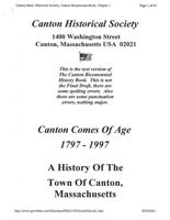
Canton Historical Society
1400 Washington Street
Canton, Massachusetts USA 02021
This is the text version of
The Canton Bicentennial
History Book. This is not
the Final Draft, there are
some spelling errors. Also
there are some punctuation
errors, nothing major.
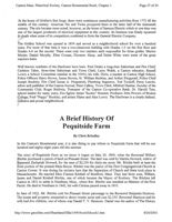
Canton Comes Of Age
1797-1997
A History Of The
Town Of Canton,
Massachusetts
http://www.geocities.com/Heartland/Hills/1496/book/bibook1.htm
8/20/2003
Canton Mass. Historical Society, Canton Bicentennial Book, Chapter 1
Page 2 of 30
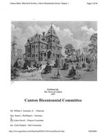
RESIDENCE DE A MORSE
GANTON
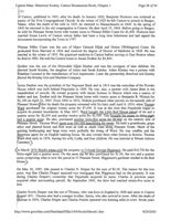
Published By:
The Town of Canton
1997
Canton Bicentennial Committee
Mr. William J. Armando, Jr. - Chairman
Mrs. Susan L. Reddington - Secretary
Mt. Cabot Devoll - Finance Committee
Mr. Clyde Pushard - Ball Committee
http://www.geocities.com/Heartland/Hills/1496/book/bibook1.htm
8/20/2003
Canton Mass. Historical Society, Canton Bicentennial Book, Chapter 1
Page 3 of 30
Mr. Joseph Uliano - Parade Committee
Mrs. Lee Thompson - Parade Committee
Mrs. Ada Goodrich - Festival Committee
Mrs. Maureen Dickie - Fundraising Committee
Mrs. Linda Cammarata - Fundraising Committee
Mrs. Norma Gaynor - Fundraising Committee
Mr. Edward Lynch, Jr. - Historical Committee
Mr. Daniel C. Keleher - Historical Committee
Mr. Richard Staiti - Legal Advisor
Mr. Richard Rousseau - School Department Liaison
Mr. Al D'Attanasio - School Department Liaison
Mrs.
Bicentennial Historical Committee
Mr. Edward Lynch, Jr. - Committee Chairman & Writer
Mr. Daniel C. Keleher - Research Advisor
Mr. Edward Bolster - President, Canton Historical Society & Writer
Mr. Christopher Brindley - Curator, Canton Historical Society & Word Processing
Mr. James Roache - Writer
Mr. Peter Pineo - Writer
This Book Is Dedicated To The Memory Of
Daniel Thomas Vose Huntoon,
Canton's Greatest Historian.
http://www.geocities.com/Heartland/Hills/1496/book/bibook1.htm
8/20/2003
Canton Mass. Historical Society, Canton Bicentennial Book, Chapter 1
Page 14 of 30
The Kenney family erected the Tavern in 1753. In 1818, they sold out to John Gerald who added a
second story and expanded the Tavern. He was competing with the popular Ponkapoag Hotel just
down the road which boasted of its access to Ponkapoag Pond. Gerald decided to create his own
access. In 1831, he dug a canal through Ponkapoag Bog and set up a small fleet of boats to take
Tavern guests on excursions out to the pond itself. While the project was certainly ambitious, it was
not a success.
The yellow house at 3 Homans Lane once stood right on Washington Street across from Cherry Hill
Tavern's original site. The building served as a stables and bowling alley. In 1839, it was moved back
from Washington Street and is now owned by Mr. James Homans. In the 1980's, the apartment at the
back of this house was home to the present host of NBC's "TODAY" Show, Matt Laurer and his wife
Nancy.
Canto-
Francis Sturtevant purchased Cherry Hill Tavern in 1841 and ran it until his death in 1863. Two years
later the tavern building was acquired by Samuel Cabot for use as a summer residence. Cabot was a
prominent Boston physician who served on the staff of Massachusetts General Hospital. He was also a
pioneer in the woman's suffrage movement and an abolitionist. His Boston home was reportedly a stop
on the underground railroad.
In 1902, Cabot's son Arthur hired architect Charles Platt to design a Georgian Mansion on the
property. This imposing building was home to the Cabot and Bradley families until 1990 when Eleanor
Cabot Bradley died and the 70 acre property was bequeathed to the Trustees of Reservations. The
resulting Eleanor Cabot Bradley Reservation is a well-preserved example of the era of country
retreats, and is open to the public
At the very top of Ponkapoag Hill, next to Route 138, stands the Ponkapoag Schoolhouse. This
neighborhood landmark, opened in 1894, was generously donated to the Town by Augustus
Hemenway of Green Street.
Many long time Ponkapoag residents have rich memories of their education at the Ponkapoag School.
In its earliest days, the school house comprised two classrooms on the ground floor where eight
grades were taught. On the second floor there was a single large room for "rainy day" activities. Years
later it became a four room schoolhouse with grades one through four.
Most residents also fondly remember the school's red cedar shingles with distinctive diamond-cut
patterns which are currently hidden by practical but less attractive vinyl siding. The present structure is
actually the third Ponkapoag schoolhouse. The first which opened in 1726, was located to the south
on the site of the Redman Farmhouse. The second school house is what is now the Ponkapoag Chapel
which was moved to its present location when the neighborhood's population outgrew the school.
The opening of the modern Hansen School in 1969 signaled the end of the Ponkapoag School's
educational career. In 1975, Police Chief Ruane proposed converting the building into a police
substation. The Selectmen supported this idea but for various reasons, it did not come to be. The
school presently houses the administrative offices of the Old Colony Boy Scout Council.
Directly across Route 138 from the school yard once stood Indian Line Farm. Founded by Albert
Whittier in the 1920's, the name refers to the northern boundary of Ponkapoag Plantation which passes
through the property.
http://www.geocities.com/Heartland/Hills/1496/book/bibook1.htm
8/20/2003
Canton Mass. Historical Society, Canton Bicentennial Book, Chapter 1
Page 21 of 30
to
shelter were built. On May 6, 1897, Hoosic Whisick Club was elected to the United States Golf
Association, and in 1903, to the Massachusetts Golf Association.
In the early 1900's, the Club hired Scottish golf course designer, Willie Parks. Parks designed courses
worldwide, including 70 in the United States, and was responsible for the basic nine-hole design which
exists to this day.
In 1942, World War II forced the closure of the Club. Fairways became hayfields, and the clubhouse
was boarded up. In 1946, the Milton Club and the Whisick merged, forming the Milton Hoosic club.
The Milton Club, founded in 1891, provided members with bowling, billiards, dances, lectures,
concerts and plays. Its Milton function facility is still part of the Milton Hoosic, a club with a hundred
year history of serving families in Milton and Canton.
Continuing on Greenlodge Street, we will end our tour at a simple spot at the center of Ponkapoag,
which symbolizes the nature of this Canton neighborhood.
On the right, where Greenlodge Street intersects Route 138, there is an open field. A mere field, one
might say. So what? This happens to be the sole remaining hay field along this stretch of highway from
Mattapan to Stoughton, a stretch that was once virtually lined with hay fields and farms.
We end our tour of Ponkapoag here. Our tour was not meant to be a full definitive history, merely a
glimpse of a special place, Ponkapoag, and its unusual background.
If Ponkapoag seems to be a fine place in which to live or recreate or both, it is no accident. Certainly
those who live here owe something to the foresight of the Commonwealth in setting aside public
lands. Also, it is a credit to the private landowners who carefully maintained open, natural spaces
against considerable temptations of commercial development. Above all, a fierce spirit of preservation
in the people of Ponkapoag themselves has assured that, despite such intrusions as Route 128,
Ponkapoag would remain a green and pleasant place, the true gateway to Canton, rich in the deepest
American history.
whic
Canton Corner Yesterday & Today
Canton Corner was the most affluent of the five known areas in Canton. This section started at 926
Washington Street at the site of the Elijah A. Morse's red brick mansion. Today it is the site of the
high school auditorium. It continued north for approximately two miles and ended at the entrance gate
of the Canton cemetery. Today the connecting land is known as Dogpatch.
Chapman and Dedham Streets on the left and Eliot, Pleasant and Randolph Streets on the right formed
the "Corner". The Ponkapoag and York areas were the first to be settled. As population increased the
town expanded southward following the main Street. The General Court in Boston demanded that the
town of Stoughton build a spiritual and municipal center. This was done in 1707, and the First Parish
Church Congregational was built.
whie
Canton Corner got named because the old road curved in the Randolph Street area. It was called the
road to Fennos then. It also curved near the Chapman Street section where Gilbert Endicott ran a
http://www.geocities.com/Heartland/Hills/1496/book/bibook1.htm
8/20/2003
Canton Mass. Historical Society, Canton Bicentennial Book, Chapter 1
Page 22 of 30
tavern.. The road was wider at these points.
The Corner was known as the home of the industrialists. Elijah A. Morse built his mansion on the hill
overlooking his Rising Sun Stove Polish Company. Charles H. French built his stone mansion on the
adjoining property to Morse. His textile business, the French & Ward Co., was in West Stoughton.
George Walter Capen was a noted architect and builder. He built several Draper Victorian homes on
Washington Street and many others on Chapman Street. The Asa Shepard and the John Withington
homes are two of the oldest still standing today. The Chapman Street section of the Corner went just
beyond the Wattles property. From this point west it became known as the Junction. It was a tree
lined residential Street. The Knitted Padding Co., which was hardly visible from the road was one of
the very few industries there. Some of the early residents on the Street were Brightman, Bright,
French, Sumner and Wattles.
Eliot Street has remained a quiet residential Street. Early families here were Griffin, McKenna, Keefe,
Weldon, Hepworth, Goss, Allen and Hughes. Pleasant Street was called Ragged Row in 1770. There
were no houses on the east side of the Street heading south until after 1850. On the west side of the
Street, Reverend William Ritchie built his house in 1809. Today it is the Pequitside farm. New Streets
have been added to the area. Reservoir Circle, Pleasant Garden road, Oak road, Wood road, and
Pleasant Circle. The "Corner" ended at the Capper property. From there on it was referred to as
Springdale. Some of the early residents were John Draper, Paul Draper, Daniels, Robotham, Williams,
Alexander, Dean, Lincoln, Gill, Guild, Gelpke and Capper.
Randolph Street was known as the "way to Randolph", St. Mary's cemetery and the Massachusetts
Hospital School commanded the most attention. There were very houses here until Randolph Street
was widened and paved. New roads were added, Brayton Circle, Russell Street and Wentworth Road
and others branching from these. There are many new houses with well kept property. Some of the
early residents were Titus, Martin, and Black. Canton Corner ended at the Turnpike.
The first high school was located at the Corner. The building cost $10,000 to erect in 1866 and
demolished in 1950. It served as the high school until 1912 when the new Hemenway/Canton High
school was built. The old school remained through the years and had various use. Mr. E. J. Henniker
operated an auto repair shop there. In 1935 Dave Medlicott took over the business and opened a
gasoline and neighborhood store. Later Richard Mugford ran the same business. Today Getty Gas
occupies the space.
The John Adams family lived at 1184 Washington and they ran a small store from a front room.
Further up the Street Louise Titus operated a small store on Draper Lane. The old Vose Tavern next
to the store belonged to the Draper Company and it was dismantled in 1993.
The Gilbert Endicott tavern was on the corner of Washington and Chapman Street. The Li'l White
store has become a favorite in the same location. Mary Estey ran a small candy shop in her front room
at 1390 Washington and a small gas station and convenience store was operated by John Farrow.
Alexander Sturrock also had a store in his home. Today the DePalma Nursery and Greenhouse is in
the area.
The original Eliot School, dedicated in 1867, stood on the corner of Washington and Randolph
Streets. It was later moved to the present location. The Public Works and the Planning Board have use
of it now.
http://www.geocities.com/Heartland/Hills/1496/book/bibook1.htm
8/20/2003
Canton Mass. Historical Society, Canton Bicentennial Book, Chapter 1
Page 23 of 30
the
The old Everett Tavern, later the George Frederick Sumner Mill was deeded to the Canton Historical
Society in 1911 by Mr. Sumner.
The Morse and French estates became the site of the present Canton High School. An article in the
1963 town warrant opened the flood gates to many new roads. Wildwood Drive, Old Meadow Lane,
Historical Way, First Parish Road, Brayton Circle, Williams Street, and many more followed, adding
many new ;homes and residents. In 1887 the population was 4,516, today it is approximately 18,900.
Some of the early families have gone from the "Corner" but their names remain. Burt, Capen, Clayton,
Danahy, Downes, Endicott, French, Galligan, Gerald, Goding, Healy, Hewett, Morse, Packard, Reed,
Shepard, Titus, Wetherbee, and Wilde.
Gone from the "Corner" are the first Town Hall, The Canton Corner Post Office, The first High
School, The Corner Fire station, The Vose Tavern, The Draper Mill houses, and the Helen Williams
Farm.
Starting at the French property (the High School) and continuing up to the Endicott property (Audry
Fields Real Estate Office) there were great deep fields. In the center of the French property there was
a great oak tree where Ahauton, Indian sachem, held tribal meetings. Today the WW II memorial
marks the spot. After the Endicott house there were more fields, ledge, bushes, briars and scrub trees.
This section was called the Dark Corner and rightly SO as there were no Street lights here. Post cards
and letters were often sent to the post office marked Dark Corner, Canton. No zip code or state.
Anyone walking by the Dark Corner after five o'clock ran or hastened their steps, Today it is no
longer dark. Now in 1997 there are several business here. Two photographers, three real estate
agencies, two dentists, and one optometrist. Added to the postman's route is the Temple Beth
Abraham and the United Church of Christ.
Canton looks kindly on the past and sets its sights on the future. We praise the residents for keeping
the "Corner" a lovely residential section of the town.
THE SPRINGDALE NEIGHBORHOOD
Springdale, SO named because of its abundance of springs and its rural setting, is located in the
southern section of Canton. It incorporates Pleasant Street from Bolivar Street to the Stoughton town
line, and Pine street across the railroad tracks to North Street and adjacent streets.
Huntoon's History of Canton states that in March, 1719 the neighborhood was called "Dorchester
Swamp, now Pleasant Street." In the early maps it is also referred to as District V (5). The map of
1876 shows it largely undeveloped, though a few names familiar to old Cantonians emerge: Pitcher,
Bailey, Reed, Downes, Upham, Draper, Mansfield, and Withington. Pine Street was accepted by the
town in 1881, and by the turn of the twentieth century growth was seen in the area. By 1934 there
were 150 residents with names like Barnes, Bomar, Connor, Gardner, Meadows, Paul and Shaw.
Pleasant Street was surveyed in March 1831 and was called the "Stoughton Road", with Beaver
http://www.geocities.com/Heartland/Hills/1496/book/bibook1.htm
8/20/2003
Canton Mass. Historical Society, Canton Bicentennial Book, Chapter 1
Page 24 of 30
Brook running into it from today's Route 138, which was then called the "Stoughton Turnpike".
Beaver Brook fed water power to several industries : C. Draper Cardigan Jacket Manufacturing
Company, the Satinette Factory which was later the site of the Springdale Finishing Company and still
later Groveton Paper Company. The Springdale Manor apartment complex is now situated on this
former industrial location.
In 1796 one of the first schools was erected on Pleasant Street, called the "Ragged Row" Branch to
accommodate some sixty children living in the area. The drive to erect the school was spearheaded by
some familiar Canton names: Estey, Withington, Clark, Wentworth and Morse. The early school was
replaced by the present building on the same site in 1853 and named the Sherman School in honor of
its location near the early home of Roger Sherman, a signer of the Declaration of Independence. The
building is now a private residence having evolved from school to VFW hall to a home.
Edward Galvin's history of Canton Junction reports that the opening of the Stoughton Branch
Railroad in 1844 speeded up growth of the area. The line was double tracked and sidings installed for
gravel removal in 1886. Gravel from this thirty-two acre pit was used to provide fill for Boston's
Pemberton Square area for building the new Court House. In 1969 additional spur lines were installled
for Groveton Paper and the Ferrera Food Warehouse.
In 1891 a train station costing $1200 was built replacing one constructed in 1855. In 1919, locals were
thrilled when "Anne of Green Gables" featuring the movie star Mary Miles Minter was filmed at the
Springdale Station. Unfortunately hard times and bankruptcy forced the station to close in 1938 and to
be razed in 1940. During World War II troop trains ran through the area at all hours, causing many a
family heartache knowing their boys quite likely were heading overseas. The hill overlooking the
station was actively used as a watch tower during World War II to be on guard for enemy planes.
Springdale produced many fine athletes, the most famous being the "Springdale Mudhens" baseball
club, SO called from the primitive conditions at their field on the corner of Bolivar and Pleasant
Streets, since improved and enlarged to today's Devoll Field.
No neighborhood would be complete without its little variety store and no politician's campaign could
neglect a stop at what is now "Springdale Variety" at the corner of Bolivar and Pine Streets, started by
the Estey family back in the 1940's.
Today Springdale has grown immensely and includes a dozen new streets and about 500
condominiums and apartments. The old under-developed, horse and carriage area has gone forever as
12,000 vehicles stream through the section each day. All this is two hundred years old - and still
growing.
THE JUNCTION
Two hundred years ago transportation and communication in Canton was almost non-existent. The
early settlers found it necessary to give names to areas to pinpoint their location in the town. Thus
Ponkapoag was named for the location where the Indians lived. Part of this area was also called "The
Farms" for obvious reasons. Springdale was SO called because of its pristine springs and ponds. The
Hardware was named for two reasons. The slag and bits of metal from the blast furnace at the Kinsley
http://www.geocities.com/Heartland/Hills/1496/book/bibook1.htm
8/20/2003
Canton Mass. Historical Society, Canton Bicentennial Book, Chapter 1
Page 25 of 30
Iron Works was dumped in this part of town, and the Gridley mill and the Gridley Forge were
manufacturing cannons and mortars here.
Canton Corner, sometimes called the Dark Corner, was situated between Washington and Chapman
Streets and Washington and Randolph Streets. The Junction was not named until after the Viaduct
was begun in 1835 and the branch railroad line opened to Stoughton and Easton. It was only fitting to
call this area "The Junction". It consisted of ten streets: Beaumont, Lower Chapman, Everett, Fuller,
Jackson, Spaulding, Van Buren, the west end of Neponset, the west end of Sherman, and part of
Walpole Street.
Benjamin Everendon and James Beaumont had established businesses in the general area as early as
1800. The Stone Factory (today's Emerson and Cummings building) opened in 1824 and the area
became a thriving community. English, Irish, Scots and Italiens moved here and many worked at the
Bleachery which manufactured cotton and woolen textiles. Some of the firms established here were
the C. C. Callahan Fire Hose Company, Grow Tire, Crow Blacking, Deane Coal, Hatfield Paint and
Art Supplies, J. J. White, Porter Patent Leather, Rathburn Patent Leather, and Wattles Dressing and
Sizing.
Perhaps the most famous person to live in the Junction was the Transcendentalist. Margaret Fuller.
Born in Cambridge in 1810, her father, Timothy Fuller, was a professor at Harvard, while her mother,
Margaret Crane Fuller, was the daughter of Peter Crane of Canton. She grew up on Neponset Streeet,
where the Canton Estates Apartments are presently located. Margaret had a phenomenal intelligence
and was known as a "Cultural Reformer". Her friends included Emerson, Thoreau, Poe, Bronson, and
many other literary giants of the time. She was an author and contributed articles to all the important
periodicals of the day. She was on the staff of the New York Tribune and went to Italy as a
correspondent for that paper and contributed up to date material on the crisis in Italy under Garibaldi.
In 1850 she sailed from Italy with her husband, Count D'Ossoli, and their son. Her ship met with a
terrible storm off Fire Island in New York and tragically all three were drowned.
The Bleachery owned a building that was converted into a community hall and was used by various
denominations as a place of worship. Farrell's store on Neponset Street and Allie Bisbee's store on
Chapman Street helped serve the neighborhood. Both Andrew Oliver and Raymond Dickie operated
blacksmith shops in the area. There were no paved roads and automobiles were a novelty at the turn of
this century. Dr. Lonergan ministered to medical needs, and his daughter, Mary, was the school
teacher in the old Revere School. She taught in this school until the new Revere School was
completed in 1915. She then became Principal of the avant-garde building, whose progressive design
15017
became known all over the United States. The prior Revere School served as a barracks for soldiers
guarding the Viaduct during World War I.
In 1861 Lincoln's call came for volunteers for the Civil War and twenty-two year old Hiram Briggs
and his eighteen year old brother, Edwin, of Fuller Street marched off together to serve the Union in
Company A of the Fourth Regiment. Thomas Tapper was a noted pianist who lived on the corner of
Neponset and Chapman Streets. He played in many of the music halls of America, and his recordings
were made on early Edison cylinders.
There was a small pond behind Fuller Street called "the goosey" where young children swam and
skated. There was also Mrs. Chapman's pond beside the railroad tracks that was used exclusively for
boys. The opening of the Canton Airport was a boon to the Junction. The neighbors often went there
on Sundays to take advantage of the dollar flight and to see Canton from the air. The Graf Zepplin and
http://www.geocities.com/Heartland/Hills/1496/book/bibook1.htm
8/20/2003
Canton Mass. Historical Society, Canton Bicentennial Book, Chapter 1
Page 26 of 30
the Shenendoah dirigibles were plainly visible as they followed the railroad tracks to New York.
Then there were the legendary White sisters, whose house overlooked the airport and who invited
friends to fly with them in a cabin plane to Plymouth and return for tea at their home. The charming
sisters were frequent visitors at the airport. Known for their sense and sensitivity, they were a fixture
at town meetings and often questioned the financial feasibility of proposals and the effect change
would make on the town.
There have been many changes in the Junction section of Canton with the explosion of growth on
Neponset and lower Chapman Streets. The Neponset Valley Industrial Park, the business building at
Number 345, Chapman Park, Nick's Restaurant, gas stations, and Gabriel's Auction Centre are
burgeoning commercial enterprises, while there has been corresponding growth in apartments and
condominiums at the Junction. The road to Norwood was once known as the Willow Road, but today
all the willow trees have been lost to development and highways.
Where is this little community now? Where is it heading? The Viaduct is scheduled for redesign SO
high speed trains can roar through. The old Canton Junction railroad station building will be literally
picked up and moved to a new location to provide for hundreds of more commuter parking spots.
And what of the river? Who will care about pollution and rubble poisoning the stream? Mr. Carl Lavin
of Fuller Street has dared to guard it. His dream is to make the fowl meadows Canton's jewel. He
knows that every weary river one day meets the sea.
THE HARDWARE
The Hardware section of Canton extends from Washington Street at High Street to the Sharon-
Stoughton line and encompasses the side streets Pierce Place, Drake Lane, Shepard Street, Pond
Street, Kinsley Place and the west end of Dunbar Street.
Water power essential for manufacturing in the early days was abundant in this part of town. An early
fabrication site was located where Massapoag Brook crosses Shepard Street. Here at first were
manufactured wagon wheels, and here, too, William Otis invented America's first earth excavator.
Later in 1855 Luke and Joel Shepard erected a silk mill there where silk stockings were produced for
sale across the country. The business flourished until destroyed by fire and explosion shortly after the
beginning of the 20th century.
On the easterly side of Washington Street, near the present Newell S. Hagen Court, water flowing
under Washington Street powered a forge owned by Richard Gridley who lived nearby at what is
today 178 Washington Street. Gridley was a Major General in the American Revolution and founder
of the Army Corps of Engineers. Nearby, too, at Kinsley Place is the burial ground where Gridley was
initially interred.
Across the street on the westerly side a building was erected in 1835 by the Canton Hardware
Company whose principal was Jonathan Robinson. The enterprise became SO successful that soon that
whole end of town became known as "The Hardware." Their output consisted of pruning, knives,
ferules, and screwdrivers.
http://www.geocities.com/Heartland/Hills/1496/book/bibook1.htm
8/20/2003
Canton Mass. Historical Society, Canton Bicentennial Book, Chapter 1
Page 9 of 30
meteorologist.
During the infamous Blizzard of 1978, the Observatory recorded continual wind gusts in excess of 90
MPH. Winds of over twice this speed, 186 MPH, were recorded by the Observatory during the
Hurricane of 1938.
The Blue Hill Weather Observatory is truly the foremost landmark structure in the history of American
weather forecasting.
The Observatory and the Ski Area, are just two of the features of the the 8,000 acre Blue Hills
Reservations, probably the single most important recreational resource in metropolitan Boston.
The Reservation was laid out in 1892 by Charles Eliot, the famous landscape architect and partner
with Frederick Law Olmsted. Eliot reconfigured the boundaries of the original Ponkapoag Plantation
to include the thirteen peaks currently in the Reservation.
The Reservation's use of its open space has since become a model for open land use planning
worldwide. It is the oldest metropolitan park in the United States, growing from an original 6,000
acres to the present 8,000 acres and including over 500 miles of wooded trails. Hundreds of thousands
of people have enjoyed the Reservation, including Pope John Paul II. In 1980, at the invitation of The
Friends of the Blue Hills, the papal motorcade ascended to the summit of the Great Blue Hill.
As we proceed toward the intersection of Route 138 and Royal Street, Howard Johnson's comes into
view. A landmark since 1937, this was one of the first franchises of this restaurant chain, started in
Quincy during the 1920's.
This particular "HoJo's" has been a popular meeting place through the years, despite a major fire
which damaged much of the building. Franchise Associates bought the building, renovated it and
updated the HoJo images. Today this restaurant serves as a training facility for HoJo personnel.
Howard Johnson's and the cluster of gas stations known as Gasoline Alley owe their creation to the
"old" Route 128. On Royal Street is a unique mix of residential, State Park land and businesses such
as Instron, the Bank of Boston, and Boston Mutual, some of Canton's largest taxpayers.
Instron, situated on the former Chase estate, is of particular note. They are recognized as a "model"
company, having kept most of their 65 acre estate as open space. And for many years, the company
operated a working farm, complete with livestock. The company served up their own produce in the
cafeteria.
The Trinity Episcopal Church anchors the corner of Route 138 and Blue Hill River Road on land
donated by the late Martha Prowse in 1964. The church was dedicated in September 1969.
The entrance to Prowse Farm, presently owned by Meditech, is a short distance down River Road on
the right.
thousands of years, Indians farmed the broad plain on which the farm sits. They called this area
Maswatusek or "Land by the Great Hill". This is the origin of the name Massachusetts.
http://www.geocities.com/Heartland/Hills/1496/book/bibook1.htm
8/20/2003
Canton Mass. Historical Society, Canton Bicentennial Book, Chapter 1
Page 27 of 30
At the home of Gridley's first forge, there were continuous manufacturing activities from 1772 till the
middle of this century. American Net and Twine prospered there in the latter half of the nineteenth
century. The site became more noted, however, as the home of Samson Electric which at one time was
one of the largest producers of electrical equipment in this country. Its business was finally squeezed
to death when some of its competitors combined to form the General Electric Company.
The Gridley School was opened in 1854 and served as a neighborhood school for over a hundred
years. For most of that time it was a two-classroom building with Grades 1-3 on the first floor and
Grades 4-6 on the second. There were only two teachers each responsible for three grades. Marion
Maxim, Daniel Murphy, Ellen Cronan, Florence Alsop, and Helen White were some of the great
teachers there.
Well known residents of the Hardware have been: Fred Drake a long-time Selectman and Fire Chief;
Carleton Taber, three-time Selectman and Town Clerk; Larry Walsh, a Canton educator; Russell
Lowry a School Committee member in the 1930's; his wife, Doris, a teacher at Canton High School;
Police Officers Harry Brown, James Brown, Sr. William Buckley, and Arthur Fitzgerald; Police Chief
Joseph Buckley; Fire Chief James A. Fitzpatrick; Plumbing Inspector, Ted Tordoff; Percy Leavitt,
editor and publisher of the Canton Journal; Peter Callery, Town Clerk; Mildred Dunbar, founder of the
Community Club; Roger Baldwin, Treasurer of the Canton Co-operative Bank; Dr. Harold Tate,
school dentist for many years; Fire fighter James "hookis" Bennett; Professor John Powers of Boston
College; Fred "Pappy" Buckley; and artists Elaine and Alan Lowry. The Hardware is a clearly defined,
cohesive and proud neighborhood.
A Brief History Of
Pequitside Farm
By Chris Brindley
In this Canton's Bicentennial year, it is also fitting to pay tribute to Pequitside Farm that will be one
hundred and eighty-eight years old this summer.
The story of Pequitside Farm as we know it began on May 20, 1809, when the Reverend William
Ritchie purchased a parcel of land on Pleasant Street. The land was sold by Martha Howard, widow of
Reverend Zachariah Howard, for the sum of $2,230 for thirty-six acres. Mr. Ritchie built at least the
front portion of the present Main House. Ritchie was the pastor of the First Congregational Church at
Canton Corner. It was during his ministry here that the Separation of Church and State took place in
Massachusetts. He married Miss Clarissa Kimball of Bradford, Mass. They had three sons, William,
James and Daniel Kimball Ritchie, one of which became the Mayor of Roxbury. The Ritchies left
Canton in 1821 to settle in Needham, Mass., where Rev. Ritchie was installed as Minister of the First
Parish. He died in Needham in 1842, his wife Clarissa passed away in 1855.
In June of 1822, Mr. Ritchie sold his Pleasant Street parsonage to the Reverend Benjamin Huntoon.
The house and property amounted to about twenty acres and cost $2,250. Reverend Huntoon and his
wife had five children, one of whom was Daniel T. V. Huntoon. Daniel was the author of The History
http://www.geocities.com/Heartland/Hills/1496/book/bibook1.htm
8/20/2003
Canton Mass. Historical Society, Canton Bicentennial Book, Chapter 1
Page 28 of 30
of Canton, published in 1893, after his death. In January 1822, Benjamin Huntoon was ordained as
pastor of the First Congregational Church. In the winter of 1829 he left Canton to preach in Bangor,
Maine. After the death of his wife in 1839, he returned to Massachusetts in 1840. In the spring of
1842 he returned to his old congregation in Canton. He died April 19, 1864. Before going to Bangor,
he sold his Pleasant Street home with twenty acres to Phineas Miller Crane for $1,800. Huntoon later
married Susan Lewis of Canton whose father had been a long time Selectman and had signed the
documents incorporating the Town in 1797.
Phineas Miller Crane was the son of Major General Elijah and Desire (Withington) Crane. He
graduated from Harvard in 1824 and received his degree of Doctor of Medicine in 1828. He was
married in the winter of 1833. He practiced medicine in Canton before moving to East Boston where
he died in 1882. He sold his Canton home to James Dunbar for $1,800.
Dunbar was the son of the Honorable Elijah Dunbar and was the youngest of nine children. He
married Sarah Kinsley, the daughter of Adam and Sarah Kinsley. Adam Kinsley was a partner with
Jonathan Leonard in the manufacture of iron implements. Later the partnership dissolved and Kinsley
started the Kinsley Iron and Machine Company.
James Dunbar was the president of the Neponset Bank and in 1814 was the custodian of the Powder
House which was built behind Pequitside in 1809. He was, also, a partner with James Bent in the
manufacture of swords. He owned property with James Sumner in Sharon which was a source of
timber and hay. Dunbar sold the Pleasant Street home with twenty acres to Benjamin R. Nichols for
$2,100 on April 22, 1843. From 1846 to 1852, Nichols purchased other parcels on the easterly side of
Pleasant Street. After his death the property remained with his heirs until April 8, 1854, when Thomas
Ward purchased the original twenty acres for $7,600. It was at this time that Pequitside began to
acquire its present boundaries. In May 1857, Ward bought the Little Red House parcel of six and a
quarter acres for $2,600 and another twelve acres for $1,000. This brought his estate to thirty-eight
and a quarter acres. He also, purchased another forty-five acres for $9,000 on the easterly side of
Pleasant Street. Thomas Ward spent over $40,000 beautifying his estate. He built a greenhouse, grape
arbor and planted forest and fruit trees as well as shade trees along Pleasant Street. Much of the
existing landscaping and large trees were probably the doing of Ward. He was wealthy and the
American agent for an English banking house. He also owned three other homes in Boston. Thomas
Hona
Ward died early in 1858, leaving his wife, Lydia, and four children. He was interred at Mount Auburn
Cemetery.)
In March 1876 Ward's estate sold the property to Colonel George Higginson. He paid $16,750 for the
thirty-eight and a quarter acres. On the same day he also purchased for $1.00, the two and a quarter
acres comprising what is now the parcel at 55 Pleasant Street. Higginson's gardener resided in the Red
House.
On May 18, 1885, title passed to Charles N. Draper for the sum of $1.00. The reason for this low
price, was that Charles Draper assumed two mortgages that Higginson had on the property. It was
during Charles Draper's ownership that Pequitside acquired its name. Charles in previous years
acquired other surrounding parcels. By September 1890, the farm had reached ninety-five acres in
size.
Charles Norris Draper was the son of Thomas, who was born in England in 1808 and came to Canton
around 1851. Thomas also had a younger brother, James, who also arrived in town. After the death of
Thomas in 1856, Charles Draper and Charles French operated two knitting mills in town. Seven years
http://www.geocities.com/Heartland/Hills/1496/book/bibook1.htm
8/20/2003
Canton Mass. Historical Society, Canton Bicentennial Book, Chapter
1
Page 29 of 30
later, Charles and Matthew Townsend formed the partnership of Draper and Townsend. In 1864,
Charles purchased part of the Billing's Farm at Washington and Dedham Streets. Then a year later, he
incorporated his mills as the Canton Woolen Mills. In 1869, the Canton Woolen Mills failed and were
sold at auction to James Draper and Charles Sumner. In 1870, Charles built the Springdale Mill on
Pleasant Street, where the Creekside Condominiums are today. In October 1888, through a taking
of
the Canton Board of Water Commissioners, Charles lost part of his Springdale Mill parcel. The
original Water Works structure still exists today on the south side of Pine Street at the railroad
crossing.
The main barn at the rear of Pequitside was completed by Charles N. Draper in July of 1893. The
weather vane bears the initials C.N.D. and was originally plated with gold leaf. Charles N. Draper died
on July 1, 1903, leaving his wife Martha (Gill) Draper and sons Joseph, John, Paul and James. Martha
Draper in her younger days was a great friend to Martha (Crafts) Howard, sometimes referred to as
"Patty" Howard, widow of Reverend Zachariah Howard. Martha Draper, at some point acquired Mrs.
Howard's "Mourning Ring", which contained a lock of Rev. Howard's hair. It would be nice to see this
artifact donated to the Historical Society.
The property was now under a trusteeship of the Martha and son Joseph until August 1915, when it
was sold to John H. Draper for $6,000. In October 1919, Joseph and John Draper, as joint tenants,
purchased the parcel at 10 Sumner Street, and built the house that still stands today. This property is
at the rear of the main barn at Pequitside. In October 1923, Pequitside and the Sumner Street lot were
transferred to Paul and Marjorie Draper. In the following years, parcels were sold off, and the farm
went from ninety-five acres to its present thirty-four +/- acres. The SO called "Tavern" building was
probably built in the 1870's. This structure was where the gardener kept his supplies, this was also the
laundry. In the 1920's, Paul Draper remodeled the tavern building as well as most of the main house.
As well as being a partner in the Draper Brothers Company, Paul also had half interest in the Stockton
Wool Company, a limited partnership of Bradco Oil and Gas Company. He also had one-sixteenth
interest in a Texas oil well. Paul A. Draper passed away on July 24, 1969, leaving his wife Marjorie
and two children, Phyllis and Donald. Marjorie Draper passed away on April 6, 1970.
On June 15, 1971, the Town of Canton purchased Pequitside Farm from the Estate of Marjorie
Draper. The town received matching grants from the Federal and State governments to acquire the
property for $260,000. Today, Pequitside Farm is managed by the Canton Conservation Commission
and most of the programs and events held there are under the direction of the Recreation Department.
Home
Mail
Next
CREATED&MANAGED
WITH
Middlef!
FrontPage
http://www.geocities.com/Heartland/Hills/1496/book/bibook1.htm
8/20/2003
Viewer Controls
Toggle Page Navigator
P
Toggle Hotspots
H
Toggle Readerview
V
Toggle Search Bar
S
Toggle Viewer Info
I
Toggle Metadata
M
Zoom-In
+
Zoom-Out
-
Re-Center Document
Previous Page
←
Next Page
→
Canton Public Library
Details
Series 5

