
From collection Creating Acadia National Park: The George B. Dorr Research Archive of Ronald H. Epp

Page 1
Page 2
Page 3
Page 4
Page 5
Page 6
Page 7
Page 8
Page 9
Page 10
Page 11
Page 12
Page 13
Page 14
Page 15
Search
results in pages
Raisz, Erwin J.
Raisz, Erwin J.
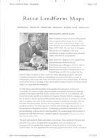
Erwin Raisz - Wikipedia, the free encyclopedia
Page 1 of 2
Erwin Raisz
From Wikipedia, the free encyclopedia
Erwin Raisz (1 March 1893, Löcse, Hungary - 1
December 1968, Bangkok, Thailand) was a
Erwin Josephus Raisz
Hungarian-born American cartographer, best known
Born
March 1, 1893
for his physiographic maps of landforms.
Löcse, Hungary
Died
December 1, 1968 (aged 75)
Biography
Bangkok, Thailand
Fields
Born in Löcse, Hungary (now part of Slovakia) in
cartography, geography, geology
1893, Raisz was the son of a civil engineer, who
Institutions Institute of Geographical Exploration
introduced him to maps through his work. The son
at Harvard University
received his degree in civil engineering and
Alma mater Columbia University (M.A.), (PhD)
architecture from the Royal Polytechnicum in
Budapest in 1914, and after serving in the army
Known for artful and insightful cartography
during World War I, he immigrated to New York in
1923. He worked for the Ohman Map Company while studying for his 1929 Ph.D. at Columbia
University. He offered a course in cartography while a student, one of the first such in the United States.
In 1931 he joined the Institute of Geographical Exploration at Harvard University, where he taught
cartography and was curator of the map collection for 20 years. He created a significant body of work
using hand-drawn pen-and-ink techniques, which during that period were largely being replaced by
photo-mechanical processes and scribing. Because they were hand-drawn, his maps and graphics have a
distinctive look to them, unique to his hand.
He was author of the first cartography textbook in English, General cartography (1938).
Raisz is best known for his physiographic maps, which describe landforms using his "orthoapsidal" or
"armadillo" projection (essentially a small-scale variation on an isometric projection). Created for
continents, nations and states, they form a solid corpus of work whose use continues today. Raisz
Landform Maps, operated by his family, continues to publish much of his work.
Sources
Biography of Raisz (http://www.raiszmaps.com/biography.html) on the Raisz Landform Maps
web site.
Designerati: Cartographers - Erwin Raisz (http://designorati.com/cartography/history-
13/2005/cartographers-erwin-raisz/
Robinson, Arthur H. (March 1970). "Erwin Josephus Raisz, 1893-1968". Annals of the
Association of American Geographers 60 (1): 189-93. doi:10.1111/j.1467-8306.1970.tb00712.x
(https://dx.doi.org/10.1111%2Fj.1467-8306.1970.tb00712.x). ISSN 0004-5608
(https://www.worldcat.org/issn/0004-5608).
https://en.wikipedia.org/wiki/Erwin_Raisz
7/27/2015
Erwin Raisz - Wikipedia, the free encyclopedia
Page 2 of 2
Bibliography
Raisz, Erwin Josephus (1938), General cartography, McGraw-Hill Series in Geography, New
York; London.
Raisz, Erwin Josephus (1948). General cartography. McGraw-Hill Series in Geography (2d ed.).
New York.
Retrieved from"https://en.wikipedia.org/w/index.php?title=Erwin_Raisz&oldid=660472216"
Categories: American cartographers / Harvard University faculty 1893 births 1968 deaths
This page was last modified on 2 May 2015, at 18:34.
Text is available under the Creative Commons Attribution-ShareAlike License; additional terms
may apply. By using this site, you agree to the Terms of Use and Privacy Policy. Wikipedia® is a
registered trademark of the Wikimedia Foundation, Inc., a non-profit organization.
https://en.wikipedia.org/wiki/Erwin_Raisz
7/27/2015
The scenery of Mt. Desert Island: its origin and development
Author
Raisz, Erwin, 1893-1968.
Title
Available from:
The scenery of Mt. Desert Island: its origin and development, by
Erwin J. Raisz
Offsite - Place Request for delivery within 2 business days
Call Number: 378.7CZO R132
Published
Available
[New York, 1929]
Description
Request:
p. [121]-186. illus., fold. map. 25 cm.
Offsite
Series
Contributions from the Dept. of Geology of Columbia University ; V.
o
Rare Book - Request at Rare Book Lib (Non-Circ)
42, no. 1, 1929.
Today's Hours: 9am-4:45pm
Subjects
Call Number: CZO R132
Geology > Maine > Mount Desert Island.
Available
Mount Desert Island (Me.)
Request:
Also Listed Under
Special Collections
Wood, George McLane, 1850-1930.
Notes
Google Books
Vita.
More info at Google books
"The geology of Mount Desert, by George McLane Wood": 1 folded
leaf (58 X 48 cm) with map on verso, laid in.
"Reprinted from the Annals of the New York academy of sciences, vol.
XXXI."
Cover-title
Thesis (PH. D.)-Columbia university, 1929.
Bibliography: p. 185-186.
Language
English
LCCN
30004638
Format
Book,
Thesis
Bookmark As
http://clio.columbia.edu/catalog/1934164
Natural History Division
m. Dour Geology, N.P.a
18
ANNALS OF THE NEW YORK ACADEMY OF SCIENCES
Vol. XXXI, Pp. 121-186
Editor, HERBERT F. SCHWARZ
THE SCENERY OF MT. DESERT ISLAND:
ITS ORIGIN AND DEVELOPMENT
BY
ERWIN J. RAISZ
and
A CAREMY
THE S CLENCES
1315
takes 6
NEW YORK
PUBLISHED BY THE ACADEMY
September 18, 1929
7/27/2015
Cartographers: Erwin Raisz Designorati
Designorati
CARTOGRAPHY, FEATURES
CARTOGRAPHERS: ERWIN RAISZ
SAT, 01 OCTOBER 2005 | SAMUEL JOHN KLEIN | 1 COMMENT
Cartographic Giant of the 20th century pioneered and perfected the physical relief map
A Section of Erwin Raisz's Landform Map of the United States (courtesy
Raisz Landform Maps)
Erwin Raisz (1893-1968) has, at this writing, left precious little in the way of biographical
information, but his achievements in the field of rendering and education shaped the mapmaking
field of the early-mid 20th Century to an unmistakeable degree, if for no other reason than
providing the public with the example of the sheer beauty and perfection that landform mapping
can achieve.
Born in Hungary, he was the son of a civil engineer, being introduced to maps at a young age.
From there it became a life devoted to studying the maps, geography and cartography with time
spent in the army and in engineering. In 1923 he emigrated to the United States with a degree in
civil engineering and architecture from Royal Polytechnicum in Budapest and attended Columbia
University graduate school. Eventually he found a place at Harvard University where he taught
cartography and was curator of the Map Collection for almost 20 years from 1931.
Educational Pioneer
http://designorati.com/articles/t1/cartography/232/cartographers-erwin-raisz.php
1/3
7/27/2015
Cartographers: Erwin Raisz Designorati
During that time he perfected the ongoing gifts that are some of cartography's greatest
treasures. Amongt them are the first cartography textbook in the English language, General
Cartography, first published in 1938, a copy of which exists (a 1948 2nd edition) in my own
collection. The book itself is beautiful, with detailed information on how to hand render maps,
how to construct projections, deep mapmapking history and the state of the surveying and
mapping art of the day, accompanied throughout with illustrations that were plainly produced by
a master of the art, each a work of art in its own right.
Regarded as a great talent by his peers, his works and papers were read widely national and
international professional organizations. He pioneered and perfected certain statistical styles
and created at least one standard projection. But his other great achievement was the landform
map, two samples of which can be seen above and just to the left.
A closeup sample of the astounding Raisz landform drafting style (courtesy
Raisz Landform Maps)
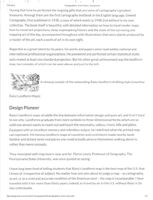
Design Pioneer
Raisz's landform maps straddle the line between information design and pure art, and it isn't hard
to see why. Landforms graduate from mere symbols to three-dimensional forms which are SO
solid one almost wants to reach out and touch the mountains, valleys, rivers, hills and plains.
Equipped with an excellent memory and relentless output, he redefined what the printed map
can represent. His famous landform maps of countries and contintents made nearby lands
familiar and distant lands real places one could actually picture themselves walking about in,
rather than mere concepts.
They resonated with map lovers near and far. Pierce Lewis, Professor of Geography, The
Pennsylvania State University, was once quoted as saying:
I have long been fond of telling students that Raisz's landform map is the best map of the U.S. that
I know of, irrespective of subject. No matter how one sets about to judge a map - as cartography,
as art, or as a vivid and accurate rendition of the American land - the map is incomparable. I have
traveled with it for more than thirty years; indeed, to travel by air in the U.S. without Raisz is (to
me) unthinkable.
http://designorati.com/articles/t1/cartography/232/cartographers-erwin-raisz.php
2/3
III
7/27/2015
Cartographers: Erwin Raisz I Designorati
Raisz Today
Perhaps the best news for cartophiles, casual or otherwise, is that Raisz Landform Maps are still
available today. Ranging in prices from USD $4.00 to USD $30.00, offerings include the landform
displays of the United States and the world's continents, relief maps of the world, and of various
countries.
Truly Raisz landform maps are timeless, holding up well against maps made today, only surpassed
by the crystal clear satellite photography of today-but in them, there is no artistic human hand.
One of the utmost expressions of the intersections of art and cartography, Raisz's maps draw the
viewer in, involving them esthetically as well as informationally, a feat few maps since have been
able to claim.
(Many thanks to Raisz Landform Maps, without whose generous assistance biographical
information about Erwin Raisz would have been impossible to come by, and for granting
permission to use the above illustrations)
http://designorati.com/articles/t1/cartography/232/cartographers-erwin-raisz.php
3/3
Raisz Landform Maps - Biography
Page 1 of 2
,
Raisz Landform Maps
VIEW SAMPLE
PRICE LIST
ORDER FORM BIOGRAPHY REVIEWS LINKS MISCELLANY
BIOGRAPHY: ERWIN RAISZ
Raisz Landform Maps has been selling hand-
drawn topographical maps for over forty
years. The genius behind these maps is the
work done by renowned cartographer Erwin
Raisz (1893-1968). He was born in Hungary,
the son of a civil engineer, who was
introduced to maps and their uses when his
father took him on assignments.
Raisz received a degree in civil engineering
and architecture from the Royal
Polytechnicum in Budapest in 1914. After a
brief term in the army he worked for an
engineering firm before immigrating to the
United States in 1923. He worked for the
Ohman Map Company in New York City while attending graduate school at
Columbia University. While at Columbia he was the first to offer a course in
cartography, and it was one of the first such courses in the United States. In 1929 he
received his Ph.D. in Geology with a dissertation entitled "Scenery of Mount Desert
Island: its origin and development."
In 1931 Raisz joined the Institute of Geographical Exploration at Harvard
University. For nearly twenty years he taught cartography at Harvard and was
curator of the Map Collection. In the course of his career he was affiliated with
Clark University and the Universities of Virginia, Florida, British Columbia and
Rio de Janeiro. He has produced thousands of maps, dozens of articles, four books
and two atlases. His early work consisted mainly of landform drawings. He was
accurate, fast and prolific. His fine drawing ability was complemented by an
excellent memory. His drawing style explained the landscape, allowing for easy
interpretation of landform features. "Combining a scientist's fascination with
geomorphology with an artist's drawing ability, he created maps that continue to
intrigue us with their accuracy, aesthetic appeal, and elegance.' (Joseph Garver, Boston
Map Society Newsletter, 11/98).
The style advanced by Raisz and others was unique. Raisz perfected the pen and
ink style, his work is recognized by geographers and cartographers as
unsurpassed. He significantly helped to shape the field of cartography in the
United States. He was appointed the first map supplement Editor of the "Annals of
http://www.raiszmaps.com/biography.html
7/27/2015
Raisz Landform Maps - Biography
Page 2 of 2
the Association of American Geographers." His papers were read before meetings
of the members of the Association of American Geographers, The American
Congress on Surveying and Mapping and the International Geographical
Congress. At the time of his death he was assisting in the compilation of the
"National Atlas of the United States." His "General Cartography," first published in
1938, was the first such text in the English language. He perfected block-pile maps,
introduced value-by-area-cartograms, created the orthoapsidal projection, but is
best known for his landform maps.
Raisz's interests were varied and he was particularly interested in advancing the
understanding of cartography. He was very aware of the changes time had on the
cartographer's craft. In his later years he put effort into advancing ideas, such as
the use of aerial photographs. He was looking into the use of Gemini photographs
in cartography and was also skeptical about the use of computers to produce maps.
He feared that there would be a loss of reality and that these maps were being
produced by skilled technicians with little interest in geography or cartography.
He traveled extensively around the world for his work and at the time of his death
on December 1, 1968 he was in Bangkok, en route to present a paper at the
International Geographical Congress meeting in New Delhi.
Raisz Landform Maps continues to be a family owned company committed to
insuring that Erwin Raisz's work lives on.
HOME I VIEW SAMPLE I PRICE LIST I BIOGRAPHY I REVIEWS I LINKS MISCELLANY
http://www.raiszmaps.com/biography.html
7/27/2015
Raisz Landform Maps - Reviews -
Page 1 of 2
Raisz Landform Maps
VIEW
SAMPLE PRICE LIST ORDER FORM BIOGRAPHY REVIEWS LINKS MISCELLANY
"Earth Scientists generally agree that the hand-drawn landform maps of Erwin Raisz are
classics of the cartographers art. His large 1939 (revised for the sixth and last time in 1957)
map of the old 48 United States, in particular, must rank as a national treasure. There
really are no other maps quite like these, and I dare say there will never again be anything
else like them."
Richard J. Pike, U.S. Geological Survey, Menlo Park, CA
"I have long been fond of telling students that Raisz's landform map is the best map of the
U.S. that I know of, irrespective of subject. No matter how one sets about to judge a map -
as cartography, as art, or as a vivid and accurate rendition of the American land the map
is incomparable. I have traveled with it for more than thirty years; indeed, to travel by air
in the U.S. without Raisz is (to me) unthinkable."
Peirce Lewis, Professor of Geography, The Pennsylvania State University,
University Park, PA
"
"... there is still time to celebrate a tireless worker by hand, the John Henry of cartography,
the late Harvard cartographer Erwin Raisz, who drove a steel pen. Long ago he drew the
U.S. landforms using a clear vocabulary for hatch marks, stipples and shading to
represent relief symbolically. Moreover he lettered right across his map a whole gazetteer
naming a couple of thousand towns, streams, and forms."
Philip Morrison, Scientific American, June 1992
"Like a body stripped of its clothing, Erwin Raisz's "Landforms of the United States" offers
us the lay of the land. Or SO it would seem. Actually, beneath the vivid but highly arbitrary
portrayal of landforms, lies a wealth of "cultural" information: nominal, urban, political.
Yet all has been subordinated to Raisz's commitment (for this too is a committed map) to
share with us his interest in physiography, that is, in the "natural" features of valley and
hill, plain and plateau."
Dennis Wood, Orion Magazine, Spring 1994
"Everytime I take a look at "Map of the landforms of the U.S. I cannot help but admire that
fine workmanship more and more. Furthermore I learn something every time I review it. I
can hardly conceive how the human hand can be directed to carry out such meticulous work
- but you have done it." E.J.P
"Your maps are just the combination of cartography and artistry I have been looking for in
maps." U.K.
"...I speak of them as art, because it is that, which in additon to their impeccable scholarship,
has caught my fancy. They are really works of beauty." F.M.
http://www.raiszmaps.com/reviews.html
7/27/2015
ILL
Map Collection Is Window to Past, Present
Page 1 of 4
the
HARVARD
January 28, 1999
UNIVERSITY
Gazette
HARVARD GAZETTE ARCHIVES
contents
Map Collection Is Window to Past,
notes
Present
newsmakers
police log
By Alvin Powell
Contributing Writer
Gazette home
Gazette archives
In 1808, Harvard acquired 10,000 maps of America from a
Harvard News
German collector who gathered the maps while compiling a
Office
history of America.
Feedback
Those maps formed the initial Harvard Map Collection, the
SEARCH THE
nation's oldest. From those
GAZETTE
beginnings, the Collection
CAMBRIDGE
today has some 400,000
maps and 15,000 books, of
search
which 10,000 are atlases.
The Collection's maps date
back to 1511 and cover
everything from Colonial
America to modern
population density and
CHARGE:,
incidence of crime. They've
come from hundreds, if not
thousands, of sources over
the years and together make
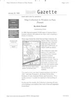
From an Erwin Raisz hand-
up a valuable resource for
drawn Christmas card.
Harvard faculty and
students.
"I've used it every year since I started teaching in the fall of
1965," said John Womack Jr., the Robert Woods Bliss
Professor of Latin American History and Economics. "It's a
terrific resource. I wouldn't be surprised to find anything in
there."
For the next few months, the Collection is showing off some
of its holdings in an exhibit of the work of Harvard mapmaker
Erwin Raisz.
http://news.harvard.edu/gazette/1999/01.28/maps.html
7/27/2015
Map Collection Is Window to Past, Present
Page 2 of 4
Raisz, who specialized in landform maps, which depict the
earth's physical features, was one of the last pen-and-ink map
makers, according to Head of the Map Collection David
Cobb. Raisz was SO careful in drawing mountains, streams,
and other land features that today his maps are collected as
art.
"He developed the landform map to such an extent of detail
above his contemporaries that it became an art form," Cobb
said.
The exhibit is just outside the Map Collection in Pusey
Library. It opened this month and runs through July 1.
The exhibit, jointly sponsored by the Boston Map Society,
presents a variety of Raisz's maps, along with some diaries,
sketch books, and personal items like Christmas cards, which
Raisz and his wife made up and illustrated to inform family
and friends about the past year. Raisz taught cartography from
1931 to 1950 at the now-closed Harvard Institute for
Geographical Exploration. He also curated the Institute's map
collection.
Though the Harvard Map Collection has a wide assortment of
maps from all over the world, its collection of early American
and European maps is particularly extensive. Though many
maps have been donated to the Collection, Harvard has
actively sought out and purchased maps since the late 1800s,
Cobb said.
Although collecting
efforts continue all
over the world, there
is an emphasis on
gathering the maps
of the former Soviet
Union, where many
Martin von Wyss is a digital
once-secret maps are
cartography specialist at the Harvard
now available.
Map Collection.
In fact, maps of some security-conscious countries, like
Turkey and South Korea, are more readily available from
former Soviet sources than from the countries themselves.
"We are buying maps of Turkey and Cuba that are in Russian
because we can't get them from the original country," Cobb
said. "We can't get maps from South Korea but we can get
Russian maps of South Korea."
http://news.harvard.edu/gazette/1999/01.28/maps.html
7/27/2015
Map Collection Is Window to Past, Present
Page 3 of 4
In recent years, faculty and students using the Collection can
get maps from another unique source: themselves.
With computerization and the increasing availability of
federal, state, and local data, Collection staff can help students
and faculty create their own maps, showing whatever data is
pertinent to their subject of study.
"We feel at times the data rains on us," Cobb said. "We used
to have to wait for Rand McNally or the U.S. government to
produce a map. Now we have that data and we can produce a
map any way a student or faculty member wants it."
Another thrust has been to expand the Collection's presence
on the World Wide Web, Cobb said. The Collection's Web
page contains a few maps, including the Massachusetts
Electronic Atlas, which uses GIS, a geographic information
system to help users create their own maps of Massachusetts
based on factors such as crime, median income, and other
statistics of their choosing.
Prue Adler, assistant executive director of the Association of
Research Libraries in Washington, D.C., said GIS projects
such as the Massachusetts Electronic Atlas provide access to
data in a visual way not available until recently.
"[GIS] gives the ability to manipulate information visually in
a way very, very differently from what we had before," Adler
said. "Harvard has done quite an extraordinary job, not just in
making it accessible to the University community, but to the
broader community through its Website," Adler said.
The Web presence and
increasing availability
of government
information has
expanded the pool of
people who use the
Collection, Cobb said.
From the traditional
users in the humanities
have been added
Harvard Map Collection Director
David Cobb describes two
everyone from botanists
panoramas by Erwin Raisz,
to researchers from the
Harvard's most prominent
School of Public Health.
mapmaker.
In the early '90s,
perhaps a half-dozen people would come into the Collection
in a typical day. Today the number is closer to 50, Cobb said.
http://news.harvard.edu/gazette/1999/01.28/maps.html
7/27/2015
Map Collection Is Window to Past, Present
Page 4 of 4
"We've seen a tremendous increase [in usage]," Cobb said.
"Digital information has brought people here who never were
aware there was a Map Collection."
Managing the flood of data brought on by the Information
Age is one of the Collection's biggest challenges, Cobb said.
Collection managers need to ensure that the historic paper
collection is not forgotten in the flood of new data.
"We don't want to over-emphasize one or the other," Cobb
said. "If we stayed just with the paper collection, we would
have become a paper museum. But we don't want to become a
computer lab, either."
The Collection's strength, from Cobb's point of view, is the
fact that it does have extensive collections of both old maps
and current records. One can see students in the library, he
said, working at a computer, with sheets of data spread before
them and an old map or atlas on the floor near their chair.
"People can look at old maps of the 15th and 16th centuries
and follow changes in boundaries, transportation systems, and
other things up to the present day," Cobb said.
Map Maker Erwin Raisz
What: Exhibit of the work of Harvard mapmaker Erwin Raisz
When: Through July 1
Times: 9 a.m. to 5 p.m.
Where: Harvard Map Collection, Pusey Library
Sponsors: Harvard Map Collection and the Boston Map
Society
G
Copyright 1998 President and Fellows of Harvard College
http://news.harvard.edu/gazette/1999/01.28/maps.html
7/27/2015
Viewer Controls
Toggle Page Navigator
P
Toggle Hotspots
H
Toggle Readerview
V
Toggle Search Bar
S
Toggle Viewer Info
I
Toggle Metadata
M
Zoom-In
+
Zoom-Out
-
Re-Center Document
Previous Page
←
Next Page
→
Raisz, Erwin J.
Details
Series 2

