
From collection Organization

Related Items
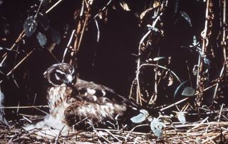
Pant Ce Exhibit Birds
Color slide of a marsh hawk sitting on a ground nest next to vegitation. Notes on slide read: Marsh Hawk, #97 Color slides which are part of an exhibit. The slides are numbered were not stored in the box in sequential order. The slides are…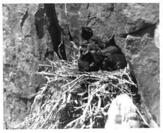
Raven Nestlings
8 X 10 black and white photograph of several newly hatched birds in straw nest in the side of the cliff. Black birds one with mouth opened in center. Paper attatched to the back, “ This Nestful, quite full in fact, of young ravens was phot…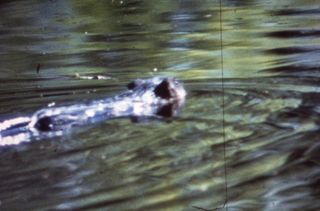
Pant Ce Exhibit Birds
Color slide of a muskrat swimming in a body of water. The slide is out of focus. Notes on slide read: Muskrat, #77 Color slides which are part of an exhibit. The slides are numbered were not stored in the box in sequential order. The slide…
Acadia
Mapr distributed to all park visitors 2011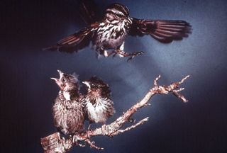
Pant Ce Exhibit Birds
Color slide of three song sparrows. Two are sitting on a branch looking to the left and one bird is comming in for a landing on the branch. Notes on slide read: Song Sparrows, #69 Color slides which are part of an exhibit. The slides are n…
Map of Proposed Changes to Eden Street, Bar Harbor
Map of proposed changes to Eden Street, Bar Harbor. Date of map not marked, most likely 1950s.60s.
A. Murray Young Path, Acadia National Park, Hancock County, ME
A. Murray Young Path (ANP trail #25) is a long, gradually ascending, highly crafted, memorial endowed woodland trail that travels up the south gorge between Cadillac and Dorr Mountains, starting from the Canon Brook Path (#19) to the inter…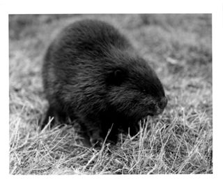
Beaver
Black Beaver. The back of the photograph is marked: "The beaver is the largest of American rodents. Almost exterminated by the turn of the century, they have now been re.established in the wilder sections of the country. There are several …
Amphitheatre Trail, Acadia National Park Hancock County ME
The Amphitheatre Trail (ANP #56) travels through woodland and along Little Harbor Brook, with some open ledges near Birch Spring. The south end of the trail starts at the Little Harbor Brook carriage road bridge and ascends north, then goe…

