
From collection Jesup Library JDR Jr. Collection

Page 1

Page 2
Page 3
Page 4
Page 5
Page 6
Page 7
Page 8
Page 9
Page 10
Page 11
Page 12
Page 13
Page 14
Page 15
Page 16
Page 17
Page 18
Page 19
Page 20
Page 21
Page 22
Page 23
Page 24

Page 25
Page 26
Page 27
Page 28
Page 29
Page 30
Page 31
Page 32

Page 33
Page 34
Page 35
Page 36
Page 37
Page 38
Page 39
Page 40
Page 41
Page 42
Page 43
Page 44
Page 45
Page 46
Page 47
Page 48
Page 49

Page 50
Page 51
Page 52
Page 53
Page 54
Page 55
Page 56
Page 57
Page 58
Page 59
Page 60
Page 61
Page 62
Page 63
Page 64
Page 65
Page 66
Page 67
Page 68
Page 69
Page 70
Page 71
Page 72
Page 73
Page 74
Page 75
Page 76
Page 77
Page 78
Page 79
Page 80
Page 81
Page 82
Page 83
Page 84
Page 85
Page 86
Page 87
Page 88
Page 89
Page 90
Page 91
Page 92
Page 93
Page 94
Page 95
Page 96
Page 97
Page 98
Page 99
Page 100
Page 101
Page 102
Page 103
Page 104
Page 105
Page 106
Page 107
Page 108
Page 109
Page 110
Page 111
Page 112
Page 113
Page 114
Page 115
Page 116

Page 117
Page 118
Page 119
Page 120
Page 121
Page 122
Page 123
Page 124

Page 125
Page 126
Page 127
Page 128
Page 129
Page 130
Page 131
Page 132
Page 133
Page 134
Page 135
Page 136
Page 137
Page 138
Page 139
Page 140
Page 141
Page 142
Page 143
Page 144
Page 145
Page 146
Page 147
Page 148
Page 149
Page 150
Page 151
Page 152
Page 153
Page 154
Page 155
Page 156
Page 157
Page 158
Page 159

Page 160
Page 161
Page 162
Page 163
Page 164
Page 165
Page 166
Page 167
Page 168
Page 169
Page 170
Page 171
Page 172
Page 173
Page 174
Page 175
Page 176
Page 177
Page 178
Page 179
Page 180
Page 181
Page 182
Page 183
Page 184
Page 185
Page 186
Page 187
Page 188
Page 189
Page 190
Page 191
Page 192
Page 193
Page 194
Page 195
Page 196
Page 197
Page 198
Page 199
Page 200
Page 201
Page 202
Page 203
Page 204
Page 205
Page 206
Page 207
Page 208
Page 209
Page 210
Page 211
Page 212

Page 213
Page 214
Page 215
Page 216
Page 217
Page 218
Page 219
Page 220
Page 221
Page 222
Page 223
Page 224
Page 225
Page 226
Page 227
Page 228
Page 229
Page 230
Page 231
Page 232
Page 233
Page 234
Page 235
Page 236
Page 237
Page 238
Page 239
Page 240
Page 241
Page 242
Page 243
Page 244
Page 245
Page 246
Page 247
Page 248
Page 249
Page 250
Page 251
Page 252
Page 253
Page 254
Page 255
Page 256
Page 257
Page 258
Page 259
Page 260
Page 261
Page 262
Page 263
Page 264
Page 265
Page 266
Page 267
Page 268
Page 269
Page 270
Page 271
Page 272
Page 273
Page 274
Page 275
Page 276
Page 277
Page 278
Page 279
Page 280
Page 281
Page 282
Page 283
Page 284
Page 285
Page 286
Page 287
Page 288
Page 289
Page 290
Page 291
Page 292
Page 293
Page 294
Page 295
Page 296
Page 297
Page 298
Page 299
Page 300
Page 301

Page 302
Page 303
Page 304
Page 305
Page 306
Page 307
Page 308
Page 309
Page 310
Page 311
Page 312
Page 313
Page 314
Page 315
Page 316
Page 317
Page 318
Page 319
Page 320
Page 321
Page 322
Page 323
Page 324
Page 325
Page 326
Page 327
Page 328
Page 329
Page 330
Page 331
Page 332
Page 333
Page 334
Page 335
Page 336
Page 337
Page 338
Page 339
Page 340
Page 341
Page 342
Page 343
Page 344
Page 345
Page 346
Page 347
Page 348
Page 349
Page 350
Page 351
Page 352
Page 353
Page 354
Page 355
Page 356

Page 357
Page 358
Page 359
Page 360
Page 361
Page 362
Page 363
Page 364
Page 365
Page 366
Page 367
Page 368
Page 369
Page 370
Page 371
Page 372
Page 373
Page 374
Page 375
Page 376
Page 377
Page 378
Page 379
Page 380
Page 381
Page 382
Page 383
Page 384
Page 385
Page 386
Page 387
Page 388
Page 389
Page 390
Page 391
Page 392
Page 393
Page 394
Page 395
Page 396
Page 397
Page 398
Page 399
Page 400
Page 401
Page 402
Page 403
Page 404
Page 405
Page 406
Page 407
Page 408
Page 409
Page 410
Page 411
Page 412
Page 413
Page 414
Page 415
Page 416
Page 417
Page 418
Page 419
Page 420
Page 421
Page 422
Page 423
Page 424
Page 425
Page 426
Page 427
Page 428
Page 429
Page 430
Page 431
Page 432
Page 433
Page 434
Page 435
Page 436
Page 437
Page 438
Page 439
Page 440
Page 441
Page 442
Page 443
Page 444
Page 445
Page 446
Page 447
Page 448
Page 449
Page 450
Page 451
Page 452
Page 453
Page 454
Page 455
Page 456
Page 457
Page 458
Page 459
Page 460
Page 461
Page 462
Page 463
Page 464
Page 465
Page 466
Page 467
Page 468
Search
results in pages
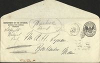
Markoe Lot
DEPARTMENT OF THE INTERIOR,
NATIONAL PARK SERVICE
Markre
OFFICIAL
WASHINGTON
Lafayette
fand
4
1921
National Palt Lynaw
SECURITY
Ban Haun Main
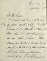
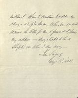
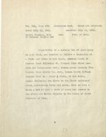
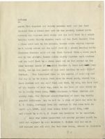
Feb 5th 1921
Washington W.C.
Wear M Xyann,
(1) I will Unit Myself to nn Ogden
(2) you drawing of Cow lots
I believe to be he error, but I Cannot be
sure Juring
four darin Whw I return think,
surveywar made al the have beefist
fought, N the am one nty laud ascutance,
but what because of that Jully I
do out kum- (3) but regard to
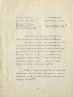
II
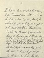
the Marker land Uu had best Couvery
If the Government now lots E ry for
the plan which return, leaving D
which in Complicated by My residuary light
to be dealt hit late these two lot,
E.which Mm M. originally ound, devived
through hu hustand from th Ringham their,
and 4, which the got by elebange from Yes
and which was party the product My father
bought to Higgin land
Do getty
this had Ext, ready for acceptance
In the dud you Impa Mr. M's
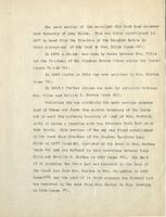
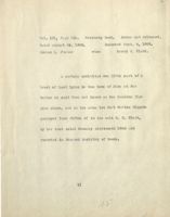
III
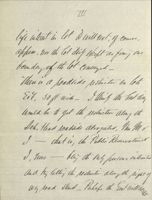
life interest the lot Id will W (.of Counce,
appear Un the lot daily except as for your
form day with lot Conveyed-
then in a poadtide restricted On lot
Ert, 50 ft wide_ Ithing the best way
undala te get the pesticution along the
Deb. Head roadside atrogated, Mu Mr
I- - that in, the Public Reservation
I, him - bling the my purm interested
and hy letter, its. restriction
Why load stand Pubefo the
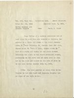
iv
it vo; if ful, we Can what the did at
the taken, decd what lie beyond a
Culam line - the 50ft live ben- -
leave the real fn lem, lu the hands y
the Public Reservations to them
as I cell it, that Mus M's deed
Was drawn last fall Please let
nu be assured on this
How about the Rowler hadly Hallicore
War that also decded for the G the
Reservation ? as how is it how held?
V
the R g which
you find Mr City dated Feb. gnd f have
gone to this & on that date_ will
unit to this hy Jely, concerning it
I thing it as good ar you Could
have dom He culaurly would lu
are to acquirs new all he Can_
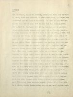
Let the kun What you have done
about the M Harland land, wau doing
It is Mifer but to Licure that, N the John
you Can www.gnt an often be it, fir
VI
litte ar on other fortelt, the
better the Rock land Mumin Was
1
unit With again about along live
Neu if the will agree to tell at ay
learnable price- alm t then also, let
Mu kunw
Hadly wit ham got back by now_
Ihall Mazon between him V New Ent
for a while longer linth Rufy mm
polled as bay movement
Ry the Way, th B.H. Bill sent me
III
tu must Statumt which I/o then
Moon, checkmark_ntt Myma L the W. G.g Acadia-
GRW
addressed Steely to weft y the
duterior Washing W.C v that they
Mached tue shows intelligence Oa
Done fair part here In I am a
"field Office " he the with to hier
have many thousan Imployer li it
Acattend the Whole Comily Mum; and
July the National Party Durin purble
would know that Mar hen Plan
instruct them to Continue faddin Mr
always at Ra Hair, When Some One will
Mccium the letteffor Me fourned it,bang
they address - always liable to la a
shifting one When I aw away-
The Sincerely
large B. was
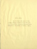
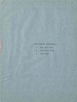
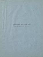
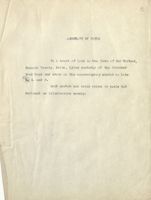
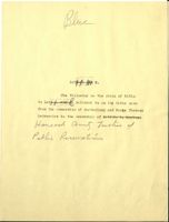
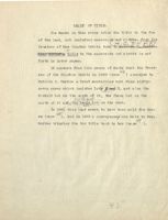
ABSTRACT OFTITLE
OF
PROPOSED EXTENSION
TO
LAFAYRTTE NATIONAL PARK,
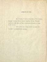
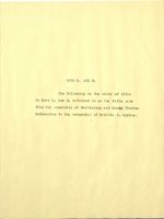
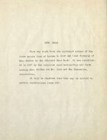
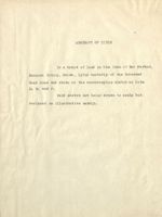
ABSTRACT OF TITLE
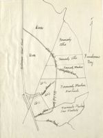
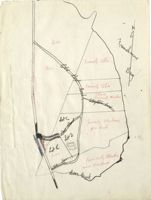
To a tract of land in the Town of Bar Harbor,
Hancock County, Maine, + lying easterly of the Schooner
Head Road and shown on the accompanying sketch as lots
D. E. and I'de
Said sketch not being drawn to scale but
designed as illustrative morely.
EARLY HISTORY
V
EARLY HISTORY
Mount Desert Island was formerly S part of the French
Province of Acadia. In 1688 Louis x1V, King of France,
granted to M. De La Motte Cadillac, one lesgue of land on
each side of the river Donaquec (now Jordans River) to-
rether with "Mount Desert Island and other islands on the
fore part of said two leagues."
So far 9.8 we know M. Cadillac did not take possession
of the property and by the Trouty of Utrecht, which was
concluded between Great Britain End France, Mount Desert
became a part of the District of Maine an appendage of the
British province of Massachusetts.
In the year 1762 the General Court of Massachusetts
granted the Island of Mount Desert to Francis Barnard,
Governor of Massachusetts. But Barnard Was 8 British
sympathizer, and going back to England just before the
Revolution, his estates were soon after the war confiscat-
ad by the State.
In 1785 John Barnard, son and devisee of Trane is Barn-
ard, made application to have his father's confiscated
estates restored to him, and producing evidence that he
had been a patriot notwithstanding his father's Coryism
the General Court granted to him (in 1785) an undivided
moiety of the Island. About this time Maria Theresa Do -
Greguire, grand-daughter and heir of M. Cadillac appeared
and potitioned to have the grant of the French King to her
ancestor confirmed to her. The General Court considered
her application favorably and while protesting that Madam
DeGregoire had no legal right to the estate, and providing
that the act should not be drawn into 8 precedent, in 1787
by Resolve granted to Kadam DeGregoire and her husband
Bartholemy DeGregoire "All such parts and parcels of the
Island of Mt. Desert and other islands and tractsof land
particularly described in the grant or patent of his late
Most Christian Majesty Louis X1V to said Mongieur De La
Motte Cadillac, which now remains the property of the
Commonwealth whether by original right, cessation, confis-
cation or forfeiture, TT conditioned however that the De-
Gregoires should become naturalized. Their naturalization
was effected immediately after.
The Frants to Cadillac and to the Barnards do not
appear of record in this County, The former is recorded in
Quebec, the latter in the Secretary of State's office in
Massachusetts.
The grant to the Degeegoires and the naturalization
proceedings appear of record in the Hancock County Maine
Registry of Deeds, in Vol. 1, Page 426, and Vol. 2, Page 199.
Except where otherwise specified, the records herein
referred to are those of the Hancock County, Maine, Registry
of Deeds.
PARTITION OF THE ISLAND.
In the year 1788 Madam DeGregoire and her husband
petitioned to the Supreme Judicial Court in Massachusetts
to have the property partitioned and their moiety set off
to them to hold in severalty.
An attorney appeared for John Barnard and consented to
the proceedings and Stephen Jones, Nathan Jones and Thomas
Richardson were appointed Commissionery to make the parti-
tion. Their report was confirmed in 1794 and is found of
fecord in Vol. 2, Page 487 and reads as follows:
"We, Stephen Jones, Nathan Jones and Thomas Richardson
pursuant to the foregoing warrant to us directed. have set
off to Bartholemy DeGregoire and Maria Theresa DeGregoire,
his wife, their moiety of the Island of Mount Desert which
is bounded as follows, viz: Beginning above Mr. James
Richardson's st & stake and stones at the have of the tide
at the Northern extremity of Mount Desert Sound and from
thence running North thirty-e ight degrees West to a stake
and stones upon the adge of the bank of high water mark upon
the Northern side of said Island: thenco Easterly along by
highwater mark down to and around the East end of said
Island thence Westerly by the shore to said Mount Desert
Sound: then Northerly by the shore up said Sound to the
first mentioned bound, and that the whole of that nart of
said Island to the Westward of said Sound and of said North-
erly line from the head of said Sound to the Northerly
shore to be the moiety (jr share of John Barnard, Esa.
Bartholemy and Maria Theresa DeGrogoire thus acquired
title to all that part of Mount Desert Island lying east
of Somes Sound, including the pr perty in question.
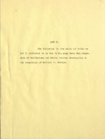
LOT F.
The following is the chain of title to
Lot F. referred to on the title page from the owner-
ship of Barthclemy and Maria Theresa DeGregoire to
the ownership of Matilda C. Markoe.
This parcel comes out of a lot, marked on the plan
of the Island of Mount Desert, "John Cousins" although there
is, of record, no deed to him of the property. I do not
know what his relation was to the property, he may have
been a squatter upon it or it may have been bonded to him.
The fact that it is so marked upon the plan has no special
importance.
It was divided into two parts, the eastern part
was known as the Zacheus Higgins lot and the western part
as the Doan Higgins lot. While the locus seems to come
out of the Zacheus Higgins lot, some part of it may extend
into the Dean Higgins lot. I am therefore setting forth
the detailed history of both lots.
1
Vol. 2, Page 558.
Warranty Deed.
Dower released.
Dated March 28, 1792.
Recorded Sept. 1, 1794.
Bartholomy DeGregoire &
Maria Theresa DeGregoire
nee de Caddillace
-to-
Henry Higgins.
A certain tract or parcel of land containing one
hundred acres situated lying and being on Mount Desert Island
in the County of Hancock & Commonwealth of Massachusetts &
bounded 8.9 follows viz: beginning at a stake and stones,
the bounds between Stephen Higgins and Henry Higgins, first
running north sixty five degrees west five rods to a pine
tree, then south 15 degrees west 347 rods to an oak stake,
then south seventy five degrees East 60 rods to a cedar
stump, then North 15 degrees East to the Shore - then fol-
lowing the shore to the first mentioned bounds - Together
with all the Estate, right, title, Interest, use, property
claim and demand whatsoever of us the said Bartholomy &
Maria Theresa which we now have or at any time heretofore had
of in, and to the aforementioned premises, with the appur-
tenances, or any part thereof, or which at any time hereto-
fore has been held, used, occupied, or enjoyed as part or
parcel of the same.
2
HEIRS OF-HENRY HIGGINS.
I learn from Eben Hamor's History of the Town of
Eden, now Town of Bar Harbor, that Henry Higgins died March
24, 1794, leaving two children Stephen and Mary, and a widow
Anna, who married Roger Googins.
The following is an extract from said History:-
Israel and Mary Snow Higgins
See Book 1, p. 116.
Their children were:
1.
Henry, born Nov. 27, 1769 at Eastham mar. Ann
Googins and settled in Trenton (now Lamoine) He died
Mar. 24, 1794.
Their children were:
1. Stephen
settled in Trenton (now Lamoine)
see p. 159.
2.
Mary
married Eaton settled in Trenton (now
Lamoine)
Henry Higgins' widow mar. Roger Googins of Trenton
(now Lanoine)
3
ZACHEUS
HIGGINS
LOT.
The heirs of Henry Higgins, the grantee in the
preceding deed, conveyed the western half of the "Cousins"
lot to Dean Higgins, see page 19. No deed, however, is
found of record of the eastern half.
David Stanwood who apparently claimed title to
it died without conveying.
All of his heirs conveyed except Thomas born in
1793 and Humphry born in 1809.
I have been unable to learn about them.
They
may have pre-deceased their brothers and sisters. So far
as I can learn no one has claimed any interest under them.
And at this late date I feel no claim could be success-
fully made.
4
DAVID STANWOOD AND HIS FAMILY
David Stanwood son of Jacob and Martha Bradstreet
Stanwood WES born Aug. 22, 1772, married Eunice, daughter
of Thomas and Eunice Wasgatt. She was born at Mt. Desert
Feb. 2. 1777, settled at Bar Harbor. He died August 6,1818.
Their children were :-
Thomas born Feb. 7, 1793
Sally
"
May 6, 1796 married 1st Richard son of
Semuel and Lydia Higgins Hadley, sottled at Town Hill married
2nd Dea. John Dodge of Blue Hill, where she died.
Job born Oct. 17, 1798 died Sept. 13, 1818.
Deborah born June 20. 1801 married see p. 154
Roxalana 77
April 3, 1804
Eunice " May 2, 1807
Humphry " Aug. 31, 1809
William W. " June 1, 1812
Martha
11
Aug. 10, 1815 married Zacheus son of
Abijah and Nancy Buckley Higgins sottled at Cromwells Herbor.
She was deaf and dumb.
NOTE:- The above was taken from Eben Hamor's History
of Eden.
5
Vol. 67, Page 178.
Quitclaim Deed.
Dower not released.
Dated Aug. 30, 1834.
Recorded June 27, 1838.
William Stanwood
-to-
Dean Higgins.
All my right title & interest in & unto a
certain tract or lot of land being & lying in Eden
aforesaid it being known as the lot of land former-
ly owned by David Stanwood of said Eden deceased and
now in common with the other heirs of said deceased,
containing fifty acres more or less.
NOTE:- Apparently by some oral arrangement Dean
Higgins accepted in place of the above the eight
and a half rod strip which he conveyed to Charles
Bunker (see page 24)
6
Vol. 127, Page 143. Quitclaim Deed.
Dower not released.
Dated Dec. 26, 1846.
Recorded Sept. 3, 1866.
Eunice Higgins, John Dodge,
Sally R Dodge, Iseac
Collier and Roxalana Collier. -to-
Martha Higgins.
In Eden:
Beginning at a stake and stone the bounds be-
tween Stephen Higgins & Henry Higgins first running
North 65° West 5 rods to a pine tree; then South
15° West 347 rods to an oak stake then South 75° East
60 rods to a Cedar stump then North 15° East to the
Shore then following the shore to the first mention-
ed bounds, containing forty five acres more or less.
Reference to be had to former deeds of said lot.
NOTE: George Foster and Eunice foster appear
in the body of the deed, but they do not sign.
Eunice Foster, however, released her
interest by separate deed, see page 15. The interest
of her husband George being only a dower right, pro-
vided he survived his wife, lapsed upon his death.
7
Vol. 127, Page 144.
Quitclaim Deed.
Dower released.
Dated Nov. 16, 1855.
Recorded Sept. 3. 1866.
Daniel Rodick end
Deborah Rodick
-to-
Martha Higgins.
All our right, title & interest in and
unto a certain tract or lot of land being and
lying in Eden aforesaid it being known as the
lot of land formerly owned by David Stanwood
of said Eden (now deceased) and now in common
with the other heirs of said deceased, con-
taining fifty acres more or less.
8
Vol. 114, Page 108. Quitclaim Deed. Dower not released.
Dated July 15, 1861.
Recorded July 23, 1861.
Martha Higgins, wife
-to-
Town of Eden.
of Zacheus Higgins 2nd
Four-fifths of a certain lot of land lying
in said Eden, and bounded as follows - Beginning at
a Stake and Stone at the Shors, running South 15
degrees West following Mr. Conners line three hun-
dred and forty-seven rods, thence south Seventy five
degrees East twenty Six rods, thence North fifteen
degrees East to E Stake & Stone, at the shore,
thence following the Shore to the first mentioned
bound, containing forty six ecres, more or less -
being a lot of land a part of which was deeded to
the aforesaid Martha Higgins by the heirs of David
Stanwood of Eden.
9
Vol. 127, Page 145.
Quitclaim Deed
Dated Oct. 14, 1865.
Recorded Sept. 3, 1866.
Benjamin H Higgins,
John McFarland and
Martha Higgins, wife of
Henry Knowles, Select-
to
Zacheus Higgins, 2nd.
men of the Town of Eden.
Four fifths of a certain undivided lot of
land, lying in said Eden and bounded as follows:-
Beginning at a stake and stones at the shore
running South 15° West following Wm. Conners line
347 rods; thence South 750 East 26 rods; thence North
150 East to a stake end stones at the shore; thence
following the shore to the first mentioned bounds,
containing 46 acres more or less in the whole lot,
and is that which was deeded to the town of Eden,
by the said Martha Higgins July 15, 1861.
NOTE: It does not appear that the Selectmen,
who executed this deed, wera authorized to do so by
vote of the town; To cure this defect a new deed was
obtained, see page 34.
10
Vol. 131, Page 315.
Warranty Deed.
Dower not released.
Dated August 25, 1868.
Recorded Sept. 4, 1868.
Eunice R. Foster
-to-
Henry H. Clark.
A certain undivided one fifth part of a
tract of land lying in the town of Eden at Bar
Harbor in said Town and known as the Zacheus Hig-
gins place, and is the same lot that Martha Higgins
conveyed four fifths of to the said H. H. Clark,
by her deed dated January eighteenth 1866 and
recorded in Hancock Registry of Deeds.
11
Vol. 127, Page 146. Quitclaim Deea.
Dower released.
Dated Jan. 18, 1866.
Recorded Sept. 3, 1866.
Martha Higgins and
Zacheus Higgins
-to-
Henry H. Clark
Four fifths of a certain undivided lot of
land lying in said Eden and bounded as follows, Be-
ginning at a stake and stone at the shore running
South 15 O West following Mr. Conners line 347 rods,
o
thence South 75 OWest 25 rods, thence North 15
East to a stake and thence at the shore thence
following the shore to the first mentioned bounds,
containing in the whole lot 46 acres more or less
and is the same lot deeded to the town of Eden by
me the said Martha Higgins July 15, 1861.
NOTE: The deed recites as being from Marthe
Higgins in hor own right and Zaccheus Higgins 2nd
in right of his wife Martha.
12
Vol. 131, Page 314.
Warranty Deed.
Dower released.
Dated Sept. 1, 1868.
Recorded Sept. 4, 1868.
Henry H. Clark
-to-
Charles H. Dorr and
Thornton K. Lothrop
In Eden:
A lot of land lying in the nei ghborhood of Bar
Harbor end known as the Zacheus Higgins lot and bounded
as follows, Beginning at a Stake and Stone at the Shore,
running South 15 degrees West following the Conners line
three hundred and forty seven rods, thence South seventy
five degrees East twenty five rods, thence North fif-
teen degrees East to a Stake and thence to the shore,
then following the shore to the first men tioned bounds,
containing fortysix acres more or less, said lot is to
be twenty five rods wide and no more measuring South
Easterly from Conner's line square across the lot, the Stake
and Stones at which the boundary of the premises begins
is situated on the Northerly shore of the Cove and the
above boundaries include the Southern side and landing
of the Cove.
13
Vol. 153, Page 268. Quitclaim Deed.
Dower released.
Datad July 19, 1875.
Recorded Nov. 12, 1875.
Thornton K. Lothrop
-to-
Charles H. Dorr.
half
One undivided/part # all that lot of land in
Eden in the County of Hancock and State of Maine in the
neighborhood of Ber Harbor and known as the Zacheus
Higgins lot bounded 28 follows
Beginning at E. stake and stones at the shore
running south 15 degrees west following the Conners
line three hundred end forty seven rods; thence South
seventy five degrees East twenty five rods, tienoe
North fifteen degrees East to a stake and thence to the
Shore then following the Shore to the first montioned
bounds containing forty six acres more or less, said
lot is to be twenty-five rods wide and no more measuring
South Easterly from Conners line square across the lot;
the Stake and Stones at which the boundary of the
premises begins is situated on the Northerly shore of
the Cove and the above boundaries include the southern
side and landing of the Cove or however otherwise the
premises may be bounded measured or described. Being
the seme premises conveyed to me by Henry H. Clark
by deed dated Sept 1, 1868 & recorded with Hancock
Deeds Vol. 131 page 314 with all the rights and
easements thereto belonging.
14
DEAN HIGGINS LOT
Vol. 42, Page 311. Warrenty Deed. Dower not released.
Dated March 11, 1822.
Recorded March 19, 1822.
Stephen Higgins, Anna
Googins and Mary Eaton -to-
Dean Higgins.
In Eden:
Beginning at the shore at a stake and stone former-
ly the bounds between Stephen Higgins and Henry Higgins
first running North sixty five degrees West five rods to a
pine tree thence South fifteen degrees West three hundred
and forty seven rods to an oak stake thence South seventy
five degrees East thirty rods formerly to Devid Stanwood
Western line thence following said Stanwood line to the
shore thence following the shore to the first mentioned
bounds containing fifty acres be there more or less.
NOTE: The grantors herein are the two
children and widow of Henry Higgins, see page 7
e
15
Vol. 65, Page 445. Warranty Deed.
Dower Released.
Dated May 16, 1838
Recorded June 27, 1838.
Dean Higgins
-to-
Ambrose Higgins.
In Eden:
Beginning at the shore at a stake and stone
formerly the bounds between Stephen Higgins end Henry
Higgins, first running north sixty five degrees West
five rods to E pine tree; thence south fifteen degrees
West, three hundred& forty seven rods to an oak stump:
thence south seventy five degrees East, thirty rods
formerly to David Stanwoods western line; thence
following said Stanwood's line to the shore; thence
following the shore to the first mentioned bounds,
containing fifty acres more or less with the buildings
thereon. Reference to former deeds of said lot.
16
Vol. 65, Page 446. Mortgage Deed.
Dower not released.
.
Dated May 16, 1838.
Recorded June 27, 1838.
Ambrose Higgins
-to-
Dean Higgins and Funice
Higgins, his wife.
In Eden:
Beginning at the shore at a stake & stone, former-
ly the bounds between Stephen Higgins & Henry Higgins,
first running north sixty five degrees west five rods
to & pine tree; thence South fifteen degrees West three
hundred and forty seven rods to an oak stump; thence South
seventy five degrees East, thirty rods formerly to David
Stanwoods western line; thence following said Stanwoods line
to the shore; thence following the shore to the first
mentioned bounds - Contains fifty acres more or less with
the buildings thereon- Reference to former deeds of said
lot.
After habendum appears:
PROVIDED NEVERTHELESS, that if the said Ambrose Higgins his
heirs, executors, administrators or assigns shall & do
during the natural lives of the said Deen Higgins & Eunice
Higgins his wife, & the survivor of them provide for the
maintenance of said Dean and Eunice according to their rank
& condition in life, & more particularly according to a
17
Vol. 65, Page 446.
2-
certain bond, being the one hereafter mentioned, and
perform the same, then this Deed & also said certain bond
bearing oven date with these presents, given by the said
Ambuose Higgins to provide maintenance &foresaid during
the natural lives Of the said Dean & Eunice shall be void,
otnerwise shall remain in full force.
NOTE: The bond referred to does not appear of record.
The conditions were apparently not fulfilled for Dean
Higgins afterward conveyed the same property to Charles
Bunker for the purpose of securing "maintenance" for
himself and his wife during the remainder of their lives.
See pages 24, 125 and 126.
18
Vol. 81, Page 3.
Quitclaim Deed. Dower not released.
Dated July 8, 1843.
Recorded Oct. 5, 1846.
Phebe Higgins
Widow of Ambrose Higgins
-to-
Deen Higgins.
All my right, title & interest in and to a certain
lot of land on which the said Deene Higgins now resides and
the same lot as conveyed by my late husband by mortgage deed
dated May 16th, A.D.1838 & recorded in Hancock Registry,
Book 65, Page 446. Beginning at the Shore at a Stake and
Stone, formerly the bounds between Stephen Higgins and
Henry Higgins, first running North sixty five degrees West
five rods to a Pine tree, thence South fifteen degrees
West, three hundred and forty seven rods to an Ock Stump;
thence South seventy five degrees East, thirty rods formerly
to David Stanwood's westerly line: thence following said
Stanwood's line to the Shore; thence following the Shore
to the first mentioned bounds:- containing fifty acres more
or less with the buildings thereon - Reference to former
Deeds of said lot.
19
Vol. 80, Page 347,
Warranty Deed.
Dower released.
Dated October 20, 1846.
Recorded Dec. 51, 1846.
Dean Higgins
-to-
Charles Bunker.
A certain tract or parcel of land lying in Eden
aforesaid, and bounded and described as follows in the
original deed of said lot recorded in the Registry of
Deeds, Book 42, Page 311, "Beginning at the shore at
a stake & stone formerly the bounds between Stephen Higgins
and Henry Higgins first running North sixty five degrees
west five rods to a pine tree; thence South fifteen degrees
West three hundred & forty seven rods to an oak stump;
thence South seventy tive degrees East thirty rods former-
ly to David Stanwoods western line; thence following said
Stanwood's line to the shore; thence following the shore
to the first mentioned bounds - containing fifty acres
more or less, with the buildings thereon."
Also another piece of land lying on the Eastern side of
the above named lot, and edjoining the same, eight &
a half rods in width extending from the shore to the head
of the lots.
NOTE: Apparently, by some oral arrangement
Deen Higgins accepted for his interest in the Stanwood lot,
acquired of William Stanwood, Page 10, the eight and &
half rod strip above described.
20
Vol. 113, Page 125.
Warranty Deed.
Dower not released.
Dated March 19, 1861.
Recorded May 13, 1861.
Lydia C Bunker
-te-
John Conners
In Eden:
Beginning at the Shore at as Stake and Stone thence
North sixty five degrees west five rods to E. pine tree
thence so fifteen degrees West three hundred and forty
rods to en Oak stump thence South Seventy five deg East
thirty rods to what was formerly David Stanwoods western
line thenco following said Stenwoods line to the Shore to
the first mentioned bounds containing fifty acres more or
less also another piece of lang lying on the Easternside
of the above named lot and adjoining the Same Eight and
a half rois in wedth extending from the Shore to the
head of the lots.
NOTE: After the covenents appears the following: Except
the lot 81 rods wide adjoining the first mentioned lot
against the heirs of David Stenwood. The 81/2018 rod strip is
therefore excepted from the covenants of warranty.
The deed purports to be from Lydia C Bunker, it
is signed however Lydia C. Mills, the acknowledgment is
"Lydia C. Bunker originally, now Lydia C. Mills."
21
Vol. 131, Page 263.
Warranty Deed. Dower not released
Dated July 7, 1868.
Recorded Aug. 10. 1868.
Lydia C. Mills.
-to-
John Conners.
In Eden:
Beginning at the Shore at a Popple stone beach
on the North side of what is termed Dean Higging Cove
at Ei Stake and Stone thence running North sixty five
degrees West five rods to Vm. Douglass land, Thence
South fifteen degrees West by said Douglass land three
hundred and forty roas to an Oak stump thence South
seventy five degrees East thirty rods to what was for-
marly called David Stahwood's Western line thence fol-
lowing said Stanwood's line to the Shore to & Cedar
Stake thence following the Shore in as Northerly direc-
tion to the first mentioned bound Containing Fifty
Ecres more or less. Also another piece of land lying
on the Eastern side of the above named lot and ed-
joining the same Eight and & half rods in width ex-
tending from the Shore to the head of the Lot.
NOTE: After the covenants appears the following: Except
the lot of 81/2 rods wide edjoining the first mentioned lot
in fevor of the heirs of David Stanwood. The 81 rod strip
is therefore excepted from the covenants of warranty.
The deed purports to be from Lydia C. Bunker, it is
signed however Lydia C. Mills, the acknowledgment is "Lydia
C. Bunker originally, now Lydia C. Mills. "
22
Vol. 131, Page 282.
Warranty Deed.
Dower released.
Dated Aug. 13, 1868.
Recorded Aug. 17, 1868.
John Conners
-to-
Mary H Mahan, wife of
Dennis H. Mohan.
In Eden:
Beginning at a Stone at a Cobble Stone beach on
the North side of what is termed Dean Higgins Cove at &
Stake end Stone; thence running North 659 West five role
to William Douglass' land thence South 15° West by said
Douglass land three hundred and forty rolls to an Oak
stump: thence South 75° East thirty rods to what was for-
merly called Devil Stanwood's Western line; thence fol-
lowing said Stanwood's line to the Shore to a ceder Stake;
thence following the Shore in a Northerly direction to
the first mentioned bound containing fifty acres more
or less. Also another piece of land lying on the Eastern
side 01 the above named lot and aijoining the same eight
and a half rods in width, extending from the shore to
the head of the lot, with all the buildings on the above
described premises being the sime conveyed to me by deed
of Lydia C. Mills, dated July 7th A. D. 1868, and 10-
corded in Hancock Registry Vol. 131, Page 263.
23
Vol. 143, Page 81,
Warranty Deed.
Dower not released.
Detod June 15, 1872.
Recorded June E1, 1872.
M.H. Mahan
widow of Dennis
-to-
Charles H. Dorr.
H. Mahan
In Eden:
Beginning at a stone at E. cobble stone beach on the
North side of what is termed Dean Higgins Cove, at E stake
and stone, thence running norty sixty five degrees (650)
West five rods to William Douglass' land, thence South
fifteen degrees (15°) West by said Douglass' land three
hundred and forty cods to an oak stump, thence South seventy
five degrees (75°) East thirty rods to what was formerly
called David Stanwood's Western line thence following said
Stanwood's line to the shore to a codar stake thonce fol-
lowing the shore in & Northerly direction to the first
mentioned bound, containing Fifty acres more or less. Also
another piece of land lying on the Eastern side of the above
named lot and edjoining the same eight and a half rois in
width extending from the shora to the head of the lot,
with all the buildings on the above described premises.
24
Charles H. Dorr died prior to May 1893, and by
his will dated July 11, 1891 and probated in Hancock County,
Maine, at the May term 1893 End recorded in Vol. 85, Page
160 of the Probate records for said Hancock County, de-
vised all his property to his wife Mary G. Dorr.
The will is also recorded in the Registry of
Deeds in Vol. 272, Page 15.
241/2012
Will of Charles H. Dorr
I, Charles Hazen Dorr of Boston Massachusetts
do make and publish the following as and for my last will and
testement hereby revoking all wills by me at any time here- -
tofore made, intending to dispose of all my property real
personal and mixed wherever situate, and to exercise all
powers of appointment which I may under any will settlement
or otherwise possess.
First.
I direct all my just debts and all proper charges
against my estate to be first paid.
Second. I give to my wife Mary Gray Dorr surviving me all
my property real personal or mixed including all that I have
at my decease any interest in claim to or power over:-
should she not survive me, then to my son George Bucknam
Dorr should he survive his mother and myself. Should
neither my wife or son survive me I give the same after
payment of such legacies as I may hereafter by codicil
bequeath to form E charitable trust fund the income to be
applied from time to time to such charitable purposes ES
my trustees may deem most for the benefit of the people
of the New England States and especially of Boston it
being my wish that it should be used to stimulate and aid
such movements as shall in the opinion of my trustees
tena to make the general life of the people more vigorous
25
and healthful mentally morally or physically without being
in their character "specifically religious or political.
It is also my wish that the said income should not be used
for the alleviation of already existing evils that have re-
sulted from unwholesome conditions of life among the people
as in the support of hospitals so called and similar insti-
tutions but shall be rather used to aid in altering those
conditions to others of & more healthful character.
Nor do I wish either that this income should be spent in
advencing the cause of a higher education by giving aid to
universities and similar institutions but rather in the
develooment of Ei sound and practical education for working
men and women and in giving aid to any wisely conceived
movements for widening their interests, developing their
powers OI mini or body, cultivating their tastes enlarging
their opportunities for wholesome pleasure and giving a
healthful end invigorating environment to their lives.
It is my intention by codicil to express my wishes more
fully, but if I should not do so I believe that the above
directions will suffice.
Third. I appoint Charles P. Bowditch of Boston first
trustee of said Trust and request that by writing in his
lifetimo, if he see tit or by will, ne associate with
himself or appoint such persons as he sees fit to con-
stitute Ei perpetual Board of Trustees to carry on the
26
trust with power to fill vacancies and give to said
Bowditch so long as he see fit to remain sole trustee
and to the Board after he shall have once constituted it,
or should it fail to ne constituted to such Trustees
es the Court may appoint full power of management inclu-
ding power to lease or let for long or short tarms and
for improvement or otherwise and with or without option of
purchase, to change real to personal or vice versa to sel 1
real or personal estate at any time forming part of the
funa at public or private sele and convey tree of all trust
and without liability to see to application of purchase
money, end in general all the powers of an absolute owner,
and I desire that no bonds or sureties or. surety be required
of any trustees hereunder and said trustees may delegate
their power by power OI attorney for not over six months at
& time and the acts of 8 majority shall be as velid US
though joined in by all,
Fourth. I Eppoint said Charles P. Bowditch sole executor
of this will and request that no sureties or surety be
required on his bond and I give to my said executor and to
any aaministrator of my estate with this will annexed rull
power to sell any real or personal estate I may leave at
public or private sale or to dispose by gift of any part of
it that he may see fit, at any time whatever after my decease
27
if deemed expedient for change of investment 01 otherwise
the proceeds if there are any to be assets of my estate
End to convey accordingly free of all trusts 2nd without
liability on part of any purchaser to see to application
of purchase money.
Notwithstanling anything hereinbefore contained
I give all my personal effects, epparel, furniture, orna-
ments, works of act, books, viete, linon. supplies all
articles of personal or household use or ornament live stock
and the like to said Charles P. Bowditch free of all trust.
In witness whoreof I hereto set my hand and seal this
eleven th day of Jul, in the year eighteen hundred and nine-
ty-one.
Charles H. Jorr (Seal)
Signed, sealed and published by said tostator es and for
his last will and testament in our presence who in his
presence and the presence of each other have at his
request hereto set our hands witnesses.
Francis V. Balch
Charles S. Rackemann
Felix Rackemann.
28
Vol. 325, Page 252
Quit-Claim Doed
Dated May 27, 1898
Recorded June 10. 1898.
Inhabitants of the
Town of Eden
to
Mary G. Dorr
Four-fifths undivided of a certain lot of land
lying in said Eden, bounded as follows :-
Beginning at a stake and stones at the shore:
thence running South fifteen degrees West following lend
formerly of William Conners three hundred and forty-seven
rods; thence South Seventy-five - degrees East twenty-six
rods; thence North fifteen degrees East to & Stake and
stones at the shore; thence following the shore to the
first mentioned bound, containing forty-six acres more or
less in the whole.
Being the same land described in a certain deed
fromthe Municipal Officers of said Eden to Martha Higgins
dated October 14th, 1865 and recorded September 3rd, 1866
in the Hancock County Maine Registry of Deeds, Vol. 127,
Page 145.
The intent of this deed being to ratify and
confirm said former deed to the said Mary G. Dorr, who has
acquired title to the same under said Martha Higgins.
NOTE:
This deed was executed by John E. Bunker, Jr
H. E. Wakefield and L. A. Austin, who were in the body of
the deed recited to be the municipal officers of said town
and authorized by a vote of said town, at E meeting held
on the 26th dey of May 1898.
29
Vol. 377, Page 167
Abstract of Will of Mary G. Dorr
Dated May 28, 1902
Recorded May 28, 1902
Will dated Apr. 20, 1897
Will ellowed May 6, 1902.
First:
If my son George Bucknam Dorr survive me,
I devise and bequeath to him all my estate, real and
personal and I appoint to him all property over which I
may have any power of testamentary appointment.
30
Vol. 454, Page 547.
Warranty Dead
datad Oct. 12, 1907.
Recorded Oct, 30, 1908.
Goorge B. Dorr
-to-
Matilda C. Markoe.
In Bar Harbor.
Beginning at the junction of the division line
between land of the said Grentor and land of the said
Grantee herein, with the northeastern side of the Schooner
Head Road, so-called; thence North thirty two degrees and
ten minutes West (N. 32, 0 -10' W. ) but everywhere following
said Schooner Head Road saven hundred (700) feet, more or
less to the junction of said Schooner Head Road with the
private wey established and the boundaries of which fully
set forth in & certain indenture between the parties hereto,
bearing even date herewith (The Mount Desert Nurseries,
E corporation, being also E party to said indenture);
thence by the following three courses, but everywhere
following the center line of said private way, to wit, first,
South Seventy-three degrees East (S. 73 E. ) four hundred
and twenty-one (421) fect; thence South eighty-two degrees
and thirty minutes East (s. 82 o ~30' E.) sixty-three (63)
feet; thence North eighty-nine degrees & na thirty minutes
East (N. 89 0-30' E.) sixty-eight (68) feet to the division
line between land owned by the Crantor and land owned by the
Grantee herain; thence South twenty-one degrees and fifteen
minutes West (s. 21° -15' W.) but everywhere following
said division line four hundred and sixty-five (465) feet
454-547
2-
more or less to the place of beginning, containing three
acres, more or less. Being a parcel of land marked "Lot F. "
upon a certain plan made by E. W. Hill, C.E., and entitled
"Map of Property Belonging to Mrs. John Markoe and George
B. Dorr, Bar Harbor, Hancock County, Maine, 1907," which
plan is to be recorded herewith in the Hancock County, line,
Registry of Deeds, Book of Plans.
Two strips of land being parts and parcels of
said Lot F are hereby conveyed expressly subject to the fol-
lowing restrictions, not conditions subsequent, to wit:
First:- That no building or other structure
or any part thereof shell ever be erected or maintained there-
on, or upon any part of the same.
Second:- That no poles or wires for electrical
or other service carried on or above ground and no water
pipes or other pipes on or above the surface of the ground
shall ever be laid 01 maintained thereon. or upon any part
thereof.
Third:- That no yards or enclosures such as
yards for animals or poultry, stable yards, laundry yards or
yards for storage, shall ever be maintained upon any part
thereof.
Bourth:- That no manure or garbage heaps, garden
or other refuse or any other obvious source of disfigurement
or ammoyance to either sight or smell, shall ever be deposited
upon-any part thereof.
Vol. 454-547-
3-
The object and purpose of the above restrictions
is to preserve the beauty of the road sides end the pleasant-
ness of the roads to those abutting on or using them. The
strips of land hereby conveyed subject to the above rastric-
tions are described as follows:-
1st:- A strip of land fifty feet wide in every part
bounded Northerly by the Southern side line of said private
way; Easterly by Lot E., as shown upon said plan; Southerly
by a line parallel with the Southern side of said private way
and everywhere fifty feet distant therefrom; and Westerly by
said Schooner Head Road.
2nd:- A strip OI land fifty feet wide in every
part bounded Southwasterly by the Northeastern side of said
Schooner Head Road; Northwesterly by the strip of land next
hereinabove described as restricted; Northeasterly by E line
parallel with the Northeastern side of said Schooner Head
Road and everywhere fifty feet distent therefrom; and
Southeasterly by Lot E. as shown upon said plan.
The Grantee herein, for herself and her Heirs by
acceptance of this deed covenants and agrees with the Grantor
herein, his Heirs and Assigns that no part of said strips of
land fifty feet wide, next hereinabove described, shall ever
be used for any purpose prohibited by the restrictions above
set forth. It is agreed that said restrictions shall run with
the land and be binding upon the Grantee and all future
454-547
4-
owners and tenants thereof in favor of the Grantor, his Heirs
and Assigns and all future owners and tenants of his estate
known as "Old Farm" End all parts thereof, and all future
ownern and tenants of the lots of land conveyed by the Grantee
herein to the Grantor herein by deed bearing even date herewith.
But neither said Grantee herein nor her Heirs or any
future owner or tenant of seid restricted strips of land or any
part thereof shall be personally liable for any violation of
said restrictions by her or their Grantees or Lessees.
And I, the said George B. Dorr, for the consideration
aforesaid do hereby impose similar restrictions upon two strips
of land beingpart and parcel of my estate known as"Old Farm"
said strips of land being bounded and described ES follows:-
First: A strip of land bounded Northeasterly by the
Southwentern side of said Schooner He ad Road; Southerly by land
of the Grentee herein; Southwesterly by a line parallel with the
Southwestern side of said Schooner Head Road and everywhere fifty
feet distant therefrom; Northerly by a line parallel to the
Southern boundary line above described, so drawn that a production
thereof will intersect the Northeastern side line of the Schooner
Head Road at E: point fifty (50) feet Southerly from the junction
of said Northeastern side line with the Southern line of said
private way.
Second:- A strip of land bounded Southerly by the
Northern side of said private way; Masterly by the Western line
454-547
5-
of Lot C. . as shown upon said plan; Northerly by line parallel with
the Northern line of said private way and everywhere fifty feet
distant therefrom; and Westerly by seid Schooner Head Road.
And the said Grantor herein, for himself and his Heirs,
hereby covenants and agrees with the said Grantee herein,
her Heirs and Assigns, that no part of said strips of land
fifty feet wide next herein above described shall ever be
used for any purpose prohibited by the restrictions above
set forth.
It is agreed that said restrictions shall run with
the land End be binding upon said Grantor and Ell future
owners and tenants thereof, in favor of said Grantee, her Heirs
and Assigns and all future owners and tenants of the lot of
land herein described as conveyed, and all future owners
end tonants of land of said Grantee lying Southerly and
Easterly of said "old Farm" or any part thereof.
But, neither the said Grantor herein nor his Heirs,
nor any future owner of said strips of land or any part there-
of, shall be personally liable for any violation of said
restrictions by his or their Grantees or Lessees.
Said ways and restrictions are expressly excepted
from the operation of the covenants hereinafter contained.
LOTS D. AND E.
The following is the chain of title
to Lote I. and E. referred to on the title page
from the ownership of Bartholemy and Maria Theresa
DeGregoire to the ownership of Matilda C. Markoe.
Bartholomey and Maria Theresa DeGregoire gave to
Henry Jeckson a warranty deed, being one undivided moiety
of
Motust Desert Island. The deed Was dated August 4, 1792,
and recorded in Volume 1, Page 518. The island WES PE.C-
titioned by Commissioners appointed by the Suorene
Judicial Court in Massachusetts whose report was confirmed
in 1794 and is found in Volune 2, Page 487. This per-
tition gave the DeGregoires the eastern half of the island
which included the Iscus.
ii nry Jackson conveyed the same property to
William Bingham of Philodelphia, by warrenty deed, dated
July 9, 1796, end recorded in Volune 4, Page 74.
William Bingham by his will, dated January 30,
1804, and proved in this county February 27, 1810, and
recorded in the Probate Records Volume 5. Page 365,
devised Ell his American property to five trustees,
in trust, two-fifths for his son and three-fifths for
his two daughters. By the terms of his will, the trust
terminated prior to 1850 and the property became vosted
absolutely in the son and the heirs of the daughters in
the proportions above stated.
For the more convenient management of the estate,
the property was again put in the hands of trustees, Joseph
Reed Ingersoll, then United States Minister to Great
Britain, and John Craig Miller of Philad lphia, being
selected as trustees.
The trust under which these trustees claimed title WES
created by the following conveyances; deed dated December
17, 1851 and recorded in Book 98, Page 144; deed datel June
21, 1849 and recorded in Book 166, Page 308; deed dated
July 18, 1853 and recorded in Volume 98, Page 150; will
dated June 11, 1855 end recorded in the Probate Records
Volune 52, Page 156; deed dated April 11, 1861, and recorded
in Volume 143, Page 343; deed dated August 12. 1862 and
recorted in Volune 143, Page 346.
The said trustees were given the fullest nowers to sell
and convey and make and execute deeds 01 any or all of the
property and their grantees are absolved from ell responsi-
bility as to the application of the proceeds. It WES further
provided that the surviving trustee shall have power to fill
any vacancy caused by death, or otherwise.
There is another clause in these trust deeds providing
that the cestuis que trust may revoke or annul the trust at
any time by an instrument in writing executed in the manner
described in the trust deed.
The court of last resort in this state has decided that
the Bingham trust is not violative of the rule against ner-
petuities End that the titles derived under it are clear EO
far as this objection.is concerned; see Pulitzer VE. Living-
ston, 89 Maine Report Page 359.
In 1867 Mr. John Craig Miller having deceased,
William Bingham Clymer was appointed to fill the vacency
and convoyances were mede and executed vesting the property
in Messrs, Ingersoll end Clymer. See deeds dated December
4, 1867, and December 12, 1867, and recorded August 26,
1868 and June 30, 1894, in Vol. 132, Pages 49 & 52, and Vol.
282, Pages 28 & 35.
In 1868 Joseph Reed Ingersoll having deceased,
Charles Willing was appointed trustee to fill the vacancy
and conveyances were executed vesting the property in
Messrs. Clymer and Willing as trustees. See deeds dated
April 22, 1868, and recorded August 26, 1868, in 701. 132,
Pages 56, 60, 64 and 69.
In 1873 William Bingham Clymer having deceased,
Chapman Biddle was appointed to fill the vacancy, and
conveyences were made and executed vesting the title in
Messrs. Willing and Biddle as trustees,
See deeds dated
August 11th, 1873, and recorded Aug. 25th, and 27th, 1879,
in Vol. 167, Pages 18, 25,39 & 46.
CHAIN OF TITLE.
The deeds in this group bring the title to the fee
of the land, not including easements and rights, from the
Trustees of the Bingham Estate down to Matilda C. Markoe.
Mrs. Markoe's title to the easements and rights is set
forth in later pages.
It appears from this group of deeds that the Trust-
ees of the Bingham Estate in 1880 (page 46) conveyed to
Matilda C. Markoe a tract containing more than eighty-
seven acres which includes Lots D and E, and also the
Newbold Lot on the south of it, the Chase Lot on the
north of it and the Leeds Lot on the east.
In 1881 this land seems to have been sold for tax-
es ( page 48), but in 1883 8 conveyances was made to Mrs.
Markoe bringing the tax title back to her ( page 49).
Vol. 174, Page 100.
Quitclaim deed,
Dated May 4, 1880.
Recorded May 24, 1880.
Charles Willing and Chapman Biddle,
Trustees of the Estate which was
formerly of William Bingham, the
elder deceased
-to- Matilde C. Markoe.
Beginning neer the mouth of Best Brook at a point
on the sea between Ber derbor and Schooner Head at an iron
bolt in the ledge at low water mark and running thance South
fifty-six and three-fourths degrees West across the beach
to a stake on the top of the beach, which stake bears South
thirty-five and a half degrees East from a spruce tree on tue
top of the beech and is distant two rods and sixteen links
from said spruce tree (these courses and ell the courses here-
in given or described being from the magnetic meridian):
thence from said stake North seventy-nine degrees Test to the
centre line of said Bear Brook; thence in & general Wester-
ly direction for one hundred and fifteen rods and thirteen
links from the said stake on the top of said beach up the
middle of said Bear Brook where there is only one chennel
of seil Brook, but where there are more than two channels
of sui Brook in and through the middle line of the
mildle channel of said Brook, and where there are only two
channels OI said Brook, then through the middle of the Island
formed by the said two channels to a stake in the centre of
a small Island on the East line of land of Charles H. Dorr;
174-100
2-
thence on said East line of said land of said Dorr, North
nineteen degrees East one hundred and twelve rods to a
stake and stones on the South line of land of Lucy Ellis;
thence on said South line or said land of said Lucy Ellis
North eighty-five degrees East, eighty-nine rods and six-
teen links to the sea; thence by the sea in a general
Southerly direction one hundred and fifty-one rods end
twenty-tvo links to the sui iron bolt E T . low water mark at
the place of beginning, and containing eighty-seven (87)
acres and one hundred and fourteen and three-tenths square
rods, and being always hereinafter meant and intended by the
words "said parcel of land" wherever said words are herein
used, be ssiu requirements or said contents more of less.
Vol. 190. Page 115.
Tax deed.
Dated Dec. 22, 1831.
Recorded Oct. 4, 1883.
Eben M. Hamor
-to-
George S. Hale.
This lot was assessed in the sum of thirty-
two dollars and no cents, to C. Willing and C. Biddle,
Trustees of Markoe lot as E. non-resident owner of
real estate.
A certain parcel of real estate in said town
described as follows, to wit:- Situated at Bear Brook
between Crowwells Harbor and Schooner Head in said
Town of Eden and contains eighty-eight acres.
Vol. 190, Page 227,
Dower/released,
Dated Oct. 16, 1883.
Recorded Oct. 23, 1883.
Geo. S. Hale
-to-
Matilda Merkoe.
A certain lot or parcel 0.£ land situated in
the Town of Edon, County of Hancock and State of Maine,
and being the same premises described in a certein deed
dated December 22, 1881, and recorded in the Registry
of Deeds for said County of Hancock in Vol. 190,
Folio 115 to which deed and said record thereof reference
is hereby expressly made for a more particular descrip-
tion of the premises herein conveyed.
Lots D. E. and F from the ownership of
Matilda C. Markoe to the present time.
The title of Matilda C. Markoe passed to
George 5. Dorr and the Hancock County Trustees of
Public Reservations by the following proup of deeds.
Mrs. Markoe in 1907 conveyed Lot D. sub-
ject to certain restrictions, to Mr. Dorr, see pages
51 to 58 who, the same day reconveyed the property to
Mrs. Markoe for her life, see pages 59 to 62.
In 1920 Mrs. Markoe conveyed Lots H. and
F. and all her interest in D. to the Hancock County
Trustees of Public Reservations, see pages 63 to 64.
Vol. 454, Page 543.
Warrenty Deed.
Deted Oct. 12, 1907.
Recorded Oct. 30, 1908.
Matilda C. Markoe
-to-
George B. Dorr.
Two certain lots or parcels of lend situated at
Bar Harbor, Town o Elen, eforesaid, bounded and described
as follows: to wit:-
First Lott- Beginning at E stone post set in the
ground in the Western line of a certain private way known as
the Old Right of Way Road, in the Northern line of land of
Newbold; thence South sixty-five degrees and thirty minutes
West (S. 65 -30' W.) but everywhere following sail Northern
line of land of Newbold, two hundred and eleven (211) feet,
more or less to an iron bolt set in a ledge; thence North
twenty-five degrees West (N. 25 W.) passing through two
iron bolts set in ledges, seven hundred (700) feet to a
stone post set in the ground in the Southern line of a private
way established End the boundaries of which fully set forth
in a certain indenture between the parties hereto, bearing
even date herewith (The Mount Desert Hurseries, E corpora-
tion, being also a party to suid indenture); thence on same
course ten (10) foot, more or less, to the center line of
said private WEJ; thence by the following seven courses, but
everywhere following the genter line of said private way. to
wit: first, South sixty-seven degrees and forty minutes East
(s. 67 -40 E ) one hundred and forty-three and five -tenths
Vol. 454-543
2-
(145,3) feet; thence North eighty-three degrees and three
minutes Best (N.83 -3 E. ) forty-six (46) feet; thence
North forty-eight degreos and thirteen minutes East (N. 48 -
13 E.) fifty-six (56) feet; tience North ten degrees and
fifty-two minutes East (N. 10 - 52 E.) one hundred and seventy-
five and see-tenths (175.3) feet; thonce North thirty-
three degrees and forty-five minutes East (N. 33 - 45 E.) fifty-
six (56) feet; thence North thirty-seven degrees and eighteen
minutes East (N. 37 - 18 E.) two hundred and eighty-three
(283) feet; thence North twenty-five degrees and thirty
four minutes East (N. 25 -34' E.) eighty-sid(86) feet to the
center of said Old Right of Way Road in the Southern line of
land formerly of Theodore Chase; thence South four degrees
and thirty minutes West(s. 4 -30' W. ) buteveywhere following
the center line of said Old Right of Way Road, four hundred
and eighty (480) feet; thence South two degrees and thirty
minutes East (s. 2 -30' E.) still everywhere following
the center line of said Old Right of Way Road, five hundred
and seventy-two (572) feet to said Newbold lino; thence South
sixty-five degrees End thirty minutes West (S. 65 -30' W.)
bur everywhere following said Newbold line, one roa more
or less to the place of beginning, containing six acres,
more or less. Being a parcel of land marked "Lot D. n upon
E certain plan made by E. W. Hill, C.E. and entitled
"Map of Property Belonging to Mrs. John Markoe and Geo. B. Dorr,
454-543
3-
Bar Harbor, Haneock County, Maine, 1907" which plan is to
be recorded herewith in the Hancock County, Maine,
Registry of Deeds, Book of plans.
Second Lot:- Beginning at a stone post set in the
ground in the Eastern line of land of the Grantee herein,
at the Southwestern corner of a lot of land owned formerly
by said Theodore Chase: thence South twenty-one degrees and
fifteen minutes West (S. 21° -15' W.) but everywhere following
the Eastern line 01 said land of the Grantee six hundred and for-
ty (640) feet to a stone post set in the ground in the North
line of the private way established as aforesaid; thence
on same course ten (10) feet more or less to the center of
said private way; thence by the following eleven courses, but
everywhere following the center line of said private way, to
wit, first North seventy-five degrees East (N. 75' E.)
ninety-five (95) feet; thence North fifty-three degrees and
twenty minutes East (N. 53° o -20' E.) ninety-three End five-
tenths (93.5) feet; thence North sixty-one degrees and fifty
minutes East (N. 61°-50' E.) seventy-three (73) feet; thence
South eighty-nine degrees and thirty-four minutes East
(S. 89° -34' E.) seventy (70) feet; thence South sixty-seven
degrees and forty minutes East (S. 670-40' E.) one hundred and
forty-three and five tenths (143.5) feet; thence North
454-543
4-
thence North eighty-three degrees and three minutes East
(N. 83° -38 E.) forty-six (46) feet; thence North forty-
eight degrees and thirteen minutes East (N. 48° -13' E. )
fifty-six (56) feet; thence North ten degrees and fifty-two
minutes East (N. 10° -52' E.) one hundred and seventy-five
and three -tenths (175.3) feet; thence North thirty-three degrees
and forty-five minutes East (N. 33°-05 I E.) fifty-six (56)
feet; thence North thirty-seven degrees and eighteen minutes
East (N. 370 -18' E.) two hundred and eighty-three feet; thence
North twenty-five degraes and thirty-four minutos East (N.
25° o -34' E. ) eighty-six (86) feet to the South line of said
land formerly of Theodore Chase; thence South eighty-six
degrees West (S. 86° W. ) but everywhere following said South
line of Chase, ten (10) feet, more or less, to a stone post
set in the ground inthe Western line of said private way:
thence on same course still following the Southern line
of said land of Chase, five hundred end eighty-live (585)
feet to the place of beginning, containing six and five-tenths
(6.5) acres, more or less.
Being a parcel of land marked "Lot C. F upon said plan.
A strip of lend being part and parcel of Lot C.
is hereby conveyed expressly subject to the following re-
strictions, not conditions subsequent, to wit:-
454-543
5-
First: - that no building or other structure or any part thereof
shall ever be erected or maintained thereon, or upon any
part OI the same.
Second: That no polos or wires for electrical
01 other service carried on or above ground ant no water
pipes If other pipes on or above the surface of the ground.
shall ever be laid 0: maintained therson, or upon any part
thereof.
Third: - The L no yerds Of enclosures, such as yards
for animals or poultry, stable yerds, laundry yards or yards
for storage, shall ever be maintained upon any part thereof.
Fourth: :- That no manure or garbage herps, garden
or other refuse or any other obvious source OI didfigurement
or ennoyance to either sight or smell, shall ever be deposited
upon any part therof.
The object anu purpose of The above restrictions is
to preserve the beauty of the roadsides and the pleasantness
of the roads to those abutting on 02 using them. The strip
of land hereby conveyalsubject to the abovo restrictions is
described SS follows :- Bounded on the South by the North
line of saiu Drivate way; on the east by E production of
the Westerb line of Lot D. hereinabove described; on
the North by a line with the North line of said
private way and everywhere fifty (50) feet distant therefrom:
454-543
6-
and on the "rest by the nestern line of said lot hereinabove
described as conveyed.
The Grantee herein for himself and his neirs by
acceptance of this deed covenants and agrees with the Grantor
herein, her Heirs and Assigns, that no part of said strip
of land fifty feet wide next hereinabove described shall
ever be used for any purpose prohibited by the restrictions
bove set forth. It is agreed that said restrictions shall
run with the land and be binding upon the Grantee and all
future owners and tenants thereof in favor of the Grantor, her
Heirs and Assigns and all future owners and tenants of her
estate lying Southerly and Easterly of "Ofd Farm" so-called,
and all perts thereof, including the lot 01 land conveyed
by the Grantee herein to the Grantor herein by deed bearing
even date herewith.
But neither said Grantee herein, nor his Heirs,
nor any future owner or tenant of said restricted strip
of land or any part thereof shall be personally liable for
any violation of seia restrictions by his or their Grantees
or Lessees.
454-543
7-
And I the said Matilue C. Markoe for the considere-
tion aforesaid do hereby impose similar restrictions upon
the strip of lana, being part and parcel of Lot E, as shown
upon said plan, seiá strip of land being pounded and de-
scribed as follows:-
Bounded Northerly by the Southern line of said
private way first hereinabove mentioned; Easterly by the
Western line of said Lot D. ; Southerly by a line parallel
with the Southern line of said private way and everywhere
fifty feet distant therefrom; and Westerly by Lot I.
shown upon said plan, being the same lot conveyed by said
Dorr to said Markoe by deed bearing even date herewith.
And the said Grantor herein for herself and her
Heirs, hereby covenants and agrees with the said Grantee
herein, his Heirs and Assigns that no part of said strip
of land fifty feet wide, next hereinabive described snall
ever be used for any purpose prohibited by the restrictions
above set forth.
It is agreed that said restrictions shall run with
the land and be binding upon said Grantor and all future
owners and tenants thereof in favor of said Grantee, his
Hoirs end Assigns and all future owners and tenants of the
lot herein described as conveyel, and all future owners and
tenants of the Grantees estate known as "012 Farm" or any
part thereof.
454-543
8-
But neither the said Creator herein nor nor Heirs
nor any future owner of said strip of land or any part there-
of shall be personally liable for any violation of said
restrictions by her'or their Grantees or Lossees, Said ways
and restrictions are expressly excepted from one operation
of the covenants hereinafter contained.
Vol. 454, Page 535.
Indenture
Dated Oct. 12, 1907.
Recorded Oct. 30, 1908.
George B Dorr
-to-
Matilda C. Markoe
In Bar Harbor.
Beginning at a stone post set in the ground in the
western line of a certain private way known as the old Right
of Way Road, in the Northern line of land of Newbold;
thence South sixty-five degrees and thirty minutes West
(S. 65° -30' W. ) but everywhere following said Northern
line of land of Newbold, two hundred and eleven (211) feet,
more or less to an iron bolt set in a ledge; thence North
twenty-five degrees West (N. 25 W. ) passing through two
iron bolts sat in ledges, seven hundred (700) feet to a
stone post set in the ground in the Southern line of a
private way established and the bounderies of which fully
set forth in a certain indenture between the parties hereto,
bearing even date herewith (The Mount; Desert Nurseries,
a corporation being also & party to said indenture); thence
on same course ten (10) feet, more or less, to the center
line of said private way; thence by thefollowing Seven
courses, but everywhere following the center line of said
private way, to wit:- first, South sixty~soven degrees and
forty minutes East(s. 670 40' E.) one hundred and forty-three
and five-tenths (143.5) feet; thence North eighty-three
degrees and three minutes East (N. 83° -3' E.) forty-six (46)
454-535
2-
feet; thence North forty-eight degrees and thirteen minutes
East (N. 48° -13' E.) fifty-six (56) feet; thence North tan
degrees and fifty-two minutes East (N. 10° - 52' F. ) one
hundred and seventy-five and three-tenths (175.3) feet; thence
North thirty-three degrees and forty-five minutes East
0
(N. 33 -45' E. fifty-six (56) feet; thence North thirty-
seven degrees end eighteen minutes East (N. of -18' E.) two
hundred and eighty-three (283) feet; thence North twenty-
five degrees and thirty-four minutes East (N. 25 o -341 E. )
eighty-six (86) feet to the center of said Old Right of
Way Road in the Southern line of land formerly of Theodore
Chase; thonce South four degrees and thirty minutes West
(S. 4° o -30' W. ) but every=here following the center line of
said Old Right of Way Road, four hundred and ei ghty (480)
feet; thence South two degrees and thirty minutes East (s.
2° -30' E. still everywhere following the center line of
said Old Right of Way Road, fivehundred end seventy-two
(572) feet to said Newbold's line; thence South sixty-five
degrees and thirty minutes West (s. 65 o -30' W. ) but everywhere
following said Newbold's line one rod, more or less to the
place of beginning, containing six acres, more or less. Being
a parcel of land marked "Lot D.' upon a certain plan made by
E. W. Hill, C.E., and entitled "Map of Property Belonging to
Mrs. John Markoe and Geo. B. Dorr, Bar Harbor, Hancock County,
Maine, 1907" which plan isto be recorded in the Hancock County
454-535
3-
Maine, Registry of Deeds Book of plans.
Meaning and intending to include the whole OI the lot
described and numbered First Lot in a certain deed from the
Grantee herein to the Grantor herein, Dearing even date with
this instrument, but delivered prior to the delivery hereof.
TO HAVE AND TO HOLD the premises above described
and hereby granted, together with all privileges and appur-
tenances thereof, to her, the said Matilda C. Markoe and
hor Assigns for and during the term of the natural life of
her, the said Matilda C. Markoe.
This convayance is made expressly subject to the
following restrictions, not conditions subsequent, to wit,
that no buildings 01 other structures shall be erected on
said Lot D. , and no trees shall be allowed to stend or grow
thereon and nothing shall be placed, deposited or allowed
to remain thereon, during the term herebf, that shall in
either such case so obstruct or disfigure the view from any
part of Lot C , shown upon said plan, ES to lesser the value
of said Lot C.
Nothing Shell be considered an obstruction of
disfigurement within the meaning hereof unless &greed to
be such by the parties interested or determined to be such
by as compatent person selected by the parties or (in case
of failure to agree, or failure to take action) selected
by the Chief Justice of the Supreme Judicial Court of Maine.
454-535
4-
Such person £0 selected shall have power to cause
the removal of any such obstruction of disfigurement pro-
vided that the game shall not be removed by the Grantee or
her Assigns for thirty days after such determination.
The expense of such reference and such tremoval by
order of referee shall be borne by the parties equally.
Those restrictions aball run with the land and be
binding upon the Grantee and her Assigns, owners of the estate
in said Lot D. hereby created in favor of the Grantor, his
Heirs and Assigns, owners or tenants of all or any part of said
Lot C. But, the Grantee shall not be personally liable for
any violation of such restrictions by her assignee or Tenant.
Vol. 556, Page 100.
Quit Claim Deed.
Dated Oct. 6, 1920.
Recorded Oct. 12, 1920.
Matilda C. Markoe
-to- Lancock County Trustees
of Public Reservations,
All my right, title and interest in and to a
certain lot or percel of lend situated at Bar Harbor &fore-
said, bounded and described as follows. to wit:-
Beginning in the eastern lino of the Schooner Head
Road at the junction of said eastern line with the center
lino of El private way established, and the boundaries of which
are fully set forth in a certain Indonture between the par-
ties hereto and the Mount Desert Nurseries, said Indenture
being dated October 12, A.D.1907 and recorded in the Regis-
try of Deeds in Book 454, Page 537; thence in En easterly
End nottheasterly direction, but everywhere following
the center line of said private way established as aforesaid,
to the southern line of land formerly of Theodore Chase, at
which point said private way forms & junction with the way
known as the 01₫ Right of Way Road, said Old Right of Way
Road being marked Et this point by stone posts set in the
ground in the west and east lines thereof, said stone posts
boing in the south line of said land formerly of Chase;
thence south four degrees and thirty minutes west, but
everywhere following the center line of said Old Right of
Way Road four hundred and ei ghty feet; thence south two
degrees and thirty minutes east, still everywhere following
the center line of said Old Right of Way Road five hundred
556-100
2-
and seventy-two feet to a stone post set in the ground in the
northern line of land of Newbold; thence south sixty-five
degrees and thirty minutes west, but everywhere following
said northern line of land of Newbold eight hundred feet, more
or less, to the said eastern line of said Schooner Head Road;
thence by said Schooner Hear Road, in E northerly direction,
ten hundred and seventy-five feet, more or less, to the
point of baginning. Being a pa rcel of land marked D, E and
F upon a certain plan made by E. W. Hill, Civil Engineer,
and entitled "Hap of property belonging to Mrs. John Markoe
and Goo. B. Dorr, Bar Harbor, Hamcock County, Maice, 1907,"
which plan is recorded in said Registry 01 Doeds in Plan Book
3, Page 27.
The consideration for this deed is less than one
hundred dollars.
APPURTENA NT PASKMENTS.
1. OLD POST ROAD
2.
STOUGHTON ROAD
3.
DORR ROAD
OLD POST ROAD.
OLD POST ROAD.
This name is applied in one of the early deeds to
the way beginning at the Schooner Head Road and running
southeasterly to the northeast corner of the locus; thence
southerly, forming the eastern boundary line of the locus,
and thence southerly and southwesterly TO the schooner He ad
Road near Beer Brook. This is said to be an old road which
was in use before it way described or mentioned in any deed.
The northern and of this way crosses land of Dorr.
This part of the way was in 1878 laid out as & private way
by the selectmen of the town and in 1079 released by the
Bingham trustees. We have not considered whether this
laying out and release were 02 were not valid masquen as
the way as now used was subsequently established by deed.
In 1879 Charles H. Dorr granted to the Trustees of
the Bingham Estate, then owning the locus, and also to
Lucy Ellis, who owned land north of the Markoe lot, as an
appurtenent way, a right of way across his land to the
Schooher Head Road, ( page 70 )
By this dead Mr. Dorr
reserved the right to change the location of the way.
In 1880 rights in this way were accuired by Mrs.
Markoe (page
79 ). .
.
In 1890 Matilde C. Markoe released her rights
under said deed from Dorr (page 92 ) and received from
Mr. Dorr a grant of & new way., Page 88.
The next section of the 80-called Old Post Road crossos
land formerly of Lucy Ellis. This was first established in
1877 by deed from the Trustees of the Bingham Estate in
their conveyance of the land to Mrs. Ellis (page 68).
In 1879 a change was made by deeds between Mrs. Ellis
and the Trustees of the Bingham Estate then owning the locus)
( pages 76 and 78).
In 1880 rights in this way were acquired by Mrs. Markoe
(page 79).
In 1883 & further change was made by indenture be tween
Mrs. Ellis and Matilda C. Markoe ( page 81).
Following the way southerly the next section crosses
land of Chase and forms the eastern boundary of the locus
and in part the northern boundary of land of Mrs. Newbold,
until it makes a junction with the Schooner Head Road near
Boar Brook. This section of the way was first established
by the deed from Trustees of the Bingham Estateto Lucy
Ellis in 1877 (page 68), included in the deed to Mrs. Markoe
(page 79) and was defined in said indenture between Lucy
Ellis and Matilda C. Markoe in 1883 (page 81) . The part
of it crossing the Chase Lot was reserved in the deed of
the Chase Lot from Mrs. Markoe to Mrs. Stoughton in 1885
( page 100) and the part of it which crosses the Newbold lot
was reserved in the deed from Mrs. Markoe to Mrs. Newhold
in 1904 (page 97).
Rights over this road were granted by Mrs. Markoe to Mrs.
Newbold ( page 97).
Vol. 156, Page 443.
Quitclaim Deed.
Dated Feb. 5, 1877.
Recorded Feb. 17, 1877.
Charles Willing and Chapman Biddle,
Trustees of the Estate which was
formerly of William Bingham the
elder deceased
-to-
Lucy Ellis.
General description:
A tract of land next north of land conveyed by the
Bridgham Estate to Mrs. Markoe in 1880 (Book 174, Page 100)
and lying between land of Dorr and the sea.
"And do also give, grant, bargain, sell and convey
to said Lucy Ellis and her neirs and assigns as appurtenant
to the said parcel of land hereby conveyed, a right of way
two rods wide for animals, vehicles and on foot and for all
purposes from said parcel of land Southerly and Westerly and
to the same Easterly and Northerly over and through the land
of the grantors to and from the highway from Bar Harbor to
Schooner Head in said town of Eden b.7 the essiest fessible
route to be Locatedwenever the grantors or their heirs or
assigns or the grantee and her heirs and assigns shall
agree or if they do not agree, whenever the County Com-
missioners of said County of Hancock shall determine. But
reserving out of said parcel of land hereby conveyed 8.8
appurtonant to land of said Grantors South of said parcel
of land a right of WEY two rods wide for animals vehicles and
on foot and for all purposes to and from such a way as shell
first be laid out from said parcel of land to the highway
156-443
2-
leading to Bar Harbor from the Southern boundary of said
parcel of land beginning at the Eastern base of the hill
near the Western boundary line of said parcel of land;
thence around the foot of the hill Northerly and Westerly
and to said boundary Easterly and Southerly around said
foot to said base to be located when the grantees shall
prefer, but not more than thirty rods from the Southwest
corner of said parcel of lani.
Vol. 169, Page 229. Quitclaim deed. Dower released.
Dated Nov. 29, 1879.
Recorded Jen. 24, 1880.
Charles H. Dorr
-to- Lucy Ellis and Charles Willing
and Chapman Biddle, Trustees
of the Egtate which was formerly
of William Bingham, the elder
deceased.
And to all others for the time being owners or
rightful occupants of all or any part of E. certain parcel
of land, now of said Lucy Ellis, situate in Eden, Hancock
County, End State of Meine:
Bounded North and East by the sea; South by land
of the Bingham Estate and West by land of said Dorr, forever;
as appurtenant to all and every part of her asid parcel of
land, and unto the said Charles Willing and Chepman Biddle
End their heirs End essigns, and their successors in said
Trust and their Heirs and essigns and to all others for
the time being owners or rightful occurants of all or any
now
part of 8 certain parcel of land/of said Trustees situate
in said Eden, bounded North by land of said Lucy Ellis,
East by the sea, South by Bear Brook and west by land of
seil Dorr, forever, as appurtenant to all and every part
of their said parcel of land last herein mentioned a
right of way over and across the lani of said Dorr to and
from the highway known and called the Schoolior Heed Road.
Such way hereby granted being particularly located and
described as follows:- that is to say:
169-229
2-
Beginning on the east side of said highway called the
Schooner Head Road at the Southwest corner of & cottage of
said Dorr and thence running following the avenue of said Dorr
as now built first South 74° Bast eight and three-fourths
rods to the west line of the "Sherman Lot" so-called; thence
South 41.8.° East. five rods; thence South 513East five rods;
thence South 621° East two rodd: thence South 7030 East five
code; thence South 541 ° East nine and three-fifths rods to
the Weat lina of land of said Dorr, which line is the East
line of the said "Sherman Lot": thence South 671 East three
rols; thence South 55% East five rods: thence South 481
Dent ten rois; thence South 50 East (diverging from the
main avonue of said Dorr) four 20ds to E stake; thence South
261° East twelve rods: thence South 461° Eact six and three
fourths rods: thence South 29° East three rolls; thence
South 311° East four rods and seven links; thence South
501-0 East four roas and seventeen links; thence South
5430 East four rods; thance South fifty-eight and one-half
degrees East two rods: thence South 831° Best two rods; thence
North 81° East two rods; thence North 71. EES two rois
to the point of & ledge;thenue south 891° East two rods;
thance South 732° East two roda to E stake, the said way
from the place of beginning to this last nerein mentioned
stake. to be twenty feet wide; thence South 531 Fest one
rod to a stake on the West line of said land of said Lucy Ellis:-
169-229
3-
the said WEV at this place to be thirty feet wide.
The line hereinabove Rescribed by its several courses,
distances end monuments from said Schoonet Heed Boad to the
said West line of land of said Lucy Ellis to be the centre
line of the Way hereby granted. The courses hereinbefore
named are the several courses but there are courses between
the points hereinbafore given and said way is a curving WEI,
running through said points hereinbefore named.
For fur-
ther indentifiction of said way hereby grented reference
may be had to a clai of said W&J made by E. M Hamor, Sur-
veyor, from his survey of the same made September 13th,
1879, said plan being dated Seot 13, 1879, Marked "A"
and signed by Said . M Hemor ml herewith to be recorded,
the wwy hereoy granted being marked on said plen in red
ink which said way hereby granted shall be held and enjoyed
by the said LUCY sllip and her heirs and assigns, and all
said owners for the time being of her suit parcel of land
as amartenant to all END every part or hersaid parcel
of land, that is to say, the parcel first hereinbefore
described forever, and by the said Charles Willing end
Chapmen Biddle, Trustees as aforessid, their said successors,
heirs anu as igns and all said other owners, for the time
being of their said parcel of land as appurtenant to all
and every part 0.1 their said reel of lani, that is to say
of the parcel secondly hereinbefore mentioned and described
169-229
4
forever, to the full extent end with the same rights
thereto 5.9 if the said way had been duly and legelly laid
out and est blished as a private way for and to ent from
sail parcels of land, to and from said highway called the
Schooner Head Road by the proper officers end authorities
under the Statutes of the State of Maine, the way hereby
granted being a substitute for and instead of 8 way hereto-
fore 20 laid out and established and which is hereby excepting
and reserving to each and all of said grentees her, his and
their said successors, heirs and assigns all and whatever
is hereby to her, him or them granted hereby surrendered to
said Dora his heirs and assigns, in consideration of the
conveyence hereby of the way coreby grented.
Reserving however to said Dorr and his Heirs and
Assigns the right to change. except as hereinafter excepted,
the location and direction of the way hereby granted to some
other suitable location and direction, subetantially as
good,
and convenient for those who are to enjoy and
use the same as said way so surrendered and whenever such
change is made said Dorr hereby agrees for himself and his
Heirs, Executors, Administretors and Assigns with each and
all of said grantees herein named and of her, his and their
executors End administrators, said successors, heirs and
Essigns that he, the said Dorr and his Heirs and Assigns will
make to each and all of said grantors herein named and to her
169-229
5
his and their said successors, heirs and assigns then owning all
or any part now owned by said grantee or grantees of said
parcel of land now of said Lucy Ellis hareinhefora described
or of said parcel of land now of said Trustees heroinbefore
described a new conveyance similar to those presente of
such so changed way in fee simple to be held and enjoyed
the same, and in end to all respects and intents whatsoever
as this way hereby granted is or is to be under this con-
veyence and thereupon each end Ell of the 881.1 grantees
end of her, his and their said successors, heirs and assigns
shall have the further use of the WEY hereby comved for the
term of three months from the date of such new conveyance,
after which they shall have no further rights therein wi th
the exceptions hereinafter named but instead thereof shall
have, hold and enjoy the said so changed way so to be con-
veyed to her, him OF them as sforessid in lieu thereof; In
C83C of disagreement 88 to the suitableness of any proposed
location and direction of said SO changed way, the same shell
be determined by the Count,7 Commissioners 01 the County of
daneock for the time then being, but no change shall bo
made in the termination of the way hereby granted at the said
West line of said land of said Lucy Ellis nor in the said way
itself for & distance of ten rods Easterly of said line, End any
new location of or change of direction in the rest of said way
169-229
6-
shell be SO made as to connect conveniently with such part
or parts of said way as cannot or shell not be changed under
and in accordance with the right of change hereinbefore re-
served to said Dorr and his Heirs and assigns and all the
rights, titles, interests, and easements hereby granted in,
to upon OF over said part or parts, as hereby excepted and res
served to and for each and all of said grentee or grantees
herein named 01 said rights, titles, interests and ease-
ments and to and for his, her and their said successors,
heirs and assigns. The use by said Dorr or his Heirs or
Assigna of the way hereby grented is not abridged by this
conveyence.
Vol. 169, Page 236. Quitclaim deed. Dower not released.
Dated Nov. 29, 1879.
Recorded January 24, 1880.
Lucy Ellis
-to-
Charles Willing and Chapman
Biddle, Trustees of the Estate
which WES formerly of William
Bingham the elder deceased.
Grent of way to Willing and Biddle, Trustees, as
owners of the land conveyed to Mrs. Markoe in 1380, Book
174, Page 100.
Way described as follows:
"Forever as expurtenent to every partion said parcel
of land. a right of way over End across land of said Lucy Ellis,
to and from the termination of a way hereinafter mentioned,
granted to her and others by said Dorr, on the West line of
gaid Tend of said Lucy Ellia, such way herein granted being
particularly located and described 25 follows, to wit:-
Beginning at & stake on the North side of a way
granted by said Charles H. Dorr, across his land to said Lucy
Ellis and others, by his deed dated this day and on the said
West line of said land of said Lucy Ellis and thence on said
west line South 190 West six rods and seventeen links to a
stake about one rod Northerly of a ledge; thence diverging
from said line, South 1° West two and three fifths rods to a
stake; thence South 31/20 West one and three fifths rods to a
stake, seven feet Westerly from a cherry tree, such hereby
grented way to be twenty feet wide and the above described
line in its several courses and distances to be the westerly
line of such way. The aforesaid line being that run and
169-236
2-
located by E. M. Hamor, surveyor, Sept. 13, A.D. 1879, and
as shown on a plan made by said demor dated Sept. 13, 1879,
and marked "A" end referred to iri and recorded 0 $ to be re-
corded with said deed of said Doer which seid way hereby
granted shall be held and enjoyed by soil Charles Willing,
Trustees as aforesaid, their said successors, heirs and
assigns and Ell owners of 811 and Eny pirt of said parcel of
land first herein described forever, as appurtenant to every
part of sail parcel to the full extent and with every right
and all rights therein IS were reserved by said Charles will-
ing and Chapman Biddle Trustees 88 &foressid in their reser-
vation of E way cross said parcel of land of sail Lucy Ellis
in their conveyance to her of paid parcel by deed dated Feb.
5, 1877 and recorded in the Hancock County Registry of Deeds,
Vol. 156, Folio 443 but without right of any class ge or relo-
cetion of the way as herein grented, the way herein granted
being an extension of the said way reserved in said deed to
said way acrose said land of said Dorr."
Vol. 169, Page 233.
Dated Nov. 29, 1879.
Recorded January 24, 1880.
Charles Willing and Chapman Biddle,
Trustees of the Estate which was
formerly of William Bingham the
elder deceased
- to -
Lucy Ellis.
Release of certain part of way formerly existing
for which released part the way granted by the next preceding
deed is a substitute.
A certain part of the WEY reserved in our former
deed to said Lucy Ellis, dated Feby. 5, A.D. 1877 and recorded
in the Hancock County Registry of Deeds in the State of Maine,
Vol. 156, folio 443, to wit:- All that part of said way which
lies to the Eastward of the way this day conveyed to us by the
deed of the said Lucy Ellis end laid out by E. M. Hamor, Sur-
veyor, to which deed reference may be had, and also all right,
titlos, interest and easements of us, of either of us in or to
saidpart horsin released, so that all the way the said Trustees,
their successors or assigns shall have upon and across the
land of said Lucy Ellis named in said deed of Feby. 5, 1877 to
the northward of the stake, named in said dead from said Lucy
Ellis to said Truetees of this day, as being saven feet west-
erly of the Cherry-tree, shell be all and only the way this
day conveyed to said Trustees by said Lucy Ellis
But this
conveyence shall not affect any part of the way to the South-
ward of said stake, reserved in our said former deed of Feby.
5, 1877.
Vol. 174, Page 100.
Quitclaim Deed.
Dated May 4, 1880.
Recorded May 24, 1880.
Charles Willing and Chapman
Biddle, Trustees of the Estate
which was formerly of William
Bingham, the elder, deceased, -to- Matilda C. Markoe.
Conveyance of a tract of land containing eighty-seven
acres and one hundred and fourteen and three tenths square
rods (See p .46) together with & way described as follows:
And also as appurtenant to said parcel of land, certain
rights of way to wit:- All the rights of way reserved to and
by said Trustees in their deed to Lucy Ellis, dated February
5th, A.D. 1877 and recorded in the Hancock County Registry of
Deeds, Vol. 156, folio 443, except so far as the said last
herein mentioned rights of way are abridged or surrendered by
a deed from said Trustees to said Ellis dated November 29th,
A.D. 1879, and recorded in said Registry of Deeds, Vol. 169,
Folio 233, to both which deeds and such records thereof re-
ference is to be had for a more particular description of the
extent, limitations and conditions of said last herein men-
tioned rights of way; and also as appurtenant to said parcel
of land all the rights of way conveyed to said Trustees by
said Lucy Ellis by her deed dated November 29th, A.D. 1879, and
recorded in said Registry of Deeds, Vol. 169, Folio 236, and
all the rights of way conveyed to said Trustees by Charles H.
Dorr by his deed dated November 29th, A.D. 1879 and recorded
in said Registry of Deeds Vol. 169, Folio 229 to both which
174-100
2-
last herein mentioned deeds and such records thereof reference is
to be had for E particular description of the extent limitations
and conditions of said last herein mentioned rights of way so
conveyed by said Ellis or by said Dorr, subject always to the
right of way heretofore granted across said parcel of land to
said Lucy Ellis by, and described in a deed from said Trustees
to her dated February 5th, A.D. 1877 and recorded in said Regis-
try of Deeds, Vol. 156, Folio 443 to which deed and rocord
reference may be had for a particular description of the extent,
limitations and conditions of said last herein mentioned right
of way
The premises above described and hereby conveyed being
subject &lso to the easement or all existing legal public high-
ways over the same and the foregoing decription of said parcel
of land being according to at survey and plan of the same mede
by Levi B. Wyman, Surveyor, September 10th and 11th, A.D. 1879.
Meaning hereby to convey to the said Matilda C. Markoe
as
and her heirs and assigns/aforesaid, all and the same rights,
titles and interests in and to said parcel of land which
the said William Bingham, the elder derived from the Common-
wealth of Massechusetts whether directly or by mesne conveyences,
as appears by his title deeds duly recorded in said Hancock
County and said State of Maine.
Vol. 189, Page 179. Indenture.
Dated May 28, 1883.
Recorded June 11, 1883.
Lucy Ellis
-and-
Metilde C. Merkoe.
WITNESSETH: That whereas Charles Willing and Chapman
Biddle, Trustees of the Estate which Was formerly of William
Bingham, the elder, deceased, by their deed dated on the
fifth day of February A.D. 1877, and recorded in the Registry
of Deeds for the County of Hancock in the Stateof Meine in
Vol. 156, Page 443, conveyed to said Lucy Ellis & certain
parcel of lani situate in the town of Eden in said County,
and also as appurtenant to said parcel of land a right of way
two rods wide ES therein described, to be located wherever
they Or their Heirs or assigns and said Lucy Ellie or her
heirs OF assigns should agree or if they dil not agree, wherever
the County Commissioners of said County should determine,
and reserved another right of way in said feed described as
appurtenant to land then of said Trustees noi 90 conveyed
lying South of said parcel of land 80 conveyed out of and
over said last herein mentioned parcel of land, and whereas
said last herein mentioned right of WEV S) reserved has been
extended by a deed dated on the twenty ninth day of November
A.D. 1879 from svid Lucy Ellis to said Trustees, recorded in
said Registry Vol. 169, Page 236, and in part relessed by a
deed from them to her dated on said day and recorded in said
gistry Vol. 169, folio 233, and said Trustees have since
189-179
2-
the dates of said three deeds conveyed said land held by them
at said dates over and through which land said first herein
mentioned right of way was so granted as aforesaid ( and as
appurtenant to which also said secondly herein mentioned right
of way was so reserved as aforesaid) to said Matilda C. Markoe
by their deed dated on the fourth day of May A.D. 1880 and
recorded in said Registry Vol. 174, page 100, so that she has
all the rights, powers and interests which said Trustees at
and immediately before said deed to har had in, or in refer-
ence to both said rights of way or said extension, and where-
as said Matilda C. Markoe and said Lucy Ellis have agreed to
fix, define and locate as hereinsfter set forth, the route
and limits of said first harein mentioned right of way, and
of said secondly hereinbefore mentioned right of way 80 far
as not fixed, determined and located hy said two deeds both
dated on said twenty ninth day of November A.D. 1879.
Now then said Lucy Ellis doth hereby grant, convey, re-
lease and confirm unto said Matilda C. Markoe and her heirs
and assigns all and the same rights of way granted to said
Trustees by said Lucy Ellis by her said deed dated on the
twenty-ninth day of November A.D. 1879 and also in full sat-
isfaction of any and all rights of way so reserved as afore-
said to said Trustees in and by their said deed to said Lucy
Ellis dated on the fifth day of February A.D. 1877, doth grant.
189-179
3-
release and convey to said Metilda C. Markoe and her heirs
and assigns forever, a right of way two rods wide for animals,
vehicles and on foot and for all purposes to and from and as
appurtenant to Ell and any and every part of said parcel of
land conveyed to said Metilda C. Markoe by the said deed of
said Trustees dated on said fourth day of May A. .D., 1880 to
and from, upon and over said right of way granted to said
Trustees by said Lucy Ellis by her deed dated on the twenty-
ninth day of November A.D. 1879, to and from the way in said
deed referred to as grented to her and others by Charles H.
Dorr, and to and from upon and over and through g. certain
strip or pacvel of land which is part of said land conveyed
to said Lucy Ellis by said Trustees as aforesaid, and by
their deed dated on the fifth day of February A.D.1877, the
centre line of which striv of land is one rod from the outer
or boundery lines thereof and is described and runs as follows:-
Beginning at a stake which stand one rod Easterly from a
stone post which post stands seven feet westwardly from a
cherry tree, saii stone post being the southwest terminus
of E right of w&y already granted by said Lucy Ellis to said
Charles Willing and Chapman Biddle Trustees, by her said deed
to them dated on the twenty-ninth day of November A.D. 1879
as appurtenant to land then of said Trustees now owned by
said Metilda C. Markoe and as an extension of the way so
189-179
4-
reserved by said Trustee in and by their said deed to her dated
on the fifth day of February A.D.1877, said centre line runs
from said stake first South 14° 15' E. 1 rod and 1 link;
Thence S. 24° 55' E. 3 rods and 19 links: thence South 12°
20' E. 1 rod and 12 links; thence S. 20 W. 6 rods and 12
links; thence South 6€ 15' W. 2 rods and 8 links: thence S.
12 E. 1 roa and 17 links; thence South 225 301 E. 3 cods
and 4 links; thence S. 270 25' E. 6 rods and 2 links; thence
South 19° 30' E. 6 rods and 5 links; thence S. 130 H. 1 rod
and 14 links; to a stake in the line between land of seid
Lucy Ellis and said Matilda C. Markoe. The courses given
being b.v compass at this date according to E survey by E.
M. Hamor, Surveyor.
TO HAVE AND TO HOLD unto the said Matilda C. Markoe and
her heirs and assigns forever all and singular the premises
hereby granted or released to her or them; and said Matilda
C. Markoe for herself and her heirs and assigns hereby accept
said rights of way so hereby to her and them granted, convey-
ed or confirmed in full of all and any rights, claims, and
domands to or for ell or any rights of mey or passage over,
on or through all or any part or parts of said parcel of land
convayed or purporting to be conveyed to said Lucy Ellis by
said Trustees by their said deed dated on the fifth day of
February A.D. 1877 and doth hereby remise, release and forever
189-179
5-
quit-claim to her the said Lucy Ellis and her heirs and
assigns all right of way End passage over all or any part or
parts of said parcel of lana, except the land over and through
which any rights of way are hereby granted and conveyed or
confirmed; and the said Matilia C. Markoe doth hereby grant,
release and convey unto the said Lucy Ellis and her heirs
and assigns, 88 appurtenant to said parcel of land conveyed
or purporting to be conveyed to her by sid Trustoes by said
deed dated on the fifth day of February A.D. 1877, a right of
way two rods wide for animals, vehicles or on foot and for all
purposes from and to said parcel of land Southerly and Wester-
ly nn to the same Easterly and Northerly as appurtenent to said
parcel of land and to and fromtha highway from Bar Harbor to
Schooner Head in seid town over end through & certain strip or
parcel of lend which is part of said De real of lend conveyed
as aforossid to said Matilda C. Markoe, the centre line of which
is one rod front the outer boundary lines thereof and is de-
scribed and runs as follows, namely:- Beginning at E. stake on
the line between lands of said Lucy Ellis and Matilda C.
Markoe in the centre Of said two roas Right of Way granted by
Seid Ellis to said Markoe, said centre line rims from said
Stake S. 90 E. 4 rods and 1 links; thence S. 30 c E. I rod
and 23 links; thence S. 55° 15' E. 1 rod and 81 links; thence
S. 71° 30' E. 1 rod and 18 links; thence N. 730 E. 5 rods and
15 links; thence N. 84 °E. one rod and 22 links; thence S. 73
189-179
6-
45' E. 1 rod and 3 links to Old Path; thence l'ollowing said Old
1:3°
PathSouth /451 W. rj rode and 2 links; thence S. 50° 30' West
6 rods and 00 links; thence South 18° W. 6 rols and 24 links;
Thence S. 33 ° 10" W. 2 rois and 21 links; thence South 6° 30'
W. 7 rods; thence S. 22 a 45' W. 4 rods and 26 links; thence
South 50' E. 7 rods; thence S. 10 55' W. 5 rods End eight
links; thence South 5° 55' W. 5 rods and 12 links; thence S.
4° 30' E. 3 robs and 23 links; thenca South 11° 25' i. 3 rods
and 9 links; thence 3.07 30' E. 3 rods and 21 links; thence
South 26° 40' E. 2 rods and 12 links; thence S. 5° 25' E. by
rods and 9 links; thence South 2 0.30' E. 2 rods and 21 links
thence S. 11 W. 4 rods end 18 links; thence South 70 55' E.
6 rods and 2 links; thence S. 3°5 W. 6 rois and -- links;
thence South 13° 30' W. 4 rods and 10 links; thence S. 31°
15' W. 4 rods and 22 links; thence South 6° 50' W. 5 rois and
20 links; thence S. 64° 15 W. 3 rods and 19 links; thence
North 74 ₫ 25' W. if rods and 3 links; thence It. 570 W. 3 rods
End 16 links; thenco North 170 45' W. 5 rods and 20 links;
thence S.° 73 W 4 rods and 16 links; thence South 50° W. 4
rods and 13 links; thence S. 74° 10' W. 6 rods and 6 links;
thence South 79 45' W. 8 rods and 8 links; to a stake on the
east side of Schooner Head Road, which said stake is 9 rods
and 17 links N. 28 W. from the centre OI Bear Brook on the
189-179
7-
east side of the bridge across said brook, said courses
are by compass at this date according to a survey by E. M.
Hamor, Surveyor.
TO HAVE AND TO HOLD unto the said Lucy Ellis and
her heirs and Assigns forever, e.11 and singular the premises
hereby granted or released to her or them. And said Lucy
Ellis for herself and her Heirs and Assigns hereby accepts
said right of way SO hereby to her and them granted and
conveyed in full for all and any rights of way or passage
over or through all or any part or parts of said parcel
of land conveyed or purporting to be conveyed to said
Matilda C Markoe by said deed dated on the fourth day
of May A. D. 1880 and doth hereby remise, release and forever
quit-claim to her the said Matilda C. Markoe and her heirs the
and assigns all rights of way or passage over or through
ell or any part or parts of seid parcel 01 land except
said strip or parcel of land hereinbefore described LE
that over or through which a right of way is hereby
granted and released.
Vol. 247, Page 145.
Quitclaim
deed. Dower released.
Dated March 31, 1890.
Recorded Sept. 10, 1890.
Charles H. Dorr
-to-
Matilda C. Markoe.
Grent of way appurtenant to Markoe land.
The description is ES follows:
Do hereby give, grant, bargain, sell and convey unto the
said Matilda C. Markoe and to her heirs end assigns and to all
others, for the time being, owners or rightful occupants of
all or any part of a certain lot or parcel of land now owned
in part by said Matilde C. Markoe situated in the town of Eden
County of Hancock and State of Maine, bounded north by land of
Lucy Ellis; east by the sea, south by Bear Brook and west by
land of said Dorr, forever, as appurtenant to all and every part
of the said barcel of land, a right of way over and across land
of said Dorr, situated in said town of Eden to and from the
highway known as and called the Schooner Head Road, such way
hereby granted being particularly loeated and described as
follows, that is to SEY: Beginning at a stone post set in the
ground in the east line of the County road, and at the centre
of a road built by said Charles H. Dorr in the fell of 1888;
thence following the contre of said Dorr's road and crossing
sid Dorr's land as follows, to wit, south thirty-four degrees and
twenty five minutes east seventy nine feet to & point bearing
north fifty degrees east and ten feet distant from a stone post
set in the ground; thence south forty xix degrees east eighty
seven and one helf feet to a point bearing north forty two degrees
247-145
2-
and thirty minutes east and ten feet distant from a stone post
get in the ground; thence south forty eight degrees and ten
minutes east three hundred and twenty two feet to a point bear-
ing north forty five degrees and thirty minutes east and ten
feet distant from E stone post set in the ground; thence e-outh
forty degrees and twenty five minutes east eightyeight and
one half feet to a point bearing north forty six degrees and
thirty minutes east and ten feet distant from E stone post
set in the ground; thence south forty nine degrees and thirty
minutes east forty five feet to a point bearing north thirty
degrees and thirty nine minutes east and ten feet distant
from a stone post set in the ground; thence south sixty nine
degrees and thirty minutes east fifty three and one half feet
to a point bearing north nineteen degrees and thirty minutes
east End ten feet distant from an iron bolt set in the ground
near the outlet of the Pond; thence south seventy one degrees
and forty five minutes east one hundred thirty eight and one
half feet to a point bearing north twenty four degrees east
and ten feet distant from a stone post set in the ground;
thence south sixty one degrees End thirty minutes east six
hundred and fifteen feet to E point bearing North ninetoen
degrees east and ten feet distant from a stone post set in
the ground; thence south eighty four degrees End fifty min-
utes east thirty six and one half feet to a point bearing
247-145
3-
north five degrees and thirty minutes west and ten feet
distent from a stone post set in the ground; thence north
seventy six degrees Gest sixty and one half feet to & point
bearing north thirty minutes weet and ten feet distant from
& stone post set in the ground; thence south eighty degrees
east thirty seven and one helf feet to a point baaring north
nineteen degrees CEST and ten feet distant from a stone post
set in the ground; thence south eighty degrees east sixteen
and one half feet to E. stone post set in the growni in the
line between lands 01 was ssid Charles II. Dorr and Smith Lucy
Ellis, and in The centre 01 the road leading to said Ellis'
Cottage. The described line is the centre of said way and
the WEY is to be twenty feet wide in every part, except the
last sixteen and one half feet and that, to wit, the last rod
of the length of said way, next to the line of sail Ellis is
to we thirty feet wide. Whole distance fifteen hundred and
eighty feet. For further identification of said way hereby
granted reference may be had to Ei plan of said way made by
E. M Hamor, surveyor from his surveys 01 the same made in
April A.D. 1889, said plan being dated April 5th, 1889
and signed by slid E. M Humor and herewith to be recorded.
Said way above described and hereby granted shall be
held and enjoyed by said Matilda C. Markoe and her hei rs
End assigns and all said for the time being, owners or rightful
247-145
4-
occupants of her said parcel of land as appurtenant to all
and every part thereof forever, and to the full extent and
with the same rights there to , as if said way had been duly
and legally laid out and established as a private way for
and to and from said highway called the Schooner Head Road
by the proper officers and authorities under the Statutes
of the State of Maine, not however intending hereby to give
any rights over said way to the public or to any person or
persons, except the owners or rightful occupants (for the
time being) of the parcel of land herein described. The
way hereby granted is intended as a substitute for, and
instead of any and all rights of way heretofore granted by
said Dorr, or acquired in any manner across land of said
Durr, as appurtenant to the lot of land of said Dorr as
appurtenant to the lot of land herein described. And all
said rights of way so previously granted or in any manner
acquired and surrendered, except in so far as such rights
of way in any part or parts thereof may be identical with
the rights of way hereby granted. The use by said Dorr his
heirs and assigns of the way hereby granted is not abridged
by this conveyance.
Vol. 247, Page 134. Quitclaim Deed. Dower released.
Dated March 31, 1890.
Recorded Sept. 10, 1890.
Matilda C. Markoe and John
Markoe, husband of said
Matilda.
-to-
Charles H. Dorr.
Owners and rightful occupants of a portion of the
land situated in the town of Eden County of Hancock and
State of Maine, mofe fully described in E certain deed of
the ways and easements hereinafter described, from Charles
H. Dorr to Lucy Ellis and others, dated Nov. 29th, 1879,
and recorded in the Registry of Deeds for Hancock County,
State of Maine, Vol. 169, Page 229, to which deed and record
reference is expressly made for a full description, said
land being described generally as two lots, to wit: First,
bounded North and East by the see, South by land formerly
of the Bingham Estate and West by lend of Charles H. Dorr.
Second, bounded north by land of Lucy Ellis, East by the
sea, South by Beer Brook and West by land of said Dorr,
in consideration of the sum of one dollar and other good and
valuable considerations to each of us paid by Charles H.
Dorr, of the City of Boston, County of Suffolk, Common-
wealth of Massachusetts, the receipt whereof we do hereby
acknowledge do hereby remise, release, sell and convey and
forever quitclaim unto the said Charles H. Dorr, his heirs
and assigns forever &11 claims, rights, titles, interests
and easements except as hereinafter stated, which are ap-
purtenant to the portion of the above described land owned,
held or occupied by us, and all claims, rights, titles,interests
247-134
2-
and easements, which we derived, under said deed from Charles
H. Dorr, dated and recorded as above specified, and which are
described in said deed as follows: " A right of way over and
across the land of said Dorr to and from the highway known
and celled the Schooner Head Road, such way hereby granted
being particularly located and described as follows, that is
to SSI, Beginning on the East side of said highway, called the
Schooner Head Road, at the South West corner of a cottage of
said Dorr and thence running following the Avenue of said Dorr
as now built, first South seventy four degrees East eight and
three fourths rods to the West line of the "Sherman Lot" so
celled; thence South forty one and three fourths degrees
Fast five rods; thence South fifty one and three fourths
degrees East five rods; thence South sixty two and one fourth
degrees East two rods; thence South seventy and three fourths
dagrees East five rods; thence south fifty four and one half
degrees East nine and three fifths rods to the West line of
land of said Dorr which line is the East line of said Sherman
lot; thence South sixty seven and one fourth degrees East
three rods thence South fifty five and three fourths degrees
East five rods; thence South forty-eight & one half degrees
East ten rods; thence south fifty & three fourths degrees
east (diverging from the main avenue of said Dorr) four rods
to E stake; thence South twenty six and one half degrees East
247-134.
3-
twelve rods; thence South forty six end one half degrees East
six and three fourths rods; thence South twenty nine degrees
East three rods; thence South thirty one & one half degrees
East four rods end seven links; thence South fifty and one
helf degrees East four rods and seventeen links; thence South
fifty four and one fourth degrees East four rods; thence South
fifty eight and one half degrees East two rods; thence South
eighty three and one fourth degrees East two rods; thence
North eighty-one degrees east two rods; thence north seventy
one & one fourth degrees East two rods to the point of &
ledge; thence South eighty nine & one half degrees East two
rods; thence South seventy three and three fourths degrees
East two rods to a stake, the aforesaid way from the place of
beginning to this last herein mentioned stake to be twenty
feet wide thence South fifty three and one half degrees East
one rod to a stake in the West line of said land of said Lucy
Ellis; the said way at this point to be thirty feet wide, the
line hereinabove described by its various courses, distances
and monuments from said Schooner Head Road to the said West
line of land of said Lucy Ellis to be the center line of the
way hereby granted. The courses hereinabove named are the
general courses, but there are curves between points herein-
before given, and said way is a curving way running through
said points hereinbefore named for further identification of
said way hereby granted reference may be had to a plan of
247-134
4-
said way made by E. M. Hamor, Surveyor, from his survey, the
same made September 13th, A.D.1879, said plan being dated
September 13th, 1879, marked "A" and signed by said E. M.
Hamor and herewith to be recorded, the way hereby granted
being marked on said plan in red ink." Meaning and intending
hereby to remise, release and quit-claim to the said
Charles H. Dorr his heirs and assigns forever except as here-
inafter stated all rights, titles, interests, claims and
easements, however the same may be described set forth in
said deed from Charles H. Dorr, dated and recorded as above
specified, so far as the same may be owned, held or occupied
by as or either of us, or appurtenant to any of the above de-
scribed land owned, held or occupied by us or either of us,
meaning and intending further that this deed shall supplement
E certain doed bearing even date herewith from Lucy Ellis,
Theolore Chase & Alice B. Chase to the said Charles H Dorr
in the body of which deed the names of the grantors herein
appear, but which is not executed by them, so that this deed
together with said deed from Lucy Ellis and others bearing
even date herewith shall re-invest in said Charles H. Dorr,
except as hereinafter stated all the claims, rights. titles,
interests and easements conveyed by Charles H. Dorr by his
deed first hereinabove described excepting and we
10 not here-
by release any, but hereby except end reserve to and for our-
247-134
5-
selves our heirs and assigns, and 3800 of us, ani the heirs
and assigns of aach of us, forever, all of the claims, rights,
interests, aasements ant titles in or to Eny way 01 other
thingagranted or conveyed to us and our heirs and assigns by
the deed of Charles D. Dorr, beering even date with these
presents and to be recorded in the Hancock County Registry of
Deeds although the same or any part theraof may be identical
with the ways, rights, titles, interests and easements herein
described or in upon or over any land covered by or included
in said wa,7 herein described or Eny part thereof.
Vol. 412, Page 249.
Quitclaim deed.
Dated October I, 1904.
Recorded Oct. 3, 1904.
Matilde C. Markoe
-to-
Virginia Newbold.
Deed of land adjoining Beer Brook. Also granting and
reserving ways as follows:
Together with, and 8.2 spourtenant to the lot of lend
above described, and all parts thereof, a right of way in
common with myself, my hoire and assigns, owners or tenants
of the Lot of land lying North of the lot herein described,
and also in common with all persons lawfully entitled to
Fimilar rights in, over end through the came ways described
in two certain deeds, to wit, Indentura between Lucy Ellis and
myself dated May 28th, 1883, and recorded June 11th 1883 in
said Registry, Vol. 139, Page 179, and Dead from Charles H.
Dorr to myealf dated Maroh 31st, 1890 and recorded in said
Registry September 10th, 1890 in Vol. 247, Page 145.
Meaning and intanding to grant and convey, end I do hereo
by convey to sail Virginia Newbold, her heire and assigns. all
rights and assements acquired by 140 under and by virtue of paid
last described deed and indenture, 00 for 88 the same are
appurtenant to the land herein described as conveyed, and
any and all parto thereof; and also E right of way for all pur-
poses in, over and through such part of said WE., described in
said indenture as lies in and upon my land.
412-249
2-
Reserving however, to myself and my heirs and assigns
a right of way for all purposes in, over and through such
part of said way described in said indenture. as lies in and
upon the land herein described as conveyed.
Rights of way herein granted and reserved shall be
held and enjoyed by said Virginia Newbold and myself, our
heirs and assigns in common, and in common with all persons
lawfully antitled to similar rights,
STOUGHTON
ROLD.
STOUGHTON ROAD.
I have applied this name to the way leading scross the
Chase Lot. formerly Stoughton Lot, from the Old Post Road in
a general southeasterly direction to the land bargained to
Mrs Leeds. I call this the Stoughton Road because it
first was described and reserved in the deed from Mrs. Markoe
to Mrs. Stoughton in 1885 (page 100).
It will be observed that this way is subject to
change in location by the owner of the Chase Lot (pages
102 to 10 5)
It is appurtenant to the whole Markoe Lot.
Vol. 203, Page 169.
Quitclaim deed,
Dated Sept. 18 1885.
Recorded Not. 18, 1885.
Matilda C. Markoe and John
Markoe, her husband.
-to-
Mary Fiske Stoughton
Grant of lot afterward owned by Theodore Chase and
knowness the Chase lot. This lot comprises the northern
part of the truct conveyed by the Trustees of the Bingham
Egtate to Mrs. Markoe in 1880, Book 174, Page 100.
By this deed Mrs. Markoe reserves as appurtenant to
the locus rights of way in and over so much of the so-called
"Old Post Road" as lies within the lot and also a further way
which we have dseignated as the "Stoughton Road."
The
reservation is as follows:
Excepting always that we said Matilda C. Markoe, and
John Markoe, do hereby reserve for her and for her heirs and
assigns forever, owners of all or any part or parts not
hereby granted or released, of the parcel of land to her con-
veyed by said deed of said Willing and Bidile and as appur-
tenent to such pe.rt or parts, first the right to use and enjoy
all and each of the rights of way hereby grented or hereby
released, at any and all times and in common and in like
menner and to end for the same extent and purposes with and
as said Mary Fiske Stoughton end her heirs end assigns, own-
ers of all or any part or parts of the land hereby granted or
released, and as appurtenant thereto, may use and enjoy all,
any End each of said rights of way hereby granted, or released,
203-169
2-
and second
Also a certain other right of way two rods
wide for animals, vehicles, and on foot, and to pass and re-
pass, and for all purposes, to and from all and each and
every of said part or parts not hereby granted or released
of said parcels of land, conveyed to said Matilda C. Markoe,
by said deed of said Willing and Biddle both, to, from and
over a certain strip or percel two rods wide at all points
of land which is pert of said first herein described parcel
of land, and the centro line of which is as follows, to wit:-
Beginning in said centre line in the southerly boundary line
of said land hereby released at E. point thirteen rods and
nine links westerly from the iron bolt hereinbeforg mentioned
in the ledge nee: the top of the bank and one rod End four
links easterly from a stonepost standing in said southerly
line and running from said point of beginning and following
the centre of said NO.Y or strip of land, first north thirty
eight degrees and twenty five minutes west two rods and twenty
links; thence north thirty four degrees and thirty five min-
utes west five rois and two links; thence north twenty nine
degrees and fifty minutes west, five rods and fifteen links;
thence north fifty-six degrees west one roa and twelve links
to at stone post set in the ground; said stone post being at C
on a plan herewith to be recorded marked as follows: "Plan of
land near Bar Harbor, in Eden, Mt. Desert belonging to John
203-169
3-
Markoe , The outline plan and division into lots made by L.
B. Wyman, Surveyor, in 1879, The location of sites and roads
leading thereto designed and laid out and approximately drawn
upon this Plan by Jos. H. Curtis, Landscape Eng. Sept 1881,
recopied and courses of roads given by E. M. Hemor, Surveyor,
sept. 1885." thence north ninety degrees west, six rois end
nine links; thence north eighty-five degrees end thirty min-
utes west three rods and fourteen links; trence north eighty-
eight degrees and thirty minutes wost five rods end five links;
thence north sixty-eight degrees and fifteen minutes west
five rods; thencenorth eighty asgrees and forty fivo minutes
west two rods and twenty-four links; thence north seventy de-
grees west five rods and eleven links; thence north sixty-
seven degrees and forty five minutes west four rods and
twenty-one links to E stone post set in the ground in said
land over which said Lucy Ellis has a right of way, this
point being indicated on said plan by E letter B., said
strip of land and the said way over the same being two cods
wide as &foresaid, one of each of said rods on each side of
said line, and said point indicated by said letter "B", being
at a point where said right of way last hereby reserved meets
another right of way hereby released to said Stoughton and
reserved for said Markoe, granting however to said Stoughton
and her heirs and assigns, the right within, and not after
203-169
4-
the expiration of one year from anu after any dwelling house
shall have been built on any part 01 the said parcel of land
hereby grented or released wholly at hor or their expense,
and without expense to said Matilda C. Markoe or to any
person claiming under her, to change , axcent as hereinafter
excepted, the location and diraction 01 said way hereby
reserved, the centro line of which begins. as aforesaid in said
southerly boundary lins at said point thirteen rods and nine
links westerly from said iron bolt, and to substitute for said
W2.7, a W&J of the same width, and substentiãly of 88 easy
grade and as good and convenient in every respect for those
for whom said way is hereby reserved as said way, and running
over suitable land, and to construct and fit for use end put
in as good a condition for use and travel &E seid way shall
be, at the time of said change, such substituted ray, except
and provided that no change shall be made at of in the said
beginning of said way hereby reserved, nor et or in the said
point shown by the letter 3, at marked on said plan, end
the only change 02 substitution hereby authorized, is and shall
be between said beginning and said point. And whenever such
change and substitution shall be medo, then the said Stoughton
or, her heirs or assimn, owners of the said percel here-
by granted or released, shall make to said Matilda C. Markoe
or to her heirs or assigns, ov ning all or any part or parts
not hereby conveyed of the larger parcel of land hereinbefore
203-169
5-
and hereinefter mentioned and referred to as conveyed
to her by said Charles Willing and Chapman Biddle, trustees,
as aforas aid, a proper grant End conveyance of said so sub-
stituted way in fee simple to be held End enjoyed by her,
end her said heirs and assigns, owning as aforeseid, like as
and in and to the same manner and extent. and in and to all
respects and intents whatsoever as said way hereby reserved
is or is to be, or CEN be held and enjoyed under these pre-
sents. And thereupon end thereafter the said Matilda C.
Markoe, and her heirs and assigns owning as adoresaid shall
have the further and continued use of the said way hereby
reserved until said Stoughton or her heirs or assigns shall
have made and constructed said substituted way as aforesaid,
and put the same in said condition, after which they the said
Matilda C. Markoe and her said heirs and assigns owners as
aforesaid, shall have no further rights therein, but instead
thereof shall have, hold and enjoy as affresaid, the said
so substituted way SO to be conveyed to her and them as afore-
said in lieu thereof. In case of any question or dis-
agreement as to the convenience, grade, quality, suitableness,
or condition of said substituted way, or of any proposed loca-
tion or direction of such so substituted way, the said ques-
tion or direction of such so substituted way, the said ques-
or disagreement shall be determined by the award of a
majority of the County Commissioners, for the County of
203-169
6-
Hancock for the time then being, after an opportunity for all
the parties in interest then of age and carable of acting, to
be heard by all of said Commissioners.
Notice of the hearing before such Commissioners may
be given by mail and the certificate of said Commisai oners
or a majority thereof that all parties have had such oppor-
tunity shall be conclusive.
DORR ROAD.
DORR ROAD
This way leads from the northwest corner of the
locus across land of George 3. Dorr and land formerly of
Mrs. Markoe to the Schooner Head Road. It was establish-
ed in 1907 by the indenture next hereinafter set forth
between Mrs. Markoe and Mr. Dorr and the Nurseries,
corporation.
It will be observed that this way is subject to
certain restrictions (page 109)
Vol. 454, Page 537.
Indenture.
Dated Oct. 12, 1907.
Recorded Oct. 30, 1908.
George B. Dorr, Matilda C. Markoe and The Mount Desert Nurseries.
Indenture establishing way appurtenant to property of
the parties to it, including the locus (
)
Way described as follows:
Beginning in the Eastern lineor the Schooner Head Road
at the junction of said Eastern line with the center line of
said private way to be established hereby, said point of
beginning being forty (40) feet distant measured by the East-
ern side of said Schooner He ad Road from a stone post set in
the ground near the South side of said private way; thence
from said point of beginning running South seventy-three
degrees East (S. 73° E. four hundred and twenty-one (421)
feet; thence South eighty-two degrees and thirty minutes
East (s. 82° - 30' E. ) sixty-three (63) feet; thence North
eighty-nine degrees and thirty minutes East (N. 89 o -30' E.)
sixty-eight (68) feet to the division line between land of
the parties of the first and second parts hereto said pri- -
vate way to be established hereby is at this point marked by
a stone post set in the ground in the North line thereof and
another stone post set in the ground in the South line there-
of, both said stone posts being in said division line; thence
North seventy-five degrees East (N. 75 E. ninety-five (95)
feet; thence North fifty-three degrees and twenty minutes
454-537
2-
East (N.° 53 - 20' E.) ninety-three and five -tenths (93.5)
feet; thence North sixty-one degrees and fifty minutes East
(N. 61°50' E.) seventy-three (73) feet; thence South eighty-
nine degrees and thirty-four minutes East (S. 892341 E.)
seventy (70) feet to line between lote D. and F., as shown
upon the plan hereinefter referred to; at this point said
private way is marked by a stone post set in the ground in
the Southern line thereof, seid stone post being in the
division line between saia lots D. and E. ; thence South sixty-
seven degrees and forty minutes East (S. 67°-40 E.) one
hundred and forty-three and five- tenths (143.5) feet; thence
North eighty-three degrees and three minutes East (N. 83°- -
3' E. ) forty-eix (46) feet; thence North forty-eight degrees
and thirteen minutes East (N. 48-13' E.) fifty-six (56) feet;
thence North ten degrees and fifty-two minutes East (N. 100-
52' E.) one hundred and seventy-five and three-tenths (175.8)
feet; thence North thirty-three degrees and forty-five min-
utes East (N. 330-451 E.) fifty-six (56) feet; thence North
thirty-seven degrees and eighteen minutes East (N. 37°- 181 E.)
two hundred and eighty-three (283) feet; thence North twenty-
five degrees and thirty-four minutes East (N. 250 -34' E.)
eighty-six (86) feet to the Southern line of land formerly of
said Theodore Chase, at which point said private way forms a
Old
junction with the way known as the/Right of Way Road, said
454-537
3-
old Right of Way Road being marked at this point by stone posts
set in the ground in the West and East lines thereof, said stone
posts being in the South line of said land formerly of
Chase. Said private way hereby established is shown unon a
certain plan entitled Map of Property Belonging to Mrs. John
Markoe and Geo. B. Dorr, Bar Harbor, Hancock County, Maine,
1907, made by E. W. Hill, C.E., to be recorded in the Hancock
County, Maine Registry of Deeds.
Said private wey hereby established is twenty (20) feet
in width in every part and the line above described follows
substantially the center line thereof, said private way has
been built End wherever the line above described as the center
line conflicts with the stone posts hereinabove referred to
and with the lines of the wey as built, such stone posts End
the lines of the wey as built shall control.
It is agreed by and between the parties that said private
way hereby established shall be subject to certain restric-
tions, not conditions subsequent, to wit:-
First:- That no poles, wires or pipes shall ever be erect-
ed or maintained within, along or across the same on or above
the surface of the ground.
Second - That so long as both or either of the parties of
the first or second parts hereto, their Heirs or Devises own
any land abutting on said private way hereby established, no
454-537
4-
rights of way or other rights or essements therein, and no
right to use or enjoy any pipes or wires laid or maintained
therein (save only as appurtenant to all or some part of the
land hereinabove referred to as owned by the parties hereto
shall be granted otherwise then by consent of said party or
parties, their Heirs or Devises, owners of said abutting
land.
NOTE:
The right to lay, maintain, repair, renew, use
and enjoy water, gas and sewer pipes and electric light
wires and suitable conduits for same beneath the surface
of the ground in and under said way was specifically granted.
RESTRICTIONS UPON THE LOCUS.
1. Dorr Road, 01₫ Post Road and Schooner
Head Road.
2. Ten Foot way for electric line.
The Dorr Road referred to on the foregoing
page is fully set forth on pagos 106 to 110.
The center line of this way forms the north-
ern line of the locus.
The Old Post Road also crosses the property
and the Schooner Head Road is subject to the rights of
the public.
RESTRICTIONS UPON THE LOCUS.
1. Dorr Road, Old Post Road and Schooner
Head Road.
2. Ten Foot way for electric line.
The Dorr Road referred to on the foregoing
page is fully set forth on pages 106 to 110.
The center line of this way forms the north-
ern line of the locus.
The Old Post Road also crosses the property
and the Schooner Head Road is subject to the rights of
the public.
TEN
FOOT
WAY
FOR
ELECTRIC
LINE.
TEN FOOT WAY FOR ELECTRIC LINE.
This way leads in part over land of Mrs. Markoe
and in part over land of George B. Dorr, in which Mrs.
Markbe formerly had a life estate. It follows the
northern line of the Newbold Lot, which line is defined
in the deed from Mrs. Markoe to Mrs. Newbold (page
)
The deed described on page grants to Mrs. Markoe
the way leading across that part which lies within
land of Dorr. The deeds from Mrs. Markoe to Harrison
and Scott also describe and grant the whole way.
Vol. 462, Page 251.
Quit-claim Deed. Dower not released
Dated September 1, 1909.
Recorded Septembor 4, 1909.
George B. Dorr
-to-
Matilda C. Markoe
As appurtenant to all and every part of a certain lot
01 land situated in Bar Harbor, owned by the said Grantee,
bounded generally as follows: Northerly by land now or form-
erly of "heodore Chase: Easterly by the 808; Southerly by
land of Virginia Newbold, and Westerly by the center line
of the private road leading from the Sols Cliff Drive to the
Schooner Head Road.
The right and assement to construct, maintain, repair
renew, use and enjoy telephone and electric light wires and
poles in and over a strip of land ten feet wide extending from
the Easterly line of Lot Is! as shown upon plan of property
belonging to Mrs. John Markoe and Geo. B. Dorr, recorded
October 30, 1908 in plan book 3 page 27 of the Hancock County,
Maine, Registry of Deeds, to the center line of said above
mentioned private road, said strip being bounded Southerly
by the Northern lino of the tract of land conveyed by said
Matilda C. Markoe to Virginia Newbold by deed dated October
1, 1904,and recorded in said Registry of Deeds in Book 412,
Page 294, being a strip of land ten tent in width from and
adjoining the Southorn line of Lot D 88 shown upon said plan
recorded as aforesaid. The location of said poles and wires,
within said strip, shall be determined by said George B. Dorr
his Heirs and Assigns. Provided how ever that the same shall
462-251
2-
be so located to afford at all times practical and efficient
service.
This conveyance is made by virture of my ownership of
the fee of said strip of land and is subject to the life
estate of said Matilda C. Markoe created by deed from me
to her dated October 12, 1907 and recorded in said Registry
in Book 454, Page 535. This conveyance is also made sub-
ject to all existing rights and easements in, through and
over said above mentioned private road and to the right of
the Grantor his Heirs and Assigns to use and enjoy the same.
RESTRICTIONS UPON OTHER LAND
For the benefit of the locus
On pages 117 to 121 are deeds from Mrs.
Markoe to Harrison and Scott conveying land near the
locus and imposing restrictions thereon.
The land conveyed is marked by the sketch
ad Lot 2.
Vol. 462, Page 258.
Warranty Deed.
Dateú Sept. 1, 1909.
Recorded Sept. 4, 1909.
Natilda C. Markoe
- to -
Rrancis Burton Harrison
and Henry T. Scott, as
Trustees.
By this deed one undivided half part of the two lots
lying to the east of the locus is conveyed with the follow-
ing appurtenent rights.
Together with and us appurtenant to the land above
described and all parts thereof, all rights of W&T and
other rights, privileges and essements (in common with
myself, my heire and assigns, owners or tenants of the
lot of land lying West of the land herein described, and
also in common with all persons lawfully entitled to
similar rights in, over and through the same ways, rights,
privileges and easements) described in the following deeds,
to wit:-
Indenture between Lucy Ellis and myself dated May 28,
1883, and recorded June 11, 1884 in the Hancock County,
Maine, Registry of Deeds, in Volume 189, Page 179:
Dead from Charles H. ,Dorr to myself dated March 31,
1890 and recorded in said Registry Sent. 10, 1890 in Vol.
247, Page 145, and
Indenture between George B. Dorr, the Mount Desert,
Nurseries and myself dated October 12, I.D. 1907 sad re-
corded October 30, 1908 in Book 454 Page 537 of said
462-258 2-
Registry, subject however to the conditions and reutric-
tions therein set forth, and
4230 I do hereby convey to said Francis Burton
Harrison and Henry in. Scott, Trustees as aforesaid, the
same WELVE reserved by 188 in the deed from myself to
Mary Fiske Stoughton, datad September 18, 1885 and 10-
corded November 18, 1885 in Vol. 203. Dake 169 of asid
Registry.
Mesning and intending to grant and convey and I
do hereby grant and convey to said Francis Burton Har-
rison and Henry I. Scott, Trustees as nforesaid, their
Successors, Heirs and Assigns all rights of way and all
other rights and susements appurtenant to said above
described land and all parts thereof.
Together with and SS appurtenant as sforesoid the
right and easement to construct, maintain, repair. renew,
use and enjoy telephone and electric light wires and poles
in and over ,11 strip of land ten feet wide extending from
the Schooner Hand Road to the center of said private road
leading? from the sols Cliff Drive to said Schooner Head
Road, said strip being bounded southerly by the northern
line of the tract 0 $ land conveyed by said Matilda i.
Markos to Virginia Newbold by deed dated October I, 1904,
and recorded in the Registry of Deeds for said Hencock
County in Book 412, Page 249. Subject however to all
462-258
3-
existing rights and ease in. through and over said
last mentioned private road, and also subject to the
rights of the Grantor and of George B. Durr, his Heirs
or Assigns to use and enjoy the same. The fee of the
said strip of land is owned innpart by the Grantor and
in part by the said George B. Derr (subject to the Grant-
ors life estate therein) and the right and easement
granted therein in and over land of said Dorr are so
granted subject to all conditiona and provisions set
forth in his deed to the grantor bear ins even date
herewith.
The lot or marcel of land hereinabove described 88
convoyed marked "Second" is code expressly subject to the
following restriction, not condition subsequent, to wit:-
that 110 building or other structure shall be erected
thoreon. This restriction shall run with the land and be
binding unon the Grentees and all future owners and
tenants thereof.
The lot or narcel of land hereinabove described as
conveyed marked "First Lot" is made expressly subject to
all public rights in the shore between high and low water
mark and to all existing rights and eassements in and to
the private road situated and lying unon and along the
western boundary thereof.
462-258
4-
NOTE:
The lot above referred to marke (i" Second" is
shown on the plan profixed hereto as Lot No. 2.
Vol. 488, Page 255.
Warranty Deed.
Dated Sept. 1, 1909.
Recorded Sent. 4, 1909.
Hatilda C. Markoe
- to -
Francis Burton Harrison
By this deed the other undivided half of the
lot referred to on the proceeding pages tog-ther with
the same appurtenant rights are conveyed.
By the instrument set forth on pages 51 to
58 Matilda C. Markoe conveyed to George B. Dorr a lot
of land on both sides of the Dorr Road, imposing restric-
tions,for the benefit of the locus and other land,upon
a strip of land fifty feet wide next north of tho Dorr
Roud and extending from the Dorr land easterly to the
western line of Lot D. produced (plan recorded in Han-
cock County Registry of Deeds, Plan Book 3, Page 271.
By the instrument set forth on pages 36
to
40 George 3. Dorr, imposed for the benefit of certain
lands including the locus, restrictions similar to those
referred to on the preceeding page.
MOR TGAGES AID DISCHARGES.
By the instrument set forth on pages 36
to
40 George B. Dorr, imposed for the benefit of certain
lands including the locus, restrictions similar to those
referred to on the preceeding page.
MOR TGAGES AND DISCHARGES.
Vol. 2, Page 557. Mortgage Deed. Dower not released.
Dated Sept. 2. 1794.
Recorded Sept. 8, 1794.
Henry Higgins and
Stephen diggins
-to-
Semuel Jackson.
This is E mortgage of Iot No. . F given to
secure the sum of 105 pounds.
Samuel Jackson discharges the above mortgage to
denry Higgins and Stephen Higgins by quitclaim deed dated
June 16, 1800 and recorded May 7, 1805 in Vol. 15, Page
191.
The register recites that the above discharge
Was taken from back of the original mortgage deed,
recorded Lib. 2, Fol. 280.
Vol. 2, page 280 has been renumbered, now being
Vol. 2, Page 557.
107
Vol. 80, Page 348.
Mortgage Deed.
Dower released.
Dated October 20, 1846.
Recorded Dec. 31, 1846.
Charles Bunker
-to- Deen Riggins & Eunice his
wife.
Deed recited that consideration was paid by Dear Higgins.
Consideration of $1,000.
This is a mortgage of the same land described in
the deed from Stephen Higgins et als to Deen Higgins,
recorded in Vol. 42, Page 311. (Lot No. F). #
After the covenants the following appears:
PROVIDED NEVERTHELESS That if the said Cherles Bunker
his heirs, executors 0.2 administrators, shall well &c
truly provide suitable maintenance for the said Daen
Higgins and Eunice Higgins his wife, during their natural
lives and more na ticularly according to a certain bond
given this day by the said Charles Bunker to the said
Deen Higgins & wife, then this deed shall be void;
otherwise shall remain in full force & virtue.
108
Vol. 81, Page 130.
Bond.
Dated October 20. 1846.
Recorded Dec. 31, 1846.
Charles Bunker
-to-
Doen Higgins and Eurica
Higgins his wife and the
survivor of them.
This is & bond for $1,000.
The condition of the above obligation is such that
whereas it has been agreed between me the said Bunker and
said Higgins and his sail wife it would be suitable to
provide for their future comfort by having some person
engered to take that charge upon himself and whereas said
Higgins has according thereto proposed to giva me & deed
in fee with warrenty of =11 the real estate he owns, being
his farm land whereon he now lives in said Eden, on con-
dition that I will give to him and his wife a bond as above
with condition for their maintenance during their lives,
together with g deed in fee with-warrenty and of mortgage
conditioned to be void on fulfillment of the conditions of
this bond, to all which I have agreed and in fulfiliment
of which agreement this bond is now made.
Now therefore the condition of the aforescid
bond is such that if I the said Charles Bunker, my heirs,
executors, administrators, or assigns shall and do during
the natural lives of the seil Deen Riggins and Eunice his
wife and of the survivor of them well and faithfully
provide for them at my table or at one of their own as
109
81-130
-2
they shall choose, all such necessary food and drink as is
suited to their and my rank and condition in life and all
necessary caiment suited to rank and conditions as aforessid,
with all such things in sickness and health ES may reasonably
be understood to be included in the term maintenance, having
regard to their comfort as far as that can be reasonably
expected in the house wherein I live or may live on the
said land (unless it should be thought best to remove) .
Then the aforesaid obligation to be null and void,
otherwise to remain in full force & virtue.
110
SUMMARY.
INCUMBRANCE .
INCUMBRANCES.
1. So much of the private ways, Old Post Road and
the Dorr Road, and the Public way, the Schooner Head Road
(one half of their width) as lies upon the locue is sub-
joct to rights of way in others.
2. Lot D. is subject to certain restrictions im-
nosed for the benefit of Iot C. land lying north of the
Dorr Road, 800 page 61.
3. 4 strip of land along the southern boundary "is
subject to a way. for electric line, see pagell4.
4. Ambrose Higgins and his wife gave a mortgage
to secure a bond for their maintenance. The conditions
ware undoubtedly broken. Ambrose Higgins died prior to
1843 and while his heirs might have performed the condi-
tions, they apparently did not. as Dean Higgins in 1846
conveyed the property to Charles Bunker, and received
back & mortgage securing & bond for the maintenance of
hinself and wife. I have been unable to determine de-
finitely whether the conditions of this bond were ful-
filled. It is mynopinion, however, that they were sat-
isfactorily performed.
5. There are certain restrictions in reference to the
use of the Durr Road, see page 109.
6.All the appurtenant ways are to be used in common
with others having rights.
DOWER.
In & few of the very early deeds dower was
not released, I believe, however, that the land in quec--
tion was then what is termed "wild land" and as such was
not subject to dower.
In all other cases the dower is either re-
leased where necessary, or the deed was given 80 long
ago that dower rights are now practically impossible.
I find no mortgages, attachments, judgements,
liens or other incumbrances affecting the property except
as above described and summarized as follows:
1. Rights in the Old Post Road, the Dorr
Road and the Schooner Head Road, the center line forming
the western, northern and eastern boundaries.
2. Rights in common and restrictions unon
certain ways.
3. Restrictions imposed upon Lot D. for the
benefit of Lot C. page 61.
4. Way for Electric Line.
5. old mortgage, page 126.
In my opinion George 3. Dorr and The Hancock
County Trustees of Public Reservations have clear and un-
incumbered title to the property under discussion, with
the exceptions set forth in the brief.
January 29, 1921.
}
HEVE
OI
NOISNHIKE
20
8
VITI
13
V
a
ABSTRACT OF TITLE
To a tract of land in the Town of Bar Harbor,
Hancock County, Maine, lying easterly of the Schooner
Head Road and shown on the accompanying sketch as lots
D. E. and F.
Said sketch not being drawn to scale but
designed as illustrative merely.
N
Dorr
formerly
Ellis
Door
townerly Ellis
Frenchmans
Bay.
Formerly Markoe
Strughter
Let
for
Formerly Markoe
Now Leeds
LtD
Lot E
formerly Markoe
Now Newbold
Bear break
EARLY HISTORY
V
EARLY HISTORY
Mount Desert Island was formerly 8. nart of the French
Province of Acadia. In 1688 Louis X1V, King of France,
granted to M. De La Motte Cadillac, one league of land on
each side of the river Donaquec (now Jordans River) to-
gether with "Mount Desert Island and other islands on the
fore part of said two leagues."
So far as we know M. Cadillac did not take possession
of the property and by the Treaty of Utrecht, which was
concluded between Great Britain and France, Mount Desert
became & part of the District of Maine an appendage of the
British province of Massachusetts.
In the year 1762 the General Court of Massachusetts
granted the Island of Mount Desert to Francis Barnard,
Governor of Massac husetts. But Barnard was a British
sympathizer, and going back to England just before the
Revolution, his estates were soon after the war confiscat-
ed by the State.
In 1785 John Barnard, son and devisee of Franc it's Barn-
ard, made application to have his father's confiscated
estates restored to him, and producing evidence that he
had been a patriot notwithstanding his father's Toryism
the General Court granted to him in 1785) an undivided
moiety of the Island. About this time Maria Theresa Do -
Gregoire, grand-daughter and heir of M. Cadillac appeared
and petitioned to have the grant of the French King to her
ancestor confirmed to her. The General Court considered
her application favorably and while protesting that Madam
DeGregoire had no legal right to the estate, and providing
that the act should not be drawn into a precedent, in 1787
by Resolve granted to Madam DeGregoire and her husband
Bartholemy DeGregoire "All such parts and parcels of the
Island of Mt. Desert and other islands and tractsof land
particularly described in the grant or patent of his late
Most Christian Majesty Louis XIV to said Mongieur De La
Motte Cadillac, which now remains the property of the
Commonweälth whether by original right, cessation, confis-
cation or forfeiture," conditioned however that the Do-
Gregoires should become naturalized. Their naturalization
was effected immediately after.
The grants to Cadillac and to the Barnards do not
appear of record in this County, The former is recorded in
Quebec, the latter in the Secretary of State's office in
Massachusetts.
The grant to the DeGregoires and the naturalization
proceedings appear of record in the Hancock County Maine
Registry of Deeds, in Vol. 1, Page 426, and Vol. 2, Page 199.
Except where otherwise specified, the records herein
referred to are those of the Hancock County, Maine, Registry
of Deeds.
PARTITION OF THE ISLAND.
In the year 1788 Madam DeGregoire and her husband
petitioned to the Supreme Judicial Court in Massachusetts
to have the property partitioned and their moiety set off
to them to hold in severalty.
An attorney appeared for John Barnard and consented to
the proceedings and Stephen Jones, Hathan Jones and Thomas
Richardson were appointed Commissioners to make the parti-
tion. Their report was confirmed in 1794 and is found of
record in Vol. 2, Page 487 and reads as follows:
"We, Stephen Jones, Nathan Jones and Thomas Richardson
pursuant to the foregoing warrant to us directed, have set
off to Bartholemy DeGregoire and Maria Theresa DeGregoire,
his wife, their moiety of the Island of Mount Desert which
is bounded as follows, viz: Beginning above Mr. James
Richardson's at a stake and stones at the head of the tide
at the Northern extremity of Mount Desert Sound and from
thence running North thirty-eight degrees West to a stake
and stones upon the edge of the bank of high water mark upon
the Northern side of said Island; thence Easterly along by
highwater mark down to and around the East end of said
Island; thence Westerly by the shore to said Mount Desert
Sound : then Northerly by the shore up said Sound to the
first mentioned bound, and that the whole of that nart of
said Island to the Westward of said Sound and of said North-
erly line from the head of said Sound to the Northerly
shore to be the moiety or share of John Barnard, Esq.
11
Bartholemy and Maria Theresa DeGregoire thus acquired
title to all that part of Mount Desert Island lying east
of Somes Sound, including the nr perty in question.
LOT F.
The following is the chain of title to
Lot F. referred to on the title page from the owner-
ship of Bartholemy and Maria Theresa DeGregoire to
the ownership of Matilda C. Markoe.
This parcel comes out of a lot, marked on the plan
of the Island of Mount Desert, " John Cousins" although there
is, of record, no deed to him of the property. I do not
know what his relation was to the property, he may have
been a squatter upon it or it may have been bonded to him.
The fact that it is so marked upon the plan has no special
importance.
It was divided into two parts, the eastern part
was known as the Zacheus Higgins lot and the western part
as the Dean Higgins lot. While the locus seems to come
out of the Zacheus Higgins lot, some part of it may extend
into the Dean Higgins lot. I am therefore setting forth
the detailed history of both lots.
1
Vol. 2, Page 558.
Warranty Deed.
Dower released.
Dated March 28, 1792.
Recorded Sept. 1, 1794.
Bartholomy DeGregoire &
Maria Theresa DeGregoire
nee de Caddillace
-to-
Henry Higgins.
A certain tract or parcel of land containing one
hundred acres situated lying and being on Mount Desert Island
in the County of Hancock & Commonwealth of Massachusetts &
bounded as follows viz: beginning at a stake and stones,
the bounds between Stephen Higgins and Henry Higgins, first
running north sixty five degrees west five rods to a pine
tree, then south 15 degrees west 347 rods to an oak stake,
then south seventy five degrees East 60 rods to a cedar
stump, then North 15 degrees East to the Shore - then fol-
lowing the shore to the first mentioned bounds - Together
with all the Estate, Lght,title, Interest, use, property
claim and demand whatsoever of us the said Bartholomy &
Maria Theresa which we now have or at any time heretofore had
of in, and to the aforementioned premises, with the appur-
tenances, or any part thereof, or which at any time hereto-
fore has been held, used, occupied, or enjoyed as part or
parcel of the same.
2
HEIRS OF HENRY HIGGINS.
I learn from Eben Hamor's History of the Town of
Eden, now Town of Bar Harbor, that Henry Higgins died March
24, 1794, leaving two children Stephen and Mary, and a widow
Anna, who married Roger Googins.
The following is an extract from said History:-
Israel and Mary Snow Higgins
See Book 1, p. 116.
Their children were:
1.
Henry, born Nov. 27, 1769 at Eastham mar. Ann
Googins and settled in Trenton (now Lamoine) He died
M&r. 24, 1794.
Their children were:
1.
Stephen
settled in Trenton (now Lamoine)
see p. 159.
2.
Mary
married Eaton settled in Trenton (now
Lamoine)
Henry Higgins' widow mar. Roger Googins of Trenton
(now Lamoine)
3
ZACHEUS HIGGINS LOT.
The heirs of Henry Higgins, the grantee in the
preceding deed, conveyed the western half of the "Cousins"
lot to Dean Higgins, see page 19. No deed, however, is
found of record of the eastern half.
David Stanwood who apparently claimed title to
it died without conveying.
All of his heirs conveyed except Thomas born in
1793 and Humphry born in 1809.
I have been unable to learn about them. They
may have pre-deceased their brothers and sisters. So far
as I can learn no one has claimed any interest under them.
And at this late date I feel no claim could be success-
fully made.
4
DAVID STANWOOD AND HIS FAMILY
David Stanwood son of Jacob and Martha Bradstreet
Stanwood was born Aug. 22, 1772, married Eunice, daughter
of Thomas and Eunice Wasgatt. She was born at Mt. Desert
Feb. 2. 1777, settled at Bar Harbor. He died August 6,1818.
Their children were:-
Thomas born Feb. 7, 1793
Selly
11
May 6, 1796 married 1st Richard s on of
Samuel and Lydia Higgins Hadley, settled at Town Hill married
2nd Dea. John Dodge of Blue Hill, where she died.
Job born Oct. 17, 1798 died Sept. 13, 1818.
Deborah born June 20, 1801 married see p. 154
Roxalana
" April 3, 1804
Eunice TP May 2, 1807
Humphry " Aug. 31, 1809
William W. TT June 1, 1812
Martha
"
Aug. 10, 1815 married Zacheus son of
Abijah and Nancy Buckley Higgins settled at Cromwells Harbor.
She was deaf and dumb.
NOTE:- The above was taken from Eben Hamor's History
of Eden.
5
Vol. 67, Page 178.
Quitclaim Deed.
Dower not released,
Dated Aug. 30, 1834.
Recorded June 27, 1838.
William Stanwood
-to-
Denn Higgins.
All my right title & interest in & unto a
certain tract or lot of land being & lying in Eden
aforesaid it being known as the lot of land former-
ly owned by David Stanwood of said Eden deceased and
now in common with the other heirs of said deceased,
containing fifty acres more or less.
NOTE:- Apparently by some oral arrangement Dean
Higgins accepted in place of the above the eight
and a half rod strip which he conveyed to Charles
Bunker (see page 24).
6
Vol. 127, Page 143. Quitclaim Deed.
Dower not released.
Dated Dec. 26, 1846.
Recorded Sept. 3, 1866.
Eunice Higgins, John Dodge,
Sally R. Dodge, Isaac
Collier and Roxalana Collier. -to-
Martha Higgins.
In Eden:
Beginning at a stake and stone the bounds be-
tween Stephen Higgins & Henry Higgins first running
North 650 West 5 rods to a pine tree; then South
15° West 347 rods to an oak stake then South 750 East
60 rods to a Cedar stump then North 15° East to the
Shore then following the shore to the first mention-
ed bounds, containing Iorty five acres more or less.
Reference to be had to former deeds of said lot.
NOTE: George Foster and Eunice Foster appear
in the body of the deed, but they do not sign.
Eunice Foster, however, released her
interest by separate deed, see page 15.
The interest
of her husband George being only a dower right, pro-
vided he survived his wire, lapsed upon his death.
7
Vol. 127, , Page 144.
Quitclaim Deed.
Dower released.
Dated Nov. 16, 1855.
Recorded Sept. 3, 1866.
Daniel Rodick and
Deborah Rodick
-to-
Martha Higgins.
All our right, title & interest in and
unto a certain tract or lot of land being and
lying in Eden aforesaid it being known as the
lot of land formerly owned by David Stanwood
of said Eden (now deceased) and now in common
with the other heirs of said deceased, con-
taining fifty acres more or less.
8
Vol. 114, Page 108. Quitclaim Deed. Dower not released.
Dated July 15, 1861.
Recorded July 23, 1861.
Martha Higgins, wife
-to-
Town of Eden.
of Zacheus Higgins 2nd
Four-fifths of a certain lot of land lying
in said Eden, and bounded ES follows - Beginning at
a Stake and Stone at the Shore, running South 15
degrees West following Mr. Conners line three hun-
dred and forty-seven rods, thence south Seventy five
degrees East twenty Six rods, thence North fifteen
degrees East to E Stake & Stone, at the Shore,
thence following the Shore to the first mentioned
bound, containing forty six acres, more or less -
being a lot of land a part of which was deeded to
the aforesaid Martha Higgins by the heirs of David
Stanwood of Eden.
9
Vol. 127, Page 145.
Quitclaim Deed
Dated Oct. 14, 1865.
Recorded Sept. 3, 1866.
Benjamin H Higgins,
John McFarland and
Martha Higgins, wife of
Henry Knowles, Select-
to
Zacheus Higgins, 2nd.
men of the Town of Eden.
Four fifths of a certain undivided lot of
land, lying in said Eden and bounded as follows :-
Beginning at a stake and stones at the shore
running South 15° West following Wm. Conners line
347 rods; thence South 75° East 26 rods; thence North
15° East to a stake and stones at the shore; thence
following the shore to the first mentioned bounds,
containing 46 acres more or less in the whole lot,
and is that which was deeded to the town of Eden,
by the said Martha Higgins July 15, 1861.
NOTE:
It does not appear that the Selectmen,
who executed this deed, were authorized to do so by
vote of the town; To cure this defect a new deed was
obtained, see page 34.
10
Vol. 131, Page 315.
Warranty Deed.
Dower not released.
Dated August 25, 1868.
Recorded Sept. 4, 1868.
Eunice R. Foster
-to-
Henry H. Clark.
A certain undivided one fifth part of a
tract of land lying in the town of Eden at Bar
Harbor in said Town and known as the Zacheus Hig-
gins place, and is the same lot that Martha Higgins
conveyed four fifths of to the said H. H. Clark,
by her deed dated January eighteenth 1866 and
recorded in Hancock Registry of Deeds.
11
Vol. 127, Page 146.
Quitclaim Deed.
Dower released.
Dated Jan. 18, 1866.
Recorded Sept. 3, 1866.
Martha Higgins and
Zacheus Higgins
-to-
Henry H. Clark
Four fifths of a certain undivided lot of
land lying in said Eden and bounded as follows, Be-
ginning at a stake and stone at the shore running
South 15 o West following Mr. Conners line 347 rods,
thence South 750 West 25 rods, thence North 15 °
East to a stake and thence at the shore thence
following the shore to the first mentioned bounds,
containing in the whole lot 46 acres more or less
and is the same lot deeded to the town of Eden by
me the said Martha Higgins July 15, 1861.
NOTE: The deed recites as being from Marthe
Higgins in her own right and Zaccheus Higgins 2nd
in right of his wife Martha.
12
Vol. 131, Page 314.
Warranty Deed.
Dower released.
Dated Sept. 1, 1868.
Recorded Sept. 4, 1868.
Henry H. Clark
-to-
Charles H. Dorr and
Thornton K. Lothrop
In Eden:
A lot of land lying in the neighborhood of Bar
Harbor and known as the Zacheus Higgins lot and bounded
as follows, Beginning at a Stake and Stone at the Shore,
running South 15 degrees West following the Conners line
three hundred and forty seven rods, thence South seventy
five degrees East twenty five rods, thence North fif-
teen degrees East to a Stake and thence to the shore,
then following the shore to the first mentioned bounds,
containing forty six acres more or less, said lot is to
be twenty five rods wide and no more measuring South
Easterly from Conner's line square across the lot, the Stake
and Stones at which the boundary of the premises begins
is situated on the Northerly shore of the Cove and the
above boundaries include the Southern side and landing
of the Cove.
13
Vol. 153, Page 268.
Quitclaim Deed. Dower released.
Dated July 19, 1875.
Recorded Nov. 12, 1875.
Thornton K. Lothrop
-to-
Charles H. Dorr.
half
One undivided/part # all that lot of land in
Eden in the County of Hancock and State of Maine in the
neighborhood of Bar Harbor and known as the Zacheus
Higgins lot bounded as follows
Beginning at a stake and stones at the shore
running south 15 degrees west following the Conners
line three hundred and forty seven rods; thence South
seventy five degrees East twenty five rods, thence
North fifteen degrees East to a stake and thence to the
Shore then following the Shore to the first mentioned
bounds containing forty six acres more or less, said
lot is to be twenty-five rods wide and no more measuring
South Easterly from Conners line square across the lot;
the Stake and Stones at which the boundary of the
premises begins is situated on the Northerly shore of
the Cove and the above boundaries include the southern
side and landing of the Cove or however otherwise the
premises may be bounded measured or described. Being
the same premises conveyed to me by Henry H. Clark
by deed dated Sept. 1, 1868 & recorded with Hancock
Deeds Vol. 131 page 314 with all the rights and
easements thereto belonging.
14
DEAN HIGGINS LOT
Vol. 42, Page 311.
Warranty Deed.
Dower not released.
Dated March 11, 1822.
Recorded March 19, 1822.
Stephen Higgins, Anna
Googins and Mary Eaton -to-
Dean Higgins.
In Eden:
Beginning at the shore at a stake and stone former-
ly the bounds between Stephen Higgins and Henry Higgins
first running North sixty five degrees West five rods to a
pine tree thence South fifteen degrees West three hundred
and forty seven rods to an oak stake thence South seventy
five degrees East thirty rods formerly to Devid Stanwood
Western line thence following said Stanwood line to the
shore thence following the shore to the first mentioned
bounds containing fifty acres be there more or less.
NOTE: The grantors herein are the two
children and widow of Henry Higgins, see page
7
.
15
Vol. 65, Page 445. Warranty Deed.
Dower Released.
Dated May 16, 1838
Recorded June 27, 1838.
Dean Higgins
-to-
Ambrose Higgins.
In Eden:
Beginning at the shore at a stake and stone
formerly the bounds between Stephen Higgins and Henry
Higgins, first running north sixty five degrees West
five rods to a pine tree; thence south fifteen degrees
West, three hundred& forty seven rods to an oak stump;
thence south seventy five degrees East, thirty rods
formerly to David Stanwoods western line; thence
following said Stanwood's line to the shore; thence
following the shore to the first mentioned bounds,
containing fifty acres more or less with the buildings
thereon. Reference to former deeds of said lot.
16
Vol. 65, Page 446. Mortgage Deed.
Dower not released.
Dated May 16, 1838.
Recorded June 27, 1838,
Ambrose Higgins
-to-
Dean Higgins and Eunice
Higgins, his wife.
In Eden:
Beginning at the shore at a stake & stone, former-
ly the bounds between Stephen Higgins & Henry Higgins,
first running north sixty five degrees west five rods
to a pine tree; thence South fifteen degrees West three
hundred and forty seven rods to an oak stump; thence South
seventy five degrees East, thirty rods formerly to Devid
Stanwoods western line; thence following said Stanwoods line
to the shore; thence following the shore to the first
mentioned bounds - Contains fifty acres more or less with
the buildings thereon- Reference to former deeds of said
lot.
After habendum appears:
PROVIDED NEVERTHELESS, that if the said Ambrose Higgins his
heirs, executors, administrators or assigns shall & do
during the natural lives of the said Dean Higgins & Eunice
Higgins his wife, & the survivor of them provide for the
maintenance of said Dean and Eunice according to their rank
& condition in life, & more particularly according to a
17
Vol. 65, Page 446.
2-
certain bond, being the one hereafter mentioned, and
perform the same, then this Deed & also said certain bond
bearing even date with these presents, given by the said
Ambrose Higgins to provide maintenance aforesaid during
the natural lives of the said Dean & Eunice shall be void,
Otherwise shall remain in full force.
NOTE: The bond referred to does not appear of record.
The conditions were apparently not fulfilled for Dean
Higgins afterward conveyed the same property to Charles
Bunker for the purpose of securing "maintenance" for
himself and his wife during the remainder of their lives.
See pages 24, 125 and 126.
18
Vol. 81, Page 3.
Quitclaim Deed. Dower not released.
Dated July 8, 1843.
Recorded Oct. 5, 1846.
Phebe Higgins
Widow of Ambrose Higgins
-to-
Dean Higgins.
All my right, title & interest in and to a certain
lot of land on which the said Deene Higgins now resides and
the same lot as conveyed by my late husband by mortgage deed
dated May 16th, A.D.1838 & recorded in Hancock Registry,
Book 65, Page 446. Beginning at the Shore at a Stake and
Stone, formerly the bounds between Stephen Higgins and
Henry Higgins, first running North sixty five degrees West
five rods to a Pine tree, thence South fifteen degrees
West, three hundred and forty seven rods to an Oak Stump;
thence South seventy five degrees East, thirty rods formerly
to David Stanwood's westerly line; thence following said
Stanwood's line to the Shore; thence following the Shore
to the first mentioned bounds:- containing fifty acres more
or less with the buildings thereon - Reference to former
Deeds of said lot.
19
Vol. 80, Page 347,
Warranty Deed.
Dower released.
Dated October 20, 1846.
Recorded Dec. 31, 1846.
Dean Higgins
-to-
Charles Bunker.
A certain tract or parcel of land lying in Eden
aforesaid, and bounded and described as follows in the
original deed of said lot recorded in the Registry of
Deeds, Book 42, Page 311, "Beginning at the shore at
a stake & stone formerly the bounds between Stephen Higgins
and Henry Higgins first running North sixty five degrees
west five rods to a pine tree; thence South fifteen degrees
West three hundred & forty seven rods to an oak stump;
thence South seventy five degrees East thirty roas Iormer-
ly to David Stanwoods western line; thence following said
Stanwood's line to the shore; thence following the shore
to the first mentioned bounds - containing fifty acres
more or less, with the buildings thereon."
Also another piece of land lying on the Eastern side of
the above named lot, and adjoining the same, eight &
a half rods in width extending from the shore to the head
of the lots.
NOTE: Apparently, by some oral arrangement
Dean Higgins accepted for his interest in the Stanwood lot,
acquired of William Stanwood, Page 10, the eight and a
half roa strip above described.
20
Vol. 113, Page 125.
Warranty Deed. Dower not released.
Dated March 19, 1861.
Recorded May 13, 1861.
Lydia C. Bunker
-to-
John Conners.
In Eden:
Beginning at the Shore at a Stake and Stone thence
North sixty five degrees west five rods to & pine tree
thence So fifteen degrees West three hundred and forty
rods to an Oak stump tnence South Seventy five deg East
thirty rods to what was formerly David Stanwoods western
line thence following said Stanwoods line to the Shore to
the first mentioned bounds containing fifty acres more or
less also another piece of lang lying on the Eastemside
of the above named lot and adjoining the Same Eight and
a half rods in wed th extending from the Shore to the
head of the lots.
NOTE: After the covenants appears the following: Except
the lot 81/2018 rods wide adjoining the first mentioned lot
against the heirs of David Stanwood. The 81/2018 rod strip is
therefore excepted from the covenants of warranty.
The deed purports to be from Lydia C Bunker, it
is signed however Lydia C. Mills, the acknowledgment is
"Lydia C. Bunker originally, now Lydia C. Mills."
21
Vol. 131, Page 263.
Warranty Deed. Dower not released.
Dated July 7, 1868.
Recorded Aug. 10, 1868.
Lydia C. Mills.
-to-
John Conners.
In Eden:
Beginning at the Shore at a Popple stone beach
on the North side of what is termed Dean Higgins Cove
at a Stake and Stone thence running North sixty five
degrees West five rods to Wm. Douglass land, Thence
South fifteen degrees West by said Douglass land three
hundred and forty rods to an Oak stump thence South
seventy five degrees East thirty rods to what was for-
merly called David Stanwood's Western line thence fol-
lowing said Stanwood's line to the Shore to E Cedar
Stake thence following the Shore in a Northerly direc-
tion to the first mentioned bound Containing Fifty
acres more or less. Also another piece of land lying
on the Eastern side of the above named lot and ad-
joining the same Eight End a half rods in width ex-
tending from the Shore to the head of the Lot.
NOTE: After the covenants appears the following: Except
the lot of 81/200 rods wide adjoining the first mentioned lot
in favor of the heirs of David Stanwood. The 81/200 rod strip
is therefore excepted from the covenants of warranty.
The deed purports to be from Lydia C. Bunker, it is
signed however Lydia C. Mills, the acknowledgment is "Lydia
C. Bunker originally, now Lydia C. Mills.
11
22
Vol. 131, Page 282.
Warranty Deed.
Dower released.
Dated Aug. 13, 1868.
Recorded Aug. 17, 1868.
John Conners
-to-
Mary H. Mahan, wife of
Dennis H. Mahan.
In Eden:
Beginning at a Stone at a Cobble Stone beach on
the North side of what is termed Dean Higgins Cove at a
Stake and Stone; thence running North 65 o West five rods
to William Douglass' land thence South 15 ° West by said
Douglass land three hundred and forty rods to an O&K
stump; thence South 75° East thirty rods to what was for-
merly called David Stanwood's Western line; thence fol-
lowing said Stanwood's line to the Shore to a cedar Stake;
thence following the Shore in a Northerly direction to
the first mentioned bound containing fifty acres more
or less. Also another piece of land lying on the Eastern
side of the above named lot and adjoining the same eight
and a half rods in width, extending from the shore to
the head of the lot, with all the buildings on the above
described premises being the same conveyed to me by deed
of Lydia C. Mills, dated July 7th A. D. 1868, and re-
corded in Hancock Registry Vol. 131, Page 263.
23
Vol. 143, Page 81,
Warranty Deed.
Dower not released.
Dated June 15, 1872.
Recorded June 24, 1872.
M. H. Mahan
widow of Dennis
-to-
Charles H. Dorr.
H. Mahan
In Eden:
Beginning at a stone at a cobble stone beach on the
North side of what is termed Dean Higgins Cove, at a stake
and stone, thence running norty sixty five degrees (650)
West five rods to William Douglass' land, thence South
fifteen degrees (15°) West by. said Douglass' land three
hundred and forty rods to an oak stump, thence South seventy
five degrees (75°) East thirty rods to what was formerly
called David Stanwood's Western line thence following said
Stanwood's line to the shore to a cedar stake thence fol-
lowing the shore in a Northerly direction to the first
mentioned bound, containing Fifty acres more or less. Also
another piece of land lying on the Eastern side of the above
named lot and adjoining the same eight and a half rods in
width extending from the shore to the head of the lot,
with all the buildings on the above described premises.
24
Charles H. Dorr died prior to May 1893, and by
his will dated July 11, 1891 and probated in Hancock County,
Maine, at the May term 1893 and recorded in Vol. 85, Page
160 of the Probate records for said Hancock County, de-
vised all his property to his wife Mary G. Dorr.
The will is also recorded in the Registry of
Deeds in Vol. 272, Page 15.
242
Will of Charles H. Dorr
I, Charles Hazen Dorr of Boston Massachusetts
do make and publish the following as and for my last will and
testament hereby revoking all wills by me at any time here-
tofore made, intending to dispose of all my property real
personal and mixed wherever situate, and to exercise all
powers of appointment which I may under any will settlement
or otherwise possess.
First. I direct all my just debts and all proper charges
against my estate to be first paid.
Second. I give to my wife Mary Gray Dorr surviving me all
my property real personal or mixed including all that I have
at my decease any interest in claim to or power over:-
should she not survive me, then to my son George Bucknam
Dorr should he survive his mother and myself. Should
neither my wife or son survive me I give the same after
payment of such legacies as I may hereafter by codicil
bequeath to Iorm E charitable trust fund the income to be
applied from time to time to such charitable purposes as
my trustees may deem most for the benefit of the people
of the New: England States and especially of Boston it
being my wish that it should be used to stimulate and aid
such movements as shall in the opinion of my trustees
tena to make the general life of the people more vigorous
25
and healthful mentally morally or physically without being
in their character specifically religious or political.
It is also my wish that the saia income should not be used
for the alleviation of already existing evils that have re-
sulted from unwholesome conditions of life among the people
as in the support of hospitals so called and similar insti-
tutions but shall be rather used to aid in altering those
conditions to others of a more healthful character.
Nor do I wish either that this income should be spent in
advancing the cause of a higher education by giving aid to
universities and similar institutions but rather in the
development of a sound and practical education for working
men and women and in giving aid to any wisely conceived
movements for widening their interests, developing their
powers OI minu or body, cultivating their tastes enlarging
their opportunities for wholesome pleasure and giving a
healthful and invigorating environment to their lives.
It is my intention by codicil to express my wishes more
fully, but if I should not do so I believe that the above
directions will suffice.
Third. I appoint Charles P. Bowditch of Boston first
Trustee of said Trust and request that by writing in his
lifetime, if he see tit or by will, ne associate with
himself or appoint such persons as he sees fit to con-
stitute a perpetual Board of Trustees to carry on the
26
trust with power to fill vacancies and give to said
Bowditch so long as he see fit to remain sole trustee
and to the Board after he shall have once constituted it,
or should it Tail to be constituted to such Trustees
as the Court may appoint full power of management inclu-
ding power to lease or let for long or short terms and
for improvement or otherwise and with or without option of
purchase, to change real to personal or vice versa to sel 1
real or personal estate at any time forming part of the
fund at public or private sale and convey free of all trust
and without liability to see to application of purchase
money, and in general all the powers of an absolute owner,
and I desire that no bonds or sureties or surety be required
of any trustees hereunder and said trustees may delegate
their power by power OI attorney for not over six months at
a time and the acts of a majority shall be as valid as
though joined in by all.
Fourth. I appoint said Charles P. Bowditch sole executor
of this will and request that no sureties or surety be
required on his bond and I give to my said executor and to
any anministrator of my estate with this will annexed full
power to sell any real or personal estate I may leave at
public or private sale or to dispose by gift of any part of
it that he may see fit, at any time whatever after my decease
27
if deemed expedient for change of investment Or Dinerwise
the proceeds if there are any to be assets of my estate
and to convey accordingly free of all trusts End without
liability on part of any purchaser to see to application
of purchase money.
Notwithstanding anything hereinbefore contained
I give all my personal effects, apparel, furniture, orna-
ments, works of art, books, plate, linen, supplies all
articles of personal or household use or ornament live stock
and the like to said Charles P. Bowditch free of all trust.
In witness whereof I hereto set my hand and seal this
eleventh day of July in the year eighteen hundred and nine-
ty-one.
Charles H. Dorr (Seal)
Signed, sealed and published by said testator ES and for
his last will and testament in our presence who in his
presence and the presence of each other have at his
request hereto set our hands ES witnesses.
Francis V. Balch
Charles S. Rackemann
Felix Reckemann.
28
Vol. 325, Page 252
Quit-Claim Deed
Dated May 27, 1898
Recorded June 10, 1898.
Inhabitants of the
Town of Eden
to
Mary G. Dorr
Four-fifths undivided of a certain lot of land
lying in said Eden, bounded as follows :-
Beginning at a stake and stones at the shore;
thence running South fifteen degrees West following land
formerly of William Conners three hundred end forty-seven
rods; thence South Seventy-five degrees East twenty-six
rods; thence North fifteen degrees East to a Stake and
stones at the shore; thence following the shore to the
first mentioned bound, containing forty-six acres more or
less in the whole.
Being the same land described in a certain deed
from the Municipal Officers of said Eden to Martha Higgins
dated October 14th, 1865 and recorded September 3rd, 1866
in the Hancock County Maine Registry of Deeds, Vol. 127,
Page 145.
The intent of this deed being to ratify and
confirm said former deed to the said Mary G. Dorr, who has
acquired title to the same under said Martha Higgins.
NOTE:
This deed was executed by John E. Bunker, Jr.
H. E. Wakefield and L. A. Austin, who were in the body of
the deed recited to be the municipal officers of said town
End authorized by a vote of said town, at a meeting held
on the 26th day of May 1898.
29
Vol. 377, Page 167
Abstract of Will of Mary G. Dorr
Dated May 28, 1902
Recorded May 28, 1902
Will dated Apr. 20, 1897
Will allowed May 6, 1902.
First:
If my son George Bucknam Dorr survive me,
I devise and bequeath to him all my estate, real and
personal and I appoint to him all property over which I
may have any power of testamen tary appointment.
30
Vol. 454, Page 547.
Warranty Deed
dated Oct. 12, 1907.
Recorded Oct. 30, 1908.
George B. Dorr
-to-
Matilda C. Markoe.
In Bar Harbor.
Beginning at the junction of the division line
between land of the said Grantor and land of the said
Grantee herein, with the northeastern side of the Schooner
Head Road, so-called; thence North thirty two degrees and
ten minutes West (N. 32° -10' W. ) but everywhere following
said Schooner He ad Road seven hundred (700) feet, more or
less to the junction of said Schooner Head Road with the
private way established and the boundaries of which fully
set forth in a certain indenture between the parties hereto,
bearing even date herewith (The Mount Desert Nurseries,
a corporation, being also a party to said indenture);
thence by the following three courses, but everywhere
following the center line of said private way, to wit, first,
South Seventy-three degrees East (s. 73° E. ) four hundred
and twenty-one (421) feet; thence South eighty-two degrees
and thirty minutes East (S. 82° -30' E.) sixty-three (63)
feet; thence North eighty-nine degrees and thirty minutes
East (N. 89 -30' E.) sixty-eight (68) feet to the division
line between land owned by the Grantor and land owned by the
Grentee herein; thence South twenty-one degrees and fifteen
minutes West (S. 21 o -15' W.) but everywhere following
said division line four hundred and sixty-five (465) feet
454-547
2-
more or less to the place of beginning, containing three
acres, more or less. Being a parcel of land marked "Lot . 11
upon a certain plan made by E. W. Hill, C.E., and entitled
"Map of Property Belonging to Mrs. John Markoe and George
B. Dorr, Bar Harbor, Hancock County, Maine, 1907," which
plan is to be recorded herewith in the Hancock County,Maine,
Registry of Deeds, Book of Plans.
Two strips of land being parts and parcels of
said Lot F are hereby conveyed expressly subject to the fol-
lowing restrictions, not conditions subsequent, to wit:
First:- That no building or other structure
or any part thereof shall ever be erected or maintained there-
on, or upon any part of the same.
Second:- That no poles or wires for electrical
or other service carried on or above ground and no water
pipes or other pipes on or above the surface of the ground
shall ever be laid or maintained thereon, or upon any part
thereof.
Third :- That no yards or enclosures, such as
yards for animals or poultry, stable yards, laundry yards or
yards for storage, shall ever be maintained upon any part
thereof.
Fourth:- That no manure or garbage heaps, garden
or other refuse or any other obvious source of disfigurement
or amoyance to either sight or smell, shall ever be deposited
upon any part thereof.
Vol. 454-547-
3-
The object and purpose of the above restrictions
is to preserve the beauty of the road sides End the pleasant-
ness of the roads to those abutting on or using them. The
strips of land hereby conveyed subject to the above restric-
tions are described as follows:-
1st:- A strip of land fifty feet wide in every part
bounded Northerly by the Southern side line of said private
way; Easterly by Lot E., as shown upon said plan; Southerly
by a line parallel with the Southern side OI said private way
and everywhere fifty feet distant therefrom; and Westerly by
said Schooner Head Road.
2nd:- A strip OI land fifty feet wide in every
part bounded Southwesterly by the Northeastern side of said
Schooner Head Road; Northwesterly by the strip of land next
hereinabove described as restricted; Northeasterly by a line
parallel with the Northeastern side OI said Schooner Head
Road and everywhere fifty feet distant therefrom; and
Southeasterly b., Lot E. as shown upon said plan.
The Grantee herein, for herself and her Heirs by
acceptance of this deed covenants and agrees with the Grantor
herein, his Heirs end Assigns that no part of said strips of
land fifty feet wide, next hereinabove described, shall ever
be used IOr any purpose prohibited by the restrictions above
set forth. It is agreed that said restrictions shall run with
the land and be binding upon the Grantee and all future
454-547
4-
owners and tenants thereof in fevor of the Grantor, his Heirs
and Assigns and all future owners and tenants of his estate
known as "Old Farm" and all parts thereoI, and all future
owners and tenants of the lots of land conveyed by the Grantee
herein to the Grentor herein by aeed bearing even date herewith.
But neither said Grantee herein nor her Heirs or any
future owner or tenant of said restricted strips of land or any
part thereof shall be personally liable for any violation OI
said restrictions by her or their Grantees or Lessees.
And I, the said George B. Dorr, for the consideration
aforesaid do hereby impose similar restrictions upon two strips
of land beingpart and parcel of my estate known as"Old Farm"
said strips of land being bounded and described as follows:-
First:- A strip 01 land bounded Northeasterly by the
Southweatern side of said Schooner Head Road; Southerly by land
OI the Grantee herein; Southwesterly by a line parallel with the
Southwestern side of said Schooner Head Road and everywhere fifty
feet distant therefrom; Northerly by a line parallel to the
Southern boundary line above described, so drawn that a production
thereof will intersect the Northeastern side line 01 the Schooner
dead Road at a point fifty (50) feet Southerly from the junction
of said Northeastern side line with the Southern line of said
private way.
Second:- A strip of land bounded Southerly by the
Northern \side of said private way; Easterly by the Western line
454-547
5-
of Lot C. as shown upon said plan; Northerly by line parallel with
the Northern line of said private way and everywhere fifty feet
distant therefrom; and Westerly by said Schooner Head Road.
And the said Grantor herein, for himself and his Heirs,
hereby covenants and agrees with the said Grantee herein,
her Heirs and Assigns, that no part of said strips of land
fifty feet wide next hereinabove described shall ever be
used for any purpose prohibited by the restrictions above
set forth.
It is agreed that said restrictions shall run with
the land and be binding upon said Grantor and all future
owners and tenants thereof, in favor OI said Grantee, her Heirs
and Assigns and all future owners and tenants of the lot OI
land herein described as conveyed, and all future owners
and tenants of land of said Grantee lying Southerly and
Easterly of said "Old Farm" or any part thereof.
But, neither the said Grantor herein nor his Heirs,
nor any future owner of said strips of land or any part there-
of shall be personally liable for any violation of said
restrictions by his or their Grantees or Lessees.
Said ways and restrictions are expressly excepted
from the operation of the covenants hereinafter contained.
LOTS D. AND E.
The following is the chain of title
to Lots D. and E. referred to on the title page
from the ownership of Bartholemy and Maria Theresa
DeGregoire to the ownership of Matilda C. Markoe.
Bartholomey and Maria Theresa DeGregoire gave to
Henry Jackson a warranty deed, being one undivided moiety
of Mount Desert Island. The deed was dated August 4, 1792,
and recorded in Volume 1, Page 518. The island was per-
titioned by commissioners appointed by the Supreme
Judicial Court in Massachusetts whose report was confirmed
in 1794 and is found in Volune 2, Page 487. This par-
tition gave the DeGregoires the eastern half of the island
which included the focus.
Henry Jackson conveyed the same property to
William Bingham of Philadelphia, by warranty deed, dated
July 9, 1796, and recorded in Volume 4, Page 74.
William Bingnam by his will, dated January 30,
1804, and proved in this county February 27, 1810, and
recorded in the Probate Records Volume 5, Page 365,
devised all his American property to five trustees,
in trust, two-fifths for his son and three-fifths for
his two daughters. By the terms of his will, the trust
terminated prior to 1850 and the property became vested
absolutely in the son and the heirs of the daughters in
the proportions above stated.
For the more convenient management of the estate,
the property was again put in the hands of trustees, Joseph
Reed Ingersoll, then United States Minister to Great
Britain, and John Craig Miller of Philadelphia, being
selected as trustees.
The trust under which these trustees claimed title WES
created by the following conveyances: deed dated December
17, 1851 and recorded in Book 98, Page 144; deed dated June
21, 1849 and recorded in Book 166, Page 302; deed dated
July 18, 1853 and recorded in Volume 98, Page 150; will
dated June 11, 1855 and recorded in the Probate Records
Volume 52, Page 156; deed dated April 11, 1861, and recorded
in Volume 143, Page 343; deed dated August 12, 1862 and
recorded in Volume 143, Page 346.
The said trustees were given the fullest powers to sell
and convey and make and execute deeds of any or all of the
property and their grantees are absolved from all responsi-
bility as to the application of the proceeds. It was further
provided that the surviving trustee shall have power to fill
any vacancy caused by death, or otherwise.
There is another clause in these trust deeds providing
that the cestuis que trust may revoke or annul the trust at
any time by an instrument in writing executed in the manner
described in the trust deed.
The court of last resort in this state has decided that
the Bingham trust is not violative of the rule against per -
petuities and that the titles derived under it are clear so
far as this objection is concerned; see Pulitzer vs. Living-
ston, 89 Maine Report Page 359.
In 1867 Mr. John Craig Miller having deceased,
William Bingham Clymer was appointed to fill the vacancy
and conveyences were made and executed vesting the property
in Messrs, Ingersoll and Clymer. See deeds dated December
4, 1867, and December 12, 1867, and recorded August 26,
1868 and June 30, 1894, in Vol. 132, Pages 49 & 52, and Vol.
282, Pages 28 & 35.
In 1868 Joseph Reed Ingersoll having deceased,
Charles Willing was appointed trustee to fill the vacancy
and conveyances were executed vesting the property in
Messrs. Clymer and Willing as trustees. See deeds dated
April 22, 1868, and recorded August 28, 1868, in Vol. 132,
Pages 56, 60, 64 and 69.
In 1873 William Bingham Clymer having deceased,
Chapmen Biddle was appointed to fill the vacancy, and
conveyances were made and executed vesting the title in
Messrs. Willing and Biddle as trustees.
See deeds dated
August 11th, 1873, and recorded Aug. 25th, and 27th, 1879,
in Vol. 167, Pages 18, 25,39 & 46.
CHAIN OF TITLE.
The deeds in this group bring the title to the fee
of the land, not including easements and rights, from the
Trustees of the Bingham Estate down to Matilda C. Markoe.
Mrs. Markoe's title to the easements and rights is set
forth in later pages.
It appears from this group of deeds that the Trust-
ees of the Bingham Estate in 1880 (page 4 46) c onveyed to
Matilda C. Markoe a tract containing more than eighty-
seven acres which includes Lots D and E, and also the
Newbold Lot on the south of it, the Chase Lot on the
north of it and the Leeds Lot on the east.
In 1881 this land seems to have been sold for tax-
es ( page 48). but in 1883 a conveyances was made to Mrs.
Markoe bringing the tax title back to her ( page 49).
Vol. 174, Page 100.
Quitclaim deed.
Dated May 4, 1880.
Recorded May 24, 1880.
Charles Willing and Chapman Biddle,
Trustees of the Estate which was
formerly of William Bingham, the
elder deceased
-to- Matilda C. Markoe.
Beginning near the mouth of Bear Brook at a point
on the sea between Bar Harbor and Schooner Head at an iron
bolt in the ledge at low water mark and running thence South
fifty-six and three-fourths degrees West across the beach
to a stake on the top of the beach, which stake bears South
thirty-five and a half degrees East from a spruce tree on the
top of the beach and is distant two rods and sixteen links
from said spruce tree (these courses and all the courses here-
in given or described being from the magnetic meridian):
thence from said stake North seventy-nine degrees West to the
centre line of said Bear Brook; thence in a general Wester-
ly direction for one hundred and fifteen rods and thirteen
links from the said stake on the top of said beach up the
middle of said Bear Brook where there is only one channel
of said Brook, but where there are more than two channels
of said Brook up and through the middle line of the
middle channel of said Brook, and where there are only two
channels OI said Brook, then through the middle of the Island
formed by the said two channels to a stake in the centre of
a small Island on the East line of land of Charles H. Dorr;
174-100
2-
thence on said East line of said land of saia Dorr, North
nineteen degrees East one hundred and twelve rods to a
stake and stones on the South line of land of Lucy Ellis;
thence on said South line of said land of said Lucy Ellis
North eighty-five degrees East, eighty-nine rods and six-
teen links to the sea; thence by the sea in a general
Southerly direction one hundred and fifty-one rods and
twenty-two links to the said iron bolt at low water mark at
the place of beginning, and containing eighty-seven (87)
acres and one hundred and fourteen and three-tenths square
rods, and being always hereinafter meant and intended by the
words "said parcel of land" wherever salu words are herein
used, be saiu measurements or said contents more of less.
Vol. 190, Page 115.
Tax deed.
Dated Dec. 22, 1881.
Recorded Oct. 4, 1883.
Eben M. Hamor
-to-
George S. Hale.
This lot was assessed in the sum of thirty-
two dollars and no cents, to C. Willing and C. Biddle,
Trustees of Markoe lot as a non-resident owner of
real estate.
A certain parcel of real estate in said town
described as follows, to wit:- Situated at Bear Brook
between Cromwells Harbor and Schooner Head in said
Town of Eden and contains eighty-eight acres.
Vol. 190, Page 227,
Dower released.
Dated Oct. 16, 1883.
Recorded Oct. 23, 1883.
Geo. S. Hale
-to-
Matilda Markoe.
A certain lot or parcel of land situated in
the Town of Eden, County OI Hancock and State of Maine,
and being the same premises described in a certain deed
dated December 22, 1881, and recorded in the Registry
of Deeds for said County of Hancock in Vol. 190,
Folio 115 to which deed and said record thereof reference
is hereby expressly made for a more particular descrip-
tion of the premises herein conveyed.
Lots D. E. and F from the ownership of
Matilda C. Markoe to the present time.
The title of Matilda C. Markoe passed to
George 3. Dorr and the Hancock County Trustees of
Public Reservations by the following group of deeds.
Mrs. Markoe in 1907 conveyed Lot D. sub-
ject to certain restrictions, to Mr. Dorr, see pages
51 to 58 who, the same day reconveyed the property to
Mrs. Markoe for her life, see pages 59 to 62.
In 1920 Mrs. Markoe conveyed Lots E. and
F. and all her interest in D. to the Hancock County
Trustees of Public Reservations, see pages 63 to 64.
Vol. 454, Page 543.
Warranty Deed.
Dated Oct. 12, 1907.
Recorded Oct. 30, 1908.
Matilda C. Markoe
-to-
George B. Dorr.
Two certain lots or parcels of land situated at
Bar Harbor, Town of Eden, aforesaid, bounded and described
as follows: to wit:-
First Lot:- Beginning at a stone post set in the
ground in the Western line of a certain private way known as
the Old Right of Way Road, in the Northern line of land of
Newbold; thence South sixty-five degrees and thirty minutes
West (S. 65° -30' W. ) but everywhere following said Northern
line of land of Newbold, two hundred and eleven (211) feet,
more or less to an iron bolt set in a ledge; thence North
twenty-five degrees West (N. 25 W. ) passing through two
iron bolts set in ledges, seven hundred (700) feet to a
stone post set in the ground in the Southern line of a private
way established and the boundaries of which fully set forth
in a certain indenture between the parties hereto, bearing
even date herewith (The Mount Desert Nurseries, a corpora-
tion, being also a party to said indenture); thence on same
course ten (10) feet, more or less, to the center line of
said private way; thence by the following seven courses, but
everywhere following the center line of said private way, to
wit: first, South sixty-seven degrees and forty minutes Egst
(S. 67 -40 E ) one hundred and forty-three and five -tenths
Vol. 454-543
2-
(145.3) feet; thence North eighty-three degrees and three
minutes East (N.83 -3 E. ) forty-six (46) feet; thence
North forty-eight degrees and thirteen minutes East (N. 48 -
13 E.) fifty-six (56) feet; thence North ten degrees End
fifty-two minutes East (N. 10 - 52 E.) one hundred and seventy-
five and three-tenths (175.3) feet; thence North thirty-
three degrees and forty-five minutes East (N. 33 - 45 E.) fifty-
six (56) feet; thence North thirty-seven degrees and eighteen
minutes East (N. 37 - 18 E.) LWO hundred and eighty-three
(283) feet; thence North twenty-five degrees and thirty
four minutes East (N. 25 -34' E. ) eighty-six(86) feet to the
center of said Old Right of Way Road in the Southern line of
land formerly of Theodore Chase; thence South four degrees
and thirty minutes West(s. 4 -30 W.) but everywherefollowing
the center line of said Old Right of Way Road, four hundred
and eighty (480) feet; thence South two degrees and thirty
minutes East (S. 2 -30' E.) still everywhere following
the center line of said Old Right of Way Road, five hundred
and seventy-two (572) feet to said Newbold line; thence South
sixty-five degrees and thirty minutes West (S. 65 -301 W. )
bur everywhere following said Newbold line, one rod more
or less to the place of beginning, containing six acres,
more or less. Being a parcel of land marked "Lot D. upon
& certain plan made by E. W. Hill, C.E. and entitled
"Map of Property Belonging to Mrs. John Markoe and Geo. B. Dorr,
454-543
3-
Bar Harbor, Han ock County, Maine, 1907" which plan is to
be recorded herewith in the Hancock County, Maine,
Registry of Deeds, Book of plans.
Second Lot:- Beginning at a stone post set in the
ground in the Eastern line of land of the Grantee herein,
at the Southwestern corner of a lot of land owned formerly
by said Theodore Chase: thence South twenty-one degrees and
fifteen minutes West (S. 21 -15' W. ) but everywhere following
the Eastern line of said land of the Grantee six hundred and for-
ty (640) feet to a stone post set in the ground in the North
line of the private way established as aforesaid; thence
on same course ten (10) feet more or less to the center of
said private way; thence by the following eleven courses, but
everywhere following the center line of said private way, to
wit, first North seventy-five degrees East (N. 75° E.)
ninety-five (95) feet; thence North fifty-three degrees and
twenty minutes East (N. 53 0 -20' E.) ninety-three - and five- -
tenths (93.5) feet; thence North sixty-one degrees and fifty
minutes East (N. 61°-50" E.) seventy-three (73) feet; thence
South eighty-nine degrees and thirty-four minutes East
(S. 89° -34' E. ) seventy (70) feet; thence South sixty-seven
degrees and forty minutes East (S. 670-40 E.) one hundred and
forty-three and five tenths (143.5) feet; thence North
454-543
4-
thence North eighty-three degrees and three minutes East
(N. 83 0 -3' E. ) forty-six (46) feet; thence North forty-
eight degrees and thirteen minutes East (IV. 48° -131 E.)
fifty-six (56) feet; thence North ten degrees and fifty-two
minutes East (N. 10° -52' E. ) one hundred and seventy-five
and three -tenths (175.3) feet; thence North thirty-three degrees
and forty-five minutes East (N. 33°-05 I E.) fifty-six (56)
feet; thence North thirty-seven degrees and eighteen minutes
East (N. 37° -18' E.) two hundred and eighty-three feet; thence
North twenty-five degrees and thirty-four minutes East (N.
25 is -34' E.) eighty-six (86) feet to the South line of said
land formerly of Theodore Chase; thence South eighty-six
degrees West (S. 86 W.) but everywhere following said South
line of Chase, ten (10) feet, more or less, to a stone post
set in the ground inthe Western line of said private way;
thence on same course still following the Southern line
of said land of Chase, five hundred and eighty-five (585)
feet to the place of beginning, containing six and five-tenths
(6.5) acres, more or less.
Being a parcel of land marked "Lot C." upon said plan.
A strip of land being part and parcel of Lot C.
is hereby conveyed expressly subject to the following re-
strictions, not conditions subsequent, 00 wiu:-
404-040
0-
First - That no building or other structure or any part thereof
shall ever be erected or maintained thereon, Of upon any
part OI the same.
Second: That no poles or wires for electrical
or other service carried on or above ground and no water
pipes or Other pipes on or above the surface of the ground,
shall ever be laid or maintained thereon, or upon any part
thereof.
Third: - Tha no yards Or enclosures, such as yards
for animals or poultry, stable yards, laundry yards or yards
for storage, shall ever be maintained upon any part thereof.
Fourth:- That no manure or garbage heaps, garden
or other refuse or any other obvious source OI disfigurement
or annoyance to either sight or smell, shall ever be deposited
upon any part therof.
The object and purpose OI we avove restrictions is
to preserve the beauty of the roadsides and the pleasantness
of the roads to those abutting on or using them. The strip
of land hereby conveyed subject to the above restrictions is
described as follows:- Bounded on the South by the North
line OI saiu private WEY; on the east by a production of
the Western line of Lot D. hereinabove described; on
the North by a line parallel with the North line of said
private way and everywhere fifty (50) feet distant therefrom;
454-543
6-
ana on one BOOL wy one western line of said lot hereinabove
described as conveyed.
The Grantee herein for himself and his nells NY
acceptance of this deed covenants and agrees with the Grantor
herein, her Heirs and Assigns, that no pass Of salu STEP
of land fifty feet wide next hereinabove described shall
ever be used for any purpose prohibited by the restrictions
above set forth. It is agreed that said restrictions shall
run with the land and be binding upon the Grantee and all
funure owners and tenants thereof in favor of the Grantor, her
Heirs and Assigns and all future owners and tenants of her
estate lying Southerly and Easterly of "OId Farm" so-called,
and all parts thereof, including the lot of land convyed
by the Grantee herein to the Grantor herein by deed bearing
even date herewith.
But neither said Grantee herein, nor his Heirs,
nor any future owner or tenant OI said restricted strip
of land or any part thereof shall be personally liable for
any violation It said restrictions by his or their Grantees
or Lessees.
454-543
7-
And I the said Matilua U. Markoe for the considera-
tion aforesaid do hereby impose similar restrictions upon
the strip 01 lana, being part and parcel of Lot E, as shown
upon said plan, said strip of land being bounded and ae-
scribed as follows:-
Bounded Northerly by the Southern line of said
private way Ilrst hereina pove mentioned; Easterly by the
Western line of said Lot D. ; Southerly by a line parallel
with the Southern line of said private way and everywhere
fifty feet distant thereIrom; and Westerly by Lot F.
shown upon said plan, being the same lot conveyed by said
DO I's to said Markoe by deed bearing even date herewith.
And the said Grantor herein for nerself and her
Heirs, hereby covenants and agrees with the said Grantee
herein, his Heirs ana Assigns that no part of said strip
of land fifty feet wide, next hereinabove described snall
ever be used for any purpose prohibited by the restrictions
above set forth.
it is agreed that said restrictions shall run with
the land and be binding upon saia Grantor and all future
owners and tenants thereof in favor of said Grantee, his
Heirs and Assigns and all future owners and tenants of the
lot herein described as conveyer anu all future owners and
tenants of the Grantees estate known as "Old Farm" or any
part thereof.
454-543
8-
But neither the said Grantor herein 1101 her Heirs
nor any future owner of said strip of land or any part there-
01 shall be personally liable for any violation of said
restrictions by her or their Grantees or Lessees. Said ways
and restrictions are expressly excepted iron ullo operation
of the covenants hereinafter contained.
Vol. 454, Page 535.
Indenture
Dated Oct. 12, 1907.
Recorded Oct. 30, 1908.
George B. Dorr
-to-
Matilda C. Markoe
In Bar Harbor.
Beginning at a stone post set in the ground in the
western line of a certain private way known as the Old Right
of Way Road, in the Northern line of land of Newbold;
thence South sixty-five degrees and thirty minutes West
(S. 65° -30' W. ) but everywhere following said Northern
line of land of Newbold, two hundred and eleven (211) feet,
more or less to an iron bolt set in a ledge; thence North
twenty-five degrees West (N. 250 W. ) passing through two
iron bolts set in ledges, seven hundred (700) feet to a
stone post set in the ground in the Southern line of a
private way established and the boundaries of which fully
set forth in a certain indenture between the parties hereto,
bearing even date herewith (The Mount Desert Nurseries,
a corporation being also E party to said indenture); thence
on same course ten (10) feet, more or less, to the center
line of said private way; thence by thefollowing seven
courses, but everywhere following the center line Of said
private way, to wit:- first, South sixty-seven degrees and
forty minutes East 67° 40' E.) one hundred and forty-three
and five-tenths (143.5) feet; thence North eighty-three
degrees and three minutes East (N. 83° -3' E.) forty-six (46)
454-535
2-
feet; thence North forty-eight degrees and thirteen minute's
East (N. 48 °-13' E.) fifty-six (56) feet; thence North ten
degrees and fifty-two minutes East (N. 10° - 52' E. ) one
hundred and seventy-five and three-tenths (175.3) feet; thence
North thirty-three degrees and forty-five minutes East
(N. 33 0451 E. fifty-six (56) feet; thence North thirty-
seven degrees and eighteen minutes East (N. 370 -18' E.) two
hundred and eighty-three (283) feet; thence North twenty-
five degrees and thirty-Iour minutes East (N. 25° -34 E. )
eighty-six (86) feet to the center of said Old Right of
Way Road in the Southern line of land formerly of Theodore
Chase; thence South four degrees and thirty minutes West
(S. 4° -30' W.) but everywhere following the center line OI
said Old Right of Way Road, four hundred and ei ghty (480)
feet; thence South two degrees and thirty minutes East (S.
2° -30 E. ) still everywhere following the center line of
said Old Right of Way Road, fivehundred and seventy-two
(572) feet to said Newbold's line; thence South sixty-five
degrees and thirty minutes West (s. 65° -30' W. ) but everywhere
following said Newbold's line one rod, more or less to the
place of beginning, containing six acres, more or less. Being
a parcel of land marked "Lot D." upon a certain plan made by
E. W. Hill, C.E., end entitled "Map of Property Belonging to
Mrs. John Markoe and Geo. B. Dorr, Bar Harbor, Hancock County,
Maine, 1907" which plan isto be recorded in the Hancock County
454-535
3-
Maine, Registry of Deeds Book OI plans.
Meaning and intending to include the whole OI the lot
described and numbered First Lot in a certain deed from the
Grantee herein to the Grantor herein, bearing even date with
this instrument, but delivered prior to the delivery hereof.
TO HAVE AND TO HOLD the premises above described
and hereby grented, together with all privileges and appur- -
tenances thereof, to her, the said Matilda C. Markoe and
her Assigns for and during the term of the natural life of
her, the said Matilda C. Markoe.
This conveyence is made expressly subject to the
following restrictions, not conditions subsequent, to wit,
that no buildings or other structures shall l be erected on
said Lot D. , and no trees shall be allowed to stand or grow
thereon and nothing shall be placed, deposited or allowed
to remain thereon, during the term hereof, that shall in
either such case so obstruct or disfigure the view from any
part of Lot C., shown upon said plan, as to lessen the value
of said Lot C.
Nothing shall be considered an obstruction or
disfigurement within the meaning hereof unless agreed to
be such by the parties interested or determined to be such
by a competent person selected by the parties or (in case
of failure to agree, or failure to take action) selected
by the Chief Justice of the Supreme Judicial Court of Maine.
454-535
4-
Such person SO selected shall have power to cause
the removal of any such obstruction or disfigurement pro- -
vided that the same shall not be removed by the Grantee or
her Assigns for thirty days after such determination.
The expense of such reference and such removal by
order of referee shall be borne by the parties equally.
These restrictions shall run with the land and be
binding upon the Grantee and her Assigns, owners of the estate
in said Lot D. hereby created in favor of the Grantor, his
Heirs and Assigns, owners or tenants of all or any part of said
Lot C. s But, the Grantee shall not be personally liable for
any violation of such restrictions by her Assignee or Tenant.
Vol. 556, Page 100.
Quit Claim Deed.
Dated Oct. 6, 1920.
Recorded Oct. 12, 1920.
Matilda C. Markoe
-to- Hancock County Trustees
of Public Reservations.
All my right, title and interest in and to a
certain lot or parcel of land situated at Bar Harbor afore-
said, bounded and described as follows, to wit:-
Beginning in the eastern line of the Schooner Head
Road at the junction of said eastern line with the center
line of a private way established, and the boundaries of which
are fully set forth in a certain Indenture between the par-
ties hereto and the Mount Desert Nurseries, said Indentu
being dated October 12, A.D.1907 and recorded in the Regis-
try of Deeds in Book 454, Page 537; thence in an easterly
and northeasterly direction, but everywhere following
the center line of said private way .established as aforesaid,
to the southern line of land formerly of Theodore Chase, at
which point said private way forms a junction with the way
known as the Old Right of Way Road, said Old Right of way
Road being marked at this point by stone posts set in the
ground in the west and east lines thereof, said stone posts
being in the south line of said land formerly of Chase;
thence south four degrees and thirty minutes west, but
everywhere following the center line of said Old Right of
Way Road four hundred and ei ghty feet; thence south two
degrees and thirty minutes east, still everywhere following
the center line of said Old Right of Way Road five hundred
556-100
2-
and seventy-two - feet to a stone post set in the ground in the
northern line of land of Newbold; thence south sixty-five
degrees and thirty minutes west, but everywhere following
said northern line of land of Newbold eight hundred feet; more
or less, to the said eastern line of said Schooner Head Road;
thence "by said Schooner Head Road, in a northerly direction,
ten hundred and seventy-five feet, more or less, to the
point of beginning. Being a pa rcel of land marked D, E and
F upon a certain plan made by E. W. Hill, Civil Engineer,
and entitled "Map of property belonging to Mrs. John Markoe
and Geo. B. Dorr, Bar Harbor, Hancock County, Maine, 1907,"
which plan is recorded in said Registry of Deeds in Plan Book
3, Page 27.
The consideration for this deed is less than one
hundred dollars.
APPURTENANT EASEMENTS.
1.
OLD POST ROAD
2.
STOUGHTON ROAD
3.
DORR ROAD
OLD POST ROAD.
OLD POST ROAD.
This name is applied in one of the early deeds to
the way beginning at the Schooner Head Road and running
southeasterly to the northeast corner of the locus; thence
southerly, forming the eastern boundary line of the locus,
and thence southerly and southwesterly to the Schooner Head
Road near Bear Brook. This is said to be an old road which
was in use before it was described or mentioned in any deed.
The northern end of this way crosses land of Dorr.
This part of the way was in 1878 laid out as a private way
by the selectmen of the town and in 1879 released by the
Bingham trustees. We have not considered whether this
laying out and release were or were not valiu masmuch as
the way as now used was subsequently established by deed.
In 1879 Charles H. Dorr granted to the Trustees of
the Bingham Estate, then owning the locus, and also to
Lucy Ellis, who owned land north of the Markoe lot, as an
appurtenant way. a right of way across his land to the
Schooner Head Road, ( page 70 ) .
By inis deed Mr. Dorr
reserved the right to change the location of the way.
In 1880 rights in this way were acquired by Mrs.
Markoe (page
79 ). .
In 1890 Matilda C. Markoe released her rights
under said deed from Dorr (page 92 ) ana received from
Mr. Dorr a grant of a new WEY: Page 88.
The next section of the so-called Old Post Road crosses
land formerly of Lucy Ellis. This was first established in
1877 by deed from the Trustees of the Bingham Estate in
their conveyance of the land to Mrs. Ellis page 68).
In 1879 a change was made by deeds between Mrs. Ellis
and the Trustees of the Bingham Estate ( then owning the locus)
( pages 76 and 78).
In 1880 rights in this way were acquired by Mrs. Markoe
(page 79).
In 1883 a further change was made by indenture be tween
Mrs. Ellis and Matilda C. Markoe (page 81).
Following the way southerly the next section arosses
land of Chase and forms the eastern boundary of the locus
and in part the northern boundary of land of Mrs. Newbold,
until it makes a junction with the Schooner Head Road near
Bear Brook. This section of the way was first established
by the deed from Trustees of the Bingham Estateto Lucy
Ellis in 1877 ( page 68), included in the deed to Mrs. Markoe
( page 79) and was defined in said indenture between Lucy
Ellis and Matilda C. Markoe in 1883 (page 81) . The part
of it crossing the Chase Lot was reserved in the deed of
the Chase Lot from Mrs. Markoe to Mrs. Stoughton in 1885
( page 100) and the part of it which crosses the Newbold lot
was reserved in the deed from Mrs. Markoe to Mrs. Newbold
in 1904 (page 97).
Rights over this road were granted by Mrs. Markoe to Mrs.
Newbold ( page 97).
Vol. 156, Page 443.
Quitclaim Deed.
Dated Feb. 5, 1877.
Recorded Feb. 17, 1877.
Charles Willing and Chapmen Biddle,
Trustees of the Estate which was
formerly of William Bingham the
elder deceased
-to-
Lucy Ellis.
General description:
A tract of land next north of land conveyed by the
Bridgham Estate to Mrs. Markoe in 1880 (Book 174, Page 100)
and lying between land of Dorr and the sea.
"And do also give, grent, bargain, sell and convey
to said Lucy Ellis and her heirs and assigns as appurtenant
to the said parcel of land hereby conveyed, a right of way
two rods wide for animals, vehicles and on foot and for all
purposes from said parcel of land Southerly and Westerly and
to the same Easterly and Northerly over and through the land
of the grantors to and from the highway from Bar Harbor to
Schooner Head in said town of Eden by the easiest fessible
route to be locatedwhenever the grantors or their heirs or
assigns or the grantee and her heirs and assigns shall
agree or if they do not agree, whenever the County Com-
missioners of said County of Hancock shall determine. But
reserving out of said parcel of land hereby conveyed as
appurtenant to land of said Grantors South of said parcel
of land a right of way two rods wide for animals vehicles and
on foot and for all purposes to and from such a way as shall
first be laid out from said parcel of land to the highway
156-443
2-
leading to Bar Harbor from the Southern boundary of said
parcel of land beginning at the Eastern base of the hill
near the Western boundary line of said parcel of land;
thence around the foot of the hill Northerly and Westerly
and to said boundary Easterly end Southerly around said
foot to said base to be located when the grantees shall
prefer, but not more then thirty rods from the Southwest
corner of said parcel of land.
Vol. 169, Page 229. Quitclaim deed. Dower released.
Dated Nov. 29, 1879.
Recorded Jan. 24, 1880.
Charles H. Dorr
-to- Lucy Ellis and Charles Willing
and Chapman Biddle, Trustees
of the Estate which was formerly
of William Bingham, the elder
deceased.
And to all others for the time being owners or
rightful occupants of all or any part of a certain parcel
of land, now of said Lucy Ellis, situate in Eden, Hancock
County, and State of Maine:
Bounded North and East by the sea; South by land
of the Bingham Estate and West by land of said Dorr, forever;
as appurtenent to all and every part of her said parcel of
land, and unto the said Charles Willing and Chapman Biddle
and their heirs and assigns, and their successors in said
Trust and their Heirs and assigns and to all others for
the time being owners or rightful occupants of all or any
now
part of a certain parcel of land/of said Trustees situate
in said Eden, bounded North by land of said Lucy Ellis,
East by the sea, South by Bear Brook and west by lend of
said Dorr, forever, as appurtenant to all and every part
of their said parcel of land last herein mentioned a
right of way over and across the land of said Dorr to and
from the highway known and called the Schooner Head Road.
Such way hereby granted being particularly located and
described as follows:- that is to say:
169-229
2-
Beginning on the east side of said highway called the
Schooner Head Road at the Southwest corner of a cottage of
said Dorr and thence running following the avenue of said Dorr
as now built first South 74 East eight and three-fourths
rods to the west line of the "Sherman Lot" so-called; thence
South East, five rods; thence South five rods;
thence South 621° East two rods; thence South 7030 o East rive
rods; thence South 541° East nine and three-fifths rods to
the West line of land of said Dorr, which line is the East
line of the said "Sherman Lot" thence South 671 East three
rods: thence South 55 East five rods; thence South 481 °
East ten rods; thence South 50-00 East (diverging from the
main avenue of said Dorr) four rods to a stake; thence South
261 ° East twelve rods; thence South 461° East six and three
fourths rods; thence South 29° o East three rods; thence
South 311° East four rods and seven links; thence South
501° East four roas and seventeen links; thence South
541° East four rods; thence South fifty-eight and one-half
degrees East two rods; thence South 831° East two rods; thence
North 81 0 East two rods; thence North 711 East two rods
to the point of a ledge; thence South 891° East two rods;
thence South East two rods to a stake, the said way
from the place of beginning to this last nerein mentioned
stake, to be twenty feet wide; thence South 531°East one
rod to a stake on the West line of said land or said Lucy Ellis:
169-229
3-
the said way at this place to be thirty feet wide.
The line hereinabove described by its several courses,
distances and monuments from said Schooner Head Road to the
said West line of land of said Lucy Ellis to be the centre
line of the way hereby granted. The courses hereinbefore
named are the several courses but there are courses between
the points hereinbefore given and said way is a curving way,
running through saia points hereinbefore named.
For fur-
ther indentification of said way hereby granted reference
may be had to a plan 01 saiu way made by E. M. Hamor, Sur-
veyor, from his survey of the same made September 13th, A.D.
1879, saia plan being dated Sept. 13, 1879, Marked "A"
and signed by said E. M. Hamor and herewith to be recorded,
the way hereoy granted being marked on said plan in red
ink which said way hereby granted shall be held and enjoyed
by the said Lucy Ellis and her heirs and assigns, and all
said owners for the time being of her said parcel of land
as appurtenant to all and every paru or hersaid parcel
of land, that is to say, the parcel first hereinbefore
described forever, and by the said Charles Willing and
Chapman Biddle, Trustees as aforesaid, thei : r said successors,
heirs ana as igns and all said other owners, for the time
being of their said parcel of land as appurtenant to all
and every part 01 their said parcel of land, that is to say
of the parcel secondly hereinbefore mentioned and described
169-229
4-
IOrever, 60 the full extent and with the same rights
thereto as if the said way had been duly and legally laiu
ouu anu established as a private way for and to and from
said parcels of land, to and from said highway celled the
Schooner Head Road by the proper officers end authorities
under the Statutes of the State of Maine, the way hereby
granted being a substitute for and instead of a way hereto-
fore SO laid out and established and which is hereby excepting
and reserving to each and all of said grantees her, his and
.
their said successors, heirs and assigns all and whatever
is hereby to her, him or them granted hereby surrendered to
said Dorr his heirs and assigns, in consideration of the
conveyance hereby of the way hereby granted. IT
Reserving however to said Dorr and his Heirs and
Assigns the right to change, except as hereinafter excepted,
the location and direction of the way hereby granted to some
other suitable location and direction, substantially as
good, and convenient for those who are to enjoy and
use the same as said way SO surrendered and whenever such
change is made said Dorr here by agrees for himself and his
Heirs, Executors, Administretors and Assigns with each and
all of said grantees herein named and of her, his and their
executors and administrators, said successors, heirs and
assigns that he, the said Dorr and his Heirs and Assigns will
make to each and all of said grantors herein named and to her
169-229
5
his and their said successors, heirs and assigns then owning all
or any part now owned by said grantee or grantees of said
parcel of land now of said Lucy Ellis hereinbefore described
or of said parcel of land now of said Trustees hereinbefore
described a new conveyence similar to these presents of
such so changed way in fee simple to be held and enjoyed
the same, and in and to all respects and intents whatsoever
as this way hereby granted is or is to be under this con-
veyence and thereupon each and all of the said grantees
and of her, his and their said successors, heirs and assigns
shall have the further use of the way hereby convyed for the
term of three months from the date of such new conveyance,
after which they shall have no further rights therein ith
the exceptions hereinafter named but insteed thereof shall
have, hold and enjoy the said so changed way so to be con-
veyed to her, him or them as aforesaid in lieu thereof; In
case of disagreement as to the suitableness of any proposed
location and direction of said so changed way, the same shall
be determined by the County Commissioners of the County of
danoock for the time then being, but no change shall be
made in the termination of the way hereby granted at the said
West line of said land of said Lucy Ellis nor in the said way
itself for a distence of ten rods Egsterly of said line, and any
new location of or change of direction in the rest of said way
169-229
6-
shall be so made as to connect conveniently with such pari
or parts of said way as cannot or shall not be changed unuer
and in accordance with the right of change hereinbefore re-
served to said Dorr and his Heirs and assigns and all the
rights, titles, interests, and easements hereby granted in,
to upon or over said part or parts, as hereby excepted and re-
served to and for each and all of said grantee or grantees
herein named of said rights, titles, interests and ease-
men ts and to and for his, her and their said successors,
heirs and assigns. The use by said Dorr or his Heirs or
Absigns of the way hereby granted is not abridged by this
conveyance.
Vol. 169, Page 236. Quitclaim deed. Dower not released.
Dated Nov. 29, 1879.
Recorded January 24, 1880.
Lucy Ellis
-to- Charles Willing and Chapman
Biddle, Trustees of the Estate
which was formerly OI William
Bingham the elder deceased.
Grant of way to Willing and Biddle, Trustees, as
owners of the land conveyed to Mrs. Markoe in 1880, Book
174, Page 100.
Way described as follows:
"Forever as appurtenant to every part of said parcel
of land, a right of way over and across land of said Lucy Ellis,
to and from the termination of a way hereinafter mentioned,
granted to her and others by said Dorr, on the West line of
said land of said Lucy Ellis, such way herein granted being
particularly located and described as follows, to wit:-
Beginning at a stake on the North side of a way
granted by said Charles H. Dorr, across his land to said Lucy
Ellis and others, by his deed dated this day and on the said
West line of said land of said Lucy Ellis and thence on said
west line South 19° West six rods and seventeen links to a
stake about one rod Northerly of a ledge; thence diverging
from said line, South 1° West two and three fifths rods to a
stake; thence South The West one and three fifths rods to a
stake, seven feet Westerly from a cherry tree, such hereby
granted way to be twenty feet wide and the above described
line in its several courses and distances to be the westerly
line of such way. The aforesaid line being that run and
169-236
2-
located by E. M. Hamor, surveyor, Sept. 13, A. D. 1879, and
as shown on a plan made by said Hamor dated Sept. 13, 1879,
and marked "A" and referred to in and recorded or to be re-
corded with said deed of said Dorr which said way hereby
granted shall be held and enjoyed by said Charles Willing,
Trustees as aforesaid, their said successors, heirs and
assigns and all owners of all and any part of said parcel of
land first herein described forever, as appurtenant to every
part of said parcel to the full extent and with every right
and all rights therein as were reserved by said Charles Will-
ing and Chapman Biddle Trustees as aforesaid in their reser-
vation of a way across said parcel of land of.said Lucy Ellis
in their conveyance to her of said parcel by deed dated Feb.
5, 1877 and recorded in the Hancock County Registry of Deeds,
Vol. 156, Folio 443 but without right of any change or relo-
cation of the way as herein granted. The way herein granted
being an extension of the said way reserved in said deed to
said way across said land of said Dorr.'
Vol. 169, Page 233.
Dated Nov. 29, 1879.
Recorded January 24, 1880.
Charles Willing and Chapman Biddle,
Trustees of the Estate which was
formerly of William Bingham the
elder deceased
- to -
Lucy Ellis.
Release Of certain part of way formerly existing
for which released part the way granted by the next preceding
deed is a substitute.
A certain part of the way reserved in our former
deed to said Lucy Ellis, dated Feby. 5, A.D. 1877 and recorded
in the Hancock County Registry of Deeds in the State of Maine,
Vol. 156, folio 443, to wit:- All that part of said way which
lies to the Eastward of the Way this day conveyed to us by the
deed of the said Lucy Ellis and laid out by E. M. Hamor, Sur-
veyor, to which deed reference may be had, and also all right,
titles, interest and easements of us, or either of us in or to
saidpart herein released, so that all the way the said Trustees,
their successors or assigns shall have upon and across the
land of said Lucy Ellis named in said deed of Feby. 5, 1877 to
the northward of the stake, named in said deed from said Lucy
Ellis to said Trustees of this day, as being seven feet west-
erly of the Cherry-tree, shall be all and only the way this
day conveyed to said Trustees by said Lucy Ellis.
But this
conveyence shall not affect any part of the way to the South-
ward of said stake, reserved in our said former deed of Feby.
5, 1877.
Vol. 174, Page 100.
Quitclaim Deed.
Dated May 4, 1880.
Recorded May 24, 1880.
Charles Willing and Chapman
Biddle, Trustees of the Estate
which was formerly of William
Bingham, the selder, deceased, -to- Matilda C. Markoe.
Conveyence of a tract of land containing eighty-seven
acres and one hundred and fourteen and three tenths square
rods (See p.46) together with a way described as follows:
And also as appurtenant to said parcel of land, certain
rights of way to wit:- All the rights of way reserved to and
by said Trustees in their deed to Lucy Ellis, dated February
5th, A.D. 1877 and recorded in the Hancock County Registry of
Deeds, Vol. 156, folio 443, except so far as the said last
herein mentioned rights of way are abridged or surrendered by
a deed from said Trustees to said Ellis dated November 29th,
A.D. 1879, and recorded in said Registry of Deeds, Vol. 169,
Folio 233, to both which deeds and such records thereof re-
ference is to be had for a more particular description of the
extent, limitations and conditions of said last herein men-
tioned rights of way; and also as appurtenant to said parcel
of land all the rights of way conveyed to said Trustees by
said Lucy Ellis by her deed dated November 29th, A.D. 1879, and
recorded in said Registry of Deeds, Vol. 169, Folio 236, and
all the rights of way conveyed to said Trustees by Charles H.
Dorr by his deed dated November 29th, A.D. 1879 and recorded
in said Registry of Deeds Vol. 169, Folio 229 to both which
174-100
2-
last herein mentioned deeds and such records thereof reference is
to be had for a particular description of the extent limitations
and conditions of said last herein mentioned rights of way SO
conveyed by said Ellis or by said Dorr, subject always to the
right of way heretofore granted across said parcel of land to
said Lucy Ellis by, and described in a deed from said Trustees
to her dated February 5th, A.D. 1877 and recorded in said Regis-
try of Deeds, Vol. 156, Folio 443 to which deed and rocord
reference may be had for a particular description of the extent,
limitations and conditions OI said last herein mentioned right
of way
The premises above described and hereby conveyed being
subject also to the easement of all existing legal public high-
ways over the same and the foregoing decription of said parcel
of land being according to a survey and plan of the same made
by Levi B. Wymen, Surveyor, September 10th and 11th, A. D. 1879.
Meaning hereby to convey to the said Matilda C. Markoe
as
and her heirs and assigns/aforesaid, all and the same rights,
titles and interests in and to said parcel of land Which
the said William Bingham, the elder derived from the Common-
wealth of Massachusetts whether directly or by mesne conveyances,
as appears by his title deeds duly recorded in said Hancock
County and said State of Maine.
Vol. 189, Page 179.
Indenture.
Dated May 28, 1883.
Recorded June 11, 1883.
-and-
Matilda C. Markoe.
Lucy Ellis
WITNESSETH: That whereas Charles Willing and Chapman
Biddle, Trustees of the Estate which was formerly of William
Bingham, the elder, deceased, by their deed dated on the
fifth day of February A.D. 1877, and recorded in the Registry
of Deeds for the County of Hancock in the Stateof Maine in
Vol. 156, Page 443, conveyed to said Lucy Ellis a certain
parcel of land situate in the town of Eden in said County,
ana also as appurtenant to said parcel of land a right of way
two rods wide as therein described, to be located wherever
they or their heirs or assigns and said Lucy Ellis or her
heirs or assigns should agree or if they did not agree, wherever
the County Commissioners of said County should determine,
and reserved another right of way in said deed described as
appurtenant to land then of said Trustees not so conveyed
lying South of said parcel of land SO conveyed out of and
over said last herein mentioned parcel of land, and whereas
said last herein mentioned right of way SO reserved has been
extended by a deed dated on the twenty ninth day of November
A.D. 1879 from said Lucy Ellis to said Trustees, recorded in
said Registry Vol. 169, Page 236, and in part released by a
deed from them to her dated on said day and recorded in said
R gistry Vol. 169, folio 233, and said Trustees have since
189-179
2-
the dates of said three deeds conveyed said land held by them
at said dates over and through which land said first herein
mentioned right of way was so granted as aforesaid ( and as
appurtenant to which also said secondly herein mentioned right
of way was so reserved as aforesaid) to said Matilda C. Markoe
by their deed dated on the fourth day of May A.D. 1880 and
recorded in said Registry Vol. 174 page 100, so that she has
all the rights, powers and interests which said Trustees at
and immediately before said deed to her had in, or in refer-
ence to both said rights of way or said extension, and where-
as said Matilda C. Markoe and said Lucy Ellis have agreed to
fix, define and locate as hereinsfter set forth, the route
and limits of said first herein mentioned right of way, and
of said secondly hereinbefore mentioned right of way SO far
as not fixed, determined and located by said two deeds both
dated on said twenty ninth day OF November A.D. 1879.
Now then said Lucy Ellis doth hereby grant, convey, re-
lease and confirm unto said Matilda C. Markoe and her heirs
and assigns all and the same rights of way granted to said
Trustees by said Lucy Ellis by her said deed dated on the
twenty-ninth day of November A.D. 1879 and also in full sat-
isfaction of any and all rights of way so reserved as afore-
said to said Trustees in and by their said deed to said Lucy
Ellis dated on the fifth day of February A.D. 1877, doth grant,
189-179
3-
release and convey to said Matilda C. Markoe and her heirs
and assigns forever, a right of way two rods wide for animals,
vehicles and on foot and for all purposes to and from and as
appurtenant to all and any and every part of said parcel of
land conveyed to said Matilda C. Markoe by the said deed of
said Trustees dated on said fourth day of May A. D. 1880 to
and from, upon and over said right of way granted to said
Trustees by said Lucy Ellis by her deed dated on the twenty-
ninth day of November A.D. 1879, to and from the way in said
deed referred to as granted to her and others by Charles H.
Dorr, and to and from upon and over and through a certain
strip or parcel of land which is part of said land conveyed
to said Lucy Ellis by said Trustees as aforesaid, and by
their deed dated on the fifth day of February A. D. 1877, the
centre line of which strip of land is one rod from the outer
or boundary lines thereof and is described and runs as follows:-
Beginning at a stake which stand one rod Easterly from a
stone post which post stands seven feet westwardly from a
cherry tree, said stone post being the southwest terminus
of E right of WEY already granted by said Lucy Ellis to said
Charles Willing and Chapman Biddle Trustees, by her said deed
to them dated on the twenty-ninth day of November A.D. 1879
as appurtenant to land then of said Trustees now owned by
said Matilda C. Markoe and as an extension of the way so
189-179
4-
reserved by said Trustee in and by their said deed to her dated
on the fifth day of February D.1877, said centre line runs
from said stake first South 14°15' E. 1 rod and 1 link;
Thence S. 24° 55' E. 3 rods and 19 links; thence South 12
20' E. l rod and 12 links; thence S. 2 o W. 6 rods and 12
links; thence South 6° 15' W. 2 rods and 8 links; thence S.
12 E. 1 rod End 17 links; thence South 220 30' E. 3 rods
and 4 links; thence S. 27 0 25' E. 6 rods and 2 links; thence
South 19° 30' E. 6 rods and 5 links; thence S. 13 0 E. 1 rod
and 14 links; to a stake in the line between land of said
Lucy Ellis and said Matilda C. Markoe. The courses given
being by compass at this date according to a survey by E.
M. Hamor, Surveyor.
TO HAVE AND TO HOLD unto the said Matilda C. Markoe and
her heirs and assigns forever all and singular the premises
hereby granted or released to her or them; and said Matilda
C. Markoe for herself and her heirs and assigns hereby accept
said rights of way so hereby to her and them granted, convey-
ed or confirmed in full of all and any rights, claims, and
demands to or for all or any rights of way or passage over,
on or through all or any part or parts of said parcel of land
conveyed or purporting to be conveyed to said Lucy Ellis by
said Trustees by their said deed dated on the fifth day of
February A.D. 1877 and doth hereby remise, release and forever
189-179
5-
quit-claim to her the said Lucy Ellis and her heirs and
assigns all right of way and passage over all or any part or
parts of said parcel of land, except the land over and through
which any rights of way are hereby granted and conveyed or
confirmed; and the said Matilda C. Markoe doth hereby grant,
release and convey unto the said Lucy Ellis and her heirs
and assigns, as appurtenant to said parcel of land conveyed
or purporting to be conveyed to her by said Trustees by said
deed dated on the fifth day of February A.D. 1877, a right 01
way two rods wide for animals, vehicles or on foot and for all
purposes from and to said parcel OI land Southerly and Wester-
ly and to the same Easterly and Northerly as appurtenant to said
parcel of land and to and fromthe highway from Bar Harbor to
Schooner He ad in said town over and through a certain strip or
parcel of land which is part of said parcel of land conveyed
as aforesaid to said Matilda C. Markoe, the centre line of which
is one rod fromtthe outer boundary lines thereof and is de- -
scribed and runs as follows, namely:- Beginning at a stake on
the line between lands of said Lucy Ellis and Matilde C.
Markoe in the centre OI said two rods Right of Way granted by
said Ellis to said Markoe, said centre line runs from said
Stake S. 90 E. 4 rods and 4 links; thence S. 30 o E. 1 roa
and 23 links; thence S. 55 15' E. 1 rod and 21 links; thence
S. 71° 30' E. 1 rod and 18 links; thence N. 73° E. 5 rods and
15 links; thence N. 84°E. one rod and 22 links; thence S. 73
189-179
6-
45' E. 1 rod and 3 links to Old Path; thence following said Old
13°
PathSouth /45' W. 7 rods and 2 links; thence S. 590 30' West
6 rods and 00 links; thence South 18° W. 6 rods and 24 links;
Thence S. 33° 10' W. 2 rods and 21 links; thence South 58 30
W. 7 rods; thence S. 22° 45' W. 4 rods and 26 links; thence
South 8° 50' E. 7 rods; thence S. 10° 55' W. 5 rods and eight
links; thence South 5° 55' W. 6 rods and 12 links; thence S.
4° 30' E. 3 rods and 23 links; thence South 11° 25' W. 3 rods
and 9 links; thence S. 70 30' E. 3 rods and 21 links; thence
South 26° 40' E. 2 rods and 12 links; thence S. 5 o 25' E. 5
rods and 9 links; thence South 2 o 30' E. 2 rods and 21 links
thence S. 11°W. 4 rods and 18 links; thence South 70 55' E.
6 rods and 2 links; thence S. 305 , W. 6 rods and -- links;
thence South 18° 30' W. 4 rods and 10 links; thence S. 31 o
15' W 4 rods and 22 links; thence South 6 o 50' W. 5 rods and
20 links; thence S. 64°15' W. 3 rods and 19 links; thence
North 74 ° 25' W. 4 rods and 3 links; thence N. 570 W. 3 rods
end 16 links; thence North 77 ° 45' W. 5 rods and 20 links;
thence S . 73 ° W 4 rods and 16 links; thence South 50°W. 4
rods and 13 links; thence S. 74 o 10' W. 6 rods and 6 links;
thence South 79 ° 45' W. 8 rods and 8 links; to a stake on the
east side of Schooner Head Road, which said stake is 9 rods
and 17 links N. 28 OW. from the centre OI Bear Brook on the
189-179
7-
east side of the bridge across said brook, said courses
are by compass at this date according to a survey by Ei. M.
Hamor, Surveyor.
TO HAVE AND TO HOLD unto the said Lucy Ellis and
her heirs and Assigns forever, all and singular the premises
hereby granted or released to her of them. And SE10 Lucy
Ellis for herself and her Heirs End Assigns hereby accepts
said right of way SO hereby to her and them granted and
conveyed in full for all and any rights of way or passage
over or through all or any part or parts of said parcel
of land conveyed or purporting to be conveyed to said
Matilda C. Markoe by said deed dated on the fourth day
of May A. D. 1880 and doth hereby remise, release and forever
quit-claim to her the said Matilda C. Markoe and her heirs
and assigns all rights of way OF passage over or through
all of any part or parts of said parcel of land except
said strip or parcel of land hereinbefore described as
that over or through which a right of way is hereby
granted and released.
Vol. 247, Page 145.
Quitclaim in deed. Dower released.
Dated March 31, 1890.
Recorded Sept. 10, 1890.
Charles H. Dorr
-to-
Matilda C. Markoe.
Grent OI way appurtenant to Markoe land.
The description is as follows:
Do hereby give, grant, bargain, sell and convey unto the
said Matilda C. Markoe and to her heirs and assigns and to all
others, for the time being, owners or rightful occupants of
all or any part of a certain lot or parcel of land now owned
in part by said Matilda C. Markoe situated in the town of Eden
County of Hancock and State of Maine, bounded north by land of
Lucy Ellis; east by the sea, south by Bear Brook E na west by
land of saia Dorr, forever, as appurtenant to all and every part
of the said parcel of land, a right of way over and across land
of said Dorr, situated in said town of Eden to and from the
highway known as and called the Schooner Head Road, such way
hereby granted being particularly loeated and described as
follows, that is to say: Beginning at a stone post set in the
ground in the east line of the County road, and at the centre
of a road built by said Charles H. Dorr in the fall of 1888;
thence following the centre of saia Dorr's road End crossing
said Dorr's land as follows, to wit, south thirty-four degrees and
twenty five minutes east seventy nine feet to a point bearing
north fifty degrees least and ten feet distant from a stone post
set in the ground; thence south forty six degrees east eighty
seven and one helf feet to a point bearing north forty two degrees
247-145
2-
and thirty minutes east and ten feet distant from a stone post
set in the ground; thence south forty eight degrees and ten
minutes least three hundred and twenty two feet to a point bear-
ing north forty five degrees and thirty minutes east and ten
feet distant from a stone post set in the ground; thence south
forty degrees and twenty five minutes east eightyeight and
one half feet to a point bearing north forty six degrees and
thirty minutes east and ten feet distant from a stone post
set in the ground; thence south forty nine degrees and thirty
minutes east forty five feet to a point bearing north thirty
degrees and thirty nine minutes east and ten feet distant
from a stone post set in the ground; thence south sixty nine
degrees and thirty minutes east fifty three and one half feet
to a point bearing north nineteen degrees ana thirty minutes
east and ten feet distant from an iron bolt set in the ground
near the outlet of the Pond; thence south seventy one degrees
and forty five minutes east one hundred thirty eight and one
half feetw a point bearing north twenty four degrees east
and ten feet distant from a stone post set in the ground;
thence south sixty one degrees and thirty minutes east six
hundred and fifteen feet to a point bearing North nineteen
degrees east and ten feet distant from a stone post set in
the ground; thence south eighty four degrees and fifty min-
utes east thirty six and one half feet to a point bearing
247-145
3-
north five degrees and thirty minutes west and ten feet
distant from a stone post set in the ground; thence north
seventy six degrees east sixty and one half feet to a point
bearing north thirty minutes west and ten feet distant from
a stone post set in the ground; thence south eighty degrees
east thirty seven and one half feet to a point bearing north
nineteen degrees east and ten feet distant from a stone post
set in the ground; thence south eighty degrees east sixteen
and one half feet to a stone post set in the ground in the
line between lands of the said Charles H. Dorr and seid Lucy
Ellis, and in the centre of the road leading to said Ellis'
Cottage. The described line is the centre of said way and
the way is to be twenty feet wide in every part, except the
last sixteen and one half feet and that, to wit, the last rod
of the length of said way, next to the line of said Ellis is
to be thirty feet wide. Whole distance fifteen hundred and
eighty feet. For further identification of said way hereby
granted reference may be had to a plan of said way made by
E. M Hamor, surveyor from his surveys of the same made in
April A. D. 1889, said plan being dated April 5th, 1889
and signed by said E. M. Hamor and herewith to be recorded.
Said way above described and hereby granted shall be
held and enjoyed by said Matilda C. Markoe and her hei rs
and assigns and all said for the time being, owners or rightful
247-145
4-
occupants of her said parcel of land as appurtenant to all
and every part thereof forever, and to the full extent and
with the same rights there to , as if said way had been duly
and legally laid out and established as a private way for
and to and from said highway called the Schooner Head Road
by the proper officers and authorities under the Statutes
of the State of Maine, not however intending hereby to give
any rights over said way to the public or to any person or
persons, except the owners or rightful occupants (for the
time be ing) of the parcel of land herein described. The
way hereby granted is intended as a substitute for, and
instead of any and all rights of way heretofore granted by
said Dorr, or acquired in any manner across land of said
Dorr, as appurtenant to the lot of land of said Dorr as
appurtenant to the lot of land herein described. And all
said rights of way 80 previously granted or in any manner
acquired and surrendered, except in so far as such rights
of way in any part or narts thereof may be identical with
the rights of way hereby granted. The use by said Dorr his
heirs and assigns of the way hereby granted is not abridged
by this conveyance..
Vol. 247, Page 134. Quitclaim Deed. Dower released.
Dated March 31, 1890.
Recorded Sept. 10, 1890.
Matilda C. Markoe and John
Markoe, husband of said
Matilda.
-to-
Charles H. Dorr.
Owners and rightful occupants of a portion of the
land situated in the town of Eden County of Hancock and
State of Maine, more fully described in a certain deed of
the ways and easements hereinafter described, from Charles
H. Dorr to Lucy Ellis and others, dated Nov. 29th, 1879,
and recorded in the Registry of Deeds for Hancock County,
State of Maine, Vol. 169, Page 229, to which deed and record
reference is expressly made for a full description, said
land being described generally as two lots, to wit:
First,
bounded North and East by the sea, South by land formerly
of the Bingham Estate and West by land of Charles H. Dorr.
Second, bounded north by land of Lucy Ellis, East by the
sea, South by Bear Brook and West by land of said Dorr,
in consideration of the sum of one dollar and other good and
valuable considerations to each of us paid by Charles H.
Dorr, of the City of Boston, County of Suffolk, Common-
wealth of Massachusetts, the receipt whereof we do hereby
acknowledge do hereby remise, release, sell and convey and
forever quitclaim unto the said Charles H. Dorr, his heirs
and assigns forever all claims, rights, titles, interests
and easements except as hereinafter stated, which are ap- -
purtenant to the portion of the above described land owned,
held or occupied by us, and all claims, rights, titles, interests
247-134
2-
and easements, which we derived, under said deed from Charles
H. Dorr, dated and recorded as above specified, and which are
described in said deed as follows: " A right of way over and
across the land of said Dorr to and from the highway known
and called the Schooner Head Road, such way hereby granted
being particularly located and described as follows, that is
,to say, Beginning on the East side of said highway, called the
Schooner Head Road, at the South West corner of a cottage of
said Dorr and thence running following the Avenue of said Dorr
as now built, first South seventy four degrees East eight and
three fourths rods to the West line of the "Sherman Lot" so
called; thence South forty one and three fourths degrees
East five rods; thence South fifty one and three fourths
degrees East five rods; thence South sixty two and one fourth
degrees East two rods; thence South seventy and three fourths
degrees East five rods; thence south fifty four and one half
degrees East nine and three fifths rods to the West line of
land of said Dorr which line is the East line of said Sherman
lot; thence South sixty seven and one fourth degrees East
three rods thence South fifty five and three fourths degrees
East five rods; thence South forty-eight & one half degrees
East ten rods; thence south fifty & three fourths degrees
east (diverging from the main avenue of said Dorr) four rods
to a stake; thence South twenty six and one half degrees East
247-134.
3-
twelve rods; thence South forty six and one half degrees East
six and three fourths rods; thence South twenty nine degrees
East three rods; thence South thirty one & one half degrees
East four rods and seven links; thence South fifty and one
half degrees East four rods and seventeen links; thence South
fifty four and one fourth degrees East four rods; thence South
fifty eight and one nalf degrees East two rods; thence South
eighty three and one fourth degrees East two rods; thence
North eighty-one degrees east two rods; thence north seventy
one & one fourth degrees East two rods to the point of ai
ledge; thence South eighty nine & one half degrees East two
rods; thence South seventy three and three fourths degrees
East two rods to a stake, the aforesaid way from the place of
beginning to this last herein mentioned stake to be twenty
feet wide thence South fifty three and one half degrees East
one rod to a stake in the West line of said land of said Lucy
Ellis; the said way at this point to be thirty feet wide, the
line hereinabove described by its various courses, distances
and monumen ts from said Schooner Head Road to the said West
line of land of said Lucy Ellis to be the center line of the
way hereby granted. The courses hereinabove named are the
general courses, but there are curves between points herein-
before given, and said way is a curving way running through
said points hereinbefore named for further identification of
said way hereby granted reference may be had to a plan of
247-134
4-
said way made by E. M. Hamor, Surveyor, from his survey, the
same made September 13th, A.D.1879, said plan being dated
September 13th, 1879, marked "A" and signed by said E. M.
Hamor and herewith to be recorded, the way hereby granted
being marked on said plan in red ink." Meaning and intending
hereby to remise, release and quit-claim to the said
Charles H. Dorr his heirs and assigns forever except as here-
inafter stated all rights, titles, interests, claims and
easements, however the same may be described set forth in
said deed from Charles H. Dorr, dated and recorded as above
specified, SO far as the same may be owned, held or occupied
by us or either of us, or appurtenant to any of the above de-
scribed land owned, held or occupied by us or either of us,
meaning and intending further'that this deed shall supplement
a certain deed bearing even date herewith from Lucy Ellis,
Theodore Chase & Alice B. Chase to the said Charles H Dorr
in the body of which deed the names of the grantors herein
appear, but which is not executed by them, so that this deed
together with said deed from Lucy Ellis and others bearing
even date herewith shall-re-invest in said Charles H. Dorr,
except as hereinafter stated all the claims, rights, titles,
interests and easements conveyed by Charles H. Dorr by his
deed first hereinabove described excepting and we do not here-
by release any, but hereby except and reserve to and for our-
247-134
5-
selves our heirs and assigns, and each of us, and the heirs
and assigns of each of us, forever, all of the claims, rights,
interests, easements and titles in or to any way or other
thing granted or conveyed to us and our heirs and assigns by
the deed of Charles D. Dorr, bearing even date with these
presents and to be recorded in the Hancock County Registry of
Deeds although the same or any part thereof may be identical
with the ways, rights, titles, interests and easements herein
described or in, upon or over any land covered by or included
in said way herein described or any part thereof.
Vol. 412, Page 249.
Quitclaim deed.
Dated October 1, 1904.
Recorded Oct. 3, 1904.
Matilda C. Markoe
-to-
Virginia Newbold.
Deed of land adjoining Bear Brook. Also granting and
reserving ways as follows:
Together with, and as appurtenant to the lot of land
above described, and all parts thereof, a right of way in
common with myself, my heirs and assigns, owners or tenants
of the lot of land lying North of the lot herein described,
and also in common with all persons lawfully entitled to
similar rights in, over and through the same ways described
in two certain deeds, to wit, Indenture between Lucy Ellis anu
myself dated May 28th, 1883, and recorded June 11th , 1883 in
said Registry, Vol. 189, Page 179, and Deed from Charles H.
Dorr to myself dated March 31st, 1890 and recorded in said
Registry September 10th, 1890 in Vol. 247, Page 145.
Meaning and intending to grant and convey, and I do here.
by convey to said Virginia Newbold, her heirs and assigns, all
rights and easements acquired by me under and by virtue of said
last described deed and indenture, SO far as the same are
appurtenant to the land herein described as conveyed, and
any and all parts thereof; and also a right of way for all pur-
poses in, over and through such part of said way described in
said indenture as lies in and upon my land.
412-249
2-
Reserving however, to myself and my heirs and assigns
a right of way for all purposes in, over and through such
part of said way described in said indenture, as lies in and
upon the land herein described as conveyed.
Rights of way herein granted and reserved shall be
held and enjoyed by said Virginia Newbold and myself, our
heirs and assigns in common, and in common with all persons
lawfully entitled to similar rights.
STOUGHTON
ROAD.
STOUGHTON ROAD.
I have applied this name to the way leading across the
Chase Lot, formerly Stoughton Lot, from the Old Post Road in
a general southeasterly direction to the land bargained to
Mrs Leeds. I call this the Stoughton Road because it
first was described and reserved in the deed from Mrs. Markoe
to Mrs. Stoughton in 1885 ( page 100).
It will be observed that this way is subject to
change in location by the owner of the Chase Lot (pages
102 to 105).
It is appurtenant to the whole Markoe Lot.
Vol. 203, Page 169.
Quitclaim deed.
Dated Sept. 18 1885.
Recorded Nov. 18, 1885.
Matilda C. Markoe and John
Markoe, her husband.
-to-
Mary Fiske Stoughton
Grant of lot afterward owned by Theodore Chase and
known as the Chase lot. This lot comprises the northern
part of the tract conveyed by the Trustees of the Bingham
Estate to Mrs. Markoe in 1880, Book 174, Page 100.
By this deed Mrs. Markoe reserves as appurtenant to
the locus rights of way in and over so much of the so-called
"Old Post Road" as lies within the lot and also a further way
which we have dseignated as the "Stoughton Road." The
reservation is as follows:
Excepting always that we said Matilda C. Markoe, and
John Markoe, do hereby reserve for her and for her heirs anu
assigns forever, owners of all , or any part or parts not
hereby granted or released, of the parcel of land to her con-
veyed by said deed of said Willing and Biddle and as appur-
tenantato such part or parts, first the right to use and enjoy
all and each of the rights of way hereby granted or hereby
released, at any and all times and in common and in like
manner and to and for the same extent and purposes with and
as said Mary Fiske Stoughton and her heirs and assigns, own-
ers of all or any part or parts of the lana hereby granted or
released, and as appurtenant thereto, may use and enjoy all,
any and each of said rights of way hereby granted, or released,
203-169
2-
and second
Also a certain other right of way two rods
wide for animals, vehicles, and on foot, and to pass and re-
pass, and for all purposes, to and from all and each and
every of said part or parts not hereby granted or released
of said parcels of land, conveyed to said Matilda C. Markoe,
by said deed of said Willing and Biddle both, to, Irom ana
over a certain strip or parcel two rods wide at all points
of land which is part of said first herein described parcel
of land, and the centre line of which is as follows, to wit:
Beginning in said centre line in the southerly boundary line
of said land hereby releasea at a point thirteen rods and
nine links westerly from the iron bolt hereinbefore mentioned
in the ledge near the top of the bank and one rod and four
links easterly Irom a stonepost standing in said southerly
line and running from said point of beginning and following
the centre of said way or strip 01 lana, tirst north thirty
eight degrees and twenty five minutes west two rods and twenty
links; thence north thirty four degrees and thirty five min-
utes west live roas anu two links; thence north twenty nine
degrees and fifty minutes west, five rods and fifteen links;
thence north fifty-six degrees west One rod and twelve links
to a stone post set in the ground; said stone post being at C
on a plan herewith to be recorded marked as follows: "Plan of
land near Bar Harbor, in Eden, Mt. Desert belonging to John
203-169
3-
Markoe The outline plan and division into lots made by L.
B. Wyman, Surveyor, 111 1879, The location of sites and roads
leading thereto designed and laid out and approximately drawn
upon this Plan by Jos. H. Curtis, Landscape Eng. Sept. 1881,
recopied and courses of roads given by E. M. Hamor, Surveyor,
Sepu. 1880.
thence north ninety degrees west, six rods and
nine links; thence north eighty-five degrees and thirty min-
utes west three rods anu Iourteen links; thence north eighty-
eight degrees and thirty minutes west five rods and five links;
thence north sixty-eight degrees anu Illieen minutes west
five rods; thencenorth eighty degrees and forty five minutes
west two rods and twenty-four links; thence north seventy de-
grees west five rods and eleven links; thence north sixty-
seven degrees and forty five minutes west four rods and
twenty-one links to a stone post set in the ground in said
land over which said Lucy Ellis has a right of way, this
point being indicated on said plan by a letter B., said
strip of land and the said way over the same being two rods
wide as aforesaid, one of each OI said rods on each side of
said line, and said point indicated by said letter "B", being
at a point where said right of way last hereby reserved meets
ano ther right of way hereby released to said Stoughton and
reserved for said Markoe, granting however to said Stoughton
and her heirs and assigns, the right within, and not after
203-169
4-
the expiration 01 one year irom anu aiter any awelling house
shall have been built on any part of the said parcel of lana
hereby granted or released wholly at her or their expense,
and without expense to said Matilda C. Markoe or to any
person claiming under her, to change , except as hereinafter
excepted, the location and airection 01 ssaid way hereby
reserved, the centre line of which begins, as aforesaid in said
southerly boundary line at said point thirteen rods and nine
links westerly from said iron bolt, and to substitute for said
way, a way of the same Wiuth, and substantially of as easy
grade and as good and convenient in every respect for those
for whom said way is hereby reserved as said way, and running
over suitable land, and to construct and fit for use and put
in as good a condition for use and travel as said way shall
be, at the time of said change, such substituted way, except
and provided that no change shall be made at or in the said
beginning of said way hereby reserved, nor at or in the said
point shown by the letter B, as marked on said plan, and
the only change or substitution hereby authorized, is and shall
be between said beginning and said point. And whenever such
change and substitution shall be made, then the said Stoughton
or, her heirs or assigns, owners of the said parcel here-
by granted or released, shall make to said Matilda C. Markoe
or to her heirs or assigns, orning all or any part or parts
not hereby conveyed of the larger parcel of land hereinbefore
203-169
5-
and hereinafter mentioned and referred to as conveyed
to her by said Charles Willing and Chapman Biddle, trustees,
as afores aid, a proper grant and conveyance of said SO sub-
stituted way in fee simple to be held and enjoyed by her,
and her said heirs and assigns, owning as aforesaid, like as
and in and to the same manner and extent, and in End to all
respects and intents whatsoever as said way hereby reserved
is or is to be, or can be held and enjoyed under these pre-
sents. And thereupon and thereafter the said Matilde C.
Markoe, and her heirs and assigns owning as aforesaid shall
have the further and continued use of the said way hereby
reserved until said Stoughton or her heirs or assigns shall
have made and constructed said substituted way as aforesaid,
and put the same in said condition, after which they the said
Matilda C. Markoe and her said heirs and assigns owners as
aforesaid, shall have no further rights therein, but instead
thereof shall have, hold and enjoy as adoresaid, the said
so substituted way so to be CO inveyed to her and them as afore-
said in lieu thereof. In case of any question or dis-
agreement as to the convenience, grade, quality, suitableness,
or condition of said substituted way, or of any proposed loca-
tion or direction of such so substituted way, the said ques-
tion or direction of such so substituted way, the said ques-
or disagreement shall be determined by the award of a
majority of the County Commissioners, for the County of
203-169
6-
Hancock for the time then being, after an opportunity for all
the parties in interest then of age and capable of acting, to
be heard by all of said Commissioners,
Notice of the hearing before such Commissioners may
be given by mail and the certificate of said Commissioners
or a majority thereof that all parties have had such oppor-
tunity shall be conclusive.
DORR ROAD.
DORR ROAD
This way leads from the northwest corner of the
locus across land of George B. Dorr and land formerly of
Mrs. Markoe to the Schooner Head Road. It was establish-
ed in 1907 by the indenture next hereinafter set forth
between Mrs. Markoe and Mr. . Dorr and the Nurseries,
corporation.
It will be observed that this way is subject to
certain restrictions (page 109).
Vol. 454, Page 537.
Indenture.
Dated Oct. 12, 1907.
Recorded Oct. 30, 1908.
George B. Dorr, Matilda C. Markoe and The Mount Desert Nurseries.
Indenture establishing way appurtenant to property OI
the parties to it, including the locus (
).
Way described as follows:
Beginning in the Eastern lineor the Schooner Head Road
at the junction of said Eastern line with the center line OI
said private way to be established hereby, said point of
beginning being forty (40) feet distant measured by the East-
ern side of said Schooner He ad Road from a stone post set in
the ground near the South side of said private way; thence
from said point of beginning running South seventy-three
degrees East (S. 73° E.) four hundred and twenty-one (421)
feet; thence South eighty-two degrees and thirty minutes
East (S. 82° - 30' E.) sixty-three (63) feet; thence North
eighty-nine degrees and thirty minutes East (N. 89 0 -30' E.)
sixty-eight (68) feet to the division line between land of
the parties of the first and second parts hereto said pri- -
vate WEY to be established hereby is at this point marked by
a stone post set in the ground in the North line thereof and
another stone post set in the ground in the South line there-
of, both said stone posts being in said division line; thence
North seventy-five degrees East (N. 75 E. ) ninety-five (95)
feet; thence North fifty-three degrees and twenty minutes
454-537
2-
East (N.o 53 - 20' E.) ninety-three and five -tenths (93.5)
feet; thence North sixty-one degrees and fifty minutes East
(N. 61°-50' E.) seventy-three (73) feet; thence South eighty-
nine degrees and thirty-four minutes East (s. 89-341 E.)
seventy (70) feet to line between lots D. and E., as shown
upon the plan hereinafter referred to; at this point said
private way is marked by a stone post set in the ground in
the Southern line thereof, said stone post being in the
division line between saia lots D. and E. ; thence South sixty-
seven degrees and torty minutes East (s. 67°-408 E.) one
hundred and forty-three and five-tenths (143.5) feet; thence
North eighty-three degrees and three minutes East (N. 83°- -
31 E.) forty-eix (46) feet; thence North forty-eight degrees
and thirteen minutes East (N. 48-13' E.) fifty-six (56) feet;
thence North ten degrees and fifty-two minutes East (N. 10°.
52' E.) one hundred and seventy-five and three- tenths (175.3)
feet; thence North thirty-three degrees and forty-five min-
utes East (N. 33°-45' E.) fifty-six (56) feet; thence North
thirty-seven degrees and eighteen minutes East (N. 37th - 181 E.)
two hundred and eighty-three (283) feet; thence North twenty-
five degrees and thirty-four minutes East (N. 25 o -341 E.).
eighty-six (86) feet to the Southern line of land formerly of
said Theodore Chase, at which point said private way forms a
Old
junction with the way known as the/Right of Way Road, said
454-537
3-
old Right of Way Road being marked at this point by stone posts
set in the ground in the West and East lines thereof, said stone
posts being in the South line of said land formerly of
Chase. Said private way hereby established is shown upon a
certain plan entitled Map of Property Belonging to Mrs. John
Markoe and Geo. B. Dorr, Bar Harbor, Hancock County, Maine,
1907, made by E. W. Hill, C.E., to be recorded in the Hancock
County, Maine Registry of Deeds.
Said private way hereby established is twenty (20) feet
in width in every part and the line above described Iollows
substantially the center line thereof; said private way has
been built and wherever the line above described as the center
line conflicts with the stone posts hereinabove referred to
and with the lines of the way as built, such stone posts and
the lines of the way as built shall control.
It is agreed by and between the parties that said private
way hereby established shall be subject to certain restric-
tions, not conditions subsequent, to wit:-
First: That no poles, wires or pipes shall ever be erect-
ed or maintained within, along or across the same on or above
the surface of the ground.
Second: - That so long as both or either of the parties of
the first or second parts hereto, their Heirs or Devises own
any land abutting on said private way hereby established, no
454-537
4-
rights of way or other rights or easements therein, and no
right to use or en joy any pipes or wires laid or maintained
therein (save only as appurtenant to all or some part of the
land hereinabove referred to as owned by the parties hereto
shall be grented otherwise than by consent of said party or
parties, their Heirs or Devises, owners of said abutting
land.
NOTE:
The right to lay, maintain, repair, renew, use
and enjoy water, gas and sewer pipes and electric light
wires and suitable conduits for same beneath the surface
of the ground in and under said way was specifically granted.
RESTRICTIONS UPON THE LOCUS.
1. Dorr Road, Old Post Road and Schooner
Head Road.
2. Ten Foot way for electric line.
The Dorr Road referred to on the foregoing
page is fully set forth on pages 106 to 110.
The center line of this way forms the north-
ern line of the locus.
The Old Post Road also crosses the property
and the Schooner Head Road is subject to the rights of
the public.
TEN
FOOT WAY FOR ELECTRIC LINE.
TEN FOOT WAY FOR ELECTRIC LINE.
This way leads in part over land of Mrs. Markoe
and in part over land of George B. Dorr, in which Mrs.
Markbe formerly had a life estate. It follows the
northern line of the Newbold Lot, which line is defined
in the deed 1' r om Mrs. Markoe to Mrs. Newbold (page
)
The deed described on page
grants to Mrs. Markoe
the way leading across that part which lies within
land of Dorr. The deeds from Mrs. Markoe to Harrison
and Scott also describe and grant the whole way.
Vol. 462, Page 251.
Quit-claim Deed. Dower not released
Dated September 1, 1909.
Recorded September 4, 1909.
George B. Dorr
-to-
Matilda C. Markoe
As appurtenant to all and every part of a certain lot
of land situated in Bar Harbor, owned by the said Grantee,
bounded generally as follows: Northerly by land now or form-
e l y of Theodore Chase; Easterly by the sea; Southerly by
land of Virginia Newbold, and Westerly by the center line
of the private road leading from the Sols Cliff Drive to the
Schooner Head Road.
The right and easement to construct, maintain, repair
renew, use and enjoy telephone and electric light wires and
poles in and over a strip of land ten feet wide extending from
the Easterly line of Lot H as shown upon plan of property
belonging to Mrs. John Markoe and Geo. B. Dorr, recorded
October 30, 1908 in plan book 3 page 27 of the Hancock County,
Maine, Registry of Deeds, to the center line of said above
mentioned private road, said strip being bounded Southerly
by the Northern line of the tract of land conveyed by said
Matilda C. Markoe to Virginia Newbold by deed dated October
1, 1904,and recorded in said Registry of Deeds in Book 412,
Page 294, being a strip of land ten feet in width from and
adjoining the Southern line of Lot D as shown upon said plan
recorded as aforesaid. The location of said poles and wires,
within said strip, shall be determined by said George B. Dorr
his Heirs and Assigns. Provided how ever that the same shall
462-251
2-
be so located to afford at all times practical and efficient
service.
This conveyance is made by virture of my ownership of
the fee of said strip of land and is subject to the life
estate of said Matilda C. Markoe created by deed from me
to her dated October 12, 1907 and recorded in said Registry
in Book 454, Page 535. This conveyance is also made sub-
ject to all existing rights and easements in, through and
over said above mentioned private road and to the right of
the Grantor his Heirs and Assigns to use and enjoy the same.
RESTRICTIONS
UPON
OTHER
LAND
For the benefit of the locus
On pages 117 to 121 are deeds from Mrs.
Markoe to Harrison and Scott conveying land near the
locus and imposing restrictions thereon.
The land conveyed is marked by the sketch
ad Lot 2.
Vol. 462, Page 258.
Warranty Deed.
Dated Sept. 1, 1909.
Recorded Sept. 4, 1909.
Matilda C. Markoe
- to -
Rrancis Burton Harrison
and Henry T. Scott, as
Trustees.
By this deed one undivided half part of the two lots
lying to the east of the locus is conveyed with the follow-
ing appurtenant rights.
Together with and as appurtenant to the land above
described and all parts thereof, all rights of way and
other rights, privileges and easements ( in common with
myself, my. heirs and assigns, owners or tenants of the
lot of land lying West of the land herein described, and
also in common with all persons lawfully entitled to
similar rights in, over and through the same ways, rights,
privileges and easements) described in the following deeds,
to wit:-
Indenture between Lucy Ellis and myself dated May 28,
1883, and recorded June 11, 1883 in the Hancock County,
Maine, Registry of Deeds, in Volume 189, Page 179:
Deed from Charles H. Dorr to myself dated March 31,
1890 and recorded in said Registry Sept. 10, 1890 in Vol.
247, Page 145, and
Indenture between George B. Dorr, the Mount Desert
Nurseries and myself dated October 12, A.D. 1907 and re-
corded October 30, 1908 in Book 454 Page 537 of said
462-258 2-
Registry, subject however to the conditions and restric-
tions therein set forth, and
Also I do hereby convey to said Francis Burton
Harrison and Henry T. Scott, Trustees as aforesaid, the
same ways reserved by me in the deed from myself to
Mary Fiske Stoughton, dated September 18, 1885 and re-
corded November 18, 1885 in Vol. 203, Page 169 of said
Registry.
Meaning and intending to grant and convey and I
do hereby grant and convey to said Francis Burton Har-
rison and Henry T. Scott, Trustees as aforesaid, their
Successors, Heirs and Assigns all rights of way and all
other rights and easements appurtenant to said above
described land and all parts thereof.
Together with and as appurtenant as aforesaid the
right and easement to construct, maintain, repair, renew,
use and enjoy telephone and electric light wires and poles
in and over a strip of land ten feet wide extending from
the Schooner Head Road to the center of said private road
leading from the Sols Cliff Drive to said Schooner Head
Road, said strip being bounded southerly by the northern
line of the tract of land conveyed by said Metilda C.
Markoe to Virginia Newbold by deed dated October 1, 1904,
and recorded in the Registry of Deeds for said Hancock
County in Book 412, Page 249. Subject however to all
462-258
3-
existing rights and easements in, through and over said
last mentioned private road, and also subject to the
rights of the Grantor and of George B. Dorr, his Heirs
or Assigns to use and enjoy the same. The fee of the
said strip of land is owned in part by the Grantor and
in part by the said George B. Dorr (subject to the Grant-
ors life estate therein) and the right and easement
granted therein in and over land of said Dorr are so
granted subject to all conditions and provisions set
forth in his deed to the grantor bearing even date
herewith.
The lot or parcel of land hereinabove described as
conveyed marked "Second" is made expressly subject to the
following restriction, not condition subsequent, to wit:-
that no building or other structure shall be erected
thereon. This restriction shall run with the land and be
binding upon the Grantees and all future owners and
tenants thereof.
The lot or parcel of land hereinabove described as
conveyed marked "First Lot" is made expressly subject to
all public rights in the shore between high and low water
mark and to all existing rights and easements in and to
the private road situated and lying upon and along the
western boundary thereof.
462-258
4-
NOTE:
The lot above referred to marked Second" is
shown on the plan prefixed hereto as Lot No. 2.
Vol. 462, Page 255.
Warranty Deed.
Dated Sept. 1, 1909.
Recorded Sept. 4, 1909.
Matilda C. Markoe
- to -
Francis Burton Harrison
By this deed the other undivided half of the
lot referred to on the preceeding pages together with
the same appurtenant rights are conveyed.
By the ins trument set forth on pages 51 to
58 Matilda C. Markoe conveyed to George B. Dorr a lot
of land on both sides of the Dorr Road, imposing restric-
tions,for the benefit of the locus and other land, upon
a strip of land fifty feet wide next north of the Dorr
Road and extending from the Dorr land easterly to the
western line of Lot D. produced (plan recorded in Han-
cock County Registry of Deeds, Plan Book 3, Page 27)
By the instrument set forth on pages 36 to
40 George B. Dorr, imposed for the benefit of certain
lands including the locus, restrictions similar to those
referred to on the preceeding page.
MORTGAGES AND DISCHARGES.
Vol. 2, Page 557. Mortgage Deed. Dower not released.
Dated Sept. 2, 1794.
Recorded Sept. 8, 1794.
Henry Higgins and
Stephen Higgins
-to-
Samuel Jackson.
This is E mortgage of Lot No. F given to
secure the sum of 105 pounds.
Samuel Jackson discharges the above mortgage to
Henry Higgins and Stephen Higgins by quitclaim deed dated
June 16, 1800 and recorded May 7, 1805 in Vol. 16, Page
191.
The register recites that the above discharge
was taken from back of the original mortgage deed,
recorded Lib. 2, Fol. 280.
Vol. 2, page 280 has been renumbered, now being
Vol. 2, Page 557..
107
Vol. 80, Page 348.
Mortgage Deed.
Dower released.
Dated October 20, 1846.
Recorded Dec. 31, 1846.
Charles Bunker
-to- Deen Higgins & Eunice his
wife.
Deed recited that consideration was paid by Dean Higgins.
Consideration of $1,000.
This is a mortgage of the same land described in
the deed from Stephen Higgins et als to Deen Higgins,
recorded in Vol. 42, Page 311. (Lot No. Fi) .
After the covenants the following appears:
PROVIDED NEVERTHELESS That if the said Charles Bunker
his heirs, executors or administrators, shall well &
truly provide suitable maintenance for the said Deen
Higgins and Eunice Higgins his wife, during their natural
lives and more particularly according to a certain bond
given this day by the said Charles Bunker to the said
Deen Higgins & wife, then this deed shall be void;
otherwise shall remain in full force & virtue.
108
Vol. 81, Page 130.
Bond.
Dated October 20, 1846.
Recorded Dec. 31, 1846.
Charles Bunker
-to-
Deen Higgins and Eunice
Higgins his wife and the
survivor of them.
This is E bond for $1,000.
!The condition of the above obligation is such that
whereas it has been agreed between me the said Bunker and
said Higgins and his said wife it would be suitable to
provide for their future comfort by having some person
engared to take that charge upon himself and whereas said
Higgins has according thereto proposed to give me a deed
in fee with warranty of all the real estate he owns, being
his farm land whereon he now lives in said Eden, on con-
dition that I will give to him and his wife a bond as above
with condition for their maintenance during their lives,
together with a deed in fee with warranty end of mortgage
conditioned to be void on fulfillment of the conditions of
this bond, to all which I have agreed and in fulfillment
of which agreement this bond is now made.
Now therefore the condition of the aforesaid
bond is such that if I the said Charles Bunker, my heirs,
executors, administrators, or assigns shall and do during
the natural lives of the said Deen Higgins and Eunice his
wife and of the survivor of them well and faithfully
provide for them at my table or at one of their own as
109
81-130
-2
they shall choose, all such necessary food and drink as is
suited to their and my rank and condition in life and all
necessary raiment suited to r a nk and conditions as aforesaid,
with all such things in sickness and health ES may reasonably
be understood to be included in the term maintenance, having
regard to their comfort as far as that can be reasonably
expected in the house wherein I live or may live on the
said land (unless it should be thought best to remove)
.
Then the aforesaid obligation to be null and void,
otherwise to remain in full force & virtue.
SUMMARY
INCUMBRANCES
INCUMBRANCES.
1. So much of the private ways, Old Post Road and
the Dorr Road, and the Public way, the Schooner Head Road
( one half of their width) as lies upon the locus is sub-
ject to rights of way in others.
2. Lot D. is subject to certain restrictions im-
posed for the benefit of Lot C., land lying north of the
Dorr Road, see page 61.
3. A strip of land along the southern boundary is
subject to a way for electric line, see pagell4.
4. Ambrose Higgins and his wife gave & mortgage
to secure a bond for their maintenance. The conditions
were undoubtedly broken. Ambrose Higgins died prior to
1843 and while his heirs might have performed the condi-
tions, they apparently did not, as Dean Higgins in 1846
conveyed the property to Charles Bunker, and received
back a mortgage securing a bond for the maintenance of
ninself and wife. I have been unable to determine de-
finitely whether the conditions of this bond were ful- -
filled. It is my opinion, however, that they were sat-
isfactorily performed.
5. There are certain restrictions in reference to the
use of the Dorr Road, see page 109.
6.All the appurtenant ways are to be used in common
with others having rights.
DOWER.
In a few of the very early deeds dower was
not released, I believe, however, that the land in ques--
tion was then what is termed "wild land" and as such was
not subject to dower.
In all other cases the dower is either re-
leased where necessary, or the deed was given so long
ago that dower rights are now practically impossible.
I find no mortgages, attachments, judgements,
liens or other incumbrances affecting the property except
as above described and summarized as follows:
1. Rights in the Old Post Road, the Dorr
Road and the Schooner Head Road, the center line forming
the western, northern and eastern boundaries.
2. Rights in common and restrictions upon
certain ways.
3. Restrictions imposed upon Lot D. for the
benefit of Lot C. page 61.
4. Way for Electric Line.
5. Old mortgage, page 126.
In my opinion George B. Dorr and The Hancock
County Trustees of Public Reservations have clear and un-
incumbered title to the property under discussion, with
the exceptions set forth in the brief.
January 29, 1921.
Caser paye
1552
the Blue
other
abstract of Title
Proposed of to
Safayth
national Park
Taxis
ABSTRACT OF TITLE
TO 8. tract of land in the Town of Bar Harbor,
Hancock County, Maine, lying easterly of the Schooner
Head Road and shown on the accompanying sketch as lots
D.
E. and ir.
Said sketch not being drawn to scale but
designed as illustrative merely.
A
Don
transfer 7 2 many
Formerly Ellis
Dan
a
Boy
Formerly Ellis
chase
formerly Marker
dot c
formally Markae
Now Red
Lts
7
bay
Ltd
formally
Martine
fras
formerly Marker
now Newbold
sear brank
EARLY. HISTORY
EARLY HISTORY
Mount Desert Island was formerly a nert of the French
Province of Acadia. In 1688 Louis XIV, King of France,
granted to M. Do La Motte Cadillac, one league of land on
each eide of the river Donaquec (now Jordans River) to-
rather with "Mount Desert Island and other islands on the
fore part of said two leagues."
So far as we know 11. Cadillac did not take possession
of the property and by the Treaty of Utrecht, which was
concluded between Great Britain and France, Mount Desert
became El cart of the District of Maine an appendage of the
British province of Massschnsetts.
In the year 1762 the General Court of Massachusetts
granted the Island of Mount Desert to Francis Barnard,
Governor of Massachusetts. But Barnard W&R E British
sympathizer, and going back to England just before the
Revolution, his estates were soon after the war confiscat-
ed by the State.
In 1785 John Barnard, son and devisee of Francis Barn-
ard, made application to have his father's confiscated
estates restored to him, and producing evidence that he
had been a patriot notwithstanding hia father's Toryism
the General Court granted to him (in 1785) an undivided
moiety of the Island. About this time Naria Theresa Do-
Cregoire, grand-daughter and heir of M. Cadillac appoared
and potitioned to have the grant of the French King to her
ancestor confirmed to her. The General Court considered
her application favorably and while protesting that Madam
DeGregoire had no legal right to the estate, and providing
that the act should not he drawn into ,7 precedent. in 1787
by Resolve granted to Madam DeGregoire and her husband
Bartholomy DeGrepoire "All such parte and parcels of the
Island of lit. Desert and other islands and tracts of Jand
particularly described in the grant or patent of his Inte
Most Christian Kajesty Louis X1V to said Monsieur De La
Motte Cadillac, which now remains the property of the
Commonwealth whether by original right, cossation. confis-
cation or forfeiture, conditional however that the De-
Gregoires should become naturalized. Their mnnturalization
was effected immediately after.
The prants to Cadillac and to the Barnards do not
appear of record in this County, The former is recorded in
Queboe, the latter in the Secretary of Stato's office in
Mass@chnsotts.
The grant to the Dogregoires and the meturalination
proceedings sprear of record in the Hancock County Maine
Registry of Deeds, in Vol. 1, Page 426, and Vol. 2, Page 199.
Except where otherwise specified. the records herein
referred to are those of the Hancock County, Maine, Registry
of Deeds.
2
PARTITION OF THE ISLAND.
In the year 1788 Madam DeCrogoire and her husband
patitioned to the Supreme Judicial Court in Massachusetts
to have the property partitioned and their moiety set off
to them to hold in severalty.
An attorney appeared for John Barnard and consented to
the proceedings and Stephen Jones, Nathan Jones and Thomas
Richardson were appointed Commissioners to make the parti-
tion. Their report was confirmed in 1794 and is found of
fecord in Vol. 2, Page 487 and reads 29 follows:
"We, Stephen Jones, Nathan Jonos and Thomas Richardson
pursuant to the foregoing warrant to us directed, have set
off to Bartholemy DeGrogoire and Maris Theresa DeGregoire,
his wife, their moiety of the Island of Mount Desert which
is bounded as follows, viz: Beginning above Mr. James
Richardson's at a stake and stones at the herd of the tide
at the Northern extremity of Mount Desert Sound and from
thence running North thirty-eight degrees West to a stake
and stones upon the edge of the bank of high water mark upon
the Northern side of said Island; thence Easterly along by
highwater mark down to and around the East and of said
Island; the nce Westerly by the shore to said Mount Desort
Sound ; then Northerly by the shore up said Sound to the
first mentioned bound, and that the whole of that part of
said Island to the Westward of said Sound and of said North-
erly line from the head of said Sound to the Northerly
shore to be the moiety or share of John Barnard, Esq.' "
Bartholemy and Maria Theresa DoGragoire thue acquired
title to all that part of Mount Desert Island lying east
of Somes Sound, including the or perty in question.
3
LOT F.
The following is the chain of title to
Lot F. referred to on the title page from the owner-
ship of Bartholemy and Maria Theresa Detrogoire to
the ownership of Matilde O. Workee. Hancock
Country Trustue of Public Resuration
PARTITION OF THE ISLAND.
In the year 1788 Madam DeCrogoire and her husband
petitioned to the Supreme Judicial Court in Massachusetts
to have the property partitioned and their moiety set off
to them to hold in severalty.
AM attorney appeared for John Barnard and consented to
the proceedings and Stephen Jones, Nethan Jones and Thomas
Richardson were appointed Commissioners to make the parti-
tion. Their report was confirmed in 1794 and is found of
fecord in Vol. 2, Page 487 and reads as follows:
"We, Stephen Jones, Nathan Jones and Thomas Richardson
pursuant to the foregoing warrant to us directed, have 3et
off to Bartholemy DoGregoire and Maris Theresa DeGregoire,
his wife, their moiety of the Island of Mount Desert which
is bounded as follows, viz: Beginning above Mr. Janes
Richardson's at a stake and stones at the herd of the tide
at the Northern extremity of Mount Desert Sound and from
thence running North thirty-e ight degrees West to a stake
and stones upon the edge of the bank of high water mark upon
the Northern side of said Island; thence Easterly along by
highwater mark down to and around the East end of said
Island; thence Westerly by the shore to said Mount Desort
Sound; then Northerly by the shore up said Sound to the
first mentioned bound, and that the whole of that nart of
said Island to the Westward of said Sound and of said North-
erly line from the head of said Sound to the Northerly
shore to be the moiety or share of John Barnard, Esq. "
Bartholemy and Maria Theresa DoGragoire thue acquired
title to all that part of Mount Desert Island lying east
of Somes Sound, including the pr perty in question.
3
LOT F.
The following is the chain 01 title to
Lot F. referred to on the title page from the owner-
ship. of Bartholemy and Maria Theresa Detrogoire to
the ownership of Wattide So Markoe. Hamarch
Country Trustue of Public Resurated
This parcel comes out of a lot, marked on the plan
of the Island of Mount Desert, "John Cousins" although there
is, of record, no deed to him of the property. I do not
know what his relation was to the property. he may have
been a squatter upon it or it may have been bonded to him.
The fact that it is so marked upon the plan has no special
importance.
It was divided into two parts, the eastern part
was known as the Zacheus Higgins lot and the western part
as the Dean Higgins lot. While the locus seems to come
out of the Zacheus Higgins lot, some part of it may extend
into the Dean Higgins lot. I am therefore setting forth
the detailed history of both lots.
Vol. 2, Page 558.
Warranty Deed.
Dower released,
Dated March 28, 1792.
Recorded Sept. 1, 1794.
Bartholomy DeGregoire &
Maria Thoresa DeGregoire
nee de Caddillace
-to-
Henry Higgins.
A certain tract or parcel of land containing one
hundred acres situated lying and being on Mount Desert Island
in the County of Hancock & Commonwealth of Massachusetts &
bounded ES follows viz: beginning at a stake and stones,
the bounds between Stephen Higgins and Henry Higgins, first
running north sixty five degrees west five rods to a pine
tree, then south 15 degrees west 347 rods to an oak stake,
then south seventy five degrees East 60 rods to a cedar
stump, then North 15 degrees East to the Shore - then fol-
lowing the shore to the first mentioned bounds - Together
with all the Estate. right, title, Interest, use, property
claim and demand whatsoever of us the said Bartholomy &
Maria Therosa which we now have or at any time heretofore had
of in, and to the aforementioned premises, with the appur-
tenances, or any part thereof, or which at any time hereto-
fore has been held, used, occupied, or enjoyed as part or
parcel of the same.
2
6
HEIRS OF HENRY HIGGINS.
I learn from Eben Hamor's History of the Town of
Eden, now Town of Bar Harbor, that Henry Higgins died March
24, 1794, leaving two children Stephen and Mary, and & widow
Anna, who married Roger Googins.
The following is an extract from said History:-
Israel and Mery Snow Higgins
See Book 1, p. 116.
Their children were:
1.
Henry, born Nov. 27, 1769 at Easthem mar. Ann
Googins and settled in Trenton (now Lamoine)
He died
Mar. 24, 1794.
Their children were:
1. Stephen
settled in Trenton (now Lemoine)
see D. 159.
2.
Mary
married Eaton settled in Trenton (now
Lamoine)
Henry Higgins' widow mer. Roger Googins of Trenton
(now Lamoine)
3
ZACHEUS
HIGGINS
LOT.
The heirs of Honry Higgins, the grantee in the
preceding deed, conveyed the western half of the "Cousins"
19
lot to Dean Higgins, see page
.
No deed, however, is
found of record of the eastorn half.
David Stanwood who apparently claimed title to
it died without conveying.
All of his heirs conveyed except Thomas born in
1793 and Humphry born in 1809.
I have been unable to learn about them.
They
may have pre-deceased their brothers and sisters. So far
as I can letrn no one has claimed any interest under them.
And at this late date I feel no claim could be success-
fully made.
4
8
DAVID STANWOOD AND HIS FAMILY
David Stanwood son of Jacob and Martha Bradstreet
Stanwood was born Aug. 22, 1772, married Eunice, daughter
of Thomas and Eunice Wasgatt. She was born at Mb. Desert
Feb. 2, 1777, settled at Bar Harbor. He died August 6,1818.
Their children were
Thomas born Feb. 7, 1793
Sally
11 May 6, 1796 married 1st Richard son of
Samuel and Lydia Higgins Hadley, settled at Town Hill married
2nd Dea. John Dodge of Blue Hill, where she died.
Job born Oct. 17, 1798 died Sept. 13, 1818.
Deborah born June 20, 1801 married see p. 154
Roxalana "
April 3, 1804
Eunice " May 2, 1807
Humphry IT Aug. 31, 1809
William W. June 1, 1812
Martha
" Aug. 10, 1815 married Zacheus son of
Abijah and Nancy Buckley Higgins settled at Cromwells Herbor.
She was deaf and dumb.'
NOTE:- The above wag taken from Eben Hamor's History
of Eden.
5
9
Vol. 67, Page 178.
Quitclaim Deed.
Dower not released.
Dated Aug. 30, 1834.
Recorded June 27, 1838.
William Stanwood
-to-
Dean Higgins.
All my right title & interest in & unto a
certain tract or lot of land being & lying in Eden
aforesaid it being known 8£ the lot of land former-
ly owned by David Stanwood of said Eden deceased and
now in common with the other heirs of said deceased,
containing fifty acres more or less.
NOTE:- Apparently by some oral arrangement Dean
Higgins accepted in place of the above the eight
and a half rod strip which he conveyed to Charles
Bunker (see page 241.
6
10
Vol. 127, Page 143. Quitclaim Deed. Dower not released.
Dated Dec. 26, 1846.
Recorded Sept. 3, 1856.
Eunice Higgins, John Dodge,
Sally R. Dodge, Isaac
Collier and Roxalana Collier. -to-
Martha Higgins.
In Eden:
Beginning at & stake and s tone the bounds be-
tween Stephen Higgins & Henry Higgins first running
North 65° West 5 rods to a pine tree; then South
15° West 347 rods to an oak stake then South 75° East
60 rods to a Cedar stump then North 15° East to the
Shore then following the shore to the first mention-
ed bounds, containing forty five acres more or less.
Reference to be had to former deeds of said lot.
NOTE: George Foster and Eunice Foster appear
in the body of the deed, but they do not sign.
Eunice Foster, however, released her
15
interest by separate deed, see page
The interest
of her husband George being only a dower right, pro-
vided he survived his wife, lapsed uoon his death.
7
Vol. 127, Page 144.
Quitclaim Deed.
Dower released.
Dated Nov. 16, 1855.
Recorded Sept. 3, 1866.
Deniel Rodick end
Deborah Rodick
-to-
Martha Higgins.
All our right, title & interest in and
unto & certain tract or lot of land being and
1
lying in Eden aforesaid it being known as the
lot of land formerly owned by David Stanwood
of said Eden (now deceased) and now in common
with the other heirs of said decement, con-
taining fifty acres more or loss.
8
12
Vol. 114, Page 108.
Quitclaim Deed.
Dower not released.
Dated July 15, 1861.
Recorded July 23, 1861.
Martha Higgins, wife
-to-
Town of Eden.
of Zacheus Higgins 2nd
Four-fifths of e. certain lot of land lying
in said Eden, end bounded as follows - Beginning at
a Stake end Stone at the Shore, running South 15
degrees West following Mr. Conners line three hun-
dred and forty-seven rods, thence south Seventy five
degrees East twenty Six rods, thence North fifteen
degrees East to E. Stake & Stone, at the Shore,
thence following the Shore to the first mentioned
bound, containing forty six ecres, more or less -
being a lot of land a part of which was deeded to
the aforesaid Martha Higgins by the heirs of David
Stanwood of Eden.
9
13
Vol. 127. Page 145.
Quitclaim Deed
Dated Oct 14, 1865,
Recorded Sept. 3, 1866.
Benjamin H Higgins,
John McFarland and
Martha Higgins, wife of
Henry Knowles, Select-
to
Zacheus Higgins, 2nd.
men of the Town of Edon.
Four fifths of 8 certain undivided lot of
land, lying in said Edon and bounded 88 follows:
Beginning at a stake and stones at the shore
running South 15° West following Wm. Conners line
347 rods; thence South 750 East 26 rods; thence North
15° East to a stake and stones at the shore; tience
following the shore to the first mentioned bounds,
containing 46 acros more or less in the whole lot,
and is that which was deeded to the town of Eden,
by the said Martha Higgins July 15, 1861.
NOTE:
It does not Eppear that the Selectmen,
who executed this deed, were authorized to do so by
vote of the town: To cure this defect a now deed was
obtained, see page
34.
10
14
Vol. 131, Page 315. Warranty Deed. Dower not released.
Deted August 25, 1868.
Recorded Sept. 4, 1868.
Eunice R. Foster
-to-
Henry H. Clark.
A certain undivided one fifth part of a
tract of land lying in the town of Eden at Bar
Harbor in said Town and known &8 the Zacheus Hig-
gins place, and is the same lot that Martha Higgins
conveyed four fifths of to the said H. H. Clark,
by her deed dated January eighteenth 1866 and
recorded in Hancock Registry of Deeds.
11
15
Vol. 127, Page 146.
Quitelaim Deed.
Dower released.
Dated Jen. 18, 1866.
Recorded Sept. 3, 1366.
Martha Higgins and
Zacheus Higgins
-to-
Henry H. Clark
Four fifths of a certain undivided lot of
land lying in said Eden and bounded 8.8 follows, Be-
ginning at & stake and stone at the shore running
South 15 OWest following Mr. Conners line 347 rods,
thence South 75 OWest 25 rods, thence North 15
o
East to a stake and thence at the shore thence
following the shore to the first mentioned bounds,
containing in the whole lot 46 acres more or less
and is the same lot deeded to the town of Eden by
me the said Martha Higgins July 15, 1861.
NOTE: The deed recites as being from Martha
Higgins in hor own right and Zaccheus Higgins 2nd
in right of his wife Martha.
12
16
Vol. 131, Page 314.
Warranty Deed,
Dower released.
Dated Sept. 1, 1868.
Recorded Sent. 4, 1868.
Henry H. Clark
-to-
Charles H. Dorr and
Thornton K. Lothrop
In Eden:
A lot of land lying in the neighborhood of Bar
Herbor and known as the Zacheus Higgins lot and bounded
as follows, Beginning at & Stake and Stone at the Shore,
running South 15 degrees West following the Conners line
three hundred and forty seven rods, the nce South seventy
five degrees East twenty five rods, thence North fif-
teen degrees East to a Stake and thence to the shore,
then following the shore to the first mentioned bounds,
containing fortysix acres more or less, said lot is to
be twenty five rods wide and no more measuring South
Easterly from Conner's line square across the lot, the Stake
and Stones at which the boundary of the premises begins
is situated on the Northerly shore of the Cove and the
above bounderies include the Southern side and landing
of the Cove.
13
Vol. 153, Page 268. Quitclaim Deed. Dower released.
Dated July 19, 1875.
Recorded Nov. 12, 1875.
Thornton K. Lothrop
-to-
Charles H. Dorr.
half
One undivided/part # all that lot of land in
Eden in the County of Hancock and State of Maine in the
neighborhood of Ber Harbor and known as the Zacheus
Higgins lot bounded as follows
Beginning at & stake and stones at the shore
running south 15 degrees west following the Conners
line three hundred and forty seven rods; thence South
seventy five degrees East twenty five rods, thence
North fifteen degrees East to a stake and thence to the
Shore then following the Shore to the first mentioned
bounds containing forty six acres more or less, said
lot is to be twenty-five rods wide and no more measuring
South Easterly from Conners line square across the lot;
the Stake and Stones'at which the boundary of the
premises begins is situated on the Northerly shore of
the Cove and the above boundaries include the southern
side and landing of the Cove or however otherwise the
premises may be bounded measured or described. Being
the same premises conveyed to me by Henry H. Clark
by deed dated Sept 1, 1868 & recorded with Hancock
Deeds Vol. 131 page 314 with all the rights and
easements thereto belonging.
14
DEAN
HIGGINS
LOT
Vol. 42, Page 311.
Warranty Deed. Dower not released.
Dated March 11, 1822.
Recorded March 19, 1822.
Stephen Higgins, Anna
Googins and Mary Eaton -to-
Dean Higgins.
In Eden:
Beginning at the shore at a stake and stone former-
ly the bounds between Stephen Higgins and Henry Higgins
first running North sixty five degrees West five rods to a
pine tree thence South fifteen degrees West three hundred
and forty seven rods to an oak stake thence South seventy
five degrees East thirty rods formerly to Devid Stanwood
Western line thence following said Stanwood line to the
shore thence following the shore to the first mentioned
bounds containing fifty acres be there more or less.
NOTE:
The grantors herein are the two
7
children and widow of Henry Higgins, see page
15
19
Vol. 65, Page 445.
Warranty Deed.
Dower Released.
Dated May 16, 1838
Recorded June 27, 1838.
Dean Higgins
-to-
Ambrose Higgins.
In Edon:
Beginning at the shore at a stake and stone
formerly the bounds between Stophen Higgins and Henry
Higgins, first running north eixty five degrees West
five rods to a pine tree; thence south fifteen degrees
West, three hundred& forty seven rods to an oak stump:
thence south seventy five degrees East, thirty reds
formerly to David Stenwoods western line; thence
following said Stanwood's line to the shore; thence
following the shore to the first mentioned bounds,
containing fifty acres more or less with the buildings
thereon. Reference to former deeds of said lot.
16
Vol. 65, Page 446. Mortgage Deed.
Dower not released.
.
Dated May 16, 1838.
Recorded June 27, 1838.
Ambrose Higgins
-to-
Dean Higgins and Eunice
Higgins, his wife.
In Eden:
Beginning at the shore at a stake & stone, former-
ly the bounds between Stephen Higgins & Henry Higgins,
first running north sixty five degrees west five rods
to a pine tree; thence South fifteen degrees West three
hundred end forty seven rods to an oak stump; thence South
seventy five degrees East, thirty rods formerly to David
Stanwoods western line; thence following sain Stanwoods line
to the shore; thence following the shore to the first
mentioned bounds - Contains fifty acres more or less with
the buildings thereon- Reference to former deeds of stia
lot.
After habendum appears:
PROVIDED NEVERTHELESS, that if the said Ambrose Higgins his
heirs, executors, Edministretors or assigns shall & do
during the natural lives of the said Down Higgins & Eunice
Higgins his wife, & the survivor of them provide for the
maintenance of said Deen and Eunice according to their rank
& condition in life, & more particularly according to a
17 21
Vol. 65, Page 446.
2-
certain bond, being the one hereafter mentioned, and
perform the same, then this Deed & also said certain bond
bearing even lete with these presents, given by the said
Ambrose Higgins to provide maintenance aforesaid during
the natural lives of the suid Deen & Eunice shall be voiu,
otherwise shall remain in full force.
NOTE: The boni reforred to does not uppear of record.
The conditions were apparently not fulfilled for Dean
Higgins afterward conveyed the same property to herles
Bunker for the purpose of securing "maintenance" for
himself and his wife during the remainder of their lives.
See 24-125-126
pages
18
22
Vol. E1, Page 3.
Quitclaim Deed. Dower not released.
Dated July E, 1843.
Recorded Oct. 5, 1346.
Phebe Higgins
Widow of Ambrose Higgins
-to-
Dean Higgins.
All my right, title & interest in and to a certain
lot of land on which tho said Deone Higgins now resides and
the 3ame lot as conveyed by my late husband by mortgage deed
dated May 16th, A.D.1838 & recorded in Hancock Registry,
Book 65, Page 446. Beginning at the Shore at a Stake and
Stone, formerly the bounds between Stephen Higgins and
Henry Higgins, first running North sixty five degrees West
five rods to a Pine tree, thenoe South fifteen degrees
West, three hundred and forty seven rods to an Oek Stump:
thence South seventy five degrees East, thirty rods formerly
to Dovid Stanwood's wasterly line; thence following said
Stenwood's line to the Shore: thence following the Shore
to the first mentioned bounds:- containing fifty acros more e
or less with the buildings thereon - Reference to former
Deeds of stil lot.
19
23
Vol. 80, Page 347,
Warranty Deed.
Dower relessed.
Dated October 20, 1846.
Recorded Dec. 31, 1846.
Deen Higgins
-to-
Charles Bunker.
A certain tract or parcel of land lying in Eden
aforesaid, and bounded and described as follows in the
original deed of said lot recorded in the Registry of
Deeds, Book 42, Page 311, "Beginning at the shore at
a stake & stone-formerly the bounde between Stephen Higgins
and Henry Higgins first running North sixty five degrees
west five rods to E pine tree; thence South fifteen degrees
West three hundred & forty seven rode to an oak stump;
thence South seventy five degrees East thirty roas former-
ly to Devid Stenwoods western line; thence following said
Stanwood's lina to the shore; thence following the shore
to the first mentioned bounds - containing fifty acres
more or less, with the buildings therson."
Also another piece of land lying on the Eastern side of
the above named lot, and adjoining the samo, eight &
a helf rods in width extending from the shore to the head
of the lots.
NOTE: Apparently, by some oral arrangement
Dein Higgins accepted for his interest in the Stanwood lot,
10
acquired of William Stenwood, Page
the eight and a
half rod strip above described.
20
22
d
Vol. 113, Page 125.
Warranty Deod.
Dower not released.
Dated March 19, 1861.
Recorded May 13, 1861.
Lydia C. Bunker
-to-
John Conners
In Eden:
Beginning at the Shore at a Stake and Stone thence
North sixty five dearees vest five rois to E pine tree
thence So fifteen degrees West three hundred and forty
rods to an Oak stump thence South Seventy five deg East
thirty rois to what Was formerly David Stanwoods western
line thence following said Stanwoods line to the Shore to
the first mentioned bounde containing fifty acres more or
less also another piece 01 lang lying on the Eastemside
of the above named lot and adjoining the Same Eight and
a half rois in woddh extending from the Shore to the
head of the lots.
NOTE: After the covenants appears the following: Except
the lot 8 1/2 rods wide adjoining the first mentioned lot
against the heirs of David Stanwood. The 81 rod strip is
therefore excepted from the covenants of warrenty.
The deed ourports to be from Lydia C Bunker, it
is signed however Lydia C. Mills, the ecknowledgment is
"Lydia C. Bunker originally, now lydia C. Mills."
25
21
Vol. 131, Page 263.
Warranty Deed.
Dower not released
Dated July 7, 1868.
Recorded Aug. 10. 1868.
Lydia C. Mills.
-to-
John Conners,
In Eden:
Beginning at the Shore at a Popple stone beach
on the North side of what is termed Deen Higgins Cove
at & Stake and Stone thence running North sixty five
iegrees West five cods to Wm. Douglass lend, Thence
South fifteen degrees West by said Douglass land three
hundred and forty rods to an Oak stump thence South
seventy five degrees East thirty rods to what was for-
merly called David Stenwood's estern line thence fol-
lowing said Stanwood's line to the Shors to E Cedar
Stake thence following the Shore in a Northerly direc-
tion to the first mentioned bound Containing Fifty
acres more or less. Also another piece of land lying
on the Eastern side of the above named lot end :
joining the same Eight and & half rods in width ex-
tonding from the Shore to the head of the Lot.
NOTE: After the covenents appears the following: Except
the lot of 81/2 rods wide adjoining the first mentioned lot
in favor of the heirs of David Stanwood. The rod strip
is therefore excepted from the covenants of warranty.
The deed purports to be from Lylia C. Bunker, it is
signed however Lydia C. Mills, the acknowledgment is "Lydia
C. Bunker originally, now Lydia C. Mills."
22
2.6
Vol. 131, Page 282.
Warranty Deed.
Dower released.
Dated Aug. 13, 1868.
Recorded Aug. 17, 1868.
John Conners
-to-
Mary H Mahan, wife of
Dennis H. Mahan.
In Eden:
Beginning at a Stone at a Cobble Stone beach on
the North side of what is termed Dean Higgins Cove at E
Stake End Stone; thence running North 55° West five rois
to William Douglass' land thence South 159 West by said
Douglass land three hundred and forty rods to an Oak
stump; thence South 75 East thirty rods to what was for-
merly called Devid Stanwood's Western line: thence fol-
lowing said Stanwood's line to the Shore to a cedar Stake;
thence following the Shore in a Northerly direction to
the first mentioned bound containing fifty acres more
or less. Also enother piece of land lying on the Eastern
side of the above named lot and adjoining the same eight
and a half rods in width, extending from the shore to
the head of the lot, with all the buildings. on the above
described premises being the same conveyed to me by deed
of Lydia C. Mills, dated July 7th A. D. 1868, and ro-
corded in Hancock Registry Vol. 131, Page 263.
27
23
Vol. 143, Page 81,
Warranty Deed.
Dower not released.
Dated June 15, 1872.
Recorded June 24, 1872.
M.H.Mahan
widow of Dennis
-to-
Charles H. Dorr,
H. Mehan
In Edon:
Beginning at a stone at E cobble stone beech on the
North side of what is termed Dean Higgins Cove, at a stake
and stone, thence running norty sixt.7 five degrees (65°)
West five rods to William Douglase' land, thence South
fifteen degrees (15°) West by said Donglass' land three
hundred and forty rods to an oak stump, thenco South seventy
five degrees (75°) East thirty rods to what was formerly
called David Stanwood's Western line thence following said
Stanwood's line to the shore to e codar stake thence fol-
lowing the shore in a Northerly direction to the first
mentioned bound, containing Fifty acres more or less. Also
another piece of land lying on the Eastern side of the above
named lot and adjoining the same eight and a half rods in
width extending from the shore to the head of the lot,
with all the buildings on the above described premises.
28
24
Charles H. Dorr died prior to May 1893, and by
his will dated July 11, 1891 and probated in Hancock County,
Maine, at the May term 1893 and recorded in Vol. 85, Page
160 of the Probate records for said Hancock County, de-
vised all his property to his wife Mary G. Dorr.
The will is also recorded in the Registry or
Deeds in Vol. 272, Page 15.
241/2012
29
Will of Charles H. Dorr
I, Charles Hazen Dorr of Boston Massachusetts
do make and publish the following as and for my last will and
testement hereby revoking ell wille by me at any time here- -
tofore made, intending to dispose of all my property real
personal and mixed wherever situate, and to exercise Ell
powers of appointment which I may under any will settlement
or otherwise possess.
First.
I direct all my just debts and all proper charges
against my estate to he fir:t paid.
Second. I give to my wife Mary Gray Dorr surviving me all
my property real personal or mixed including all that I have
at my decease any interest in elaim to 05 power over:-
should she not survive me, then to my son George Bucknam
Dorr should he survive his mother and myself. Should
neither my wife 0.0 son survive me I give the same after
payment of such legscies as I may hereafter by codicil
bequeath to Form F charitable trust fund the income to be
applied from time to time to such charitable purposes 88
my trustees may deem most for the benefit of the people
of the New England States and especially of Boston it
bein my wish that it should be used to stimulate and aid
such movements 88 shall in the opinion of my trustees
tend to make the general life of the people more vigorous
25
30
and healthful mentally morally or physically without being
in their character specifically religions or political.
It is also my wish that the said income should not be used
for the Elleviation of already existing evils that have re-
sultea Iron unwholesome conditions of life among the people
8.6 in the support of hospitals so called and similar inati-
tutions but shall be rather used to aid in altering those
conditions to others of ° more healthful character.
Nor do I wish either that this income should be spent in
advencing the cause of a higher education by giving aid to
universities and similar institutions but rather in the
development of E sound and practical education for working
men and women End in giving aia to any wisely conceived
movements for widening their interests developing their
powers OI mind or body, cultivating their tastes enlarging
their opportunities for wholesome pleasure ana giving a
healthful and invigorating environment to their lives.
It is my intention by conicil to express my wishes more
fully, but if I should not do so I believe that the above
directions will suffice.
Third. I appoint Charles P. Bowditch of Boston first
Trustoo of said Trust and request that by writing in his
lifetime, if he see fit or by will, ne associate with
himself or appoint such persons &8 no 8008 fit to con-
stitute E perpetual Board of Trustees to carry on the
26
3
trust with power to till vacancies and give to suid
Bowditch 80 long 88 no see fit to remain sole trustee
and to the Board after ne shell have once constituted it,
or should it fail to 08 constituted to such Trustees
as the Court may appoint full power of management inclu-
ding power to lesse or let for long or short terms and
for improvement or otherwise and with or without option of
purchase, to change real to personal or vice versa to sel 1
real or personal estata at any time forming part of the
fund 80 public or private sale and convey free of all trust
and without liability to see to application of purchase
money, and in general all the powers of an absolute owner,
End I desire that no bonds or sureties or surety be required
or any trustoes he rounder and said trustees may delegate
their power by power 01 attorney for not over six months at
& time and the acts of & majority shall DO 88 velid is
though joined in by all.
Fourth. I appoint said Charles P. Bowditch sole executor
of this will and request that no sureties or surety be
required on his bond and I give to my said executor and to
any anministretor of my estate with this will annexed rull
power to sell ny real or personal estate I may leave at
public of private sale or to dispose by gift of Eny part of
it that he may see fit, at any time whatever siter my decease
27
32
if deemed expedient for change of investment Or otherwise
the proceeds if there are any to be assets of my estate
and to convey accordingly free of all trusts and without
liability on part of any purchaser to see to application
of purchase money.
Notwithstanding anything hereinbefore contained
I give ell my personal effects, upparel. furniture, orna-
nents, works of art, books, plate, linen, supplies &11
articles of personal 03' householl use or ornsment live stock
and like like to ssid Charles P Bowditch free of ell trust.
In witness whereof I hereto set my hind and 3eal this
eleva th dey of July in the year eighteen hundred end nine-
ty-one.
Charles H. Dorr (Seal)
Signed, sealed and published by said testator EE and for
his last. vill and tostamont in our preserce who in his
presence and the presence of each other have at his
request hereto set our hands 28 witnesses.
Francis V. Belch
Charles S. Rackemenn
Felix Rackemann.
28
33
vol. 325, Page 252
Quit-Claim Deed
Dated May 27, 1898
Recorded June 10. 1898.
Inhabitants of the
Town of Eden
to
Mary G. Dorr
Four-fifths undivided of a certain lot of land
lying in said Eden, bounded as follows:-
Beginning at & stake and stones at the shore;
thence running South fifteen degrees West following land
formerly of William Conners three hundred and forty-seven
rods: thenca South Saventy-five degrees East twenty-six
rods; thence North fifteen degrees East to & Stake End
stones at the shore; thence following the shore to the
first montioned bound, containing forty-six acres more or
less in the whole.
Being the same land described in & certain deed
fromthe Municipal Officers of said Eden to Martha Higgins
dated October 14th, 1865 and recorded September 3rd, 1866
in the Hancock County Maine Registry of Deeds, Vol. 127,
Page 145.
The intent of this deed being to ratify and
confirm said former deed to the said Mery G. Dorr, who has
accuired title to the same under said Martha Higgins.
NOTE:
This deed was executed by John E. Bunker, Jr
H. E. Wakefield and L. A. Austin, wilo were in the body of
the deed recited to be the municipal officers of said town
End authorized by a vote of said town, at E meeting held
on the 26th day of May 1898.
34
29
Vol. 377, Page 167
Abstract of Will of Mary G. Dorr
Dated May 28, 1902
Recorded May 28, 1902
Will dated Apr. 20, 1897
will allowed May 6. 1902.
First:
If my son George Bucknam Dorr survive me,
I devise End bequeath to him all my estate. real and
personal and I appoint to him all property over which I
may have any power of testamentary appointment.
30
35
Vol. 454, Page 547.
Warranty Deed
dated Oct. 12, 1907.
Recorded Oct. 30, 1908.
Goorge 3. Dorr
-10-
Matilda C. Markon.
In Bar Harbor.
Beginning at the junction of the division line
between land of the said Grantor end land of the said
Grantee harein. with the northeasiern side of the Sohooner
Head Road, so-called; thenco North thirty two degrees and
ten minutes Wast (I. 32° 10' W.) out everywhere following
said Schooner Head Road seven hundred (700) feet, more or
less to the junction of said Schooner Head Road with the
private way established and the boundaries of which fully
set forth in ii certain indenture between the parties hereio,
beering even date herewith (The Mount Dosert Nurseries,
a corporation, being also a party to said indenture);
thence by the following three courses, but everywhere
following the center line of said private way, to wit, first,
South Seventy-three degrees East (s. 730 E.) four hundred
and twenty-one (421) foot; thenue South eighty-two degrees
and thirty minutes East (S. 82° -30° E.) sixty-three (63)
feet; thence North eighty-nine degrees a nd thirty minutes
East (N. 89°-30' E.) sixty-eight (68) feet to the division
line between land owned by the Grantos and land owned by the
Grantee herein; thence South twenty-one degrees and fifteen
minutes West (s. 21° -15' W.) but everywhere following
sail division line four hundred and sixty-five (465) feet
36
b
454-547
2-
more or less to the place of beginning, containing three
acros, MOIC or less. Being E: parcel of land marked "Lot F. "
upon a certain plan made by E. 55. Hill, C.E., and entitled
"Man of Property Belonging to Mrs. John Markoe and George
B. Dorr, Bar Harbor, Hencock County, Maine, 1907," which
plan is to be recorded herewith in the Hancock County, Weine,
Registry of Deeds, Book of Plans.
Two atrips of land being parts and parcels of
said Lot F7 are hereby conveyed expressly subject to the fol-
lowing restrictions, not conditions subsequent, to wit:
First:- That no building or other structure
of any part thereof shall ever be erected or maintained there-
on, or upon any part of the same,
Second:- That no poles or wires for electrical
or other service cerried on or above ground and no water
pipes or other pipes on or above the surface of the ground
shall ever be leid or maintained thereon, or upon any purt
thereof.
Third:- That no yerds or enclosures, such EE
yaris for animals or poultry, stable yerds, laundry yerds or
yards for storage, shall ever be maintained upon Eny part
thereof.
Sourth:- That no menure or garbage heaps, garden
or other refuse or any other obvious sou ce of disfigurement
or amogence to either sight or smell, shall ever be deposited
upon any part thereof.
3)
Vol. 454-547-
3- -
The object and purpose of the above restrictions
is to preserve the beauty of the road sides and the pleasant-
ness of the roads to thoso abutting on OI using them. The
strips of lanu hereby doeveyed subject to the above restric-
tions are described as follows:-
1st:- is strip of land fifty feet wide in every part
bounded Northerly by the Southern side line 01 said private
way; Easterly by Lot E., as shown upon said plan; southerly
by E. line parallel with the Southern sids. of said private way
and everywhere fifty feet distant therefrom; and Westerly by
said Schooner Head Road.
End:- A strip or land fifty feet wide in every
part bounded Southwesterly by the Northeastern side of said
Schooner Head Goad; Northwesterly by the strip of land next
hereinabove described as restricted; Northeasterly by E line
parallel with the Northeastern side of said Schooner Head
Road end everywhere fifty feet distant therefrom; and
Southeasterly by Lot E 2.8 shown upon sain plan.
The Grentee herein, for herself and her Heirs by
acceptance of this dead covenants End agrees with the Grantor
herein, his Heirs and Assigns that no part of said strips of
land fifty feet, wide, next hereinabove described, shell ever
be used for any purpose prohibited by the restrictions above
set forth. It is agreed that said restrictions shal 1 run with
the land and be binding upon the Grentee and all future
38
454-547
4-
owners and tenants thereof in favor of the Grantor, his Heirs
and Assigns and all future ov ners and tanents of Mis estate
known as "018 Ferm" and all parts thereof, and ell future
ownera and tenants of the lots of land conveyed by the Grentao
herein to the Grentor herein BY deed Dearing even data herewith.
But neither said Grantse herein nor her Hoirs 0 7 arv
future owner or tenant of said restrictei stripe of land or any
part thereof shell be personally liable for any violation of
said restrictions by her or their Grentees or Lessees.
And I, the said George B. Dorry for the consideration
aforesaid do hereby impose similar restrictions upon two strips
of lend beingpart and parcel of my estate known 28"01₫ Farm"
said strips of land being bounded and described as follows :-
First:- A strip or land bounded Northcasterly by the
Southeentorn side of said Schooner Head Road; Southerly by land
of the Grantee herein; Southwesterly by a line parallel with the
Southwestern side 07 said Schooner Head Road and everywhere fifty
feet distant therefrom; Northerly by to line parallel to the
Southorn boundary line above described, SO arawn that a production
thereof will intersect the Northeastern side line of T10 Schooner
Hell Road at a point fifty (50) feet Southerly troin the junction
of sail Northeastern side line with the Southern line of said
privato way.
Second:- A strin of land bounded Southerly by the
Northern sgide of said privi te way; Easterly by the Westorn line
39
454-547
5-
of Lot C. 85 shown upon said plan; Northerly by line parallel with
the Northern line of said private way and everywhere fifty feet
distant therefrom; and Westerly by said Schooner Head Road
And the said Grantor herein, for himself and his Heirs,
hereby covenents and agrees with the said Grantos nerein.
her Heirs and Absigns, that no part of said strips 07 land
flft, feet wide next hereinabove described shall ever be
used for any purpose prohibited by the rastrictions above
sat forth.
It is &greed that said restrictions shall run with
the land and be binding upon said Grantor and all future
owners and tenants thereof, in favor of sai Grantes, her Heirs
and Assigns and all future owners and tenants of the lot of
land hersin lescribed B.S. conveyed, and ell future owners
and tenents of land of said Grantee lying Southerly and
Basterly 0% said "01₫ Farm" or eny part thoreof.
But, neither the said Grantos herein nor his Heirs,
nor any future owner of said stripe OF land or any part there-
of shall be personally liable for any violation It said
restrictions by his or their Grantees or Lessees.
Said ways and restrictions are expressly excepted
from the operation of the covenants hereinafter contained.
40
Tol. 556, Page 100.
Quit Claim Deed.
Dated Oct. 6, 1920.
Recorded Oct. 12, 1920.
Matilda C. Markoe
-to- Hancock County Trustees
of Public Reservations.
All my right, title and interest in and to a
certain lot Or parcel of land situated at Ber Harbor afore-
said, bounded and described 88 follows, to wit:-
Beginning in the esstorn line of the Schooner Head
Road at the junction of said gastern line with the center
line of a private way established, and the bounderies of which
are fully set forth in E certain Indeature between the par-
ties heroto and the Mount Desert Nurseries, said Indenture
being dated October 12, A.D.1907 and recorded in the Regis-
try of Deeds in Book 454, Page 537; thance in en easterly
ind northeasterly direction, but everywhere following
the center line of said private way established as aforesaid,
to the southern line of land formerly of Theodore Chase at
which point said private may forms E function with the way
known as the Old Right of Way Road, said 013 hight of Way
Road being marked at this point by stone obsts set in the
ground in the west and east lines thereof, said stone posts
being in the south line of said land formerly of Chase:
thence south four degrees and thirty minutes west, but
everywhere following the center line of said 01 i Right of
Way Road four hundred and ai ghty feet; thence south two
degrees and thirty minutes east, still everywhere following
the center line of said Old Right of Way Road five hundred
556-100
2-
and seventy-two feet to a stone post get in the ground in the
northern line of land of Newbold; therce south sixty-five
degrees and thirty minutes west, but everywhere following
said northern line of land of Newbold eight hundred feet, more
or less, to the said eastern line of said Schooner Head Road;
thence by said Schooner deal Road, in a northerly direction,
ten hundred and seventy-tive feet, more or less, to the
point of beginning. Boing 2. pl. reel of land marked D, E and
F upon 4 certain plan made by E. W. Hill, Civil Engineer.
and entitled Map of property belonging to Mrs. John Markoe
and Geo. B. Dorr, Bar Harbor, Hancock County, Mile, 1907,"
which plan is recorded in said Registry of Deeds in Plan Book
5, Page E7.
The consideration for this dead is 1083 than one
hundred dollars.
64
Blue
LOT
E.
The following is the ohain of title
to Lot and referred to on the title pe po
from the ownership of Bartholemy and Maria Theresa
DeGrepoire to the ownership of Hatilda C. Markoer
Hancock County Tructures of
Public Reservation
Bartholomey and Maria Theresa DeGregoire gave to
Henry Jackson E warranty deed, being one undivided moiety
of Mount Desert Island. The deed WES dated August 4, 1792,
and recorded in Volume 1, Page 518. The island WES par-
titioned by Commissioners appointed by the Suprome
Judicial Court in Massachusette whose report wae confirmed
in 1794 and is found in Volume 2, Page 487. This per-
tition gave the DeGrogoires the esstern half of the island
which included the locus.
denry Jackson conveyed the same property to
William Bingham of Philadelphia, by warranty desi. dated
July 9, 1796, and recorded in Volume 4, Page 74.
William Bingham by his will dated January 30,
1804, and proved in this county February 27, 1810, and
recorded in the Probate Records Volume 5, Page 365,
devised all his American property to five trustees,
in trust, two-fiftha for his son and three-fifths for
his two daughters. By the terms of his will, the trust
torminate prior to 1850 and the property became vosted
absolutely in the son and tie hoirs of the daughters in
the proportions above stated.
For the more convenient management of the estate,
the propetty WES again out in the hands 01 trustees, Joseph
Reed Ingersoll, then United States Minister to Great
Britain, and John Craig Miller of Philadelphia, being
selected as truetees.
42
The trust under which these trustees claimed title WEE
crasted by the following conveyences: deed dated December
17, 1851 and recorded in Book 98, Page 144; deed Astei June
21, 1849 and recorded in Book 166, Page 302; dead dated
July 18, 1853 and recorded in Volume 98, Page 150; will
dated June 11, 1855 end recorded in the Probate Records
Volume 52, Page 156; deed dated April 11, 1861, and recorded
in Volume 143, Page 343; deed dated August 12, 1862 and
recorted in Volume 143, Page 346.
The said trustoes were given the fullest powere to sell
and convey and make and execute deeds of EN, or all of the
property and their grantees are absolved from all responsi-
bility ES to the application of the proceeds. It was further
provided that the surviving trustee shell have power to fill
any vacancy caused by death, or otherwise.
There is another clause in these trust deeds providing
that the cestuis que trust MEY revoke or annul the trust at
:ny time by an instrument in writing executed in the manner
described in the trust deed.
The court of last resort in this state has decided that
the Bingham trust is not violativa of the rule against per-
petuities End that the titles derived under it are clear 80
far 28 this objection is concerned; 800 Pulitzer VE. Living-
ston, 89 Mine Report Page 359.
43
In 1367 Mr. John Craig Miller having deceased,
William Bingham Clymer was appointed to fill the vacancy
and conveyences were made and executed vesting the property
in Messrs, Ingersoll and Clymer. See deeds dated December
4, 1867, and December 12, 1867, and recorded August 26,
1868 and June 30, 1894, in Vol. 132, Pages 49 & 52, and Vol.
282, Pales 28 & 35.
In 1868 Joseph Reed Ingersoll having deceased,
Charles Willing WES appointed trustee to fill the vacuncy
and conveyances were executed vesting the property in
Messes. Clymer and Willing as trustees See deeds dated
April 22,.1868, and recorded August 28, 1868, in Vol. 132,
Pages 56, 60, 64 and 69.
In 1873 William Bingham Clymer having deceased,
Chapman Biddle was appointed to fill the vacancy, and
conveyences were meda and executed vesting the title in
Mossrs. Willing and Biddle as trustees, See deeds dated
August 11th, 1873, and recorded Aug. 25th, and 27th, 1879,
in Vol. 167. Pages 18, 25,39 & 46.
44
CHAIN OF TITLE.
The deeds in this group bring the title to the fee
of the land, not including easerenta and ri phts, from the
(Hic, T. of P.B.
Trustoes of the Bingham Estate down to Hatilde C Harkee
Mrs. Marketie title to the easements and rights is set
forth in later pages.
It appears from this group of deeds that the Trust-
ees
of the Bingham Estate in 1880 (pare 46, C onveyed to
Matilda C. Markoe a tract containing more than eighty-
seven acres which includes Lots Land E, and also the
Newbold Lot on the south of it, the Chase Lot on the
Lot R and
north of it and the Leeds Lot on the east.
stu-
In 1881 this land seems to have been sold for tax-
es ( page 48, but in 1883 8 conveyances was made to Mrs.
49
Markoe bringing the tax title back to her ( Dage
).
.
45
Vol. 174, Page 100.
Quitclaim deed.
Dated May 4, 1880.
Recorded May 24, 1880.
Charlee Willing and Chepman Biddle,
Trustees of the Estate which was
formerly of William Bingham, the
elder deceased
-to- Metilda C. Markoe.
Beginning neer the mouth of Beur Brook at & point
on the sea between Bar Herbor and Schooner Head at an iron
bolt in the ledge at low water mark and running thance sours
fifty-six and three-fourthe degrees West scroés the beach
to at stake on the top of the besch, which stake bears South
thirty-five End a half degrees East from a spruce tree on the
top of the beach and is distant two rods and sixteen links
from scid spruce tree (these courses and all the courses here-
in givon 02 described being from the magnetic meridian):
thence from seid stake North seventy-nine degrees West to the
centre line of said Beer Brook; thance in a general Wester-
ly direction for one hundred and fifteen rods and thirteen
links from the said stake on the too of said be can up the
middle of said Be r Brook where there is only one ch nnel
of said Brook, but where there are more than two channels
of seii Brook up and through the midale line of the
middle channel of said Brook, and where there are only two
channels II stid Brook, then through the middle of the Island
formed by the said two channels to a stake in the centre of
a small Island on the East line 0£ land of Charles H. Dorr;
4.6
174-100
2-
thence on said East line of said land of said Dorn, North
nineteen degrees East one hundred and twelve rods to a
stake end stones on the South line of land of Lucy Ellis;
thence on said South line of said land of said Lucy Ellis
North eighty-five degrees Eact, eighty-nine rode and six-
teen links to the sea; thance by the sea in E general
Southerl7 direction one hundred and fifty-oce rods and
twonty-two links tc the said iron bolt at low water mark at
the place 01 beginning, and containing eighty-seven (87)
weres and one hundred and fourteen and three-tenths square
rods, and being always hereinafter meant ana intenied by the
words "gaid purcel of land" wherever seid words are herein
used. De said messurements of said d patents more of less.
47
Vol. 190, Page 115.
Tax deed.
Dated Dec. 22, 1881.
Recorded Oct. 4, 1883.
Eben M. Hemor
-to-
George S. Hale.
This lot was assessed in the sum of tairty-
two dollars and n.) cents, to C. Willing End C. Biddle,
Trustees of Markoo lot E.E E nor-resident owner OI
real estate.
A certain parcel of resl estate in said town
described 0.8 follows, to wit:- Situated at Bear Brook
between Cronwells Harbor and Schooner Held in said
Town of Elden and contains eighty-eight acres.
48.
Vol. 190, Page 227,
Dower released.
Detod Oct. 16, 1883.
Recorded Oct. 23, 1883.
Geo. S. Hele
-to-
Matilde Markoe.
is certain lot or parcel of land situated in
the Town of Eden, County 01 Hancook and State of Maine,
and being the same premises described in at Gertain deed
deted December 22, 1881, and recorded in the Registry
of Deeds for said County of Hancock in Vol. 190,
Folio 115 to which deed and said record thereof reference
is hereby expressly made for 8 more particular descrip-
tion of the premises herein conveyed.
49
Vol 556 Page 100 2uit claim Deed
Dated Oct 6 1920 Recarded Oct 12, 1920
Matilda C Markoe to Hancock Country
Inster of Public
Reservations
By this deed Mrs. Markse armys
not only lot E. fat lot F. as well
f for a full description see
Page
C
APPURERMANT RASEMENTS.
1. OLD POST ROAD
2. STOUGHTON ROAD
3. DORR ROAD
4 Restrictions when other
land for benefit offers
OLD POST ROAD.
OLD POST ROAD.
This name is applied in one of the early deeds to
the WEY beginning at the Schooner Read Road and running
southeasterly to the northeast corner of the locus; thence
southerly, forming the eastern boundary line of the locus,
and thence southerly and southwesterly to the Schooner He ad
Road nose Beer Brook This is naid to be an old road which
WES in use before it was described or montioned in eny deed.
The northern and of this way crosses land of Dorr.
This part of the way was in 1878 laid out as E private way
by the selectmen of the town and in 1879 released by the
Bingham trustees. We have not considered whether this
laying out and release were or were DOL valid masmuch as
the way &S now used was subsequently established by deed.
In 1879 Cherles ii. Dorr granted to the Trustees of
the Bingham Estate, then owning the Issuy, and also to
Lucy Ellie, who owned land north of the Markoe lot, as un
apourtenant way, a right of way 807058 his land to the
Schooner He
4 Road, (page 70 !
By this deed Mr. Dorr
reserved the right to change the location of the way.
In 1880 rights in this way were Ecquired by Mrs.
Markoe
(page 79 ) .
In 1890 Matilda C. Markoe released her rights
under said deed from Dorr
(page 92 ) end received from
Mr. Dorr a grant of E new way. Page 887
65
The next section of the so-called Old Post Road crosses
land formerly of Lucy Ellis. This was first established in
1877 by deed from the Trustees of the Bingham Estate in
their conveyance of the land to Mrs. Ellis (page
).
In 1879 a change was made by deeds between Mrs. Ellis
and the Trustees of the Bingham Estate (then owning the locus)
(
pages and 781.
In 1880 rights in this way were acquired by Mrs. Markoe
(page 79). .
In 1883 & further change was made by indenture be treen
81
Mrs. Ellis and l'atilda C. Markoe (page ). .
Following the way southerly the next section crosses
land of Chase and forms the eastorn boundary of the locus
and in part the northern boundary of land of Mrs. Newbold,
until it makes a junction with the Schooner Head Road near
Bear Brook. This section of the way was first established
by the Good from Trustees of the Bingham Estate to Lucy
Ellis in 1877 ( page ). included in the deed to Mrs. Markoe
68,
(page 79 ) and was defined in said indenture between Lucy
Ellis and Matilda C. Markoe in 1883 (page
).
The part
of it crossing the Chase Lot was reserved in the deed of
the Chase Lot from Mrs. Markoe to Mrs. Stoughton in 1885
100
( page ) and the part of it which crosses the Newbold lot
was reserved in the deed from Mrs. Markoe to Mrs. Newhold
in 1904 ( page 97,
66
Rights over this road were granted b.7 Mrs. Markoe to Mrs.
Newbold ( page 97).
67
Vol. 156, Page 443.
Quitclaim Deed.
Dated Feb. 5, 1877.
Recorded Feb. 17, 1877.
Charles Willing and Chapmen Biddle,
Trustees of the Estate waich was
formerly of William Binghan the
eller deceased
-to-
Lucy Ellis.
General description:
A treet of land next north of land conveyed by the
Bridgham Estato to Mrs. Markos in 1880 (Book 174, Page 100)
and lying between land of Dorr and the sea.
"And do also give, grent, bargain, sell and convey
to said Lucy Ellin and her heirs and assigns as appurtenant
to the said parcel of land hereby conveyed, E right of way
two roits wide fox animals, vehicles and on foot and for all
purposes from said parcol of land Southerly and Westerly and
to the same Easterly and Northerly over and through the land
of the grantors to and from the highway from Bar Harbor to
Schooner Head in asid town of Eden by the essiest fessible
route to be locatedwhenever the grantors or their heirs or
assigns or the grantee and her heira and assigns shall
agree or if they do not agree, whenever the County Com-
missioners of said County of Hancock shall determine. But
reserving our of said parcel of land hereby conveyed as
appurtenant to land of said Grantors South of said parcel
of land & right of wey two rods wide for animals vehicles and
on foot and for all purposes to and from such a way as shall
first be laid out from said percel of land to the nighway
68
156-443
2-
leading to Bar Harbor from the Southern boundary of said
parcel of land beginning at the Eastern base of the hill
near the Western boundary line of said parcel of land;
thence around the foot of the hill Northerly and Westerly
and to said boundary Easterly and Southerly around said
foot to said base to be located when the grantses shall
prefer, but not more then thirty role from the Southwest
corner of said percol of land.
leg
Vol. 169, Page 229. Quitclaim deed. Dower released.
dated Nov. 29, 1879.
Recorded Jan. 24, 1880.
Charles H. Dorr
-to- Lucy Ellis and Charles Willing
end Chaoman Biddle, Trustees
of the Egtate which was formerly
of William Bingham. the elder
deceased.
An't to all others for the time being owners or
rightful occupants of all or any part of a cortain parcel
of land, now of said Lucy Ellis, situate in Eden, Hancock
County, end State of Maine:
Bounded North and East by the see; South by land
of the Bingham Estata and West by land of said Dorr, forever;
as appurtenant to all and every part of her sold parcel of
land. and unto the said Charles Willing and Chapman Biddle
and their heirs and essigns, and their successors in said
Trust and their Heirs and assigns end to all others for
the time being owners or rightful occurants of all or any
now
part of 8 certein parcel of land/of said Trustees situate
in seid Elen. bounded North by land of said Lucy Ellis,
East by the sea, South by Bear Brook and west by land of
seil Dorr, forever, as appurtenant to all and every part
of their said parcel of land last harein mentioned a
right of way over and across the land of said Dorr to and
from the highway known and called the Schooner Head Road.
Such way hereby granted being particularly located and
described as follows:- that is to say:
70
169-229
2-
Beginning on the east side of said highway called the
Schooner Head Road at the Southwest corner of a cottage of
said Jorr and thence running following the avenue of said Dorr
as now built first South 74° East eight and three-fourths
rods to the west line of the "Sherman Lot" so-celled; thence
South 412 o East, five rods; thence South 51°East five rods;
thence South 6210 East two rods; thence wouth 70.20 East tive
rods; thence South 541° East nine and three-fifths rods to
the West line of land of stid Dorr, which line is the East
line of the said "Sherman lot"; thence South 671° East three
rods; thence South 55.2°East five rods; thance South 481/2014
Lest ten code; thence South botheast (diverging from the
main avenue of said Dorr) four rods to a stake; thence South
263° East twelve rods: thence South 4619 East siz and three
fourths*rode; thence South 29° East three rods: /- nence
South East four rods and seven links; thence South
501 ° East four rods and seventeen links; thence South
541° East four rods; thence South fifty-eight and one-half
degrees East two rods; thence South 831° East two rods; thence
North 81° East two rods; thence North 7110 East two rods
to the point of a ledge;thense South 891° East two rods:
thence South 7320 East two roda to a stake, the said way
from the place of beginning to this last nerein mentioned
stake, to be twenty feet wide; thence South 531° East one
rod to a stake on the West line of said land of said Lucy Ellis
169-229
3-
the said WEY at this place to be thirty feet wide.
The line hereinabove described by its several courses,
distaness end monuments from said Schooner Head Road to the
said West line of land of said Lucy Ellis to be the centre
line of the way hereby granted. The courses hereinbefore
nemad are the savaral courses but there are courses between
the points hereinbefore given and said way is a curving way,
running through said points hareinbafore named.
For fur-
the indiontifcetion of said way hereby grented reference
may be had to a plan of said way made by R M Hanor, Sur-
veyor, from his survey of the same made September 13th, .D.
1873, gait plen being dated Sopi 15, 1879, Marked "All
and eigned by said E. M Hamon and herowith to be recorded,
the way heraby granted being marked on said plan in red
ink which said way hereby granted shall be hell nd enjoyed
by the chil Lovey illis and nec heirs and assigns, end all
anid owners for the time being of her sil parcol of land
as appurtenant to Ell and every part DI herseid parcel
0 £ land, that is to say, the percel first hereinbefore
described forever, and by the SEIL Charles Willing and
Chapmen Bitdle, Trustees 08 aforessid, their seid successors,
heirs ana ES igns and =11 said other owners, for the time
boing of their said parcel of land as appurtenant to ell
and every pari of their said pareel of lan?, that is to 88.7
of the parcel secondly hereinbefore mentioned and described
72
169-229
4-
forever, to the full extent and with the same rights
thereto as if the said way had been duly and lagally lai
our anu established as a private WEJ for and to and from
suit careels of land, to and from said highway celled the
Schooner Head Road by the proper officers and authorities
under the Statutes of the State of Meine, the way hereby
granted being a substitute for End instead of a way hereto-
fore 20 laid out End established and which is hereby excepting
and reserving to each and all of 2815 grentees her, his and
their said successors, heire and Basigna ell and whatever
is hereby to her, him or them granted hereby surrendered to
BRiE Dorr hie hoirs and sesigns, in consideration of the
conveyence hereby of the way hereby get nted."
Reserving however to ssid Dorr and his Hoirs and
Aesigns the right to change, except as hereinafter excepted.
the location and direction of the Wey hereby grented to some
other suitable location End direction, substantially as
good
and convenient for those who are to enjoy and
use the same & E said way so surrendered and whenever such
change is made said Dorr hereby agrees for himself and his
Heirs, Executors, Administrstors and Assigns with each and
all of said grantees herein named and 91 nor, his End their
executors and administrators, sail successors, heirs and
E.S igns that he, the said Dorr and his Heirs and Assigns will
make to each and ell of said grantore herein named and to her
73
169-229
5
his End their said successors, heirs and assigns then owning all
or any part now owned by said grantee or grantees of said
purcel of land now 01 said Luc. Ellie hareinbefore described
or of said parcel of land now of seid Trustees hereinbefore
described a new conveyence similar to these presents of
such so changed way in fee simple to be held and enjoyed
the came, and in end to all respects and intents whatsoever
8E this way hereby granted is or is to be under this con-
veyence and thereupon each and all of the said granteor
and of her, his and their said successors, heirs and assigns
skell have the further 123.9 of the way hereby colvyed for the
term of three months from the date of such new conveyance,
after which they shall have no further rights therein ith
the exceptions hereinafter named but instead thereof shall
have hold and enjoy the said 20 changed wey so to be con-
veyed to har, him or them EE aforesail in lieu thereof; In
case of disagreement BE is the suitableness of any proposed
location and direction of said so changed way, the Skine shell
be determined by the County Commissioners of the County of
dancock for the time then being, but no change shull DO
mate in the termination of the way hereby granted at the said
West line of said land of said Incy Ellis nor in the said way
itself for a distance of ten rods Egsterly of said line, End any
new location of or change of direction in the fast of said way
74
169-229
6-
shall be so made as to connect conveniently with such part
or. parts of said way as cannot or shall not be changed under
and in accordance with the right of change hereinbefore re-
served to seid worr and his Heirs and assigns and ell the
rights, titles, interests, and ease hereby granted in,
to upon or over said part or parts, as hereby excepted and res
served to and for each and all of said grantee or grantees
herein named of said rights, titles, interests and 8888-
men te and to end for his, her and their said successors,
heirs and assigns. The use by said Dorr or his Heirs or
Assigns of the wey hereby granted is not abridged by this
conveyence.
75
Vol. 169, Page 236. Quitclaim deed. Dower not released.
Dated Nov. 29, 1879.
Recorded January 24, 1880.
Lucy Ellis
-to- Charles Willing and Chapman
Biddle, Trustees of the Estate
which WLS formerly or William
Bingham the eller deceased.
Grant of way to Willing and Biddle. Trustees, as
owners of the land conveyed to Mrs. Markoe in 1880, Book
174, Page 100.
Way described as follows:
"Forever as appurtenant to every part of said parcel
of land, a right of way over and across land of said Lucy Ellis,
to and from the termination of a way hereinafter mentioned,
grinted to her and others by said Dorr, on the West line of
said land of said Lucy Ellis, such way herein granted being
particularly located and described as follows, to wit:-
Beginning at & stake on the North side of a way
granted by seid Charles H. Dorr, across his land to said Lucy
Ellis and others, by his deed dated this day and on the said
West line of said land of said Lucy Ellis End thence on said
west line South 19c West six rods and seventeen links to a
stake about one rod Northerly of a ledge; thence diverging
from said line, South 1° West two and three fifths rods to a
stake; thence South 8 West one and three fifths rods to a
stake, saven feet Westerly from a cherry tree, such hereby
grented way to be twenty feet wide and the above described
line in its several courses and distances to be the wasterly
line of such way. The aforesaid line bein that run and
76
169-236
2-
loceted by E. M. Hamor, surveyor, Sept. 13, A.D. 1879, and
8E shown on a plan made by said Hamor dated Sept. 13, 1879,
and marked "A" and referred to in ani recorded or to be ro-
corded with said deed of s.id Dorr which said way hereby
granted shall be held and enjoyed by said Charles Willing,
Trustees as &foresaid, their said successors, heirs and
essigns and all owners of all and any part of said parcel of
land first herein described forever, 88 appurtenant to every
part of said parcel to the full extent and with every right
and all rights therein as were reserved by said Charlee will-
ing and Chapman Biddle Trustees as aforesaid in their reser-
vation of a way across said parcel of land of saii Lucy Ellis
in their conveyance to her of said parcel b deed dated Feb.
5, 1877 and recorded in the Hancock County Registry of Deeds,
Vol. 156, Folio 443 but without right of any change or relo-
cation of the way as herein granted. The way herein granted
being an extension of the said WEY reserved in said deed to
said way across said land of said Dorr."
77
Vol. 169, Page 233.
Dated Nov. 29, 1879.
Recorded January 24, 1880.
Charles Willing and Chapman Biddle,
Trustees of the Estate which was
formerly of William Bingham the
elder deceased
- to -
Lucy Ellis.
Release of certain part of way formerly existing
for which released pert the way granted by the next preceding
deed is a substitute.
A certain part of the way reserved in our former
deed to said Lucy Ellis, dated Foby. 5, A.D. 1877 and recorded
in the Hancock County Registry of Deeds in the State of Mine,
Vol. 156, folio 443, to wit:- All that part of said way which
lies to the Eastward of the way this day conveyed to us by the
deed of the said Lucy Ellis and laid out by E. M. Hamor, Sur-
voyor, to which deed reference may be had, and also all right,
titles, interest and passements of us, or either of us in of to
sampart herein released, so that all the way the said Trustees,
their successors or assigns shall have upon and across the
land of said Lucy Ellis named in said deed of Feby. 5, 1877 to
the northward of the stake, named in said deed from stid Lucy
Ellis to said Trustees of this day, as being seven feet west-
erly of the Cherry-tree, shall be all and only the way this
day conveyed to said Trustees by said Lucy Ellis, But this
conveyence shell not effect any part of the way to the South- -
ward of said stake, reserved in our sail former deed of Foby.
5, 1877.
78
Vol. 174, Page 100.
Quitclaim Deed.
Dated May 4, 1880.
Recorded May 24, 1880.
Charles Willing and Chaoman
Biddle, Trustees of the Estate
which was formerly of William
Bingham Manelier, deceased, -to- Matilda C. Markoe.
Conveyence of a treet of land containing eighty-seven
acres and one hundred and fourteen and three tenths source
46
rods (See 2. 211) together with a way described as follows:
And also 88 appurtenent to sail D&reel of land, certain
rights of way to mit:- All the Lights of way reserved to and
by said Trustees in their dood to Lucy Ellis, dated February
5th, L.D. 1877 and recorded in the Hancock County Registry of
Deeds, Vol. 156, folio 445, except 80 for 88 the caid last
herein mentioned righte of way are abridged OF surrendered by
a deed from sell Trustees to 001₫ Ellis dated November 29th,
A.D. 1679. and recorded in said Registry of Deads, Vol. 169,
Folio 335, to both which deeds and such records thereof re-
ference is to do had for a more particular description of the
extent. limitations and conditions of said last herein men-
tioned rights of way; and also 86 apportedant to eail D. reel
of land all the rights of W&Y conveyed to said Trustees by
said Lucy Ellis by har deed dated November 29th, A.D. 1379, and
recorded in said Registry of Deeds, Vol. 169, Folio 236, and
all the rights of way conveyed to said Trustees by Charles H.
Dorr by his daed datal November 29th, A.D. 1379 and recorded
in said Registry of Deeds Vol. 169, Folio 229 to both which
199
174-100
2-
last herein mentioned deeds and such records thereof reference is
to be and for E particular description of the extent limitations
and conditions of said last herein mentioned rights or way so
conveyed by seid Allia 02 by said Dorr, subject always to the
right 0£ 787 heretofore grantai ECROSS said parsel of land to
said Iucy Ellis by, and described in a deed from said Trustees
to her deted February 5th, A.D. 1877 and recorded in scid Regis-
try of Deeds, Vol, 156, Folio 445 to which deed and record
reference may be had for 2 particular de oription of the extent,
limitations end conditions of said last herein mentioned right
of way The premises above described and hereby couvoyed being
subject also to the of sll existing legal public high-
ways over the same end the forogoing decription of sail barsel
of leni being according to L eurvey and plan of the same made
by Levi B. Wymen, Surveyor, September 10th and 11th, A.D. 1879.
Meaning hereby to convey to the seid Matilde C. Markoe
as
End her hoirs and essigne/uforessid, all and the same rights,
titles EAL interests in and to said parcel of land which
the geid Villiem Bingham, the older derived from the Common-
wealth of Masrachusetts whether directly OF by masns convayances,
as appears by his title deeds duly recorded in said Hancock
County and saia State of Maine.
80
Vol. 189, Page 179. Indenture.
Dated May 28, 1883.
Recorded June 11, 1883.
Lucy Ellis
-End- -
Matilda C. Markoe.
WITNESSETH: That wherees Charles Willing and Chapman
Biddle, Trustees of the Estate which was formerly of William
Bingham, the elder, deceased, by their deed dated on the
fifth day of February A.D. 1877, and recorded in the Registry
of Deeds for the County of Hancock in the Stateof Maine in
Vol. 156, Page 443, conveyed to said Lucy Ellis & certain
percel of land situate in the town of Eden in said County,
and also as appurtenant to said parcel of land a right of way
two rods wide as therein described, to be located wherever
they or their heirs or assigns and said Lucy Ellis or her
heirs or assigns should agree or if they did not agree, wherever
the County Commissioners of said County should determine,
and reserved another right of way in said deed described as
appurtenant to land then of said Trustees not so conveyed
lying South of said parcel of land so conveyed out of and
over said last herein mentioned parcel of land, and whereas
said last herein mentionel right of way so reserved has been
extended by a deed dated on the twenty ninth day of November
A.D. 1879 from said Lucy Ellis to said Trustees, recorded in
said Registry Vol. 169, Page 236, and in purt released by a
deed from them to her dated on said day and recorded in said
igistry Vol. 169, folio 233, and said Trustees have since
189-179
2-
the dates of said three deeds C conveyed said land held by them
at said dates over and through which land said first herein
mentioned right of way was so granted as aforesaid (and as
appurtenant to which also said secondly herein mentioned right
of way was so reserved as aforesaid) to said Matilda C. Markoe
by their deed dated on the fourth day of May A.D. 1880 and
recorded in said Registry Vol. 174, page 100, so that she has
all the rights. powers and interests which said Trustees at
and immediately before said deed to har had in, or in refer-
ence to both said rights of way or said extension, and where-
as said Matilda C. Markoe and said Lucy Ellis have agreed to
fix, define and locate as hereinofter set forth, the route
and limits of said first herein mentioned right of way, and
of said secondly hereinbefore mentioned right of way 80 far
as not fixed, determined and located by said two deeds both
dated on said twenty ninth day of November A.D. 1879.
Now then said Lucy Ellis doth hereby grant, convey, re-
leage and confirm unto said Matilda C. Markoe and her heirs
and assigns all and the same rights of way granted to said
Trustees by said Lucy Ellis by her said deed dated on the
twenty-ninth day of November A.D. 1879 and also in full sat-
isfaction of any and all rights of way 80 reserved as afore-
said to said Trustees in and by their said deed to said Lucy
Ellis dated on the fifth day of February A.D. 1877, doth grant.
189-179
3-
release and convey to said Matilda C. Markoe and her heirs
and assigns forever, a right of way two rods wide for animals,
vehicles and 011 foot and for ell purposes to and from and as
appurtenant to Ell and any and every part of said parcel of
land conveyed to said Matilda C. Markoe by the said deed of
said Trustees dated on said fourth day of May A. D., 1880 to
and from, unon and over said right of way granted to said
Trustees by said Lucy Ellis by her deed dated on the twenty-
ninth day of November A.J. 1879, to and from the way in said
deed referred to as granted to her and others by Charles H.
Doer, and to and from upon and over ini through E certain
strip or paccel of land which is part of said land conveyed
to said Lucy illie by said Trustees as &foressid, and by
their deed dated on the fifth day of February A. D. 1877, the
centre line of which strip of land is one roa from the outer
or boundary lines thereof and is described and runs as follows:-
Beginning at Ei take which stand one rod Eastorly from a
stone post which post stands seven feet westwardly from a
cherry tree, said stone post being the southwest terminus
of E right of way already granted by said Lucy Ellis to said
Charles Willing and Chapman Biddle Trustees, by her said deed
to them dated on the twenty-ninth day of November A.D. 1879
as appurtenant to land then of said Trustees now owned by
said Matilda C. Markoe and as an extension of the way so
83
189-179
4-
reserved by said Trustee in and by their caid dead to her dated
on the fifth day of February A.D.1877, seil centre line was
from said stake first South 14°15' E. 1 rod and 1 link;
Thence S. 240 55' B. 3 rods and 19 links; thence South 120
20' 3. 1 rod and 12 links; thence S. 20 He 6 rods and 12
links; thence South 50 15' W. 2 rods and 8 links; thence S.
12 I. 1 rod and 17 links; thenas South 220 30' E. 3 rods
and 4 links; thence S. 270 25' E. E rols and 2 links; thence
South 19° 30' E. 6 rode and 5 links; thence S. 130 E. 1 rod
and 14 links: to a stake in the line between lend of said
Lucy Ellie and said Metilia C. Markos, The courses given
being by complea at this date according to a survey by E.
M. Hanor, Surveyor,
TO HAVE AND TO HOLD unto the said Metilda C. Markoe and
her hairs end assigns forever all and singular the premises
hereb granted or released to her or them; end said Matilde
C. Markoa for herself and her heige ,and assigns hereby accept
said rights of way so hereby to her and them granted, convey-
od 0.° confirmed in full of 277 and any rights, claims, and
demands to or for all or any rights of way or passage over,
on or through all or any pr t or parts of said parcel of land
conveyed or purporting to be conveyed to said Lucy Ellis by
said Trustees by their said feed dated on the fifth day of
February A.D. 1877 and doth hereby remise, release and forever
84
189-179
5-
quit-elaim to her the said Lucy Ellis and her heire and
assigns all right of way and passage over all OF any part or
parts of said parael of lengs except the land over and through
which any rights of way are hereby grented ani conveyed or
confirmed; and the said Metilda C. Markee doth hereby grert.
release end convey unto the seil They Ellis and her heire
2.21 assigns, US appartenant to said pareel of lend conveyid
or purporting to be conveyed to nor by S 1d Trustees by said
dead datel on the fifth day of February A.D. 1877, a eight of
way two rode wide for animals, vehicles OF Oil foot and for all
purposes from and to said pereel of lend Southerly and Wester-
Iy and to the same Egaterly and Northerly as appurtenent to said
parcel of lend end to end fromthe highway from Bar Harbor to
Schooner Head in said town over and through a certain strip or
parcel of land which is part of said parcel of land conveyed
as aforezsii to suid Motilds C. Markoe, the centre line of which
is one rod from the outer boundery lines thereof and is de-
scribed and runs as follows, namely:- Beginning at a stake on
the lice between lenda of said Inicy Ellis and Matilia C.
Markos in the centre of skil two rode Right of Wey granted by
said Ellis to said Markoe, said centre line runz from said
Stake S. 90 E. 4 rods and 4 links; thance S. 30° E. 1 rod
and 23 links; thense S. 55° 15' E. 1 cod and 21 links; thence
S. 71° 30' E. 1 rod and 18 links; thence N. 73 E. in rols and
15 links; thence N. 84 °E. one rod end 22 links thence S. 73
85
189-179
6-
45' E. 1 rod End 3 links to Ula Path; thence following said Old
PathSouth 13° 45' W. 7 rods and 2 links; thence S. 59 D 30' West
6 rods End 00 links; thence South 18° W. 6 rods and 24 links;
Thence. S. 33° 10' W. 2 rods and 21 links; thence South 50 30'
W. 7 rods: thence S. 22° 45' W. 4 rods and 20 links: thence
South 8° 50' E. 7 rods; thence S. 10° 55' W. 5 rods and eight
links; thence South 5° 55' W. 6 rods and 12 links; thence S.
4 C 30' E. 3 rods end 23 links; thence South 11° 25' W. 3 rods
and 9 links; thence S. 70 30' E. 3 rods and 21 links; thence
South 26° 40' E. 2 rods and 12 links; thence S. 50 25' E. 5
rods and 9 links; thence South 20 30' E. 2 rods and 21 links
thence S.°11° W. 4 rods and 18 links; thence South 70 55' E.
6 rods and 2 links; thence S. 3° 5 , W. 6 rods and -- links;
thence South 18 o 30' W. 4 rods and 10 links; thence S. 31 0
15' W 4 rods and 22 links; thenca South 6° 50' W. 5 rods and
20 links; thence S. 64° 15' W. 3 rods and 19 links; thence
North 74° 25' W. 4 rods and 3 links; thence H. 57 0 W. 3 rods
and 16 links; thence North 77 o 45' W. 5 rods and 20 links;
thence S 73° W 4 rods and 16 links; thence South 50 o 4
rods and 13 links; thence S. 74° 10' W. 6 rods and 6 links;
thence South 73 ° 45' W 8 rods end 8 links; to a stake on the
east side of Schooner Head Road, which said stake is 9 rods
and 17 linky N. 28° W. from the centra OI Bear Brook on the
86
189-179
7-
east side of the bridge across said brook, said courses
are by compass at this date recording to a survey by E. M.
Hamor. Surveyox.
TO HAVE MID TO HOLD unto the said Lucy Ellis and
her heire End Assigns forever, ell and simpular the premises
hereby granted ) released to ner of team.
And said Lucy
Ellis for horself and her Heirs end Assigns hereby accepts
said right of way SO hereby to her and them grented and
conveyed in full for all and any rights of WEY or preserve
over of through all of any part or parts of seid parcel
of lan conveyer 0 : purporting to be conveyed to paid
C. Markoe by 8014 1880 dated on the fourth day
of May A. . D. 1830 und doth hereby remise, release and forever
quit-claim to her the sail Matilda C. Markoe and her heirs 80
and assigns all rights of way or passage over I: through
ll or any part or parts of said parcel or land except
SLid strip Of parcel of lead hareinboford described ES
that over or through which E right of way is hereby
grinted and released.
87
Vol. 247. Page 145.
Quitclaim
deed.
Dower released.
Dated March 31, 1890.
Recorded Sept. 10, 1890.
Cherles 11. Dorr
-to-
%atilda C. Markoe.
Grant of way appurtenant to Markon land.
The description is ae follows:
Do hereby give, grant, bargain, Bell and convey unto the
said Mitilia C. Markoe and to her heirs and assigns and to Ell
others, for the time being, owners or rightful occupants of
all OF any part 01 E certain lot or parcel of land now owned
in part by said Metilde C Markoe situated in the town of Elen
County ) Hancock and State of Meine, bounded north b3 land of
Lucy Ellis; east by the see, south by Benr Brook and west by
land of skin Dorr, forever, as admartedent to all and avery part
of the saia parcel of land. 2? right of way over and ECCOSS land
of SEil Doer, situated in said town of Rden to and from the
highway known 35 and cilled the Schooner Head Rosi. such NEY
hereby grentei being particularly located and describod as
follows, thei is to say: Beginning et is stone post 801 in the
ground in the east line of the County road, and at the centre
of e road built by said Charles H. Dorr in the Iall of 1888;
thence following the centre of skid Dorr's road and crossing
sil Dorr's land 0.5 follows, to wit, south thirty-four degrees and
twenty five minutea east seventy nize feet 60 E point pasring
north fifty degrees east and ten feet distant from E stone post
set in the ground; thence south forty kix degrees east eighty
seven and one helf feet to as point bearing north forty two degrees
247-145
2-
and thirty minutes aget and ten fest/distent from a stone post
eet in the ground; thence south forty eight degrees and ten
minutes east three hundred ent twenty two feet, to E: point bear-
ing north forty five degrees and thirty minutos east and ten
feet distent from C stone post set in the ground; thence e outh
forty degrees and twenty five minutes east eighty eight and
one half feet to 8 point boaring north forty six degrees and
thirty minutes east and ben feet distant from E stone post
set in the ground; thence south forty nine degreet and tairty
minutes east forty five feet to a point bearing north thirty
degrees and thirty nins minutes east and ten feet distant
from E stone DOST set in the ground; thence south sixt.7 nine
degrees and thirty minutes east fifty three and one half feet
to e point be ring north nineteem degrees and thirty minutes
eest and ten feet distant 1600 an iron bolt set in the ground
neer the outlet of the Pond; thence smin seventy one degrees
end forty five minutes east one hundred thirty eight and one
half feet# a point bearing north teanty four dagrees east
and ten feet distant from a stone post set in the ground;
thence south sixty one degrees and thirty minutes east six
hundred and fifteen fest to a point bearing North nineteen
degrees eact and can feet distent from a stone post set in
the ground: thence south eighty four degrees end fifty min-
utes east thirty six and one half feet to a point bearing
89
247-145
3-
north five degrees and thirty minutes west and ten feet
distant from a stone post set in the ground; thence north
seventy six degrees Gest sixty and one half feet to a point
bearing north thirty minutes west and tan feet distant from
& stone post set in the ground; thence south eighty degrees
east thirty seven and one half feet to & point bearing north
nineteen degrees east and ten feet distant from E stone post
set in the ground; thence south eighty degrees east sixteen
and one helf feet to a stone post set in the ground in the
line between lands of
said Charles II. Dorr and
Lucy
Ellis, and in the centre of the road leading to said Ellis'
Cottage. The described line is the centre of said W&Y end
the way is to be twenty foot wide in every part, except the
last sixteen and one half feet end that, to wit, the last rod
of the length of said way, next to the line of said Ellis is
to be thirty feet wide. whole distance fifteen hundred and
eighty feet. For further identification of said way hereby
granted reference may be had to a plan of said way made by
E. M Hamor, surveyor from his surveys 01 the same made in
April A.D. 1889, said plan being deted April 5th, 1889
and signed by sid E. M. Hamor and herowith to be recorded.
Said way above described and hereby granted shall be
hell and enjoyed by sail Matilda C. Markoe and her hei rs
and assigns and all said for the time being, owners or rightful
90
247-145
4-
occupants of her said parcel of land as appurtenant to all
and every part thereof forever, and to the full extent and
with the same rights there to , as if said way had been duly
and legally laid out and established as a private WAY for
and to and from said highway called the Schooner Head Road
by the proper officers and authorities under the Statutes
of the State of Maine, not however intending hereby to give
any rights over said way to the public or to any person or
persons, except the owners or rightful occupants (for the
time being) of the parcel of land herein described. The
way hereby granted is intended as Ei substitute for, and
instead of any and all rights of way heretot fore granted by
said Dorr, or acquired in any manner across land of said
Durr, as appurtenant to the lot of land of said Dorr as
appurtenant to the lot of land herein described. And all
said rights of way so previously granted or in any manner
acquired and surrendered, excent in 80 far as such rights
of way in any part or rarts thereof may be identical with
the rights of way hereby granted. The use by said Dorr his
heirs and assigns of the way hereby granted is not abridged
by this conveyance.
Vol. 247, Page 134. Quitclaim Deed. Dower relessed.
Dated March 31, 1890.
Recorded Sept. 10, 1890.
Matild. C. Markoe and John
Markoe, husband I'd' said
Matilda.
-to-
Charles H. Dorr.
Owners and rightful occupants of 8 portion of the
land situated In the town of Ellen County of and
State of Meine. more fully described in is certain deed of
the ways and easements hapsinsfter described, from Charles
H. Dorr to Lucy Ellis and others, dated Bov. 29th, 1879,
and recorded in the Registry of Deeds for Handock County,
State of Maine, Vol. 169, Page 229. to which deed And record
reference is expressly made for E fail description, said
land being described generally 40 two lote, to wit: First,
Dounter North and East by the sea, South by 1std formerly
of the Binghan Eatete and Weet by lana of Charles H. Dorr.
Second, bounded north by land of Incy Ellie, Sent by the
258, South of Bear Brook and West b.7 land of said Dorr,
in consideration of the BRUN of one dollar and other good and
valuable considerations to each of we paid hy Charles H.
Doer, of the City of Boston, County of Suffolk, Common-
wealth of Massechunetts, the receipt whereof we do hereby
ecknowledge do hereby remise, release, cell and coavey and
forsver quitclain ut to the said Charles H. Dorr, his heirs
and assigns forsver all claims, rights, titles, interests
and easements except as hereinafter stated, which are ap-
ourtenant to the portion of the above described land owned,
held or occupied by us, and all claims, rights, titles, interests
92
247-134
2-
and easements, which N8 derived. under said dood from Charles
H. Dorr, dated and recorded as above specified, End which are
described in sain deed as follows: "A right of way over and
across the land of said Doer to and from the highway known
and called the Schooner Head Road, such way hereby granted
being particularly located and described as follows, that is
to say, Beginning on the Bapt side of said highway, called the
Schooner Hard Road, at the South West corner OF a cottage of
said Dore and theree running following the Avenue of said Dorr
as now built. first South seventy four degraes Best eight and
three fourths rods to the West line of the "Shefman Lot" so
called; thence South forty one and three fourths degrees
Fast five rods: Shange South fifty 3710 and three fourths
degrées Zant five rods; thelica Bonth sixty two and one fourth
degrees Bust two rode; thenco South seventy and three fourths
degrees East five rods; thence month fifty four and one half
dagreea East nino and three fifths rods to the West line of
land of said Dor r which line is the Best line of said Sherman
lot; thence South sixty seven and one fourth degrees East
three rois thence South fifty five and three fourths degrees
Egat live rois; thence South torty-sight : one half degrees
East ten role; thence south fifty is three fourthe degrees
east (diverging from the main avenue of said Doer) four rods
to i stake; thence South twenty six and one half degrees East
93
C
247-134.
5-
twelve rods; thence South forty eix End one half degrees East
six and three fourths rode; thence South twenty pine degrees
East three gods; thence South thirty one & one helf degrees
East four rods and seven links; thence South fifty and one
helf degrees Eaet four role and seventsen links; thence South
fifty four and one fourth degrees East four rods; thence South
fifty eight and one half degrees East two rods; thence South
eighty three and one fourth degrees East two roas; thence
North eighty-one degrees east two rods; thence north seventy
one & one fourth degrees East two rods to the point of a)
ledge; thence South eighty nine as one half degrees Best two
rods; thence South seventy three and turee fourths degrees
Bast two rods to a state, the aforesaid WEY from the place of
beginning to this last herein mentioned stake to be twenty
fest wille thence South fifty three and one half degrees East
one roil to a stake in the West line of said land of said Lucy
Ellie; the said way at this point to be thirty fast wide, the
line hereinebove described by its various courses, distances
and morninen from said Jehooner Head Road to the said West
line of land of said Lucy Ellis to be the center line of the
way hereby grenter.
The courses hereinabove named are the
general courses, but there are curves between points herein-
before given, and said way is a curving way running through
said points hereinbefore named for further identification of
said way hereby granted reference may be had to Li plan of
94
247-134
1-
said way made by ribe Mr Hamor, Surveyor, from his survey, the
same made September 15th, A.D.1879, seil plan being detad
September 13th, 1879, marked "A" and signed by seid E. M.
Hamor and horswith to be recorded, the W&Y hereby granted
being marked on said vian in cod ink." Meaning and intending
hereby to remise, release and quit-claim to the said
Charles H Dorr his heirs and assigns forever ascent as here-
inafter stated all rights, titles, interests, eleima end
easements, however the same may be described set forth in
said deed from Charles H. Dorr, dated and recorded E.S above
specified, so far as the same may be owned, held or occupied
by U.S or either of us, or appurtenant to any of the above do-
scribel land owned, held or occuried by us or either of us,
meaning end intending further that this deed shell supplement
E certain deed beering even date herewith from Lucy Ellis,
Theofore Chase & Alice 5. Chase to the seil Charles H Dorr
in the body 01 which deec the names of the grantors herein
appear, but which is not executed by then, so that this deed
together with said deed from Lucy Ellis and others beering
even date herewith shell re-invest in gail Charles H. Dorr,
except as hereinafter stated all the claims, rights, titles,
interests and easements conveyed by Charles H. Dorr by his
deed first horeinabove described excepting and we
to not here-
by release any, but hereby except and reserve to and for our-
95
247-134
5-
selves our heirs and assigns, end 3804 of us, env the hairs
End assigns of each of us, forever, all of the claims, rights,
interests, essements and titles in or to any way or other
thingegranted or conveyed to and our heirs and assigns by
the dead of Charlos H. Dorr, bearing even date with these
presente and to be recorded in the County Registry of
Decis elthough the same 0r any part thereof may be indntical
with the ways, rights, titler, intereste and assements herein
described of in, moon 37 over any Jend covered by or included
in eaid way heroin described or any part thereof.
Vol. 412, Page 249.
Quitclaim deed.
Dated October I, 1904.
Recorded Oct. 3. 1904.
Matilda C. Markoe
-to-
Virginia Newbold.
Deed of land adjoining Bear Brook. Also granting and
reserving ways as follows:
Together with, and as appurtenant to the lot of land
above described, and all parts thereof, a right of way in
common with myself, my heirs and assigns, owners or tenants
of the lot of land lying North of the lot herein described,
and also in common with all persons lawfully entitled to
similar rights in, over and through the same ways described
in two certain deeds, to wit, Indenture between Lucy Ellis and
myself dated May 28th, 1883, and recorded June 11th 1883 in
said Registry, Vol. 189, Page 179, and Deed from Charles H.
Dorr to myself dated March 31st, 1890 and recorded in said
Registry September 10th, 1890 in Vol. 247, Page 145.
Meaning and intending to grant and convey, and I do here
by convey to said Virginia Newbold, her heirs and assigns, all
rights and easements acquired by me under and by virtue of said
last described deed and indenture, SO far as the same are
appurtenant to the land herein described as conveyed, and
any and all parts thereof; and also & right of way for all pur-
poses in, over and through such part of said way described in
said indenture as lies in and upon my land.
97
412-249
2-
Reserving however, to myself and my heirs and assigns
a right of way for all purposes in, over and through such
pert of said way described in said indenture, as lies in End
upon the land herein described as conveyed.
Rights of way herein granted End reserved shall be
held and enjoyed by said Virginia Newbold and myself, our
heirs end assigns in common, and in common with all persons
lawfully entitled to similar rights.
98
STOUGHTON
ROLD.
STOUGHTON ROAD.
I have applied this name to the way leading across the
Chase Lot, formerly Stoughton Lot, from the old Post Road in
E general southeasterly direction to the land bargained to
Mrs Leeds. I call this the Stoughton Road because it
first was described and reserved in the deed from Mrs. Markoe
100
to Mrs. Stoughton in 1885 (page
).
It will be observed that this way is subject to
change in location by the owner of the Chase Lot (pages
102 103
67 to 70).
It is appurtenent to the whole Markoe Lot.
99
Vol. 203, Page 169.
Quitclaim deed.
Dated Sept. 18 1885.
Recorded Not. 18, 1885.
Inside C. Markos and John
Markoe, her husband.
-to-
Mar,7 Fiske Stoughton
Grent of lot afterward owned by "theodore Chase and
knowneas the Chase lot. This lot comprises the northern
part of the treat conveyed by the Trustees of the Bingham
Estate to Mrs Markoe in 1830, Book 174, Page 100.
By this deed Mrs. Markoe reserves as eppurtenant to
the locus righte of way in and over SO much of the 30-called
"014 Post Road" 88 lies. within the lot and also a further way
which we have designated as the "Staughton Road," The
reservation is as follows:
Excepting always that we said Matilda C. Markoe, and
John Markoe, do hereby reserva for her and for her heirs and
assigns forever, owners of all, of any part or parts not
hereby granted or released, of the parcel of land to her con-
veyed by said Aeed of said Willing and Biddle and as appur-
tenant to such part Or parts, first the right to use and enjoy
all and each of the rights of way hereby grented or hereby
released, ct any and all times and in common tnd in like
manner and to and for the same extent and purposes with and
as said Mary Fiske Stoughton end her heirs and assigns. own-
ere of ell or any part or parts of the land hereby grented or
released, end as appurtenent thereto, may use and enjoy all,
any and each of said rights of way hereby granted, or released,
100
203-169
2-
and second
Also & certain other right of way two rods
wide for animals, vehicles, and on foot, and to pass and re-
pass, nd for all purposes, to and from all and esch and
every of said part or parts not hereby granted of released
of said parcals of land, conveyed to said Matilda C. Markoe,
by said deed of aaid Willing and Biddle both, to, from and
over E certain stric Oi parcel two rods wide at E.11 pointe
of land which is part of said first herein described parcel
of land, end the centre line of which is as follows, to wit:-
Beginning in said o n t r e line in the southerly boundary line
of said land hereby released at a point thirteen rods End
nine links westerly from the iron bolt hereinbefore mentioned
in the lodge near the top of the bank and one I'di and four
links easterly from a stonepost standing in said southerly
line and running from said point of ha inning and following
the contre of said wag of strip OI land, first north thirty
eight degrees and twenty five minutes west two rods and twenty
links; thence north thirty four dagrees and thirty five min-
utes west five roas and two links; tience north twenty nine
degrees and fifty minutes west, five rods and fifteen links;
thence north fifty-six degrees west one rod and twelve links
to a stone post set in the ground; said stone post being at C
on a plan herewith to be recorded marked as follows: "Plen of
land near Bas Harbor, in Eden, Mt. Desert belonging to John
101
203-169
3-
Markoe The outline plan and division into lots made by L.
B. Wyman, Surveyor, in 1879, The location of sites and roads
leading thereto designed and laid out and approximately drawn
upon this Plan by Jos. H. Curtis, Landscape Eng. Sept. 1881,
recopied and courses of roads given by 5. M. Hamor, Surveyor,
Dept. 1885." thence north ninety degrees weet, six rods and
nine links: thence north eighty-five degrees and thirty min-
utos west three rods and fourteen links; thence north eighty-
eight degrees and thirty minutes west five cods and five links;
thence north sixty-eight degrees and rifseen minutes west
five rods; thencenorth eighty degrees and forty five minutes
west two. rods and twenty-four links; thence north seventy de-
grees west five rols and eleven links; thence north sixty-
seven degrees and forty five minutes west four rods and
tworty-one links to in stone post act in the ground in said
land over which said Lucj Ellis has a right of way, this
point being indicated on said plan by a letter B., said
strip of land and the said way over the same being two rods
wide as aforesaid, one of each of said rods on each side of
said line, and said point indicated by said letter "B", being
at 2 point where said right of way last hereby reserved meets
another right of way hereby released to said Stoughton and
reserved for said Merkoe, granting however to said Stoughton
and her heirs and assigns, the right within, and not after
102
203-169
4-
the expiration of one year from and after any dwelling house
shell have been built OFI any part of the said parcel of land
hereby granted or released wholly at her or their expense,
and without expense to said Metilda C. Markoe 07 to any
person claiming under her, to change , except es hereinafter
excepted, the location and direction of -said way hereby
reserved, the centre line of which begins, ES eforesaid in said
southerly boundary line at said point thirteen rods and nine
links wasterly from said iron bolt, and to substitute for said
WaJ, a way of the same width, and substentià1} of as easy
grade and as good and convenient in every respect for those
for whom said way is hereby reserved as said way, and running
over suitable land, End to construct and fit for use end put
in as good a condition for use and travel as said way shell
be, at the time of said change, such substituted way, except
and provided that no change shall be made st or in the said
beginning of said way hereby reserved, nor at or in the said
point shown by the letter B, UF marked on said plan, end
the only change or substitution hereby authorized, is and shall
be between said beginning and said point. And whenever such
change and substitution shall be made, then the said Stoughton
or, her heirs or assigns, owners of the said parcel here-
by granted or released, shall make to said Matilda C. Markos
or to her heirs or assigns, n ving Ell or any part or parts
not hereby conveyed of the larger parcel 01 land hereinbefore
103
203-169
5-
and hereinafter mentioned and referred to 2E conveyed
to her by said Charles Willing and Chapman Biddle, trustees,
as afores aid, EL propor grant and conveyance of said 80 sub-
stituted way in fea simple to be held and enjoyed by her,
end her said heirs and assigns, owning 88 aforessid, like as
and in and to the same mannar and extent, and in and to all
respects and intents whatsoever as said way hereby reserved
is or is to bo, or can be held and enjoyed under these pro-
sents. And thereunon end thereafter the said Matilda C.
Merkoe, and her heirs End assigns owning as aforesaid shall
have the further and continued use of the said way hereby
reserved until said Stoughton or her hoirs or Eseigns shall
have made and constructed said substituted WE F as aforesaid,
and put the same in said condition, eiter which they the said
Hetilda C. Markon and hor said heirs and assigns owners as
aforesaid, shall have no further rights therein, but instead
thereof shell have, hold and enjoy as addressid, the seid
30 substituted way 80 to be conveyed to her and them as aforo-
said in lieu thereof. In 0886 of tiny question or dis
agreement as to the convenience, grade, quality, suitableness,
or condition of said substituted way, or 0+ any proposed loca-
tion or direction of such so substituted way, the said ques-
tion or direction of such so substituted way, the said ques-
or disagreement shell be determined by the award of a
mejority of the County Commissioners, for the County of
104
203-169
5-
Hancock for the time then being, after an opportunity for all
the parties in interest then of age and capable of seting, to
be hoard by all of said Commissioners,
Notice of the hearing before such Commissioners may
be Fivan by mail and the certificate of said Commissi oners
or a majority thereof that all parties have had such oppor-
tunity shall be conclusive,
105
DORR ROAD.
DORR ROAD
Old Port Road
This way leads from the northwest dorner of the
loous across land of George 3. Dorr and land formerly of
Mrs. Markoe to the Schooner Head Road. It was establish~
ed in 1907 by the indenture next hereinafter get forth
between Mrs. Markoe and Mr. Dorr and the Nurseries.
corporation.
It will be observed that this way is subject to
certain restrictions (page 109,
106
Vol. 454, Page 537.
Indenture.
Dated Oct. 12, 1907.
Recorded Oct. 30, 1908.
George B. Dorr, Matilda C. Markoa and The Mount Desert Nurseries.
Indenture establishing way appurtenent to property of
the parties to it, including the locus,
Way described as follows:
Beginning in the Eastern lineor the Schooner Head Road
at the junction of said Eastern line with the center line of
said private way to be established hereby, said point of
beginning being forty (40) feet distant measured by the East-
ern side of said Schooner Head Road from a stone post set in
the ground near the South side of said private way; thence
from said point of beginning running South seventy-three
degrees East (S. 73° E. four hundred and twenty-one (421)
feet; thence South eighty-two degrees and thirty minutes
East (s. 82° - 30' E.) sixty-three (63) feet; thence North
eighty-nine degrees and thirty minutes East (N. 89° -30' E.)
sixty-eight (68) feet to the division line between land of
the parties of the first and second parts hereto said pri-
vate way to be established hereby is at this point marked by
E stone post set in the ground in the North line thereof and
another stone post set in the ground in the South line there-
of, both said stone posts being in said division line; thence
North seventy-five degrees East (N. 7.5 E.) ninety-five (95)
feet; thence North fifty-three degrees and twenty minutes
107
454-537
2-
East (N.o 53 - 20' E.) ninety-three and five -tenths (93.5)
feet; thence North sixty-one degrees and fifty minutes East
(N. 61250' E.) seventy-three (73) feet; thence South eighty-
nine degrees and thirty-four rinutes East (S. 89°34' E.)
seventy (70) feet to line between lots D. and E., as shown
upon the plan hereinafter referred to; at this point said
private way is marked by a stone post set in the ground in
the Southern lino thereof, said stone post being in the
division line between said lots D. and E. ; thence South sixty-
seven degrees and forty minutes East (S. 67°-40° E.) one
hundred and forty-three and five-tenths (143.5) feet; thence
North eighty-three degrees and three minutes East (No 830-
3' E.) forty-six (46) feet; thence North forty-eight degrees
and thirtoen minutes East (N. 48-13' E.) fifty-six (56) feet;
thence North ten degrees and fifty-two minutes East (N. 100-
52' E. one hundred and seventy-five and three-tenths (175.3)
feet; thence North thirty-three degrees and forty-five min-
utes East (N. 33° -45' E.) fifty-six (56) feet; thence North
thirty-seven degrees and sighteen minutes East (N. 37°- 18" E.)
two hundred and eighty-three (283) feet; thence North twenty-
five degrees and thirty-four minutes East (N. 25 ~34' E.)
eighty-six (86) foot to the Southern line of land formerly of
said Theodore Chase, at which point said private WE J forms E.
Old
junction with the way known as the/Right of Way Road, said
108
454-537
3-
old Right of Way Road being marked at this point by stone posts
set in the ground in the West and East lines thereof, said stone
posts being in the South line of said land formerly of
Chase. Said private way hereby established is shown upon a
certain plan entitled Map of Property Belonging to Mrs. John
Markoe and Geo. B. Dorr, Bar Harbor, Hancock County, Maine,
1907, made by E. W. Hill, C.E., to be recorded in the Hancock
County, Maine Registry of Deeds.
Said private way hereby established is twenty (20) feet
in width in every part and the line above described follows
substantially the center line thereof, said private way h&s
been built end wherever the line above described as the center
line conflicts with the stone posts hereinabove referred to
and with the lines of the WEY as built, such stone posts and
the lines of the WE J as built shall control.
It is agreed by and between the parties that said private
way hereby established shall be subject to certain restric-
tions, not conditions subsequent, to wit:-
First:- Thai no poles, wires or pipee shall ever be erect-
ed or maintained within, along 0.0 across the same on or above
the surface of the ground.
Second:- That 30 long as both or either of the parties of
the first or second parta hereto, their Heirs or Devises own
any land abutting on said private way hereby established, no
109
454-537
4-
rights of way or other rights or easements theroin, and no
right to use of en joy any pipes or wires laid or maintained
therein (save only ars appurtenant to all or some part of the
land hereinabove referred to as owned by the parties hereto
shall be granted otherwise than by consent of said party of
parties, their Heirs of Devises, owners of said abutting
land.
NOTE:
The right to lay, maintain, repair, renew, use
and enjoy water, gas and sewer pipes and electric light
wires and suitable conduits for same beneath the surface
of the ground in and under said WEY WES specifically granted.
110
yellow
that
RESTRICTIONS UPON
OTHER
LAND
For the benefit of the locus
1.
454-537
4-
rights of way or other rights or easements therein, and no
right to use or enjoy any pipes or wires laid or maintained
therein (save only ars appurtenant to all or some part of the
land hereinabove referred to as owned by the parties hereto
shall be granted otherwise than by consent of said party of
parties, their Heirs or Devises, owners of said abutting
land.
NOTE:
The right to lay, maintsin, repair, renew, use
and enjoy water, gas and sewer pipes and electric light
wires and suitable conduits for same beneath the surface
of the ground in and under said way WES specifically granted.
110
yellow
she
RESTRICTIONS UPON OFIER LAND
For the benefit of the locus
"Ristilitimis your other found
to go on yellowshut leving "
upons sand Scall
land monthy the Dass riad
5. Upon 1 be didini
Ifd adjusting foot E. ,
31. Uyon and worthing the Dain
Td adgining Lat 7
17 your land west the debrous
and Rd adjaining Lot 7.
On pages 147 to 121 are deeds from Mrs.
Markoe to Harrison and Scott conveying land near the
locus and imposing restrictions thereon. a part Thank
restricted
The land conveyed is marked by the sketch
as Lot 2.
Vol. 462, Page 258.
Warranty Deed.
Dated Sept. 1, 1909.
Recorded Sept. 4, 1909.
Matilda C. Markoe
- to -
Rrancis Burton Harrison
and Henry I. Scott, as
Trustees.
By this deed one undivided half part of the two lots
lying to the east of the locus is conveyed with the follow-
ing appurtument rights.
Together with and as appurtenant to the land above
described and all parts thereof, all rights of W&Y and
other rights, privileges and esserents ( in common with
myself, heirs and assigns, owners or tenants of the
lot of land lying West of the land herein described, and
also in common with all persons lawfully entitled to
similar rights in, over and through the sare ways, rights,
privileges and enserents) described in the following deeds,
to wit:-
Indenture between Lucy Ellie and myself dated May 28,
1883, and recorded June 1.1. 1883 in the Hancock County,
Naine, Registry of Deeds, in Volume 189, Page 179:
Doed from Charles 11. Dorr to myself dated March 31,
1890 and recorded in said Registry Sept. 10, 1890 in Vol.
247, Page 145, and
Indenture between George B. Dorr, the Mount Desert
Nurseries and myself dated October 12, A.D. 1907 and re-
corded October 30, 1908 in Book 454 Page 537 of said
117
462-258 2-
Registry, subject however to the conditions and rastric-
tions there in set forth, and
Also I do hereby convey to said Francis Burton
Harrison and Henry In Scott, Trustees as aforesaid, the
same ways reserved 1 by Die in the deed from myself to
Mary Fiske Stoughton, dated September 18, 1885 and re-
corded November 18, 1885 in Vol. 203, Page 169 of said
Registry.
Massing and intending to grant and convey and I
do hereby grant and co v e e to said Francis Burton Har-
rison and Henry I. Scott. Trustees as aforesaid, their
Successors, Hoire and Assigns all rights of way and all
other rights and easements appurtenant to said above
described Land and all parts thereof.
Together with and as appurtenant as foresaid the
right and gasement to construct, maintain, repair, renew,
use and enjoy telephone and electric light wires and poles
in and over a strip of land ten feet wide extending from
the Schooner Head Road to the center of said private road
leading from the Sols Cliff Drive to said Schooner Head
Road, said strip being bounded southerly by the northern
lina of the tract of land conveyed by said Matilda C.
Markue to Virginia Newbold by deed dated October 1, 1904,
and recorded in the Registry of Deeds for said Hancock
County in Book 412, Page 249. Subject however to all
118
462-258
3-
existing rights and easements in. through and over said
last mentioned private road, and also subject to the
rights of the Grantor and of George 3. Dorr, his Heirs
or Assigns to use and enjoy the same. The fee of the
said strip of land is owned inspart by the Crantor and
in part by the said George B. Dorr (subject to the Grant-
life estate therein) and the right and easement
granted therein in and over land of paid Dorr are SO
granted subject to E.ll.conditions and provisions get
forth in his dees to the grantor hearing even date
herewith.
The lot or parcel of land larginabove described 88
convoyed marked "Second" is sade expressly sub, ect to the
following restriction, not condition subsequent, to wit:-
that no building or other structure shall be erected
thereon. This restriction shell run with the land and he
bindiag unon the Grantees and all future owners and
tenants thereof.
The lot or parcel of land heroinabove described 88
conveyed marked "First Lot" is made expressly subject to
all public rights in the shore between high and low water
mark and to all existing rights and easements in and to
the private road situated and lying upon and along the
western boundary thereof.
119
462-258
4-
NOTE:
The lot above referred to marked 'Second" is
shown on the plan profixed hereto as Lot No. 2.
120
Vol. 468, Page 255.
Warrunty Deed.
Dated Sept. 1, 1909.
Recorded Sept. 4, 1909.
Natilda C. Markoe
- to -
Francis Burton Harrison
By this deed the other undivided half of the
lote referred to on the preceeding pages together with
the same appurtenant rights are conveyed.
121
on pg - to - In B Dour
By the instrument ser Sed firsts
improved restrictions, for the
benefit of the breast other wide land
you a strip of land 57 ft
next north H the Over leand T
adjoining La b1E reptending from
This strip is sharers in
the accompaning skitch in blue
Seo B. Don in his did to
all Page
mus make 2 fat 7 improve
restrictions, for the benefit of the
bees & other land, upon a strip
the pau Rd x also upon a
of land 50 H wide melt worth of
strip of loud or for wide next weat
of the Rd, #
These strips are shown
bet the accounting shiles in blue
Blue
Incumberness
/.
Dan
2 old Piet Itf
3 Schnoner Ht Rd X supg
4. Ten fast wayford Electricitive
infra gifty "and Holeprining the the pasked
(ahalid 477)
rafes
upon a
5 / 58 fort strip aldy' the Dan Road (part y
sa page
The Don Rd & the ad
Pret Rd framing the facendary
The locus is founded in
part by the Dour (ddr the all
center lives of the
Poet Rd. so much of these
way min as eil upon the lacus
Us width) is subject to
rights The in Schnoner others Head P Rd. Caputlic
road) is subject to the rights ofthe
public
Electric Line
the
This way crosses the Lat E,
its Southern
of fallows the line
of
market is mas page -
depositive the without
to Harrison + Scott ilen describe
The deeds forming mus, mackne
to grant the where way
By the instrument set forth on pages 51 to
58 Matilda C. Markoe conveyed to George B. Dorr & lot
of land on both sides of the Dorr Road impos ing restric-
Pland of sai / Drr including all pats of the South wate
tions, for the benefit of the locus and ot her land, upon brown
South
&
a strip of land fifty feet mide next north of the Dorr
old Tan
LETE)
from lot F.
Road and extending from the Horr land easterly to the
western line of Lot D. produced (plan recorded in Han-
cook County Registry of Deeds, Plan Book 3. Page 27).
This ship is shown on the accordance statch
in the Red
Vol. 454, Page 543.
Warrenty Deed.
Dated Oct. 12, 1907.
Recorded Oct. 30, 1908.
Matilda C. Markoe
-to-
George B. Doss.
TWO certain lots or parcels of land situated at
Bar Herbor, Town of Eden, sforesaid, bounded and described
as follows: to wit:-
First Lots- Beginning at E. stone post set in the
ground in the Western line of a certain private way known as
the Old Right of W& Road, in the Northern line of land of
Newbold; thence South sixty-five degrees and thirty minutes
West (S. 65 -30 W.) but everywhere following said Northern
line of land of Newbold, two hundred and eleven (211) feet,
more or less to an iron bolt set in a ledge; thence Nonth
twenty-five degrees West (N. 25 W.) passing through two
iron bolts set in ledges, seven hundred (700) feet to &
stone post set in the ground in the Southern line of & private
way established and the boundaries of which fully set forth
in & certain indenture between the parties hereto, bearing
even date herewith (The Mount Desert Nurseries, a corpora-
tion, being also a party to said indenture); thence on same
course ten (10) feet, more or less, to the center line of
said private way; thence by the following seven courses, but
everywhere following the center line of said private way, to
wit: first, South sixty-soven degrees and forty minutes East
(S. 67 -40 E ) one hundred and forty-three and five -tenths
51
Vol. 454-543
2-
(145.3) feet; thence North eighty-three degrees and three
minutes East (N.83 -3 E. ) forty-six (46) feet; thence
North forty-eight degrees and thirteen minutes East (N. 48 -
13 E.) fifty-six (56) feet; tience North ten degrees and
fifty-two minutes Rast (II. 10 - 52 E.) one hundred and sevent.7-
five and three-tenths (175.3) feet; thence North thirty-
three degrees end forty-five minutes East (N. 33 - 45 E. ) fifty-
siz (56) feet; thence North thirty-saven degrees and eighteen
minutes East (1). 37 - 18 E.) two hundred and eighty-three
(283) feet; thence North twenty-five degrees and thirty
four minutes East (N. 25 -34' E. ) eighty-six(86) feet to the
center of said 011 Right of Way Road in the Southern line of
land formerly of Theodore Chase; thence South four degrees
and thirty minutes West(s. 4 -30' W.) butsveywhere following
the center line of said 01 ₫ Right of Tay Road, four hundred
and eighty (480) foot; here thence South two degrees end thirty
minutes East is. 2 -30' E. ) still every here following
the center line of said Old Right of Way Road, five hundred
and aeventy-two (572) feet to said Nowbold lino; thence South
sixty-five degrees and thirty minutes West (S. 65 -30' W. )
but everywhere following suid Newbold line, one rod more
or less to the place of beginning, containing six acres,
moro 01 less. Being 2 percel of land marked "Lot D. TV upon
& certain plan mede by E. W. Hill, C.E. and entitled
"Map of Property Belonging to Mrs. John Markoe End Geo. B. Dorr,
52
b
454-545
3-
Bar Harbor. Hen ock County Mains, 1907" which plan is to
be recorded herewith in the Hancock County, line,
Registry of Deeds, 300k of plans,
Second Lot:- Beginning at a atone post seu in the
ground in the Eastern line of land of the Grantee herein,
at the Southwestern cornor of a let of lend owned formerly
by said Theodore Chace: thence South twenty-one degrees and
fifteen minutes Wost (s. 210 -15' W.) but everywhere following
the Sastern line Of said land 01 the Grantee six hundred and for-
iy (640) feet to a stone post set in the ground in the North
line of the private way established as aforessid; thenco
on same course ton (10) feet more or less to the center of
said private way; thence by the following eleven courses, but
everywhere following the center line of said private wey, to
wit, first North seventy-five degreeb East (N. 75 E.)
ninety-five (95) feet; thence North fifty-three degraes and
twenty ninutes East (N. 53 -20' E.) minety-three - and five-
tenths (93.5) feet; thence North sixty-one degraes and fifty
minutes East (N. 61 -50° E.) seventy-throe (73) fest; thence
South eighty-nine degrees and thirty-four minutes East
(S. 89 -34' E. ) seventy (70) feat; thence South sixty-seven
degrees and forty minutes East (S. 67 -40' E.) one hundred and
forty-three and five tenths (143.5) feet: thence North
33
b
454-543
4-
thence North eighty-three degrees and three minutes East
(N. 83 o -3' E. ) forty-six (46) feet; thence North forty-
eight degrees and thirteen minutes East (N. 48° -13' E.)
fifty-six (56) feet; thance Noct: ten degrees and fifty-two
minutes last (N. 10° -52' E.) one hundred onn seventy-five
and three -tenths (175.3) fact; thence North thirty-three degrees
and forty-five minutes East (N. 330-45 t E.) fifty-six (56)
feet; thenca North thirty-seven degrees and eighteen minutes
East (N. 370 -18' E. ) two hundred and eighty-three feet; thence
North twenty-five degrees and thirty-four minutes East (N.
25° -34' E.) eighty-six (86) feet to the South line of said
land formerly of Thoodore Chase: thence South eighty-six
degrees West (s. 86° W.) but everywhere following seil South
line of Chase, ten (10) feet, more or less, to a stone post
set in the ground inthe Wostern line of said private way;
thence on same course still following the Southern line
of said land of Chase, five hundred and eighty-five (535)
feet to the place of beginning, containing six and five-tenths
(6.5) scres, more or less,
Being E percel of land m riced "Lot C. upon said plan.
A strip of land being part end parcel of Lot C.
is hereby conveyed expressly subject to the following re-
etrictions, not conditions subsequent, to wit:-
54
454-543
5-
First: That no building or other structure of any part thereof
shall ever be erected or maintained thereon, O' unon any
part OI the same.
Second:
That no poles or wires for electrical
or other service carried on or above ground and no water
pipes 01 other pipes on or above tho surface of the ground,
shall ever be laid or maintained thereon, or upon any part
thereof.
Third:- - That no yurds or enclosures, such as yards
for animals or poultry, stable yards, laundry yards or yards
for storage, shall ever be maintained upon any part thereof.
Fourth: That no manure or garbage hesps, garden
or other refuse or any other obvious source II didfigurement
or annoyance to either sight or smell, shall ever be deposited
upon any part therof.
The object and purpose of tie above restrictions is
to preserva the besuty of the roadsides and the pleasantness
of the roads to those abutting on or using tham. The strip
of land hereby conveyedsubject to the abovo restrictions is
described as follows:- Bounded on the South by the North
line of said private way; on the east by a production of
above
the Westerb line of Lot D. herein
described; on
the North by a line Offailel with The North line of said
private way and everywhare fifty (50) foot distant therefrom;
55
454-543
6-
and on the west by the Restorn line of said lot hareinabove
Rescribed 85 conveyed.
The Grantes becein for himself and his aelis by
acceptence of this deed Govenants and agrees with the Grantor
herein, her Heirs and Assi US, that no pass of said strip
of land fifty feet wide next hereinebove described shall
ever be used for say purpose prohibited by the restrictions
above set forth. It is agreed that said restrictions shall
run with the land and be binding upon the Grantee and all
Lume owners and tenents thereof in favor of the Grantor, her
Hoirs End Assigns and all future owners ana tenente of her
estate lying Southerly and E sterly of "ofd Farm" so-cilled,
and all oarts thereof. including tnc lot of land convyed
by the Grantee herein to the Grentor herein by dood bearing
even date herewith,
But neither said Grentee herein, nor his Hoirs.
nor any future owner or tonant of said restricted strip
of land or any part thereof shall be personally liable for
any violation of Said restrictions by his or their Grantees
or Lessees.
Gasenth faveral E+7 tother lad,
56
454-543
7-
And I the said M tilda 0. Marioe for the considers -
tion aforesaid do hereby impose similer restrictions upon
the atrio of land, being port 2226 parcel of Lot E, 85 shown
upon said plan, said strip of land being bounded and (1.0-
scribed as follows:
Bounded Northerly by the Southern line 01 said
private way first insreinabove mentioned; Castorly by the
Western line of said Lot D. ; Southerly by a line parallel
with the Southern line of said private way and overywhere
fifty feet distant theratrom: and Westerly by Lot F.
shown upon said plan, being the same lot conveyed by seid
00 siya to said Markoe by deed bearing even dete herewith.
And the said Grantor hersir for herself and her
Heirs, hereby covenants and agrees with the said Grantee
herein, his Heirs and Assigns that 110 part of said strip
of land fifty feet wide, next hereinandve described 6 2811
ever be used for any purpose prohibited by the restrictions
above set forth.
It is agreed that said restrictions shall oun with
the land and be binding upon said Grantor and all tuture
omers and tenants thereof in favor of asid Grantee, his
Heirs and Assisms and all future omere and tenante of the
lot herein describad as conveyal and all future OWNEYS and
tenents of the Grantees estate known 8E "01] Farm" or any
part thereof.
57
454-543
8-
But neither the said Grantor herein 110. her Heirs
nor any future owner of said strip of land or any part there-
of snall be personally liable for my violation of said
restrictions by her 01 Their Grantees or Lessees. Said ways
and restrictions are expressly excepted from the operation
of the covenants hereinafter contained.
58
50 fort straiges
hume des B Dour in his and upon to
a
of Lot 7 imposed restrictions the
hay them
consent
to int upon a strip to or ft wide
standing adjoining the DanoRd,
+ upon a strip good 57 finde
adjoining the fcloomes Stead
RoadH These strips are shown
out the accompling shitch
in red R
the stips restricted
This ship is well is The
HATE
strip ser forth on pay - was
restricted for the purpose of pusiness
the beauty of the wonderfist Her
pleasantness of the coods to these absting
or using .
Them
MORTGAGES AND DISCHARGES
Vol. 2, Page 557. Mortgage Deed. Dower not released.
Dated Sept. 2, 1794.
Recorded Sept. 8. 1794.
Henry Higgins end
Stephen Higgins
-to-
Senuel Jackson.
7.
This is a mortgage of Lot No. 3) givon to
secure the EUM of 105 pounds.
Samul Jackson discharges the above mortgage to
Henry Higgins and Stephen Higgins by quitclaim deed dated
June 16, 1800 and recorded May 7, 1805 in Vol. 16, Page
191.
The register recites that the above discharge
was taken from back of the original mortgage deed,
recorded Lib. 2, Pol. 280.
Vol. 2. page 280 has beon renumbered, now being
Vol. 2, Page 557.
107 124
Vol. 80, Page 348.
Mortgage Deed.
Dower released.
Dated October 20, 1846.
Recorded Dec. 31, 1846.
Charles Bunker
-to- Deen Higgins is Eunice his
wife.
Deed recited that consideration was paid by Deen Higgins.
Consideration of $1,000.
This is a mortgage of the samo land described in
the deed from Stephen Higgins et als to Deen Higgins.
recorded in Vol. 42, Page 311. (Lot No.
After the acvenants the following appears:
PROVIDED NEVELTHELESS That if the said Charles Bunker
his heirs, executors 02 administrators, shall well &
truly provide suitable meintenance for the said Deen
Higgins end Eunice Higgins his wife, during their natural
lives and more pa ticularly according to a certain bond
given this day by the said Charles Bunker to the said
Daen Higgins & wife, then this deed shall be void;
otherwise snall remain in full force &c virtue.
108
/25
Vol. 81, Page 130.
Bond.
Dated October 20, 1846.
Recorded Dec. 31, 1846.
Charles Bunker
-to-
Deen Higgins and Eurice
Higgins his wife and the
survivor of them.
This is a bond for $1,000.
The condition of the above obligation is such that
wheress it has been agreed between me the said Bunker and
said Higgins/and his said wife it would be suitable to
provide for their future comfort by having some person
engated to take that charge upon himself and whereas said
Higgins has according thereto proposed to give me E deed
in fee with warranty of ell the recl estate he owns, being
his farm lani whereon he now lives in said Eden, on con-
dition that I will give to nim and his wife a bond as above
with condition for their maintenance during their lives,
together with a deed in fee with warranty and of mortgage
conditioned to be void on fulfillment of the conditions of
this bond, to all which I have agreed and in fulfillment
of which agreement this bond is now made.
Now therefore the condition of the aforesaid
bond is such that if I the said Charles Bunker, my heirs,
executors, administrators, or assigns shell and do during
the natural lives of the said Deen Miggins and Eunice nis
wife and of the survivor of them well and faithfully
provide for them at my table or ct one of their own as
126
109
81-130
-2
they shell choose, all such necessary food and drink as is
suited to their and my rink and condition in life and all
necessary raiment suited to rank and conditions as aforesaid,
with ell such things in sickness and health as missing reasonably
be understood to be included in the term maintenance, having
regard to their comfort as for as that c.n be reasonably
es Dected in the house wherein I live or my live on the
seil land (unless it should be thought best to remove) +
Then the aforesaid obligation to be null and void,
otherwise to remain in full force & virtuo.
110
127
SUMMARY
Incumbrances.
Insurance
2) a strips of land 50 fr ricks
adjoining the Dru Rd is sub-
just to restrictions, see page -
INCUMBRANCES.
1. So much of the private ways, Old Post Road and
the Dorr Road, and the Public way, the Schooner Head Road
(one half of their width) as lies upon the locus is sub-
fact to rights of way in others.
2. Lot D. is subject to certain restrictions im-
nosed for the benefit of Lot C. , land lying north of the
Dorr Road, sea page 61.
3. j strip of land along the southern boundary is
subject to a wey for electric line, see pagell4.
4. Ambrose Higgins and his wife gave a mortgage
to secure a bond for their maintenance. The conditions
were undoubtedly broken. Ambrose Higgins died prior to
1843 and while his hairs might have performed the condi-
tions, they apparently did not. as Dean Higgins in 1846
conveyed the property to Charles Bunker, and received
back a mortgage securing a bond for the maintenance of
himself and wife. I have been unable to determine de-
finitely whether the conditions of this bond were ful- -
filled. It is mynopinion, however, that they were sat-
isfactorily performed.
5. There are certain restrictions in reference to the
use of the Dorr Road, see page 101.
S.All the appurtenant ways are to be used in common
with others having rights.
DOWER.
In & few of the very early deeds dower was
not released, T believe, however, that the land in ques+-
tion was then what is termed "wild land" and as such was
not subject to dower.
In all other cases the dower is either re-
leased where necessary, or the deed was Riven so long
ago that dower rights are now practically impossible.
rewrite
I find no mortgages, attachments, judgements,
lions or other incumbrances affecting the property except
as above described and summarized as follows:
1. Rights in the old Post Road, the Dorr
Thelocus Hit Roindiction have
Road and the Schooner Head Road, the center line forming soming then
the western. northurn are esstern boundaries.
V2. Rights in common and restrictions upon
cortain ways. "Le hope
se+7
3. Restrictions imposed upon Lot It for the
benefit Lot 3. page 61. su hage
4. May for Electric Line. mulge
5. old mortgage, page 126.
In my opinion George B. Durr and The Hanoock
County Trustees of Public Reservations have. clear and un-
has
incumbered title to the property under discussion, with
the exceptions set forth in the brief.
January 29. 1921.
A. H. LYNAM,
U.
Counsellor at Law.
Bar Narbor, Me
189
Bartholemy and Maria Theresa DeGregoire gave
to Henry Jackson a warranty deed, being one undivided
moiety of Mount Desert Island. The deed was dated
August 4, 1792, and recorded in Volume 1, Page 518.
The island was partitioned by Commissioners appointed
by the Supreme Judicial Court in Massachusetts, whose
report was confirmed in 1794 and is found in Volume
2, Page 487. This partition gave the DeGregoires the
eastern half of the island which included the locus.
Henry Jackson conveyed the same property to William
Bingham of Philadelnhia, by warranty deed, dated July
9, 1796 and recorded in Volume 4, Page 74.
William Bingham by his will dated January 30,
1804, and proved in this county February 27, 1810, and
recorded in the Probate Records Volume 5, Page 365,
devised all his American property to five trustees, in
trust, two-fifths for his s on and three-fifths for his
two daughters. By the terms of his will, the trust ter-
minated prior to 1850 and the property became vested
absolutely in the son and the heirs of the daughters
in the proportions above stated.
For the more convenient management of the estate,
the property was again put in the hands of trustees,
Joseph Reed Ingersoll, then United States Minister to
Great Britain, and John Craig Miller of Philadelphia,
being selected as Trustees.
The trust under which these trustees claimed title
was created by the following conveyances: deed dated
December 17, 185฿ and recorded in Book 98, Page 144;
deed dated June 21, 1849 and recorded in Book 166, Page
302, deed dated July 18, 1853 and recorded in Volume
98, Page 150; will dated June 11, 1855 and recorded
in the Probate Records Volume 52, Page 156; deed dated
April 11, 1861, and recorded in Volume 143, Page 343;
deed dated August 12, 1862 and recorded in Volume 143,
Page 346.
The said trustees were given the fullest powers to
sell and convey and make and execute deeds of any or all
of the property and their grantees are absolved from all
responsibility as to the application of the proceeds. It
was further provided that the surviving trustee shallhave
power to fill any vacancy caused by death, or otherwise.
There is another clause in these trust deeds pro-
viding that the cestuis que trust may revoke or annul the
trust at any time by an instrument in writing executed
in the manner described in the trust deed.
The court of last resort in this state has decided
that the Bingham trust is not violative of the rule
against perpetuities and that the titles derived under
it are clear so far as this objection is concerned;
see Pulitzer vs. Livingston, 89 Maine Report Page 359.
In 1867 Mr. John Craig Miller having deceased,
William Bingham Clymer was appointed to fill the vacancy,
and conveyances were made and executed vesting the pronerty
in Messrs. Ingersoll and Clymer. See deeds dated Decem-
ber 4, 1867, and December 12, 1867, and recorded August
26, 1868, and June 30, 1894, in Vol. 132, Pages 49 & 52,
and Vol. 282, Pages 28 & 35.
In 1868 Joseph Reed Ingersoll having deceased,
Charles Willing was appointed trustee to fill the vacancy
and conveyances were executed vesting the property in
Messrs. Clymer and Willing as Trustees. See deeds dated
April 22, 1868, and recorded August 28, 1868, in Vol.
132, Pages 56, 60, 64 and 69.
In 1873 William Bingham Clymer having deceased,
Chapman Biddle was appointed to fill the vacancy, and
conveyances were made and executed vesting the title
in Messrs. Willing and Biddle as Trustees.
See deeds
dated August 11th, 1873, and recorded Aug. 25th, and
27th, 1879, in Vol. 167, Bages 18, 25, 39 & 46.
Bartholemy and Maria Theresa DeGregoire gave
to Henry Jackson a warranty deed, being one undivided
moiety of Mount Desert Island. The deed was dated
August 4, 1792, and recorded in Volume 1, page 518.
The island was partitioned by Commissioners appointed
by the Supreme Judicial Court in Massachusetts, whose
report was confirmed in 1794 and is found in Volume
2, Page 487. This partition gave the DeGregoires the
eastern half of the island which included the locus.
Henry Jackson conveyed the same property to William
Bingham of Philadelnhia, by warranty deed, dated July
9, 1796 and recorded in Volume 4, Page 74.
William Bingham by his will dated January 30,
1804, and proved in this county February 27, 1810, and
recorded in the Probate Records Volume 5, Page 365,
devised all his American property to five trustees, in
trust, two-fifths for his son and three-fifths for his
two daughters. By the terms of his will, the trust ter-
minated prior to 1850 and the property became vested
absolutely in the son and the heirs of the daughters
in the proportions above stated.
For the more convenient management of the estate,
38
the property was again put in the hands of trustees,
Joseph Reed Ingersoll, then United States Minister to
Great Britain, and John Craig Miller of Philadelphia,
being selected as Trustees.
The trust under which these trustees claimed title
was created by the following conveyances: deed dated
December 17, 1851 and recorded in Book 98, Page 144;
deed dated June 21, 1849 and recorded in Book 166, Page
302, deed dated July 18, 1853 and recorded in Volume
98, Page 150; will dated June 11, 1855 and rec orded
in the Probate Records Volume 52, Page 156; deed dated
April 11, 1861, and recorded in Volume 143, Page 343;
deed dated August 12, 1862 and recorded in Volume 143,
Page 346.
The said trustees were given the fullest powers to
sell and convey and make and execute deeds of any or all
of the property and their grantees are absolved from all
responsibility as to the application of the proceeds. It
was further provided that the surviving trustee shallhave
power to fill any vacancy caused by death, or otherwise.
There is another clause in these trust deeds pro-
viding that the cestuis que trust may revoke or annul the
trust at any time by an instrument in writing executed
in the manner described in the trust deed.
The court of last resort in this state has decided
that the Bingham trust is not violative of the rule
against perpetuities and that the titles derived under
it are clear so far as this objection is concerned;
see Pulitzer vs. Livingston, 89 Maine Report Page 359.
In 1867 Mr. John Craig Miller having deceased,
William Bingham Clymer was appointed to fill the vacancy,
and conveyances were made and executed vesting the property
in Messrs. Ingersoll and Clymer. See deeds dated Decem--
ber 4, 1867, and December 12, 1867, and recorded August
26, 1868, and June 30, 1894, in Vol. 132, Pages 49 & 52,
and Vol. 282, Pages 28 & 35.
In 1868 Joseph Reed Ingersoll having deceased,
Charles Willing was appointed trustee to fill the vacancy
and conveyences were executed vesting the property in
Messrs. Clymer and Willing as Trustees. See deeds dated
April 22, 1868, and recorded August 28, 1868, in Vol.
132, Pages 56, 60, 64 and 69.
In 1873 William Bingham Clymer having deceased,
Chapman Biddle was appointed to fill the vacancy, and
I
conve yances were made and executed vesting the title
in Messrs. Willing and Biddle as Trustees.
See deeds
dated August 11th, 1873, and recorded Aug. 25th, and
27th, 1879, in Vol. 167, Rages 18, 25, 39 & 46.
Markere Lot
DEPARTMENT OF THE INTERIOR
NATIONAL PARK SERVICE
LAFAYETTE NATIONAL PARK
BAR HARBOR, MAINE
OFFICE OF THE SUPERINTENDENT
February 2, 1921.
George B. Dorr, Esq.,
National Park Service,
Department of the Interior,
Washington, D.C.
Dear Mr. Dorr:-
In regard to the Markoe gift of three lots
to the Government, comprising lots D.E. and F. , I beg to
say that lot F. was conveyed by you to Mrs. Markoe, Mrs.
Markoe previously owning D. and F.
Lot D. was conveyed by Mrs. Markoe to you
and you reconveyed lot D. to Mrs. Markoe for her life
time. Mrs. Markoe then conveyed her interest in D.E. and
i. to the Hancock County Trustees of Public Reservations,
so that now you and the Hancock County Trustees of Public
Reservations have deeds to the whole tract.
I am enclosing a rough illustrative sketch
of the lots.
Upon receiving your telegram, I got such
typewriting help as I could and have finished 127 pages
of the abstract. I then laid it to one side to go on to
the other more pressing work.
Yours very truly,
AHL-M
Marke for
DEPARTMENT OF THE INTERIOR
NATIONAL PARK SERVICE
LAFAYETTE NATIONAL PARK
BAR HARBOR, MAINE
OFFICE OF THE SUPERINTENDENT
February 8, 1921.
George B. Dorr, Esq.,
University Club,
Fifth Ave. & 54th St.,
New York City.
Dear Mr. Dorr:-
The abstract of the Markoe lot revised to include
only lots E and F and appurtenant rights shows the title to be
in the Reservations, and subject to the following incumbrances:
1. So much of the Dorr Road, The Old Post Road and the
Schooner Head Road as lies un on the locus it their width) is
subject to rights of way in others.
2. A strip ten feet wide crossing the southern end of
lot E is subject to a way for an electric line (marked "pole
line").
3. There are certain restrictions in reference to the
use of the Dorr Road, restrictions against maintaining poles,
wires or pipes on or above the surface of the ground and res-
trictions as to granting rights to others.
4. A strip of land ( part of E and F) fifty feet wide ad-
joining the Dorr Road (marked in red on the enclosed sketch) is
subject to certain restrictions, the purpose of which is to
DEPARTMENT OF THE INTERIOR
NATIONAL PARK SERVICE
LAFAYETTE NATIONAL PARK
BAR HARBOR, MAINE
OFFICE OF THE SUPERINTENDENT
-2-
preserve the beauty of the roadsides and the pleasantness of
the rods to those abutting, or us ing them.
Appurcenant rights
Restrictions similar to those imposed upon lots E
and F described in the preceeding paragraph have been placed
for the benefit of lots E and F upon a strip of land fifty
feet wide lying on the northern side of the Dorr Road adjoin-
ing lots ET and F and upon another strip of land fifty feet
wide lying on the western side of the Schooner Head Road and
adjoining lot F.
I have not as yet inquired whether the taxes are
paid. .
In 1909 Mrs. Markoe conveyed to the Reservations
a tract of land marked"G" on the enclosed sketch, the east-
ern side line being the western side of the Schooner Head
Road.
Before completing the abstract, I am writing to
see whether you want this lot (G) included or not and whether
you have any further suggostions.
Yours very truly,
AHL-M
DEPARTMENT OF THE INTERIOR
NATIONAL PARK SERVICE
LAFAYETTE NATIONAL PARK
BAR HARBOR, MAINE
OFFICE OF THE SUPERINTENDENT
-2-
preserve the beauty of the roadsides and the pleasantness of
the rods to those abutting, or using them.
Appurcement rights
Restrictions similar to those imposed upon lots E
and F described in the preceeding paragraph have been placed
for the benefit of lots E and F upon 8 strip of land fifty
feet wide lying on the northern side of the Durr Road adjoin-
ing lots 12 and F and upon another strip of land fift, feet
wide lying on the western side of the Schooner Head Road and
adjoining lot F.
I have not as yet inquired whether the taxes are
paid.
In 1909 Mrs. Markoe conveyed to the Reservations
& tract of land marked"G" on the enclosed aketch, the east-
orn side line being the western sine of the Schooner Head
Road.
Before completing the abstract, I am writing to
see whether you want this lot (G) included or not and whether
you have any further suggestions.
Yours very truly,
AHL-M
Ltd
Lot E
Nowfold family
makae
Marker Lot
DEPARTMENT OF THE INTERIOR
NATIONAL PARK SERVICE
LAFAYETTE NATIONAL PARK
BAR HARBOR, MAINE
OFFICE OF THE SUPERINTENDENT
February 8, 1921.
George B. Dorr, Esq.,
University Club,
Fifth Ave. & 54th St.,
New York City.
Doar Mr. Dorr:-
The abstract of the Markoe lot revised to include
only lots E and F and appurtenant rights shows the title to be
in the Reservations and subject to the following incumbrances:
1. So much of the Dorr Road, The Old Post Road and the
Schooner Head Road as lies upon the locus 1 their width) is
subject to rights of way in others.
2. A strip ten feet wide crossing the southern end of
lot E is subject to a way for an electric line (marked "nole
line").
3. There are certsin restrictions in reference to the
use of the Dorr Road, restrictions against maintaining poles,
wires or pipes on or & bove the surface of the ground and res-
trictions 88 to granting rights to others.
4. A strip of land (part of E and F) fifty feet wide ad-
joining the Dorr Road (marked in red on the enclosed sketch) is
subject to certain restrictions, the purpose of which is to

