
From collection Jesup Library JDR Jr. Collection

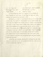
Page 1
Page 2

Page 3

Page 4

Page 5
Page 6
Page 7

Page 8
Page 9

Page 10
Page 11
Page 12

Page 13

Page 14
Page 15
Page 16
Page 17
Page 18
Page 19
Page 20
Page 21
Page 22
Page 23
Page 24

Page 25
Page 26
Page 27
Page 28
Page 29
Page 30
Page 31
Page 32
Page 33
Page 34
Page 35

Page 36
Page 37
Page 38
Page 39

Page 40
Page 41
Page 42
Page 43
Page 44
Page 45
Page 46
Page 47
Page 48
Page 49
Page 50
Page 51
Page 52
Page 53
Page 54
Page 55
Page 56
Page 57
Page 58
Page 59
Page 60
Page 61
Page 62
Page 63
Page 64
Page 65
Page 66
Page 67
Page 68
Page 69
Page 70
Page 71
Page 72
Page 73
Page 74
Page 75
Page 76
Page 77
Page 78
Page 79
Page 80
Page 81
Page 82
Page 83
Page 84
Page 85
Page 86
Page 87
Page 88
Page 89
Page 90
Page 91
Page 92
Page 93
Page 94
Page 95
Page 96
Page 97
Page 98
Page 99
Page 100
Page 101
Page 102
Page 103
Page 104
Page 105
Page 106
Page 107
Page 108
Page 109
Page 110
Page 111
Page 112
Page 113
Page 114
Page 115
Page 116
Page 117
Page 118
Page 119
Page 120
Page 121
Page 122
Page 123
Page 124
Search
results in pages
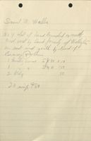
Otter Creek, Mrs [ ] Otter Creek, in Vicinity of Kelly
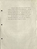
George A. Bunker who lives at Otter Creek
tells me that he knew Timothy Smallidge; that he
lived with Peleg Tracy on the lot now known as
the Samuel Hadley 2nd lot. He died there and
Tracy maintained Smalliedge during his life time.
He also tells me that Nacy M. Walls was
the wife of William T. Walls and that Otilda A.
Walls was the wife of Samuel J. Walls.
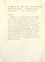
Vol. 446, Page 84.
Warranty Deed.
Dower released.
Consideration $1.00 &C.
Dated Nov. 20, 1907.
Acknowledged Nov. 23, 1907.
Recorded Nov. 25, 1907.
Hattie V. Smith of Eden, Hancock County, Maine -to- James
F. Kelley, conveys
"A certain lot or parcel of land situated in that part of said
Eden known as Otter Creek and bounded and described as follows, to
wit:- Beginning at a stone which marks the northwest corner bound of
the Timothy Smallidge lot and southeast corner bound of the "Notch"
lot, so called; thence by the east line of the "Notch" lot north 4°
5'
east eight hundred and eighty eight and five tenths (888.5) feet to
a stake; thence north 85° east one thousand nine hundred and sixty
(1960) feet to the center of the road leading from Bar Harbor to the
Ocean Drive; thence south 13° 30' west following the center of said
road six hundred and eighty five and fourteenth one hundredths (1685.14)
feet; thence south 17° west still following the center of said road one
hundred and four (104) feet to the central point which marks the inter-
section of said road leading from Bar Harbor to the Ocean Drive and the
road leading to Otter Creek; thence south 87° west following the center
of the last named road three hundred and thirty seven (337) feet; thence
south 58° west still following the road leading to Otter Creek fifty
three (53) feet; thence south 46° 30' west sixty five and five tenths
(65.5) feet following still the center of the road leading to Otter Creek
thence south 86° west intersecting at the westerly side of said road
leading to Otter Creek certain stake and stones marking the northeast
corner bound of the Thomas Smallidge lot, and following the northern
line of said Smallidge lot fourteen hundred and twelve (1412) feet to
the place of beginning, and containing thirty-six and seventy-five hund-
redths acres, more or less.
The above description is from a plan and survey made by E. W. Hill,
C. E. in October 1903, and entitled "Plan of Survey and Division of
property on Otter Creek Road, Eden, Me.", recorded or to be recorded in
2
the Hancock County, Maine Registry of Deeds, and the land herein in-
tended to be conveyed is represented thereon by three distinct lot
marked respectively "C. C. Burrill, H. D. Smith and H. D. Smith", con-
taining 10.5, 10.5 and 15.75 acres respectively.
Being the lot of land first described in a certain warranty deed
from Herman D. Smith to Hattie V. Smith dated August 31, 1905, and
recorded in the Hancock County, Maine, Registry of Deeds, Book 425,
Page 507.
Together with the buildings thereon." TT
Underhill white mtn
the
CH on
Bark
Crick
fits
Copy
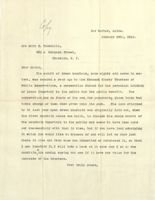
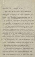
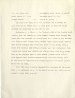
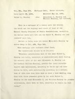
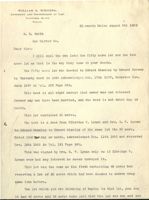
Bar Harbor, Maine.
January 28th, 1910.
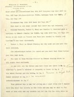
Mrs Mary E. Underhill,
463 a Hancock Street,
Brooklyn, N. Y.
Dear Madam,
The summit of Green Mountain, some eighty odd acres in ex-
tent, was secured a year ago by the Hancock County Trustees of
Public Reservations, a corporation formed for the perpetual holding
of lands important to the public for the public benefit.
The
corporation has no funds of its own for purchasing those lands but
takes charge of them when given into its care.
The land obtained
by it last year upon Green Mountain was originally laid out, when
the first mountain house was built, to include the whole summit of
the mountain important to the public and seems to have been laid
out successfully with that in view, but if you have land admoining
it which you would like to dispose of and will let me know just
where it lies and from whom you inherited or purchased it, so that
I can identify it, will take a look at it some day I am on the
m
mountain, the coming spring and see if it have any value for the
purposes of the trustees.
Very truly yours,
or.
Kig.
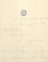
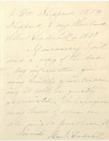
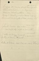
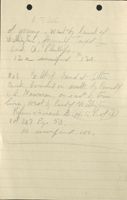
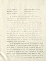
February 28-1910
No. GB. Dorr
Den Sir:
The funty acres I
own on breen Mountam
Daniel If Brewer sdd to
Geo, in 1873 Serani
to fm Shipped 1884
Shoppard to my this hand
Albert Underhallin 1888
If necessary , will
send a copy of the dud
any only orm atem you
may build give Concern
it wike
accrumated,
may Honey of some one
who purchase it,
Sincerely Many E Underhill
463a Novach St
Brooklyn n.y.
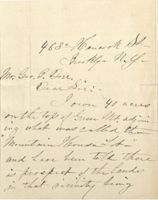
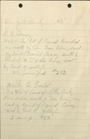
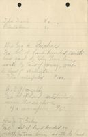
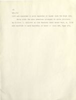
Mr. Geo, B. Dorr
Dear Sir :
-
Ioron own 40 acres
ing what was called the
on the top of Green Mt adjoin
Lot "
and have been tota there
is prospect of the lando
in that accidently being
taken by the State In a a
park. I am andious
to dispose of it, and
any information you can
give appreciated me will be greatly
Your buty
Many
10 to
W. D.
396-82
Edu. Stanley
to
Harmon Q Smith
2/5 large let.
swith
Lurge
=
1/5 small los.
to smult
Gev. M. Jullisin
Jullion
1'
Lange
to small
396-86
my
H.D. smith
eyeo m gree?
same profect
(397-272)
to
mtg. Dis hurged -
Hall v.futch
397-276
Geo he Jullism
1/5 hugs
CE. Dollars
to small.
H.D. Smith
wig.
397-281
C.E. wall.
#225-2 noui
2/5 have
to
Hath V. Smith
widoving
1 small
hudes eligis
10
397-286
C.C. Morrisin
tedange her
2.C. suith
1/0 ruchful
H.D. smile &
1/5 t. small
= Doll
to
car Date.
10
397-290
H.D.S
1/5 Lurge
hits
to
4300.
undiselfed.
Merrisin
's
smull
399-252
Sunh Friend
1/3 Laign 2.C.
to
HID.S.
1/3 small
H Ds
15 Large
with
Induring hrt
399-259
8250-
10
Halter
15 small
409-446
Burrie N. Bunk
s/shange
2.C
N Dti Smith
1/5 small
Page Lot
Beg.
90 Rd
20 a
Mary
fordefind by 443 130
Bray Lot
state
5.3a
5890W 1159ft.
west 70 Rds
maple he
Edward Junly
182-318 andrew gray
to Elizabeth slarty
263 55
Eligabeth Le Stanly
Walter L.Slanly
a/n.25-1892
May14,1192
333
277
Walter & Stanley
41.
George m.Jollisin and
W,O,
No
feb.11.1899
feb. 14,1899
copy.
on Margin "See Dis. hereof vol 345,8 261"
345
264
George M. Jellison
11/1
William H. Dolliver
2CN
yes
Dec 13,1899
Dec 18.1899
same Des as 420-315 to 2nd Ref. (not AN
recit music
355
159
William H. Dolliver
&1,
clifton E. Dolliver
2CD
No
Nov.1.1900
Nov. 2,1900
same as 345-264
397
274
clifton E. Dolliver
#1,
annie Jollison
WW
yes
seff5,1903
Seft.16.1903
do,
403
499
annie Jellison
$1,
M. Elsie Earfint m.g lillion and
WN
March 12/904
do
yes
March 9 1904
424
175
M. L, Sarfink
$1,
O. Jellison
recitionmand
WD
No
Seft 26,1905
Sell 27.1905
ack before to hn E, Bunker de No 6 mention of office Natarial seal officed
X
435
95
O
350,
GeorgeHarmon
W,D
yes
Oct, 23,1906
Oct, 24,1906
zzame as 345-264 to let hel. Then refers to 403-499
1/20% 345-264 same ad 1424-1754
Jellison hissirife Joing as Gearton
X
420
315
Elsie m.jellison
$1,
Nan 7 Johnston
W.D,
May 6.1905
May 10,1905
see Dud.
av
yes
x
459
534
C.S.Johnston and N,7
8/1
H.R Wilson
Sheriff
July 11/ 989
Any 4.1909,
UV
Def.Shiff B H, Smalledge
see deed,
472409
Nan 7. Johnstan
do
Release
yes
any 26 1910
seft5 1910
410
Hi R1 Wilson
greethe triff
2 C
Oil, Jellison
yes
de
do
424 175
mind Sarfaits
1965
1905
95
OH. Jellison
bco. Harmon
1906
1906
x
412412
George Harmon
J.E. triff
1910
1910
X
Joseph E. Ziff
ge B.Derr
(
1915
2191.1915
Mtjajes.
333280
Georgen Jellison and William
H.Dolliner
245,
Walter L. Stanley
M.D
Dollivernes unmarried
Jellism yes
Feb. 11. 1899
Feb.14,1899
focus,
mortgag given by (granties) dated Febill. 1899 + recorded
345 261
Walter LiStanly
Beorge M. Jellison and
william Dolliver
Dis
Dec 13,1899
Dec 18,1899
in Book 333 Page 277.
345
267
340.
Walter L. Stanley
M.D
no
Dec 13,9899
Dec 18,1899
Locus
355
252
Walter L Stanley
Vernon G.Wasgatt
assgm
Oct 3, 1900
Nov 9 1900
assgmt 345-267 vv
3:55
253
Vernon s.wasgatt
clifton E, Dollirel
Dis
Nov. to 1900
Nov. 9, 1900
Dis of 345-267
420
317
Nan 7, Johnston
$110,
Leonard A A. Austin
M.D
yes
May 6. 1905
May 10.1905
Locus see deed
- AotDis,
Janes
261
270
mD
273
Bond
473 278
Lewis Friend
stat afth 34,
Je a Peters ?
474-106
401-410 2hm of 384
470
196-44 2 M.D. ?
396-86 mar
397-281 m20
259-482 W.Dadfliff. copy
196-853 NW zaht copy.
399-259 M
202-414 MD disty 333-276
397-290 m
261-270 m
3
416-454
345-262 only.
425-507
397-286
511-260
397-281 MD. dis by 445-1001
397-272 Dis of 396-86
290 M.D, win Margin
439-522 M,Dis by 445-143
416-457
441-447 For 496-531
arsgend 475-459
496-557 copyall.
445-439 m D
456-85 do
458-355 assend 475
Fore 496-547
?
475-460
For 496-550
481-533
For 496-391
486-51 Fue 496-548
327-233 mid Ellenate
384-470 MD. the
50 a lot
C. E. Dolliner acquires
10 a lot
1/5 = 2/9
ssuts
1/10
397-376 3. M.Jellison Seft 5, - Seft 16.1903
1/5 10
115-ko
with Smills
286 C.C. Musicon Seft-11.1903 do
SSWY
ssuta
15700
75
a lot
416-454 H.D.Smith 7eb.18.1905 - 7eb.21.1905
He Dispours some yes
J. Searls All R.E. 441-447 SS whack July 22 I 907 July 23.1907
Trust Co
d
458-355
do Denve april27 1909 apr. 301809
Roberts
de
475-460
as Rauma
do
481-533
Roberts
do
486-51
441-447 his cliften E. Dolliver f Thomas X Searls
Dower Released
all my real estate and and all my rights, privily
and easements in and unon estate situated in
said County of Hancock, however the same may he discribe
475-459 Thomas Searls to W illiam M.Roberts, Truste
of Tobias L. Roberts and Mary S.Roberts (ss whack)
Dec 24.1910 Jan 5.1911.
496-551.
for of abord by William m. Roberts, Trustie, Tobias
L. Roberts and Mary S.Roberts by his attaing Hide
braham
by put first jub in Ells Amea
March19.1913 Rec april 5.1913
Lewis Friend 1/50/ both to H.DS To
C
C Munian to 13- M both to C.E.D H.D.S. 1/10 1/10
W Vincent to E.Stanly 267-1 1/50/ both
B Bradley Insticc Bunill
PC word to E.Stanley 257-432 - 1/50/50alt/ same is 215-342
3/5/50 H.D.S
Wi Stanly
1/5
$ 710
S.M.J.
Burrill Bank 15-of both K.N.D,S,
P.C Word had not conigd his is int in 10a
lot from 1887
to 1912 inclusive
236-278 & Stamly M,D.
212-46 WE Radick ml Dent
216-177 Estaily M.D 50a Dis
225-135 ENDrals MD Dis.
v
M.D,
paliers
5th
Hermon D. Smith and clifton E. Dolliner
to
Charles C Marison
dated seft 9. 1903 Rec Seft.16,1903
1 ot 397 Page 290
Dad 1th
offer
M.
Herman D. Smith to Hattie U. Smith
dated Nov. 181903 Rec Nov. 21,1903
V of 399 Page 259
8th
Elestrom R Hall -List of assets
John J.Cass Insolancy
assets does not show land in Eden or
mr Dent around Eagle Lake
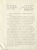
Vol. 409, Page 446.
Quit-claim Deed.
Consideration $1.00 &C.
Dated July 26th. 1904.
Acknowledged Aug. 1, 1904.
Recorded Aug. 5, 1904.
Burrill National Bank of Ellsworth -to-
Herman D. Smith of
Eden, conveys
***
and all
right
title
and
interest
and
to
our
HAlse undivided fifth parts of another certain lot or parcel
tenth
n
of land situated in that part of the town of Eden, Hancook County,
Maine, known as Bar Harbor, and bounded and described as follows, to
wit:-
the back lot formerly of
Beginning at the southwest corner of William Stanley back
lot and runs south nine and one half degrees west eleven rods and
eight links to a spotted spruce tree standing on the east side of the
meadow brook, so called; thence north eighty-nine and one half degrees
west thirty rods to an iron bolt in the ledge; thence north eighteen
and one half degrees east fifty-eight rods to a pine spotted on four
sides on the south side of a back lot owned by F. & S. H. Rodick;
formerly
thence on said south line easterly twenty nine rods to the center of
said meadow brook; thence on said Wm. Stanley's west line southerly
to the first mentioned bound and contains ten acres, more or less.
Being the second lot described in a certain quit claim deed
from William Vincent to Edward Stanley, dated October 28, 1892 and
recorded in said Hancock Registry in book 267, page 115."
Stit
Vol. 416, Page 454.
Quit-claim Deed.
Dower released.
Consideration $1.00.
Dated Feby. 18, 1905.
Acknowledged Feby. 18, 1905. Recorded Feby. 21, 1905.
Herman D. Smith of Eden, County of Hancock, State of Maine,
-to- Clifton E. Dolliver of said Eden, conveys
Two" A certain lotsor parcels of land situated in that part of said
town of Eden, known as Otter Creek, and bounded and described as
tp First to
follows, to wit:- Beginning at a stake at the northwest corner of
owned now formely by James F Kalley
a
lot of land this day conveyed to me By the said Clifton E. Dolliver,
by his quit-claim deed to be recorded in the Registry of deeds for said
County of Hancock on the eastern line of the "Notch Lot" so called;
thence running north four degrees and five minutes east on said eastern
line of the Notch lot, three hundred fifty-five and five tenths feet
to a stake; thence running north eighty five degrees east two thousand
sixty-two feet to the center of the road leading from Bar Harbor to
the Ocean Drive; thence running south thirty degrees and thirty min-
utes west following the center of said road one hundred and fifty-three
feet; thence running south thirteen degrees and thirty minutes west two
hundred forty four and nine tenths feet following the center of said
sand land offames F. Kelley
road; thence running south eighty-five hundred
and sixty feet to the place of beginning, containing fifteen and seventy
five hundredths acres, more or less.
Then Refert this dead
above description is from a survey and plan made by E. W.Hill,
C. E., in October 1903, and entitled "Plan of Survey and Division of
property on Otter Creek road, Eden, Maine." to be recorded in the Reg-
istry of Deeds for said County of Hancock, and the land intended hereby
to be conveyed is the lot marked C. Dolliver on said plan."
***
IN WITNESS WHEREOF, I, the said Herman D. Smith and Hattie V.Smith,
wife of the said Herman D. Smith, joining in this deed as Grantor, and
relinquishing and conveying all my rights by descent, and all other
rights - expressly releasing and conveying all my right, title and in-
terest acquired under a certain mortgage from Herman D. Smith, dated
2
Nov. 21, 1903, and recorded in Hancock Registry of Deeds, in Book 399,
page 259, so far as said mortgage relates to the lot herein conveyed,
but not as against the remainder of said property.
Bor
Liggs m Dairs died buried abt in 35ys Joneshor, ago
of 2
Lorana Hadley (white) ling
yr ago
Mary C Hadley undow 2 yrago
Samuel Hadley. 2nd diad Jan 29, 1888
Johnsk Davis lives in B, Id,
see Dan Daigle
Dan Damples wife is John W, Dani sister
in Bumswick
Nathe M Dairs / albee 36 yrsold in
methe NDanis 44yorld
Lester W Davis Died Nov. 22 1888 ( 4/mos aged )
His La Handy No
L. B, Deasy
No3 - 1/2 lot of land bounded
on math by Edin Tom line, east-
land of W, T.Walls hens, west
by land of Dan'd Bracy south by
by land of wellight
I
25 unwined
250,
Waller B, Gould
1/10 #41 of land at Other Guk,
bounded on math by town him, on
east by land of of David Bicay
wed G land Willight
5 min $50,
Hno E, H. Every
Na3 Let if land known as
the Pierce fot
Reference is mad X H (R.P.)
VM 257 Ps 50
3/2 inf #50
Saml m walls
No 4 Lot of land founded m north
and west by land founderly of Wellights
on east and south or land of
Bravy Arthur
/ dwelly hard syn 250
/
sm N 150
2 Hely
50
20 unit 480
b, Tzils
Weshington formery Tayd L
of young, wealth land of
bed a, Phillips
12 a ununfind x1 20,
No1, 1/2 lifil and at Other
cruck bounded on month by landof
H.R. Newman, on east by tom
line westly land of Willight
Reference is mach to H.S.R.o.D
Vol 207 Pye 50
14 univinford 100,
Ida Davis
No.
Palmilia Bover
No.
Hrs Seo A, Parcher
1/10 lot of land founded nath
and east by Eden Town line
south by land of young west
by land of Wellington
7 7/10 uninproved
9100
a. C Hegalty
1/20 lot of land substantially
Runn dho as above
4 a unimposed 460
Hrs J T. Giles
3/20 sot of land founded on
north by tom line, south by land
Fredurish X Stanley
Bum 184.1
died 19 15
annie P A,
did aps. 22 1881
ae 33 yr 6 MP 12d
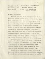
Vol. 385, Page 404.
Warranty Deed. Dower released.
Dated Jan. 9, 1903.
Recorded Jan. 12, 1903.
Thomas F. Davis
-to-
George E. Davis.
In Mount Desert:
Beginning at the northeast corner of the lot
being described at a stake and stone on the south side of
the county road leading from Otter Creek to Seal Harbor;
thence southerly along the way leading to the Cemetery
twelve rods to the cemetery fence; thence west along
the cemetery fence three rods to the corner of said
cemetery; thence in the same direction one-half rod
to a stake and stones; thence north but everywhere para-
llel with and three and one-half rods distant from the
first mentioned bound nine and one-half rods to a stake
and stones in the south side of said County Road; thence
in a general easterly direction along the south side of
said road three and one-half rods more or less to the
place of beginning, together with the buildings thereon.
Being a portion of the lot described in Warranty Deed
from Daniel Brewer et al to Samuel Davis November 23,
1863, and recorded Dec. 9, 1863 in Book 119, Page 491,
And a portion of the lot described in Warranty Deed from
Samuel Davis to said Thomas F. Davis dated August 24, 1880
385-404
-2
and recorded August 30, 1880 in Book 172, Page 404, to
both of which said deeds and the records thereof refer-
ence thereof is hereby expressly made.
bt E. if Cemity Rd
next
Vol. 197, Page 98. Warranty Deed. Dower released.
Dated Nov. 22, 1883.
Recorded Nov. 28, 1884.
Thomas E. Davis
-to-
R.J. Young, E.G.Young,
R. Grindle, C. P.
Dodge, Wm. Stanley,
L. A. Hadley, E. Y.
Hadley, Edward Stanley,
W. 11. Bunker and Eri
L. Bunker.
In Otter Creek.
Commencing at a stone post at the southwest
corner of the "Davis" burial ground and running south
ten and three-fourths rods more or less to a stone post
thence east four rods six feet more or less to a stone
post; thence northerly ten and three-fourths rods more
or less to a stone post; thence west four rods six feet
more or less to the first mentioned bound, containing
forty-six and one-half square rods, more or less.
With right of way for road to same.
Think pont of Miami Camily
e
BOUNDARY DEEDS.
S.S. Wet9,
Vol. 345, Page 262.
Quitclaim deed, Dower not released.
Dated Dec. 13, 1899.
Recorded Dec. 18, 1899.
William H. Dolliver
- to - George M. Jellison.
Lot Next Norther
In Eden - Otter Creek:
345-264
Beginning at a stake in the western side line of the
county road running from BarHarbor to Otter Creek; thence
North 20° east one hundred and ninety (190) feet to a piece
of iron pipe set in the ground in the western side line of
said county road; thence south 89° west three hundred
ninety-six (396) feet to a stake; thence north 20° east one
hundred twenty (120) feet to a stake; thence south 89° west
two hundred eighty-four and four-tenths (284.4) feet to a
stake; thence north 20° east two hundred fifty-six (256) feet
to a stake; thence south 89 west five hundred nine (509)
feet to the brook; thence by the brook in a general south-
westerly direction five hundred eighty-five (585) feet to a
maple tree which marks the northwest corner of a lot of land
this day conveyed by said George M& Jellison to said William
H. Dolliver; thence north 89° east along the northern line
of said lot conveyed by Jellison to Dolliver, twelve hundred
forty and eight-tenths (1240.8) feet to the place of begin-
ning, containing ten and five-tenths (10.5) acres, more or le ss.
Reserving, howeverm the same right of way mentioned in a
certain warranty deed from Walter L. Stanley to said Jellison
and Dolliver, dated Feb. 11, A.D. 1899, and recorded in Book
333, Page 277 of the Registery of Deeds for said County of
127
345-262
2-
Hancock to which deed and record r ference is hereby
expressly made.
The lot hereby conveyed is the northern two-thirds
of the lot described in the deed from Walter L. Stanley
ro said Jellison and Dolliver.
6406 3 ml
N 2/3 of Era, fort
think 2 lots Weffle
Lot next month of Light
{ of Brokk
128
Mary Ann Erelly
One eighth gradevidel an
owned in Common nith the Herro
heorge A Parches poled W.
The
Jee and the heris of J. T. Ziles asth for B
a had of sh let know 7
No 2 At.
Cinniged firm E,H, Eriky by del
dated April 29 1909 and secsite
in the Hancid Greenly Reject, 2
Deeds, Dol 458 Rje 358
£180,
some as above
mth it Many Air, li
and the al-all Geb be
part of so culte tenny /
1
did recorded in the HCRMD VM 257 PSP
J. 5a T - biles 1/2 #180 same 20a= 4720, 3/601-
-
it
a 6335-120
B.H.
176
497-381 DT siles
1/2 No B, stalo
?
gin
ayar
special
will
of
hill
177 506-230 Tax 1912 Jeremin The
R
10
1/2 No5 if
/
if
No5.
Pq.191. - That a Emly
192 Bunill Julia A.Biles,
193 min that s Enly
Japa
Heris of It Eilespore taped in my Desert
No 1, 1/2 lot of land at other Crake Nib H.R.Mr...
EG Town him W by millight Ry 207-50
His
alis 188-59H K
Dard for Mang Group,
i
663 ,T
Sipp not pes-ave
551
Green
5\1
con
plust a than
Kinne
plain hat ams SP EPI
SPI
have bypot endy rife 8.7 If will
4d.4 day to-to S loh
02-505-141 a for rid not 3
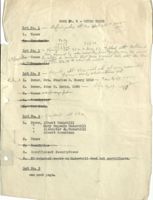
BOOK NO. 5 - OTTER CREEK
Lot
No. 1 - sellingwells abt 17. a about 600.03 to
1. Taxes
F7
25
Max deeds
48.32
15
724.80
725,-
Lot No. 2- Kings 484267 24/60 of 1/3 48a who said - Dec they 13, paid Talked 30, prace, mtts He Nathan would D
Taxes be King milly owner to consider that price t would tath with the Here
of other 2/3 as is what this wished
2. Boundaries
Lot No. 3 Hagelth figmi-wants abt 4/a -mil what sell others at am get reasonable
Released 1. Dower, Mrs. Charles H. Emery 1910 1 Fee Pa45 42/20
2.
Dower, John W. Davis, 1890 - life P939 the 1'h
3. Taxes C.7 P, say fd
Boundaries
5.
Tax doods
Lot No. 4 - abt 40 a
1. Dower, Albert Underhill
"
Mary Eugenia Underhill
"
Alexander Jo. Underhill
"
Albert Rosenbaum
2. Taxes
3. Boundaries
4. Insufficient descriptions
5. No notarial seals in Underhill deed but certificate.
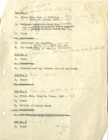
Lot No. 5
see next page.
you
a
306
abt 35 a
Lot q5a No. 5 - Hojelty-Panchi - sich truly
free
1.
Dower, Mrs. Geo. A. Phillips
- 182-284 100 2a
If
Silas F. Pierce, 1891
Life
7314
2. Mortgage 11
IT
, Greeny Greely Giles to to Union Trust Turst Co. Nat 1 Co. Bank 191 193
7934
" E
to Burrill 192
3. Taxes
Boundaries
5. Attachment vs.
Hagerthy 167-1757
Phillips glo-BH. 176 ITT
6. Tax deeds Phillips sites B.Danis abf40/za 16845174 Inc. wants 3500 for whab lit
get mt.Diset
Lot No. 6- Ida
1. Taxes
2. Boundaries
3. Cemetery and way between old and new roads
Lot No. 7 - Bow, aft 30 a
1. Taxes
2. Boundaries
Lot No. 8 Dear ts, abt 50 a less land E. of Road,
1. Dower, Mrs. Frank E. Young, 1887 life
2.
Taxes
3. Probate of Daniel Deasy
4. Boundaries
5. See distance along Bracy's north line
Lot No. 9 Brew R. Co
1. Taxes
w
167
333 - 547 Tax1896 SA phillips by SalesPacked
that patosis, 5 m B.H,
let,
168 344-549 Tax 1897 SAPhillif, h-No st saw w Deat
169
360-120 Tax1845 same
YEARS
newer
170
370-510 Tax 1899
same
171
same
389-124 Tax 1900
192
same
oer
404-99 Tax 1901
?
173
dis ?
Mc-243 Tax 1912
sam
74
same
dest
126-478 Tax 1903
75 115-307 Jax 1900 S.A.Phillifs the Silas 7,Prim life
1/4 of No5m B.H. dated 1900 Re 180.57
Bad
what
15/120
46al / 774-975
6 Mar 332-334
Texas & Sio A. Phillips
1/4
Silas F.Price 257-50 = 333-547
344-549
1/4 forders NIEL Main lin sh welgh
dr sold to Robet w 415-307
defective dated 1900 Notice gin 1701
2016 made Dec 2 1901 ack Dec 5 1901
Recad for 2 1905
Eiles ack,
Elm
3 33-424 Tap 1896 lay
469 Tax 1857
1902 soldtRolls thefe h
375-190
555-93
Juh ofB,N, Striff =377
Tapt that /
Christifier
Should partifular abt
Trustees, difficult and agents he
Tax deeds sswta
See 266-125 standing Great 7 Loana Hally
ellsmith
Hattie oft
mD aris t Nethight. aris licence 2 Wed Uct 18
No Probate estate of
Lizzie Dan's
do
Samuel Walls
or
dr
get particulars Proble Samuel
John W.D avis now living
yes
Should Indexid Saml Hadly 2d
S. K. whiten
and
mortgages
Eliza whiling be brought to a
Part, oft death
what Liffinguall girls were married beside amail
Powert ally for fut Now
see 214-3631 sames 127 480
Pyp 6-3-8-19-20 et Back 4:
Company go 9 44.6
Locate Danl Kennerdy fit:
when did Timothy Smallidge die (ts )
Ma
duif 148 407 is sswta
yes
Particulars aff but Christific
Should oft
Trustas, differently anyl agents. he
Tax deeds sswta
Ellsmutts
See 266-125 foods Grand 7 Lnana Hally
Hattie mD avis + aris oft licence 2 Wed Uct 1892
No Probate estate of Lizzie Dans
do
or
Samuel, walls
get particulars Relation "Sandly Wall
John W.D avis now living yes
Should Indexd Saml Hadly 2d
mantages
S. K. whiten and
Eliza whiling be brought to date
Part oft death T.I.W. Handy,
what diffingerell girls were married besid amaire
Powerfalls for for No 2
see 214-363 sameon 127 480
copy Pgs 6-7-8-19-20 Bork 4:
Company go 9 446
Locate Danl Kennerdy Lot
when did Timothy Smallidge die (Ps ) Manta
duif 148 407 is Sg wta yes
Mortgages
East of Burk
136-96
141-44
196-228
142-260
214-18
143-471
192-181
146-387
202-426
163-9
196-216 dis by 206-385
201-468
214-320
207-424
234-406
268-65
188-120
191-97
227-540 Fore 237-520
531-288 dis531-434
521-277
457-476
Boundaries a Excelled
148-412
105-419
459-102
129-193
210-362
182-284
155-423
164-451
Tax Deeds
184-473
370-519 360-100
Notch Lot
333-296
416-243
105-333
436-44 426-478
119-288
426-472
415307
168-258
404-71
191.292
360-108
130-443
333-547
138-589
344-549
168-257
360-120
135-269
389-124
370-510
s.g. Wall Lot
497-381
148-408
506-230
Hrs C, S heffingell
Lot boundid north by land of d C Morrism and others
E by the Smallidge for
S n the County Rd
P W by land former of Berry thing 15a
1887 Berry thing and 48 a out JN185
See Ed. Stanly 1857
a C Hayulth now own No85,
Giles Evaly - Parch Think
Ida B. Dan's
Oth Cruck fanded
Attny fal of Find Steely
N h land of Lillia Slould
S from Luic
E S Rl
w h a C Nagella
39. 5a
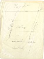
Vol. 135, Page 269. Warranty Deed. Dower released.
Dated October 6, 1869.
Recorded October 6, 1869.
Daniel W. Brewer
-to-
Thomas Swazey.
A certain lot or tract of land lying between
Green Mountain and Dry Mountain in the town of Eden,
County and State aforesaid being a part of Brewer
and Gilmore purchase and described as follows:
Beginning at the Northeast corner of Timothy Small-
edge lot, so called; thence Westerly by said Small-
edge lot to Green Mountain and un the mountain so
far as there is any lumber; thence Northerly on
said mountain taking in all the lumber on said
mountain to and through the spruce growth in the
Gulch formed by Green mountain and Dry mountain
coming near together; thence across said Gulch up
Dry mountain taking all the lumber on Dry mountain
thence Southerly on the Westerly side of Dry Mountain
(up far enough on the mountain to take in all the
lumber) to the line of the E. Stanley lot, so called;
thence by said Stanley land to first bounds contain-
ing 3000 acres, more or less, meaning to conveyall
the lumber land between the mountains, bounded South~
erly by the Smalledge lot.
NOTE: Other land is also included in this deed.
Edward Brewer owning the southern portion of the
Gilmore and Brewer purchase gave a warranty deed to Ed-
ward Stanley of sixty acres, more or less, dated blank,
acknowledged October 17, 1857.
The description commenced at a poplar tree at
Timothy Smallidge's western line and runs North 4° East
to and Joshua M. Page's southern line.
This lot is between the Notch lot so called and the town
road although the description is inaccurate. Timothy
Smallidge's lot was south of the Notch lot and the west-
ern line would appear to be also the western line of the
Notch lot produced instead of the eastern line.
The
course North 4° East would not touch the A.G. and Leander
Bage lot there being, so far as I've been able to learn,
no Joshua M. Page lot.
The lot next east of the Timothy Smallidge lot was
the Thomas Smallidge lot.
It must be therefore that the eastern line of the
Timothy Smallidge lot and the western line of the Thomas
Smallidge lot was meant as the point of beginning.
No clain seems to have been made to the Notch lot
by Stanley or those claiming under him.
Edward Brewer also gave a deed to Daniel, Porter
and Perry Brewer of numerous lots, warranty in form, but
Edward Brewer owning the southern portion of the
Gilmore and Brewer purchase gave a warranty deed to Ed-
ward Stanley of sixty acres, more or less, dated blank,
acknowledged October 17, 1857.
The description commenced at a poplar tree at
Timothy Smallidge's western line and runs North 4° East.
to
and Joshua M. Page's southern line.
This lot is between the Notch lot so called and the town
road although the description is inaccurate. Timothy
Smallidge's lot was south of the Notch lot and the west-
ern line would appear to be also the western line of the
Notch lot produced instead of the eastern line.
The
course North 4° East would not touch the A.G. and Leander
Bage lot there being, so far as I've been able to learn,
no Joshua M. Page lot.
The lot next east of the Timothy Smallidge lot was
the Thomas Smallidge lot.
It must be therefore that the eastern line of the
Timothy Smallidge lot and the western line of the Thomas
Smallidge lot was meant as the point of beginning.
No clain seems to have been made to the Notch lot
by Stanley or those claiming under him.
Edward Brewer also gave a deed to Daniel, Porter
and Perry Brewer of numerous lots, warranty in form, but
containing a clause at the commencement of the description
of "All my right, title and interest". This deed included
the Notch lot. If however the Notch lot was included in
the deed to Stanley it would not pass to the Brewers be-
cause the deed to them was of "right, title and interest".
The interest of Porter and Perry passed to Daniel
Brewer who conveyed the Notch lot bywarranty deed to
Thomas Savage and by various conveyances the titled passed
to the United States.
containing a clause at the commencement of the description
of "All my right, title and interest". This deed included
the Notch lot. If however the Notch lot was included in
the deed to Stanley it would not pass to the Brewere be-
cause the deed to them was of "right, title and interest".
The interest of Porter and Perry passed to Daniel
Brewer who conveyed the Notch lot bywarranty deed to
Thomas Savage and by various conveyances the titled passed
to the United States.
H,D,S acquire by
Burrell NatBank
409-446
in
E Stanley
396-82 with B.M.Jellison
1/10
Sanah friend
399-252
1/5
cc Monism
397-286 with CE Dolline
1/10
Defects.
M.D. H.D.S to Hathic U. Smith 399-259 Imp.Disty 399-257
M.D. ( do+ced to CSMonison 397-290 not dis
Jaxes Paint
w
See whether Conyan to Dolliner
Bein at 30 on H.D.S
d dud
License A in 1898 33 yrs rago
No action after 5 yrs from dirality
1883
Sec 30 Chh 71
Page 598
License was for pale a enchange
him was for Er change
Sold to CH Enn
t
CHH Every sold Ells lot 263-417
Executin issued of 26.1909
By Viston of this Ex, in the 18th day of May 1989 I look
the following dis Real Est, tallth right, filts t
intest which the within named I N79 had
in + to the same on this 11 th dayf april the him
when same was attached etc
Dis 2 lots
and on the sami / th day Man 1909 big more than
30days before time affted fn sale I gare L the
saidc s.g and Nifid, each, in hand a notice in writing
thtsd real estate would lc sold by pub. anct. on the
21st day June 1909 at 10 o cha in presentation
SLK2C at B. H, etc + on same day I also posted
a like notice at the store PHiHHHopkins a public place
etc Irenton also like notice slin R.H.B Fenalet
Julbied MY Deart sd 7 of J.M Ms king adj T.t Eda in which
land his of same day like Notic P.O B,H, like
notice the Jub. 3 w succ, before tim fsale B,IJ.Reed
mench printed in B. H. etc + on the 2/ at day of June 1909 at
10 ochur in form at ad office etc during it fn int of all
concerned to post. rd sale, adj it to the 25 of June al -
3-30 etc, at same place where f public pirclamatic
talsand him + place of adj duning if fr int if
all concerned to a again footpain sd sale adj
puplic purchasing present to od adj dood
offer on bt July steld public audio the od
ra about ds tall high etc on 11 a/mil 1905
at The lot etc (was So st profitis
the dec of sd lots to H.R. Wilson he his the
highed bidden f Sun of x del duda
in fall schifitis
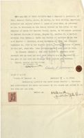
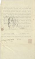
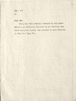
KNOW ALL MEN BY THESE PRESENTS:That I Charles C. Morrison, of
Eden, Hancock County, Maine, do hereby, by this writing, expressly
authorize and empower Albert H. Lynam of said Eden, an Attorney
at Law, to discharge on the record thereof in the office of the
Registry of Deeds for Hancock County, Maine, in the manner provided
by Revised Statutes of Maine, Chapter 92, Section 31, a certain
mortgage from Herman D. Smith and Clifton E. Dolliver to me the
said Charles C. Morrison, dated September 9 ru 1903. and recorded
5
September 16, 1903 in the Hancock County Maine, Registry of Deeds
in Book 397, Page 290. Said mortgage daving been paid in full.
In Witness Whereof I, the said Charles g. Morrison have
hereunto set my hand and seal this seventh day of December in
the year of our Lord one thouse nd nine hundred and fourteen.
Signed, sealed and delivered
in presence of
STATE OF M.INE
County of Hancock SS
December 9 A. D. 1914.
Personally appeared the above named Charles C. Morrison
and acknowledged the above instrument by him signed and sealed to be
his free act and deed.
Before me
OMEN
gustile John Pence
10 MOBITTOM .0 I Jent HEHHT YE VIM ITA WOMX
,gatthrw aint rd Edgesd ob Noodash ,nebi
as ,nebh bisa to menya .H JIODIA rewoqne bas
edd Io soffic edd at edit no of ,WEI ts
bebtvorq edt at NoooasH rot abee( to Extatgen
s .IE se TeJgsd0 enter to beaiver vd
edj em a 25 NOTTHIO has .0 asmroh OTO I
on
behroogi bns 2001 graddetgee betab ,MOBITIOM .5 selfed0 bise
abood to Vitata
Donisl
NooonsH edt nt soer e ,ar redmetge&
Hut at bin feed
PERJION bisa .0es 9389 ,PEE 2008 at
leven noat
Lisa ont I fostedW aI
Todness
ard Isoa bns basd yor Jee
berbaus brot INC IO ISOV ent
betevifeb bas belsea bengta
to nit
thuellost
HMI M 50 STATE
pref .Q
P
Todmess(
28 NooonsH to
moarTroM .0 bemsn evods edj betsoqqs VIISHORTES
ed of belses bas bengie mid gd evods end bo3beIwondos bns
beeb bne tos 9911 and
em 970198
east
original
sswta
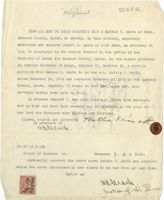
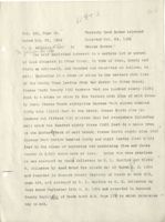
KNOW ALL MEN BY THESE PRESENTS That I Hattie V. Smith of Eden,
Hancock County, Maine, do hereby, by this writing, expressly
authorize and empower Albert H. Lynam of said Eden, an attorney at
law, to discharge on the record thereof in the office of the
Registry of Deeds for Hancock County, Maine, in the manner provided
by Revised Statutes of Maine, Chapter 92, Section 31, a certain
mortgage from Herman D. Smith to me the said Hattie V. Smith,
dated November 18, 1903 and recorded November 21 1903 in the Hancock
County, Maine, Registry of Deeds in Book 259. Said
mortgage having been paid in full.
In witness Whereof I, the said Hattie V. Smith have hereunto
set my hand and seal this seventh day of December in the year of
our Lord one thousand nine hundred and fourteen.
Signed, in sealed presence and of delivered Hathic Vhan it's
7.
STATE OF M.INE
County of Hancock SS.
December 7. A.
D. 1914.
Personally appeared the above named Hattie V. Smith and acknowl-
edged the above instrument by her signed to be her free act and deed.
Before me
G
actuach
justice of the Peace
wtw28
languy
neba to djing .V elitish I JENT YE IHM JJA WORN
ards yd eydoxed ob enter xooonsH
is CONTOJIS as ,neba bise to .H Jiedia Iewoque bas estrodum
edt to esitto edlt nit Ineredt sdit ao of wel
bebtvorq TORASLY edd ni ,enfsh , XooonsH rot abooC to Ertatgoff
AFIJIDO s , IS notJoot ,se , to beaiver vd
fore V OIJJSH bise edj em of Atina .C MOTI
Nooo edt at behroper ,8£ rednevoli betch
bisa as Fall FOE aise(I Io ,entsM
[fot bisq need selved
othered even did body shubasa one I fostedW agentiti aI
To YESY ent Vasib eint 1098 bas basd For Jea
Care barba enta basawont eno BIOT INS
Delovileb bas bolsea , bongie
10 at
HMI.M 10 STATE
.AICI .C. A is , tedmess(I
.88 to VIANOD
-Iwondos bas .V SIJJSH bemsa ovods edt betseqge VIIsnoated
boob has JOB 0911 red ed of bengia red rd evods edd begbe
900 970198
water
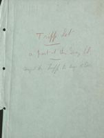
Tripp lot
a part al the Gray lot,
Corged f hiff to Buy, B. Dors
The early title to this lot
is the same as Kelly lot
S.S. w a a .
Vol. 105, Page 333. Warranty Deed. Bower hot released.
Dated
#
#
1856.
Recorded Nov. 24, 1857.
Edward Brewer
- to -
Edward Stanley.
In Eden:
Commencing at a poplar tree, at Timothy Smallage's
Western line, thence North four degrees East to Joshua
M. Page's Southern line, thence following said line
Easterly to the county road, thence following said Road
to Thomas P. Smallage's Northern line, thence following
Thomas Smallage's and Timothy Smallages Northern line to
the first mentioned bound which is a poplar tree, contain-
ing Sixty acres more or less.
S.S. w.ta.
Vol. 119, Page 288.
Warranty Deed. Dower not released.
Dated October 13, 1863.
Recorded Oct. 13, 1863.
Edward Stanley
- to -
Frederic A. Stanley
In Eden:
Beginning at a poplar tree at Timothy Smallbridge's
Western line thence north four degrees East to Joshua M.
Pages southern line thence following said line Easterly
to the County road, thence following said road to Thomas
Smalledges northern line, thence following Thomas
Salledges & Timothy Smallidges Northern line to the
first mentioned bounds containing sixty acres more or
less it being the same premises conveyed by deed to me
from Edwin Brewer dated October seventeenth A. D. 1857,
and recorded in the Hancoc k Registry of Deeds Vol. 105
page 333.
s,s.w.ta.
Vol. 130, Page 443.
Warranty Deed. Dower not released.
Dated Dec. 2, 1867.
Recorded Jan. 15, 1868.
Frederick A. Stanley
-to- William Stanley.
In Eden:
Beginning at a maple tree on the West side of the
road leading from Otter Creek to Bar Harbor, and running
West seventy rods to a cedar stake then north twenty
degrees East forty five and five sevenths rods to the
South line of land owned by Daniel W. and Porter Brewer,
itbeing the south line of lot known as the Page lot,
then East following said line to the road aforesaid seventy
rods then following said road Southerly to the first bound
containing twenty acres more or less.
S.S. a
Vol. 138, Page 589.
Warranty Doed.
Dower released.
Dated March 20, 1870.
Recorded March 21, 1871.
William Stanley
- to -
Frederick A. Stanley
Also another lot of land situated asfollows, to wit:
Commencing at the Brook on Pages line following said line
easterly to the highway thence Southerly by the highway
to land of Edward Stanley's, thence Westerly by E.
Stanley line to the Brook, thence following the brook
Northerly to first mentioned bounds, containing Twenty
acres more or less.
Note:
One other lot is included in this deed, not
affecting the locus. It is therefore omitted.
S.S. wit a.
Vol. 168, Page 257,
Warranty Deed, Dower not released.
Dated Nov. 21, 1879.
Recorded Jan. 5, 1880,
Frederick A. Stanley
- to -
Andrew Gray.
In Eden:
Commencingat the brook on Pages line following said
line Easterly to the highway thence Southerly by the high-
way to land of Edward Stanley's thence Westerly by E.
Stanley line to the brook; thence following the brook
northerly to first mentioned bound containing twenty acres
more or less.
ssu.ta, e
Vol. 182, Page 318.
Warranty Deed.
Dower released.
Dated April 8, 1888.
Recorded April 14, 1882.
Andrew Gray
- to -
Elizabeth S. Stanley
In Eden:
Commencing at the brook on Pages line following
said line Easterly to the highway; thence Southerly by
the highway to land of Edward Stanley's; thence Westerly
by Edward Stanley line to the brook; thence following the
brook northerly to the first mentioned bound containing
twenty acres more or less.
SSW.IA,
Vol. 263, Page 55,
Warranty Deed. Dower released.
Dated April 5, 1892.
Recorded May 14, 1892.
Elizabeth S. Stanley
-to-
Walter L. Stanley
Two certain lots or parcels of land situated at Otter
Creek in Eden aforesaid and bounded and described as
follows to wit:
(Note: First lot does not affect locus and is therefore
omitted;)
Second, A back lot described as follows in a deed
from Andrew Gray to me dated April 8th, 1882 and recorded
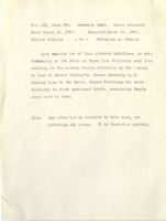
April 14th, 1882, Book 189, Page 318.
"Commencing at the brook on Pages line following said
line Easterly to the highway thence Southerly by the high-
way to land of Edward Stanley; thence Westerly by Edward
Stanley's line to the brook; thence following the brook
northerly to the first mentioned bound containing twenty
acres more or less", excepting however from this conveyance
one lot of three acres sold to George Rodick and one lot
of about one and one half acres sold to Tyler W. Stanley.
sata
Vol. 333, Page 277. Warranty Deed. Dower not released.
Dated Feb. 11, 1899.
Recorded Feb. 14, 1899.
Walter L. Stanley
- to - George M. Jellison and
William H. Dolliver.
In Eden - Otter Creek:
Commencing at the brook on Page's line, following said
line easterly to the highway; thence Southerly by the high-
way to land of Edward Stanley; thence Westerly by Edward
Stanley's line to the brook; thence following the brook
Northerly to the first mentioned bound, containing twenty
acres more or less. The above description being from the
deed from Andrew Gray to Elizabeth S. Stanley dated April 8,
1882 and recorded April 14, 1882 in Book 182, Page 318 of
the Registry of Deeds for said County of Hancock. Except-
ing however from this conveyance one lot of 3 acres sold to
George Rodick and one lot of about one and one half acres
sold to Tyler W. Stanley, and also excepting a right of way
leading from the highway along the southern line of the
above mentioned George Rodick lot, now occupied by A. F.
Manning to land of Tyler W. Stanley, said way being sixteen
feet wide.
The lot hereby conveyed is the second lot described
in Warranty Deed from Elizabeth S. Stanley to said Walter
L. Stanley dated April 25, 1892, and recorded May 14, 1892
in Book 263, Page 55 to both of which mentioned deeds and
the record thereof reference may be had.
On Margin appears: See Dis. hereof Vol. 345, P. 261.
S.S. w. ta
Vol. 345, Page 264.
Quitclaim Deed. Dower released.
9
Dated Dec. 13, 1896.
Recorded Dec, 18, 1899.
George M. Jellison
- to - William H. Dolliver.
In Eden - Otter Creek.
Beginning at a stake in the western side line of the
county road running from Bar Harbor to Otter Creek, thence
south ,30° west one hundred ninety (190) feet to a stake in
the western side line of said county road; thence south
89 owest eleven hundred fifty-nine (1159) feet to the brook
thence north 5° 15' east, but everywhere following said
brook, one hundred eighty-three (183) feet to a maple tree
on the eastern bank of said brook; thence north 89° east,
twelve hundred forty and eight-tenths (1240.8) feet to the
place of beginning and containing five and three-tenths
(5.3) acres, more or less.
Being the southern one third part of the lot described
in deed from Walter L. Stanley to said George M.Jellison
and William II. Dolliver, dated Feb. 11 A.D. 1899, and re-
corded Feb. 14, 1899, in Book 333, Page 277, of the
Registry of Deeds for said County of Hancock, to which deed
and record reference is hereby expressly made.
South 3d of 3ig 20abf,
sswita
Vol. 355, Page 159. Quitclaim Deed. Dower not released.
Dated Nov. 1, 1900.
Recorded Nov. 2, 1900.
William H. Dolliver -to- Clifton E. Dolliver.
In Eden - Otter Creek.
Beginning at a stake in the western side line of the
county road leading from Bar Harbor to Otter Creek, thence
south twenty degrees west one hundred andninety (190) feet
to a stake in the western side line of said county road;
thence south eighty-nine degrees west eleven hundred and
fifty-nine (1159) feet to the brook; thence north five
degrees and fifteen minutes east but everywhere following
said brook one hundred and eighty-three (183) feet to a
maple tree on the eastern bank of said brook; thence north
eighty-nine degrees east twelve hundred forty and eight-
tenths (1240.8) feet to the place of beginning and con-
taining five and three-tenths (5.3) acres more orless.
Being the southern one-third part of the lot de-
scribed in a deed from Walter L. Stanley to George M.
Jellison and said William H. Dolliver dated February 11 ADD,
1899 and recorded February 14 1899 in Book 333 Page 277 of
the Registry of Deeds for said County of Hancock to which
deed and record reference is hereby expressly made.
71 Witner
x
S.Swaa
Vol. 397, Page 274.
Warranty Deed. Dower released.
Dated Sept. 5th, 1903. Recorded Sept. 16, 1903.
Clifton E. Dolliver
- to -
Annie Jellison
In Eden - Otter Creek.
Beginning at a stake in the Western side line of
the County Road leading from Bar Harbor to Otter Greek;
thence South twenty degrees West one hundred and ninety (100)
feet to a stake in the Western side line of said County
Road; thence South eighty-nine degrees West eleven hun-
dred and fifty nine (1159) feet to the brook; thence North
five degrees and fifteen minutes East but everywhere
following said brook one hundred and eighty-three (183)
feet to a maple tree on the Eastern bank of said brook;
thence north eighty-nine degrees East twelve hundred
forty and eight tenths (1240.8) feet to the place of begin-
ning and containing five and three tenths (5.3) acres more
or less.
Being the southern one-third part of the lot describ-
ed in a deed from Walter I. Stanley to George M. Jellison
and said William H. Dolliver dated February 11, A.D. 1899
and recorded February 14, 1899 in Book 333, Page 277 of the
Registry of Deeds for said County of Hancock to which deed
and record reference is hereby expressly made.
Beign akso the same premises conveyed to said Clifton
E. Dolliver by William H. Dolliver by his quit-claim deed
dated Nov. 1, 1900, and recorded in said Registry in book
355, page 159.
S. S W to.
Vol. 403, Page 499.
Warranty Deed. Dower Released.
Dated March 9, 1904.
Recorded March 18, 1904.
Annie Jellison
- to -
M. L. Garfink, and
Elsie M. Jellison.
In Eden - Otter Creek:
Beginning at a stake in the western side line of the
County road leading from Bar Harbor to Otter Creek; thence
South twenty degrees West one hundred and ninety feet (190)
to a stake in the western side line of said County road;
thence south eighty-nine degrees west ekeven hundred and
fifty-nine (1159) feet to the brook; thence northfive
degrees and fifteen minutes East but everywhere following
said brook one hundred and eighty-three (183) feet to à
maple tree on the Eastern bank of said brook; thence North
eighty-nine degrees East twelve hundred forty and eight
tenths (1240.8) ) feet to the place of beginning and contain
ing five and three tenths (5.3) acres more or less.
Being the southern one-third part of the lot described
in a deed from Walter L. Stanley to George M. Jellison and
William H. Dolliver dated February 11, A.D. 1899, and re-
corded February 14, 1899 in Book 333 Page 277 of the
Registry of Deeds for said County of Hancock to which
deed and record reference is hereby expressly made.
Being also the same premises conveyed to Clifton E.
Dolliver by William H. Dolliver by his quit-claim deed dated
3
November X, 1900 and recorded in said Registry in Book 255
403 - 499
2-
Page 159,
Being the same premises conveyed to said Annie
Jellison by Clifton E. Dolliver by his warranty deed
dated September 5,1903, and recorded in said Registry
in Book 397, Page 274.
st nt
CO
Vol. 424, Page 175
Warranty Deed
Dated Sept. 26, 1905
Recorded Sept. 27, 1905
M. L. Garfink
to
0. H. Jellison
One half undivided interest in a certain lot or parcel of
land situated at Otter Creek in said town of Eden, and bounded
and described as follows, to wit:- Beginning at a stake in the
western side line of the County Road leading from Bar Harbor to
Otter Creek; thence south twenty degrees west one hundred and
ninty feet to a stake in the western side line of said County
Road; thence south eighty-nine degrees west eleven hundred and
fifty-nine feet to the brook; thence north five degrees and fif-
teen minutes east, but everywhere following said brook one hun-
dred and eighty-three feet to a maple tree on the eastern bank
of said brook; thence north eightyOnine degrees east twelve hun-
dred forty and eight-tenths feet to the place of beginning, and
containing five and three-tenths acres, more or less.
Being the same premises as was conveyed by Annie Jellison
to the said Garfink and Elsie M. Jellison, by deed dated the
ninth day of March A. D. 1904, and recorded in the Hancock Coun-
ty Registry of Deeds, in Book 403, Page 499, to which deed and
record thereof for a more full description express reference is
hereby made.
Note: Witness clause recites grantor "Unmarried." "
Natural seal world office after notings signature
m
CO
SS It t a
Vol. 435, Page 95.
Warranty Deed Dower released
Dated Oct. 23, 1906
Recorded Oct. 24, 1906
0. H.
Jellison FElsie to
George Harmon
m Jellism his wife
One half undivided interest in a certain lot or parcel
of land situated in Otter Creek, in Town of Eden, County and
State as aforesaid, and bounded and described as follows; to
wit:- - Beginning at a stake or stone in the western side line
of the County Road leading from Bar Harbor to Otter Creek;
thence South twenty (20) degrees West one hundred ninety (190)
feet to a stake or stone in the Western side line of said Coun-
ty Road; thence South eightynine degrees West eleven hundred
fifty nine . (1159) feet to the brook; thence North five (5)
degrees and fifteen (15) minutes East but everywhere following
said brook One Hundred eighty three (183) feet to a maple tree
on the Easter fybank of said brook; thence North eighty nine (89)
degrees East twelve hundred forty and eight tenths (1240 8/10)
feet to the place of beginning and containing five and three
tenths (5 3/10) Acres more or less. Being the same premises
S
as was conveyed by Annie Jellerson to M. L. Garfink and Elsie
M. Jellerson by deed dated the nineth day of March A. D. 1904
and recorded in Hancock County Registry of Deeds in book 403,
page 499, and conveyed by M. L. Garfink to O. H. Jellerson by
deed dated September 26th A. D. 1905 and recorded in Hancock
County Registary of Deeds book 424, Page 175 to which reference
may be had.
& git
C
Vol. 472, Page 412
Quit-Claim Deed Dower released
Dated August 27, 1910
Recorded Sept. 5, 1910
George Harmon
to
Joseph E. Tripp
One undivided half part of a certain lot or parcel of
land situated at Otter Creek in said town of Eden and being
bounded and described as follows, to wit:
Beginning at a stake in the Western side of the County road
leading from Bar Harbor to Otter Creek; thence South twenty de-
grees West one hundred and ninety feet to 8 stake in the western
side line of said County Road; thence South eighty-nine degrees
West eleven hundred and fifty-nine feet to the brook; thence
North five degrees and fifteen minutes East but everywhere fol-
lowing said brook one hundred and eighty-three feet to a maple
tree on the eastern bank of said brook; thence North eighty-
nine degrees East twelve hundred forty and eight-tenths feet
to the place of beginning and containing five and three tenths
acres more or less.
Being the same property described as conveyed in the deed
from 0. H. Jellison et al. to me dated October 23, 1906 and re-
corded in Book 435, Page 95.
0
Vol. 420, Page 315
Warranty Deed Dower released
Dated May 6, 1905
Recorded May 10, 1905
Elsie M. Jellison
to
Nan F. Johnston
One undivided half part of a certain lot or parcel of
land situated at Otter Creek in said town of Eden and being
bounded and described as follows, to wit:-
Beginning at a stake in the Western side of the County
road leading from Bar Harbor to Otter Creek; thence South twen-
ty degrees West one hundred and ninety feet to a stake in the
Western side line of said County Road; thence South eighty nine
degrees West eleven hundred and fifty nine feet to the brook;
thence North five degrees and fifteen minutes East but every-
where following said brook one hundred and eighty three feet
to a maple tree on the Eastern bank of said brook; thence
North eighty nine degrees East twelve hundred forty and eight
tenths feet to the place of beginning and containing five and
three tenths acres more or less.
The above described premises being the Southern one third
part of the lot of land described in a deed from Walter I. Stan-
ley to George M. Jellison and William H. Dolliver dated Feb. 11
A. D. 1899 and recorded Feb. 14, 1899 in book 333, Page 277 of
the Registry of Deeds for said County of Hancock to which said
deed and record thereof reference is hereby expressly made.
Being also the same premises conveyed to Clifton E. Dolli-
ver by William H1 Dolliver by his quit claim deed dated Nov. 1,
-2-
420-315
1900 and recorded in said Registry of Deeds Book 355 Page 159.
Being also the same premises conveyed to Annie Jellison
by Clifton H. Dolliver by his Warranty Deed dated Sept. 5, 1903
and recorded in said Registry of Deeds in Book 397, Page 274.
s.s.wita
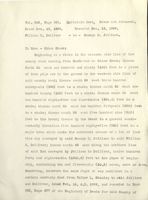
Vol. 472, Page 409.
Release Deed. Dower released.
Dated August 26, 1910.
Recorded Sept. 5, 1910.
Nan F. Johnston
- to -
H. R. Wilson.
All my right, title and interest in and
to one undivided half part of a certain lot or parcel of
land situated at Otter Creek in said town of Eden and being
bounded and described as follows, to wit:
Beginning at a stake in the Western side of the County
Road leading from Bar Harbor to Otter Creek; thence South
twenty degrees West one hundred and ninety feet to a stake
in the Western side line of said County Road; thence South
eighty-nine degrees West eleven hundred and fifty-nine
feet to the brook; thence North five degrees and fifteen
minutes East but everywhere following said brook one hun-
dred and eighty-three feet to a maple tree on the eastern
bank of said brook; thence North eighty-nine degrees East
twelve hundred forty and eight-tenths feet to the place of
beginning and containing five and three tenths acres more
or less.
Being the same property described in a certain warranty
deed from Elsie M. Jellison to said Nan F. Johnston dated
May 6, 1905, and recorded in Hancock County Maine Registry
of Deeds Book 420, Page 315, to which deed and record
express reference is made.
kayta
a
0
Vol. 459, Page 534
Sheriff's Deed
Dated July 1, 1909
Recorded Aug. 4, 1909
C. S. Johnston and
N. F. Johnstoh by
to
H. R. Wilson
H. G. Smallidge,
Deputy Sheriff
This instrument recites that all the right, title and
interest which the said C. S. and N. F. Johnston had in and to
the following described property on the eleventh day of April,
1908 was conveyed at public sale by virtue of an execution
against the said Johnstons.
A certain lot or parcel of land situated at Otter Creek
in said Eden and bounded and described as follows, to wit:
Beginning at 8. stake in the western side of the County road
leading from Bar Harbor to Otter Creek; thence south 20 degrees
west one hundred and ninety feet to a stake in the western side
line of said County road; thence south 89 degrees west eleven
hundred and fifty nine feet to the brook; thence north five de-
grees 15 minutes east but everywhere following said brook one
hundred and eighty-three feet to a maple tree on the eastern
bank of said prook; thence north 89 degrees east twelve hundred
and forty and eight tenths feet to the place of beginning and
containing five and three tenths acres more or less.
Being the same premises conveyed to the said II. F. Johnston
by deed from Elsie M. Jellison, dated May 6, 1905, and recorded
with the Hancock County, Maine, Registry of Deeds, in Book 420,
Page 315, and the same second described in said notice of said
sale.
0
S. S.W. the a
Vol. 472, Page 410. Quitclaim deed. Dower released.
Dated August 26, 1910.
Recorded Sept. 5, 1910.
H. R. Wilson
- to -
Joseph E. Tripp
One undivided half part of a certain lot or parcel
of land situated at Otter Creek in said town of Eden and
being bounded and described as follows, to wit:
Beginning at a stake in the Western side of the County
Road leading from Bar Harbor to Otter Creek; thence South
twenty degrees West one hundred and ninety- feet to a
stake in the Western side line of said County Road;
thence South eighty-nine degrees West eleven hundred and
fifty-nine feet to the brook; thence North five degrees
and fifteen minutes East but everywhere following said
brook one hundred and eighty-three feet to a maple tree on
the eastern bank of said brook; thence North eighty-nine
degrees East twelve hundred forty and eight=tenths feet to
the place of beginningand containing five and three tenths
acres more or less.
Being the same property described as conveyed in the
deed from H. G. Smallidge, Deputy Sheriff, to me the said
H. R. Wilson dated July 1, 1909 and recorded in the Hancock
County Maine Registry of Deeds Book 459, Page 534, and also
in the deed of even date herewith from Nan F. Johnston to me
the said H. R. Wilson, to be recorded in said Registry of
Deeds.
C" 0
Su original
S.S.W.Ta.
Vol. .520 Page 304
Quit-Claim Deed Dower released
Dated June 8, 1915
Recorded nov 9,1915
Joseph E. Tripp
to
George B. Dorr
All my right, title and interest in and to a certain lot
or parcel of land situated at Otter Creek in said town of Eden
and being bounded and described as follows, to wit:
Beginning at a stake in the Western side of the County
road leading from Ber Harbor to Otter Creek; thence South twen-
ty degrees West one hundred and ninety feet to a stake in the
western side line of said County Road; thence South eighty-nine
degrees West eleven hundred and fifty-nine feet to the brook;
thence North five degrees and fifteen minutes East but every-
where following said brook one hundred and eighty-three feet to
a maple tree on the eastern bank of said brook; thence North
eighty-nine degrees East twelve hundred forty and eight-tenths
feet to the place of beginning and containing five and three
tenths acres more or less.
Being the same premises described &s conveyed in a deed
from George Harmon to me the said Tripp, dated August 27, 1910
and recorded in the Hancock County, Maine, Registry of Deeds,
Book 472, Page 412 and also in a deed from H. R. Wilson to me
the said Tripp, dated August 26, 1910, recorded in said registry
Book 472, Page 410.
Vol. 130, Page 443.
Warranty Deed. Dower not released.
Dated Dec. 2, 1867.
Recorded Jan. 15, 1868.
Frederick A. Stanley
-to- William Stanley.
In Eden:
Beginning at a maple tree on the West side of the
road leading from Otter Creek to Bar Harbor, and running
West seventy rods to a cedar stake then north twenty
degrees East forty five and five sevenths rods to the
South line of land owned by Daniel W. and Porter Brewer,
itbeing the south line of lot known as the Page lot,
then East following said line to the road aforesaid seventy
rods then following said road Southerly to the first bound
containing twenty acres more or less.
Vol. 138, Page 589.
Warranty Doed.
Dower released.
Dated March 20, 1870.
Recorded March 21, 1871.
William Stanley
- to -
Frederick A. Stanley
Also another lot of land situated asfollows, to wit:
Commencing at the Brook on Pages line following said line
easterly to the highway thence Southerly by the highway
to land of Edward Stanley's, thence Westerly by E.
Stanley line to the Brook, thence following the brook
Northerly to first mentioned bounds, containing Twenty
acres more or less.
Note: One other lot is included in this deed, not
affecting the locus. It is therefore omitted.
Vol. 168, Page 257.
Warranty Deed. Dower not released.
Dated Nov. 21, 1879.
Recorded Jan. 5, 1880.
Frederick A. Stanley
- to -
Andrew Gray.
-
In Eden:
Commencingat the brook on Pages line following said
line Easterly to the highway thence Southerly by the high-
way to land of Edward Stanley's thence Westerly by E.
Stanley line to the brook; thence following the brook
northerly to first mentioned bound containing twenty acres
more or less.
Vol. 182, Page 318.
Warranty Deed.
Dower released.
Dated April 8, 1882.
Recorded April 14, 1882.
Andrew Gray
- to -
Elizabeth S. Stanley
In Eden:
Commencing at the brook on Pages line following
said line Easterly to the highway; thence Southerly by
the highway to land of Edward Stanley's; thence Westerly
by Edward Stanley line to the brook; thence following the
brook northerly to the first mentioned bound containing
twenty acres more or less.
Vol. 263, Page 55. Warranty Deed. Dower released.
Dated April 5, 1892.
Recorded May 14, 1892.
Elizabeth S. Stanley
-to-
Walter L. Stanley
Two certain lots or parcels of land situated at Otter
Creek in Eden aforesaid and bounded and described as
follows to wit:
(Note: First lot does not affect locus and is therefore
omitted;)
Second, A back lot described as follows in a deed
from Andrew Gray to me dated April 8th, 1882 and recorded
April 14th, 1882, Book 182, Page 318.
"Commencing at the brook on Pages line following said
line Easterly to the highway thence Southerly by the high-
way to land of Edward Stanley; thence Westerly by Edward
Stanley's line to the brook; thence following the brook
northerly to the first mentioned bound containing twenty
acres more or less", excepting however from this conveyance
one lot of three acres sold to George Rodick and one lot
of about one and one half acres sold to Tyler W. Stanley.
Vol. 333, Page 277. Warranty Deed. Dower not released.
Dated Feb. 11, 1899.
Recorded Feb. 14, 1899.
Walter L. Stanley
- to - George M. Jellison and
William H. Dolliver.
In Eden - Otter Creek:
Commencing at the brook on Page's line, following said
line easterly to the highway; thence Southerly by the high-
way to land of Edward Stanley; thence Westerly by Edward
Stanley's line to the brook; thence following the brook
Northerly to the first mentioned bound, containing twenty
acres more or less. The above description being from the
deed from Andrew Gray to Elizabeth S. Stanley dated April 8,
1882 and recorded April 14, 1882 in Book 182, Page 318 of
the Registry of Deeds for said County of Hancock. Except-
ing however from this conveyance one lot of 3 acres sold to
George Rodick and one lot of about one and one half acres
sold to Tyler W. Stanley, and also excepting a right of way
leading from the highway along the southern line of the
above mentioned George Rodick lot, now occupied by A. F.
Manning to land of Tyler W. Stanley, said way being sixteen
feet wide.
The lot hereby conveyed is the second lot described
in Warranty Deed from Elizabeth S. Stanley to said Walter
L. Stanley dated April 25, 1892, and recorded May 14, 1892
in Book 263, Page 55 to both of which mentioned deeds and
the record thereof reference may be had.
On Margin appears: See Dis. hereof Vol. 345, P. 261.
Vol. 345, Page 264. Quitclaim Deed. Dower released.
Dated Dec. 13, 1896.
Recorded Dec, 18, 1899.
George M. Jellison
- to -
William H. Dolliver.
In Eden - Otter Creek.
Beginning at a stake in the western side line of the
county road running from Bar Harbor to Otter Creek, thence
south 20 west one hundred ninety (190) feet to a stake in
the western side line of said county road; thence south
89 west eleven hundred fifty-nine (1159) feet to the brook
thence north 5 15' east, but everywhere following said
brook, one hundred eighty-three (183) feet to a maple tree
on the eastern bank of said brook; thence north 89 east,
twelve hundred forty and eight-tenths (1240.8) feet to the
place of beginning and containing five and three-tenths
(5.3) acres, more or less.
Being the southern one third part of the lot described
in deed from Walter L. Stanley to said George M.Jellison
and William H. Dolliver, dated Feb. 11 A.D. 1899, and re-
corded Feb. 14, 1899, in Book 333, Page 277, of the
Registry of Deeds for said County of Hancock, to which deed
and record reference is hereby expressly made.
Vol. 355, Page 159. Quitclaim Deed. Dower not released.
Dated Nov. 1, 1900.
Recorded Nov. 2, 1900.
William H. Dolliver
-to- Clifton E. Dolliver.
In Eden - Otter Creek.
Beginning at a stake in the western side line of the
county road leading from Bar Harbor to Otter Creek, thence
south twenty degrees west one hundred andninety (190) feet
to a stake in the western side line of said county road;
thence south eighty-nine degrees west eleven hundred and
fifty-nine (1159) feet to the brook; thence north five
degrees and fifteen minutes east but everywhere following
said brook one hundred and eighty-three (183) feet to a
maple tree on the eastern bank of said brook; thence north
eighty-nine degrees east twelve hundred forty and eight-
tenths (1240.8) feet to the place of beginning and con-
taining five and three-tenths (5.3) acres more orless.
Being the southern one-third part of the lot de-
scribed in a deed from Walter L. Stanley to George M.
Jellison and said William H. Dolliver dated February 11 ADD,
1899 and recorded February 14 1899 in Book 333 Page 277 of
the Registry of Deeds for said County of Hancock to which
deed and record reference is hereby expressly made.
Vol. 397, Page 274.
Warranty Deed.
Dower released.
Dated Sept. 5th, 1903.
Recorded Sept. 16, 1903.
Clifton E. Dolliver
- to -
Annie Jellison
In Eden - Otter Creek.
Beginning at a stake in the Western side line of
the County Road leading from Bar Harbor to Otter Creek;
thence South twenty degrees West one hundred and ninety (190)
feet to a stake in the Western side line of said County
Road; thence South eighty-nine degrees West eleven hun-
dred and fifty nine (1159) feet to the brook; thence North
five degrees and fifteen minutes East but everywhere
following said brook one hundred and eighty-three (183)
feet to a maple tree on the Eastern bank of said brook;
thence north eighty-nine degrees East twelve hundred
forty and eight tenths (1240.8) feet to the place of begin-
ning and containing five and three tenths (5.3) acres more
or less.
Being the southern one-third part of the lot describ-
ed in a deed from Walter L. Stanley to George M. Jellison
and said William H. Dolliver dated February 11, A.D. 1899
and recorded February 14, 1899 in Book 333, Page 277 of the
Registry of Deeds for said County of Hancock to which deed
and record reference is hereby expressly made.
Beign also the same premises conveyed to said Clifton
E. Dolliver by William H. Dolliver by his quit-claim deed
dated Nov. 1, 1900, and recorded in said Registry in book
355, page 159.
Vol. 403, Page 499.
Warranty Deed.
Dower Released.
Dated March 9, 1904.
Recorded March 12, 1904.
Annie Jellison
- to - M. L. Garfink, and
Elsie M. Jellison.
In Eden = Otter Creek:
Beginning at a stake in the western side line of the
County road leading from Bar Harbor to Otter Creek; thence
South twenty degrees West one hundred and ninety feet (190)
to a stake in the western side line of said County road;
thence south eighty-nine degrees west ekeven hundred and
fifty-nine (1159) feet to the brook; thence northfive
degrees and fifteen minutes East but everywhere following
said brook one hundred and eighty-three (183) feet to a
maple tree on the Eastern bank of said brook; thence North
eighty-nine degrees East twelve hundred forty and eight
tenths (1240.8) feet to the plaze of beginning and contain
ing five and three tenths (5.3) acres more or less.
Being the southern one-third part of the lot described
in a deed from Walter L. Stanley to George M. Jellison and
William H. Dolliver dated February 11, A.D. 1899, and re-
corded February 14, 1899 in Book 333 Page 277 of the
Registry of Deeds for said County of Hancock to which
deed and record reference is hereby expressly made.
Being also the same premises conveyed to Clifton E.
Dolliver by William H. Dolliver by his quit-claim deed dated
November 8, 1900 and recorded in said Registry in Book 255
403 - 499
2-
Page 159.
Being the same premises conveyed to said Annie
Jellison by Clifton E. Dolliver by his warranty deed
dated September 5,1903, and recorded in said Registry
in Book 397, Page 274.
Vol. 424, Page 175
Warranty Deed
Dated Sept. 26, 1905
Recorded Sept. 27, 1905
M. L. Garfink
to
O. H. Jellison
One half undivided interest in a certain lot or parcel of
land situated at Otter Creek in said town of Eden, and bounded
and described as follows, to wit:- Beginning at a stake in the
western side line of the County Road leading from Bar Harbor to
Otter Creek; thence south twenty degrees west one hundred and
ninty feet to a stake in the western side line of said County
Road; thence south eighty-nine degrees west eleven hundred and
fifty-nine feet to the brook; thence north five degrees and fif-
teen minutes east, but everywhere following said brook one hun-
dred and eighty-three feet to a maple tree on the eastern bank
of said brook; thence north eightyOnine degrees east twelve hun-
dred forty and eight-tenths feet to the place of beginning, and
containing five and three-tenths acres, more or less.
Being the same premises as was conveyed by Annie Jellison
to the said Garfink and Elsie M. Jellison, by deed dated the
ninth day of March A. D. 1904, and recorded in the Hancock Coun-
ty Registry of Deeds, in Book 403, Page 499, to which deed and
record thereof for a more full description express reference is
hereby made.
Note: Witness clause recites grantor "Unmarried.
Vol. 435, Page 95.
Warranty Deed Dower released
Dated Oct. 23, 1906
Recorded Oct. 24, 1906
0. H. Jellison
to
George Harmon
One half undivided interest in a certain lot or parcel
of land situated in Otter Creek, in Town of Eden, County and
State as aforesaid, and bounded and described as follows; to
wit:- Beginning at a stake or stone in the western side line
of the County Road leading from Bar Harbor to Otter Creek;
thence South twenty (20) degrees West one hundred ninety (190)
feet to a stake or stone in the Western side line of said Coun-
ty Road; thence South eightynine degrees West eleven hundred
fifty nine (1159) feet to the brook; thence North five (5)
degrees and fifteen (15) minutes East but everywhere following
said brook One Hundred eighty three (183) feet to a maple tree
on the Eastern bank of said brook; thence North eighty nine (89)
degrees East twelve hundred forty and eight tenths (1240 8/10)
feet to the place of beginning and containing five and three
tenths (5 3/10) Acres more or less. Being the same premises
as was conveyed by Annie Jellerson to M. L. Garfink and Elsie
M. Jellerson by deed dated the nineth day of March A. D. 1904
and recorded in Hancock County Registry of Deeds in book 403,
page 499, and conveyed by M. L. Garfink to 0. H. Jellerson by
deed dated September 26th A. D. 1905 and recorded in Hancock
County Registery of Deeds book 424, Page 175 to which reference
may be had.
Vol. 472, Page 412
Quit-Claim Deed Dower released
Dated August 27, 1910
Recorded Sept. 5, 1910
George Harmon
to
Joseph E. Tripp
One undivided half part of a certain lot or parcel of
land situated at Otter Creek in said town of Eden and being
bounded and described as follows, to wit:
Beginning at a stake in the Western side of the County road
leading from Bar Harbor to Otter Creek; thence South twenty de-
grees West one hundred and ninety feet to a stake in the western
side line of said County Road; thence South eighty-nine degrees
West eleven hundred and fifty-nine feet to the brook; thence
North five degrees and fifteen minutes East but everywhere fol-
lowing said brook one hundred and eighty-three feet to a maple
tree on the eastern bank of said brook; thence North eighty-
nine degrees East twelve hundred forty and eight-tenths feet
to the place of beginning and containing five and three tenths
acres more or less.
Being the same property described as conveyed in the deed
from 0. H. Jellison et al. to me dated October 23, 1906 and re-
corded in Book 435, Page 95.
Vol. 420, Page 315
Warranty Deed Dower released
Dated May 6, 1905
Recorded May 10, 1905
Elsie M. Jellison
to
Nan F. Johnston
One undivided half part of a certain lot or parcel of
land situated at Otter Creek in said town of Eden and being
bounded and described as follows, to wit: -
Beginning at a stake in the Western side of the County
road leading from Bar Harbor to Otter Creek; thence South twen-
ty degrees West one hundred and ninety feet to a stake in the
Western side line of said County Road; thence South eighty nine
degrees West eleven hundred and fifty nine feet to the brook;
thence North five degrees and fifteen minutes East but every-
where following said brook one hundred and eighty three feet
to a maple tree on the Eastern bank of said brook; thence
North eighty nine degrees East twelve hundred forty and eight
tenths feet to the place of beginning and containing five and
three tenths acres more or less.
The above described premises being the Southern one third
part of the lot of land described in a deed from Walter I. Stan-
ley to George M. Jellison and William H. Dolliver dated Feb. 11,
A. D. 1899 and recorded Feb. 14, 1899 in book 333, Page 277 of
the Registry of Deeds for said County of Hancock to which said
deed and record thereof reference is hereby expressly made.
Being also the same premises conveyed to Clifton E. Dolli-
ver by William H1 Dolliver by his quit claim deed dated Nov. 1,
-2-
420-315
1900 and recorded in said Registry of Deeds Book 355 Page 159.
Being also the same premises conveyed to Annie Jellison
by Clifton H. Dolliver by his Warranty Deed dated Sept. 5, 1903
and recorded in said Registry of Deeds in Book 397, Page 274.
Vol. 472, Page 409.
Release Deed. Dower released.
Dated August 26, 1910.
Recorded Sept. 5, 1910.
Nan F. Johnston
- to -
H. R. Wilson.
All my right, title and interest in and
to one undivided half part of a certain lot or parcel of
land situated at Otter Creek in said town of Eden and being
bounded and described as follows, to wit:
Beginning at a stake in the Western side of the County
Road leading from Bar Harbor to Otter Creek; thence South
twenty degrees West one hundred and ninety feet to a stake
in the Western side line of said County Road; thence South
eighty-nine degrees West eleven hundred and fifty-nine
feet to the brook; thence North five degrees and fifteen
minutes East but everywhere following said brook one hun-
dred and eighty-three feet to a maple tree on the eastern
bank of said brook; thence North eighty-nine degrees East
twelve hundred forty and eight-tenths feet to the place of
beginning and containing five and three tenths acres more
or less.
Being the same property described in a certain warranty
deed from Elsie M. Jellison to said Nan F. Johnston dated
May 6, 1905, and recorded in Hancock County Maine Registry
of Deeds Book 420, Page 315, to which deed and record
express reference is made.
Vol. 459, Page 534
Sheriff's Deed
Dated July 1, 1909
Recorded Aug. 4, 1909
C. S. Johnston and
IV. F. Johnston by
to
H. R. Wilson
H. G. Smallidge,
Deputy Sheriff
This instrument recites that all the right, title and
interest which the said C. S. and N. F. Johnston had in and to
the following described property on the eleventh day of April,
1908 was conveyed at public sale by virtue of an execution
against the said Johnstons.
A certain lot or parcel of land situated at Otter Creek
in said Eden and bounded and described as follows, to wit:
Beginning at a stake in the western side of the County road
leading from Bar Harbor to Otter Creek; thence south 20 degrees
west one hundred and ninety feet to a stake in the western side
line of said County road; thence south 89 degrees west eleven
hundred and fifty nine feet to the brook; thence north five de-
grees 15 minutes east but everywhere following said brook one
hundred and eighty-three feet to a maple tree on the eastern
bank of said prook; thence north 89 degrees east twelve hundred
and forty and eight tenths feet to the place of beginning and
containing five and three tenths acres more or less.
Being the same premises conveyed to the said N. F. Johnston
by deed from Elsie M. Jellison, dated May 6, 1905, and recorded
with the Hancock County, Maine, Registry of Deeds, in Book 420,
Page 315, and the same second described in said notice of said
sale.
Vol. 472, Page 410. Quitclaim deed. Dower released.
Dated August 26, 1910.
Recorded Sept. 5, 1910.
H. R. Wilson
- to -
Joseph E. Tripp
One undivided half part of a certain lot or parcel
of land situated at Otter Creek in said town of Eden and
being bounded and described as follows, to wit:
Beginning at a stake in the Western side of the County
Road leading from Bar Harbor to Otter Creek; thence South
twenty degrees West one hundred and ninety- feet to a
stake in the Western side line of said County Road;
thence South eighty-nine degrees West eleven hundred and
fifty-nine feet to the brook; thence North five degrees
and fifteen minutes East but everywhere following said
brook one hundred and eighty-three feet to a maple tree on
the eastern bank of said brook; thence North eighty-nine
degrees East twelve hundred forty and eight-tenths feet to
the place of beginningand containing five and three tenths
acres more or less.
Being the same property described as conveyed in the
deed from H. G. Smallidge, Deputy Sheriff, to me the said
H. R. Wilson dated July 1, 1909 and recorded in the Hancock
County Maine Registry of Deeds Book 459, Page 534, and also
in the deed of even date herewith from Nan F. Johnston to me
the said H. R. Wilson, to be recorded in said Registry of
Deeds.
Vol.
Page
Quit-Claim Deed Dower released
Dated June 8, 1915
Recorded
Joseph E. Tripp
to
George B. Dorr
All my right, title and interest in and to a certain lot
or parcel of land situated at Otter Creek in said town of Eden
and being bounded and described as follows, to wit:
Beginning at a stake in the Western side of the County
road leading from Bar Harbor to Otter Creek; thence South twen-
ty degrees West one hundred and ninety feet to a stake in the
western side line of said County Road; thence South eighty-nine
degrees West eleven hundred and fifty-nine feet to the brook;
thence North five degrees and fifteen minutes East but every-
where following said brook one hundred and eighty-three feet to
a maple tree on the eastern bank of said brook; thence North
eighty-nine degrees East twelve hundred forty and eight-tenths
feet to the place of beginning and containing five and three
tenths acres more or less.
Being the same premises described as conveyed in a deed
from George Harmon to me the said Tripp, dated August 27, 1910
and recorded in the Hancock County, Maine, Registry of Deeds,
Book 472, Page 412 and also in a deed from H. R. Wilson to me
the said Tripp, dated August 26, 1910, recorded in said registry
Book 472, Page 410.
Vol. 213, Page 217.
Warranty Deed.
Dower released.
Dated May 9, 1887.
Recorded May 14, 1887.
Geo. W. Rodick
- to -
Lewis Friend, Chas. C.
Morrison, Bryant Bradley,
Wm. Vincent and Parker C.
Wood.
In Eden:
Beginning at the South West corner of Wm. Stanley's
back lot and runs South 9 1/2 West eleven rods and eight
links to a spotted spruce standing on the east side of
"Meadow" Brook so called; thence north 89 1/2 West thirty
rods to an iron bolt in the ledge; thence south 18 1/2
East fifty eight rods to a Pine spotted on four sides on
the south line of a back lot owned byF. and S. H. Rodick
thence on said south line easterly twenty nine rods to the
center of said Meadow Brook; thence on said Wm. Stanley's
west line southerly to the first mentioned bound and con-
tains ten acres more or less. Being the same premises
conveyed to me by Edw. Stanley by his Warranty deed dated
Dec. 14" 1883 and recorded in Hancock County Registry of
deeds, Book 194, Page 326, to which said deed and the
record thereof reference is expressly made.
Vol. 105, Page 333. Warranty Deed. Dower not released.
Dated
#
#
1856.
Recorded Nov. 24, 1857.
Edward Brewer
- to -
Edward Stanley.
In Eden:
Commencing at a poplar tree, at Timothy Smallage's
Western line, thence North four degrees East to Joshua
M. Page's Southern line, thence following said line
Easterly to the county road, thence following said Road
to Thomas P. Smallage's Northern line, thence following
Thomas Smallage's and Timothy Smallages Northern line to
the first mentioned bound which is a poplar tree, contain-
ing Sixty acres more or less.
Vol. 119, Page 288.
Warranty Deed. Dower not released.
Dated October 13, 1863.
Recorded Oct. 13, 1863.
Edward Stanley
- to -
Frederic A. Stanley
In Eden:
Beginning at a poplar tree at Timothy Smallbridge's
Western line thence north four degrees East to Joshua M.
Pages southern line thence following said line Easterly
to the County road, thence following said road to Thomas
Smalledges northern line, thence following Thomas
Salledges & Timothy Smallidges Northern line to the
first mentioned bounds containing sixty acres more or
less it being the same premises conveyed by deed to me
from Edwin Brewer dated October seventeenth A.D. 1857,
and recorded in the Hancoc k Registry of Deeds Vol. 105
page 333.
Vol. 215, Page 392.
Warranty Deed, Dower not released.
Dated May 9, 1887.
Recorded May 31, 1887.
Edward Stanley
- to -
Lewis Friend, Wm. Vincent,
Parker C. Wood, Chas. C.
Morrison and Bryant Bradley.
In Eden - Otter Creek.
Beginning at a stake and stones the northeast corner
bound of the Thomas Smallidge lot; thence South 85 1/4
West by thenorth line of said Smallidge lot one thousand
three hundred forty seven (347) feet more or less to a stone
the northeast corner bound of the Timothy Smallidge lot and
the South East corner bound of the Notch lot so called;
thence by the East line of said Notch lot North 4'1/4 East
two thousand one hundred twenty seven (2127) feet to an
iron bolt in a granite Boulder; thence South 88 3/4 East
six hundred thirty four feet by South line of land of F.
& S. H. Rodick to a pine tree the North West corner bound of
Geo. W. Rodicks lot; thence South 8 1/2 West by the West
line of said Geo. W. Rodicks lot nine hundred fifty seven
feet more or less to an iron bolt in a ledge the Southwest
corner bound of said Geo. W. Rodicks lot; thence by said Geq
W. Rodicks South line South 89 1/2 East four hundred
ninety five (495) feet more or less to a spotted spruce on
the East side of meadow brook so called thence North 9 1/2
East but still following said Geo. W. Rodicks line One hun-
dred eighty seven feetmore or less to the South West corner
bound of land of William or Elizabeth Stanley; thence by
215- 392
2-
the South line of said Stanleys land South 88 3/4 East one
thousand one hundred and six (1106) feet more or less to a
maple tree on the west side of the road keading from Bar
Harbor to Otter Creek; thence by the center of said road
South 25 50' 1 one hundred fifty three and one half 153 1/2
feet more or less to a stake; thence by center of said
road South 14 20' West nine hundred twenty (920) feet
more or less to a stake; thence still following the center
of said road South 21 50' West one hundred and three
fourths (100 3/4) feet more or less to the junction of the
road leading to Otter Cliffs and the road first mentioned;
thence South 79 20' West but still following the Otter
Creek road three hundred thirty six and one half (336 1/2)
feet more orless to a stake; thence South 51 West by center
of said road fifty three and three fourths (53 3/4) feet;
thence South 85 1/4 West fifty seven feet to place of
beginning and contains fifty acresmore or less.
Vol. 345, Page 262.
Quitclaim deed, Dower not released.
Dated Dec. 13, 1899.
Recorded Dec. 18, 1899.
William H. Dolliver
- to - George M. Jellison.
In Eden - Otter Creek:
Beginning at a stake in the western side line of the
county road running from BarHarbor to Otter Creek; thence
North 20 east one hundred and ninety (190) feet to a piece
of iron pipe set in the ground in the western side line of
said county road; thence south 89 west three hundred
ninety-six (396) feet to a stake; thence north 20 east one
hundred twenty (120) feet to a stake; thence south 89 west
two hundred eighty-four and four-tenths (284.4) feet to a
stake; thence north 20 east two hundred fifty-six (256) feet
to a stake; thence south 89 west five hundred nine (509)
feet to the brook; thence by the brook in a general south-
westerly direction five hundred eighty-five (585) feet to a
maple tree which marks the northwest corner of a lot of land
this day conveyed by said George M& Jellison to said William
H. Dolliver; thence north 89 east along the northern line
of said lot conveyed by Jellison to Dolliver, twelve hundred
forty and eight-tenths (1240.8) feet to the place of begin-
ning, containing ten and five-tenths (10.5) acres, more or less.
Reserving, howeverm the same right of way mentioned in a
certain warranty deed from Walter L. Stanley to said Jellison
and Dolliver, dated Feb. 11, A.D. 1899, and recorded in Book
333, Page 277 of the Registery of Deeds for said County of
345-262
2-
Hancock to which deed and record r ference is hereby
expressly made.
The lot hereby conveyed is the northern two-thirds
of the lot described in the deed from Walter L. Stanley
ro said Jellison and Dolliver.
Vol. 261, Page 270. Mortgage Deed. Dower released.
Dated April 25, 1892.
Recorded May 14, 1892.
Walter L. Stanley
-to-
Elizabeth S. Stanley and
William Stanley, her husband.
This is a mortgage of a twenty acre lot between
the brook and the highway next south of land of the
Hancock County Trustees of Public Reservations, excepting
the Rodick three acre lot and the Tyler W. Stanley one and
one-half acre lot.
Refers as being same lot deeded Elizabeth Stanley by
Andrew Gray in Vol. 182, Page 318.
This mortgage also includes other land.
The conditional clause is as follows:
"Provided nevertheless that if the said Walter L.
Stanley his heirs, executors or administrators shall during
the natural lives of the said Elizabeth S. Stanley and
her husband William Stanley, provide for their suitable
support and maintenance, according to their age and con-
dition in life, more particularly according to a certain
bond of this date then this deed as also a bond hearing even
date with these presents given by the said Walter L.
Stanley to the said Elizabeth S. and William Stanley to provide
maintenance, shall both be void, otherwise to remain in full
force.' If
Vol. 261, Page 273.
Dower not released.
Dated April 25, 1892.
Recorded May 14, 1892.
Walter L. Stanley
- to -
Elizabeth S. Stanley
and William Stanley
her husband.
This is a bond in the sum of $1,000 conditioned
as follows:
"The condition of the above obligation is such that
whereas the said Elizabeth S. Stanley has this day convey-
ed certain real estate situated at Otter Creek in said Eden,
to said Walter L. Stanley on the consideration that the
said Walter L. is to maintain them the said Elizabeth S.
and William Stanley, during their natural lives.
Now know ye that if the said Walter L. shall well
and faithfully support and main them the said Elizabeth S.
& William Stanley on the place or farm on which they nnow
live, landaccording to their rank and condition in life,
having regard to their age and infirmaties, providing
them with suitable food and raiment and care and attendance
in sickness and in health in fact maintaining them according
to the meaning of the term maintain, during their natural
lives and give them a Christian burial after their decease,
then this bond as also a mortgage of said real estate of
this deed, given by said Walter L. to said Elizabeth S. and
William Stanley, shall both be void, otherwise they shall
remain in full force."
Vol. 162, Page 65. Warranty Deed. Dower not released.
Dated February 14, 1878.
Recorded Feb. 16, 1878.
George A. Bunker
-to-
Joseph E. Tripp
In Eden:
Beginning on the East side of the road leading
from Bar Harbor to, Otter Creek, at a spruce tree the
corner of Daniel W. Brewers lot, and follows said
Brewers South line Easterly forty four rods to an iron
bolt in the ledge of Newport Mountain, thence South
eighteen degrees West seventy rods more or less to an
iron bolt in the ledge of said Mountain, thence North
eighty threedegrees West forty eight rods to a poplar
tree at the aforesaid road; thence follows said road
Northerly eighty rods to the first mentioned bound,
and contains twenty acres more or less; courses are by
Compass at this date.
Vol. 2021 Page 418
Mortgage Deed
Dated Jan. 14, 1886
Recorded Jan. 16, 1886
Elizabeth Stanley
to
Nathan Ash
This is a mortgage of the Tripp lot with other land to
secure the sum of $125 in 1 year.
Nathan Ash discharges this mortgage by instrument dated
Nov. 12, 1898 and recorded Feb. 14, 1898 in Vol. 333, Page
276.
WILLIAM E. WHITING,
ATTORNEY AND COUNSELLOR AT LAW,
ELLSWORTH, MAINE.
TELEPHONE
Ellsworth Maine August 8th 1903
H. D. Smith
Bar Harbor Me.
Dear Sir:-
I will call the two lots the fifty acre lot and the ten
acre lot as that is the way they come in your deeds.
1.
The fifty acre lot was deeded to Edward Stanley by Edward Brewer
by Warranty deed in 1856 Acknowledged Oct. 17th 1857, Recorded Nov.
24th 1857 in Vol. 105 Page 333.
This deed is all right except that dower was not released
Brewer may not have been married, and the deed is not dated day or
month.
This lot contained 60 acres.
2.
The next is a deed from Elbridge V. Lyman and Mrs. E. V. Lyman
to Edward Stanley to Edward Stanley of the same lot the 60 acre,
Dated 1880 DOO day or month, Acknowledged Dec. 11th 1883 and recorded
Dec. 18th 1883 in Vol. 191 Page 292.
This was signed by Mrs. E. V. Lyman only so if Elbridge V.
Lyman ever had any interest he never conveyed it.
This lot was the same as the first containing 60 acres but
reserving a lot of 20 acres which had been deeded to Andrew Gray
some time before.
The lot which you are thinking of buying is that lot, you see
it had 60 acres and 20 acres were sold then the lot was run out and
- 2 -
WILLIAM E. WHITING,
ATTORNEY AND COUNSELLOR AT LAW,
ELLSWORTH, MAINE.
TELEPHONE
they found that they had 50 acres left the deed called for 60 more
or less.
This deed is bad as Elbridge V. L. never conveyed any thing,
and the only thing you can do is to find out what you can about the
parties them selves, it must have been that Lyman had some interest
or Stanley never would have paid for the deed when he had a deed of
the same property 24 years before.
Stanley's title might be good by adverse possession.
3
Now the ten acre lot is deeded by Edward Stanley to George W.
Rodick, dated and acknowledged Dec. 14th 1883 Recorded July 24th 1884
in Vol. 194 Page 326.
( Warranty deed )
This deed is all right but Edward Stanley has no record title
to the property.
You will have to find out from the parties where he got the
title.
4.
George W. Rodick conveyed the ten acre lot to Lewis Friend,
Chas. C. Morrison, Bryant Bradley, William Vincent and Parker C. Wood
by warranty deed May 9th 1887 acknowledged same day, recorded May
14th 1887 in Vol. 213 Page 217.
This deed is all right.
5
Edward Stanley the same day conveyed the 50 acre lot to the
same parties Friend, Vincent, Wood, Morrison and Bradley by warranty
- 3 -
WILLIAM E. WHITING,
ATTORNEY AND COUNSELLOR AT LAW,
ELLSWORTH, MAINE.
TELEPHONE.
deed dated and acknowledged May 9th 1887 Recorded May 31st 1887 in
Vol. 215 Page 392, Consideration $5000. Mortgage back for $4000. 5
Vol. 216 Page 177
Discharged May 13th 1889 Book 236 Page 268
This deed is all right except that dower was not released.
6.
William Vincent, Parker C. Wood and Charles C. Morrison gave a
mortgage to Edward Stanley for $1200. May 13th 1889 Vol. 236 Page 278
which is all right as Vincent and Wood have deeded to Stanley and
Morrison's has been discharged.
7.
Parker C. Wood to Edward Stanley was the next and you have the
deed enclosed.
Its acknowledged before its dated and you want that fixed before
you take your deed.
8,
The last is from William Vincent to Edward Stanley which is
all right. deed enclosed.
,
As you will see the things you want fixed are dower in No 1.
universed
Elbridge V. Lyman's interest in property as shown in No. 2
?
See where Stanley got his title, 3
in No. Brewer in original deed.
Dower interest in No. 5 r ho memories
Acknowledgement in No. 7
Your grantor has to pay for giving you a good title and I should
tell him about the defects in the title and you may be able to fix
most of them with out any trouble and let him fix the rest, when he
- 4 -
WILLIAM E. WHITING,
ATTORNEY AND COUNSELLOR AT LAW,
ELLSWORTH, MAINE.
TELEPHONE.
has you can then take the property.
I would not take the land the way it is if I were you with out
you are getting it for a very little money and he will give you a
warranty deed, then it might be worth taking a chance on,other wise
have the same fixed before you take it.
If they do fix the title you can see a Lawyer in Bar Harbor or
send to me so that you will be sure things are done right.
Yours very truly,
( Dictated

