
From collection Place
State of Maine created from the Commonwealth of Massachusetts' District of Maine. The geographic center, or that point on which a surface of uniform thickness would balance, for the state is located in Piscataquis County, 18 mi N of Dever.
Related Items

Whales and Climate Change
The Gulf of Maine is a large body of water in the Northern Atlantic, home to extraordinary marine wildlife. The Gulf of Maine borders on three US states, Maine, New Hampshire, Massachusetts, and two Canadian provinces: New Brunswick and No…
State Senate certification
A certification that the named person is a member of the state senate of Maine's 100th legislature.
North Woods Ways
North Woods Ways Academic and Recreational Uses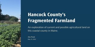
Hancock County's Fragmented Farmland
An exploration of current and possible agricultural land on this coastal county in Maine.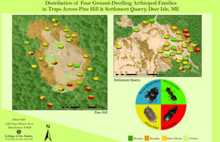
Distribution of Four Ground-Dwelling Arthropod Families
Distribution of Four Ground-Dwelling Arthropod Families in Traps Across Pine Hill and Settlement Quarry, Deer Isle, Maine
River Herring at Wight's Pond
an outreach piece from College of the Atlantic's Fisheries, Fishermen, and Fishing Communities course 2023
Aroostook Renewable Gateway GIS
A Geographic Information System designed to enable the public to make their own maps of interest along the proposed Gateway corridor
Abortion Access in MaineEva McMillan
Abortion accessibility in Maine is unique because of the state's size and rural population. With long drive times presenting a barrier for many individuals, expanding access to later abortion care should be a priority.
River Herring Co-management in Downeast Maine
A final project for College of the Atlantic's Fisheries, Fishermen, and Fishing Communities course 2023.https://storymaps.arcgis.com/stories/1d6e545864c048b9a64f4b2ccb94df16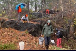

