
From collection Creating Acadia National Park: The George B. Dorr Research Archive of Ronald H. Epp


Page 1
Page 2
Page 3
Page 4
Page 5
Page 6
Page 7
Page 8
Page 9
Page 10
Page 11
Page 12
Page 13
Page 14
Page 15
Page 16
Page 17
Page 18
Page 19
Page 20
Page 21
Page 22
Page 23
Page 24
Page 25
Page 26
Page 27
Page 28
Page 29
Page 30
Page 31
Page 32
Page 33
Page 34
Page 35
Page 36
Page 37
Page 38
Page 39
Page 40
Page 41
Page 42
Page 43
Page 44
Page 45
Page 46
Page 47
Page 48
Page 49
Page 50
Page 51
Page 52
Page 53
Page 54
Page 55
Page 56
Page 57
Page 58
Page 59
Page 60
Page 61
Page 62
Page 63
Page 64
Page 65
Page 66
Page 67
Page 68
Page 69
Page 70
Page 71
Page 72
Page 73
Page 74
Page 75
Page 76
Page 77
Page 78
Page 79
Page 80
Page 81
Page 82
Page 83
Page 84
Page 85
Search
results in pages
Eliot C.W. II (1899-1993) Printed Professional Docs incl boundaries disputes
Eliot,C. W.II (1899-1993)
Printed professional does,
Inal. Boundaries Disputes
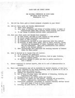
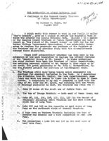
STATE PARK AND FOREST SURVEY
THE NATIONAL CONFERENCE ON STATE PARKS
904 Union Trust Building
Washington, D.C.
I.
How did the State park or forest movement originate in your State?
II. How are State parks and forests administered?
a. Under State agencies?
b.
Give names of efficers and titles of holding bodies; or names of
organizations other than official bodies holding such areas?
C. Is any change in present methods under consideration?
III. Have your State parks and forests been acquired -
a. By bond issues, and what is your opinion of this method?
b. By direct annual legislative appropriation?
C. By gifts of land or money?
d. By condemnation, and what is your experience with this method?
e. By transfer of other State lands, such as school sections, tracts
reverted for non-payment of taxes, abandoned canal rights of
way and reservoirs? Have such possibilities been investi-
gated to the fullest extent?
f. Have opportunities beon exercised for securing transfer of Federal
lands for State parks?
IV. Data is desired as to income from all sources:
a. Is it retained for parkiuses?
b. Are revenues from other State services, such as game licenses,
used to acquire parks?
C. Is admission charged to parks and what is public reaction to
such a method?
V.
Unless contained in current reports, data as to cost of administration is
desired.
VI. Where such information may not be available in current reports, or have been
given otherwise to the Field Secretary, data is desired as to use of
State parks and forests as to:
a. Camping and regulations therefor.
b. Use of areas by group camps, and methods of financing, building and
regulating such camps.
C. Transportation to and within parks and forests.
d.
Facilities for public use and comfort, existing and prospective,
hotels, commissaries, restaurants, shelters, etc.
e. Concessions permitted, percentage of revenues retained; whether turned
into park funds or back to state treasury.
f. Policing, by park forces, or other agencies.
VI.
(Continued)
g. Regulations for order and safety, and supervision of social problems.
h. Length of season?
1. Number of visitors in all classes, -in summer, in winter?
2. What is experience as to winter use and future plans?
i. Hospital, medical and nursing service.
j. Trails for walkers and campers, trail markers, shelters; canoe routes
and camps, packhorse routes and supplies.
k. Educational and scientific uses, for nature study, forestry instruc-
tion, summer schools, etc.
1. Experience as to function of State parks in promoting increased appre-
ciation of nature, reasonable treatment of natural attractions,
and influence on visitors.
VII.
Give
names of State parks or forests acquired since last report supplied to
Field Secretary and state if they were purchased or given, with maps
showing location and area and data as to cost?
VIII. Indicate projects pending for further State parks or forests?
IX.
If such information is not contained in current reports, please give plan
as to extension of State park and forest system, and reasons therefor.
X.
If State parks or forests have not yet been established, is any survey being
made or planned for such a system?
XI.
What is your experience as to gifts of land, money, labor or supplies, in
maintaining State parks and forests?
a. Can this resource be further developed?
XII. What general considerations govern your choice of land for State parks and
forests?
a. Is any survey, state-wide or by districts, not being made for future
park development?
b. Is there coordination in such studies with municipal and country park
or national park and forest developments?
Copies of laws or digests where copies are unobtainable, with amendments to date,
bearing on the establishment and development of State parks and forests would be
appreciated. Also on such related subjects as game protection, conservation, wild
flower protection, reservation of mining and timber rights, clearing of titles,
adjustment of tax losses to townships affected, retention of revenues and other
financial provisions.
QUESTIONS FROM SHEAFE SATTERTHWAITE FOR THE TRUSTEES OF RESERVATIONS
What is a reservation? And if there is an element of its being some-
thing saved, from what is it being saved? Reservedon? reserved? held rach
What are trustees? And when connected with property, that is build-
inga and lands, how do they fulfill their duties? Why is "trust"
involved? What is their work? Has the nature of their mission
changed through the years?
gh2
and capital
natocerium.
Why is such a group private in organization but public in purpose?
What are the advantages and dieadvantages of being partly public
and partly private? What problems are entailed in the excoution of
a public cause when that oauso-is being undortaken by a private body?
In its early history the Trustees, although private, wore a servant of
government through the coastal towns' surrey, the Provinootown lands
settlement, and the Metropolitan Park district founding A In what ways
may the Trustees be continuing that role today?
needest uses
Deft Consurate
sandoc Survey
weeclie
Do the Trustees rely upon gift (and henge ohanoe?) to procure their
day Certent
reservations or do they through surveys and studies solect sites for
degral.
acquisition and then go about finding the funds necessary for their
purchase?
When it is said that "the advantages of an organization like this lie
in freedom from politics /and the/ ability to aot quickly", what
would be examples of these qualities in the history of the Trustees?
What standards do the Trustees uphold?
Is there any ultimate goal to the Trustees' work?
Is there an accumption that the next seventy-five years will follow
a pattern of development similar to that of the first seventy-five?
Is an increasing amount of time being spent saving that which is
already saved? How much assurance is there that a reservation will
always be a reservation?
What attracts people to reservations?
Why was "public" removed from the name of the organization?
In what ways may the Trustees be democratic, aristocratic, oligarchio,
or selfish?
Does the influence of the Trustees extend beyond its properties and
if so, in what ways?
Is the Trustees' relationships to the National Trust of an honorary
or substantive nature?
Can property be disconnected from the environment around it; the
history and politics of a locale, the economic, social, and cultural
miliou?
- 2 -
What reality is there to saving a "piece" of something, or are the
Trustees' pieces complete?
Where have the Trustees failed? What opportunities have been lost?
What have they not done that they should have done?
Have the Trustoes traditionally viewed their work in disparate ways
(for instance, maybe one group being for & more passivo and another
for & more active policy)? What internal conflicts have the Trustees
experienced? What kind of conflicts can such a group expect to
experience, either internally or externally?
Who are the Trustees' enemies and friends?
What lossons have the Trustees learned? What does their seventy-
five year experience have to offer other groups and movements in an
era when natural beauty is much discussed?
What connections are there between places of natural beauty and places
of historic interest? Is there any conflict between man-made things
and natural things? Or rather, do the Trustees attempt to inouloate
a union between man and nature?
What relation do the Trustees maintain with governmental bodies and
with private groups also engaged in fields of interest similar to
their own?
Ho. large is the problem of vandalism?
What are the oriticisms levelled at the Trustees? Is there any
telling criticism?
What is the Trustees' conception of the Massachusetts landscape?
If the Trustees profess a purpose related to preserving places of
historic interest, why have their holdings been largely confined to
houses and not to factories, bridges, significant engineering works,
and other non-domestic structures?
If the Trustees profess a purpose related to preserving places of
natural beauty, why have their holdings been confined to parcels
of land and not to entire watersheds, valleys, or ochesive landscapes?
Can really effective preservation work be accomplished in critical
or controversial locations without the power of eminent domain?
Can the concept of preservation include the adapting of places
to new uses rather than traditional uses?
Is
one
kind of property more important than another?
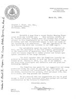
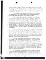
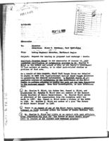
HENRY M. CHANNING, SECRETARY
18 TREMONT STREET
BOSTON, MASSACHUSETTS
March 21, 1928.
Charles W. Eliot, 2nd, Esq.,
25 Reservoir Street,
Cambridge, Mass.
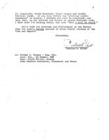
Dear Sir:
Herewith a page from a recent Boston Evening Trans-
cript which may interest you.
This article, written by
Mr. Bernard Peterson, details what has already been accom-
plished in this Commonwealth by our body among others toward
providing open and recreational spaces to meet the needs of
our increasing city population. The map reproduced is the
Open Spaces map which was included in our 1926 report.
You undoubtedly sense the need for coordinated ef-
fort, and the importance of the time element, particularly
in the acquisition of waterfront, also in the location of
roads and trails required to render present and future open
spaces available to the large centers.
You will remember that the Committee recently ap-
pointed by Governor Fuller, to work out this problem is
headed by Mr. Charles S. Bird, Jr , one of our members.
It
has been doing intelligent and effective work and plans are
developing rapidly.
The Committee has asked for our suggestions and recom-
mendations along the lines of open spaces, development of
forestry, economical and recreational, town and city parks of
all kinds, sanctuaries for animals, bird and plant life, his-
toric sites, and camp grounds and beaches.
We are assured that any suggestions you may be good
enough to send to your Secretary will have prompt and serious
consideration by the Governor's Committee.
Sincerely yours,
HMC:Q
Sécretary.
Enclosure.
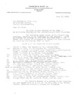
CHARLES W. ELIOT.
2ND
LANDSCAPE ARCHITECT CITY PLANNING CONSULTANT
9 PARK STREET
BOSTON
MEMBER AMERICAN SOCIETY OF LANDSCAPE ARCHITECTS
TELEPHONE HAYMARKET 5864
June 17, 1927.
Mr. Charles S. Bird, Jr.,
50 Congress Street,
Boston, Massachusetts.
Dear Mr. Bird:
In reply to your inquiry of the 16th, I
am personally sending you the information you have requested.
The following names appear on Mr. Elist's list
entitled. Members of the Committee on Open Spaces." Cards
announcing the meeting on June 20th have been sent to the
above, and replies of acceptance or regret have been received
as noted respectively by "yes" or "no".
MERBE'S OF THE COIMITTEE ON OPEN SPACES
Robert V. Beal, 185 Devonshire St., Boston, Mass.
Yes
Charles S. Bird, Jr. 50 Congress St., Boston, Mass.
Charles Blood, Barristers hell, Pemberton Sn., Boston, Mass.
Frank A. Bourne, 177 State Street, Boston, Mass.
Arthur I. Clark, 3 JOY Street, Boston, Mass.
Yes
Arthur C. Comey, 23 Erewster St., Cambridge, ass.
No
Mrs. S.
Crosby, 300 Massachusetts Avenue, Cambridge, less.
Mrs. Myron Davis, 193 Maple Street, Malden, RESS.
No
P. Eaton, Owin Fires, Sheffield, ass.
No
0.
Eliot; 2nd., 9 Park Street, boston, KESS.
Yes
Lawrence i. Fletcher, 50 Congress Street, Boston, class.
No
Dr. Alexander Forbes, Harland St. Milton, Mass.
Yes
oger Greeley, 9 Lark Street, Boston, Mass.
Hope to Nathaniel I. Kidder, 53 State Street, coston, less.
loring J. 111 Levonshire Street. Boston, Mass.
No
President wm. A. eilson, Smith College Northampton, Mass.
Hope to Winthrop Packard, 66 Newbury Street, Boston, Mass.
No
Mrs. inona Pinkham, 3 Joy Street, Boston, lass.
No
Harris a. Leynolds, 4 Joy Street, Boston, lass.
Yes
Mrs. jilly S. Tobey, 300 Usssachusetts Avenue, Boston, less.
Yes
Loring Underw od, 45 Bromfield Street, boston, ESS.
Mr. Eliot's minutes of a meeting of the Committee
on (pen Spaces held at 4 .M. at the Town call, 4 Joy Street,
Boston, (Date not entered), contain the following:
A
OF
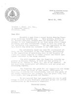
HENRY M. CHANNING, SECRETARY
18 TREMONT STREET
BOSTON, MASSACHUSETTS
March 21, 1928.
Charles 1. Eliot, 2nd, Esq., ,
25 Reservoir Street,
Cambridge, Mass.
Dear Sir:
Herewith a page from a recent Boston Evening Trans-
cript which may interest you. This article, written by
Mr. Bernard Peterson, details what has already been accom-
plished in this Commonwealth by our body among others toward
providing open and recreational spaces to meet the needs of
our increasing city population. The map reproduced is the
Open Spaces map which was included in our 1926 report.
You undoubtedly sense the need for coordinated ef-
fort, and the importance of the time element, particularly
in the acquisition of waterfront, also in the location of
roads and trails required to render present and future open
spaces available to the large centers.
You will remember that the Committee recently ap-
pointed by Governor Fuller, to work out this problem is
headed by Mr. Charles S. Bird, Jr., , one of our members. It
has been doing intelligent and effective work and plans are
developing rapidly.
The Committee has asked for our suggestions and recom-
mendations along the lines of open spaces, development of
forestry, economical and recreational, town and city parks of
all Finds, sanctuaries for animals, bird and plant life, his-
toric sites, and camp grounds and beaches.
We are assured that any suggestions you may be good
enough to send to your Secretary will have prompt and serious
consideration by the Governor's Committee.
Sincerely yours,
Maryla
Chamis
HMC:Q
Sécretary.
Enclosure.
31/
20copies
areheing
The Committee 0f the Needs and Uses of Open Spaces
has prepared a Kap which I am forward IN to you, showing
all
the existing public open spaces of Massachusetts. This is
the first step toward a. study lookin forward to a State Plan.
Some months ago the Committee recommended to the
Governor that a Commission be appointed from representatives
of different organizations interested in some phase of Open
Space work to make a report to him that would lead EDUCCTION
Though it is comparatively easy to secure public areas by
gifts in different locations, the problem of securing needed
areas on a broad scheme of development is a much larger problem.
It is my belief that if the problem were attacked with the
backing of such a Commission as recommended that by gradually
developin a. broader public realization of the need for open
spaces that it could and should be solved.
Ye believe the map above referred to will prove useful to
organizations affiliated with this Committee.
We are con-
vinced that there are many areas now privately owned which
could be secured for public reservations as time goes on if
the pruposes of the corporation of The Trustees of Public Reser-
vations was more generally realized.
Briefly stated, thin is as follows:
"This Board was created in order to provide a ready
and absolutely trustworthy instrument by means of
which persons who may desire to effect the perma-
nent preservation of any interestin or lovely
spot in Massachusetts can accomplish their purpose
without difficulty or delay from legal causes.
If
Any suggestions that you may have as to the work of our
Committee I should be very glad to receive.
for
have
newpage
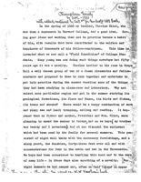
Champlawn Society
by SAE 1931
with added material by cur 2rd for his draft SAE Book
In the spring of 1880 my brother, Charles Eliot, who
was then a sophomore in Harvard College, had A good idea.
Hav->
ing good ideas and working them out in practice became a habit
of his, with results that have contributed to the welfare and
happiness of thousands of his fellow-countrymen.
This time he
invented what we now call a "Field Expedition" of College Stu-
dents. Kany young men are doing such things nowadays but fifty
years ago it was a novelty. Charles invited to his room in Grays
Hall a well chosen group of ten or a dozen classmates and fellow
students and proposed to then to club together and undertake to
put into practice during the summer vacation some of the things
they had been studying in class-room and laboratory. Why not
select some particular region and put in the summer studying its
geological formations, its flora and fauna, its birds and fishes,
its trees and shrubs? There would be a happy combination of work
and play; sea and land; tramping, sailing and reading.
It hap-
pened that my father and mother, President and Mrs. Eliot, were
planning to spend the summer in Europe, and so we boys ( my brother
was twenty and I seventeen) had at our disposal the equipment
which had been used by the family for several summers. This con
sisted of eight wall tents with the necessary furnishings, and a
sloop yacht, the Sunshine, forty-three feet over all and with
accommodations for four in the cabin and two in the forecastle.
We boys had been accustoned to handling this boat and to the ways
of camp life - in those days also something of a novelty.
From
eight summers we had camped out, often on Calf Island in upper
Y.
M. no. an -lined the W.W Vaushan's
2
Frenchmans Bay, and we had cruised the New England coast from-New
London to Grand Kanan.
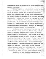
Charles' proposal was enthusiastically received and the
*Champlain Society" was organized. The members, with the excep-
tion of two entering freshmen, were all Harvard undergraduates
more or less interested in what was then called "Natural History,"
The choice of a region for our study was not difficult. Mt. Desert
Island offered a detached field of about the right size and of ex-
coptional interest alike from historic, scenic and scientific
points
of
view. It was a splendic playground and was just coming
into fame as a summer resort so that the problems of transporta-
tion and supplies were not insoluble. Moreover, the camp equip-
ment was in storage at the head of Frenchmans Bay.
The Gunshine sailed from Boston on June 29th, 180, with
Charles Eliot in command, four members of the Society, mostly land-
lubbers, in the cabin, and Orrin Donnell, seaman, and William
Breyant, steward, in the forecastle.
They had been in the yacht
the preceding summer and knew our ways.
William was a cheery
French Canadian hailing from Cape Breton.
The last I knew of
him he was mate of a vessel out of Arichat.
Orrin was a boy
from Waukeag Neck up Frenchmans Bay. In age he was between by
brother and myself. Be lived aboard the yacht when William came
ashore to be camp cook.
Orrin Donnell has been associated
with our family ever since, more than fifty years,
He mar.
ried a daughter of John Gilley, settled on the place, has been
a selectman of Mt. Desert and a good citizen and loyal friend.
Charles did not know just where he would pitch the
3
Camp but expected to find a suitable and central place somewhere
between Otter Creek and Seawall Point. So, after picking up
the camp equipment at a house on Waukeag Neck he cruised along
that shore and up into Somes Sound and anchored in what we now
call Wasgatt's Cove on the eastern shore. There, above the
gravel bank was a bit of open meadow with a good spring at the
back and just to the north the brook which is the outlet of
Hadlock Pond fell with a little waterfall into the Cove.
Mr. Asa Smalledge, who lived in the nearest house, not only was
willing to let the cappers occupy the field but also agreed to
supply the camp with milk, eggs and chickens. So on July 5th,
the Camp, known as Camp Pemetic, was pitched, the parlor tent
in the centre facing the cliff of Dog Mountain, the five sleep-
ing tents on either side and the kitchen and pantry tents at the
back
near the spring. The Campers came for different periods
some for all summer, some for a month or more.
There were no
trails or paths in those days, so exploration of the interior
meant a lot of hard scrambling; but the yacht code frequent ex--
cursions into all the coves and corners of the island coast.
Stores, meat and supplies had to be purchased at Southwest Bar-
bor and one also had to go there to find a doctor, a telegraph
office
and a steamboat connection. The summer produced a geolog-
ical survey and map of the island, lists of the birds and fishes,
the trees, flowers and marine invertebrates, and a meteorological
record kept at five points on the island.
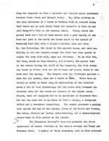
The Champlain Society's Camp was probably the first
appearance of summer visitors on the shores between the Sound and
Schooner Read. A number of these pioneers, most of whom attained
4
in after years to positions of influence in their orm communi-
ties, remained attached to Mt. Desert. Edward L. Rand contin-
ued to come hither for many summers. From the original lists
made by Rand and his associates was expanded the well known
"Flora of Lt. Desert" and Rand was our pioneer trail and map
maker. His love of the island is commenorated on a tablet on
the Jordans Pond-Seal Harbor Trail. Barry L. Rand has long been
a
cottager at Southwest Harbor. George and William Dunbar in-
terested their father, Professor Charles F. Dunbar, and he later
bought the northern end of Bear Island and built the house which
is now the summer home of his grandchildren. William c. Lane
was a regular summer visitor, betaking himself in later years
chiefly to Islesford. OR Charles Elio's, when our parents returned
from Europe, told his father that if he wented to find a place
for a permanent summer home he had better look along the shore
between Somes Sound and Seal Harbor. That advice was taken.
President and Mrs. Eliot went to Northeast Harbor in October,
1880, got a horse and buggy at Deacon Kimball's and drove along
the rough shore road, getting out from time to time to survey
possible sites. The result of that visit was the choice and
purchase of the ridge running from the sea a mile inland to the
referred
to
anceotial."
top of the Asticou Hill and the building of the house which,
with the house built that same winter (1880-81) by Bishop Doane
near the present Kimball house and the lodge built on the
Asticou Road by Mr. J. H. Curtis, now a part of the house of
Mr. R. H. Rohbins, were the first cottages in the region of
Northeast Harbor.
At that time Northeast Harbor was a very different
5
place from the busy, modern town of today.
Everything was prim-
itive. There was no steamboat connection, no telephone, no
electric light. Water came from individual vells. Household.
ers, including summer residents, cut and stored their own sup-
plies of wood and ice. You drove to Bar Harbor to mail your
letter, to send a telegram or to get a doctor or a prescription.
You sailed or rowed to Southwest Harbor for meat and groceries
save for what could be bought from an itinerant butcher who drove
a cart along the road after he had killed a lamb or pig. Trans-
portation about the island was mostly by water, in row boats and
dories and small sailing craft. There were only a few roads
and they were rough, steep and narror. The "twenty-two mile
drive" from Bar Harbor out by the Eagle Lake Road and round by
the Sound, Seal Harbor and Otter Creek, was an all day excursion.
There were only a few houses along that route and no village
center.
At the head of Northeast Harbor lived two families,
the Savages and the Roberts. [The Roberts' house has disappear-
ed.
The Savage house is now the cottage across the road east
of the Asticou Inn. On the east side of the harbor Captain
g. C. shallucd's
Smith lived in a dwelling which is now part of Urs. F. W. Pea-
body's house and on the vest side of the harbor lived the
Frazier
faxily / Where is now the village street of Northeast
Harbor there was not a house, just a narrow ribbon road running
through the thick woods and leading to Deacon Kimball's house and
to the store which stood on the beach of the little cove at the
entrance of the harbor. This store still had a trade with the
coasters and fishermen who came in for shelter. I have seen
6
fleets of fifty or sixty sail lying in Northeast Harbor.
From
the corner at Kimball's the almost untravelled road ran as far
as Mr. Corson's house - opposite what is now the golf course.
Along this road were the homes of Snalledges, Gilpatrics, Fen-
nellys, Whitmores and Manchesters. Mrs. Gilpatric kept the
Post Office in the house still standing at the head of Gilpat-
ric's Cove and Mr. Corson drove twice a week to Somesville to
fetch and carry the mail. // One lived on friendly and neighborly
terms with these good people, as, Nan glad to say, I continue
to do.
The family (I Me JAPri P. stayed at the
Everyi Kemballs for several outcome and the futura Mrs Eliot
recalls that:
Fath with THE Sett 21.57
out
MEAN
X. "One summer day in 1882 ( the grought the camp at Postions)
an elegant horse and causage drove in to the collage where the
Hophmam were staying (next the old sehang in nouthland Hantor
- and \ hed in a closet. my aister seolie Raw who was coming
and was all anticipation Sam came in and asked "where's
Lancy or ~ no answer - and started To explain to mother that
he
had an enrand To do in Bar Harlor (a whole day's drive for the
1 was ourn the closet I that was when he was in college and
round hip ) and wanted permission to take me. By that time
I was eleven?
Casey Collins were through the 1887 hit after
1883 the Elist long report Their vacations at the "Oncestial" unstead of
in Camp.
It
is
to
be
noted
that
quoted
to the
Comments on the paper A Challenge
certain designated
to the Hancock County Trustees of
fifty
strips bordering the ve
Public Reservations presented to
which fursish water to
that body by Mr. Charles W. Eliot,
and
the
lot or the Cooksay
2nd, August 1950
we
their
situated.
(n
Kay
1.
1950
the
vote
of
BO
was
except
presented
to
the Hangodk County Trustees of Public Reservations a paper entitled
On
June
THE BOUNDARIES OF ACADIA NATIONAL PARK"
fifty foot
strips
A Challenge to the Hancook County Trustees
of Public Reservations.
Asting
the
the
and June The 1peper seemed so timely. in view of the relative inactivity
in recent years with respect to the growth and development
of Acadia National Park that a committee was appointed to consider it
and to make recommendations to the Trustees on the various points which
in
the
dead)
described
the
Tarn
Little Meadow, and
14
to
the
Secord
of
Holdlare
Having been appointed a member of the committee and being
perhaps more familiar with the Trustees and its affairs so far 8# they
a
relaterseith park than are the other two members, I am taking the
liberty of reviewing Mr. Eliot's paper and offering some comments upon
it. These comments, together with some which I shall make on Mr. Paine's
letter of November 17, 1950, to Mr. Edwin R. Smith, Chairman of the
Special Committee on Policy of the Haneook County Trustees of Public
Reservation mayo serve as a guide to the committee in formulating its
recommenda tions
Bar
The paper is divided into four parts, A, B, C. and D. My
o omments wills deal with each of the parts, with possibly a further break-
down beginning with the paragraph in the middle of page 3.
A.. Land: Which the Trustees May Still Own
because of
interests Mr. Eliot lists six items of land which he says the Trustees
may still own. Before disoussing these items. with respect to their
present ownership status, it is pertinent to insert a bit of historical
data in the form of extracts from the records of the Trustees and to
follow with what occurred as a result:
the
Barr
Lake,
On August 20, 1929 the following vote was
see
later
35. Voted That all the lands now standing in the name of the
Reservations, except a strip of land one hundred and fifty feet (In
depth) bordering the various lakes and their tributaries furnishing
water to the various towns except also a lot containing approximately
five aores on Banr Hill and a lot where the Champlain Monument is on
the Cooksey Drive be transferred to the United States of America to
formea part of Acadia National Park, at such time as the said United
States of America may accept the same etc.
C
It is to be noted that the quoted vote authorized the
of
all
land
held
teet
except
certain designated parcels, specifically the one hundred fifty foot
strips bordering the various lakes and ponds and their tributaries
which
furnish
Island
villages,
aliot
Hill
and
the
lot on the Cooksay Drive onowhich then
situated.
No.
as
such,
does
LIG
1#
the
Record
of
Holdings.
On
exended
to
except
the
the
Government.
wayed
the
the
land
On June 22, 1931 the Trustees one hundred
fifty foot strips around the ponds to the Government
Acting within the authority of the votes 1929
and June 22, 1931, the Trus tees, by deed dated July 22y 1931 (Deed #61,
Government
Deed-Recerds-)
bonveyed
of
cland
the
Government.
Six
of
these
one
strips
around
the ponds and
the Trustees Record of Holdings as follows:
53,
68.
The
in the doed desertbed the Tarn or
Little
Meadow,
the
Recordior
Holdings.
Lot
41,
passed
The
the
deed
of
July
22,
1931
is as follows:
of
Holdings
"Eighth: Also all real estate and interests
Trustees
realostate owned by said Corporation or
to Mr. lookstanding in the name of said Corporation on
the records of the Hancock County Maine
Registry of Deeds situated in said Town
108,
Bar Harbory and also situated in that part
of said Town of Mount Desert lying East of owned
Somes Sound, excepted the lot where the
mentioned
Champlain Monument is on the Cooksey Drive."
shore
of
Long
Pend.
The
clause
may well be termed a catch-all, and because a number
of
things
happened. First, the Government acquired all rights and
interests in lands represented in Record of Holding numbers 37a,
49,
54, 55, 56, 57, 58, 59, 60, 61, 62, 63, 96, 111, 112. Second, the
Government acquired lots 108 and 109 in the Record of Holdings. Third,
an exchange of lands took place between Mr. Rockefeller and the Trustees
by which he received Lot No. 30, Champlain Monument Site, and Lot No. 31,
the Barr Hill Lot, and the Trustees received Lot No. 81, land at Eoho
Lake, which Mr. Rocksfeller purchased for exchanging The latter
lot
was later conveyed to the Government, by vote of the Trustees, by deed
number 35, Government Deed Records. As a further part of the exchang
e
Mr. Rockefeller deeded to the Trustees a small lot at Seawall known as
the Robert E. Newman Lot. This lot does not appear in the Record of
Holdings and the title is still in the Trustees. As a still further
part of the exchange, Mr. Rockefeller moved the Champlain Monument to
its present site on Ioy Hill and deeded the lot on which it stands to
the Town of Mount Desert.
2
D
I the six items iin 1545 Mr = Eliot's
paper:
Trushess
ownership.
the
obore
let
at
Soawall
which
for
have
(1) The so hondis of Bubble Pond
under belause "Eighth!
in
Bood No 1 tem such, does not
appear in the Record of Holdings. It is my
B.
for
Topini on that these 30 sores were excepted from
Lot 8A or Lot 18, or both, when they were con-
veyed to the Government. I base my opinion on
(1) the very involved landstrans fare in that-area is
which occurred during the ownership of Charles
H. Lewis, Weston, The Mount Desert and Eastern
Shore Land Company and others ,Atsality tent
the Government now has title to all land at the
south end of Bubble Pond except for a few small
lots which the Mount Desert and Eastern Shore
Land Company sold for octtage lots, and
owners or heirs have vanished. I do not think
(2) The title to the lot on the top of Youngs
Mountain, a one-fourth undi vided interest in
Lot 44, Peters Plan, passed to the Government
under clause "Eighth", Deed 41, and is Lot Noshes
112, trustees Record of Holdings.
(2) Sheep Island state by work into
According ly, all lands and interests in lands held by the
Trustees
east of Somes Sound have been inveyed to the Government or
to Mr. Rockefetter
or
(3)
Bald
1s
by
(3) All. lots enumerated, namely, 98, 101, 105cs100 no)
107, 113, 118 are still in Trustees ownership
andcare to the bast of Longa Pold to Also owned
which
byu the trusteeks im the area butinot men tioned
by
Eliot
iss
it
measing
the
(4)
Lot 119 is on the west shore of Long Fondie I
am not sure about 117. I am inclined to think
(4) that it is to the west of the pond but does not
touch the shore (See 5 below Also owned by
the Trustees on the west shore of the pond but
not menti oned by Mr Eliot are lots 120 and 121.
(5) The hugewarbar on. We's to rp) Mounta inn is made up: of
lots 95, 97, € 116, 116, 18, 125 and 126
(6) I detect a typing error. Mr. Eliot enumerates
4.
lots 101 and 108 on the east side of Seal Cove
Pond. The lots are there but the numbers should
Thi
bind 100 and 102
neither
the
propriety
#1
except
Lx
a
most
informal
only
the
*ather
general
veta
among
be
tie
do
with
#0
far
istentions
of
these
land
ha be not approaches on the subject.
C
(e)
(a)
use
(a)
are
all
is
Rooksfeller'
owner
D.
The
Sub-marninal
Westiof
Somes.Sound
R.
&horeaIt is in this area where the park acquired some 5,000
aores of land during the years 1935 to 1940 that the Trustees could
do some very effective work A aqquiring additional land to smooth
out the exterior boundaries and aqquire a number of inholdings. Money
would need to be raised by subscription or otherwise to buy the land
and payafon legal services incidental to perfecting titles. The
government of the absence of authorizing legislation,
Buy
landifor:the
park.
inode
of
potentially
high
tex
all
suitable
such
should
svelleb
E. Norumbega (Brown) Mountain
would
be
taken
into
she
This mountain is still in the Kimball family ownership.
Efforts in the past to reach an agreement failed.
-Time
may effect a meeting of the minds. a
of
their
Brown
Houstain
breat.
If
kize
park
should
it
would
get
that
strip.
F. West of Somes Sound
Mount
Dado:
(a)
The north slope of Acadia Mountain is, so far
ownership
and as is economically feasible, in park ownership.
The remainder is largely quarry sites, active
at times inactive at others The tax-exempt
Brook and
agencies must be careful in land-taking not to
owned by
remove revenue producing lands from taxation.
others
oured by
Only the most compelling reasons can justify
that action. In this case no compelling reasons
The
are present.
which
,150t
suggests
should be
(b) Canada Hollow is partially in government and
adminis-
partially in private ownership. The bulk of the detached
ent outlying
privately owned portion is destined for park owner
to protest
ship, and will, when conveyed, leave a relatively
small acreage between the Southwest Harbor Road and
tabe bottom of the Hollow outstanding
ownership
(a) the south ridge of Beech Mountain is in Trustees
so
ownership. See reference under paragraph 3, page
(d) The north spur of Western Mountain is in park
ledgee
ownership.
pribile
(a) The southeast slope of Western Mountain is partly
doze in government and partly in Trustees ownership.
do See reference in paragraphs 4 and 5, page 3.
roving
patrol
by
ponwil
boat,
top landing
The
park
10ks
the
boat
to
undertake
a
that
years
to
Golla.
X was for (a) Dhere is a paroel of about 27 aeres on the
found
it
desirable to
northeast slope of Champlain Mountain still in
private ownership. Continued efforts to acquire
it for the park have been unavailing. Hope still
remains that it can. eventually be had.
(b) The south tip of Dorr (Flying Squadron) Mountain,
except for a parcel of 40 acres is in park owner-
ship. The 40 acres outstanding will in due course
d o m o into the park.
5
(o) (d) and (a) are all in Mr. Rockefeller's owner-
totas
and Ship. Their ultimate disposition is not known.
H.
ShoresCand
Isbands:
has
made
gathering
take
samer-
the
principal
anti and Mr. Eliot lists eight shore locations which he thinks
should be added to the park. Items (a) Fernald Point; (b) the head
of Somes iSound, and (d) Seal Cove and along the brook to Seal Gove
Pend whileond .doubt desirable for park ownership are for the present
and probably for some time in the future not to be seriously considered
for acquisition: They are lands of potentia high Due, all are
suitable sident lopment and Fas sudh should remain available
for
that
use.
would
one
or
all
to be taken into the park.
Item
(o),
the
strip
othe
Sargen
Drive
and
the
Sound
Birth judge belongs to the Kimbable tasta parti of their Brown Mountain tract.
If the park should get the amounts in it would get that with
Item (e) Seal Marbor Beach, was conveyed the Town of
Mount Desert by Mr. Rockefeller some years ago. is secure
in
town
ownership and should remain there.
ownad.
ever
oz
deed, Items (f) Bracy Cove shingle, (g) the shore between Hunter
Brook and Ingraham Point and (h) Bennett Cove at Wonderland are all
owned by Rockefeller. The di sposition of these parcels, Wilke others
owned
by
him,
is
matter
for
conjecture
only
may
The islands or portions of islands which Mr. Eliot suggests
should be added to the park are, from my point of view as an adminis-
trative official, not to be considered. They would institute
detached
and outlying fragments, difficult to administer and next to impossible
to protect from fire, vandalism and misuse.
the
As long as the islands or portions thereof are in private
ownership and the public is permitted free and unhindered use of them
NO complaints are raised by the using public if they find picnio refuse,
tin loans and bottles cluttering the landscape, the rocks and ledges fire
blackened and hacked and branches out for fire wood. But
let
a
public agency. Gome into ownership and a cry is not onde why isn't
something done to clean up those places and to stop people misusing
them?". To do that, were they in park ownership, would require a roving
patrol by power boat, and the use of a small skiff for landing. The park
has neither the personnel nor the boat equipment to undertak such
patrol, nor is there x1 fike bihood that we Town gist et years to come.
It
was
for
these
other
reasons
that
the
Brus
toos
;found
it
desirable to give its lands to the government for a national park.
6
(
J. Makes and Pends
Good progress has been made towards gathering into park owner-
ship the watersheds of the principal lakes and sponds All land at the
south end of Bubble Pond readily possible of acquisition has been
acquired (see paragraph 1, page 3), within a few months the remaining
outstanding paroels at the north end of Eagle Lake will be conveyed to
the government,
monilable
for
to
P+C
The private land to the north of Aunt Betty Pond does not
touch the pond edge. The government owns a narrow strip between the
private thand and the pond, to place it wholly within park
boundaries
could
used
as
the
mealens
around
RU
noule
be
fermulated
should
the
adjacent land is a special matter
and one which will take a long time to adjust. A good part of the land
bordering the pond will probably always remain in private ownership.
The south end of Echo Lake is in park ownership except for
two small parcels. One is the site occupied by the Appalachian Mountain
Club Camp and the other is destined to become park owned. Should the
A.M.C. ever abandon its camp the land will by virtue of a clause in the
deed, come into park ownership.
At Long Pond there are a few parcels in ownership other than
park
or the Trustees. Some will be acquired for the park The others
may or may not be depend 1 ng wholly upon circumstances.
The west-shere of Seal Cove Pond is land having taxable value
too great to be taken into park ownership. The same is true in part of
the west shore of Hodgden Pond.
to
EGG Billio
outhip to
K. The McFarland - Youngs Mountains Area be
impressions
is
Japue
1934,
The 1947 fire destroyed the wilderness character of theter
area from Lake Wood to the Bagle Lake Road. It is now a high hazard
area for fire. There is n fair possibility that much of it will come
into park ownership to connect with the park's Lake Wood tract. If
that happens, the acquisition will inevitably be bounded on the east
from: the Eagle Lake Road to near Hulls Cove by the Breakneak Road,
on
Barr
St
The Fresh Meadow and Stony Brook Heath are remote in time so
far as coming into park ownership are concerned. Their character is
such that they care likely to remain undisturbed in major part and serve
the Lune tion as wilderness areas fully as well as though they were park
owned
was
after
of
the
National
he
Road
through
government
as
and
of
Pond
Note
shows
west of Somes Sound north =thehOld Seal
but
which
have
except
the
carriage
reads,
been
the park
(1) Parkeland, outlined in green
(2) Trustees land, outlined in blue
(3.) available-for
in
January purchase or donatienptda redic for a primary *****
which Y well know, and possibly for a secondary ******.
I have restricted the map to the showings indicated because
I feel thatijuatefirst blush, those are the ones in which the Trustees
should become interested. This area could be used as the nuoleus
around and upon which an expanded program could be formulated should
the
Trustees
care
to
undertake
road
pregram
shire
park,
by
the
of
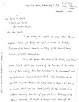
Secretary, I will now pass from Eliot's "Challenge" leaving
last paragraph thereof for later consideration, to Mr. Painci# letter
to Mr. Edwin R. Smith, dated November 17, 1950, and select from it
certain salient points upon which to comment.
terminated.
The second and third paragraphs, pages 1 and 2, of Mr. Paine's
letter repeat flam sumplification the last paragraph Elist's
Comment thereon will follow as a noonplusion, to
commentary.
his
earriage
road
had
he
mentied
to
of
Yountai
The second paragraph on page 2 raises the question of the
relationship between Mr Rockefeller and the Trustees, and suggests that
it.is a subject appropriate for the committee to explore. I am willing
to record the knowledge I possess of Mr. Rookefeller's relationship to
the Trustees prior to and during the time he was a member and my
impressions of his relationship after severance of membership in January
1924. (I have not been able to fix the date when he became a member but
have been about 1917 If that be exploration, so shall
iti
maded
park
Rooksfeller's first contact with the Trustees was probably
in the summer of 1914. He had then begun the building of his carriage
road, system on Barr Hill and wanted to extend it across Jordan Stream
to the north of Mitchell Hill and thence southward to connect with
another seation already construated on the west side of the little pond.
Finding his oressing of the stream blooked by Hand owned by the Trustees
he noiced them for permission to arross and construct his road over it to
his own land and the permission was granted. Later, after the establish-
ment of the Sieur de Monts National Monument, he gained permission from
the Secretary of the Interior to donstruct another section of carriage
road from Mitchell Hill westward to connect with the Town Road at where
the Brown Mountain Gate Lodge now stands From small
purchase.
that
the
Trustoes
had
to
depend
upon
contributions
money
frien
friends
with
which
lands. The organization had DO otler sources of revenue.
An
to
wast
Mr.
Rockefeller's
future
relationship
beginnings grew, through government acquissence, the horse-road system
as it now exists construction of he Bubble Pond Motor Road, the
rebuilding of the Ocean Drive, the construction of the Otter Point Road
and the Stanley Brook Road, all of which were financed by Mr. Rockefeller
but which have since, except the carriage roads, been incorporated into
the
park
road
systembe
question
#$
the
of
the
paragraph
Challeage
the
the
Trustees
handJanuary 1924. This he was prompted to do for a primary reason
which I well know, and possibly for a secondary reason.
trusteea
mainbain
its
massage
the
The
primary
that
month
MR.
road building program was heavily attacked by group of Mount Desert
Island summer residents led by Senator George Wharton
Pennsylvania, himself a summer resident at Northeast The attack
threatened at inception to torpedo the entire road building program in
an able and well organized defense, led by the Trustees,
successfully withstood it at a public hearing held in the Office of
the
Secretary, Department of the Interior, in March 1984
Rookefeller,
knowing that he, not the park nor the Trustees, was the principal target
of
opposition, felt that bothroo and the Trustoes would be pilec ed in
x
butter light he were note a membering Accordingly, his membership was
terminated.
sequire
other
properties
for
like
area
or
excess
Trusties secondary reason for his termination of membership,
and is straight guesswork. In the summers of 1920 Hooksfeller'
8
interest in extending his carriage road system had reached a point where
he
wanted to carry it around the west side of Parkman (Little Brown)
Mountain and the north end of Sargent Mountain, around Eagle Lake and down
the west side of Jordan Pond. He also had in mind to extend it from the
south end. of Eagle Lake to Bubble Pond, along its west side and around
the south: end of Pemetic Mountain. That route involved the crossing of
parks land and private land
offered,
His first step towards carrying out his plan was to gain hold
the
consent of the government and the Trustees to orosa their lands,
This was given. The next step was to acquire the private land he
needed to carry out the project. It was at this point that the guess-
work I have mentioned enters. The land acquisition activities of the
Trustees had materially lessened. My guess is that Mr. Rockefeller OF
preferred to carry out his acquisition single handed rather than through
the Trusteen. His financial position enabled him to do soloone therefore,
in effect, took over the acquisition program which the Trustees had there-
tofore carried out. Mr. Rockefeller's acquisition program ultimately
resulted in land purchases amounting in acreage to more than twice that
which the Trustees had acquired.
respect
to
smell
paroels
of
land
for
park
unnership
which
dannet be Rookefeller's program practically brought the Trusteen
motivity: land acquisition to a halt, Since then the Trustees hate
acquired dandrobly occasionally and then by donation rathere than byy
purchases. be remembered. that the Trustees had to depend upon
contributions of money from members or friends with which to purchase
lands. The organization had no other sources of revenue.
Isma.
As to what Mr. Rockefeller's future relationship with the
Trustees mayabe or what he thinks (Trustees ought to be doing A.baze.
necknowledge. He alone can answer those questions.
on
an
extensive
scale
han
ended
for years have satisfied true... Only infrequest
peotal @@@@@ will he purchase timed for to tha
and
the
only besaNow the question as to the future of the Trustees.
in the last paragraph of his "Challenge" and Mr. Paine in
hetsecond third and fifth paragraphs of his letter both raise. that
questi
quiring
the
out
the
part boundarise and inheldings lies out friends,
the
trus the Trustees: of its organization to
manage the Black House. Whether or not it should extend its activities
beyond the Island, is, from my point of view, an open question. I must
point out that should the Trustees decide to become active beyond the
Island they must be careful that whatever they do the end result must
justify the action. By the terms of its charter its holdings are tax
exempt and the management of its properties must be such as to offset
in recreational inspirational or other intangible values the loss in
dollar value of tax revenue. Otherwise its position becomes untenable
and open to attack, political or other. The corporation is charitable
incasture, cAs such I do not believe it cane in profit making
the
extent
of
using
profits.
to
maintain
its
properties, to acquire other properties for like uses or to distribute
excess profits tougher charitable works. I do not envision the
Tanstees as beecming a great money making institution. I point out
these to be overlooked in any expansion of activity which
majaber
general
at
The Trustees should, I believe, revive its interest as an
acquiring and holding agency for lands destined for ultimate park
Eliet points out, and I agree, that there are still
lands desi rable for inclusion in the park, I foresee the time when
offers will be made to donate small parcels for the purpose and, when
offered, the acceptance should be immediate To accomplish
this
there
should be an agency, tax exempt, which can accept the donation and hold
title until the formalities required for tender to the government have
been completed. This was the primary function of the Trustees in its
earlys it should be revived.
the
#
detashed
unbiancé
to
The real obstacle to be overcome is that of funds the PN
the legal work to prepare the land titles for government acceptance,
Donations for that purpose are not easy to come by, and unless the
Trustees have reasonable asaurance that the funds can be obtained
donations of land should not be accepted,
And
&
for a committee and LAS reaction of the other
I have true with respect to small parcels
of land which are essential or desirable for park ownership but which
cannot be acquired by donation. Money must be had with which to purchase,
not great suns, probably, but yet it must be had. Here, too, unless the
Trustees can raise modest sums for land purchases.it is idle for them to
again become active in this field.
Bar
February 27, 1981
10
What I have just said in the foregoing paragraphs has been
said because of a conviction that Mr. Rockefeller's purchase program,
on an extensive soale at least, has ended. Experiences over the last
few years have satisfied me that this is true. Only in infrequent and
special cases will he purchase land for donation to the park, and then
only because some particular phase or feature of the given situation
commands his interest. Because bf this and because of absence of
authority at law to purchase land with government funds, our only hope
of
acquiring relatively small acreage needed out the
and
to
extinguish
some
inholdings
our
friends,
the Trustees, or others yet to be found.
There
is
the
Trustees,
or
subsidiary
group
from
within the or fuxiliary group sponsored by them
can be really helpful. This group would be called the Acadia Natural
History Association. The objectives of such an Association are
foster, promote and bring to public notice the inspirational, educational
and soientific aspects and activities of the park through the preparation
and sule of pamphlets, brochures, bulletins, etc on those features.
Small profits, enough to finance those aotivities once they are gotten
under
way
can be realized. If the Trustees should evince interest in
this
proposal
go into it with them in more detail.
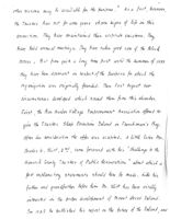
the
The thoughts which I have expressed cover pretty well my point
of view on the future relationship of the Trustees to the park and my
views on the future activities of the organization. Others may hold
similar or differing views. Perhaps what I have said may lead to a
$)
general discussion of the matter.
The concluding paragraphs of Mr. Paine's letter appeal to me
as
a prelude to a valediotory which I devoutly hope he won't deliver.
Since his association with the Trustees as member and chairman of the
Black House Committee, and now as President of the group he has endeared
himself to us all. We need his gracious presence as presiding officer
and his wise counsel as our chief executive. I believe that the circum-
stance of his sojourning for the summer at a little distance from the
Island is distinctly in his favor as President. We of the Island live
too closely to it and its problems. He can view us, it and them with
the calmness of detached observer and reach his conclusions unbiased
by local pressures or points of view. sincerely hope he has no serious
thought of relinquishing the chair.
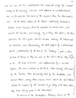
My commentary is closed. It is much longer than I had any
idea it would be but. there was much ground to cover. I await a call
for a committee meeting and the reaction of the other members to what
I have presented for consideration.
Bar
Harber
aa
February 27 1951
:C.W.Eliot, 2Nd
BOTHIARIES OF ACADIA NATIONAL 25/00
A Challenge to the Hancock County Trustees
of Public Reservations
Thereing
11
By Charles W. Eliot, 2ne
Placed
August 1950
A visit early this summer to what in our family is called
"God's Country", gave me & chance to review the wonderful work of
those who created the Acsels National Park. Because I am a member
of the Hancock County Trustees of Public Reservations and made a
report on "the Future of His. Desert Island in 1928 for the Bar
Harbor Village improvement Association, I was especially inter-
ested to compare the proposals and purposes of the Founders of
the Trustees and of my previous study with the accommitsments
towards those objectives.
Since 1928 extreordinary progress has been mede in the
extension of the park bounderies to include the primary features
of the "Beautiful Island of Mt. basert". In these extensions,
the chief factors have been the Trustees of Public Reservations,
the untiring personal efforts of Mr. George 3. Dorr right up to
his desth, the great generosity of Mr. John D. Rockerfeller, Jr.
and the Federal project for purchase of Sub-Marginal Lands.
A.
The Trustees still hold large treets which presunably are
destined for eventual inclusion in the Park. As I understand
the situation from Mr. incley, the Park Superintencent, some
funds and work are needed to clear the titles to some of these
tracts. A comparison of my man -- prepared in 1928 with the
help of Mr. Dorr and Mr. Lynem, and checking with the Record
of Holdings published in 1939, the Trustoes may still own --
1.
Some 30 acres at the south end of Subble Pond, one
2. The top of Youngs Mountain both east of
Somes
Sound;
and
3.
Lots 98, 101, 105, 106, 107, 113, 118 (in the Record of
Holdings) including Beech Mountain and the east shore and
south end of Long Pone.
4. Lots 117 and 119 on the opposite or west abore of Long
Pone on the northeast slope of Mansell Mountain.
5. A huge area on Western Mountain including the tops of
Bernard and Mansell and a wide connection to deel Love
I
Pond.
2
6. Two properties - lots 101 and 102 on the cost sico of
Seal Cove Pone.
This 11st is probably inaccurate and incomplete, but
the data in the map one descriptions included in the Record of
Holdings of 1939 is inconsistent and eoes not correspond with
the Topographic Map of Acedia National Parte (1942). It's sedition
to these properties 14 is not at all clear as to what happened
in the exchange of the Trustees property at the Champlain sonu-
ment for the new site on the main Highway on Day Mountain.
Perhaps the Trustees can be helpful as agent OF go-
between for transfer to the Park of other properties. I have in
mind particularly:
B. The Bar Derbor Village Improvement Association which still
owns
1. Pawn Pond and the northeast shore of Lake Mood: and hee
some interest in
2. Sheep Porcupine Islane, and perhaps also in
3. Bale Poroupine Island; as vell as other properties, which
might be most appropriately consolidated under Park
Management.
4.
The Approach to the Park from Bar Harbor should be a
major concern of the Village Improvement Association.
This is the valley vest of Strawberry and Great Meedow
Hills (see pp 14-16 my report on "Future of Mt. Desert
Island 1928), and the immediate need is for public
ownership of the vest slope of those hills and the strip
between the cemetery and Cromwell Brook.
C. Mr. John D. Rockerfeller, Jr. is believed to own several
properties which aejoin or are closely related to the park,
including:-
1. A large tract between the Park Line and Road
including Brower Mountain and Half Moon Pono
2. Two lots on the South Side of Ragle Lake Road
3) at the Lake are
b) a triangle opposite Break Neck Road
3. Lane north of Aunt Betty's Pond
4. s strip along the old Hunters Brook Road and is quarry or
gravel pit lot neerby,
5. pay Mountain and the portion of the Cooksey Estate between
Way Mountain and the Ocean front.
6.
A lot between the Parts and Wilewood Farm on the Jorson
Pone Rose,
3.
7. Resifold 2211, Jordon Streem, Harbor Grook Day the Riego
between Long Fond and Harbor Brook, and
8. Wonderland - between Seavell and Ship Serbor.
D.
Under the Sub-Marginal Laur Purchase Program of the early days
of the lieu Deal, large areas of march one woodland were ac-
quired by the Federal Government in Southwest Earbor and
Tremont. These lands vere incorporated in the Park. The
boundaries are quite illogical -- because the holdings pur-
chased happened to fall this way and that, and because the
"project" was never commeted. A number of holes should be
filled, and the boungaries rounded out to include the whole
of the natural topographical units involved -- as for example
1. the rest of the March vest of Mt. Gelbos and China Hill,
2. the rest of those two hills,
3.
the rest of the Sig death, westware to line between Base
Harbor Head and Adoms Budge, and
4. the rest of the Marshall Brook trainage to a line along
Freemen Ridge.
A review of the maps shows that the major objective of
the Trustees - to safeguary the Mountain Range - has almost been
realized. The big missing link in the chain in Morunbogs (Brown)
Mountain and the watershee to protect lover Hadlock Fond. Loren
Kimball, who owned much of that area, was one of the original
incorporators of the Trustees. Someone must try again to bring
that mountain into the Park.
West of Somes Sound, a) the north slopes of Acadis,
b) Canado Hollow between St. Sauveur and Beech Hill, c) the south
ridge of Beech Mountain, a) a north spur of Western and e) a piece
on the southeast slope of the same mountain seem to be still in
private ownership.
East of Somes Sound, besides the mass of Norumbega Mountain,
hill and mountain pieces of interest for future inclusion in the
park, include: a) the northeast slope of Champiain above the
Schooner Boad Road, b) the south tip of Flying Squadron, c) Day
Mountain and A) Redfield Hill as noted in connection with Mr.
Rockerfeller's properties, and e) whatever portions of Eliot
(Asticon Hill) are not safeguarded by inclusion in Asticon Terraces.
Along the Shores much more property has been turned over
to the Park than was ever contemplated by the original founders
or the Trustees, but souse of the pieces they proposed are still
out or their status is not clear. The most important items for
further consideration seem to mo to be -- in order:
E. More of Female's Point - where the Jesuite sottles.
7.
5. The heart of Sason Count - a gateway
C. Between the Sargent Drive and the Sound.
d. the aboves of Seal Cove and along the brook to the Food.
a. Soul Marbor Beach.
f. Eracy Cove - shingle.
B. Between Huntere Spook and Ingraham Polat.
h. Bennet Cove at MonderLand.
Concerning the Islanda I voule 111re to renew the recommen
dations of my 1928 Report, thet
a) the outside half of Jakers Island and the Ball Room Floor,
5) the Forcupines, and perhaps
c) the Health and Sunkers Head on Grout Cranberry,
() Beer +sland (if it is ever abandoned as a Lighthouse)
anould be added to the Fark.
The Lettes and Ponds of the Islane were of special interest
to the Trustees from the beginning -- to safeguard vater supplies
as well EXIT scenery. Private properties still touch on Subble Pone
south end, on Eagle Lake north end, a corner on Aunt Betty's Pone,
and as already noted all around Lower Bodlock Pond. West of the
Sound, similar pieces are missing from the Paric at the south ones
of Echo Lake and Great Pone and the whole vest benico of Seal Cove
Pond and Bodgeon Pond.
In my 1928 Report, at the suggestion of Mr. Less, I pro-
posed that a large area in the north part of the Island, including
McFarland and Yournes Mountains, the Health and the Meadow, should
be set asice as a Villegress Area. The Great Fire svept through
much of this territory and I have not had an opportunity to as-
certein whether that disester persanently destroyed the vilderness
character or Whether the proponal should still stand. In any
event the east alopes of the two countains, Paradise Hill and the
area over to Lekte Wood from Breakneck Brook should be part of the
perk.
on the accompanying map I have attempted to show the
properties referred to in this statement. The errors and insccur-
acics are due to lack of consistent data and the 3000 miles between
my drafting table and the areas in question.
there is much the Trustees of Public Recorrations can
still do for the project, so voll started and already so far
advanced. I hope this summary may help to arouse interest and
financial support to carry on the work.
September 7, 1950
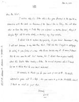
Mr. Charles W. Eliot, 2nd.
720 South San Rafuel Ave.
Pasadona, California
Dear Mr. Eliot:
I take pleasure in writing to inform you of the interest which was
expressed at our annual meeting on August 22, 1950 in your summary
entitled "A Challenge to the Hancock County Trustees of Public Reservations".
This summary and accompanying map which was explained by President
Paine during the meeting and inspected by those present at the conclusion
of the meeting was very enlightening to the Trustees.
You will be interested in the resolution that was unsnimously adopted
and recorded in the records of this meeting which follows:
"Resolved that the Bancock County Trustees of Public Reservations,
assembled in annual meeting, express their deep gratitude to Mr. Charles
W. Eliot, 2nd, for his admirable report on their past accomplishment and
possible future procedure; and that they also convey assurances to Mr.
Eliot that his friendly challenge to the Trustees will receive the careful
consideration which it deserves."
It is President Paine's plan to appoint a committee to carefully study
this matter with the Executive Committee of the Trustees.
We regret your imability to attend the meeting, but appreciate your
continued interest in our objectives.
Sincerely yours,
Gerard L. Austin, Secretary
HANCOCK COUNTY TRUSTEES OF PUBLIC RESERVATIONS
EXECUTIVE COMMITTEE
BLACK HOUSE COMMITTEE
TRUSTEES OF
Ernest T. Paine, President
Woodlawn, in Ellsworth, Maine
Ernest T. Paine, Chairman
Gerard L. Austin, Secretary
Richard W. Hale, Jr., Vice-Chairman
Bequest of GEORGE NIXON BLACK
Mrs. Jacques Cornelis
Albert H. Cunningham, Treasurer
Mrs. Philip R.. .Lovell
Philip R. Lovell, First Vice-President
Mrs. John C. Spring
John Whitcomb, Second Vice-President
BLACK HOUSE COMMITTEE
Miss Adeline Wing
Hon. John A. Peters
OFFICE OF THE CHAIRMAN
Professor Augustin Derby
Donald Stuart
Col. H. B. Hayden
Charles K. Savage
Passpect Haston mane
Sentemoes 18, 1950
Near mr. smith ;
I am writing to ask if you will become chairman
of I special committee of the Trustees.
Briefly, the function of this committee would be to
consider and knot on the policy of the Trustees with regard to the
acquisition of more holdings of land in Hancok County.
The question his come up partly because of the
activity of Mr. Charles is. Vist, 2ML who his written a "Challenge
to the Trustee, of Public Resuration, " in which he virtually asks
us what we the young to do. 3 left I why of this document at
in. Cumminghum's office al my with a co ty of mr. Viot's hamphlet
(1928) called "The Future of Mount Desert Island" and a
3
October 26,1350
B. L.Hacley, Bar Harbor, Main e
Mr. Charles K. Davage: Northeast Harbor, Maine
Gentlemen:
OS :
As you no doubt have been advised by Professor E. I.
Payne the following consittee has been appointed to consider
the challenge contained in the enclosed memorandum of Charles
W. Eliot, 2nd. addressed to the Lancock County Trustees of
Public Reservations: Committee, Benjamin I.. Hadley, C arles
K. Savage and Edwin R. Smith.
Professor Payne asked me to serve as chairman and I agreed
if such an arrangement was first cleared with you and found to
be agreeable. I have talked with Professor Payne concerning
many of the points contained in the Eliot monorandum and suggested
that a copy be forwarded to MP. Rockefoller.
Professor Payne is now exploring the background of the
Bancook County Trustees of Public Reservations activities in
relation to thos e of Mr. dockefoller in connection with the
development of Acadia National Park. the idea is that if this
committee is to make recommendations concerning the various
points contained in Mr. Ellot's VC emorandum we should coordinate
Copy
CHARLES W. ELIOT
Planning Consultant
720 S. San Rafael Ave
Pasadena 2, Calif.
Community Development
Sycamore 9-3966
City and Regional Planning
Oct. 28, 1950.
Dear Mr. Paine,
Your letter of Oct. 15 to my Father- Samuel A. Eliot-
arrived just after his death, and the family have referred it to
me. I doubt if Father knew very much more about the history of
relations between Mr. Rockefeller and the Trustees than I know,
so I hope my answer to your question will partially substitute
for what you might have learned from him.
I think Mr. Rockefell interest in the Trustees and in
the later Park was first aroused by an appeal from my Grandfather-
President Eliot- in connection with the fight over admitting
automobiles to the Island. Mr. Rockefeller was much concerned over
the increased danger to his children- kidnapping- which the
presence of automobiles would involve. That fight at the State
Capitol was just part of the continuous scrap to preserve the tax-
immunity status of the trustee's holdings. It was thus, as I
recall it, that Mr. Rockefeller and Mr. Dorr became interested in
each other and the future of the Island.
From the very beginning of his summers at Mt. Desert,
Mr. Rockefeller has been an enthusiastic road-builder. He bought
land near Barr Hill for the purpose of extending his carriage roads
and soon came to the boundaries of properties held by the Trustees.
Mr. Dorr and my Grandfather worked out arrangements for Mr.Rockefeller
to extend his roads still further. I think it was in that connection,
that the Reservation at the top of Barr Hill was turned over to Mr.
Rockefeller. Later, of course, Mr. Rockefeller bought lands at
considerable distance from his home base for more road building, and
contributed both lands and automobile roads - the Mountain Road - to
the Park.
In much of this activity Mr. Dorr acted almost as Mr.
Rockefeller's agent, with, of c ourse, the very active participation
of Mr. Lynam. There were times when Mr. Dorr just didn't know
whether property was part of the Park, Trustees, Wild Gardens,
Mr. Rockefeller's, Mr. Dorr's, or in Mr. Dorr's name pending some
other disposition.) As to this phase of Mr.Rockefeller's relations
with the Trustees; I would think that Hadley and Smith- as successors
of Dorr and Lynam, respectively- would know or could dig out the most
information.
HANCOCK COUNTY TRUSTEES OF PUBLIC RESERVATIONS
EXECUTIVE COMMITTEE
TRUSTEES OF
BLACK HOUSE COMMITTEE
Ernest T. Paine, President
Gerard L. Austin, Secretary
WoodLawn, in Ellsworth, Maine
Ernest T. Paine, Chairman
Richard W. Hale, Jr., Vice-Chairman
Albert H. Cunningham, Treasurer
Bequest of GEORGE NIXON BLACK
Mrs. Jacques Cornelis
Philip R. Lovell, First Vice-President
Mrs. Philip R. Lovell
John Whitcomb, Second Vice-President
BLACK HOUSE COMMITTEE
Mrs. John C. Spring
Miss Adeline Wing
Hon. John A. Peters
OFFICE OF THE CHAIRMAN
Professor Augustin Derby
Donald Stuart
1090 Avon Road
Col. H.B. Hayden
Schenectady 8, N.Y.
Charles K. Savage
November 17, 1950.
Mr. Edwin R. Smith
c/o Smith and Fenton
Bar Harbor, Maine.
Copy
Dear Mr. Smith:
I am writing to explain in some detail the assignment
which you kindly consented to accept in becoming Chairman of the
Special Committee on Policy of the Hancock County Trustees of Public
Reservations.
It is well known that most of the holdings on Mount
Desert Island which were acquired by the Trustees in the earlier days
of their activity have been transferred to the Government and are
included in Acadia National Park. Some properties are in question, -
no one knows who holds title to them; but this is a matter which you
are investigating for the Trustees in a different capacity from that
of your work as Chairman of the Special Committee. It might be thought
that when all the properties still held by the Trustees (apart from
the Colonel Black Mansion and its grounds in Ellsworth) have been
transferred to the Park, which is presumably their destination, the
Trustees will no longer have any reason for existence except in
connection with the Black Estate. Will this really be the case? That,
essentially, is the problem on which the Prustees would like you to
report to its Executive Committee, if possible by the summer of 1951.
This is not a new problem. Dr. Eliot spoke of it in
his excellent historical account of the Trustees, and Mr. Morris
referred to it in a letter when he was President. Both believed that
the question "Should the Trustees continue to be active even though
Acadia National Park is now a reality?" ought to be answered in the
affirmative. That is, the Trustees (in the words of their Charter)
should continue to "acquire by devise, gift, or purchase, and to own,
arrange, hold, maintain, and improve for free public use, lands in
Hancock County, Maine, which by reason of scenic beauty, historical
interest, sanitary advantages or for other reasons may be available
for the purpose." As a fact, however, the Trustees have not for some
years shown signs of life in this connection. They have maintained
their corporate existence. They have held annual meetings. They have
taken good care of the Black House. But from quite a long time past
until the summer of 1950 they have been dormant in respect of the
purpose for which the organization was originally founded. Then last
August two circumstances developed which roused them from this slumber.
HANCOCK COUNTY TRUSTEES OF PUBLIC RESERVATIONS
EXECUTIVE COMMITTEE
TRUSTEES OF
BLACK HOUSE COMMITTEE
Ernest T. Paine, President
Gerard L. Austin, Secretary
Woodlawn, in Ellsworth, Maine
Ernest T. Paine, Chairman
Richard W. Hale, Jr., Vice-Chairman
Albert H. Cunningham, Treasurer
Bequest of GEORGE NIXON BLACK
Mrs. Jacques Cornelis
Philip R. Lovell, First Vice-President
Mrs. Philip R. Lovell
John Whitcomb, Second Vice-President
BLACK HOUSE COMMITTEE
Mrs. John C. Spring
Miss Adeline Wing
Hon. John A. Peters
OFFICE OF THE CHAIRMAN
Professor Augustin Derby
Donald Stuart
1090 Avon Road
Col. H. B. Hayden
Schenectady 8, N. Y.
Charles K. Savage
Mr. Edwin R.Smith--
page 2--
Nov. 17, 1950.
First, the Bar Harbor Village Improvement Association offered to give
the Trustees Sheep Porcupine Island in Frenchman's Bay. After due
consideration the offer was accepted. A little later Mr. Charles W.
Eliot, 2nd, came forward with his "challenge to the Hancock County
Trustees of Public Reservations" about which a few explanatory state-
ments should here be made. Like his father and grandfather before him,
Mr. Eliot has been vitally interested in the proper development of Mount
Desert Island. In 1928 he published his report on the future of the
Island, and now in 1950 he has supplemented this admirable study by
a careful survey of the existing situation with reference to accomplish-
ment, that is, the question how much of the original plan has been
carried out. Are the scenic values of the Island sufficiently protected?
Should Acadia National Park be extended in certain areas, and should
the Trustees, particularly, try to bring this about? TO those questions
Mr. Eliot gives specific answers covering the Island and its environs,
and illuminating the whole subject by a colored map which, supplemented by
the text of his "Challenge", gives a clear picture of things as they are
and as Mr. Iliot thinks they ought to be. The map indicates and
differentiates by a suitable legend, the areas included in the Park,
those possibly still owned by the Trustees, those presumably held by
Mr. Rockefeller, and certain others, among them various tracts which
Mr. Eliot believes should be acquired by the Trustees to go along with
those which they have already given to the Government.
The mention of Mr.Rockefeller's holdings brings up the
question of relations between Mr. Rockefeller and the Trustees, and this
is one of the subjects which I should think it appropriate for your
Committee to explore. So far as I can learn, Mr. Rockefeller has never
been a member of the Trustees, - certainly he has not been a member in
recent years. From our point of view that is greatly to be regretted
since his aims and our own with regard to Mount Desert Island have been
so much alike. I am sure that all the Trustees would be delighted if
he would accept membership even though he might not find it possible to
attend our meetings. Be that as it may, it would be of great interest
and importance if we could learn what Mr. Rockefeller thinks the Trustees
ought to be doing and if he would give us the benefit of his counsel and
suggestions about our future procedure.
Another question of policy arises out of the fact that Mount
Desert Island does not constitute by any means the whole of Hancock
County. I should think it appropriate for your Committee to consider
the question whether we ought to extend our activities beyond the Island,
HANCOCK COUNTY TRUSTEES OF PUBLIC RESERVATIONS
EXECUTIVE COMMITTLE
BLACK HOUSE COMMITTEE
TRUSTEES OF
Ernest T. Paine, President
Woodlawn, in Ellsworth, Maine
Ernest T. Paine, Chairman
Gerard L. Austin, Secretary
Richard W. Hale, Jr., Vice-Chairman
Albert H. Cunningham, Treasurer
Bequest of GEORGE NIXON BLACK
Mrs. Jacques Cornelis
Mrs. Philip R. Lovell
Philip R. Lovell, First Vice-President
Mrs. John C. Spring
John Whitcomb, Second Vice-President
BLACK HOUSE COMMITTEE
Miss Adeline Wing
Hon. John A. Peters
OFFICE OF THE CHAIRMAN
Professor Augustin Derby
Donald Stuart
Col. H. B. Hayden
1090 Avon Road
Charles K. Savage
Schenectady 8, ,N.Y.
Mr. Edwin R. Smith--
page 3--
Nov. 17, 1950.
patterning our efforts after those made so successfully by the
Ma ssachusetts Trustees of Public Reservations; or whether in view of
the local opposition that is frequently encountered when land appears
likely to be withdrawn from taxation, your Committee is of opinion that
no program of expansion beyond the Island, if indeed there, should be
undertaken at the present time or in the foreseeable future.
Before closing it will be well for me to say a word about
my own position, or perhaps predicament, as President of the Trustees.
When Mr. Stebbins resigned a year ago last August he pressed me
urgently in his aimiable and irresistible way to accept nomination to
the Presidency although I felt that someone more closely identified
with the Island than I had been should be chosen. The time was short,
and in the absence of other candidates, I agreed to serve if elected.
I felt then, and still feel, that I accepted an interim appointment,
and I shall be only too glad to withdraw when the right successor can
be found, preferably, as I think, a permanent resident of the Island,
but also someone who will bring with him an intimate knowledge of
the region somewhat matching, shall we say, the knowledge that Mr. Dorr
had, or that which Mr. Rockefeller has, or the Eliots, or others
who might be named. In love of the Island, of course, I would not
yield to anyone.
my
The foregoing paragraph is pertinent because all concerned
should be aware that approach to the Presidency was through the
Black House rather than by way of the Island. Mr. Stebbins argued
that the Trustees are now concerned with little except the Black House,
and that because of my close connection therewith as Chairman of the
Black House Committee, I was the logical candidate for the Presidency.
I am prone to believe that the Trustees still have, or ought to have,
a wider field of effort, and that their President should be chosen with
reference to the wider interest; but, as has been explained, I con-
sented to serve for a time while these matters were being adjusted.
Your Committee ought to know these facts, and so, I think, should all
who may see this letter or a copy of it; especially Mr. Rockefeller,
should you acquaint him with our problem. I hope very much that you
will do so. You have already been in touch with him, I understand,
concerning acquisitions for the Park.
HANCOCK COUNTY TRUSTEES OF PUBLIC RESERVATIONS
EXECUTIVE COMMITTEE
BLACK HOUSE COMMITTEE
TRUSTEES OF
Ernest T. Paine, President
Woodlawn, in Ellsworth, Maine
Ernest T. Paine, Chairman
Gerard L. Austin, Secretary
Richard W. Hale, Jr., Vice-Chairman
Albert H. Cunningham, Treasurer
Bequest of GEORGE NIXON BLACK
Mrs. Jacques Cornelis
Mrs. Philip R. Lovell
Philip R. Lovell, First Vice-President
Mrs. John C. Spring
John Whitcomb, Second Vice-President
BLACK HOUSE COMMITTEE
Miss Adeline Wing
Hon. John A. Peters
OFFICE OF THE CHAIRMAN
Professor Augustin Derby
Donald Stuart
Col. H. B. Hayden
1090 Avon Road
Charles K. Savage
Schenectady 8, N. Y.
Mr. Edwin R. Smith--
page 4--
Nov. 17, 1950.
Finally, may I express my thanks to you, and to Mr. Hadley
and Mr. Savage as well, for your willingness to serve on the Special
Committee? You will all be making an important contribution to the
work of the Trustees, - an organization of which, on the basis of merit
and real accomplishment, we can be justly proud.
Sincerely,
E.T. Paine
E. T. Paine.
2-8390
1090 Aron Road, Schenectady 8, n.y. me Payne
November 17,1950.
R,
mr. Edwin R. Smith,
40 Smith and Fenton,
Bar Harbor, maine.
Dear mr. Smith :
I am writing to explain in some detail the as-
signment which you kindly consented to accept in becoming
Chairman of the Special Committee on Policy of the Hancock County
Trustees of Public Reservations,
It is well known that most of the holdings on mount
Desert Island which were acquired by the Trustees in the Earlier
days of their activity have been transferred to the Government and
are included in Acadia national Park. Some moberties are in
question, - no one knows who holds title to them; but this is
a matter which you are investigating for the Trustees in a
different capacity from that of your work as Chairman of the
Shecial committee. It might be thought. that when all the
-2-
properties still held by the Trustees (apart from the Colonel Black
mansion and its grounds in Ws worth) have been transferred to the
Park which is presumably their destination, the Trustees will no
longer have any reason for existence Except in connection with the
Black Estate, will this really be the case ? That, Essentially, is
the problem on which the Trustees would like you to rehoat to its
Executive committee if possible by the summer of 1951.
This is not a me problem. Dr. Eliot shoke of it in his
Excellent historical account of the Trustees, and m morris referred
to it in a letter when he was President. Both believed that the
question 11 " should the Trustees continue to be active Even though
Acadia national Park is now a reality 2 onight to be answer
in the affirmative. That is, the Trustees (in the words of th
Charter ) should continue to "acquire by devise gift, a hand
and to own, arrange, hold, maintain and improve for fr
public use, lands in Hancock County, maine, which by r
scomic Preside hictorical interest sanitaru advantages n
other reasons may be available for the purpose." As a fact, however,
the Trustees have not for some years shown signs of life in this
connection. They have maintained their corporate existence, They
have held annual meetings, They have taken good care of the Black
House But from quite a long time past until the summer of 1950
they have been dormant in reshect of the purpose for which the
organization was originally founded. Then last August two
circumstances developed which housed them from this slumber.
First, the Bar Harbon village Im/novement Association offered to
give the Trustees Sheep Porcuhine Island in Frenchman's Bay,
After due consideration the offer was accepted. A little later mr.
Charles W. Eliot, 2nd came forward with his " challenge to the
Hancock County Trustees of Public Reservations" about which a
few explanatory statements should here be made. Like his
father and grandfather before him Mr. Eliot has been vitally
interested in the mother development of mount Desent Island.
In 1928 he published his report on the future of the Island, and
-4-
now in 1950 he has supplemented this admirable study by is careful
survey of the existing situation with reference to accomplishment,
that is, the question how much of the original plan has been carried
out. Are the scenic values of the Island sufficiently protected
Should Acadia national Park be extended in certain areas and
should the Trustees, particularly, try to bring this about 2 To these
questions Mr. Eliot gives specific answers covering the Island and
its environs, and illuminating the whole subject by a colored mah
which supplemented by the text of his "Challenge", gives a clear
cough
picture of things as they are and as mr. Eliot thinks they ought
to be The map indicates and differentiates by a suitable
legend, the areas included in the Park those possibly still owned
by the Trustees , those presumably held by mr. Rockefeller, and
certain others among them various hacts which m. Eliot believes
should be acquired by the Trustees to go along with those which
they have already given to the Government.
The mention of m Rockefeller's holdings brings up the
-5-
question of relations between m. Rockefeller and the Trustees , and this
is one of the subjects which I should think it appropriate for your
Committee to explore. So far as I can learn mr, Rockefeller has
never been a member of the Trustees, - certainly he has not been a
member in recent years. From our point of view that is greatly to
be regretted since his aims and our own with regard to mount
Desent Island have been So much alike I am sure that all the
Trustees would be delighted if he would accept membership even
though he might not find it possible to attend our meetings. BE
that as it may, it would be of great interest and importance if
we could learn what Mr. Rockefeller thinks the Trustees ought to be
doing and if he would give us the benefit of his counsil and
suggestions about our future procedure.
Another question of policy arises out of the fact that
mount Desert I sland does not constitute by any means the
whole of Hancock county. I should think it appropriate for you
committee to consider the question who then we ought to extend
activities becond the Island hattermin'a GUA efforts after three
-6-
made so successfully by the massachusetts Trustees of Public
Reservations, or whether in view of the local ophosition that is
frequently Encountered when land appears likely to be withdrawn from
taxation, your Committee is of opinion that no program of exhansion
beyond the Island, if indeet there, should he undertaken at the present
time or in the foresigable future.
Before closing it will be well for me to say a word about my own
where
position , 0 perhaps medicament, as President of the Trustees. when
Mr. stebbins resigned a year ago last August he pressed me
urgently in his aimiable and irresistible way to accept nomination
to the Presidency although I felt that someone more closely identified
with the Island than I had been should he chosen. The time was
short, and in the absence of other candidates I agreed to serve if
elected. I felt then, and still feel that I accepted an interim
appointment and I shall be only too glad to withdraw when the
right successa can be found, preferably, as I think a permanent
resident of the Isl and but also someone who will bring with his
matering
-7-
an intimate knowledge of the region some what matching shall we say,
svori
the knowledge that Mr. Don had , n that which m. Rochefellor has,
love
or the Elists, of others who might he named. In love of the Island,
of course, I would not yield to anyone.
The foregoing paragraph is pertinent because all concerned
should he aware that my approach to the Presidency was through the
Black House nather than by way of the Island. mr. Steffins argued
that the Trustees are now concerned with little except the Black
House , and that because of my close connection there with as
Chairman of the Black House Committee, I was the logical candidate
for the Presidency. I am mone to believe that the Trustees still have
or ought to have a wider field of Effort, and that their President
should be chosen with reference to the wider interest; but, as has been
Explained, I consented to serve for a time while these matters were
being adjusted. your Committee ought to know these facts, and so,
I think should all who may SEE this letter a a copy of it;
Especially m. Pockefeller, should you acquaint him with our
-8.
problem. I hope very much that you will ds so. you have already
been in touch with him, l I understand concerning acquisitions for the
Park.
Finally may I extress my thanks to you and to ms. Hadley
and Mr. Savage as well, for your willin guess to serve on the
Special Committee you will all be making an important con.
tribution to the work of the Trustees, ,-an organization of which,
on the basis of merit and real accomplishment, we. can be justly
proud.
Sincerely
E.T. Paine
T
nov. 20,1950
Copy
Dear Mr. Eliot :
I enclose copy of a letter which has gone forward to Mr. Smith in
connection with his work as Chairman of the Special Com. on Policy. This will show
what we have been doing 4 ) will keep you informed as matters proced though I
imagine that will be nather slowly as truching any large results.
I should like to Extress my sympathy in your recent benovemen L, thou,
I will not presume to say more than that. I feel also that I ought to apologize
for writing to your father at a time when he was her haps very ill Lop course I knew
that he was none for well last summer, but I should have in quired carefully
about his health before sending a letter. The cas ual inquiries which I made
led me to think that he was much immoved.
It remains to thank you for your note of Oct. 28th The specific
information given will he a help ; also your advice to 90 to m. Rockefeller direct.
I think we shall do just that,
Sincerely,
E.T.P,
-
Ben Hadley.
Comments on the paper "A Challenge
to the Hancock County Trustees of
Public Reservations" presented to
that body by Mr. Charles W. Eliot,
2nd, August 1950
2/27/51.
In August 1950 Mr. Charles W. Eliot, 2nd, presented to
the Hancock County Trustees of Public Reservations a paper entitled
"THE BOUNDARIES OF ACADIA NATIONAL PARK"
A Challenge to the Hancock County Trustees
of Public Reservations.
The paper seemed so timely, in view of the relative inactivity
of the body in recent years with respect to the growth and development
of Acadia National Park that a committee was appointed to consider it
and to make recommendations to the Trustees on the various points which
it raised.
Having been appointed a member of the committee and being
perhaps more familiar with the Trustees and its affairs so far as they
relate to the park than are the other two members, I am taking the
liberty of reviewing Mr. Eliot's paper and offering some comments upon
it. These comments, together with some which I shall make on Mr. Paine's
letter of November 17, 1950, to Mr. Edwin R. Smith, Chairman of the
Special Committee on Policy of the Hancock County Trustees of Public
Reservations, may serve as a guide to the committee in formulating its
recommendations.
The paper is divided into four parts, A, B, C and D. My
comments will deal with each of the parts, with possibly a further break-
down beginning with the paragraph in the middle of page 3.
A. Land Which the Trustees May Still Own
Mr. Eliot lists six items of land which he says the Trustees
may still own. Before discussing these items with respect to their
present ownership status, it is pertinent to insert & bit of historical
data in the form of extracts from the records of the Trustees and to
follow with what occurred as a result:
On August 20, 1929, the following vote was passed:
Voted: That all the lands now standing in the name of the
Reservations, except a strip of land one hundred and fifty feet (In
depth) bordering the various lakes and their tributaries furnishing
water to the various towns except also a lot containing approximately
five acres on Barr Hill and a lot where the Champlain Monument is on
the Cooksey Drive be transferred to the United States of America to
form a part of Acadia National Park, at such time as the said United
States of America may accept the same -- etc.
It is to be noted that the quoted vote authorized the
conveyance to the Government of all land held by the Trustees except
certain designated parcels, specifically the one hundred fifty foot
strips bordering the various lakes and ponds and their tributaries
which furnish water to Island villages, a lot on Barr Hill and the
lot on the Cooksey Drive on which the Champlain Monument was then
situated.
On May 1, 1930 the vote of August 20, 1929 was amended to
except the Black Estate from the authority to convey land to the
Government.
On June 22, 1931 the Trustees voted to convey the one hundred
fifty foot strips around the ponds to the Government.
Acting within the authority of the votes of August 20, 1929
and June 22, 1931, the Trustees, by deed dated July 22, 1931 (Deed #41,
Government Deed Records) conveyed seven parcels of land to the Government.
Six of these parcels described the one hundred fifty foot strips around
the ponds and are numbered in the Trustees Record of Holdings as follows:
53, 68. The seventh parcel (sixth in the deed) described the Tarn or
Little Meadow, and is numbered 14 in the Record of Holdings.
The eighth and concluding clause in the deed of July 22, 1931
is as follows:
"Eighth: Also all real estate and interests
in real estate owned by said Corporation or
standing in the name of said Corporation on
the records of the Hancock County Maine
Registry of Deeds situated in said Town of
Bar Harbor, and also situated in that part
of said Town of Mount Desert lying East of
Somes Sound, excepted the lot where the
Champlain Monument is on the Cooksey Drive."
The clause may well be termed a catch-all, and because of it a number
of things happened. First, the Government acquired all rights and
interests in lands represented in Record of Holdings numbers 37a, 49,
54, 55, 56, 57, 58, 59, 60, 61, 62, 63, 96, 111, 112. Second, the
Government acquired lots 108 and 109 in the Record of Holdings. Third,
an exchange of lands took place between Mr. Rockefeller and the Trustees
by which he received Lot No. 30, Champlain Monument Site, and Lot No. 31,
the Barr Hill Lot, and the Trustees received Lot No. 81, land at Echo
Lake, which Mr. Rockefeller purchased for exchanging. The latter lot
was later conveyed to the Government, by vote of the Trustees, by deed
number 35, Government Deed Records. As a further part of the exchang e
Mr. Rockefeller deeded to the Trustees a small lot at Seawall known as
the Robert E. Newman Lot. This lot does not appear in the Record of
Holdings and the title is still in the Trustees. As a still further
part of the exchange, Mr. Rockefeller moved the Champlain Monument to
its present site on Icy Hill and deeded the lot on which it stands to
the Town of Mount Desert.
2
I will now discuss the six items in "A" of Mr. Eliot's
paper:
(1) The 30 acres at the south end of Bubble Pond
went to the Government under clause "Eighth"
in Deed No. 41. This item, as such, does not
appear in the Record of Holdings. It is my
opinion that these 30 acres were excepted from
Lot 8A or Lot 18, or both, when they were con-
veyed to the Government. I base my opinion on
the very involved land transfers in that area
which occurred during the ownership of Charles
H. Lewis, Weston, The Mount Desert and Eastern
Shore Land Company and others. At all events,
the Government now has title to all land at the
south end of Bubble Pond except for a few small
lots which the Mount Desert and Eastern Shore
Land Company sold for cottage lots, and whose
owners or heirs have vanished.
(2) The title to the lot on the top of Youngs
Mountain, a one-fourth undivided interest in
Lot 44, Peters Plan, passed to the Government
under clause "Eighth", Deed 41, and is Lot No.
112, Trustees Record of Holdings.
Accordingly, all lands and interests in lands held by the
Trustees east of Somes Sound have been conveyed to the Government
or
to Mr. Rockefeller.
(3) All lots enumerated, namely, 98, 101, 105, 106,
107, 113, 118 are still in Trustees ownership
and are to the east of Long Pond. Also owned
by the Trustees in the same area but not mentioned
by Mr. Eliot is lot 124.
(4) Lot 119 is on the west shore of Long Pond. I
am not sure about 117. I am inclined to think
that it is to the west of the pond but does not
touch the shore (See 5 below). Also owned by
the Trustees on the west shore of the pond but
not mentioned by Mr. Eliot are lots 120 and 121.
(5) The huge area on Western Mountain is made up of
lots 95, 97, 99, 114, 115, 116, 117, 125 and 126.
(6) I detect a typing error. Mr. Eliot enumerates
lots 101 and 102 on the east side of Seal Cove
Pond. The lots are there but the numbers should
be 100 and 102.
3
One .other lot, 122, at Seawall is still in
Trustees ownership, Likewise the Robert Newman
lot at Seawall which I have already mentioned.
The foregoing statement, to the best of my
knowledge, accounts for and truly represents all
lands now owned by the Trustees.
B. Land for Which the Trustees Might Act as Agent or Go-Between
for Transfer to the Park
(1) Fawn Pond and the northeast shore of Lakewood is
owned by the Bar Harbor Village Improvement
Association. It was a gift to the Association
in memory of Mr. Charles T. How, one of the early
summer visitors to Bar Harbor. Mr. How acquired
many parcels of land in both Bar Harbor and Mount
Desert. Many were sold to families who later built
cottages upon them; many more not suitable for build-
ing upon are now in the park. I do not think it wise
for the Trustees to initiate action looking to the
conveyance of Fawn Pond to the Park. I think it
should remain in V.I.A. ownership as a memorial to
Mr. How until such time as the Association wishes to
voluntarily relinquish ownership.
(2) Sheep Porcupine Island has lately come into V.I.A.
ownership. There it should remain until an oppor-
tunity presents itself to convey it to others who
will use it for residential or other desirable use.
(3) Bald (Round) Porcupine Island is owned by
Mrs. Edward Browning. It is directly opposite her
summer home on Vanderbilt Point and was acquired
so that no disfiguring use could be made of it which
would constitute an eyesore in the view from her
summer home. As long as it remains in the Browning
family ownership, that is the best possible
ownership.
(4) The plan for an approach to the park from Bar
Harbor through the valley of Cromwell Harbor -
Kebo Brook is at present on the shelf. The 1947
fire and other factors have been responsible for
the suspension of this plan for an approach to the
park from the village, but it may be revived later.
C. Mr. Rockefeller's Land
This is a matter which neither the park, the Trustees nor
the V.I.A. can with propriety discuss except in a most informal way
and then only in the rather general vein of asking among themselves
"what is he going to do with it?". He has never, so far as I know,
revealed his intentions respecting the disposition of these lands,
and I would suggest that he be not approached on the subject.
4
(c) (d) and (e) are all in Mr. Rockefeller's owner-
ship. Their ultimate disposition is not known.
H. Shores and Islands
Mr. Eliot lists eight shore locations which he thinks
should be added to the park. Items (a) Fernald Point; (b) the head
of Somes Sound, and (d) Seal Cove and along the brook to Seal Cove
Pond, while no doubt desirable for park ownership are for the present
and probably for some time in the future not to be seriously considered
for acquisition. They are lands of potentially high tax value; all are
suitable for residential development and as such should remain available
for that use. Only the most compelling reasons would justify one or all
to be taken into the park.
Item (c), the strip between the Sargent Drive and the Sound
I judge belongs to the Kimballs as a part of their Brown Mountain tract.
If the park should get the mountain it would get that strip.
Item (e) Seal Harbor Beach, was conveyed to the Town of
Mount Desert by Mr. Rockefeller some years ago. It is secure in town
ownership and should remain there.
Items (f) Bracy Cove - shingle, (g) the shore between Hunter
Brook and Ingraham Point and (h) Bennett Cove at Wonderland are all
owned by Mr. Rockefeller. The disposition of these parcels, like others
owned by him, is a matter for conjecture only.
The islands or portions of islands which Mr. Eliot suggests
should be added to the park are, from my point of view as an adminis-
trative official, not to be considered. They would constitute detached
and outlying fragments, difficult to administer and next to impossible
to protect from fire, vandalism and misuse.
As long as the islands or portions thereof are in private
ownership and the public is permitted free and unhindered use of them
no complaints are raised by the using public if they find picnic refuse,
tin cans and bottles cluttering the landscape, the rocks and ledges fire
blackened and trees hacked and branches cut for fire wood. But let a
public agency come into ownership and a cry is at once raised "why isn't
something done to clean up those places and to stop people from misusing
them?". To do that, were they in park ownership, would require a roving
patrol by power boat, and the use of a small skiff for landing. The park
has neither the personnel nor the boat equipment to undertake such a
patrol, nor is there any likelihood that we can get it for years to come.
It was for these and similar other reasons that the Trustees found it
desirable to give its lands to the government for a national park.
6
J. Lakes and Ponds
Good progress has been made towards gathering into park owner-
ship the watersheds of the principal lakes and ponds. All land at the
south end of Bubble Pond readily possible of acquisition has been
acquired (see paragraph 1, page 3); within a few months the remaining
outstanding parcels at the north end of Eagle Lake will be conveyed to
the government.
The private land to the north of Aunt Betty Pond does not
touch the pond edge. The government owns a narrow strip between the
private land and the pond, so as to place it wholly within park
boundaries.
Lower Hadlock Pond and its adjacent land is a special matter
and one which will take a long time to adjust. A good part of the land
bordering the pond will probably always remain in private ownership.
The south end of Echo Lake is in park ownership except for
two small parcels. One is the site occupied by the Appalachian Mountain
Club Camp and the other is destined to become park owned. Should the
A.M.C. ever abandon its camp the land will by virtue of 8. clause in the
deed, come into park ownership.
At Long Pond there are a few parcels in ownership other than
park or the Trustees. Some will be acquired for the park. The others
may or may not be dependi i ng wholly upon circumstances
The west shore of Seal Cove Pond is land having taxable value
too great to be taken into park ownership. The same is true in part of
the west shore of Hodgdon Pond.
K. The McFarland - Youngs Mountains Area
The 1947 fire destroyed the wilderness character of that
area from Lake Wood to the Eagle Lake Road. It is now a high hazard
area for fire. There is a fair possibility that much of it will come
into park ownership to connect with the park's Lake Wood tract. If
that happens, the acquisition will inevitably be bounded on the east
from the Eagle Lake Road to near Hulls Cove by the Breakneck Road.
The Fresh Meadow and Stony Brook Heath are remote in time so
far as coming into park ownership are concerned. Their character is
such that they are likely to remain undisturbed in major part and serve
the function as wilderness areas fully as well as though they were park
owned.
7
L. Map
A map is appended to this commentary which shows in the area
west of Somes Sound and north of the Old Seal Cove Road:
(1) Park land, outlined in green
(2) Trustees land, outlined in blue
(3) Private land, presumably available for
purchase or donation, in red
I have restricted the map to the showings indicated because
I feel that, at first blush, those are the ones in which the Trustees
should become interested. This area could be used as the nucleus
around and upon which an expanded program could be formulated should
the Trustees care to undertake it.
I will now pass from Mr. Eliot's "Challenge", leaving the
last paragraph thereof for later consideration, to Mr. Paine's letter
to Mr. Edwin R. Smith, dated November 17, 1950, and select from it
certain salient points upon which to comment.
The second and third paragraphs, pages 1 and 2, of Mr. Paine's
letter repeat in amplification the last paragraph in Mr. Eliot's
"Challenge". Comment thereon will follow as a conclusion to this
commentary.
The second paragraph on page 2 raises the question of the
relationship between Mr. Rockefeller and the Trustees, and suggests that
it is a subject appropriate for the committee to explore. I am willing
to record the knowledge I possess of Mr. Rockefeller's relationship to
the Trustees prior to and during the time he was a member and my
impressions of his relationship after severance of membership in January
1924. (I have not been able to fix the date when he became a member but
I guess it to have been about 1917.) If that be exploration, so shall
it be done.
Mr. Rockefeller's first contact with the Trustees was probably
in the summer of 1914. He had then begun the building of his carriage
road system on Barr Hill and wanted to extend it across Jordan Stream
to the north of Mitchell Hill and thence southward to connect with
another section already constructed on the west side of the little pond.
Finding his crossing of the stream blocked by land owned by the Trustees
he asked them for permission to cross and construct his road over it to
his own land and the permission was granted. Later, after the establish-
ment of the Sieur de Monts National Monument, he gained permission from
the Secretary of the Interior to construct another section of carriage
road from Mitchell Hill westward to connect with the Town Road at where
the Brown Mountain Gate Lodge now stands. From these relatively small
8
beginnings grew, through government acquiesence, the horse road system
as it now exists and the construction of the Bubble Pond Motor Road, the
rebuilding of the Ocean Drive, the construction of the Otter Point Road
and the Stanley Brook Road, all of which were financed by Mr. Rockefeller
but which have since, except the carriage roads, been incorporated into
the park road system.
Mr. Rockefeller relinquished his membership in the Trustees
in January 1924. This he was prompted to do for a primary reason
which I well know, and possibly for a secondary reason.
The primary reason was that in that month Mr. Rockefeller's
road building program was heavily attacked by a group of Mount Desert
Island summer residents led by Senator George Wharton Pepper of
Pennsylvania, himself a summer resident at Northeast Harbor. The
attack
threatened at inception to torpedo the entire road building program in
the park, but an able and well organized defense, led by the Trustees,
successfully withstood it at & public hearing held in the Office of the
Secretary, Department of the Interior, in March 1924. Mr. Rockefeller,
knowing that he, not the park nor the Trustees, was the principal target
of the opposition, felt that both he and the Trustees would be placed in
a better light if he were not a member. Accordingly, his membership was
terminated.
Now for the secondary reason for his termination of membership,
and this is straight guesswork. In the summer of 1920 Mr. Rockefeller's
interest in extending his carriage road system had reached a point where
he wanted to carry it around the west side of Parkman (Little Brown)
Mountain and the north end of Sargent Mountain, around Eagle Lake and down
the west side of Jordan Pond. He also had in mind to extend it from the
south end of Eagle Lake to Bubble Pond, along its west side and around
the south end of Pemetic Mountain. That route involved the crossing of
park land, Trustees land and private land.
His first step towards carrying out his plan was to gain
the consent of the government and the Trustees to cross their lands,
This was given. The next step was to acquire the private land he
needed to carry out the project. It was at this point that the guess-
work I have mentioned enters. The land acquisition activities of the
Trustees had materially lessened. My guess is that Mr. Rockefeller
preferred to carry out his acquisition single handed rather than through
the Trustees. His financial position enabled him to do so. He therefore,
in effect, took over the acquisition program which the Trustees had there-
tofore carried out. Mr. Rockefeller's acquisition program ultimately
resulted in land purchases amounting in acreage to more than twice that
which the Trustees had acquired.
Mr. Rockefeller's program practically brought the Trustees
activity in land acquisition to a halt. Since then the Trustees have
acquired land only occasionally and then by donation rather than by
purchase. It is to be remembered that the Trustees had to depend upon
contributions of money from members or friends with which to purchase
lands. The organization had no other sources of revenue.
9
As to what Mr. Rockefeller's future relationship with the
Trustees may be or what he thinks Trustees ought to be doing I have
no knowledge. He alone can answer those questions.
Now comes the question as to the future of the Trustees.
Mr. Eliot in the last paragraph of his "Challenge" and Mr. Paine in
the second, third and fifth paragraphs of his letter both raise that
question.
The Trustees must, of course, maintain its organization to
manage the Black House. Whether or not it should extend its activities
beyond the Island, is, from my point of view, an open question. I must
point out that should the Trustees decide to become active beyond the
Island they must be careful that whatever they do the end result must
justify the action. By the terms of its charter its holdings are tax
exempt and the management of its properties must be such as to offset
in recreational, inspirational or other intangible values the loss in
dollar value of tax revenue. Otherwise its position becomes untenable
and open to attack, political or other. The corporation is charitable
in nature. As such I do not believe it can engage in profit making
enterprises except to the extent of using its profits to maintain its
properties, to acquire other properties for like uses or to distribute
excess profits to other charitable works. I do not envision the
Trustees as becoming a great money making institution. I point out
these things as not to be overlooked in any expansion of activity which
may be undertaken.
The Trustees should, I believe, revive its interest as an
acquiring and holding agency for lands destined for ultimate park
ownership. Mr. Eliot points out, and I agree, that there are still
lands desirable for inclusion in the park. I foresee the time when
offers will be made to donate small parcels for the purpose and, when
offered, the acceptance should be immediate. To accomplish this there
should be an agency, tax exempt, which can accept the donation and hold
title until the formalities required for tender to the government have
been completed. This was the primary function of the Trustees in its
early days and it should be revived.
The real obstacle to be overcome is that of funds to pay for
the legal work to prepare the land titles for government acceptance,
Donations for that purpose are not easy to come by, and unless the
Trustees have reasonable assurance that the funds can be obtained,
donations of land should not be accepted.
The same reasoning holds true with respect to small parcels
of land which are essential or desirable for park ownership but which
cannot be acquired by donation. Money must be had with which to purchase,
not great sums, probably, but yet it must be had. Here, too, unless the
Trustees can raise modest sums for land purchase, it is idle for them to
again become active in this field.
10
What I have just said in the foregoing paragraphs has been
said because of a conviction that Mr. Rockefeller's purchase program,
on an extensive scale at least, has ended. Experiences over the last
few years have satisfied me that this is true. Only in infrequent and
special cases will he purchase land for donation to the park, and then
only because some particular phase or feature of the given situation
commands his interest. Because of this and because of absence of
authority at law to purchase land with government funds, our only hope
of acquiring the relatively small acreage needed to smooth out the
park boundaries and to extinguish some inholdings lies with our friends,
the Trustees, or others yet to be found.
There is one field in which the Trustees, or a subsidiary
group from within the body, or an auxiliary group sponsored by them
can be really helpful. This group would be called the Acadia Natural
History Association. The objectives of such an Association are to
foster, promote and bring to public notice the inspirational, educational
and scientific aspects and activities of the park through the preparation
and sale of pamphlets, brochures, bulletins, etc., on those features.
Small profits, enough to finance those activities once they are gotten
under way can be realized. If the Trustees should evince interest in
this proposal I shall be glad to go into it with them in more detail.
The thoughts which I have expressed cover pretty well my point
of view on the future relationship of the Trustees to the park and my
views on the future activities of the organization. Others may hold
similar or differing views. Perhaps what I have said may lead to a
general discussion of the matter.
The concluding paragraphs of Mr. Paine's letter appeal to me
as a prelude to a valedictory which I devoutly hope he won't deliver.
Since his association with the Trustees as member and chairman of the
Black House Committee, and now as President of the group he has endeared
himself to us all. We need his gracious presence as presiding officer
and his wise counsel as our chief executive. I believe that the circum-
stance of his sojourning for the summer at a little distance from the
Island is distinctly in his favor as President. We of the Island live
too closely to it and its problems. He can view us, it and them with
the calmness of a detached observer and reach his conclusions unbiased
by local pressures or points of view. I sincerely hope he has no serious
thought of relinquishing the chair,
My commentary is closed. It is much longer than I had any
idea it would be but there was much ground to cover. I await a call
for a committee meeting and the reaction of the other members to what
I have presented for consideration.
He Neary
B. L. Hadley
Bar Harbor, Maine
February 27, 1951
Joint meeting of the Special Committee of Hancock County
Trustees of Public Reservations on Eliot Report and Executive
Committee of the Trustees held at the offices of Bar Harbor Banking
and Trust Company, 10:30 A.M., June 25, 1951.
The Special Committee, after discussion of the various
considerations involved in its previous tentative votes, took the
following final action: On motion duly made, seconded and carried,
it was VOTED to recommend to the Trustees the following policy
with respect to their land holdings:
That the Trustees take early steps to convey to the
United States of America for inclusion in Acadia National Park,
all their remaining holdings on Mount Desert Island.
The Special Committee by vote further recommended that the
Trustees, as their géneral policy, confine future land acquisitions
to parcels abutting or within the present Park boundaries or
sufficiently near them to be of scenic importance when such
acquisition has no substantial commercial or residential value,
except that in the event an offer of donation of land is made to
the Trustees, if such land meets the requirements of scenic
importance and of no substantial commercial or residential value,
such a donation may be accepted if accompanied by sufficient funds
to guarantee adequate administration and a policing of the land so
donated.
Mr. Paine, President of the Trustees, was present at the meeting
and approved of the votes taken by the Special Committee.
A true record,
Attest,
filmer
-th
E.R.S.
P.O.L.
UNITED STATES
DEPARTMENT OF THE INTERIOR
In reply refer to:
L2219
NATIONAL PARK SERVICE
Acadia National Park
Bar Harbor, Maine
September 9, 1954
Mr. Edwin R. Smith, Attorney
REC'D
Bar Harbor
Maine
Dear Mr. Smith:
This refers to your letter dated June 29 inquiring about
possible methods whereby the Hancock County Trustees of Public
Reservations might transfer some twenty-three parcels of land to
Acadia National Park. You point out that the chains of title are
extremely involved and that the considerable amount of required
funds are not immediately available.
The following excerpts are from a letter from the office
of the Solicitor:
The memorandum of July 20, 1954, from Acting
Regional Director Stratton and the attachments thereto
propose that condemnation proceedings in the nature of
"a friendly suit to establish title" be instituted against
certain properties within Acadia National Park which are
held by the Hancock County Trustees of Public Reservations.
As outlined in the correspondence, the lands comprising
some 23 parcels constitute inholdings which the Trustees
are now taking steps to donate for addition to the Park.
Apparently, however, the Trustees are not in a position
to continue the expenditure of funds to complete
necessary title searches and the preparation of abstracts
of title. It is under these circumstances that the
possibility of the Government condemning the lands to
establish title has been suggested. It appears, there-
fore, that the objective of the proposal is to relieve
the Trustees of the financial burden of obtaining
abstracts of title.
The institution of condemnation proceedings would
not obviate the necessity for procuring title evidence.
If the Trustees do not furnish such evidence, the United
States would obtain it in order to name in the condemnation
proceedings the proper parties thereto.
If, as it appears, the objective of the proposal
is to relieve the Trustees of the financial burden of
obtaining abstracts of title, such an objective may be
achieved pursuant to the act of June 28, 1941 (55 Stat.
303, 350; 16 U.S.C., 1952 ed., sec. 14c), which provides
as follows:
"Hereafter appropriations made for the
National Park Service shall be available for
any expenses incident to the preparation and
recording of title evidence covering lands to
be donated to the United States for administration
by the National Park Service."
The following is quoted from a letter from the Regional Director
to this office:
What it amounts to is that if you can finance the
purchase of the necessary abstracts of title out of the
appropriated funds allotted for the administration of
Acadia National Park, -we legally can pur chase such abstracts
since we are authorized to accept donations of land for
addition to the Park and are further authorized to use
appropriated funds for the preparation and recording of
title evidence covering such donations. If , as Mr. Smith
"
mentioned in his letter to you of June 29, a very considerable
expense will be involved" in completing what has been
started, it may very well be that the matter will have to
be dropped for the time being at least, but possibly you
will want to get some more accurate figure before coming
to that conclusion. I am sor ry to say that we are not in
a position to furnish any additional administrative funds
at this time, and funds appropriated for land acquisition
cannot be used for this purpose. However, if the whole
thing cannot be done, it might be found possible to carry
through a few of the items.
In view of the above it appears that the National Park Service
is not presently in a position to render any financial assistance or to
suggest a method which would solve the problems which have been
encountered by the Abstracter.
Your continued interest in the devel opment of Acadia National
Park is appreciated.
Sincerely yours,
from R. rivers
Frank R. Givens
Superintendent
c.Eliot.2
Notes on
ACADIA NATIONAL PARK
The Working Draft - MASTER PLAN PROPOSAL - May 1971
By Charles W. Eliot
July 1971
I have read the Master Plan Proposal with great interest and some
care; and have made numerous Notes, so for corrections, additions, and
rearrangement of the text.
I do not know whether the format and general order of subjects is
"standardized" for all Master Plans for National Parks, but the genera?
organization of this Acadia Report strikes me as good, - easy to read and
holding attention even with the necessary repetition of some essential
points. The effort to "summarize" in the first 13 pages has the diffi-
culties of all such efforts with distortion of emphasis, dangers of
misinterpretation and omissions. In the eleven pages on Characteristics
and Factors, the brevity is particularly unfortunate, for here, it seems
to me, the reader should find a full statement of the reasons for the
Park's existence and of the values the Plan is drawn to protect.
In general I am concerned about the handling of three aspects of the
Master Plan which I would hope might have further consideration by the
"Team" responsible for this Report. They are discussed in the following
sections. The detailed suggestions for revisions are reviewed on a page
by page basis in a later section of these Notes.
1. Purposes of the Master Plan
Josh
The emphasis on page 1 - and throughout the Report - is on Uses. That
is doubtless a major problem, but the purposes of all our National Parks
are to protect and preserve natural "wonders" and to "use" the areas for
will
the public enjoyment only to the extent that such use does not endanger
those wonders. In the whole report, use appears to take precedence over
preservation.
You discuss "Capacity for Use" (p. 45) and state a goal of management
as "maintenance of the quality of the park's natural resources in the face
of continuing use." (underlining added) Should it not be the other way
round? - that only those uses and amounts of use should be allowed which
will not endanger the natural resources? If the Park Service is to be
true to the oft-stated objectives, it must have the "guts" to say "No
2
admittance" or "Stay on Paths" or "Picking Flowers or Collecting Shells
will be prosecuted"! (Something in that direction seems to be indicated
by the Kenny article in the Boston Sunday Globe of July 4th.)
On page 49 you say that "management is obliged to provide for
intense use and appropriate recreation on the east side of Mt. Desert
Island." Poppycock! The obligation of the Park Service is clearly stated
in the original Park Service Act and I suggest the Team members get it out
and read it. Then you might revise that statement on p. 49 to point out
the pressure on Park officers to overlook misuse, and the special problems
of the Ocean Drive. Are there not equally difficult problems of over-use
or misuse on Cadillac Mountain, at Sieur de Monts Spring and other points?
All the discussion of "over-use" is difficult to appraise because
nowhere in the Report is there a clear statement of the "natural resources"
which are threatened by over-uss. How do you measure the values of Anemone
Cave or of Sand Beach in terms of natural "wonders" and kinds of human use?
2. Identification and Analysis of Significant Features
If, as I would insist, the protection and preservation of the natural
"wonders" of Acadia National Park is the primary objective of & Master Plan,
it is absolutely essential to identify and analyze the location, extent,
and significance of each *feature" of the park. Every "Master Plan" for a
City, Town, Region, Park or other area, for which I have been responsible, -
either as Planner. Landscape Architect or Professor (in a class project)
has begun with a Survey of existing conditions and appraisal of values to
be protected, enhanced, or sacrificed. For the Plan - "The Future of
Mt. Desert Island" in 1928 a series of committees identified the significant
geologic, botanic, and other "natural science" features on the Island, and
I wish there could have been more on the scenic or "landscape" qualities,
historic sites, etc.
If you don't know where these features are, how are you going to
include them in the "Boundary" or protect them by scenic easements, etc.?
On page 41, the Report says that "the natural qualities, in fact, provide
a principal criteria for an acquisition proposal"; and cites as examples,
"bird rookeries, eagle and osprey nesting areas, seal ledges, forest cover,
beaches, sea cliffs, coves." Good! But go on with the "qualities" - a
much longer list. Maybe they are in the Appendix?
I would start the list with the "bold" features and go on to more
detailed and refined "qualities." First is the unique existence of the
Mountains on the immediate Coast - highest headland and highest mountain
on the east coast of the U.S. And it is mountains - plural - as you
describe them on p. 2, - "glacier scoured" - to make the desert mountains
and "lake-filled glaciated valleys". Second is the "drowned coast" which
accounts for the only fjord (Somes Sound) on the east coast and the
"archipelago" of scattered islands. With that basic Geology established
you might go on with smaller geologic features or again stress the bolder
aspects of the Botany, Ornithology or other Scientific features.
3
There is a wealth of data to start with in the Sieur de Monts
Publications, Wild Gardens of Acadia Series, and in my 1928 Report. You
have made a good start, pp. 20-21. Of course more is always needed, -
particularly with changes such as the Bar Harbor Fire. Much more is
needed, I think, on the "scenic" and landscape qualities of different
areas:- the panoramic views, the enframed vistas, the view down the Sound
from the proposed Gateway, abandoned pasture land, what I call "berry
ledges" - (burned periodically by the Indians for berries), the Tarn on
the Otter Creek - Bar Harbor Road, Fresh Meadow, the mountain ponds -
"The Bowl* and Frog Pond in the saddle between Sargent and Jordan
(Penobscot). Should there not also be a better description of the
varieties of "woodlands" than your repeated phrase - "northern forest"?
How about the man-made qualities of the landscape? - The golf
fairways, the foreground fields in the view of Jordan Pond to the Bubbles,
or up Long Pond from Rt. 3 at the Shingle, Sieur de Monts Spring, etc. You
rightly stress the fishing villages and their "activities."
I assume you will expand the Historic Resources section on pages 21-22.
On page 8 you say that the "historical values were cited first in Pres.
Wilson's proclamation. If history is 80 important it should not be
relegated to an Appendix. The outline on p. 22 is so sketchy that it may
not be fair to point out errors or omissions. May I see the draft Appendix?
Meanwhile, I assume you have my father's History of Mt. Desert Island -
credited to Dr. Street. The second edition brings the story down to 19
And you should have his history of the Hancock County Trustees. (I know
Binneweis has.) Note that the first permanent settler - Somes - was a
farmer, not a fisherman. A major historic resource is, in my opinion, the
village of Somesville. Item 4 is most in need of detail and expansion -
e.g. - the joint efforts of permanent and summer residents through Village
Improvement Societies and Hancock County Trustees. I don't like "public
will
preserve established." Sounds as though it was "putlic" - i.e. governmental
action instead of an extraordinary example of citizen, voluntary effort and
equally extraordinary generosity - with all of the area turned over to the
Federal Government in 1916 acquired by gifts - not by a few but by & great
many.
Once the natural science and historic values have been identified and
located - not only within the Park, but in other areas which, perhaps,
should be added to the Park or be subject to Easements;- the next section
of the report on the Master Plan, should deal with the policies applicable
to each of the areas 80 identified and located. This seems to me to be
the most important section of the whole Master Plan Report. You now touch
on it in the discussion of the Protective Zone" on p. 50-51 and on the
Land Classification Maps.
What do you think the Park Management should do about preserving views?
Pretty soon the mountains will be so grown over that the distant views will
be blocked and they will no longer be desert mountains? Should the Park
Service reinstate the Indian practice of periodic burning? cut out selected
views? sell timber cutting rights? or "Let 'en grow? Should rare plant
areas be publicized or kept secret, fenced, or provided with special police
4
or ranger protection? Should nesting areas be off-limits? How control
the deer population? What kinds of restrictions or easements will
preserve the historic qualities of Somesville? Those are just sample
questions among many.
3. The Boundary
The discussion of the "Boundary Proposal", Cooperative Conservation",
"Justification", and "Legislative Requirements" includes several points
which deserve special comment. I have previously written to you and to
Superintendent Good at such great length about the many questions involved
in the Boundary Proposal that I will try to make these notes short -
E. Why is a Boundary necessary or desirable? You recommend "an
ultimate and administratively workable park boundary" but the only
arguments in favor are offered indirectly, - 1) because the present legis-
lation "has caused problems to the growing communities on Mt. Desert
Island" and b) by implication the job of the Park officials would be
easier. Neither of those arguments is valid - as I have said many times
before.
If the present authority is so bad, why do you want to retain it for
"donated conservation easements"? p. 37.
The only justification for defining & boundary that I can envisage
would be to indicate the whole areas of topographic units or whole areas
identified for their scenic, scientific, historic or cultural signifi-
cance, - as a directive for major efforts to secure their acquisition -
in fee or under easements. In other statements by John Good, it is
indicated that there is some doubt in the minds of Park Service officials
that Congress could or would appropriate funds for land acquisition without
a Boundary being written into law. So far as I know, they have never asked
for an appropriation under the present legislation. If a Boundary is really
necessary to get acquisition funds and powers to condemn, then, as I have
urged before, be sure to set the line to include all the desired area and
not rely on the towns, the State or Private Trusts to do the Park's job.
b. I repeat my opposition to Exchange authority as a "violation of
trust if lands accepted as gifts are regarded as "surplus", and without
a showing in each case that the area does not contain "park qualities."
The areas previously "proposed for deletion" are isolated or projections
from the main body of the Park on Mt. Desert Island. It has been argued
that they are inconvenient to administer, - but now you propose the
acquisition of a large number of isolated parcels - much more difficult to
reach because they are "Islands."
c. The "compensation" to towns for removal of properties from tax
rolls is most welcome and most surprising - for every time I've suggested
it I've been told it was absolutely against National Park Policy. Why
limit it to "Island Towns"? From my point of view the authority should
probably be contingent on consolidation of local governments - one Town
5
covering Mt. Desert and Cranberry Isles, one Town for Swans and Long
Island Plantation, etc., so as to eliminate the silly duplication of
government costs for facilities, equipment and overhead. I still think
the Park Service should take jurisdiction and responsibility for at
least the main roads used by "visitors" to the Park on Mt. Desert
Island - and hope you will consider that proposal.
Also - on the subject of Cooperative Conservation, I would urge
authority for the Park Service to enter into agreements with Towns, State
or Trusts for single management, - ranger service, fire protection, etc.,
of properties held by those agencies which adjoin the National Park.
Page by Page Notes
Page 1.
a. Identify and Analyze those unique natural and other resources,
and their significance -- not for the visitors today but
for posterity.
b. Relationship among the Park, the Towns, the State and other
forces in the region.
C. Resource conservation for each significant natural feature
or resource -
Page 2. Not just scenery but a special kind of scenery, and "history" -
according to page 8 - consistency? Park Service will strive to
preserve and help people to enjoy its wonders without destroying
or damaging them.
Page 30 Legislative "Inadequacies"? Cf. P. 43 and above. The "Summer
Colony" acted with the permanent residents to prevent rebuilding
the Green Mountain Hotel, to prevent lumbering, to protect water
supplies, etc., by securing gifts. The national park came about
largely because local interests tried to repeal the tax exemption
of lands held by the Hancock County Trustees. Now the same local
interests are trying to prevent the extension of the Park and
asking for exchanges to put back on the tax rolls properties of
equal value with those added to the Park.
Page 5. "Ultimate" - why - ? see above.
Under Historic - Cultural - why not add "through zoning, historic
districts, easements and restrictions"
Under Land Classification - not "Zoning" which means legal
restriction - how about "Identify the significant natural qualities
to insure their inclusion in the Park for protection and appropri-
ate resource use"?
Under Traffic Circulation insert after "study" and Construction
and maintenance of principal roads" is recommended.
Page 6. Control Snowmobiles. Why no mention of foot trails? "Recreation"
requires Centers for accommodations, activities and services to
visitors.
Sylvies
Your
file
Hade
August 25, 1972
Mr. Charles W. Eliot, 2nd
Argilla Road
Ipswich, Mass.
01938
Dear Mr. Eliot:
This is in reply to your letter dated August 1,
1972, addressed to Mrs. Sylvia Whitcomb, Secretary of the Hancock
County Trustees of Public Reservations.
You probably have heard from the Rev. Mr.
McGiffert of the action taken at the Annual Meeting on August 8th, -
that is that your proposed "Resolution" was discussed and referred
to the Executive Committee for study and disposition.
The Executive Committee met on August 21, - your
"Resolution" was studied, as was of brief dated November 1, 1969
prepared by Douglas Chapman, a member of the law firm of Fenton,
Griffin and Chapman of Bar Harbor. This brief, a copy of which
could be obtained by application to the headquarters of the Acadia
National Park, cited a number of cases similar to the situation you
bring up. In each case the decision was favorable to the side
endeavoring to make a constructive approach to property and land
disposition.
It seems indisputably well and soundly established
that circumstances alter with the passage of time in many cases and
that these circumstances can be and should be met intelligently and
constructively.
In this particular cass, the members of the Executive
Committee fully understand, agree with, and commend the efforts of
the National Park officials in their endervor to make at better and
finer Acadia National Park for the benefit of all citizens. Further,
the members of the Executive Committee unanimously agree that there
is no "violation of trust."
The Executive Committee therefore adheres to its
action taken on September 16, 1969. The record of that meeting
indicates that you were to be informed by letter of the action taken
and the reasons therefor.
I assure you that it is a matter of sincere regret
that we are not in agreement with you in this instance.
Copies to the Rev. Mr. McGiffert
Very truly yours,
and Acadia National Park Hq.
Haskell Cleaves
President of the Boar
of Trustees.
COMILETS HOTEL
Sept.
FEB 1 3,1970
Admin. Officer
H
2-1)
Ch.12RM
Mzint. Spec.
inter. $pec.
Mgr. E. Dist.
Mgr. w. Dist.
12405-MRL
Gen. For. E.
6cm For. W.
Park Ranger
FEB'10
Mechanic
Memorandum
to:
Direstor
Attentions V. I Park Operation
From:
Asking Regional Director, Northeast Region
Subject: Request for hearing on proposed land exchange - Acadia
Assistant Director Hummel in his memorandum of January 15, 1970
requested verification of information provided by Mr. Charles W.
Eliot on the extent and nature of his, or his family's involvement
in land matters at Acadia, or in other park-related studies or
problems of that area.
As s result of tate request, Staff Park Ranger Bruce was detailed
to Acadia to work with Superintendent Good and Chief Ranger Binnewies
in assembling the desired information. A thorough search of all
available sources of information on the involvement of the Kliot
family in matters relating to Acadia was made and has been documented
in the enclosed report. From this investigation, we have determined
that:
1
Mr. Charles W. Eliot, his father Rev. Samuel A. Eliot, and
grandfather Dr. Chearbees w Eliot were all members of the Haneock
County Trustees of Public Reservations. Dr. Charles Eliot served
as president of the organisation from its inception until his
death in 1926. Ray. Sexual A. Kliot wrote a history of the HCTPR
in 1939. Mr. Charles W. Kliot was author of a plan "The Future
of Mount Desert Island" in 1928.
2.
There is no record of any of the Eliot family having a pecuniary
interest in lands included within the bounds of Acadia National Park.
2
3
Mr. Charles W. Eliot had little or no contact with park officials
after completing his plan for "The Future of Mount Desert Island"
until he learned of the current land exchange proposal.
4. As administrator for his grandmother's estate, Charles f.
Eliot sold lot #36 to the Old Colony Trust. The north boundary
of lot #36 abuta the Old Colony Trust on the north and about
100 feet of the Acadia National Park boundary in the Mitchell
Hill area on the northeast. (See copy of the enclosed Mount
Desert tex map.) This is the tract referred to by Mr. Kliot
as the Asticou Terraces Trust. All expenses related to the
operation of these trusts are paid by the Old Colony Trust, of
which Mr. Miot is neither an officer or trustee.
5
The Hancock County Trustees of Public Reservations has
exchanged land numerous times during its existence for the purpose
of developing the park. Therefore, there is not a "breach of
trust" in the park land exchange proposal.
George A. Palmer
Enclosures
Trip report of Staff Park Ranger Bruce
C
History of HOTPR
a
Trail map showing location Eliot Estate and Asticou Gardens
Brief by attorney for HCIPR on Breach of Trust
CI
HCTPR map showing location of Lot #16
I
Portion of tax map for Mount Desert aboving Lot #66 and Eliot Estate
In
w
cc:
Supt., Acadia, w/sawo encs.
co
hi
Mr
sul
It
tic
Mai
now
C.2: HCTPR
Notes on
ACADIA NATIONAL PARK
The Working Draft - MASTER PLAN PROPOSAL - May 1971
By Charles W. Eliot
July 1971
I have read the Master Plan Proposal with great interest and some
care; and have made numerous Notes, - for corrections, additions, and
rearrangement of the text.
I do not know whether the format and general order of subjects is
"standardized" for all Kaster Plans for National Parks, but the genera?
organization of this Acadia Report strikes me as good, - easy to read and
holding attention even with the necessary repetition of some essential
points. The effort to "summarize" in the first 13 pages has the diffi-
culties of all such efforts with distortion of emphasis, dangers of
misinterpretation and omissions. In the eleven pages on Characteristics
and Factors, the brevity is particularly unfortunate, for here, it seems
to me, the reader should find a full statement of the reasons for the
Park's existence and of the values the Plan is drawn to protect.
In general I am concerned about the handling of three aspects of the
Master Plan which I would hope might have further consideration by the
"Team" responsible for this Report. They are discussed in the following
sections. The detailed suggestions for revisions are reviewed on a page
by page basis in a later section of these Notes.
1. Purposes of the Master Plan
Just
The emphasis on page 1 - and throughout the Report - is on Uses. That
in
is doubtless a major problem, but the purposes of all our National Parks
are to protect and preserve natural "wonders" and to "use" the areas for
the public enjoyment only to the extent that such use does not endanger
those wonders. In the whole report, use appears to take precedence over
E
preservation.
You discuss "Capacity for Use" (p. 45) and state a goal of management
as "maintenance of the quality of the park's natural resources in the face
of continuing use." (underlining added) Should it not be the other way
round? - that only those uses and amounts of use should be allowed which
will not endanger the natural resources? If the Park Service is to be
true to the oft-stated objectives, it must have the "guts" to say "No
admittance" or "Stay on Paths" or "Picking Flowers or Collecting Shells
will be prosecuted"! (Something in that direction seems to be indicated
by the Kenny article in the Boston Sunday Globe of July 4th.)
On page 49 you say that "management is obliged to provide for
intense use and appropriate recreation on the east side of Mt. Desert
Island." Poppycock! The obligation of the Park Service is clearly stated
in the original Park Service Act and I suggest the Team members get it out
and read it. Then you might revise that statement on p. 49 to point out
the pressure on Park officers to overlook misuse, and the special problems
of the Ocean Drive. Are there not equally difficult problems of over-use
or misuse on Cadillac Mountain, at Sieur de Monts Spring and other points?
All the discussion of "over-use" is difficult to appraise because
nowhere in the Report is there a clear statement of the "natural resources
which are threatened by over-use. How do you measure the values of Anemone
Cave or of Sand Beach in terms of natural "wonders" and kinds of human use?
2. Identification and Analysis of Significant Features
If, as I would insist, the protection and preservation of the natural
"wonders" of Acadia National Park is the primary objective of & Master Plan,
it is absolutely essential to identify and analyze the location, extent,
and significance of each *feature" of the park. Every "Master Plan" for a
City, Town, Region, Park or other area, for which I have been responsible,
either as Planner. Landscape Architect or Professor (in & class project)
has begun with a Survey of existing conditions and appraisal of values to
be protected, enhanced, or sacrificed. For the Plan - "The Future of
Mt. Desert Island" in 1928 a series of committees identified the significant
geologic, botanic, and other "natural science" features on the Island, and
I wish there could have been more on the scenic or "landscape" qualities,
historic sites, etc.
If you don't know where these features are, how are you going to
include them in the "Boundary" or protect them by scenic easements, etc.?
On page 41, the Report says that "the natural qualities, in fact, provide
a principal criteria for an acquisition proposal"; and cites as examples,
"bird rookeries, eagle and osprey nesting areas, seal ledges, forest cover,
beaches, ses cliffs, coves." Good! But go on with the "qualities" - a
much longer list. Maybe they are in the Appendix?
I would start the list with the "bold" features and go on to more
detailed and refined "qualities." First is the unique existence of the
Mountains on the immediate Coast - highest headland and highest mountain
on the east coast of the U.S. And it is mountains - plural - as you
describe them on p. 2, - "glacier scoured" - to make the desert mountains
and "lake-filled glaciated valleys". Second is the *drowned coast" which
accounts for the only fjord (Somes Sound) on the east coast and the
"archipelago" of scattered islands. With that basic Geology established
you might go on with smaller geologic features or again stress the bolder
aspects of the Botany, Ornithology or other Scientific features.
3
There is a wealth of data to start with in the Sieur de Monts
Publications, Wild Gardens of Acadia Series, and in my 1928 Report. You
have made a good start, pp. 20-21. Of course more is always needed, -
particularly with changes such as the Bar Harbor Fire. Much more is
needed, I think, on the "scenic" and landscape qualities of different
areas:- the panoramic views, the enframed vistas, the view down the Sound
from the proposed Gateway, abandoned pasture land, what I call "berry
ledges" - (burned periodically by the Indians for berries), the Tarn on
the Otter Creek - Bar Harbor Road, Fresh Meadow, the mountain ponds -
"The Bowl* and Frog Pond in the saddle between Sargent and Jordan
(Penobscot). Should there not also be a better description of the
varieties of "woodlands" than your repeated phrase - "northern forest"?
How about the man-made qualities of the landscape? - The golf
fairways, the foreground fields in the view of Jordan Pond to the Bubbles,
or up Long Pond from Rt. 3 at the Shingle, Sieur de Monts Spring, etc. You
rightly stress the fishing villages and their "activities."
I assume you will expand the Historic Resources section on pages 21-22.
On page 6 you say that the "historical values were cited first in Pres.
Wilson's proclamation. If history is 80 important it should not be
relegated to an Appendix. The outline on p. 22 is so sketchy that it may
not be fair to point out errors or omissions. May I see the draft Appendix?
Meanwhile, I assume you have my father's History of Mt. Desert Island -
credited to Dr. Street. The second edition brings the story down to 19
And you should have his history of the Hancock County Trustees. (I
know
Binneweis has. Note that the first permanent settler - Somes - was a
farmer, not a fisherman. A major historic resource is, in my opinion, the
village of Somesville. Item 4 is most in need of detail and expansion -
e.g. - the joint efforts of permanent and summer residents through Village
Improvement Societies and Hancock County Trustees. I don't like "public
preserve established." Sounds as though it was "public" - i.e. governmental
action instead of an extraordinary example of citizen, voluntary effort and
equally extraordinary generosity - with all of the area turned over to the
Federal Government in 1916 acquired by gifts - not by a few but by a great
many.
Once the natural science and historic values have been identified and
located - not only within the Park, but in other areas which, perhaps,
should be added to the Park or be subject to Easements;- the next section
of the report on the Master Plan, should deal with the policies applicable
to each of the areas 80 identified and located. This seems to me to be
the most important section of the whole Master Plan Report. You now touch
on it in the discussion of the Protective Zone" on P. 50-51 and on the
Land Classification Maps.
What do you think the Park Management should do about preserving views?
Pretty soon the mountains will be so grown over that the distant views will
be blocked and they will no longer be desert mountains? Should the Park
Service reinstate the Indian practice of periodic burning? cut out selected
views? sell timber cutting rights? or "Let 'en grow? Should rare plant
areas be publicized or kept secret, fenced, or provided with special police
of 5pp.
is
or ranger protection? Should nesting areas be off-limits? How control
the deer population? What kinds of restrictions or easements will
preserve the historic qualities of Samesville? Those are just sample
questions among many.
3. The Boundary
The discussion of the "Boundary Proposal", Cooperative Conservation",
"Justification", and "Legislative Requirements" includes several points
which deserve special cement. I have previously written to you and to
Superintendent Good at such great length about the many questions involved
in the Boundary Proposal that I will try to `make these notes short -
8. Why is a Boundary necessary or desirable? You recommend "an
ultimate and administratively workable park boundary" but the only
arguments in favor are offered indirectly, - 1) because the present legis-
lation "has caused problems to the growing communities on Mt. Desert
Island" and b) by implication the job of the Park officials would be
easier. Neither of those arguments is valid - as I have said many times
before.
If the present authority is 80 bad, why do you want to retain it for
"donated conservation easements"? p. 37.
The only justification for defining a boundary that I can envisage
would be to indicate the whole areas of topographic units or whole areas
identified for their scenic, scientific, historic or cultural signifi-
cance, - as a directive for major efforts to secure their acquisition -
in fee or under easements. In other statements by John Good, it is
indicated that there is some doubt in the minds of Park Service officials
that Congress could or would appropriate funds for land acquisition without
a Boundary being written into law. So far as I know, they have never asked
for an appropriation under the present legislation. If a Boundary is really
necessary to get acquisition funds and powers to condemn, then, as I have
urged before, be sure to set the line to include all the desired area and
not rely on the towns, the State or Private Trusts to do the Park's job.
b. I repeat my opposition to Exchange authority as a "violation of
trust" if lands accepted as gifts' regarded as "surplus", and without
a showing 'in each case that the area does not contain "park qualities."
The areas previously "proposed for deletion" are isolated or projections
from the main body of the Park on Mt. Desert Island. It has been argued
that they are inconvenient to administer, - but now you propose the
acquisition of a large number of isolated parcels - much more difficult to
reach because they are "Islands."
c. The "compensation" to towns for removal of properties from tax
rolls is most welcome and most surprising - for every time I've suggested
it I've been told it was absolutely against National Park Policy. Why
limit it to "Island Towns"? From my point of view the authority should
probably be contingent on consolidation of local governments - one Town
5
covering Ht. Desert and Cranberry Isles, ORD Town for Swans and Long
Island Plantation, etc., as to eliminate the silly duplication of
government costs for facilities, equipment and overhead. I still think
the Park Service should take jurisdiction and responsibility for at
least the main roads used by "visitors" to the Park on Mt. Desert
Island - and hope you will consider that proposal.
Also - on the subject of Cooperative Conservation, I would urge
authority for the Park Service to enter into agreements with Towns, State
or Trusts for single management, - ranger service, fire protection, etc.,
of properties held by those agencies which adjoin the National Park.
Page by Page Notes
Page
1.
a. Identify and Analyze those unique natural and other resources,
and their significance - not for the visitors of today but
for posterity.
b. Relationship among the Park, the Towns, the State and other
forces in the region.
C.
Resource conservation for each significant natural feature
or resource -
Page 2. Not just seenery but a special kind of scenery, and "history" -
according to page 8 - consistency? Park Service will strive to
preserve and help people to enjoy its wonders without destroying
or danaging them.
Page 3. Legislative "Inadoquacies"? Cf. P. 43 and above. The "Summer
Colony" acted with the permanent residents to prevent rebuilding
the Green Mountain Hotel, to prevent lumbering, to protect water
supplies, etc., by securing gifts. The national park cane about
largely because local interests tried to repeal the tax exemption
of lands held by the Hancock County Trustees. Now the same local
interests are trying to prevent the extension of the Park and
asking for exchanges to put back on the tax rolls properties of
equal value with those added to the Park.
Page 5. "Ultimate" - why - ? see above.
Under Historic - Cultural - wky not add "through soning, historic
districts, easenents, and restrictions
Under Land Classifisation . not "Zoning" which means legal
restriction - how about "Identify the significant natural qualities
to insure their inclusion in the Park for protection and appropri-
ate resource use"?
Under Traffic Circulation insert after "study" and Construction
and maintenance of principal reeds is recommended.
Page 6.
Control Snownobiles. Why no mention of foot trails? "Recreation"
requires Centers for accommodations, activities and services to
visitors.
CHARLES W. ELIOT
LANDSCAPE ARCHITECT PLANNING CONSULTANT
25 RESERVOIR STREET CAMBRIDGE, MASSACHUSETTS 02138
TELEPHONE: KIRKLAND 7-3714
COMMUNITY DEVELOPMENT
GARDENS AND ESTATES
CITY AND REGIONAL PLANNING
PARKS AND RECREATION AREAS
December 28, 1971
Mr. Glen O. Hendrix, Director
Denver Service Center
National Park Service
7200 W. Alameda
Denver, Colorado 80226
Dear Mr. Hendrix:
As a former Federal Bureaucrat (for eighteen years), I
sympathize with you in your ad justment to re-organization
and starting on a new job. On the other hand, I recognize
a "snow job' when I see one. Your letter of 22 December
does not answer any of the questions asked in my letter to
Mr. Gustavson, and indicates that neither you nor he has
had the time or occasion to inform yourselves on the events,
actions - or inactions - and procedures involved in the
preparation of the Master Plan for Acadia National Park.
Your "understanding" of "the Acadia situation", as
indicated in your letter, is simply incorrect. I was not
"invited to meet with the master plan team. 11 The team
was
instructed by the Philadelphia Regional Office to come to
my house to consult me, - which they did on May 24th. How
you may have thought that I would want to be a "formal member"
of the Master Plan Team, I just cannot imagine. The possi-
bility never occurred to me. What I do want and shall
continue to ask - (if I have to go "over" no matter how many
heads) is the courtesy of acknowledgment and responses to the
letters, memoranda, maps and recommendations which I have
contributed.
Will you please instruct Mr. Gustavson to answer my
letter and my questions?
As indicated above, you are not dealing with an "individual
representing the public arena", but with a former government
official who has worked with (and claimed as friends,) Park
Service Directors Steve Mather, Horace Albright, Arno Cammerer,
Connie Wirth, etc., on National Park Problems and Policies
since 1926, - with special reports on the National Capital,
2
St. Augustine, Rocky Mountain, Grand Canyon and Acadia
National Parks. If you will review the "previous corre-
spondence" on Acadia, I believe you will be convinced, not
only that, on the history and future of Acadia National Park,
I know what I'm talking about, but also "that I will be heard."
Let's work out problems and differences on the Master
Plan for Acadia before instead of after Public release of the
Plan and Report!
Sincerely,
Charles W. Eliot
cc. George A. Palmer - Reg. Dir.
Asst. Dir., Ed Hummel, NPS
Supt. Kieth Miller, Acadia
Team Members Gustavson, Binneweis and Bruce
this
Easents.
t
Restrictius
CHARLES W. ELIOT
LANDSCAPE ARCHITECT PLANNING CONSULTANT
25 RESERVOIR STREET CAMBRIDGE, MASSACHUSETTS 02138
TELEPHONE: KIRKLAND 7-3714
GARDENS AND ESTATES
COMMUNITY DEVELOPMENT
CITY AND REGIONAL PLANNING
PARKS AND RECREATION AREAS
STATEMENT
HEARING on Proposed MASTER PLAN for ACADIA NATIONAL PARK
BOSTON, MASS. SepT 28,1976
My "qualifications" as an "expert witness" on these
matters rest on:
Professional training and experience as a Landscape
Architect and Planning Consultant including:
Master in Landscape Architecture 1923 Harvard;
Fellow - American Society of Landscape Architects and
American Academy of Arts and Sciences;
Member and Recipient of Honorary Award of American
Institute of Planners;
Former member Board of Directors - National Parks
Association;
Consultant for National Park Service on
Boundaries of Rocky Mountain National Park, and
Desert View in Grand Canyon National Park; and
Numerous other commissions by other public and private
agencies relating to the extent, uses and
design of Open Spaces.
Life-long (76 years) Associations with and intimate
knowledge of the Island of Mt. Desert - representing
the third generation in concern and activity for the
preservation of the "unique" qualities of the area.
Author of Report on "The Future of Mt. Desert Island" for
the Bar Harbor Improvement Society 1928, up-dated in
1950
in
"Challenge" the Hancotc County Trustees of Public Reservat.
oss conferences with Superintendents Hadley and
Givens 1951-56; and with Mr. John D. Rockefeller, Jr.
and Charles Savage for settlement of my grandfather's
Boundary Proposal of 1961; collatoration with Flamming Report
Estate in 1956; in 1960.64 inconnection with the abouted
Bar Hacher w 1960-61 and alice 1967 acontinuous effort
Pawrite conservation and citizens To sock out the
all the parties concerned Fedual State, County Local officials;
drafts of Master Plans and Environ mental Statements.
waves involved in the "Boundary Professals and successive
Charlow Cain
Charles W. Eliot
STATEMENT
1976 Draft Master Plan for
Acadia national Park
by Charles W. Eliot
at Booton Hearing Sept28,1976
Because 1 have reviewed the Draft Master Plan, Environmental
statement, Summary and Position Papers in numerous lengthy
memoranda and notes, as well as m correspondence and meetings
with Superntendent Miller and Charles Clapper of the National Park
Service, I will confine my oral statement for This heaving to a
few selected major issues, and request that these copies of
the memoranda and correspondence to which \ just retired he
incorporated as part of my testimony in the record of this
he aring. These papers are in Two groups -Concerning the
1976 Reports, and B. Concerning the previous "Boundary Proposals,
Proposed Exchange and Violation of Trust, and Studies and Drafts
for a Master Plan 1969-1975, and listed in an appendex thereorth
This second group of papers on Previous Proposals is synici cant
to the present discussion of the 1976 Draft master Plan in that These
papers deal with the same issues and print out the madequacies,
uncompleteness, maccuracies and unconsistencies incrose earlier
Plans and Reports which, unfortunately are largely repeated in
The reports under reverw this evening. many of These re pested errors
and deficiences in the 1976 master Plan are discussed in the group A.
papers.
The Major saves which require discussion and emphases
are
1) national Interests vs Local \ interests,
2) Violation of Trust.
3) a Fee Perimeter To Limit the Parte,
4) a Reduced Legislature Boundary and
5) a completely re-studied and rewritten Master Plan
National vs Local Interests
put it frunty, this is not a Plan for Readia National
Park. it so a Plan Against the National interest n favor
of strictly Local concerns.
The National interest. requires the inclusion within the Park
Coastal areas, Islands, and Scientilic Features NOT deletion of
of whole natural Units of MounTains, Valleys and Brooks,
significant parts of those units for the convenience of Park
administrators or for the mountenance of local tax rolls.
acadia national Park was established To preserve the
natural wonders of the area for future generations -and the
national Park Service is supposedly committed to that objective
But all through these 1976 Master Plan Reports, this Natural
Interest an d Purpose is subordinated To the concern of four
small Towns on mr. Desert Island for their Tax Base.
Since my family so one of the tax payers in one of those Towns,
1, ,Too, am concerned about the rel atimehip of the Park and
the Federal government To the Tax nates and costs of services of
the Local governments. The Tax Base so only one of many factors
involved but no where in This 1976 Master Plan vo there any
considuation or even mention 7 any steps or procedures, -
other than maintenance of the Tax Base which might preserve
and help the Towns in Their Traditional role as the tasic
governmental unit in new England.
Oreal plan for Acadia should must include conald-
eration of 1) pay mento-in leen ofTakes by the federal government
(as m the till which has already passed the House and openduse
in the Senate); 2) Park assumption of costs of mainTaining
improving ploughing etc of all roads on which the Park abits or
which are used primarily by Park visitors 3) sharing uncosts
or plairsion of utilities and services which involve both the
Park and the Towns; and 4) Possible savings and greater efficience
by consolidation of the four mt Desert Towns into a single Town-
(as was done for the Regional High School).
Vioration of Trust
This so-called Master Plan is also AGAINST the national Interest
units advocacy of Deletions from the Park of properties given to the
Hancoch County Trustees 9 Puture Passivations and for to the national
Park IN TRUST for the stated purposes of those organis ations.
1 am aware that in 1972 the Solicitor of the N.P.S. Regional office
and lawyers for the Rockefellers gave it as their openion that
the Terms used in the deeds covering the Mitchell All
property presented no legal distacle To the deletion of that tract
I am the Park. I do not question the ablity of either the N.P.S or the
Rockefellers to command the services of qualified lawyers,
hut I suggest that these operious should he read un the light
of the questions put to those lawyers by clients seeking justif-
ication for proposed actions To which they were already committed
Whether or not the Terms of the original set do of the Mitchell
Hill or How Tract were stated as a finding Trust, subsequent
actions in 1916 and 1929 by the Trustees and by the Coneress fully
confirmed the lach that the Donors, the Trustees and the confress
acted un the relief that those lands were held inTrust in
perpeturly.
Violation of Trust involves far more than legal language.
Morals and ethical standards must prevail The honorand
integrity of the national Park Service areat stake.
Restructions $ homer Easents
Until the Park Service makes and presents a full study of the
areas and & atures with national significance within the present
Legislative Boundary of the Park t is irresponsible - or worse-
for the N.P.S. To propose delation of the mainland of Hancoch
County from the Park, and to make no plans for lale au Haut, Deer
lala and other islands of the Quclipelago.
In Summary
This 1976 Draft Master Plan, like the
Master Plan Report for Acadia National Park, is
inadequate, incomplete, inaccurate, inconsistent, and in
violation of the requirements for such planning set forth by
the National Park Service. It must be completely re-studied
and extensively re-written."
NATIONAL PARKS
363
III. NATIONAL PARKS
1. Acadia
PUBLIC LAW 99-420-SEPT. 25, 1986
100 STAT. 955
Public Law 99-420
99th Congress
An Act
To establish a permanent boundary for the Acadia National Park in the State of
Sept. 25, 1986
Maine, and for other purposes.
[S. 720]
Be it enacted by the Senate and House of Representatives of the
United States of America in Congress assembled,
TITLE I
SEC. 101. BOUNDARIES OF ACADIA NATIONAL PARK.
Conservation.
Public
In order to protect and conserve the land and water resources of
information.
16 USC 341 note.
Acadia National Park in the State of Maine (hereinafter in this title
referred to as "the Park"), and to facilitate the administration of the
Park, the boundary depicted on the map entitled "Acadia National
Park Boundary Map", numbered 123-80011, and dated May 1986
(hereinafter in this title referred to as 'the map") is hereby
established as the permanent boundary for the Park. The map shall
be on file and available for public inspection in the offices of the
National Park Service, Department of the Interior, and it shall be
made available to the Registry of Deeds for Hancock and Knox
Counties, Maine.
SEC. 102. LANDS WITHIN BOUNDARIES.
Gifts and
property.
(a) The Secretary of the Interior (hereinafter in this title referred
16 USC 341 note.
to as "the Secretary") is authorized to acquire lands and interests
therein within the boundaries of the Park by donation, exchange (in
accordance with this section), or purchase with donated
or
appropriated funds, except that-
(1) any lands or interests therein owned by the State of Maine
or any political subdivision thereof may be acquired only by
donation or exchange; and
(2) privately owned lands or interests therein may be acquired
only with the consent of the owner thereof unless the Secretary
determines that the property is being developed or proposed to
be developed in a manner which is detrimental to the scenic,
historical, cultural, and other values for which the Park was
established.
(b)(1) Not later than 6 months after the enactment of this Act, the
Secretary shall publish specific guidelines under which
determinations shall be made under subsection (a)(2). The Secretary
shall provide adequate opportunity for public comment on such
guidelines. The guidelines shall provide for notice to the Secretary
prior to commencement of any proposed development within the
boundaries of the Park. The Secretary shall provide written notice to
the owner of the property of any determination proposed to be made
under subsection (a)(2) and shall provide the owner a reasonable
opportunity to comment on such proposal.
(2) For purposes of this section, except as provided in paragraph
(3), development or proposed development of private property within
364
NATIONAL PARKS
100 STAT. 956
PUBLIC LAW 99-420-SEPT. 25, 1986
the boundaries of the Park that is significantly from, or a significant
expansion of, development existing as of November 1, 1985, shall be
considered by the Secretary as detrimental to the values for which
the Park was established.
(3) Reconstruction or expansion of a private or commercial
building shall not be treated as detrimental to the Park or as an
incompatible development within the meaning of this section if such
reconstruction or expansion is limited to one or more of the
following;
(A) Reconstruction of an existing building.
(B) Construction of attached or accessory structural additions,
which do not exceed 25 per centum of the square footage of the
principal structure.
(C) Construction of reasonable support development such as
roads, parking facilities, water and sewage systems, and dock
facilities.
Real property.
(c)(1) The owners of any private property within the Park may, on
the date of its acquisition by the Secretary and as a condition of such
acquisition, retain for himself and his successors or assigns a right to
use and occupancy for a definite term of not more than 25 years, or
ending at the death of the owner, or his spouse, whichever is later.
The owners shall elect the term to be reserved. The Secretary shall
pay to the owner the fair market value of the property on the date of
such acquisition, less the fair market value, of the right retained by
the owner.
(2) Any such right retained pursuant to this subsection shall be
subject to such terms and conditions as the Secretary may prescribe
and may be terminated by the Secretary upon his determination and
after reasonable notice to the owner thereof that such property is
being used for any purpose which is incompatible with the
administration of the Park or with the preservation of the resources
therein. Such right shall terminate by operation of law upon
notification to the owner by the Secretary and tendering to the
owner the amount equal to the fair market value of that portion
which remains unexpired.
(d)(1) In exercising his authority to acquire lands by exchange
pursuant to this title, the Secretary may accept title to non-Federal
property located within the boundary of the Park and may convey to
the grantor of such property any federally owned property under the
jurisdiction of the Secretary which lies outside said boundary and
depicted on the map. Properties so exchanged shall be approximately
equal in value, as determined by the Secretary, except that the
Secretary may accept cash from or pay cash to the grantor in such an
exchange in order to equalize the value of the properties exchanged.
(2) Federally owned property under jurisdiction of the Secretary
referred to in paragraph (1) of this subsection which is not
exchanged within 10 years after enactment of this Act, shall be
conveyed to the towns in which the property is located without
encumbrance and without monetary consideration, except that no
town shall be eligible to receive such lands unless, within 10 years
after enactment of this Act, lands within the Park boundary and
owned by the town have been acquired by the Secretary.
(e) Notwithstanding any other provision of this section, lands
depicted on the map referenced in section 101 and identified as
10DBH and 11DBH known as the "Bar Harbor Sewage Treatment
Plant"; 14DBH known as the "New Park Street Ballfield"; and
NATIONAL PARKS
365
PUBLIC LAW 99-420-SEPT. 25, 1986
100 STAT. 957
15DBH known as the "Former Park Headquarters"; shall be
conveyed by the Secretary, without monetary consideration, to the
town of Bar Harbor, Maine, within 180 days following the enactment
of this Act. The real property conveyed pursuant to this subsection
shall be used and retained by the town for municipal and public
purposes. Title to the properties conveyed pursuant to this
subsection shall revert to the United States if such property or any
portion thereof is conveyed by the town to another party or used for
purposes other than those specified in this subsection.
(f) Notwithstanding any other provision of this section, land
depicted on the map identified as 4DBH, located in the village of
Town Hill, Maine, shall be conveyed by the Secretary without
monetary consideration, to the town of Bar Harbor, Maine, as soon
as practicable following the enactment of this Act, subject to such
terms and conditions, including appropriate reversionary provisions,
as will in the judgment of the Secretary provide for the development
and use of such property by any town which SO desires as a solid
waste transfer station in accordance with a plan that is satisfactory
to the town and the Secretary. The Secretary shall (subject to the
availability of prior appropriations) contribute toward the cost of
constructing such transfer station the lesser of-
(1) $350,000, or
(2) 50 per centum of the cost of such construction.
(g) Notwithstanding any other provision of this section, the
Secretary is authorized to acquire by donation or exchange lands or
interests therein in the area identified on the map as "Schooner
Head", which is outside the boundary of the park. The Secretary is
further authorized to acquire conservation easements on such lands
by purchase with donated or appropriated funds if he determines
after written notice to the owner and after providing a reasonable
opportunity to comment on such notice, that the property is being
developed or proposed to be developed in a manner which is
significantly different from or a significant expansion of development
existing as of November 1, 1985, as defined in subsection (b) of this
section.
(h)(1) The Secretary is authorized to acquire conservation
Conservation.
easements by purchase from a willing seller or by donation on
parcels of land adjacent to the Park on Schoodic Peninsula, the
islands of Hancock County, and the islands of Knox County east and
south of the Penobscot Ship Channel, except such islands as lie
within the town of Isle au Haut, Knox County. Parcels subject to
conservation easement acquired or accepted by the Secretary under
this subsection must possess one or more of the following
characteristics:
(A) important scenic, ecological, historic, archeological, or
cultural resources;
(B) shorefront property; or
(C) largely undeveloped entire islands.
(2) Conservation easements acquired pursuant to this subsection
shall-
(A) protect the respective scenic, ecological, historic,
archeological, or cultural resources existing on the parcels;
(B) preserve, through setback retirements or other appropriate
restrictions, the open, natural, or traditional appearance of the
shorefront when viewed from the water or from other public
viewpoints; or
(C) limit year-round and seasonal residential and commercial
development to activities consistent with the preservation of the
366
NATIONAL PARKS
100 STAT. 958
PUBLIC LAW 99-420-SEPT. 25, 1986
islands' natural qualities and to traditional resource-based land
use including, but not limited to, fishing, farming, silviculture,
and grazing.
(3) In determining whether to accept or acquire conservation
easements pursuant to this subsection, the Secretary shall consider
the following factors:
(A) the resource protection benefits that would be provided by
the conservation easement;
(B) the public benefit that would be provided by the
conservation easement;
(C) the significance of the easement in relation to the land
planning objectives of local government and regional and State
agencies;
(D) the economic impact of the conservation easement on local
livelihoods, activities, and government revenues; and
(E) the proximity of the parcel to the boundary of the Park and
to other parcels on which the Secretary maintains conservation
easements.
(4) For purposes of this subsection, the term "conservation
easement", means a less-than-fee interest in land or a conservation
restriction as defined in section 476 through 479-B inclusive, as
amended, of title 33 of the Maine Revised Statutes of 1964, as in
effect on the date of the enactment of this Act.
(5) No easement may be acquired by the Secretary under this
subsection without first consulting with, and providing written
notification to, the town in which the land is located and the Acadia
National Park Advisory Commission established by section 103 of
this title. In providing such notification, the Secretary shall indicate
the manner and degree to which the easement meet the criteria
provided in this subsection.
(i) Nothing in this section shall be construed to prohibit the use of
condemnation as a means of acquiring a clear and marketable title,
free of any and all encumbrances.
(j)(1) Notwithstanding any other provision of this section, the
Secretary shall accept an offer of the following from the Jackson
Laboratory (a not-for-profit corporation organized under the laws of
Maine):
(A) Lands depicted on the map as 55 A ABH which are held in
fee by the Jackson Laboratory.
(B) A conservation easement on lands depicted on the map
identified as 55 ABH (the developed property known as
"Highseas"). The easement shall prohibit subdivision of such
land or any further significant development on such lands,
except as permitted by the guidelines published under section
102(b)(1).
(2) Upon receipt of the lands and easement described in
paragraph (1), the Secretary shall transfer to the Jackson
Laboratory the lands depicted on the map as 8 DBH and 9 DBH. Any
disparity in the fair market value of the lands and easement referred
to in paragraph (1) and the lands described in the preceding
sentence shall be equalized as provided in section 102(d)(1).
(k) For purposes of subsection (a)(2), the construction of one
single family residence on Burnt Porcupine Island by the owner of
the Island shall not be treated as detrimental to the scenic, historic,
cultural, or other values for which the park was established if before
such construction commences, the Secretary has reviewed
NATIONAL PARKS
367
PUBLIC LAW 99-420-SEPT. 25, 1986
100 STAT. 959
and approved plans for the size, location and architectural design of
the structure.
SEC. 103. ADVISORY COMMISSION.
16 USC 341 note.
(a) There is hereby established an Acadia National Park Advisory
Commission (hereinafter referred to as "the Commission"). The
Commission shall be composed of 16 members appointed by the
Secretary as follows:
(1) 3 members at large.
(2) 3 members appointed from among individuals
recommended by the Governor of Maine.
(3) 4 members, appointed from among individuals
recommended by each of the four towns on the island of Mount
Desert.
(4) 3 members appointed from among individuals
recommended by each of the three Hancock County mainland
communities of Gouldsboro, Winter Harbor, and Trenton.
(5) 3 members, appointed from among individuals
recommended by each of the three island towns of Cranberry
Isles, Swans Island, and Frenchboro.
(b) The terms of the Commission member shall be 3 years except
that, for initial appointment under each paragraph, one member
shall serve for a term of one year, and one member shall serve for a
term of 2 years.
(c) The Commission shall elect its own chairman and adopt its
own bylaws. Any vacancy on the Commission shall be filled in the
same manner in which the original appointment was made.
(d) Members of the Commission shall serve without compensation
as such, except that the Secretary is authorized to pay the expenses
reasonably incurred by the Commission in carrying out in
responsibilities under this title.
(e) The Secretary shall consult with the Commission on matters
relating to the management and development of the Park, including
but not limited to each of the following:
(1) The acquisition of lands and interests in lands (including
conservation easements on islands).
(2) Termination of rights of use and occupancy.
(f) The Commission established under this section shall
terminate 20 years after the enactment of this Act.
SEC. 104. BEAR ISLAND.
16 USC 341 note.
(a) Notwithstanding any other provision of law, Federal property
located on Bear Island in the town of Cranberry Isle shall, with the
concurrence of the agency having custody thereof, be transferred
without consideration to the administrative jurisdiction of the
Secretary for use by him in carrying out the provisions of the title.
Such Federal property shall not be developed by the Secretary in a
manner which would provide for or encourage intensive visitor use.
(b) The Secretary is authorized to make improvements to the
Federal property on Bear Island as he deems appropriate for the
protection of adjacent private property.
SEC. 105. TOWN OF ISLE AU HAUT.
16 USC 341 note.
The provisions of this title shall not apply to those portions of the
Park lying within the Town of Isle au Haut, Maine, which lands
shall continue to be governed by the provisions of Public Law 97-
16 USC 341 note.
335.
368
NATIONAL PARKS
100 STAT. 960
PUBLIC LAW 99-420-SEPT. 25, 1986
16 USC 341 note.
SEC. 106. AUTHORIZATION OF APPROPRIATIONS.
Effective date.
(a) Effective October 1, 1986, there are authorized to be
appropriated such sums as may be necessary to carry out the
provisions of this title, but not to exceed $9,100,000 for acquisition of
lands and interests therein.
(b) For the purposes of paragraph 7(a)(3) of the Land and Water
Conservation Fund Act of 1965 as amended (16 U.S.C. 4601-9), the
statutory ceiling provided in subsection (a) shall be deemed to have
been enacted prior to the convening of the Ninety-fifth Congress.
16 USC 341 note.
SEC. 107. PAYMENTS TO LOCAL GOVERNMENTS.
(a) Notwithstanding the limitation in subsection 3(d) of the Act of
31 USC 6904.
October 20, 1976 (90 Stat. 2662) payments in the manner provided
in section 3 of that Act shall be made to the appropriate units of local
government having jurisdiction over lands with the boundary of the
Park. Such payments shall be made only for a period of 12 years.
(b) Payments received by the units of local government pursuant
to this section shall be used only for fire protection, police protection,
solid waste management, and road maintenance and improvement.
(c) Payments pursuant to this section may be made only from
funds appropriated therefor. Such payment shall be in addition to
and not in place of any other funds or form of Federal assistance to
which the units of local government are entitled.
TITLE II
SEC. 201. CAPE COD NATIONAL SEASHORE ADVISORY COMMISSION.
16 USC 459b-7.
Section 8(a) of the Act of August 7, 1961 (Public Law 87-126; 75
Stat. 292) is amended by striking out "ten years" and substituting
"30 years".
Approved September 25, 1986.
LEGISLATIVE HISTORY-S. 720:
HOUSE REPORTS: No. 99-572 (Comm. on Interior and Insular Affairs).
SENATE REPORTS: No. 99-198 (Comm. on Energy and Natural Resources).
CONGRESSIONAL RECORDS:
Vol. 131 (1985): Dec. 3, considered and passed Senate.
Vol. 132 (1986): May 5, considered and passed House, amended.
June 6, Senate concurred in House amendment with
amendments.
July 24, House concurred in certain Senate amendments,
in another with an amendment.
Sept. 11, Senate receded from its amendment.
Viewer Controls
Toggle Page Navigator
P
Toggle Hotspots
H
Toggle Readerview
V
Toggle Search Bar
S
Toggle Viewer Info
I
Toggle Metadata
M
Zoom-In
+
Zoom-Out
-
Re-Center Document
Previous Page
←
Next Page
→
Eliot C.W. II (1899-1993) Printed Professional Docs incl boundaries disputes
Details
Series 2

