
From collection Place

Champlain South Ridge Trail, ACAD #9, begins at the summit of Champlain Mountain and travels southerly along the ridge over mostly open granite ledges with stunted pitch pines and wild blueberries. The trail gradually descends for 1.6 miles until it arrives at the shore of the Bowl pond. Some stepping stones lead across the outlet of the Bowl, and a bogwalk are used along the south shore of the Bowl. Additional steps lead upwards to the connection with the Bowl Trail (ACAD #6) and the Beehive Trail (ACAD #7). Sweeping views to the east look over Frenchman Bay, views to the west look towards Dorr Mountain, and views to the south include Cadillac Mountain and the Cranberry Isles in the distance.
Related Items

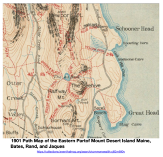
reference item ~ Path Map, 1901, Eastern MDI by Bates, Rand, and Jaques
Reference only; this item not accessioned into History Trust members' collections.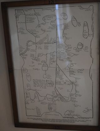
Mail Map, 1850
A hand drawn map of Bar Harbor, East Eden, and all the people who payed to receive mail once a week.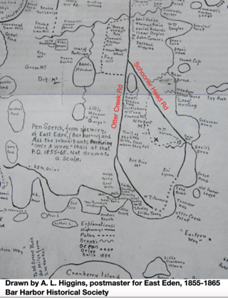

