
From collection Organization

Related Items
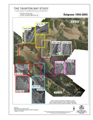
The Taunton Bay Study: Eelgrass 1955-2005
Changes in Eelgrass over time in Taunton Bay, headwaters of Frenchman Bay. This project is in ESRI GIS Story Map format.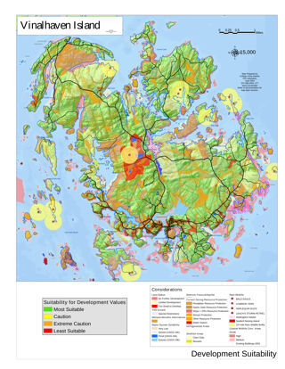
Suitability for Residential Development on Vinalhaven Island
Based on a map series funded by the Vinalhaven Land Trust. This map was presented at the ESRI International Use Conference in 2003 and was selected to be included in the ESRI Map Book. The Web link below will go to the full map series. Thi…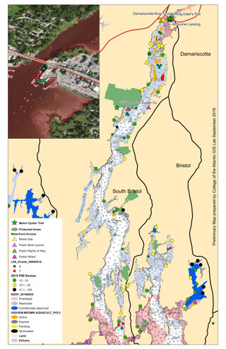
Maine Oyster Trail Pilot Project, Damariscotta River
A Map showing land use, waterfront access, and other factors important to Oyster aquiculture. This project is in ESRI GIS Story Map format.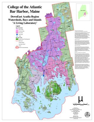
Downeast Acadia Region Watersheds, Islands, and Bays
A Living Laboratory. This project is in ESRI GIS Story Map format.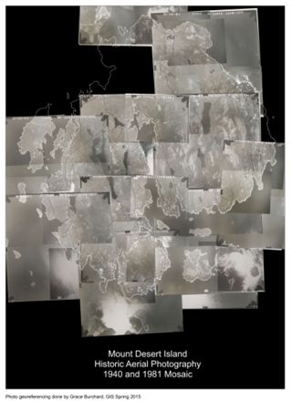
Mount Desert Island Historical Aerial Photography 1940 and 1981 Mosaic
These photos were taken at the Soil and Water Conservation Service office in Dover-Foxcroft, Maine. This project is in ESRI GIS Story Map format.

