
From collection Jesup Library JDR Jr. Collection

Page 1
Page 2
Page 3
Page 4
Page 5
Page 6
Page 7
Page 8
Page 9
Page 10
Page 11
Page 12
Page 13
Page 14
Page 15
Page 16
Page 17
Page 18
Page 19
Page 20
Page 21
Page 22
Page 23
Page 24

Page 25
Page 26
Page 27
Page 28
Page 29

Page 30
Page 31
Page 32
Page 33

Page 34
Page 35
Page 36
Page 37
Page 38
Page 39
Page 40
Page 41
Page 42
Page 43
Search
results in pages
Davis Lot Witch Hole Pond
KNOW ALL MEN BY THESE PRESENTS: That I, Louise Dana Davis
of Washington, District of Columbia, in consideration of one
dollar and other valuable considerations paid by George B. Dofr
of Bar Harbor, Hancock County, State of Maine the receipt whereof
I do hereby acknowledge, do hereby remise, release, bargain, sell
and convey and forever quit-claim unto the said George B. Dorr,
his heirs and assigns forever.
A certain lot or parcel of land, together with buildings
thereon, situated in the Town of Bar Harbor, Hancock County, State
of Maine, bounded generally as follows:- Northeasterly by the
old Hulls Cove Road; Southeasterly by the lot of land known as
the Wood & Mansfield lot; Southwesterly by Witch Hollow Pond
and Northwesterly by land of Robert Bowler; said lot of land is
more particularly bounded and described as follows:-
Beginning at a stone bound, in the Southerly side of old
Hulls Cove road; thence following the Southerly side of said
road North forty-eight degrees West (N. 48°W.) ninety-two and
five-tenths (92.5) feet; thence North seventy-six degrees and
thirty minutes West (N. 76° 30' w.) ninety-seven and five-tenths
feet; thence North eighty-six degrees and thirty minutes West
(N. 86° 30' W.) one hundred and seventy-five (175) feet; thence
North seventy-five degrees West (N. 75° W.) two hundred and forty-
five (245) feet; thence North eighty-four degrees and nine minutes
West (N. 84° 98 W.) one hundred and fifteen (115) feet; thence
North fifty-five degrees and fifteen minutes West (N. 55° 15' W.)
fifty-one (51) feet, following Southerly side of said road to
Easterly line of Bowler tract; thence following said Bowler line
South fifty-four degrees West (8.54° W.) six hundred and three
(603) feet to Witch Hole Pond; thence South seventy-throe
degrees East ( S. 73° 3.) one hundred and twenty-five feet;
thence South thirty-four degrees and thirty minutes East (i.
34° 30° E.) sixty-five (65) feet; thence South thirty-one
degrees thirty minutes West (s. 31° 30' W.) ninoty (90) feet
to westerly line of Wood and Mansfield lot at shore of said poni
(the last three courses following said pond); thenee following
said Wood and Mansfield line North eighty-two degrees and forty=
five minutes East (N. 82° 458 E.) forty (40) feet; thence North
forty-eight degrees and fifteen minutes East (N. 48° 15' E.)
ninety (90) feet; thence North sixty-three degrees forty-five
minutes East (N. 63° 45' Ee) eighty-seven (87) 200th thense North
eighty-four degrees and fifteen minutes East (N. 84° 15° E.)
ninety-four (94) feet; thence South forty-nine degrees forty=
five minutes East (S. 49° 45° E.) eighty-one (81) feet; themes
North sixty degrees East (N. 60° E.) two hundred thirty-six
(236) feet; thence North fifty-four degrees forty-five minutes
East (N. 54° 45° E.) one hundred and fifteen (115) feet; thence
North sixty-seven degrees East (N. 67° E.) ninety-one (93)
feet; thence South eighty-siz degrees thirty minutes East (S.
86° 30' E.) Seventy (70) feet; thence North eighty-four degrees
forty-five minutes East (N. 84° 45° E.) one hundred and ten (110)
feet; thence North fifty-four degrees thirty minutes East (N.
54° 30' East) two hundred and sixty (260) feet to place of begin-
ning, containing seven a more or less. Said description
being according to survey made by E. W. Hill, Surveyor. The above
conveyance, however, is made subject to a aertein right of way
now or formerly owned by Robert Bowle F.
Being the same premises described as conveyed in a certain
deed from Andrew J. Davis to me, the said Louise Dana Davis,
dated July 22, 1910 and recorded in Hancock County Maine Registry
of Deeds in Volume 472, Page 126.
TO HAVE AND TO HOLD the same, together with all the privi-
leges and appurtenances thereunto belonging, to him, the said
George B. Dorr, his heirs and assigns, forever.
AND I do COVENANT with the said George B. Dorr, his heirs
and assigns, that I will WARRANT AND FOREVER DEFEND the premises
to him, the said Grantee, his heirs and assigns forever, against
the lawful claims and demands of all persons claiming by, through
or under me.
IN WITNESS WHEREOF I, the said Louise Dana Davis, being a
widow, have hereunto set my hand and seal this seventeenth day
of September in the year of our Lord one thousand nine hundred
and twenty-six.
Signed, Sealed and Delivered
in presence of
James C Dunling
Louise Dana Davis Ls
Destrict-folumbia
STATE OF MAINE-
October t :
COUNTY OF HANCOCK, ss.
September 17, 1926.
Personally appeared the above named Louise Dana Davis and
acknowledged the above instrument to be her free act and deed.
Before me,
L.S,
Jennes Notary Dunlin Public.
my Commission enfine 7-8/926
Louise Deena Danis
to
George B.Don
Rec
Oct11/1226
2-20/M
606-91
Duflicate
with
To the Town of Eden:-
I beg to submit the following proposition :-
I will purchase or the town the Pest House lot, being the
same property conveyed by me to the town by deed dated March 14th, 1903
and recorded April 17th, 1903, in the Hancock County, Registry of Deeds,
Book 391, Page 33, for the sum of one thousand dollars. In addition to
the above I will convey to the town, without further compensation, a
lot on
or near the Break Neck Road, containing bm had cere
acre for use as a Pest House Lot; such lot to be selected from my
land by such officers es may be designated by the town.
Bar Harbor, Maine, March 7th, 1904.
Voted to accept the proposition made by Frank I. Brewer to buy
the Pest House Lot, near Witch Hollow Pond, and to furnish another lot
for same.
Voted that the Municipal Officers be authorized and instructed
to make, execute and deliver to Frank L. Brewer, on receipt of the sum
of one thousand dollars, a deed conveying to him said Pest House lot,
being same property conveyed by said Brewer to the town by deed dated
March 14th, 1903 and recorded April 17th, 1903 in the Hancock County,
Registry of Deeds, Book 391, Page 33.
Mumapul offer.
Voted that the Local Board of Health be authorized and in-
structed to select a lot on or near the Break Neck Road from land of said
Brewer, and upon receipt of a deed from said Brewer, in accordance with
his proposition, to erect thereon a building to be used as a pest house
at a cost not exceeding one thousand dollars.
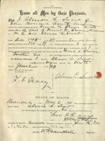
KNOW ALL MEN BY THESE PRESENTS That I, Frank L. Brewer of Eden,
Hancock County, State of Maine, individually, and as trustee under the
will of Daniel W. Brewer, late of said Eden, deceased, in consideration of
the sum of one dollar and other valuable considerations to me paid by the
Inhabitants of the Town of Eden, a municipal corporation in the County
of Hancock, State of Maine, hereinafter called corporation, the receipt
whereof I do hereby acknowledge, individually and by virtue of all rights,
power and authority conferred upon me 8.8 trustee, under the will of said
Daniel W. Brewer, and by virtue of all other rights, power and authority
me hereto enabling, do hersby give, grant, bargain, sell and convey tc
said corporation, its successors and assigns forsver, at certain 1ct of
lane situated in said Town of Eden, bounded and Rescribed as follows, to
wit:-
Beginning at an iron bolt driven in the ground on old New Mill
Meadow line, so-called, for the southeast corner of lot conveyed; thence
North forty-two degrees East (N. 42° E.) one hundred and forty-three
(143) feet, following said line to an iron bolt driven in the ground;
thence North forty-eight degrees West (N. 48° W.) one hundred and fifty-
two (152) feet to an iron bolt set in ledge; thence South forty-two de-
grees West (S. 42° w.) one hundred and forty-three (143) feet to an iron
bolt in ledge; thence South forty-eight degrees East (S. 48° E.) one
hundred and fifty-two (152) feet to place of beginning, containing one-
half (1/2) acre, more or less. Also a right of way sixteen (16) feet
wide along the Westerly side of said New Mill Meadow line from the point
where said line intersects the Northerly line of old Eagle Lake Road to
intersection with Southerly line of lot herewith conveyed. Said right
of way, however, to be held and enjoyed in common with the grantor, his
heirs and assigns and all persons to when he may convey similar rights.
TO HAVE AND TO HOTD the aforegranted and bargained premises
with all the privileges and appurtenances thereof to it, the said
corporation, its successors and assigns, to its and their use and behoof
forever.
And I do covenent with the said Grantee, its successors and
assigns that I am lawfully seized in fee of the premises; that they are
frea of all incumbrances; that I have good right tc sell and convey the
same to the said Grantee, to hold as afcresaid; and that I and my Heirs
shall and will WARRANT and DEFEND the same to the said Grantee, its
successors and assigns forever, against the lawful claims and demands
of all persons.
IN WITNESS WHEREOF I, the said Frank L. Erewer individually,
and as trustee as aforesaid, and Abbie E. Brswer, wife of the said Frank
L. Brewer joining in this deed as Grantor and relinquishing and conveying
her rights by descent and all other rights in the above described premises
have hereunto set our hands and seals this
day
of April, in the year of our Lord, one thousand, nine hundred and four.
-Signed, Sealed and Delivered-
in presence of.
STATE OF MAINE
:
: SS.
COUNTY OF HANCOCK
:
April
1904.
Personally appeared the above named Frank L. Brewer and acknow-
ledged the above instrument to be his free act and deed.
Before me,
Capel
Wamanity Deed
from
Frank L.Brun
D
BOBLY you
FORMS
KNOW ALL MEN BY THESE PRESENTS, that the Inhabitants of the Town
of Eden, and Municipal Corporation existing in the County of Hancock,
State of Maine, by John E. Bunker, Jr., Calvert G. Hamor, and
Elihu T. Hamor, Its Selectmen in consideration of one thousand dollars
paid by Frank L. Brewer, of Eden, aforesaid, the receipt whereof is
hereby acknowledged, does hereby remise, release, bargain, sell, and
convey, and forever quit-claim unto the said Frank L. Brewer, his heirs
and assigns forever, a certain lot or parcel of land, situated in said
Town of Eden, bounded and described as follows:-
Beginning at a stone bound on the Northerly line of Wood and Mans-
field Lot, so called, at junction of Old Town Road leading to Hulls Cove,
with private way leading to Witch Hole Pond: thence North forty-eight
degrees West(N.48° W.) ninety-two and five-tenths feet (92.5) feet:
thence North seventy-six degrees West (N.76° W.) ninety-seven and five-
tenths feet(97.5) (both courses following and parallel with Westerly
line of said Town Road) to stake: thence South twelve degrees and forty-
five minutes East(s. 12°-45' E.) one hundred and eighty(180) feet to
stake at intersection with Wood and Mansfield line: thence North fifty-
four degrees and thirty minutes East(N.54°-30' E.) following said line
one hundred and fifty-one (151) feet to place of beginning, containing
fourteen thousand, seven hundred and eighty-three (14783) square feet, to-
gether with buildings thereon.
TO HAVE AND TO HOLD, the afore granted and bargained premises, to-
gether with all privileges and appurtenances thereof, to him, the said
Frank L. Brewer, his heirs and assigns forever, and it does covenant
with the said Frank L. Brewer, his heirs and assigns, that it will war-
rant and forever defend the premises to him, the said Grantee, his heirs
and assigns forever, against all lawful claims and demands of all per-
sons claiming by, through, or under the said Municipal Corporation.
In witness whereof, the said Inhabitants of the Town of Eden,
by John E. Bunker, Jr., Calvert G. Hamor, and Elihu T. Hamor, Its
Selectmen, duly authorized, have hereunto set its hand and seal this
seventh day of June, in the year of our Lord one thousand nine hundred
and four.
Signed, sealed, and delivered
in presence of
Eden
many ByJober
Selecting
Blihu Educ
STATE of MAINE,
}
Hancock
) ss.
June 7, A. D. 1904.
Personally appeared the above named John E. Bunker, Jr.,
Calvert G. Hamor, and Elihu T. Hamor, and acknowledged the above instru-
ment to be the free act and deed of the Inhabitants of the Town of Eden,
and their free act and deed, in their said capacity.
Before me,
pl 3 1
Leve Notary Public. H.
O
(2) Cpul
Dead
Tom of Edw
to
Tissult L Brenza
STATE OF. MAINE.
HANCOCK.SS
REGISTRY OF DEEDS
FLCENED June 10,1904
1's 15m m P.M. AND RECORDED IN
BOOK 40 Grage 382
ATTEST REGISTER
cheon
THE OFFICE OF
LORING, SHORT & HARMON, LAW STATIONERS,
PORTLAND, MAINE.
10-12/05.50
KNOW ALL MEN BY THESE PRESENTS That the. Bar Harbor Banking &
Trust Company, a. corporation organized under the laws of the State
of Maine, and having its established place of business at Bar Harbor
in the Town of Eden, in said State, in consideration of the sum of
one dollar and other valuable considerations, paid by Frank L.
Brewer of said Eden, Trustee under the will of Daniel W. Brewer,
late of said Eden, de ceased, the receipt whereof it does hereby
acknowledge, does hereby remise, release, bargain, sell and convey
and forever quit-claim unto the said Frank L. Brewer, Trustee as 4
aforesaid, his successors, heirs and assigns forever, a certain lot
or parcel of land, together with buildings thereon, situated in the
said Town of Eden, Hancock County, State of Maine, bounded generally
as follows: Northeasterly by the old Hulls Cove Road; Southeasterly
by the lot of land known as the Wood & Mansfield lot; Southwesterly
by Witch Hollow Pond and Northwesterly by land of Robert Bowler.
Said lot of land is more particularly bounded and described as
follows:-
BEGINNING at a stone bound, in the Southerly side of old Hulls
Cove road; thence following the Southerly side of said road North
forty-eight degrees West (N. 48° W.) ninety-two and five-tenths
(92.5) feet; thence North seventy-six degrees and thirty minutes
West (N. 76°-30' w.) ninety-seven and five-tenths (97.5) feet;
thence North eighty-six degrees and thirty minutes West (N. 86°-30'
W.) one hundred and seventy-five (175) feet; thence North seventy-
five degrees West (N. 75° W.) two hundred and forty-five (245) feet;
thence North eighty-four degrees and nine minutes West (N. 84°-9' W.)
one hundred and fifteen (115) feet; thence North fifty-five degrees
and fifteen minutes West (N. 55°-15' w.) fifty-one (51) feet, follow-
ing Southerly side of said road to Easterly line of Bowler tract;
thence following said Bowler line South fifty-four degrees West
(S. 54° w.) six hundred and three (603) feet to Witch Hole Pond;
-1-
thence South seventy-three degrees East (S. 73° E.) one. hundred and
twenty-five (125) feet; thence South thirty-four degrees and thirty
minutes East (S. 34°-30' E.) sixty-five (65) feet; thence South
thirty-one degrees thirty minutes West (S. 31°-30' W.) ninety (90)
feet to Westerly line of Wood and Mansfield lot at shore of said
pond (the last three courses following said pond); thence following
said Wood and Mansfield line North eighty-two degrees and forty-five
minutes East (N. 82°-45' E.) forty (40) feet; thence North forty-
eight degrees and fifteen minutes East (N. 48°-15' E.) ninety (90)
feet; thence North sixty-three degrees forty-five minutes East
(N. 63°-45' E.) eighty-seven (87) feet; thence North eighty-four
degrees and fifteen minutes East (N. 84°-15' E.) ninety-four (94)
feet; thence South forty-nine degrees forty-five minutes East
(S. 49°-45' E.) eighty-one (81) feet; thence North sixty degrees
East (N. 60° E.) two hundred thirty-six (236) feet; thence North
fifty-four degrees forty-five minutes East (N. 54°-45' E.) one
hundred and fifteen (115) feet; thence North sixty-seven degrees
East (N. 67° E.) ninety-one (91) feet; thence South eighty-six
degrees thirty minutes East (S. 86°-30' E.) seventy (70) feet;
thence North eighty-four degrees forty-five minutes East (N. 84°-45'
E.) one hundred and ten (110) feet; thence North fifty-four degrees
thirty minutes East (N. 54°-30' E.) two hundred and sixty (260)
feet to place of beginning, containing seven acres, more or less.
Said description being according to survey made by E. W. Hill, Sur-
veyer. The above conveyance, however, is made subject to a certain
right of way now or formerly owned by Robert Bowler.
Being & portion of the property described as conveyed in a
certain mortgage from Daniel W. Brewer to John T. Higgins, dated
July 1st, 1889 and recorded July 12th, 1889 in the Hancock County,
Maine, Registry of Deeds, Vol. 237, Page 6, and assigned by said
John T. Higgins to the Bar Harbor Banking & Trust Company, aforesaid,
by instrument dated August 6th, 1890 and recorded December 20th,
1902 in said Registry, Book 385, Page 287.
-2-
The purpose and intent of this instrument is to release all
claim of said corporation in and to the property above described
and all parts thereof derived under, or by virtue of the above de-
scribed mortgage, or any other mcrtgage. Without prejudice, however,
to the right of said corporation tc hold any other preperty described
in said mortgage or mortgages, for all the purposes thereof.
TO HAVE AND TO HOLD the same, together with all the privileges
and appurtenances thereunte belonging, to him, the said Frank L.
Brewer, Trustee as aftresaid, his Successors, Heirs and Assigns for-
ever.
IN WITNESS WHEREOF the said Bar Harbor Banking & Trust Company
has caused its seal to be herete affixed, and these presents to be
signed by its Treasurer, in its name and behalf, this ninth
day of June, in the year of our Lord, one thousand, nine hundred
and four.
-Signed, Sealed and Delivered-
in presence of.
s
Mayor
STATE OF MAINE
:
: ss.
COUNTY OF HANCOCK
:
June 9
1904.
Personally appeared the above named Fred C. Lynam, Treasurer
and acknowledged the above instrument to be his free act and deed.
and the fun a is ana and of Before sund me, corporation
NOTARY
PUBLIC
-3-
we surrey
corror
I Trustles
of
Fruid L.Drawn
STATE-OF-MAINE.
HANCOOK.SS.
RECEIVED 20.1904,
AT9 REGISTRY herm a. Jame M. OF AND DEEDS RECORDED IN
BOOK 407 PAGE 371
ATTEST, REGISTER
office of
L.D. Goog
Record of meeting of Trustees of the Bar Harbor Banking &
Trust Company, held at the Company's office, Bar Harbor, Maine, on
June
9
1904. Present Fred C. Lynem, W. H. Davis and Luere
B. Teasy, being 8. querum of trustees.
Fred C. Lynem presented a certain instrument being a partial
discharge and release of the mortgage from Daniel W. Brewer to John
T. Higging, dated July 1st, 1889 and recorded July 12th, 1889
in the Hanecek County, Maine, Registry of Deeds, Book 237, Page 6,
and assigned by said Higgins to the Bar Harbor Banking & Trust
Company by instrument dated August 6th, 1890 and recorded in said
Registry, Book 385, Page 287, said instrument releasing from the
operation CI said mortgage, seven acres of land, near the shore of
Witch Hollow Pond, being the same seven acras bargained and son-
veyed by Frank L. Brewer, Trustee, to Andrew J. Davis.
On motion it was voted to authorize the Treasurer to execute
and deliver said instrument, thereby releasing all claim by mortgage
held by the Bar Harbor Banking & Trust Company , upon the savan
acre tract of land bargainsdcr convayed by said Brawer to said
Davis.
A true copy,
Attesth
buy
BRIEF OF TITLE of a 1ct of land situated in the Town of Eden,
Hancock County, State of Maine, being same described in a deed of
warranty from Frank L. Brewer to Andrew J. Davis dated June 16th,
1904 and recorded June 20th, 1904 in the Hancock County, Maine,
Registry of Deeds, Vol. 407, Page 375.
The title to this property comes through the Trustees of the
Estate of William Bingham. The title of said Trustees was undoubted-
ly good. The history in brief of their title is given in the
Abstract, dated March 9th, 1900 made by me for Mr. Davis covering
land purchased of the Haight Estate.
In brief the chain of title from the Bingham Trustees down
to Frank L. Brewer is as follows:
The records hereinafter referred tc are those of the Hancock
County, Maine, Registry of Deeds, except where otherwise specified.
-I-
Bingham Trustees, by their atterney, John Black, to Richard
Higgins, deed dated November 27th, 1841 and recorded same day in
Vcl. 72, Page 2. This conveyed lot No. 32, a large 1ct running
from the shore to, and including, the Witch Hollow Pond.
-II-
Richard Higgins to Edward Brewer, deed dated January 1st, 1847
and recorded November 24th, 1847 in Vol. 82, Page 410. Same property.
-III-
Edward Brewer to Daniel W. Brewer, porter Brewer and Perry
Brewer, deed dated November 11th, 1857 and recorded same day in
Vol. 106, Page 26. Same property.
-IV-
Dantel W., Porter, and Perry Brewer to William Morey Jr.:
deed dated June 1st, 1858 and recorded June 12th, 1858 in Vcl. 107,
Page 109. Same preperty.
-1-
-V-
William Morey Jr., to Daniel W., Porter and Perry Brewer,
deed acknowledged June 29th, 1860 and recorded July 14th, 1860 in
Vcl. 112, Page 72. Same preperty.
-VI-
Perry H. Brewer to Daniel W. and Porter Brewer, deed dated
October 19th, 1867 and recorded November 12th, 1867 in Vol. 130,
Page 255. One-third undivided of said property.
-VII-
Porter Brewer tc Daniel W. Brewer, deed dated June 13th, 1868
and recorded June 27th, 1868 in Vol. 131, Page 160. One-half un-
divided cf said property.
-VIII-
Daniel W. Brewer who thus acquired title to the entire property
died prior to August 1895. He left a will which was duly proved
and allowed by the Probate Court for Hancock County, Maine, at the
August term of said Court, 1895. Said will is recorded in the
Records of said Probate Court, and also as required by law, recorded
in the Registry of Deeds Vc1. 291, Page 376. By this will he
devises to his widow Melinda S. Brewer, his home stead. He devises
the remainder of his property to Frank L. Brewer as trustee, by
the second clause of his will, which is as follows:-
"Second:- I give and bequeath to my son, Frank L. Brewer,
all the rest, residue and remainder of my property, real, personal
and mixed wherever situated, and whether in possession, reversion or
remainder in trust however, for the following purposes, namely:
To hold, manage, sell, dispose of, mortgage, exchange or
convey in trust at his discretion, and to divide the net proceeds
thereof, or the proceeds or avails of any particular part thereof
at his discretion among, among my ten children, Chester S., Everett
K., Frank L., Fred J., Lillian Fitzgerald, Georgia Richardson, Albion
S. Brewer, Edith Brewer, Archie Brewer and Aggie Brewer
Thus Frank L. Brewer as trustee acquired title to said property
and the right to convey and dispose of the same.
-IX-
Frank L. Brewer as trustee conveyed a part of the same, viz.,
-2-
the Pest House Lot, sc-called, tc the Town cf Eden, by deed dated
March 14th, 1903 and recorded April 6th, 1903 in Vol. 391, Page 33.
-X-
At the annual town meeting held in March 1904 the town voted
to authorize its Municipal Officers to re-convey said Pest House
Lot to Frank L. Brewer. The Article in the Town Warrant and the
vete were as follows:-
"Article 101: Tc 66€ if the town will vcte to sell and convey
the Pest House Lct near Witch Hollow Pond to Frank L. Brewer in
accordance with his proposition to purchase same and furnish
another 1ct, and tc authorize the Municipal Officers to execute the
proper deed for the purpose."
Under this article it was voted"To accept the proposition
made by Frank L. Brewer tc buy the Fest House Let near Witch Hollow
Pend and to furnish another lot for same," and it was also v cted
"That the Municipal Officers be authorized and instructed tc make,
execute and deliver to Frank L. Brewer, on the receipt of the sum of
one thousand dollars, a deed, conveying to him said Pest House
Lot, being the same property conveyed by said Frank L. Brewer to the
Town by deed dated March 14th, 1903 and recorded April 17th, 1903
in the Hancock County, Mains, Registry of Deeds, Vol. 391, Page 33.
Note:- It will be observed that in this vote there is an error
in the date of record of the deed. The date of record is stated to
be April 17th, whereas April 6th is the correct date, but this is
immaterial; the date of the deed is correctly given and the volume
and page, moreover the term Pest House Lot defines the property
clearly.
This error in the vote is entirely harmless.
-XI-
Pursuant to the authority vested in them by the vote set forth
in the last preceding paragraph, the Municipal Officers of the Town
of Eden, re-conveyed said Pest House Lot to said Frank L. Brewer, by
deed dated June 7th, 1904 and recorded June 10th, 1904, in Vcl.
406, Page 382.
By the deeds above described, Frank L. Brewer acquired the
title and right to convey all the property described in the deed
-3-
lccus, and in addition tc such land he conveyed to her, as appurtenant
tc her land, a right of way for all purposes of a way over the road
of said Brewer known as the Ice Road, extending from Witch Hollow
Pond to the old County Road, to be used in common by the grantee
and grantor, their heirs and assigns. This Ice Road extends across
the locus and by the deed above referred to Mrs. Bowler and her
heirs and assigns acquired a right of way in said road in common
with Brewer and his Heire and Assigns. Mrs. Bowler's successors
therefore have a right of way for all purposes of a way over the Ice
Road. They have not the right to use it for any other purpose except
a way. They have no right tc build anything or deposit anything
upon the land, or to do any act except tc use it as a way, and if
necessary to make repairs SC as to fit it better for use as a way.
Mr. Brewer also gave to Mrs. Bowler a deed dated November 13th,
1886 and recorded in Vol. 206, Page 320, conveying certain other
rights and easements. This deed conveyed "As appurtenant to all and
every part of that tract OF land situated at Eden aforesaid, conveyed
to May W. Bowler by warranty deed from me, the said Brewer, of even
date herewith, to be recorded in the Registry of Deeds for said
Hancock County, to which said deed special reference is hereby made
for the following rights, privileges and sassments, to wit: the
right to take, conduct, transport and convey water from Witch Hollow
Pond, so-called, in and through pipes or aqueducts to any and all
parts of said lot conveyed to said May W. Bowler as aforesaid, for
use upon said lot last named for domestic, sanitary and agricultural
purposes.
Mr. Brewer also gave tc Edmund H. Pendleton and Charles T.
How a deed of land lying near Witch Hollow pond (See Vc1. 208,
Page 430) and in addition to the land granted to them "The right
&
tc lay and maintain covered water pipe or aqueduct from deep water
in Witch Hollow Pond, sc-called, across that portion of my land
lying between said Pond and the 1ct conveyed to said Pendleton and
-5-
to Andrew J. Davis.
-XII-
MORTGAGES.
Several mortgages have been given effecting the locus, but
these have been duly discharged, viz:-
Mortgage from Daniel W. Brewer to Charles C. Burrill, dated
November 9th, 1874 and recorded November 10th, 1874 in Vol. 147,
Page 351. Discharged on margin of record, September 9th, 1876.
Mortgage from Daniel W. Brewer to Samuel K. Whiting, dated
January 3rd, 1880 and recorded same day in Vcl. 170, Page 117.
Discharged on margin cf record May 22nd, 1886.
Mortgage from Daniel W. Brewer to John T. Higgins, dated July
1st, 1889 and recorded July 12th, 1889 in Vcl. 237, Page 6; assigned
by John T. Higgins to the Bar Harber Banking & Trust Company by
instrument dated August 6th, 1890 and recorded December 20th, 1902
in Vol. 385, Page 287, and Discharged by Bar Harbor Banking & Trust
Company by instrument duly authorized by vote of said corporation
dated June 9th, 1904 and recorded June 20th, 1904 in Vcl. 407,
Page 371.
Mortgage from Frank L. Brewer, Trustee, to Almon C. Snow dated
December 14th, 1897 and recorded December 15th, 1897 in Vol. 321,
Page 37: Discharged by said Almon C. Snow by instrument dated June
6th, 1904 and recerved June 10th, 1904 in Vol. 406, Page 381.
Note:- The Bar Harber Banking & Trust Company gave a partial
discharge by release to the Town of Eden dated March 14th, 1903
and recorded April 17th, 1903 in Vcl. 391, Page 31. This partial
discharge is unimportant inasmuch as the later discharge scmpletely
extinguishes the mortgage.
-XIII-
SERVITUDES.
By deed dated November 13th, 1886 and recorded November 24th,
1886, in Vol. 210, Page 315, Daniel W. Brewer conveyed to May W.
Bowler certain land containing one hundred acres, adjoining the
-40
How aforesaid to said last named lot and to enter at all times upon
and to have access tc my said land and said Pond for the purpose of
repairing said pipe or aqueduct and to do all other acts and things
necessary and proper for the conveyance of water by means of said
pipe or aqueduct from said Pond across my land to the 1ct convayed
to said Pendleton, etc."
The rights given by these deeds are not very clearly defined. It
is probable, however, that these deeds give tc Pendleton, How and
Bowler the right to lay and maintain water pipes across the west
side of the locus.
-XIV-
The deeds forming the chain of title appear to be in due form
duly executed and recorded. The deed from Porter Brewer to Daniel
Brewer (Paragraph VII) contains this exception, "Excepting and
reserving therefrom all the lands which we have hitherto sold and
conveyed.' This is a very sweeping exception and might be held to
include and except land which had been previously conveyed by deeds
which had never been recorded. But, this deed was given thirty-
six years ago. If any rights ever existed under unrecorded deeds,
such rights have undcubtedly been lost by lapse of time.
Taxes have been paid. From my examination I am satisfisd
that the title tc this property is clear, except as incumbered
by the right of way and possible rights of laying water pipss, set
forth and described in Paragraph XIII.
Bar Harber, Maine, June 28th, 1904.
-6-
Abstract City
y Title
covidely
KNOW ALL MEN BY THESE PRESENTS That I, Frank L. Brewer of Eden,
Hancock County, State of Maine, individually and also as trustee
under the will of Tanisl W. Brewer, late of said Edsn, deceased, in
consideration of the sum of one dollar end other valuable considera-
tions paid by Andrew J. Davis of Wilkesbarrs, Inzerne County, State
of Pennsylvania, the receipt whereof is hereby acknowledged, de hereby
in my individual capacity, and also by virtue of all title, power and
authority vested in me by said will and the prebate therecf, and all
other power and authority me herete enabling give, grant, bargain,
ssll and convey unto the said Andrew J. Davis, and his Heirs and
Assigns forever, 8 certain 1ct or parcel of land, together with
buildings thereon, situated in the Town of Eden, Hancock County,
State of Mains, bounded generally as follows:- Northeasterly by
the old Hulls Cove Road; Southeasterly by the lot of land known as
the Wood & Mansfield lot; Southwesterly by Witch Hollow Pond and
Northwesterly by land of Robert Bowler; Said lot of land is more
particularly bounded and described as follows:-
BEGINNING at a stone bound, in the Southerly side of c16 Hulls
Cove road; thence following the Southerly side of said road North
forty-eight degrees West (N. 46° w.) ninety-two and five-tenths
(92.5) feet; thence North seventy-six degrees and thirty minutes
West (N. 76°-30' w.) minety-seven and five-tenths (97.5) fast;
thence North eighty-six degrees and thirty minutes West (N. 66°-30'
w.) one hundred and seventy-five (175) fest; thence North seventy-
five degrees West (18. 75° w.) two hundred and forty-five (245) fest;
there North eighty-four degrees and nina minutes West (N. 84°-9' w.)
one hundred and fifteen (115) feet; thence North fifty-five degrees
and fiftsen minutes West (No 55°-15' w.) fifty-0:19 (51) fest, follow-
ing Southerly side of said road 1.0 Easterly lina of Bowler tract;
thence following said Bowler line South fifty-four de Wast
(S. 54° w.) six hundred and three (603) feet to Witch Hole Pond;
1-
thence South seventy-three degrees East (S. 73° E.) one hundred and
twenty-five (125) feet; thence South thirty-four degrees and thirty
minutes East (S. 34°-30' E.) sixty-five (65) feet; thence South
thirty-one degrees thirty minutes West (S. 31°-30' v.) ninety (90)
feet to Westerly line of Wood and Mansfield let at shere of said
pond (the last three courses following said pend); thence following
said Wood and Mansfield line North eighty-two degrees and farty-five
minutes East (N. 82°-45' E.) forty (40) feet; thenes North forty-
eight degrees and fifteen minutes East (N. 48°-15' E.) ninety (30)
feet; thence North sixty-three degrees forty-five minutes East
(N. 63°-45' E.) sighty-seven (87) feet; thence North eighty-four
degress and fifteen minutes East (N. 84°-15' E.) ninety-four (94)
fast; thence South forty-nine degrees forty-five minutes East
(S. 49°-45' E.) eightyfone (81) feet; thense North sixty degrees
East (N. 60° E.) two hundred thirty-six (236) feet; thence North
fifty-four degrses forty-five minutes East (N. 54°45' E.) one
hundred and fifteen (115) feet; thence North sixty-ssven degrees
East (N. 67° E.) ninety-one (91) feet; thence South eighty-six
degrees thirty minutes East (S. 86°-30' E.) seventy (70) feet;
thence North eighty-four degrees forty-five minutes East (N. 84°-45'
E.) one hundred and ten (110) feet; thence North fifty-four degrees
thirty minutes East (N. 54°-30' E.) two hundred and sixty (260)
feet to place of beginning, containing sever acres, more or less.
Said description being according to survey made by E. W. Hill, Sur-
veyer. The above conveyance, however, is
made subject to a
certain right of way now or formerly owned by Robert Bowler.
TO HAVE AND TO HOID the aforegranted and bargained premises
with all the privileges and appurtenances thereof to him, the said
Andrew J. Davis, his Heirs and Assigns, to his and their use and
behoof forever.
And I do covenant with the said Grantee, his Heirs and Assigns
that I am lawfully seized in fee of the premises; that they are
free of all incumbrances, except as above stated; that I have good
-2-
right to sell and convey the same to the said Grantee to hold as
aftresaid; and that I and my Heirs shall and will WARRANT AND DE-
FEND the same to the saie Grantee, his Heirs and Assigns forever,
against the lawful claims and demands of all persons, except as above
stated.
IN WITNESS WHERECE I, the said Frank L. Brewer individually and
as trustes as aforesaid, and Abbie E. Brewer wife of the said Frank
L. Brewer joining in this deed as Granter and relinquishing and scn-
veying her rights by descent and all other rights in the above de-
scribed premisss have hereunto set hands and seals this 16th
our
day of June, in the year of our L°rd, one thousand nine hundred
and four.
-Signee, Sealed and Delivered-
in presence CI.
Friend 2 Burner H
JMany
Fruin L Arim
must to
4
A1Brumer
lab bee E Areasor LP
STATE OF MAINE
:
: 85.
COUNTY OF HANCOCK
:
June 1698
1904.
Personally appeared the above nailed Frank L. Brewer, and
acknowledged the above instrument to bs his free act and deed in-
dividually, and in his said capacity as trustee.
Before me,
LS
-3-
Copy
Warranty Deado
from
2
Franked Crunt
TDD:
Trucks
to
n
June 20 1904
Recordince in
294.3
Book 4078375
12.12
Z
7.
[41]
DISCHARGE OF MORTGAGE.
know all Men by these Presents,
That 2 almon b snow of
Edin Hean cam
owner of a certain mortgage given by frouth Z. Brewn master
un an the are of Daurel m Brown dicease
to
Mr the June Remon 6. sund
dated Dic. 14th A. D. 89% and recorded in Name cock bounty
Registry of Deeds, Book 321 , Page 37 , do hereby acknowledge that 2 have received full
payment and satisfaction of the same, and of the debt thereby secured, and in consideration thereof g
do
hereby cancel and discharge said mortgage, and release unto the said front J. Brewer
trustic his
heirs and assigns forever the premises therein described.
In Witness Whereof, 2 the said Alman 6. fnow
day of June
ha UZhereunto set my hand and seal this sin the
A. D. 904
SIGNED, SEALED AND DELIVERED
IN PRESENCE OF
Almon C.Smouth
Y. B. Deary
STATE OF MAINE.
Nouncock
cock
SS.
Jum 6 1 904. Then personally appeared
the
above named
Clean b frow
and acknowledged the foregoing instrument to be his free act and deed, before me,
START
hum ADvey the
PUBLIC,
note
Pikeie
STATE
OF MAINE, Hancock ss. REGISTRY OF DEEDS. Received June 10, 1904
at / h. 15 P M.,
and recorded in Book 406 , Page 381
Attest,
Register.
573E125/-
534-302654-
y
NS2-45540
454-15294
M
NGOE-236ff 71.57 we
N54-302-260
wrong
SS C
Vol.
Page
Dower Released.
Dated April
1904.
Recorded
Frank L. Brewer, individually,
and as trustee under the will
of Daniel W. Brewer
-to-
Inhabitants of the
Town of Eden
In Eden:
Beginning at an iron bolt driven in the ground on
old New Mill Meadow line, so-called, for the southeast
corner of lot conveyed: thence North forty-two degrees
East (N. 42° E.) one hundred and forty-three (143) feet,
following said line to an iron bolt driven in the ground:
thence North forty-eight degrees West (N. 48° w : one
hundred and fifty-two (152) feet to an iron bolt set in
ledge: thence South forty-two degrees West (S. 42° W.)
one hundred and forty-three (143) feet to an iron bolt
in ledge: thence South forty-eight degrees East (S. 48°E.)
one hundred and fifty-two (152) feet to place of beginning,
containing one-half (1/2) acres, more or less. Also a
right of way sixteen (16) feet wide along the Westerly
side of said New Mill Meadow line from the point where
said line intersects the Northerly line of old Eagle
Lake Road to intersection with Southerly line of lot
herewith conveyed. Said right of way, however, to be
2-
held and enjoyed in common with the grantor, his heirs
and assigns and all persons to whom he may convey
similar rights.
Due mr Dors
41.38
The Eyrie
Seal Harbor, Maine
August 31st, 1926.
Dear Mr. Lynam:-
Your letters of August 18th, 19th and 20th
with reference to the exchange with Mrs. Davis of the seven
or more acres which she owns between Corkscrew Hill Road
and Witch Hole Pond for a portion of the property which I
own on the shore adjacent to Mrs. Davis' home, are before
me.
On the advice of Mr. Dorr and yourself, I
authorize giving in exchange for these seven acres only
such a tract of the shore property as would lie on
Mrs. Davis' side of a line drawn from the middle of the
cove between her property and the point.
You and I are agreed if this exchange is
declined, we are willing to let the matter rest and take our
chances of its going through later on.
Very truly,
John D. Pockefulling
Mr. A. H. Lynam
Bar Harbor, Maine
November 30, 1926.
Mr. John D. Rockefeller, Jres
Pain
26 Broadway,
New York City
Dear Mr. Rockefeller:
Some time ago I wrote you that Mrs. Davis seemed
opposed to clearing between the road and the shore on the
lot we conveyed to her. To make your records complete I wish
to say that yesterday I noticed that she has taken out all
the underbrush and all the poor trees, leaving only the
good trees.
Yours very truly,
Nov. 6, 1926
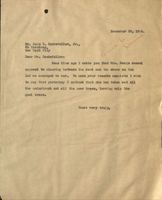
Mr. John D. Rockefeller, Jr.
26 Broadway
New York City
Dear Mr. Rockefeller:
I am returning herewith the letter from Mr. Fred
C. Lynam sent me by Miss Adams.
The White lot is owned one undivided half by the
Reservations and the other undivided half will in a few days
be acquiredby you. This lot has quite a lot of growth on it
between the road and the shore.
Mrs. Davis seems quite opposed to having any outtin,
done next to her.
I should think it would be well to look the location
over before granting permission to do the cutting requested.
Yours very truly,
October 16g 1926
Mr. John D. Rockefeller, Jr.
Seal Harbor, Maine
Dear Mr. Rockefeller:
The deed from Mrs. Davis has arrived and I have had Mr.
Dorr execute a deed to her, both of which have been entered
for record. New deeds from Mr. Dorr have been drafted and
executed. As soon as the deeds are returned from Ellsworth
I will forward them as usual to Mr. Heydt.
Yours very truly,
August 16,1926.
Mr. John D. Rockefeller, Jr.
Seal Herbor, Naine.
Doar Mr. Rockefeller:-
A few days ago I had an interview with Mrs. Arline Ireland,
the daughter of Mrs. Louise Dans Davis with reference to her lot
between Corkscrew Hill Road and Witch Hole Bond of, seven seres,
and that portion of the lot we acquired of the Haight estate
lying between the road and the shore. This is the lot I sug-
gested sometime ago we might exchange for the Witch Hole Lot,
and although nothing then could be done, now Mrs. Davis is in-
clined to make some exchange. There is no hurry about this.
At your loisure would it not he well to look at both lots and
discuss the question of a transfer?
Yours very truly,
August 19,1926.
Mr. John D. Rockefeller, Jr.
Seal Harbor, Maine.
Dear Mr. Rockefeller:-
I have today discussed with Mrs. Ireland the question
of the boundary of the proposed transfer to Mrs. Davis. Mrs.
Ireland's brother was very positive that they should receive
all of the land way over to where the road is seen from the
beach, but I told him we couldn't consent to such an exchange.
What we were willing to do was to give them sufficient land
there on the shore equal in value to the land they held at
the pond. I told them we felt that a point in the cove just
east of the Point was as far as we could go. Mrs. Ireland
wished very much that the line could be carried over a short
distance west of the Point in order that they might protect
their view from picnic parties on the shore.
I have had Mr. Hill make a rough examination on the ground
to determine the acreage both as to the line we discussed and
the line Mrs. Ireland seems willing to accept. The acregge using
our line is .75 of an acre and the acreage using Mrs. Ireland's
line is .81. Would it not be well to make another examination
on the ground?
Yours very truly,
AHL:IMS
August 20,1926.
phone
Mr. John D. Rockefeller, Jr.
Seal Harbor, Maine.
Dear Mr. Rockefeller:-
I this morning went with Mr. Dorr to the property
adjoining the Davis lot proposed to be transferred to Mrs.
Davis, and he is absolutely of the opinion that it would
be best not to carry the line farther west than where you
suggested it. He thinks that the property on the shore
is very much more valuable than that at the pond,and that
if Mrs. Davis should decline to make the transfer on the
lines as suggested you will be in as good. a position to ac-
quire the pond lot later as you are now. The Pond lot
would apparently not increase in value as rapidly as the
shore lot.
Yours very truly,
AHL:IMS
October 16, 1926
Mr. Charles 0. Heydt
26 Broadway
New York City
Dear Mr. Heyat:
Mr. Rockefeller authorized an exchange with Mrs. Louise Dana
Davis of a portion of the land on the shore at the Bluffs for a
tract of land on the shore of Witch Hole Pond. I have drafted
the deeds, one from Mr. Dorr to Mrs. Davis and the other from Mrs.
Davis to Mr. Dorr, both of which have been executed ani recorded.
I am enclosing herewith the deed from Mrs. Davis to Mr. Dorr and
a copy of the deed from Mr. Dorr to Mr. Rockefeller of the same land.
This transaction necessitated redrafting the deeds originally
given by Mr. Dorr to Mr. Rockefeller of the two thirds interest
acquired from Mrs. Monell and the one third interest acquired of
Mr. Haight. I am enclosing copies of those deeds which should
take the place of the similar deeds now on your file.
Yours very truly,
December 8, 1926.
Mr. Charles 0. Heydt,
26 Broadway,
New York City
Dear Mr. Heydt:
I am enclosing herowi th abstract of title of
all the remaining land in the vicinity of the Bluffs
desired to be acquired. Effort is now being made to
acquire the property. As soon as anything definite arises
I will advise you.
Yours very truly,
26 Broadway
New York
October 20th, 1926.
Dear Mr. Lynam:
This is to acknowledge the receipt of
your letter of October 16th with deeds therein referred
to in connection with the trade with Mrs. Louise Dana Davis
of a portion of the land on the shore at the Bluffs for a
tract of land on the shore of Witch Hole Pond.
Very truly,
Mr. A. H., Lynam,
Bar Harbor, Me.

