
From collection Jesup Library JDR Jr. Collection

Page 1
Page 2
Page 3
Page 4
Page 5
Page 6
Page 7
Page 8
Page 9
Page 10
Page 11
Page 12
Page 13
Page 14

Page 15
Page 16
Search
results in pages
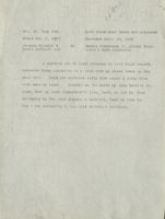
[No title on tab -- Amos Hooper to George C. Beckwith, Goose Marsh Mill Pond Lot]
Vol. 79, Page 374
Warranty Deed Dower released
Dated June 11, 1845
Recorded Feb. 26, 1846
Amos Hooper
to-
George C. Beelwith
In Mount Desert.
Beginning at 8 stump at the edge of Goose Marsh Mill
Fond & running easterly on Benj. S. Freemans North line to
land owned by Richard Heath thence Northerly by Richard
Heath line to Ei pine tree marked A. H. thence continuing
Northerly to Richard Heath corner bound thence running East-
orly by Richard HeathsNorth line to Elisha Richardsons
land thence Northerly b= said Elisha Richardson land to a
a
tree marked A. 11. thence running parallel line with Richard
Heath North line to a tree on Lewis Freeman line thence
following said line Southerly to & pile of stones and stake
marked A. H. thence Westerly a parallel line with Benf. S.
Freeman North line to & stump at the shore near the edge of
a small brook thence following the shore Southerly to the
first mentioned bound always excepting the mill privilego
together with one half acre of land adjoining said privilege
with the mill standing thereon and containing 100 acres more
or less.
Sswta
Vol. 79, Page 374
Warranty Deed Dower released
Dated June 11, 1845
Recorded Feb. 26, 1846
Amos Hooper
to-
George C. Beckwith
In Mount Desert.
Beginning at a stump at the edge of Goose Karsh Mill
Fond Ec running easterly on Benj. S. Freemans North line to
land owned by Richard Heath thence Northerly by Richard
Heath line to 8 pine tree marked A. H. thence continuing
Northerly to Richard Heath corner bound thence running East-
erly by Richard HeathsNorth line to Elisha Richardsons
land thence Northerly by said Elisha Richardson land to a
tree marked i. E. thence running/ parallel line with Richard
Heath North line to a tree on Lewis Freeman line thence
following said line Southerly to & pile of stones and stake
marked A. H. thence Westerly & parallel line with Benf. S.
Freeman North lino to a stump at the shore near the edge of
a small brook thence following the shore Southerly to the
first mentioned bound always excepting the mill privilege
together with one half acre of land adjoining said privilege
with the mill standing thereon and containing 100 acres more
or less.
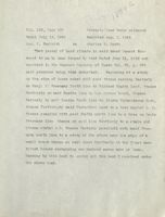
Vol. 120, Page 507
Warranty Deed Dower released
Dated July 14, 1864
Recorded Aug. 1, 1864
Coo. C. Beckwith
to
Adeline D. Heath
That parcel of land situate in said Mount Desert Con-
veyed to me by Amos Hooper by &eed dated June 11, 1845 and
recorded in the Hancock Registry of Deeds Vol. 79, I. 374
said premises being thus described. Beginning at a stump
on the edge of Goose marsh mill pond thence running Easterly
on Benj. 8. Freemans North line to Richard Heaths land, thence
Southerly on said Heaths line to his corner bound, thence
Easterly by saie Heaths Worth line to Elisha Fichardsons land,
thenco Northerlyby said Fichardson land to a tree marked 4. F.
thence parallel with said Heaths north line to a tree on Lewis
Freemans line thenco on said line Southorly to & stake and
stones marked A.TT. thence Westerly parallell with said Free-
mans north line to E stump at the shore near the edge of E
small brook thence on said shore Southerly to the first men-
tioned bounds containing one hundred acres more or less.
Moaning by this dood to convey all the land I received under
the above Need.
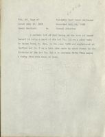
Vol. 56, Page 288.
Quit Claim Deed Dower not released
Dated Jan. 1, 1827
Recorded April 24, 1832
Francis Grindle &
to
Daniel Richerson Jr ,Elisha Rich-
David Bartlett 2nd
erson & Hugh Richerson
A certain lot of land situated in said Mount Desert,
numbered three according to & plan made by Jacob Somes in the
year 1826. Said lot contains sixty five acres &c fifty five
rods more or less.
Bounded on the north by John Smith's Jr.
line, East by Hugh Richardson's line, South by lot No. four
belonging to the said Grindle & Bartlett, West by lots No.
one & two belonging to the said Grindle &c Bartlett.
Vol. 55, Page 156
Quit-Claim Deed Dower released
Dated Feb. 21, 1827
Recorded Nov. 2, 1830
Francis Grindle & David
-
John Somes Jr. Jacob Somes &
Bartlett 2nd
to
Abraham Somes 2nd
A certain lot of land situated in Mt. Desert and is
a part of a lot numbered one hundred and eleven on a plan
made by Salem Town Junr. Esqr. in the year 1808. Said lot
contains one hundred ten acres 88 rods more or less and is
bounded on land belonging to Samuel Feed Jr. on the East and
Hugh Richardson on the North and by Jacob Learve on the West
and Samuel Millikon Jr. on the South.
Said lot was divided
and planed by Jacob Somes in 1826.
IVIDE
Vol. 59, Page 543.
Warranty Deed Dower not released
Dated July 18, 1832
Recorded Oct. 20, 1835.
Samuel Gillratrick
to
Richard Heath
Administrator of
Jocob Lurvey
is certain parcel or lot of land lying in said Mount Desert
being part of Lot, No. 111 on a planmade by Salem Towne Jr.
in 1908 and Lot No. I or a plan made by Jacob Somes in the
division of said lot No. 111 butting & bounding as follows -
beginning at a spotted tree on the Fast side of the round
rond, and running East to the Southwest corner of lot No. 4
on said plan of the division, thence North to the Southeast
corner of lot No. ? on the same plan, thence west on said lot
No. 2 to Messrs. "reeman's land, thence following said Free-
man's land to the round pond, thence following said pond to
the first, mentioned bound, containing one hundred and twenty-
three acres more or less, together with all the privileges 3
appurtenances thereunto belonging.
Vol. 92, Page 118
Cuit-Clain Deed Dower not released
Dated Feb. I, 1827
Recorded Nov. 27. 1851
Francis Grindle
to
David Bartlett 2d
All right, title and interest in and to a lot
of land being in the town of Mt. Desert, it being E part of
the lot No. 111 on a plan made by Salem Town Jr. Esquire,
and the lot No. ? on a division plan of said lot made by J&-
cob 'Somes , containing fifty five acres and forty five rods
more or less.
ROAD
Vol. 57, Page 47
Warranty Deed Dower released
Dated July 13, 1832
Recorded Oct. 16, 1832
David Bartlett
to
Israel Atherton
A certain lot of land being in the town of Mount
Desert it being a part of the lot No. Ill on a plan made
by Salem Towne Jr. Esc. in the year 1808 and registered at
Castine and No. 2.2 on a late plan made by Jacob Somes in the
division of the lot No. 117 & to contain fifty five acres
& fifty five rods more or less.
Vol. 73, Page 201.
Warranty Deed Dower released
Dated Dec. 20, 1842.
Recorded April 25, 1843
Isrnel Atherton
to
Amos Hooper
A certain lot or parcel of land situate in Mount
Desert bounded Es described as follows vis beginning at a
spotted beach tree Lewis Freeman is Israel Atherton corner
bounds thence Easterly to land owned by Daniel Richardson
thence Southerly to land owned by Richard Heath thence
Westerly to land owned by Años Hooner & Lewis Freeman thence
Northerly to the first mentioned bound it being the same lot
of land I bought of Cant. David Bartlott. Also another lot
of land situate in Mount Desert described as follows viz
twelve acros & an half acre in an undivided lot of land on
the Northern neck of the Great Fond.
st nrt
Vol. 92, Page 118
Cuit-Claim Deed Dower not released
Dated Feb. 9, 1827
Recorded Nov. 27, 1851
Francis Grindle
to
David Bartlett 2d
All right, title and interest in and to a lot
of land being in the town of Mt. Desert, it being a part of
the lot No. 111 on a rlan made by Salem Town Jr. Esquire,
and the lot No. 2 on a division plan of said lot made by ja-
cob Somes, containing fifty five acres and forty five rods
more or loss.
Vol. 59, Page 543.
Warranty Deed Dower not released
Dated July 18, 1832
Recorded Oct. 20, 1835.
Samuel Gillpstrick
to
Richard Health
Administrator of
Faccb Lurvey
A certain parcel or lot of land lying in said Mount Desert
being part of Lot, No. 111 on a planmade by Salem Towne Jr.
in 1808 and Lot No. 1 on a plan made by Jacob Somes in the
division of said lot, No. 111 butting & bounding as follows -
beginning at a spotted tree on the East side of the round
pond, and running East to the Southwest corner of lot No. 4
on said plan of the division, thence North to the Southeast
corner of lot No. 2 on the same plan, thenco west on said lot
No. 2 to Messrs. Freeman's land, thence following said Free-
man's land to the round pond, thence following said pond to
the first mentioned bound, containing one hundred and twenty-
three acres more or less, together with all the privileges &
appurtenances thereunto belonging.
SS HAA
Vol. 55, Page 156
Quit-Claim Deed Dower released
Dated Feb. 21, 1827
Recorded Nov. 2, 1830
Francis Grindle & David
-
John Somes Jr. Jacob Somes &
Bartlett 2nd
to
Abraham Somes 2nd
A cortain lot of land situated in Mt. Desert and is
a part of & lot numbered one hundred and eleven on a plan
made by Salem Town Junr. Esqr. in the year 1808.
Said lot
contains one hundred ten acres 88 rods more or less and is
bounded on land belonging to Samuel Reed Jr. or the East and
Hugh Richardson on the North and by Jacob Leervy on the West
and Samuel Milliken Jr. on the South.
Said lot was divided
and planed by Jacob Somes in 1826.
hra
Vol. 56, Page 288.
Quit Claim Deed Dower not released
Dated Jan. 1, 1827
Recorded April 24, 1832
Francis Grindle &
to
Daniel Richerson Jr Elisha Rich-
David Bartlett 2nd
erson & Hugh Richerson
A certain lot of land situated in said Mount Desert,
numbered three according to a plan made by Jacob Somes in the
year 1826. Said lot contains sixty five acres & fifty five
rods more or less.
Bounded on the north by John Smith's Jr.
line, East by Hugh Richardson's line, South by lot No. four
belonging to the said Grindle Sc Bartlett, West by lots No.
one Ec two belonging to the said Grindle & Bartlett.
Vol. 120, Page 507
Warranty Deed Dower released
Dated July 14, 1864
Recorded Aug. 1, 1864
Goo. C. Beckwith
to
Adeline D. Heath
That parcel of land situeto in said Mount Dosert Con-
veyed to me by Amos Hooper by deed dated June 11, 1845 and
recorded in the Hancock Registry of Deeds Vol. 79, p. 374
said premises being thus described. Beginning at a stump
on the edge of Goose marsh mill pond thence running Easterly
on Benj. S! Freemans North line to Richard Heaths land, thence
Southerly on said Heaths line to his corner bound, thence
Easterly by said Heaths North line to Elisha Richardsons land,
thence Northerlyby said Richardson land to a tree marked A. F.
thence parallel with said Heaths north line to a tree on Lewis
Freemans line thence on said line Southerly to a stake and
stones marked A.H. thence Westerly parallell with said Free-
mans north line to a stump at the shore near the edge of a
small brook thence on said shore Southerly to the first men-
tioned bounds containing one hundred acres more or less.
Meaning by this dood to convey all the land I received under
the above deed.
a
D.S nt
Vol. 73, Page 201.
Warranty Deed Dower released
Dated Dec. 20, 1842.
Recorded April 35, 1843
Israel Atherton
to
Amos Hooper
A certain lotnor parcel of land situate in Mount
Desert bounded Ec described as follows vin beginning at a
spotted beach tree Lewis Freeman & Israel Atherton corner
bounds thence Easterly to land owned by Daniel Richardson
thence Southerly to land owned by Richard Heath thence
Wasterly to land owned by Amos llooper & Lewis Freeman thence
Northerly to the first mentioned bound it being the same lot
of land I bought of Cant. David Bartlett. Also another lot
0 % land situate in Mount Desert described as follows viz
twelve acros & an half acre in an undivided lot of land on
the Northern neck of the Great Pond.
nd
A
Vol. 57, Page 47
Warranty Deed Dower released
Dated July 13, 1832
Recorded Oct. 16, 1832
David Bartlott
to
Israel Atherton
A certain lot of land boing in the town of Mount
Desert it being a part of the lot No. 111 on a plan made
by Salem Towne Jr. Esq. in the year 1808 and registered at
"astine and No. 2 on Ei late plan made by Jacob Somes in the
division of the lot No. 111 & to contain fifty five acres
& fifty five rods more or less.

