
From collection Jesup Library JDR Jr. Collection

Page 1
Page 2
Page 3
Page 4
Page 5
Page 6
Page 7
Page 8
Page 9
Page 10
Page 11
Page 12
Page 13
Page 14
Page 15
Page 16
Page 17
Page 18
Page 19
Page 20
Page 21
Page 22
Page 23
Page 24
Page 25
Page 26
Page 27
Page 28
Page 29
Page 30
Page 31
Page 32
Page 33
Page 34
Page 35
Page 36
Page 37
Page 38
Page 39
Page 40
Page 41
Page 42
Page 43
Page 44
Page 45
Page 46
Page 47
Page 48
Page 49
Page 50
Page 51
Page 52
Page 53
Page 54
Page 55
Page 56
Page 57
Page 58
Page 59
Page 60
Page 61
Page 62
Page 63
Page 64
Page 65
Page 66
Page 67
Page 68
Page 69
Page 70
Page 71
Page 72
Page 73
Page 74
Page 75
Page 76
Page 77
Page 78
Page 79
Page 80
Page 81
Page 82
Page 83
Page 84
Page 85
Page 86
Page 87
Page 88
Page 89
Page 90
Page 91
Page 92
Page 93
Page 94
Page 95
Page 96
Page 97
Page 98
Page 99
Page 100
Page 101
Page 102
Page 103
Page 104
Page 105
Page 106
Page 107
Page 108
Page 109
Page 110
Page 111
Page 112
Page 113
Page 114
Page 115
Page 116
Page 117
Page 118

Page 119
Page 120
Page 121
Page 122
Page 123
Page 124
Page 125
Page 126
Page 127

Page 128
Page 129
Page 130
Page 131
Page 132
Page 133
Page 134
Page 135
Page 136
Page 137
Page 138
Page 139
Page 140
Page 141
Page 142
Page 143
Page 144
Page 145
Page 146
Page 147
Page 148
Page 149
Page 150
Page 151
Page 152
Page 153
Page 154
Page 155
Page 156
Page 157
Page 158
Page 159
Page 160
Page 161
Page 162
Page 163
Page 164
Page 165
Page 166
Page 167
Page 168
Page 169
Page 170
Page 171
Page 172
Page 173
Page 174
Page 175
Page 176
Page 177
Page 178
Page 179
Page 180
Page 181
Page 182
Page 183
Page 184
Page 185
Page 186
Page 187
Page 188
Page 189
Page 190
Page 191
Page 192
Page 193
Page 194
Page 195
Page 196
Page 197
Page 198
Page 199
Page 200
Page 201
Page 202
Page 203
Page 204
Page 205
Page 206
Page 207
Page 208
Page 209
Page 210
Page 211
Page 212
Page 213
Search
results in pages
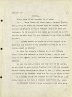
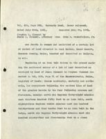
Clement Lot
146
Obse,
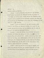
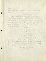
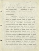
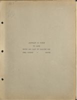
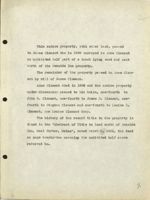
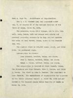
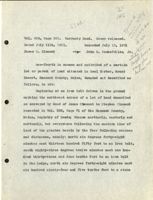
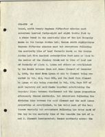
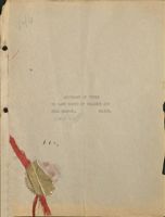
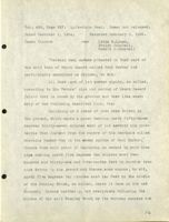
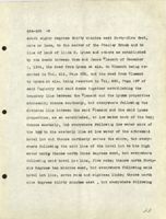
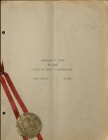
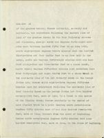
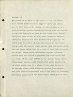
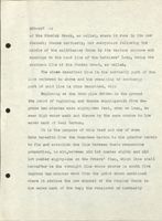
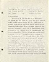
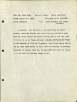
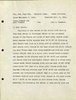
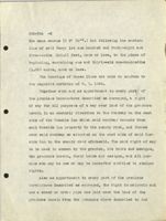
ABSTRACT OF TITLE OF A ONE-FOURTH
INTEREST IN LAND NORTH OF THE SEASIDE INN
AT SEAL HARBOR, HANCOCK COUNTY, MAINE,
BEING A PORTION OF LOT NO. 80.
J.D.R.Jr
JDRJr
lorius
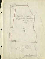
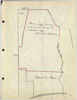
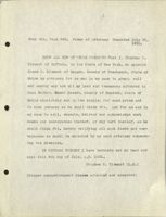
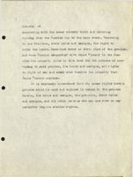
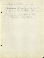
Locus is 1/4 in common
in Red -
and individual of eat enclosed
Illustrative s Ketch
only
A
of
STR
in
S.,Clement
Senside Inn
Hotel Property
B.
county Road
V
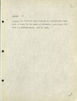
THE EARLY HISTORY OF THIS LOT UP
TO THE OWNERSHIP OF THE BINGHAMS IS THE
SAME AS PREVIOUSLY ABSTRACTED, AND IS THERE-
FORE OMITTED FROM THIS ABSTRACT.
3
ssura
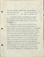
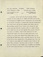
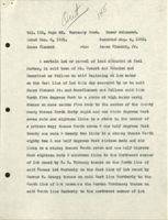
Vol. 66, Page 315. Warranty Deed.
Dated April 15, 1837.
Recorded April 25, 1839.
Alexander Baring, Henry Baring,
Joseph R. Ingersoll, William
Miller, devisees in trust of the
estate of William Bingham, and
-to- James Clements.
Joseph R. Ingersoll in his own
right by John Black Atty.
two certain lots or parcels of land, lying &
being in the town of Mount Desert in the County of Han-
cock & State of Maine, numbered Eighty & Eighty one and
butted & bounded as follows, viz: Beginning at a Spruce
tree, at the shore, on the West side of Seal Cove, (so-
called), being the Southeast corner bounds of lot number
Seventy nine, sold to John Bracy, -and running North, by
said lot number Seventy nine, two hundred & ninety rods,
to a spruce tree; thence east, one hundred & ten rods, to
a corner; thence South to the shore;- thence by the shore,
fots
round said Seal Cove, to the bounds first mentioned.-Said
580
lot number Eighty, is sixty rods wide, & contains, ninety
nine acres, & sixty rods, and lot number Eighty one, is
#81
fifty rods wide & contains ninety seven acres, 100/160
both containing one hundred & ninety seven acres, more or
less, according to a survey & plan of said town by James
Peters Surveyor.
it
)
80
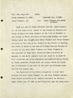
Vol. 184, Page 62.
Warranty Deed. Dower released.
Dated December 8, 1881.
Recorded Aug. 4,1882.
James Clement
-to-
James Clement Jr.
At Seal Harbor.
Beginning at low water on the East line of lot this
Jr.
day conveyed by me to said James Clement /and Amos Clement
and follows said line North five degrees West to a stake at
high water mark,-thence on same course five rods to the
center of the County road-thence North forty eight and one
sixth degrees West seven rods and eighteen links to a stake
in the center of a private way--thence north seven & one
half degrees East twenty one rods & twenty two links to a
stake--thence north eighty two & one half degrees West six-
teen rods and six links to a stake - thence South seven and
one half degrees West eighteen rods & nineteen links to t he
Northeast corner of a lot owned by R. R. Thomas-thence on
the North line of said Thomas lot Westerly to the East line
of lot owned by George W. Bracy--thence on said East line
Northerly to the South line of lot known as the Jordan Pur-
chase--thence on said South line Easterly to the Northwest
corner of lot owned by the heirs of Jacob Clement (deceased)- -
thence on the West line of said heirs lot Southerly to low
5
184-62 -2
water mark at the shore of said Seal Ha bor--thence on
low water Westerly to the first mentioned bound & contains
ninety acres more or less.
6
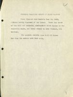
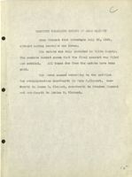
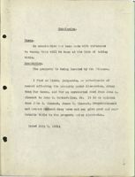
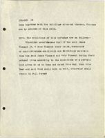
COMMENTS REGARDING ESTATE OF JAMES CLEMENT
James Clement died testate June 18, 1922,
without having disposed of our locus. Under the terms
of his will and codicils, abstracts of which appear on the
following pages, our locus passed to Amos Clement, his
brother.
The probate records show that all taxes
due from the estate have been paid.
1
Vol. 569, Page 417.
Recorded Sept. 1, 1922.
ABSTRACT OF THE WILL OF
James Clement
STATE OF MAINE.
HANCOCK SS.
PROBATE OFFICE.
Sep tember 1, 1922.
I, Robert P. King, Register of the Probate Court in
and for said County, hereby certify that the last will and
testament and codicil of James Clement, late of Mt. Desert,
in said county, deceased, was proved, approved and allowed
by the Judge of Probate for said County, at a court held
at Ellsworth on the first day of August 1922; and that the
following is a true copy of said will as devises Real Estate
in the County aforesaid.
TO WHOM IT MAY CONCERN BE IT KNOWN
That I, James Clement of Mount Desert, Hanco ck County,
Maine, being of lawful age and of sound and perfect mind
and memory do make, publish and declare this my LAST WILL
AND TESTAMENT, hereby revoking all former wills by me made,
and herein dispose of all my worldly goods and estate in
manner following:-
First: I direct my executors herein named to pay all
my just debts and funeral expenses as soon as may be ex-
8
569-417 -2
pedient after my decease.
Second: I give, bequeath and devise to my brother
Amos Clement his heirs and assigns forever, my share in
the hotel and lot at Seal Harbor called the "Seaside Inn",
together with my share of the contents thereof, and also all
the buildings and erections on the Hotel lot belonging to the
firm of A. & J. Clement.
Third: I give and devise to my said brother, Amos
Clement, his heirs and assigns forever, that part of the
former homestead lot which is now owned by me, to hold to
him and his heirs and assigns forever.
Fourth: I give and devise to my brother Charles H.
Clement, his heirs and assigns forever, the small lot of
land on the east side of Seal Harbor containing about one-
third of an acre, which is bounded on the east by the road
leading to the Steamboat Wharf, on the south by R.E.Camp-
bell's cottage lot, on the west by the shore and on the
north by land of Charles H. Clement.
Fifth: I give and devise to Charles H.C lement, his
heirs and assigns forever, my one-half interest in a lot
of wild land, in the mountains, being the same which I
a
569-417 -3
bought of the heirs of George Jordan, it being bounded
wosterly by land of E. B. Dane known as "Wild Wood Farm."
Sixth: I give and devise to my said brother Charles W.
Clement his heirs and assigns forever, my interest in a
lot of land situated at Seal Harbor, on Ox Hill so-called,
and known as the "OX Hill Lot", also my half interest
in a quarter acre lot bought of Mary I. Martin for the
purpose of obtaining a right of way to said Ox Hill Lot.
Seventh: I give and bequeath to my nephews Arthur M.
Clement and Irving 0. Clement, my naptha Launch "Dorothy".
Eighth: All the rest, residue and remainder of my
estate, real, personal and mixed, including all money on
deposit in banks or elsewhere, I give, bequeath and devise
to my brothers Amos and Charles and James N. Emery now or
formerly of Bar Harbor, in equal shares, one third to each.
Ninth: I hereby appoint Amos Clement and Charles H,
Clement to be sole executors, without bond, of this, my last
Will and testament.
IN TESTIMONY WHEREOF I have hereunto set my hand this
twenty-sourth day of September in the year of our Lord one
thousand nine hundred and eighteen.
James Clement.
569-817 -4
Signed, published and declared by the above named
James Clement as and for his last will and testament in
the presence of us, who, at his request, in his presence,
and in the presence of each other hereto subscribe our
names as witnesses thereto, on this twenty-fourth day of
September, A.D. 1918.
Harriet Shaw,
Bar Harbor, Maine.
Charles H. Wood
Bar Harbor, Maine.
Everett G. Jordan
Seal Harbor, Maine.
CODICIL TO WILL
WHEREAS I, James Clement of Mount Desert, Hancock
County, Maine, on the twenty-fourth day of September
nineteen hundred and eighteen, made and executed my last
will and testament in writing; and whereas by my saidw
will under paragraph "Third" thereof I gave and devised
to my brother, Amos Clement, his heirs and a ssigns forever,
certain real estate under the following description, to wit:
11
C
569-417 -5
"That part of the former homestead lot which is now owned
by me, now I do hereby make, publish and declare this my
Codicil to my said Last Will and Testament, to be annexed
to and taken and allowed as part thereof; and I do hereby
confirm said bequest but make this Codicil for the purpose
of more clearly describing and defining said bequest or
devise. The part of the former homestead lot which is now
owned by me is the remainder that I now own of Lot No. 80
of the Peters Survey of the town of Mount Desert.
IN TESTIMONY WHEREOF I have hereunto set my hand this
fourteenth day of April in the year of our Lord one thousand
nine hundred and nineteen.
James Clement.
Signed, published and declared by the above named
James Clement as and for a Codicil to his Last Will and
Testament, in the presence of us, who, at his request, in
his presence, and in the presence of each other hereto
subscribe our names thereto on this fourteenth day of April
A.D. 1919.
Wesley T. Paine.
Bar Harbor, Maine.
Albion W. Wallace
Bar Harbor, Maine
Charles H. Wood
1 r
569-417 -6
CODICIL.
To all whom it may concern, be it known:
That I, James Clement of Mount Desert, Hancock County,
Maine, being of sound and perfect mind and memory, do make,
publish and declare this as a Codicil to my last will and
testament, to be annexed to and taken and allowed as a part
thereof, my said last Will and Testament being dated September
24,1918.
1. I hereby revoke the whole of Article Eighth in my
said Will and dispose of the property referred to in said
Article eight as follows:
(a) From the property referred to in said Article
Eight I give and bequeath to James No Emery, now or for-
merly of Bar Harbor, Maine, the sum of one thousand dollars
($1000.)
(b) All the rest, residue and remainder of my estate,
as set forth in said Article Eighth, except the one thousand
dollars hereby bequeathed to James N. Emery, I give, bequeath
and devise to my brothers, Amos and Charles, in equal shares.
2. I hereby ratify and confirm all the rest of my said
will, including the Codicil thereto dated April 14, 1919.
IN TESTIMONY WHEREOF I have hereunto set my hand this
13
569-417 -7
twenty-third day of June, one thousand nine hundred and
twenty.
James Clement.
Signed, published and declared by the above named
James Clement, as and for a Codicil to his last Will
and Testament, in the presence of us, who, at his request,
in his presence, and in the presence of each other, hereto
subscribe our names this twent-third day of June, one
thousand nine hundred and twenty.
Fred c. Lynam,
Bar Harbor, Maine
A. B. Leland
Bar Harbor, Maine.
Chas. H. Wood.
Bar Harbor, Maine.
Amos Clement and Charles H. Clement, executors.
(Court Seal) WITNESS my hand and the Seal of the Probate
Court for said County of Hancock, the day and year first
above written.
Robert P. King, Register.
14
COMMENTS REGARDING ESTATE OF AMOS CLEMENT
Amos Clement died intestate July 28, 1928,
without having conveyed our locus.
His estate was duly probated in Waldo County.
The probate docket shows that the final account was filed
and settled.
All taxes due from the estate have been
paid.
Our locus passed according to the petition
for administration one-fourth to John C.Clement, one-
fourth to James D. Clement, one-fourth to Stephen Clement
and one-fourth to Louise R. Clement.
15
DEEDS GIVEN TO ESTABLISH EASTERN
BOUNDARY OF LOCUS
Squra
Vol. 426, Page 527. Quit-claim Deed. Dower not released.
Dated December 1, 1904.
Recorded February 6, 1906.
James Clement
-to-
Linda M.Lynam,
Evelyn Campbell,
Robert E.Campbell
"Certain real estate situated in that part of
the said town of Mount Desert called Seal Harbor and
particularly described as follows, to wit:
All that part of lot number eighty, so called,
according to the Peters' plan and survey of Mount Desert
Island that is owned by the grantor and that lies east-
erly of the following described line, viz:
Beginning at a piece of iron pipe driven in
the ground, which marks a point bearing north fifty-three
degrees thirty-seven minutes west of and seventy and nine-
tenths feet distant from the centre of the man-hole called
Man-hole Number One in the sewer system of Seal Harbor;
thence from said point of beginning so marked by said iron
pipe running north five degrees ten minutes east two-
hundred and thirty-one and five-tenths feet to another iron
pipe driven in the ground and thence same course, to wit,
north five degrees ten minutes east ten feet to the middle
of the Stanley Brook, so called, where it runs in its new
channel; thence northerly, but everywhere following the
middle of the said Stanley Brook by its various courses and
16
426-527 -2
wingings to the head line of the Settlers' Lots, being
the southern line of the Jordan tract, so called.
The above described line is the northerly part
of the line referred to above and the remaining or south-
erly part of said line is thus described, viz:
Beginning at the iron pine driven in the ground
the point of beginning and thence running south five de-
grees ten minutes west eighty-two feet, more or less, to
mean high water mark and thence by the same course to low
water mark of Seal Harbor.
It is the purpose of this deed and one of even
date herewith from the Grantees herein to the grantor here-
in to fix and establish the line between their respective
properties, to wit, between old lot number eighty and old
lot number eighty-one on the Peters' Plan, which line shall
hereafter be the straight line whose course is south five
degrees ten minutes west from the point above mentioned
where it strikes the new channel of the Stanley Brook to
low water mark of the bay; the remainder or northerly
portion of the dividing line between the two said properties
to be the middle of the Stanley Brook as heretofore, except
where a new channel has now been dug for said brook.
This deed and one of even date herewith from
the grantees herein to the grantor herein are to be con-
1
strued together.
426-527
-3
There is expressly excepted from the premises
described as conveyed in this deed and reserved the right
to use and maintain a sewer in the course and location
where it now exists from remaining land of James Clement
and land of James and Amos Clement to the point of connect-
ion with the main sewer at Seal Harbor."
18
ssu.s
Vol. 414, Page 332.
Quit-claim Deed. Dower not released.
Dated December 1, 1904.
Recorded December 24,1904.
Linda M. Lynam,
Evelyn Campbell,
Robert E.Campbell
-to-
James Clement.
"Certain real estate situated in that part of the said
town of Mount Desert called Seal Harbor and particularly
described as follows, to wit: All that part of lot number
eighty-one so called according to the Peters' Plan and Sur-
vey of Mount Desert Island that is owned by the grantors
and that lies westerly of the following described line, viz:
Beginning at a piece of iron pipe driven in the ground;
which marks a point bearing north fifty-three degrees thirty-
seven minutes east of and seventy and nine-tenths feet distant
from the centre of the man-hole called Man-hole Number one
in the sewer system of Seal Harbor; thence from said Point
of beginning so marked by said iron pine running north five
degrees ten minutes east two-hundred and thirty-one and five-
tenths feet to another iron pipe driven in the ground and
thence same course, to wit, north five degrees ten minutes
east ten feet to the middle of the Stanley Brook, so called,
where it runs in its new channel; thence northerly but
19
414-332
-2
everywhere following the middle of the said Stanley Brook
by its various courses and windings to the head line of
the Settlers' Lots, being the southern line of the Jordan
tract, so called.
The above described line is the northerly part
of the line referred to above and the remaining or south-
erly part of said line is thus described, viz:
Beginning at the iron pipe driven in the ground
the point of beginning and thence running south five de-
grees ten minutes west eighty-two feet, more or less, to
mean high water mark and thence by the same course to low
water mark of Seal Harbor.
It is the purpose of this deed and one of even
date herewith. from the grantee herein to the grantors herein
to fix and establish the line between their respective pro-
perties, to wit, between old lot number eighty and old lot
number eighty-one on the Peters' Plan, which line shall
hereafter be the straight line whose course is south five
degrees ten minutes west from the point above mentioned
where it strikes the new channel of the Stanley Brook to
low water mark of the bay; the remainder or northerly por-
tion of the dividing line between the two said properties
20
414-332
-3
to be the middle of the Stanley Brook as heretofore,
except where a new channel has now been dug for said
brook.
This deed and one of even date herewith from
the grantee herein to the grantors herein are to be con-
strued together."
21
DEEDS GIVEN WHICH ESTABLISH
SOUTHERN BOUNDARY OF
LOCUS.
lottus
sswing cath
Vol. 464, Page 456.
Warranty Deed.
Grantor unmarried.
Dated December 4, 1909.
Recorded Dec. 17, 1909.
James Clement
-to-
Amos Clement.
one-half part in common and undivided of the following
described lot or parcel of land situate in Seal Harbor, in
the town of Mount Desert aforesaid, and particularly bounded
and described in the whole as follows, to wit:-
Beginning at a stone post set in the ground in the
westerly line of the hotel lot of James and Amos Clement,
said stone post marking the northeasterly corner of the
lot of Sarah M. Emery; thence north sixty-five degrees forty-
seven minutes west, but everywhere following the
northerly line of said Emery lot, one hundred and forty-eight
and five-tenths feet to a stone post marking her northwesterly
corner; thence north nine degrees thirty minutes east four
hundred and twenty-five and seven-tenths feet to a stone post
set for a corner; thence south eighty degrees thirty minutes
east one hundred and forty-four and three-tenths feet to an
iron bolt in a bowlder set for the purpose of marking this
line; thence same course, to wit, south eighty degrees thirty
minutes east seven hundred and thirty-two and seven-tenths
feet to a yellow birch tree; thence same course, to wit,
732.7
4.4.13
n'v
s
464-456 -2
south eighty degrees thirty minutes east forty-five feet,
more or less, to the center of the Stanley Brook and to
line of land of Linda M. Lynam and others as established
by the deeds between them and James Clement of December
1, 1904, the deed from Lynam et als. to Clement being re-
corded in Vol. 414, Page 332, and the deed from Clement
to Lynam et als. being recorded in Vol. 426, Page 527 of
said Registry and said deeds together establishing the
boundary line between the Clement and the Lynam properties
aforesaid; thence southerly, but everywhere following the
division line between the said Clement and the said Lynam
properties, as so established, to low water mark of the bay;
thence westerly, but everywhere following low water mark of
the bay to the easterly line at low water of the a foresaid
hotel lot and thence northerly across the shore, but every-
where following the said line of the (hotel lot to the high
water marky thence north three degrees west, but everywhere
following said hotel lot line, five rods; thence north forty-
six degrees ten minutes west, but everywhere following said
hotel lot line, seven rods and eighteen links; thence north
nine degrees thirty minutes east, but everywhere following
V3
464-456 -3
said hotel lot line, twenty-one rods and twenty-two
links to its northeastern corner; thence north eighty
degrees thirty minutes west, but everywhere following
the northerly line of said (hotel lot, sixteen rods and
six links to its northwestern corner; thence south nine
degrees thirty minutes west, but everywhere following
the westerly line of said hotel lot nine rods and nine-
teen links to the point of beginning. The courses of
the lines of the hotel lot are the courses in 1909 accord-
ing to the survey of C.P. Simpson.
24
538-74 IVI
-
SS wta cath
Vol. 538, Page 71. Warranty Deed! Grantor unmaeried.
Dated November 9, 1917.
Recorded Nov.23,1917.
James Clement
-to-
Stephen C. Clement.
At Seal Harbor.
Beginning at an iron bolt set in the ground about
one and one half feet north of a birch tree in the easterly
line of land of John D .Rockefeller, Jr.; thence South 80°
30'East, three hundred forty-seven and six tenths (347.6)
feet to a corner; thence South 9° 30'West, forty-nine and
sixty-five hundredths (49.65) feet to the northwest corner
of land of A. & J. Clement; thence in the same course two
hundred seventy-three and seven tenths (273.7) feet to the
northeast corner of a lot of land this day conveyed to
James Donald Clement; thence North 80° 30'West, but every-
where following the northern line of said James Donald
Clement lot, three hundred twenty-eight and six tenths
(328.6) feet to the northwest corner of said last mentioned
lot; thence North 6° 8'East, Eighty-three and six tenths
(83.6) feet to a stone post, the southeast corner of said
Rockefeller land, thence in the same course, but everywhere
following said easterly line of Rockefeller, two hundred
forty and two tenths (240.2) feet to the point of beginnning.
Containing two and fifty one hundredths (2.50) acres, more
23
538-71
-2
or less.
The bearings hereinabove given refer to the mereddan
of 1909.
2'
DEED GIVEN WHICH ESTABLISHES PART
OF WESTERN BOUNDARY OF LOCUS, AND AN OPTION.
Lot
147
Isusa
Vol. 502, Page 68.
Quit-claim Deed
Dower released.
Dated August 29, 1913.
Recorded Oct. 30, 1913.
George L. Stebbins
-to-
John D.Rockefeller, Jr.
in Mount Desert.
Beginning at a stake and stones in the south
line of the George N. and John S. Jordan lot, so called,
marking the northeast corner of land of the Cooksey Realty
Company and the northwest corner of the James Clement lot,
known as Lot No. 80 on Peters' Plan of Mount Desert Island;
thence south eighty-three degrees fifty-one minutes east,
but always following the said south line of the Jordan lot
five hundred and fifty-nine and sixty-five one-hundredths
feet to a stone post set in the ground; thence south twenty
degrees fifty-four minutes west seventeen hundred and forty-
eight and eight-tenths feet to a stone post set in the ground;
thence south six degrees forty-eight minutes west six hundred
and ninety-four and five-tenths feet to an iron bolt in
the ledge; thence north eighty-three degrees twelve minutes
west one hundred and thirty-three and forty-five one-hundred-
ths feet to an iron bolt set in the ground in the east line
of land of said Cooksey Realty Company; thence northerly but
always following the east line of land of the Cooksey Realty
27
502-68
-2
Company two thousand three hundred and eighty-four feet,
more or less, to the place of beginning, containing fif-
teen and 58/100s acres, more or less.
28
levoa
Vol. 283, Page 195
Agreement to convey.
Dated September 24,1894.
Recorded Oct. 8, 1894.
James Clement
-to-
Geo. B. Cooksey.
do hereby promise, covenant and agree to and with
said Cooksey and his heirs and assigns, to sell and con-
vey to him by good and sufficient deed or deeds, carrying,
perfect title, all my ownership of what is called and known
as Lot number Eighty (80) in Seal Harbor in said Mt. Desert,
which lies north of a line to be run across the lot about
east and west immediately north of the present cultivated
portion of said lot said line to be run later by agreement
and a good and sufficient right of way for all purposes of
a way and for drainage and sewerage from said tract to the
highway; said right of grainage & sewerage extending to the
sea over remaining land of grantor; at any time within one
year from this date at the request of said Cooksey for the
purchase price of two hundred dollars per acre to be paid
(if said tract is taken under this contract as follows:
viz: all by mortgage and note or other personal obligation
of the owner for the whole purchase price, made payable upon
the death of said James Clement, with interest payable annually
29
C
283-195 -2
at the rate of five per cent per annum, with the further
understanding and agreement that said mortgage instead
of including the whole tract in one mortgage may be com-
prised in several smaller mortgages covering portions of
said tract so long as the aggregate of the land in said mort-
gages equals the whole tract in area and the total amount
so secured by said mortgages equals the total purchase price
herein agreed upon. It being also understood that Mr.
Clement's assent is essental to any division of said tract
hereunder.
It is further understood and agreed that in case the
owner of the land and the signer of the notes or other
obligations above mentioned should not be Mr. Cooksey it
shall be and said signer shall be same person who shall be
satisfactory to Mr. Clement before he shall be under any
obligation to make a conveyance hereunder.
It is also further and later agreed after having viewed
the land that the tract herein a greed to be conveyed shall
be all that portion of said lot north of a line extending
from & through a small clump of ash trees on the easterly
side of the present field westerly at right angles to the
western line of said lot & to said western line.
3 d
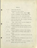
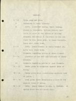
SUMMARY AND CONCLUSION
C
SUMMARY.
1 - 2
Title page and plan.
3
Reference to early history.
4
1837. Alexander Baring, Henry Baring,
Joseph R. Ingersoll, William Miller, dev-
isees in trust of the estate of William
Bingham, and Joseph R. Ingersoll in his own
right by John Black Atty. to James Clements.
Locus with other land.
5 - 6
1881. James Clement to James Clement Jr.
Locus with other land.
7
Comments regarding estate of James Clement
8 - 14
Abstract of the will and codicils of James
Clement.
15
Comments regarding estate of Amos Clement.
16 - 21
Deeds given to establish eastern line of
locus.
22 - 26
Deeds given which establishes southern line
of locus.
27 - 28
Deed given which establishes a part of the
western bound of locus.
29 - 30
1894. James Clement to Geo. B. Cooksey. An
Option which was not acted upon.
31
C
CONCLUSION.
Chain of Title.
Our locus is a portion of Lot No. 80. A
great many conveyances have been made out of Lot No.
80 and our locus is one-fourth of so much of Lot No.
80 as lies north of the line which establishes the
Seaside Inn property, excepting, however, a portion
which has been conveyed to Mr. Rockefeller.
Dower.
In all cases where necessary dower has been
released.
Probate.
In both instances where a party owning the
locus has deceased the probate proceedings seem to be
complete in all respects.
Bounds.
Io understand from Mr. Simpson that the bounds
32
C
of the lot are clear, and that he surveyed the pro-
perty a few years ago for the Clements.
Taxes.
Taxes for the year 1930 have been pai d.
Except as shown under our heading "Conclusion"
I find no liens, judgments, or attachments affecting
our locus of record. It is thereformy opinion that John C.
Clement has and can give good and marketable title to the
one-fourth interest in the lot.
Dated March 4, 1931
at one o'clock PIM.
33
145
ABSTRACT OF TITLE
TO LAND
NORTH AND EAST OF SEASIDE INN
SEAL HARBOR
-
MAINE
Locus
North line of tradth Conged Jz Junes to Amo
i45
of
Locus
of
Hotel
for
Illustrature
Smith
only
Roadi
Sea
/
This entire property, with other land, passed
to James Clement who in 1909 conveyed to Amos Clement
an undivided half part of a tract lying east and next
north of the Seaside Inn property.
The remainder of the property passed to Amos Clem-
ent by will of James Clement.
Amos Clement died in 1928 and the entire property
under discussion passed to his heirs, one-fourth to
John C. Clement, one-fourth to James D. Clement, one-
fourth to Stephen Clement and one-fourth to Louise R.
Clement, now Louise Clement Gray.
The history of the record title to the property is
10 und in the "Abstract of Title to land north of Seaside
Inn, Seal Harbor, Maine", dated March 4, 1931, the deed
on page twenty-two covering the undivided half above
referred to.
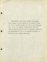
2
Reference is made to the Seaside Inn property.
This property is shown roughly on the sketch on page
one, and is defined by deed set forth on the following
page to A. & J. Clement, Incorporated. This Cor-
poration was organized in 1923 as appears by Certificate
of organization on file in the Registry of Deeds , an
extract of which appears following.
3
576-474
Vol. 576, Page 474.6 Warranty Deed. Grantor widower.
Dated April 14, 1923.
Recorded May 15, 1923.
Amos Clement
-to-
A. & J. Clement Incorporated.
A certain lot or parcel of land with the buildings
thereon situated at Seal Harbor, so called, in said Mount
Desert, being the Seaside Inn lot and buildings thereon
formerly owned by me and James Clement now deceased,-his
interest therein having been devised to me under his will.
The same being bounded and described as follows, to wit:-
Bounded on the north and east by land formerly owned
by said James Clement and devised to me under his will;
on the south by the waters of Seal Harbor, so called; and
the highway; on the west by land of one Thomas and land
of one Lynam, containing five (5) acres more or less.
H
Book 4, Page 74. Certificate of Organization.
The A. & J. Clement Inc. was organized under
Sec. 7, of Chapter 51 of the Revised Statutes of the
State of Maine, March 21, 1923.
The purposes, among other things, are to own, buy,
sell, rent, lease, hold and manage real estate and
personal property, especially to buy, own and operate
the hotel at Seal Harbor, Maine, known as the Seaside
Inn, etc.
The capital stock is $30,000 common stock, par value
$100. No preferred stock.
Subscription to stock:-
Amos Clement, Belfast, Maine, one share.
John R. Dunton, Belfast, Maine, one share.
Ralph I. Morse, Belfast, Maine, one share.
The corporation is located at Mount Desert, Maine.
The directors are Amos Clement, John R. Dunton, and Ralph
I. Morse. The Clerk is John R. Dunton. The President is
Amos Clement. The certificate of organization was approved
by the Deputy Attorney General on March 22, 1923 and re-
corded in the Hancock County Maine Registry of Deeds on
March 24, 1923.
5
Conclusion.
Taxes.
No examination has been made with reference
to taxes, this will be done at the time of taking
title.
Boundaries.
The property is being located by Mr. Simpson.
I find no liens, judgments, or attachments of
record affecting the property under discussion, other
than for taxes, and for an unrecorded deed from John C.
Clement to John D. Rockefeller, Jr. It is my opinion
that John C. Clement, James D. Clement, StephenClement
and Louise Clement Gray have and can give good and mar
ketable title to the property und er discussion.
Dated July 1, 19311
6
O
SUPPLEMENT
A
146
ssta
paco plan alma ,line A
nyta roller Nb
Vol. 634, Page 522. Warranty Deed. Dower released.
Dated March 6th, 1931.
Recorded July 13, 1931.
John C. Clement
-to- John D. Rockefeller, Jr.
one fourth in common and undivided of a certain
lot or parcel of land situated in Seal Harbor, Mount
Desert, Hancock County, Maine, bounded and described as
follows: to wit:
Beginning at a point in the east line of lot of
land described as conveyed by deed of James Clement to
Stephen Clement recorded in Vol. 538, Page 71 of the Hancock,
County, Maine, Registry of Deeds, said point being forty-
nine and six tenths feet southerly of the northeast corner
of said lot; thence north ten degrees ten minutes east
but everywhere following the east line of said Clement lot
above referred to forty-nine and six tenths feet more or
less to the northeast corner of said lot; thence north
seventy-nine degrees fifty minutes west but everywhere
following the northerly line of said Clement Lot three hun-
dred forty-seven and six tenths feet more or less to a
iron bolt marking the northwest corner of said Clement
Lot, said iron bolt being in the easterly line of land
634-522 -2
of the grantee herein; thence northerly, easterly and
northerly, but everywhere following the eastern line of
land of the grantee herein by the four following courses
and distances, namely: north six degrees forty-eight min-
utes east thirteen hundred fifty feet to an iron bolt,
south eighty-three degrees twelve minutes east one hundred
thirty-three and four tenths feet to an iron bolt in the
ledge, north six degrees forty-eight minutes east six hun-
dred ninety-four and five-tenths feet to a stone bound,
north twenty degrees fifty-four minutes east seventeen hun-
dred forty-eight and eight tenths feet to a stone bound in
the southerly line of the lot formerly known as the George
Jorden Lot; thence south eighty-three degrees fifty-one
minutes east but everywhere following the southerly line of
land formerly known as the George Jordan Lot five hundred
seventy-five feet, more or less, to a bound in the center
of the Stanley Brook; thence southerly by the center of
said stanley Brook to a point bearing south seventy-nine
degrees fifty minutes East of and nine hundred twenty-two
feet, more or less, distant from the point of beginning;
thence north seventy-nine degrees fifty minutes west nine
hundred twenty-two feet, more or less, to the place of beginning.
B
145
sera
mds,
Patrici
80
June,
#
amoa
Vol. 634, Page 523. Warranty Deed. Dower released.
Dated July 6th, 1931.
Recorded July 13, 1931.
John C. Clement
-to-
John D. Rockefeller, Jr.
theys
one fourth part in common and undivided of a certain
lot or parcel of land situated in Seal Harbor, Mount
Desert, Hancock County, Maine, bounded and described as
follows, to wit:
Beginning at a stone post set in the ground in the
westerly line of the Seaside Inn lot of A. & J. Clement
Incorporated, said stone post marking the northeasterly
corner of the lot now or formerly of Sarah M. Emery; thence
north sixty-five degrees seven minutes west, but everywhere
following the northerly line of said Emery Lot, one hundred
and forty-eight and five-tenths feet to a stone post mark-
ing the northwesterly corner thereof; thence north ten de-
grees ten minutes east four hundred and twenty-five and
seven-tenths feet to a stone post set for a corner; thence
south seventy-nine degrees fifty minutes east, but follow-
ing land heretofore conveyed by me to said grantee, nine
hundred twenty-two feet to the center of the Stanley Brook
634-523 -2
and to line of land now or formerly of Linda M. Lynam
and others as established by the deeds between them
and James Clement of December 1, 1904, the deed from
Lynam et als. to Clement being recorded in Vol. 414,
Page 332, and the deed from Clement to Lynam et als. be-
ing recorded in Vol. 426, Page 527 of said Registry and
said deeds together establishing the boundary line between
the Clement and the Lynam properties aforesaid; thence
southerly, but everywhere following the division line be-
tween the said Clement and the said Lynam properties, as
so established, to low water mark of the bay; thence west-
erly, but everywhere to llowing low water mark of the bay
to the easterly line at low water of the aforesaid Seaside
Inn lot and thence northerly across the shore, but e very-
where following the said line of the Seaside Inn lot to
the high wayer mark; thence north two degrees twenty min-
utes west, but everywhere following said Seaside Inn lot
line, eighty-two and five-tenths feet; thence north forty-
five degrees thirty minutes west, but everywhere to llowing
said Seaside Inn Lot line, one hundred twenty-seven and
four-tenths feet; thence north ten degrees ten minutes east,
634-523 -3
but everywhere following said Seaside Inn lot line,
three hundred sixty-one feet to itsnortheastern corner,
thence north seventy-nine degrees fifty minutes west, but
everywhere following the northerly line of said Seaside
Inn lot, two hundred sixty-eight feet to its northwestern
corner; thence south ten degrees ten minutes west, but
everywhere following the westerly line of said Seaside Inn
lot one hundred sixty-one feet to the paint of beginning.
Containing ten and one-tenth acres more or less.
145
146
ssid
Vol. 634, Page 523. Warranty Deed. Dower released.
Dated July 11th, 1931.
Recorded July 13, 1931
James D. Clement
-to-
John D. Rockefeller,
0.2
Jr. middle
one-fourth in common and undivided of a certain
Nafal plus
bravior USA
lot or parcel of land situated in Seal Harbor, Mount
Desert, Hancock County, Maine, bounded and described as
follows, to wit:
Beginning at an iron bolt driven in the ground
marking the northwest corner of a lot of land described
as conveyed by deed of James Clement to Stephen Clement
recorded in Vol. 538, Page 71 of the Hancock County,
Maine, Registry of Deeds; thence northerly, easterly and
northerly, but everywhere following the eastern line of
land of the grantee herein by the four following courses
and distances, namely: north six degrees forty-eight
minutes east thirteen hundred fifty feet to an iron bolt,
south eighty-three degrees twelve minutes east one hun-
dred thirty-three and four tenths feet to an iron bolt
in the ledge, north six degrees forty-eight minutes east
six hundred ninety-four and five tenths feet to a stone
634-523 -2
bound, north twenty degrees fifty-four minutes east
seventeen hundred forty-eight and eight tenths feet to a
stone bound in the southerly line of the lot formerly
known as the George Jordan Lot; thence south eighty-three
degrees fifty-one minutes east but everywhere following
the southerly line of land formerly known as the George
Jordan Lot five hundred seventy-five feet, more or less to
the center of the Stanley Brook and to line of land now or
formerly of Linda M. Lynam and others as established by the
deeds between them and James Clement of December 1, 1904,
the deed from Lynam et als to Clement being recorded in
Vol. 414, Page 332, and the deed from Clement to Lynam et
als being recorded in Vol. 426, Page 527 of said Registry
and said deeds together establishing the boundary line be-
tween the Clement and the Lynam properties aforesaid; thence
southerly, but everywhere following the division line be-
tween the said Clement and the said Lynam properties so es-
tablished, to low water mark of the bay; the nce westerly
but everywhere following low water mark of the bay to the
easterly line of the Seaside Inn Lot of A. and J. Clement
Incorporated; thence northerly across the shore but every-
634-523 -3
where following the said line of the Seaside Inn lot to
a point south seventeen degrees twenty-one minutes west
from a stone post set in the ground at an angle in the
north line of the County Road; thence north seventeen de-
grees twenty-one minutes east to high water mark; thence
on same course, to wit, north seventeen degrees twenty-one
minutes east one hundred thirty-five feet more or less to
said stone post; thence continuing same course, to wit,
north seventeen degrees twenty-one minutes east nine hundred
fifty-eight and two tenths feet to a piece of iron pipe
driven in the ground; thence north two degrees eight minutes
east six hundred nineteen and three tenths feet to a piece
of iron pipe driven in the ground; thence north seventy-one
degrees fifty-two minutes west two hundred si xty-seven and
nine tenths feet to a piece of iron pipe driven in the
ground; thence south twenty-eight degrees eight minutes
west seven hundred ten and eight tenths feet to a piece of
iron pipe driven in the ground; thence south sixty-six de-
grees five minutes west five hundred eighty-nine feet to
the point of beginning. Containing eighty-three and three
tenths acres, more or less.
145
SS+a
146 miledo Notfer orange
louin
dand
Vol. 634, Page 525. Warranty Deed. Dower released.
J lesia
mone
Dated July 11th, 1931.
Recorded July 13, 1931.
Louise Clement Gray
-to- John D. Rockefeller, Jr.
one-fourth in common and undivided of a certain lot
or parcel of land situated in said Seal Harbor, bounded
and described as follows, to wit:-
Beginning at an ir on bolt driven in the ground mark-
ing the northwest corner of a lot of land described as con-
veyed by deed of James Clement to Stephen Clement recorded
in Vol. 538, Page 71 of the Hancock County, Maine, Registry
of Deeds; thence northerly, easterly, and northerly, but
everywhere following the eastern line of land of the
grantee herein by the four following courses and distances,
namely; north six degrees forty-eight minutes east thirteen
hundred fifty feet to an iron bolt, south eighty-three
degrees twelve minutes east one hundred thirty-three and
four tenths feet to an iron bolt in the ledge, north six
degrees forty-eight minutes east six hundred ninety-four
and five tenths feet to a stone bound, north twenty de-
grees fifty-four minutes east seventeen hundred forty-
eight and eight tenths feet to a stone bound in the southerly
C
634-525 -2
line of the lot formerly known as the George Jordan lot;
thence south eighty-three degrees fifty-one minutes east
but everywhere following the southerly line of land form-
erly known as the George Jordan Lot five hundred seventy-
five feet, more or less to the center of the Stanley Brook
and to line of land now or formerly of Linda M. Lynam and
others as established by the deeds between them and James
Clement of December 1, 1904, the deed from Lynam et als
to Clement being recorded in Vol. 414, Page 332, and the
deed from Clement to Lynam et als being recorded in Vol.
426, Page 527 of said Registry and said deeds together es-
tablishing the boundary line between the Clement and the
Lynam properties aforesaid; thence southerly, but everywhere
following the division line between the said Clement and
the said Lynam properties so established, to low water
mark of the bay; thence westerly but everywhere following
low water mark of the bay to the easterly line of the Sea-
side Inn Lot of A. and J. Clement Incorporated; thence
northerly across the shore but everywhere following the
said line of the Seaside Inn Lot to a point south seventeen
degrees twenty-one minutes west from a stone post set in
634-525 -3
the ground at an angle in the north line of the County
road; thence north seventeen degrees twenty-one minutes
east to high water mark; thence on same course, to wit,
north seventeen degrees twenty-one minutes east one hundred
thirty-five feet more or less to said stone post; thence
continuing same course, to wit, north seventeen degrees
twenty-one minutes east nine hundred fifty-eight and two
tenths feet to a piece of iron pipe driven in the ground;
thence north two degrees eight minutes east six hundred nine-
teen and three tenths feet to a piece of iron pipe driven in
the ground; thence north seventy-one degrees fifty-two
minutes west two hundred sixty-seven and nine-tenths feet
to a piece of iron pipe driven in the ground thence south
twenty-eight degrees eight minutes west seven hundred ten
and eight tenths feet to a piece of iron pipe driven in
the ground; thence south sixty-six degrees five minutes
west five hundred eighty-nine feet to the point of beginning.
Containing eighty-three and three tenths scres more or less.
1+5
Book 634, Page 555. Power of Attorney Recorded July 20,
1931.
KNOW ALL MEN BY THESE PRESENTS That I, Stephen C.
Clement of Buffalo, in the State of New York, do appoint
James D. Clement of Bangor, County of Penobscot, State of
Maine my attorney for me and in my name to grant, sell
and convey any and all my land and tenements situated in
Seal Harbor, Mount Desert, County of Hancock, State of
Maine absolutely and in fee simple, for such price and
to such persons as he shall think fit. And for me and in
my name to sell, execute, deliver and acknowledge such
deeds and conveyances thereof, or any part thereof, as he
shall think fit, hereby ratifying all such deeds and con-
veyances as shall be executed by my said attorney concern-
ing the premises.
IN WITNESS WHEREOF I have hereunto set my hand and
seal this 9th day of July, A.D. 1931.
Stephen C. Clement (L.S.)
(Proper acknowledgment chase attached and executed)
145
Book 634, Page 555. Power of Attorney
Recorded July 20, 1931.
KNOW ALL MEN BY THESE PRESENTS THAT I, Jean M.
Clement of Buffalo, in the State of New York, do appoint
James D. Clement of Bangor, County of Penobscot, State of
Maine my attorney for me and in my name to grant, sell
and convey any and all my lands and tenements situated in
Seal Harbor, Mount Desert, County of Hancock, State of
Maine, or any interest therein, including my right and
title by descent in the land or lands of my husband,
Stephen C. Clement, so situated, absolutely and in fee
simple, for such price and to such persons as he shal 1
think fit. And for me and in my name to sell, execute,
deliver and acknowledge such deeds and conveyances thereof,
or any part thereof, as he shall think fit, hereby ratify-
ing all such deeds and conveyances as shall be executed
by my said attorney concerning the premises.
IN WITNESS WHEREOF I have hereunto set my hand and
seal this 13th day of July, A.D. 1931.
Jean M. Clement (L.S.)
(Properly acknowledged before a Notary Public).
145
&
146
SSFA
Vol. 634, Page 556. Warranty Deed. Dower released.
Dated July 20th, 1931.
Recorded July 20, 1931.
Stephen C. Clement by
James D. Clement, Attorney -to- John D. Rockefeller, Jr.
one fourth in common and undivided of a certain lot
or parcel of land situated in Seal Harbor, Mount Desert,
Hancock County, Maine, bounded and described as follows,
to wit:
Beginning at an iron bolt driven in the ground mark-
ing the northwest corner of a lot of land described as
conveyed by deed of James Clement to Stephen Clement re-
corded in Vol. 538, Page 71 of the HancockCounty, Maine,
Registry of Deeds; thence northerly, easterly and north-
erly, but everywhere following the eastern line of land
of the grantee herein by the four following courses and
distances, namely; north six degrees forty-eight minutes
east thirteen hundred fifty feet to an iron bolt, south
eighty-three degrees twelve minutes east one hundred
thirty-three and four tenths feet to an iron bolt in the
ledge, north six degrees forty-eight minutes east six
hundred ninety-four and five-tenths feet to a stone
634-556 -2
bound, north twenty degrees fifty-four minutes east
seventeen hundred forty-eight and eight tenths feet to
a stone bound in the southerly line of the lot formerly
known as the George Jordan Lot; thence south eighty-three
degrees fifty-one minutes east but everywhere following
the southerly line of land formerly known as the George
Jordan Lot five hundred seventy-five feet more or less to
the center of the Stanley Brook and to line of land now
of formerly of Linda M. Lynam and others as established
by the deeds between them and James Clement of December
1, 1904, the deed from Lynam et als to Clement being re-
corded in Vol. 414, Page 332, and the deed from Clement
to Lynam et als being recorded in Vol. 426, Page 527 of
said Registry and said deeds together establishing the
boundary lines between theClement and the Lynam properties
aforesaid; thence southerly, but everywhere following the
division line between the said Clement and the said Lynam
properties so established, to low water mark of the bay;
thence westerly but everywhere following low water mark of
the bay to the easterly line of the Seaside Inn Lot of A.
and J. Clement Incorporated; thence northerly across the
634-556
-3-
shore but everywhere following the said line of the
Seaside Inn Lot to a point south seventeen degrees twenty-
one minutes west from a stone post set in the ground at
an angle in the north line of the County Road; thence
north seventeen degrees twenty-one minutes east to high
water mark; thence on same course, to wit, north seven-
teen degrees twenty-one minutes east one hundred thirty-
five feet more or less to said stone post; thence contin-
uing same course, to wit, north eventeen degrees twenty-
one minutes east nine hundred fifty-eight and two tenths
feet to a piece of iron pipe drive in the ground; thence
north two degrees eight minutes east six hundred nineteen
and three tenths feet to a piece of iron pipe driven in
the ground; thence north seventy-one degrees fifty-two
minutes west two hundred sixty-seven and nine tenths feet
to a piece of iron pipe driven in the ground; thence
south twenty-eight degrees eight minutes west seven hun-
dred ten and eight tenths feet to a piece of iron pipe
driven in the ground; thence south fixty-six degrees
five minutes west five hundred eighty-nine feet to the
point of beginning. Containing eighty-three and three
tenths acres, more or less.
CONVEYANCE OF PART
OF ORIGINAL LOT
55om
Vol. 634, Page 557. Quit-claim Deed. Dower released.
Dated July 11, 1931
Recorded July 20, 1931.
maryo
John D.Rockefeller, Jr., -to- A. and J. Clement,
Incorporated.
corry
dale P e. Class
part
one-fourth/in common and undivided of a certain lot
to
or parcel of land situated in Seal Harbor, in said town
of Mount Desert, bounded and described as follows, to
wit:-
Beginning at an ir on bolt driven in the ground
marking the northwest corner of a lot of land described
as conveyed by deed of James Clement to Stephen Clement
recorded in Vol. 538, Page 71 of the Hancock County,
Maine, Registry of Deeds; thence north sixty six de-
grees five minutes east five hundred eighty nine feet
to an iron pine driven in the ground; thence north twenty
eight degrees eight minutes east seven hundred ten and
eight tenths feet to a piece of iron pipe driven in the
ground; thence south seventy one degrees fifty two
minutes east two hundred sixty seven and nine tenths
feet to a piece of iron pine driven in the ground;
thence south two degrees eight minutes west six hundred
nineteen and three tenths feet to a piece of iron pipe
634-557 -2
driven in the ground; thence south seventeen degrees
twenty one minutes west nine hundred fifty eight and
two tenths feet to a stone post set in the ground at
an angle in the north line of the County Road; thence
on same course to wit, south seventeen degrees twenty
one minutes west one hundred thirty five feet more or
less to high water mark; thence on same course to the
easterly line of the Seaside Inn Lot of A. and J.
Clement Incorporated; thence northerly across the
shore, but everywhere following the said line of the
Seaside Inn Lot to the high water mark; thence north
two degrees twenty minutes west, but everywhere follow-
ing said Seaside Inn Lot line, eighty two and five-
cell,
tenths feet; thence north forty five degrees thirty
minutes west, but everywhere following said Seaside Inn
Lot line, one hundred twenty seven and four tenths feet;
thence north ten degrees ten minutes east, but every-
where following said Seaside Inn Lot line, three
hundred sixty one feet to its northeastern corner;
thence north seventy nine degrees fifty minutes west,
but everywhere following the northerly line of said
634-557 -3
Seaside Inn lot, two hundred sixty eight feet to its
northwestern corner; thence south ten degrees ten minutes
west, but everywhere following the westerly line of said
Seaside Inn lot one hundred sixty one feet to as tone
post set in the ground, said stone post marking the north-
easterly corner of the lot now or formerly of Sarah M.
Emery; thence north sixty five degrees seven minutes
west, but everywhere following the northerly line of said
Emery Lot, one hundred and forty-eight and five tenths
feet to a stone post marking the northwesterly corner
thereof; thence north ten degrees ten minutes east
four hundred and twenty five and seven tenths feet to a
stone post set for a corner; thence on same course to
wit, north ten degrees ten minutes east but everywhere
following the east line of said Clement Lot above referred
to, forty nine and six tenths feet more or less to the
northeast corner of said lot; thence north seventy nine
degrees fifty minutes west but everywhere following the
northerly line of said Clement Lot three hundred forty-
seven and six tenths feet more or less to the iron bolt
the point of beginning. Containing twenty acres, more or
less.
CONCLUSION
145-146
C
CONCLUSION.
Taxes.
The property lies in the Town of Mount Desert.
Taxes are assessed as of the first of April each year.
All taxes assessed against the property to date have
been paid.
No adverse conditions have arisen since the
main abstract was completed. Except as therein noted
it is my opinion that John D.Rockefeller, Jr., has
and can give good and marketable title to the property
under discussion. (orange)
Dated December 1, 1934.
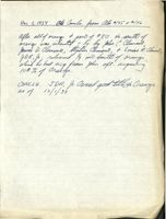
Dec 1, 1934 als Canclu. from Abs #145 f #146
after all of orange part t of #80 to south of
orange was inherited = by by John C. Clemend
James D. Clameno, Stephen Clemeno, t Louine R. Clerms,
JDR, G. releared Yy into South of orange
which he had acq from John oft. acquiring
100% Orange
CONCLU. JDR, g. Owned good tells to Orange
as of 12/1/34
663-548
JDR, Jr.
to
USA
indention
55 WA
d 4/29/34
R 10/19/38
Why line Ely line #146 t Seaside hm
Prop. Consistent w/ Hills Realty Plan
expressly selly to certain water eights
lasswents and provileges granted by
Co
Linda m. Lynam it als to George
(arements
B. Cadisey, by dud dated 9/22/1894,
and unanded m 280-461, and which
were conveyed by the said Coology
to Seal Harbor Water Supply Company,
by deed d 9/20/1898 in 457-170
ABSTRACT OF TITLE
TO LAND NORTH OF SEASIDE INN
SEAL HARBOR,
MAINE.
and H
ABSTRACT OF TITLE OF A ONE-FOURTH
INTEREST IN LAND NORTH OF THE SEASIDE INN
AT SEAL HARBOR, HANCOCK COUNTY, MAINE,
BEING A PORTION OF LOT NO. 80.
J.D.R.Jr.
J.D.R.Jr
Locus is 1/4 incommon
and un of lot
enclosed in Red.
Ielustrative Stitch andy
JDRS.
Sclement
Seaside Imm Property
county Road
2
THE EARLY HISTORY OF THIS LOT UP
TO THE OWNERSHIP OF THE BINGHAMS IS THE
SAME AS PREVIOUSLY ABSTRACTED, AND IS THERE-
FORE OMITTED FROM THIS ABSTRACT.
3
Vol. 66, Page 315. Warranty Deed.
Dated April 15, 1837.
Recorded April 25, 1839.
Alexander Baring, Henry Baring,
Joseph R. Ingersoll, William
Miller, devisees in trust of the
estate of William Bingham, and
-to- James Clements.
Joseph R. Ingersoll in his own
right by John Black Atty.
two certain lots or parcels of land, lying &
being in the town of Mount Desert in the County of Han-
cock & State of Maine, numbered Eighty & Eighty one and
butted & bounded as follows, viz: Beginning at a Spruce
tree, at the shore, on the West side of Seal Cove, (so- -
called), being the Southeast corner bounds of lot number
Seventy nine, sold to John Bracy, -and running North, by
said lot number Seventy nine, two hundred & ninety rods,
to a spruce tree; thence east, one hundred & ten rods, to
a corner; thence South to the shore;- thence by the shore,
round said Seal Cove, to the bounds first imentioned.-Said
lot number Eighty, is sixty rods wide, & contains, ninety
nine acres, & sixty rods, and lot number Eighty one, is
fifty rods wide & contains ninety seven acres, 100/160
both containing one hundred & ninety seven acres, more or
less, according to a survey & plan of said town by James
Peters Surveyor.
4
Vol. 184, Page 62.
Warranty Deed. Dower released.
Dated December 8, 1881.
Recorded Aug. 4,1882.
James Clement
-to-
James Clement Jr.
At Seal Harbor.
Beginning at low water on the East line of lot this
Jr.
day conveyed by me to said James Clement Amos Clement
and follows said line North five degrees West to a stake at
high water mark+-thence on same course five rods to the
center of the County road-thence North forty eight and one
sixth degrees West seven rods and eighteen links to a stake
in the center of a private way--thence north seven & one
half degrees East twenty one rods & twenty two links to a
stake--thence north eighty two & one half degrees West six-
teen rods and six links to a stake -- thence South seven and
one half degrees West eighteen rods & nineteen links to the
Nor theast corner of a lot owned by R. R. Thomas-thence on
the North line of said Thomas lot Westerly to the East line
of lot owned by George W. Bracy--thence on said East line
Northerly to the South line of lot known as the Jordan Pur-
chase--thence on said South line Easterly to the Northwest
corner of lot owned by the heirs of Jacob Clement (deceased)- -
thence on the West line of said heirs lot Southerly to low
5
COMMENTS REGARD ING ESTATE OF JAMES CLEMENT
James Clement died testate June 18, 1922,
without having disposed of our locus. Under the terms
of his will and codicils, abstracts of which appear on the
following pages, our locus passed to Amos Clement, his
brother.
The probate records show that all taxes
due from the estate have been paid.
7
184-62 -2
water mark at the shore of said Seal Harbor--thence on
low water Westerly to the first mentioned bound & contains
ninety acres more or less.
6
Vol. 569, Page 417.
Recorded Sept. 1, 1922.
ABSTRACT OF THE WILL OF
James Clement
STATE OF MAINE.
HANCOCK SS.
PROBATE OFFICE.
September 1, 1922.
I, Robert P. King, Register of the Probate Court in
and for said County, hereby certify that the last will and
testament and codicil of James Clement, late of Mt. Desert,
in said county, deceased, was proved, approved and allowed
by the Judge of Probat te for said County, at a court held
at Ellsworth on the first day of August 1922; and that the
following is a true copy of said will as devises Real Estate
in the County aforesaid.
TO WHOM IT MAY CONCERN BE IT KNOWN
That I, James lement of Mount Desert, Hanoock County,
Maine, being of lawful age and of sound and perfect mind
and memory do make, publish and declare this my LAST WILL
AND TESTAMENT, hereby revoking all former wills by me made,
and herein dispose of all my worldly goods and estate in
manner following:-
First: I direct my executors herein named to pay all
my just debts and funeral expenses as soon as may be ex-
8
569-417 -2
pedient after my decease.
Second: I give, bequeath and devise to my brother
Amos Glement his heirs and assigns forever, my share in
the hotel and lot at Seal Harbor called the "Seaside Inn",
together with my share of the contents thereof, and also all
the buildings and erections on the Hotel lot belonging to the
firm of A. & J. Clement.
Third: I give and devise to my said brother, Amos
Glement, his heirs and assigns forever, that part of the
former homestead lot which is now owned by me, to hold to
him and his heirs and assigns forever.
Fourth: I give and devise to my brother Charles H.
Clement, his heirs and assigns forever, the small lot of
land on the east side of Seal Harbor containing about one-
third of an acre, which is bounded on the east by the road
leading to the Steamboat Wharf, on the south by R.E.Camp-
bell's cottage lot, on the west by the shore and on the
north by land of Charles H. Clement.
Fifth: I give and devise to Charles HL lement, his
heirs and assigns forever, my one-half interest in a lot
of wild land, in the mountains, being the same which I
9
569-417 -3
bought of the heirs of George Jordan, it being bounded
wosterly by land of E. B. Dane known as "Wild Wood Farm."
Sixth: I give and devise to my said brother Charles H.
Clement his heirs and assigns forever, my interest in a
lot of land situated at Seal Harbor, on Ox Hill so-called,
and known as the "Ox Hill Lot", also my half interest
in a quarter acre lot bought of Mary I. Martin for the
purpose of obtaining a right of way to said Ox Hill Lot.
Seventh: I give and bequeath to my nephews Arthur M.
Clement and Irving 0. Clement, my naptha Launch "Dorothy".
Eighth: All the rest, residue and remainder of my
estate, real, personal and mixed, including all money on
deposit in banks or elsewhere, I give, bequeath and devise
to my brothers Amos and Charles and James N. Emery now or
formerly of Bar Harbor, in equal shares, one third to each.
Ninth: I hereby appoint Amos Clement and Charles H,
Clement to be sole executors, without bond, of this, my last
Will and testament.
IN TESTIMONY WHEREOF I have hereunto set my hand this
twen ty-fourth day of September in the year of our Lord one
thousand nine hundred and eighteen.
James Glement.
10
569-417 -4
Signed, published and declared by the above named
James Clement as and for his last will and testament in
the presence of us, who, at his request, in his presence,
and in the presence of each other hereto subscribe our
names as witnesses thereto, on this twenty-fourth day of
September, A.D. 1918.
Harriet Shaw,
Bar Harbor, Maine.
Charles H. Wood
Bar Harbor, Maine.
Everett G. Jordan
Seal Harbor, Maine.
CODICIL TO WILL
WHEREAS I, James Clement of Mount Desert, Hancock
County, Maine, on the twenty-fourth day of September
nineteen hundred and eighteen, made and executed my last
will and testament in writing; and whereas by my saidw
will under paragraph "Third" thereof I gave and devised
to my brother, Amos Glement, his heirs and a ssigns forever,
certain real estate under the following description, to wit:
11
569-417 -5
"That part of the former homestead lot which is now owned
by me, now I do hereby make, publish and declare this my
Codicil to my said Last Will and Testament, to be annexed
to and taken and allowed as part thereof; and I do hereby
confirm said bequest but make this Codicil for the purpose
of more clearly describing and defining said bequest or
devise. The part of the former homestead lot which is now
owned by me is the remainder that I now own of Lot No. 80
of the Peters Survey of the town of Mount Desert.
IN TESTIMONY WHEREOF I have hereunto set my hand this
fourteenth day of April in the year of our Lord one thousand
nine hundred and nineteen.
James Clement.
Signed, published and declared by the above named
James Clement as and for a Codicil to his Last Will and
estament, in the presence of us, who, at his request, in
his presence, and in the presence of each other hereto
subscribe our names thereto on this fourteenth day of April
A.D. 1919.
Wesley T. Paine.
Bar Harbor, Maine.
Albion W. Wallace
Bar Harbor, Maine
Charles H. Wood
12
569-417 -6
CODICIL.
To all whom it may concern, be it known:
That I, James Clement of Mount Desert, Hancock County,
Maine, being of sound and perfect mind and memory, do make,
publish and declare this as a Godicil to my last will and
testament, to be annexed to and taken and allowed as a part
thereof, my said last Will and Testament being dated September
24,1918.
1. I hereby revoke the whole of Article Eighth in my
said Will and dispose of the property referred to in said
Article eight as follows:
(a) From the property referred to in said Article
Eight I give and bequeath to James N. Emery, now or for-
merly of Bar Harbor, Maine, the sum of one thousand dollars
($1000.)
(b) All the rest, residue and remainder of my estate,
as set forth in said Article Eighth, except the one thousand
dollars hereby bequeathed to James N. Emery, I give, bequeath
and devise to my brothers, Amos and Charles, in equal shares.
2. I hereby ratify and confirm all the rest of my said
will, including the Codicil thereto dated April 14, 1919.
IN TESTIMONY WHEREOF I have hereunto set my hand this
13
569-417 -7
twenty-third day of June, one thousand nine hundred and
twenty.
James Clement.
Signed, published and declared by the above named
James Glement, as and for a Codicil to his last Will
and Testament, in the presence of us, who, at his request,
in his presence, and in the presence of each other, hereto
subscribe our names athis twenty-third day of June, one
thousand nine hundred and twenty.
Fred c. Lynam,
Bar Harbor, Maine
A. B. Leland
Bar Harbor, Maine.
Chas. H. Wood.
Bar Harbor, Maine.
Amos Clement and Charles H. Clement, executors.
(Court Seal) WITNESS my hand and the Seal of the Probate
Court for said County of Hancock, the day and year first
above written.
Robert P. King, Register.
14
7
COMMENTS REGARDING ESTATE OF AMOS CLEMENT
Amos Clement died intestate July 28, 1928,
without having conveyed our locus.
His estate was duly probated in Waldo County.
The probate docket shows that the final account was filed
and settled.
All taxes due from the estate have been
paid.
Our locus passed according to the petition
for administration one-fourth to John C.Clement, one-
fourth to James D. Clement, one-fourth to Stephen Clement
and one-fourth to Louise R. Clement.
15
DEEDS GIVEN TO ESTABLISH EASTERN
BOUNDARY OF LOCUS
Vol. 426, Page 527. Quit-claim Deed. Dower not released.
Dated December 1, 1904.
Recorded February 6, 1906.
James Clement
-to-
Linda M.Lynam,
Evelyn Campbell,
Robert E.Campbell
"Certain real estate situated in that part of
the said town of Mount Desert called Seal Harbor and
particularly described as follows, to wit:
All that part of lot number eighty, so called,
according to the Peters' plan and survey of Mount Desert
Island that is owned by the grantor and that lies east-
erly of the following described line, viz:
Beginning at a piece of iron pipe driven in
the ground, which marks a point bearing north fifty-three
degrees thirty-seven minutes west of and seventy and nine-
tenths feet distant from the centre of the man-hole called
Man-hole Number One in the sewer system of Seal Harbor;
thence from said point of beginning so marked by said iron
pipe running north five degrees ten minutes east two-
hundred and thirty-one and five-tenths feet to another iron
pipe driven in the ground and thence same course, to wit,
north five degrees ten minutes east ten feet to the middle
of the Stanley Brook, so called, where it runs in its new
channel; thence northerly, but everywhere following the
middle of the said Stanley Brook by its various courses and
16
426-527
-2
wingings to the head line of the Settlers' Lots, being
the southern line of the Jordan tract, so called.
The above described line is the northerly part
of the line referred to above and the remaining or south-
erly part of said line is thus described, viz:
Beginning at the iron pipe driven in the ground
the point of beginning and thence running south five de-
grees ten minutes west eighty-two feet, more or less, to
mean high water mark and thence by the same c ourse to low
water mark of Seal Harbor.
It is the purpose of this deed and one of even
date herewith from the Grantees herein to the grantor here-
in to fix and establish the line between their respective
properties, to wit, between old lot number eighty and old
lot number eighty-one on the Peters' Plan, which line shall
hereafter be the straight line whose course is south five
degrees ten minutes west from the point above mentioned
where it strikes the new channel of the Stanley Brook to
low water mark of the bay; the remainder or northerly
portion of the dividing line between the two said properties
to be the middle of the Stanley Brook as heretofore, except
where a new channel has now been dug for said brook.
This deed and one of even date herewith from
the grantees herein to the grantor herein are to be con-
strued together.
17
426-527
-3
There is expressly excepted from the premises
described as conveyed in this deed and reserved the right
to use and maintain a sewer in the course and location
where it now exists from remaining land of James Clement
and land of James and Amos Clement to the point of connect-
ion with the main sewer at Seal Harbor."
18
Vol. 414, Page 332.
Quit-claim Deed. Dower not released.
Dated December 1, 1904.
Recorded December 24,1904.
Linda M. Lynam,
Evelyn Campbell,
Robert E. Campbell
-to-
James Clement.
Certain real estate situated in that part of the said
town of Mount Desert called Seal Harbor and particularly
described as follows, to wit: All that part of lot number
eighty-one so called according to the Peters' Plan and Sur-
vey of Mount Desert Island that is owned by the grantors
and that lies westerly of the following described line, viz:
Beginning at a piece of iron pipe driven in the ground;
which marks a point bearing north fifty-three degrees thirty-
seven minutes east of and seventy and nine-tenths feet distant
from the centre of the man-hole called Man-hole Number one
in the sewer system of Seal Harbor; thence from said Point
of beginning so marked by said iron pipe running north five
degrees ten minutes east two-hundred and thirty-one and five-
tenths feet to another iron pipe driven in the ground and
thence same course, to wit, north five degrees ten minutes
east ten feet to the middle of the Stanley Brook, so called,
where it runs in its new channel; thence northerly but
/ 9
414-332
-2
everywhere following the middle of the said Stanley Brook
by its various courses and windings to the head line of
the Settlers' Lots, being the southern line of the Jordan
tract, so called.
The above described line is the northerly part
of the line referred to above and the remaining or south-
erly part of said line is thus described, viz:
Beginning at the iron pipe driven in the ground
the point of beginning and thence running south five de-
grees ten minutes west eighty-two feet, more or less, to
mean high water mark and thence by the same course to low
water mark of Seal Harbor.
It is the purpose of this deed and one ofeven
date herewith from the grantee herein to the grantors herein
to fix and establish the line between their respective pro-
perties, to wit, between old lot number eighty and old lot
number eighty-one on the Peters' Plan, which line shall
hereafter be the straight line whose course is south five
degrees ten minutes west from the point above mentioned
where it strikes the new channel of the Stanley Brook to
low water mark of the bay; the remainder or northerly por-
tion of the dividing line between the two said properties
20
414-332
-3
to be the middle of the Stanley Brook as heretofore,
except where a new channel has now been dug for said
brook.
This deed and one of even date herewith from
the grantee herein to the grantors herein are to be con-
strued together."
21
DEEDS GIVEN WHICH ESTABLISH
SOUTHERN BOUNDARY OF
LOCUS.
Vol. 464, Page 456.
Warranty Deed. Grantor unmarried.
Dated December 4, 1909.
Recorded Dec. 17, 1909.
James Clement
-to-
Amos Clement.
one-half part in common and undivided of the following
described lot or parcel of land situate in Seal Harbor, in
the town of Mount Desert aforesaid, and particularly bounded
and described in the whole as follows, to wit:-
Beginning at a stone post set in the ground in the
westerly line of the hotel lot of James and Amos Clement,
said stone post marking the northeasterly corner of the
lot of Sarah M. Emery; thence north sixty-five degrees forty-
seven minutes west, but everywhere following the
northerly line of said Emery lot, one hundred and forty-eight
and five-tenths feet to a stone post marking her northwesterly
corner; thence north nine degrees thirty minutes east four
hundred and twenty-five and seven-tenths feet to a stone post
set for a corner; thence south eighty degrees thirty minutes
east one hundred and forty-four and three-tenths feet to an
iron bolt in a bowlder set for the purpose of marking this
line; thence same course, to wit, south eighty degrees thirty
minutes east seven hundred and thirty-two and seven-tenths
feet to a yellow birch tree; thence same course, to wit,
22
464-456 -2
south eighty degrees thirty minutes east forty-five feet,
more or less, to the center of the Stanley Brook and to
line of land of Linda M. Lynam and others as established
by the deeds between them and James Glement of December
1, 1904, the deed from Lynam et als. to Clement being re-
corded in Vol. 414, Page 332, and the deed from Clement
to Lynam et als. being recorded in Vol. 426, Page 527 of
said Registry and said deeds together establishing the
boundary line between the Clement and the Lynam properties
aforesaid; thence southerly, but everywhere following the
division line between the said Clement and the said Lynam
properties, as so established, to low water mark of the bay;
thence westerly, but everywhere following low water mark of
the bay to the easterly line at low water of the a foresaid
hotel lot and thence northerly across the shore, but every-
where following the said line of the hotel lot to the high
water markp thence north three degrees west, but everywhere
following said hotel lot line, five rods; thence north forty-
six degrees ten minutes west, but everywhere following said
hotel lot line, seven rods and eighteen links; thence north
nine degrees thirty minutes east , but everywhere following
23
464-456 -3
said hotel lot line, twenty-one rods and twenty-two
links to its northeastern corner; thence north eighty
degrees thirty minutes west, but everywhere following
the northerly line of said hotel lot, sixteen rods and
six links to its northwestern corner; thence south nine
degrees thirty minutes west, but everywhere following
the westerly line of said hotel lot nine rods and nine-
teen links to the point of beginning. The courses of
the lines of the hotel lot are the courses in 1909 accord-
ing to the survey of C.P. Simpson.
24
538 - 71
Jean clement
Lot III
Vol. 538, Page 71. Warranty Deed. Grantor unmarried.
Dated November 9, 1917.
Recorded Nov.23,1917.
James Clement
-to-
Stephen C. Clement.
At Seal Harbor.
Beginning at an iron bolt set in the ground about
one and one half feet north of a birch tree in the easterly
line of land of John D .Rockefeller, Jr.; thence South 80°
30'East, three hundred forty-seven and six tenths (347.6)
feet to a corner; thence South 9° 30'West, forty-nine and
sixty-five hundredths (49.65) feet to the northwest corner
of land of A. & J. Clement; thence in the same course two
hundred seventy-three and seven tenths (273.7) feet to the
northeast corner of a lot of land this day conveyed to
James Donald Clement;;thence North 80° 30'West, but every-
where following the northern line of said James Donald
Element lot, three hundred twenty-eight and six tenths
(328.6) feet to the northwest corner of said last mentioned
lot; thence North 6° 8'East, Eighty-three and six tenths
(83.6) feet to a stone post, the southeast corner of said
Rockefeller land, thence in the same course, but everywhere
following said easterly line of Rockefeller, two hundred
forty and two tenths (240.2) feet to the point of beginnning.
Containing two and fifty one hundredths (2.50) acres, more
25
538-71
-2
or less.
The bearings hereinabove given refer to the meredian
of 1909.
26
DEED GIVEN WHICH ESTABLISHES PART
OF WESTERN BOUNDARY OF LOCUS, AND AN OPTION. .
Vol. 502, Page 68.
Quit-claim Deed.
Dower released.
Dated August 29, 1913.
Recorded Oct. 30, 1913.
George L. Stebbins
-to-
John .Rockefeller, Jr.
in Mount Desert.
Beginning at a stake and stones in the south
line of the George N. and John S. Jordan lot, so called,
marking the northeast corner of land of the Cooksey Realty
Company and the northwest corner of the James Clement lot,
known as Lot No. 80 on Peters' Plan of Mount Desert Island;
thence south eighty-three degrees fifty-one minutes east,
but always following the said south line of the Jordan lot
five hundred and fifty-nine and sixty-five one-hundredths
feet to a stone post set in the ground; thence south twenty
degrees fifty-four minutes west seventeen hundred and forty-
eight and eight-tenths feet to a stone post set in the ground;
thence south six degrees forty-eight minutes west six hundred
and ninety-four and five-tenths feet to an iron bolt in
the ledge; thence north e ighty-three degrees twelve minutes
west one hundred and thirty-three and forty-five one-hundred-
ths feet to an iron bolt set in the ground in the east line
of land of said Cooksey Realty Company; thence northerly but
always following the east line of land of the Cooksey Realty
27
502-68
-2
Company two thousand three hundred and eighty-four feet,
more or less, to the place of beginning, containing fif-
teen and 58/100s acres, more or less.
28
Vol. 283, Page 195.
Agreement to convey.
Dated September 24,1894.
Recorded Oct. 8, 1894.
James Clement
-to-
Geo. B. Cooksey.
do hereby promise, covenant and agree to and with
said Cooksey and his heirs and assigns, to sell and con-
vey to him by good and sufficient deed or deeds, carrying
perfect title, all my ownership of what is called and known
as Lot number Eighty (80) in Seal Harbor in said Mt. Desert,
which lies north of a line to be run across the lot about
east and west immediately north of the present cultivated
portion of said lot said line to be run later by agreement
and a good and sufficient right of way for all purposes of
a way and for drainage and sewerage from said tract to the
highway; said right of drainage & sewerage extending to the
sea over remaining land of grantor; at any time within one
year from this date at the request of said Cooksey for the
purchase price of two hundred dollars per acre to be paid
(if said tract is taken under this contract) as follows:
viz: all by mortgage and note or other personal obligation
of the owner for the whole purchase price, made payable upon
the death of said James Clement, with interest payable annually
29
283-195 -2
at the rate of five per cent per annum, with the further
understanding and agreement that said mortgage instead
of including the whole tract in one mortgage may be com-
prised in several smaller mortgages covering portions of
said tract so long as the aggregate of the land in said mort-
gages equals the whole tract in area and the total amount
so secured by said mortgages equals the total purchase price
herein agreed upon. It being also understood that Mr.
Clement's assent is essental to any division of said tract
hereunder.
It is further understood and agreed that in case the
owner of the land and the signer of the notes or other
obligations above mentioned should not be Mr. Cooksey it
shall be and said signer shall be same person who shall be
satisfactory to Mr. Clement before he shall be under any
obligation to make a conveyance hereunder.
It is also further and later agreed after having viewed
the land that the tract herein agreed to be conveyed shall
be all that portion of said lot north of a line extending
from & through a small clump of ash trees on the easterly
side of the present field westerly at right angles to the
western line of said lot & to said western line.
30
SUMMARY AND CONCLUSION .
SUMMARY.
1 - 2
Title page and plan.
3
Reference to early history.
4
1837. Alexander Baring, Henry Baring,
Joseph R. Ingersoll, William Miller, dev-
isees in trust of the estate of William
Bingham, and Joseph R. Ingersoll in his own
right by John Black Atty. to James Clements.
Locus with other land.
5 - 6
1881. James Clement to James Clement Jr.
Locus with other land.
7
Comments regarding estate of James Clement
8 - 14
Abstract of the will and codicils of James
Clement.
15
Comments regarding estate of Amos Clement.
16 - 21
Deeds given to establish eastern line of
locus.
22 - 26
Deeds given which establishes southern line
of locus.
27 - 28
Deed given which establishes a part of the
western bound of locus.
29 - 30
1894. James Clement to Geo. B. Cooksey. An
Option which was not acted upon.
31
CONCLUSION.
Chain of Title.
Our locus is a portion of Lot No. 80. A
great many conveyances have been made out of Lot No.
80 and our locus is one-fourth of so much of Lot No.
80 as lies north of the line which establishes the
Seaside Inn property, excepting, however, a portion
which has been conveyed to Mr. Rockefeller.
Dower.
In all cases where necessary dower has been
released.
Probate.
In both instances where a party owning the
locus has deceased the probate proceedings seem to be
complete in all respects.
Bounds.
I understand from Mr. Simpson that the bounds
32
of the lot are clear, and that he surveyed the pro-
perty a few years ago for the Clements.
Taxes.
Taxes for the year 1930 have been pai d.
Except as shown under our heading "Conclusion"
I find no liens, judgments, or attachments affecting
our locus of record. Itis therefore my opinion that John C.
Clement has and can give good and marketable title to the
one-fourth interest in the lot.
Dated March 4, 1931
Summa BRodul.
at one o'clock PIM.
33
145
ABSTRACT OF TITLE
TO LAND
NORTH AND EAST OF SEASIDE INN
SEAL HARBOR
MAINE.
Locus
North time of tract 1/2 Connya by James to Anos
Hotel
Locus
Lot
Illustrative
only
Road
sea
/
This entire property, with other land, passed
to James Clement who in 1909 conveyed to Amos Clement
an undivided half part of a tract lying east and next
north of the Seaside Inn property.
The remainder of the property passed to Amos Clem-
ent by will of James Clement.
Amos Clement died in 1928 and the entire property
under discussion passed to his heirs, one-fourth to
John C. Clement, one-fourth to James D. Clement, one-
fourth to Stephen Clement and one-fourth to Louise R.
Clement, now Louise Clement Gray.
The history of the record title to the property is
fo und in the "Abstract of Title to land north of Seaside
Inn, Seal Harbor, Maine", dated March 4, 1931, the deed
on page twenty-two covering the undivided half above
referred to.
2
Reference is made to the Seaside Inn property.
This property is shown roughly on the sketch on page
one, and is defined by deed set forth on the following
page to A. & J. Clement, Incorporated. This Cor-
poration was organized in 1923 as appears by Certificate
of organization on file in the Registry of Deeds , an
extract of which appears following.
3
Vol. 576, Page 474. Warranty Deed. Grantor widower.
Dated April 14, 1923.
Recorded May 15, 1923.
Amos Clement
-to-
A. & J. Clement Incorporated.
A certain lot or parcel of land with the buildings
thereon situated at Seal Harbor, so called, in said Mount
Desert, being the Seaside Inn lot and buildings thereon
formerly owned by me and James Clement now deceased, -his
interest therein having been devised to me under his will.
The same being bounded and described as follows, to wit: -
Bounded on the north and east by land formerly owned
by said James Clement and devised to me under his will;
on the south by the waters of Seal Harbor, so called; and
the highway; on the west by land of one Thomas and land
of one Lynam, containing five (5) acres more or less.
4
Book 4, Page 74. Certificate of Organization.
The A. & J. Clement Inc. was organized under
Sec. 7, of Chapter 51 of the Revised Statutes of the
State of Maine, March 21, 1923.
The purposes, among other things, are to own, buy,
sell, rent, lease, hold and manage real estate and
personal property, especially to buy, own and operate
the hotel at Seal Harbor, Maine, known as the Seaside
Inn, etc.
The capital stock is $30,000 common stock, par value
$100. No preferred stock.
Subscription to stock:-
Amos Clement, Belfast, Maine, one share.
John R. Dunton, Belfast, Maine, one share.
Ralph I. Morse, Belfast, Maine, one share.
The corporation is located at Mount Desert, Maine.
The directors are Amos Clement, John R. Dunton, and Ralph
I. Morse. The Clerk is John R. Dunton. The President is
Amos Clement. The certificate of organization was approved
by the Deputy Attorney General on March 22, 1923 and re-
corded in the Hancock County Maine Registry of Deeds on
March 24, 1923.
5
Conclusion.
Taxes.
No examination has been made with reference
to taxes, this will be done at the time of taking
title.
Boundaries.
The property is being located by Mr. Simpson.
I find no liens, judgments, or attachments of
record affecting the property under discussion, other
than for taxes, and for an unrecorded deed from John C.
Clement to John D. Rockefeller, Jr. It is my opinion
that John C. Clement, James D. Clement, StephenClement
and Louise Clement Gray have and can give good and mar-
///
ketable title to the property und er discussion.
Dated July 1, 19311
Abblyram
6
SUPPLEMENT.
146
Vol. 634, Page 522. Warranty Deed. Dower released.
Dated March 6th, 1931.
Recorded July 13, 1931.
John C. Clement
-to- John D. Rockefeller, Jr.
one fourth in common and undivided of a certain
lot or parcel of land situated in Seal Harbor, Mount
Desert, Hancock County, Maine, bounded and described as
follows, to wit:
Beginning at a point in the east line of lot of
land described as conveyed by deed of James Clement to
Stephen Clement recorded in Vol. 538, Page 71 of the Hancock,
County, Maine, Registry of Deeds, said point being forty-
nine and six tenths feet southerly of the northeast corner
of said lot; thence north ten degrees ten minutes east
but everywhere following the east line of said Clement lot
above referred to forty-nine and six tenths feet more or
less to the northeast corner of said lot; thence north
seventy-nine degfees fifty minutes west but everywhere
following the northerly line of said Clement Lot three hun-
dred forty-seven and six tenths feet more or less to a
iron bolt marking the northwest corner of said Clement
Lot, said iron bolt being in the easterly line of land
634-522 -2
of the grantee herein; thence northerly, easterly and
northerly, but everywhere following the eastern line of
land of the grantee herein by the four following courses
and distances, namely: north six degrees forty-eight min-
utes east thirteen hundred fifty feet to an iron bolt,
south eighty-three degrees twelve minutes east one hundred
thirty-three and four tenths feet to an iron bolt in the
ledge, north six degrees forty-eight minutes east six hun-
dred ninety-four and five-tenths feet to a stone bound,
north twenty degrees fifty-four minutes east seventeen hun-
dred forty-eight and eight tenths feet to a stone bound in
the southerly line of the lot formerly known as the George
Jordan Lot; thence south eighty-three degrees fifty-one
minutes east but everywhere following the southerly line of
land formerly known as the George Jordan Lot five hundred
seventy-five feet, more or less, to a bound in the center
of the Stanley Brook; thence southerly by the center of
said Stanley Brook to a point bearing south seventy-nine
degrees fifty minutes East of and nine hundred twenty-two
feet, more or less, distant from the point of beginning;
thence north seventy-nine degrees fifty minutes west nine
hundred twenty-two feet, more or less, to the place of beginning.
144
Vol. 634, Page 523. Warranty Deed. Dower released.
Dated July 6th, 1931.
Recorded July 13, 1931.
John C. Clement
-to-
John D. Rockefeller, Jr.
one fourth part in common and undivided of a certain
lot or parcel of land situated in Seal Harbor, Mount
Desert, Hancock County, Maine, bounded and described as
follows, to wit:
Beginning at a stone post set in the ground in the
westerly line of the Seaside Inn lotnof A. & J. Clement
Incorporated, said stone post marking the northeasterly
corner of the lot now or formerly of Sarah M. Emery; thence
north sixty-five degrees seven minutes west, but everywhere
following the northerly line of said Emery Lot, one hundred
and forty-eight and five-tenths feet to a stone post mark-
ing the northwesterly corner thereof; thence north ten de-
grees ten minutes east four hundred and twenty-five and
seven-tenths feet to a stone post set for a corner; thence
south seventy-nine degrees fifty minutes east, but follow-
ing land heretofore conveyed by me to said grantee, nine
hundred twenty-two feet to the center of the Stanley Brook
634-523 -2
and to line of land now or formerly of Linda M. Lynam
and others as established by the deeds between them
and James Clement of December 1, 1904, the deed from
Lynam et als. to Clement being recorded in Vol. 414,
Page 332, and the deed from Clement to Lynam et als. be-
ing recorded in Vol. 426, Page 527 of said Registry and
said deeds together establishing the boundary line between
the Clement and the Lynam properties aforesaid; thence
southerly, but everywhere following the division line be-
tween the said Clement and the said Lynam properties, as
so established, to low water mark of the bay; thence west-
erly, but everywhere following low water mark of the bay
to the easterly line at low water of the aforesaid Seaside
Inn lot and thence northerly across the shore, but e very-
where following the said line of the Seaside Inn lot to
the high water mark; thence north two degrees twenty min-
utes west, but everywhere following said Seaside Inn lot
line, eighty-two and five-tenths feet; thence north forty-
five degrees thirty minutes west, but everywhere following
said Seaside Inn Lot line, one hundred twenty-seven and
four-tenths feet; thence north ten degrees ten minutes east,
634-523 -3
but everywhere following said Seaside Inn lot line,
three hundred sixty-one feet to itsnortheastern corner,
thence north seventy-nine degrees fifty minutes west, but
everywhere following the northerly line of said Seaside
Inn lot, two hundred sixty-eight feet to its northwestern
corner; thence south ten degrees ten minutes west, but
everywhere following the westerly line of said Seaside Inn
lot one hundred sixty-one feet to the point of beginning.
Containing ten and one-tenth acres more or less.
146
Vol. 634, Page 523. Warranty Deed. Dower released.
Dated July 11th, 1931.
Recorded July 13, 1931
James D. Clement
-to-
John D. Rockefeller, Jr.
one-fourth in common and undivided of a certain
lot or parcel of land situated in Seal Harbor, Mount
Desert, Hancock County, Maine, bounded and described as
follows, to wit:
Beginning at an iron bolt driven in the ground
marking the northwest corner of a lot of land described
as conveyed by deed of James Clement to Stephen Clement
recorded in Vol. 538, Page 71 of the Hancock County,
Maine, Registry of Deeds; thence northerly, easterly and
northerly, but everywhere following the eastern line of
land of the grantee herein by the four following courses
and distances, namely: north six degrees forty-eight
minutes east thirteen hundred fifty feet to an iron bolt,
south eighty-three degrees twelve minutes east one hun-
dred thirty-three and four tenths feet to an iron bolt
in the ledge, north six degrees forty-eight minutes east
six hundred ninety-four and five tenths feet to a stone
634-523 -2
bound, north twenty degrees fifty-four minutes east
seventeen hundred forty-eight and eight tenths feet to a
stone bound in the southerly line of the lot formerly
known as the George Jordan Lot; thence south eighty-three
degrees fifty-one minutes east but everywhere following
the southerly line of land formerly known as the George
Jordan Lot five hundred seventy-five feet, more or less to
the center of the Stanley Brook and to line of lan d now or
formerly of Linda M. Lynam and others as established by the
deeds between them and James Clement of December 1, 1904,
the deed from Lynam et als to Clement being recorded in
Vol. 414, Page 332, and the deed from Clement to Lynam et
als being recorded in Vol. 426, Page 527 of said Registry
and said deeds together establishing the boundary line be-
tween the Clement and the Lynam properties aforesaid; thence
southerly, but everywhere following the division line be-
tween the said Clement and the said Lynam properties so es-
tablished, to low water mark of the bay; the nce westerly
but everywhere following low water mark of the bay to the
easterly line of the Seaside Inn Lot of A. and J. Clement
Incorporated; thence northerly across the shore but every-
634-523 -3
where following the said line of the Seaside Inn lot to
a point south seventeen degrees twenty-one minutes west
from a stone post set in the ground at an angle in the
north line of the County Road; thence north seventeen de-
grees twenty-one minutes east to high water mark; thence
on same course, to wit, north seventeen degrees twenty-one
minutes east one hundred thirty-five feet more or less to
said stone post; thence continuing same course, to wit,
north seventeen degrees twenty-one minutes east nine hundred
fifty-eight and two tenths feet to a piece of iron pipe
driven in the ground; thence north two degrees eight minutes
east six hundred nineteen and three tenths feet to a piece
of iron pipe driven in the ground; thence north seventy-one
degrees fifty-two minutes west two hundred sixty-seven and
nine tenths feet to a piece of iron pipe driven in the
ground; thence south twenty-eight degrees eight minutes
west seven hundred ten and eight tenths feet to a piece of
iron pipe driven in the ground; thence south sixty-six de-
grees five minutes west five hundred eighty-nine feet to
the point of beginning. Containing eighty-three and three
tenths acres, more or less.
Vol. 634, Page 525. Warranty Deed. Dower released.
Dated July 11th, 1931.
Recorded July 13, 1931.
Louise Clement Gray
-to- John D. Rockefeller, Jr.
one-fourth in common and undivided of a certain lot
or parcel of land situated in said Seal Harbor, bounded
and described as follows, to wit:-
Beginning at an ir on bolt driven in the ground mark-
ing the northwest corner of a lot of land described as con-
veyed by deed of James Clement to Stephen Clement recorded
in Vol. 538, Page 71 of the Hancock County, Maine, Registry
of Deeds; thence northerly, easterly, and northerly, but
everywhere following the eastern line of land of the
grantee herein by the four following courses and distances,
namely; north six degrees forty-eight minutes east thirteen
hundred fifty feet to an iron bolt, south eighty-three
degrees twelve minutes east one hundred thirty-three and
four tenths feet to an iron bolt in the ledge, north six
degrees forty-eight minutes east six hundred ninety-four
and five tenths feet to a stone bound, north twenty de-
grees fifty-four minutes east seventeen hundred forty-
eight and eight tenths feet to a stone bound in the southerly
634-525 -2
line of the lot formerly known as the George Jordan lot;
thence south eighty-three degrees fifty-one minutes east
but everywhere following the southerly line of land form-
erly known as the George Jordan Lot five hundred seventy-
five feet, more or less to the center of the Stanley Brook
and to line of land now or formerly of Linda M. Lynam and
others as established by the deeds between them and James
Clement of December 1, 1904, the deed from Lynam et als
to Clement being recorded in Vol. 414, Page 332, and the
deed from Clement to Lynam et als being recorded in Vol.
426, Page 527 of said Registry and said deeds together es-
tablishing the boundary line between the Clement and the
Lynam properties aforesaid; thence southerly, but everywhere
following the division line between the said Clement and
the said Lynam properties so established, to low water
mark of the bay; thence westerly but everywhere following
low water mark of the bay to the easterly line of the Sea-
side Inn Lot of A. and J. Clement Incorporated; thence
northerly across the shore but everywhere following the
said line of the Seaside Inn Lot to a point south seventeen
degrees twenty-one minutes west from a stone post set in
634-525 -3
the ground at an angle in the north line of the County
road; thence north seventeen degrees twenty-one minutes
east to high water mark; thence on same course, to wit,
north seventeen degrees twenty-one minutes east one hundred
thirty-five feet more or less to said stone post; thence
continuing same course, to wit, north seventeen degrees
twenty-one minutes east nine hundred fifty-eight and two
tenths feet to a piece of iron pipe driven in the ground;
thence north two degrees eight minutes east six hundred nine-
teen and three tenths feet to a piece of iron pipe driven in
the ground; thence north seventy-one degrees fifty-two
minutes west two hundred sixty-seven and nine-tenths feet
to a piece of iron pipe driven in the ground; thence south
twenty-eight degrees eight minutes west seven hundred ten
and eight tenths feet to a piece of iron pipe driven in
the ground; thence south sixty-six degrees five minutes
west five hundred eighty-nine feet to the point of beginning.
Containing eighty-three and three tenths acres more or less.
145
Book 634, Page 555. Power of Attorney Recorded July 20,
1931.
KNOW ALL MEN BY THESE PRESENTS That I, Stephen C.
Clement of Buffalo, in the State of New York, do appoint
James D. Clement of Bangor, County of Penobscot, State of
Maine my attorney for me and in my name to grant, sell
and convey any and all my land and tenements situated in
Seal Harbor, Mount Desert, County of Hancock, State of
Maine absolutely and in fee simple, for such price and
to such persons as he shall think fit. And for me and in
my name to sell, execute, deliver and acknowledge such
deeds and conveyances thereof, or any part thereof, as he
shall think fit, hereby ratifying all such deeds and con-
veyances as shall be executed by my said attorney concern-
ing the premises.
IN WITNESS WHEREOF I have hereunto set my hand and
seal this 9th day of July, A.D. 1931.
Stephen C. Clement (L.S.)
(Proper acknowledgment clause attached and executed)
Book 634, Page 555. Power of Attorney
Recorded July 20, 1931.
KNOW ALL MEN BY THESE PRESENTS THAT I, Jean M.
Clement of Buffalo, in the State of New York, do appoint
James D. Clement of Bangor, County of Penobscot, State of
Maine my attorney for me and in my name to grant, sell
and convey any and all my lands and tenements situated in
Seal Harbor, Mount Desert, County of Hancock, State of
Maine, or any interest therein, including my right and
title by descent in the land or lands of my husband,
Stephen C. Clement, so situated, absolutely and in fee
simple, for such price and to such persons as he shal 1
think fit. And for me and in my name to sell, execute,
deliver and acknowledge such deeds and conveyances thereof,
or any part thereof, as he shall think fit, hereby ratify-
ing all such deeds and conveyances as shall be executed
by my said attorney concerning the premises.
IN WITNESS WHEREOF I have hereunto set my hand and
seal this 13th day of July, A.D. 1931.
Jean M. Clement (L.S.)
(Properly acknowledged before a Notary Public).
14%
Vol. 634, Page 556. Warranty Deed. Dower released.
Dated July 20th, 1931.
Recorded July 20, 1931.
Stephen C. Clement by
James D. Clement, Attorney -to- John D. Rockefeller,
Jr.
one fourth in common and undivided of a certain lot
or parcel of land situated in Seal Harbor, Mount Desert,
Hancock County, Maine, bounded and described as follows,
to wit:
Beginning at an iron bolt driven in the ground mark-
ing the northwest corner of a lot of land described as
conveyed by deed of James Clement to Stephen Clement re-
corded in Vol. 538, Page 71 of the HancockCounty, Maine,
Registry of Deeds; thence northerly, easterly and north-
erly, but everywhere following the eastern line of land
of the grantee herein by the four following courses and
distances, namely; north six degrees forty-eight minutes
east thirteen hundred fifty feet to an iron bolt, south
eighty-three degrees twelve minutes east one hundred
thirty-three and four tenths feet to an iron bolt in the
ledge, north six degrees forty-eight minutes east six
hundred ninety-four and five-tenths feet to a stone
634-556 -2
bound, north twenty degrees fifty-four minutes east
seventeen hundred forty-eight and eight tenths feet to
a stone bound in the southerly line of the lot formerly
known as the George Jordan Lot; thence south eighty-three
degrees fifty-one minutes east but everywhere following
the southerly line of land formerly known as the George
Jordan Lot five hundred seventy-five feet more or less to
the center of the Stanley Brook and to line of land now
of formerly of Linda M. Lynam and others as established
by the deeds between them and James Clement of December
1, 1904, the deed from Lynam et als to Clement being re-
corded in Vol. 414, Page 332, and the deed from Clement
to Lynam et als being recorded in Vol. 426, Page 527 of
said Registry and said deeds together establishing the
boundary lines between theClement and the Lynam properties
aforesaid; thence southerly, but everywhere following the
division line between the said Clement and the said Lynam
properties so established, to low water mark of the bay;
thence westerly but everywhere following low water mark of
the bay to the easterly line of the Seaside Inn Lot of A.
and J. Clement Incorporated; thence northerly across the
634-556
-3-
shore but everywhere following the said line of the
Seaside Inn Lot to a point south seventeen degrees twenty-
one minutes west from a stone post set in the ground at
an angle in the north line of the County Road; thence
north seventeen degrees twenty-one minutes east to high
water mark; thence on same course, to wit, north seven-
teen degrees twenty-one minutes east one hundred thirty-
five feet more or less to said stone post; thence contin-
uing same course, to wit, north seventeen degrees twenty-
one minutes east nine hundred fifty-eight and two tenths
feet to a piece of iron pipe drivenin the ground; thence
north two degrees eight minutes east six hundred nineteen
and three tenths feet to a piece of iron pipe driven in
the ground; thence north seventy-one degrees fifty-two
minutes west two hundred sixty-seven and nine tenths feet
to a piece of iron pipe driven in the ground; thence
south twenty-eight degrees eight minutes west seven hun-
dred ten and eight tenths feet to a piece of iron pipe
driven in the ground; thence south Sixty-six degrees
five minutes west five hundred eighty-nine feet to the
point of beginning. Containing eighty-three and three
tenths acres, more or less.
CONVEYANCE OF PART
OF ORIGINAL LOT
145
Vol. 634, Page 557. Quit-claim Deed. Dower released.
Dated July 11, 1931
Recorded July 20, 1931.
John D.Rockefeller, Jr., -to- A. and J. Clement,
Incorporated.
part
one=fourth/in common and undivided of a certain lot
or parcel of land situated in Seal Harbor, in said town
of Mount Desert, bounded and described as follows, to
wit:-
Beginning at an ir on bolt driven in the ground
marking the northwest corner of a lot of land described
as c onveyed by deed of James Clement to Stephen C1 ement
recorded in Vol. 538, Page 71 of the Hancock County,
Maine, Registry of Deeds; thence north sixty six de-
grees five minutes east five hundred eighty nine feet
to an iron pipe driven in the ground; thence north twenty
eight degrees eight minutes east seven hundred ten and
eight tenths feet to a piece of iron pipe driven in the
ground; thence south seventy one degrees fifty two
minutes east two hundred sixty seven and nine tenths
feet to a piece of iron pine driven in the ground;
thence south two degrees eight minutes west six hundred
nineteen and three tenths feet to a piece of ir on pipe
634-557 -2
driven in the ground; thence south seventeen degrees
twenty one minutes west nine hundred fifty eight and
two tenths feet to a stone post set in the ground at
an angle in the north line of the County Road; thence
on same course to wit, south seventeen degrees twenty
one minutes west one hundred thirty five feet more or
less to high water mark; thence on same course to the
easterly line of the Seaside Inn Lot of A. and J.
Clement Incorporated; thence northerly across the
shore, but everywhere following the said line of the
Seaside Inn Lot to the high water mark; thence north
two degrees twenty minutes west, but everywhere follow-
ing said Seaside Inn Lot line, eighty two and five-
tenths feet; thence north forty five degrees thirty
minutes west, but everywhere following said Seaside Inn
Lot line, one hundred twenty seven and four tenths feet;
thence north ten degrees ten minutes east, but every-
where following said Seaside Inn Lot line, three
hundred sixty one feet to its northeastern corner;
thence north seventy nine degrees fifty minutes west,
but everywhere following the northerly line of said
634-557 -3
Seaside Inn lot, two hundred sixty eight feet to its
northwestern corner; thence south ten degrees ten minutes
west, but everywhere following the westerly line of said
Seaside Inn lot one hundred sixty one feet to astone
post set in the ground, said stone post marking the north-
easterly corner of the lot now or formerly of Sarah M.
Emery; thence north sixty five degrees seven minutes
west, but everywhere following the northerly line of said
Emery Lot, one hundred and forty-eight and five tenths
feet to a stone post marking the northwesterly corner
thereof; thence north ten degrees ten minutes east
four hundred and twenty five and seven tenths feet to a
stone post set for a corner; thence on same course to
wit, north ten degrees ten minutes east but everywhere
following the east line of said Clement Lot above referred
to, forty nine and six tenths feet more or less to the
northeast corner of said lot; thence north seventy nine
degrees fifty minutes west but everywhere following the
northerly line of said Clement Lot three hundred forty-
seven and six tenths feet more or less to the iron bolt
the point of beginning. Containing twenty acres, more or
less.
CONCLUS ION
CONCLUSION.
Taxes.
The property lies in the Town of Mount Desert.
Taxes are assessed as of the first of April each year.
All taxes assessed against the property to date have
been paid.
No adverse conditions have arisen since the
main abstract was completed. Except as therein noted
it is my opinion that John D. Roc kefeller, Jr., has
and can give good and marketable title to the property
under discussion.
Dated December 1, 1934.
Comp at began
material re
JOR Lot 146
Vol. 184, Page 62. Warranty Deed. Dower released.
Dated Dec. 8, 1881.
Recorded Aug. 4, 1882.
James Clement
-to-
James Clement, Jr.
A certain lot or parcel of land situated at Seal
Harbor, in said town of Mt. Desert and Bounded and
Described as follows to wit: Beginning at low water
on the East line of lot this day conveyed by me to said
James Clement Jr. and AmosClement and follows said line
North five degrees West to a stake at high water mark;
thence on same course five rods to the center of the County
road; thence North forty eight and one sixth degrees West
seven rods and eighteen links to a stake in the center of
a private way; thence North seven & one half degrees East
twenty one rods & twenty two links to a stake; thence North
eighty two & one half degrees West sixteen rods and six
links to a stake; thence South seven and one half degrees
West eighteen rods & nineteen links to the Northeast corner
of lot owned by R. R. Thomas; thence on the North line of
said Thomas lot Westerly to the East line of lot owned by
George W. Bracy; thence on said East line Northerly to the
South line of Lot known as the Jordan Purchase; thence on
said South line Easterly to the northwest corner of lot
184-62 -2
owned by the heirs of Jacob Clement (deceased); thence on
the West line of said heirs lot Southerly to low water
mark to the shore of said Seal Harbor; thence on low
water Westerly to the first mentioned bound & contains
ninety acres more or less.
Vol. 515, Page 368.
Recorded June 10, 1915.
ABSTRACT OF THE WILL OF
Linda M. Lynam.
STATE of MAINE
Hancock, SS.
Probate Office.
June 9, A. D. 1915.
I, E. E. Chase, Register of the Probate Court in
and for said County, hereby certify that the last will
and testament of Linda M. Lynam, late of Mount Desert,
in said County, deceased, was proved, approved and
allowed by the Judge of Probate for said County, at a
Court held at Ellsworth on the first day of June, 1915;
and that the following is a true copy of so much of
said will as devises Real Estate in the County aforesaid.
FIFTH: I give, devise and bequeath all the rest,
residue and remainder of my property, wherever and how-
ever situated, including my part of the hotel and
furnishings at Seal Harbor, all moneys and all property,
real and personal, that I may own at the time of my
decease to my daughter, Mabel L. Lynam.
Mabel L. Lynam, executrix.
Witness my hand and the Seal
(Court Seal)
of the Probate Court for said County
of Hancock, the day and year first
above written.
E. E. Chase, Register.
COMMENTS REGARDING ESTATE OF LINDA M. LYNAM
Linda M. Lynam died testate February 24,
1915. Her will was duly probated and final
account filed and settled in the Probate Court.
Letters were issued to Mabel L. Lynam.
Under the terms of the will, an abstract
of which appears on the following pages, our
locus passed to Mabel L. Lynam, her daughter.
Vol. 620, Page 510. Warranty Deed.
Dower released.
Dated July 16, 1928.
Recorded Oct. 19,1928.
Robert E.Campbell,
John B. Burke and
Evelyn L. Campbell,
-to-
Frank L. Huston.
and Mabel L. Lynam.
a certain lot or parcel of land situated at Seal
Harbor in said Mount Desert, bounded and described as
follows, to wit:
Beginning on the west side of the county road lead-
ing through the village of said Seal Harbor, at the north-
east corner of a lot conveyed by the herein grantors to
Everett G. Jordan, by deed dated October 1, 1924 and re-
corded in said Hancock County Registry of Deeds in Book
589, Page 550; thence westerly following the said Jordan's
north line eighty eight and five tenths (88.5) feet more
or less to a pipe driven in the ground marking the said
Jordan's northwest corner; thence northerly, on a northerly
production of the said Jordan's west line thirty (30)
feet; thence easterly and parallel to the said Jordan's
north line ninety three (93) feet, more or less to the
west line of said county road; thence southerly following
the west line of said road thirty (30) feet to the place of
620-510 -2
beginning containing two thousand seven hundred twenty
(2720) square feet more or less.
The herein conveyed premises being that lot des-
cribed in a deed from the said Campbell et als, dated
June 28, 1928 to the said Burke and Huston as @Another
lot conveyed by the said grantors to the said Jordan,
by deed dated September 14, 1927 and recorded in said
Registry, in Book
page------",
as this lot was not
conveyed to Everett G. Jordan.
Vol. 515, Page 368.
Recorded June 10,1915.
ABSTRACT OF THE WILL OF
LINDA M. LYNAM
STATE OF MAINE
Hancock, SS
Probate Office.
June 9, A.D. 1915.
I, E.E.Chase Register of the Probate Court in and
for said County, hereby certify that the last will and
testament of Linda M. Lynam, late of Mount Desert, in
said County, deceased, was proved, approved and allowed
by the Judge of Probate for said County, at a Court held
at Ellsworth on the first day of June 1915; and that the
following is a true copy of so much of said will as devises
Real Estate in the county aforesaid.
FIFTH: I give, devise and bequeath all the rest,
residue and remainder of my property, wherever and however
situated, including my part of the hotel and furnishings
at Seal Harbor, all moneys and all property, real and
personal, that I may own at the time of my decease to my
daughter, Mabel L. Lynam.
Mabel L. Lynam, executrix.
515-368 -2
Witness my hand and the Seal of
(COURT SEAL)
the Probate Court for said County of
Hancock, the day and year first above
written.
E. E. Chase, Register.
Capital
Regular
Book 4, Page 74. Certificate of Organization.
The A. & J. Clement Inc. was organized under
Sec. 7 of Chapter 51 of the Revised Statutes of the
State of Maine, March 21, 1923.
The purposes, among other things, are to own, buy,
sell, rent, lease, hold and manage real estate and
personal property, especially to buy, own and operate
the hotel at Seal Harbor, Maine, known as the Seaside
Inn, etc.
The capital stock is $30,000 common stock, par value
$100. No preferred stock.
Subscription to stock:-
Amos Clement, Belfast, Maine, one share.
John R. Dunton, Belfast, Maine, one share.
Ralph I. Morse, Belfast, Maine, one share.
The corporation is located at Mount Desert, Maine.
The directors are Amos Clement, John R. Dunton, and Ralph
I. Morse. The Clerk is John R. Dunton. The President is
Amos Clement. The certificate of organization was
approved by the Deputy Attorney General on March 22, 1923
and recorded in the Hancock County Maine Registry of
n
Deeds on March 24, 1923.
DEEDS GIVEN TO ESTABLISH EASTERN
BOUNDARY OF LOCUS
Vol. 426, Page 527. Quit-claim Deea. Dower not released.
Dated December 1, 1904.
Recorded February 6, 1906.
JamesClement
-to-
Linda M. Lynam,
Evelyn Campbell,
Robert E. Campbell.
"Certain real estate situated in that part of the
said town of Mount Desert called Seal Harbor and particu-
larly described as follows, to wit:
All that part of lot number eighty, so called, accord-
ing to the Peters' plan and survey of Mount Desert Island
that is owned by the grantor and that lies easterly of the
following described line, viz:
Beginning at a piece of iron pipe driven in the
ground, which marks a point bearing north fifty-three
degrees thirty-seven minutes west of and seventy and nine-
tenths feet distant from the centre of the man-hole called
Man-hole Number One in the sewer system of Seal Harbor;
thence from said point of beginning so marked by said iron
pipe running north five degrees ten minutes east two-
hundred and thirty-one and five-tenths feet to another iron
pipe driven in the ground and thence same course, to wit,
north five degrees ten minutes east ten feet to the middle
426-527 -2
of the Stanley Brook, so called, where it runs in its new
channel; thence northerly, but everywhere following the
middle of the saidStanley Brook by its various courses and
windings to the head line of the Settlers' Lots, being the
southern line of the Jordan tract, so called.
The above described line is the northerly part of the
line referred to above and the remaining or southerly
part of said line is thus described, viz:
Beginning at the iron pipe driven in the ground
the point of beginning and thence runningsouth five de-
grees ten minutes west eighty-two feet, more or less, to
mean high water mark and thence by the same course to low
water mark of Seal Harbor.
It is the purpose of this deed and one of even
date herewith from the Grantees herein to the grantor herein
to fix and establish the line between their respective
properties, to wit, between old lot number eighty and old
lot number eighty-one on the Peters' Plan, which line shall
hereafter be the straight line whose course is south five
degrees ten minutes west from the point above mentioned
where it strikes the new channel of the Stanley Brook to
low water mark of the bay; the remainder or northerly
426-527 -3
portion of the dividing line between the two said
properties to be the middle of the Stanley Brook as
heretofore, except where a new channel has now been
dug for said brook.
This deed and one of even date herewith from the
grantees herein to the grantor herein are to b e construed
together.
There is expressly excepted from the premises
described as conveyed in this deed and reserved the
right to use and maintain a sewer in the course and loca-
tion where it now exists from remaining land of James
Clement and land of James and Amos Clement to the point
of connection with the main S ewer at Seal Harbor."
Vol. 414, Page 332. Quit-claim Deed. Dower not released.
Dated December 1, 1904.
Recorded December 24,1904.
Linda M. Lynam,
Evelyn Campbell
-to-
James Clement.
Robert E. Campbell
"Certain real estate situated in that part of the said
town of Mount Desert called Seal Harbor and particularly
described as follows, to wit: All that part of lot number
eighty-one so called according to the Peters' Plan and Sur-
vey of Mount Desert Island that is owned by the grantors
and that lies westerly of the following described line, viz:
Beginning at a piece of iron pipe driven in the ground;
which marks a point bearing north fifty-three degrees thirty-
seven minutes east of and seventy and nine-tenths feet dis-
tant from the centre of the man-hole called Man-hole number
one in the s ewer system of Seal Harbor; thence from said
Point of beginning so marked by said iron pipe ₫running
north five degrees ten minutes east two-hundred and thirty-one
and five-tenths feet to another iron pipe driven in the ground
and thence same course, to wit, north five degrees ten
minutes east ten feet to the middle of the Stanley Brook,
so called, where it runs in its new channel; thence northerly
-2
414-332
but everywhere following the middle of the said Stanley
Brook by its various courses and windings to the head
line of the Settlers' Lots, being the southern line of
the Jordan tract, so called.
The above described line is the northerly part of
the line referred to above and the remaining or southerly
part of said line is thus described, viz:
Beginning at the iron pipe driven in the ground the
point of beginning and thence running south five degrees
ten minutes west eighty-two feet,more or less, to mean
high water mark and thence by the same course to low water
mark of Seal Harbor.
It is the purpose of this deed and one of even date
herewith from the
grantee herein to the grantors herein
to fix and establish the line between their respective pro-
perties, to wit, between old lot number eighty and old lot
number eighty-one on the Peters' Plan, which line shall
hereafter be the straight line whose course is south five
degrees ten minutes west from the point above mentioned
where it strikes the new channel of the Stanley Brook to
low water mark of the bay; the remainder or northerly portion
414-332 -3
of the dividing line between the two said properties
to be the middle of the Stanley Brook as heretofore, except
where a new channel has now been dug for said brook.
This deed and one of even date herewith from the
grantee herein to the grantors herein are to be construed
together."
DEEDS GIVEN WHICH ESTABLISHED
SOUTHERN BOUNDARY OF LOCUS
Vol. 538, Page 71. Warranty Deed. Grantor unmarried.
Dated November 9, 1917.
Recorded Nov. 23,1917.
James Clement
-to-
Stephen C. Clement.
At Seal Harbor.
Beginning at an iron bolt set in the ground about
one and one half feet north of a birch tree in the easterly
line of land of John D.Rockefeller, Jr.; thence South 80°
'East, three hundred forty-seven and six tenths (347.6)
feet to a corner; thence South 9° 30'West, forty-nine and
sixty-five hundredths (49.65) feet to the northwest corner
of land of A. & J. Clement; thence in the same course two
hundred seventy-three and seven tenths (273.7) feet to the
northeast corner of a lot of land this day conveyed to
James DonaldClement; thence North 80° 30'West, but every-
where following the northern line of said James Donald
Clement lot, three hundred twenty-eight and six tenths
(328.6) feet to the northwest corner of said last mentioned
lot; thence North 6°gi East, Eighty-three and six tenths
(83.6) feet to a stone post, the southeast corner of said
Rockefeller land, thence in the same course, but everywhere
following said easterly line of Rockefeller, two hundred
forty and two tenths (240.2) feet to the point of beginning.
538-71 -2
Containing two and fifty one hundredths (2.50) acres,
more or less.
The bearings hereinabove given refer to the meridian
of 1909.
"DEED: GIVEN WHICH ESTABLISHES PART
OF WESTERN BOUNDARY OF LOCUS, AND AN OPTION e
# 147
Vol. 502, Page 68. Quit-claim Deed. Dower released.
Dated August 29, 1913.
Recorded Oct. 30,1913.
George L.Stebbins
-to-
John D.Rockefeller,Jr.
In Mount Desert.
Beginning at a stake and stones in the south line
of the George N. and John S. Jordan lot, so called, mark-
ing the nor theast corner of land of the Cooksey Realty
Company and the northwest corner of the James Clement lot,
known as Lot No.80 on Peters' Plan of Mount Desert Island;
thence south eighty-three degrees fifty-one minutes east,
but always following the said south line of the Jordan lot
five hundred and fifty-nine and sixty-five one-hundredths
feet to a stone post set in the ground; thence south twenty
degrees fifty-four minutes west seventeen hundred and forty-
eight and eight-tenths feet to a stone post set in the ground;
thence south six degrees forty-eight minutes west six hundred
and ninety-four and five-tenths feet to an iron bolt in
the ledge; thence north eighty-three degrees twelve minutes
west one hundred and thirty-three and forty-five one-hundred=
ths feet to an iron bolt set in the ground in the east line
of land of said Cooksey Realty Company; thence northerly
but always following the east line of land of the Cooksey
502-68 -2
Realty Company two thousand three hundred and eighty-
four feet, more or less, to the place of beginning, con-
taining fifteen and 58/100s acres, more or less.
nat used
Vol. 95, Page 300.
Warranty Deed. Dower released.
Dated August 27, 1839.
Recorded April 14,1853.
James o lements
-to-
Amos Clement and Jacob
Clement.
a certain lot of Hand in the said Town of Mount
Desert, numbered Eighty one according to a Survey & plan
made by James Peters Surveyor & being one of the two lots
conveyed to me by Alex. Baring & others, Devisees in trust
of the Estate of William Bingham by John Black their Attor-
ney by deed deed dated 15 April 1857 & Recorded in Hancock
Registry of Deeds, Book No. 66 page 315 Reference to which
is to be had for further description.
Vol. 181, Page 305. Mortgage.
Dower released.
Dated December 9, 1881.
Recorded Aug. 1882.
James Clement Jr. and
James Clement and
Amos Clement
-to-
Abby Clement.
a certain lot of land with the buildings thereon
situated at Seal Harbor in Mt. Desert aforesaid and Bounded
and described as follows to wit-- Beginning on the North side
of the County road on R. R. Thomas Last line and follows said
line North seven and one half degrees East twenty rods to
the Northeast corner of said Thomas line--thence on same
course eighteen rods and nineteen links to a stake--thence
South eighty two and one half degrees East sixteen rods and
six links to a stake-- thence South seven and one half
degrees West twenty one rods and twenty two links to the
center of a private way--thence South forty eight and one
sixth degrees East seven rods & eighteen links to the center
of the County road--thence South five degrees East five rods
to a stake at high water mark--thence on said course to low
water mark; thence on low water mark to said R. R. Thomas
East line--thence on said Thomas line northerly and Westerly
to the first mentioned bound & contains four acres more or
181-305 -2
less together with the buildings situated thereon. Courses
are by compass at this date.
NOTE: The conditions of this mortgage are as follows:-
"Provided nevertheless that if the said James
Clement Jr. & Amos Clement their heirs, executors
or Administrators shall well and faithfully maintain
them the said James Clement and Abby Clement during their
natural lives according to the conditions of a certain
bond given by us to them and dated this day, then this
Deed and said Bond shall both be void, otherwise shall
remain in full force!
Vol. 183, Page 451.
Bond.
Dated December 9, 1881.
Recorded Aug. 4,1882.
James Clement, Jr.
-to-
James Clement and Abbey
Clement.
KNOW ALL MEN BY THESE PRESENTS THAT WE, James Clement
Jr. of the town of Mt. Desert in the County of Hancock and
State of Maine and Amos Clement of the City of Belfast in
the County of Waldo and State of Maine are holden and stand
firmly bound and obliged unto James Clement and Abbey Clement
his wife of the town of Mt. Desert in the County of Hancock,
and State of Maine in the sum of fifteen Hundred Dollars to
be paid to the said James Clement and Abbey Clement or
the survivor of them their Executors Administrators or
assigns to the which payment well and truly to be made We
bind ourselves our heirs executors and administrators firmly
by these presents. Sealed with our seals. Dated the ninth
day of December in the year of our Lord one thousand eight
hundred and eighty one.
The Condition of the above obligation is such that
whereas the said James Glement Jr. and Amos Clement certain
Real Estate situated in Mt. Desert aforesaid by Warranty
Deed, dated Dec. 8" 1881 on the Condition that We shall main-
183-451 -2
tain them the said James Clement and Abbey Clement his
wife during their natural lives. Now Therefore if We
the said James Clement Jr. and Amos Clement our heirs
executors administra tors or assigns shall well and faith-
fully maintain them during their matural lives by furnish-
ing them with suitable food clothing fires medical attendane
in sickness care in sickness and in health such as old
persons in their rank and station in life should have and
a suitable room to be under their exclusive control with
good and sufficient beds and lights for their use, all to
be furnished in the house in which they now live. In short
supply them with all that may reasonably be understood by
the term maintainance for persons in their rank in life
then this bond and also a certain mortgage of Real Estate
given by us the said James Clement Jr. and Amos Clement to
said James and Abbey Clement and bearing even date with this
bond shall both be null and void otherwise remain in full
force.
Vol. 214, Page 32.
Warranty Deed.
Dower not released.
Dated December 9, 1881.
Recorded January 27, 1887.
James Clement Jr.
-to-
Sarah M. Emery.
At Seal Harbor.
Bounded & described as follows to wit--Beginning
at the northeast corner of lot owned by R. R. Thomas
and follows hisnorth line Westerly nine rods to a stake-
thence north seven and one half degrees East nine rods to
a stake- thence South sixty seven & one half degrees
East nine rods to a stake on the West line of lot owned
by me and Amos Glement--thence on said line South seven
and one half degrees West nine rods to first mentioned
bound and contains one half acre. Courses by Compass at
this date.
Vol. 265, Page 82. Mortgage Deed. Dower not released.
Dated October 5, 1892.
Recorded Oct. 12,1892.
James Clement and
Amos Clement
-to-
Bar Harbor Banking & Trust
Company.
At Seal Harbor.
Beginning on the north side of the County road at
the South East corner of lot owned by R. R. Thomas, and
follows the East line of said lot North seven and one
half degrees East twelve rods to the North East corner of said
lot; thence on same course eighteen (18) rods and nineteen
(19) links to a stake; thence South seven and one half de-
grees West twenty one rods and twenty two links to a stake
in the center of a private way; thence following the center
of said way South forty eight and one sixth degrees East
seven rods and eighteen links to the center of the County
road; thence outh five degrees East five rods to a stake
at high water mark; thence on same course to low water mark
Westerly to R. R. Thomas East line; thence on said Thomas
line Northerly and Westerly to the first mentioned bound and
contains four acres more or less, together with buildings
thereon. Courses by compass at this date. Being same property
described in a certain warranty deed from James Clement to
265-82 -2
James Glement Jr., and Amos Clement, dated Dec. 8th,
1881, and recorded in Hancock County, Maine, Registry
of Deeds Aug. 4th, 1882 in Book 181, page 308.
This mortgage was discharged by the Bar Harbor
Banking & Trust Company to said Amos and James Clement
by instrument dated November 1, 1900 and recorded in
said Registry in Vol. 355, Page 191.
Vol. 508, Page 304.
Warranty Deed. Dower released.
Dated September 3, 1914.
Recorded Sept. 8, 1914.
James Clement and
James D. Clement.
Amos Clement
-to-
At Seal Harbor.
Beginning at the southwest corner of the Sarah M.
Emery lot, so called, at a point on the north line of the
Thomas lot; thence westerly, but following the northerly
line of said Thomas lot to the northwest corner thereof,
said point being in the eastern line of the Hattie M.
Lynam lot; thence north six degrees eight minutes east
( N 6° 8' E), but following the eastern line of said Lynam
lot and also the eastern line of the William T. Sedgwick
lot one hundred and forty-eight and two-tenths (148.2) feet
to an iron bolt set in the ledge; thence south eighty
degrees thirty minutes east (S. 80° 30tE.) three hundred and
twenty-four and two-tenths (324.2) feet to an ir on bolt in
the western line of lot conveyed by James Clement to A. & J.
Clement by deed dated A.D. 1909/ thence south nine degrees
thirty minutes west (s 9° 30'W.) but following the western
line of said lot seventy-seven (77) feet to a stone post
marking the northwest corner of said Emery lot; thence on
508-304 -2
the same course (s 9° 30's.) but following the western
line of said mery lot one hundred and forty-eight and
five-tenths (148.5) feet, more or less, to the place of
beginning, containing one and thirtyesix one-hundredths
(1.36) acres, more or less.
The bearings of these lines are made to conform to
the magnetic meridian of A. D. 1909.
Together with and as appurtenant to every part of
the premises hereinabove described as conveyed, a right
of way for all purposes of a way over land of the grantors
herein in an easterly direction to the roadway on the east
side of the Seaside Inn which said roadway extends from
said Seaside Inn property to the county road, and thence
over said roadway so situated on the east side of said Sea-
side Inn to the county road aforesaid. The said right of way
to be used in common by the grantee, his heirs and assigns,
the grantors herein, their heirs and assigns, and all per- -
sons who may be now or may be hereafter entitled to similar
rights.
Also as appurtenant to every part of the premises
hereinabove described as conveyed, the right to maintain and
use a sewer or drain pipe now laid over the land of the
grantors herein from the premises above described to and
508-304 -3
connecting with the sewer already built and existing
running from the Seaside Inn to the main sewer. Reserving
to the Grantors, their heirs and assigns, the right to
enter the herein described sewer or drain pipe of the grantee.
And Amos Clement c0-partner with James Clement in the Sea-
side Inn property joins in this deed for the purpose of con-
veying to said grantee, his heirs and assigns, allrights
to right of way and sewer over Seaside Inn property that
James lement conveys.
It is expressly understood that the sewer rights herein
granted shall be used and enjoyed in common by the grantee
herein, his heirs and assigns, the grantors, their heirs
and assigns, and all other persons who may now have or may
hereafter acquire similar rights.
Vol. 538, Page 73.
Warranty Deed. Grantor unmarried.
Dated November 9, 1917.
Recorded Nov. 23,1917.
James Glement.
-to-
James Donald Clement.
At Seal Harbor.
Beginning at an iron bolt set in the ground at the
northeast corner of land of J. D. Clement; thence North
80° 30' "west, but everywhere following the northern line
of said land of J. D. Clement, three hundred twenty-four
and two tenths (324.2) feet to an iron bolt marking the
northwest corner of said land of J. D. Clement; thence North
6° 8' east, seventy-five and one tenths (75.1) feet to the
southwest corner of a lot of land conveyed this day by the
Grantor to Stephen C. Glement; thence South 80° 30' East, three
hundred twenty-eight and six tenths (328.6) feet to an iron
bolt set in the ground in the western line of land of A. &
J. Clementp thence South 9° 30'West, but everywhere follow-
ing said western line of land of A. & J. Clement, seventy-
five (75) feet to the place of beginning. Containing fifty-
six one hundredths (0.56)acres, more or less.
The bearings hereinabove given refer to the meridian
of 1909.
Vol. 508, Page 306.
Warranty Deed.
Dower released.
Dated September 3, 1914.
Recorded Sept. 8, 1914.
James Clement and
Amos Clement
-to-
John C. Clement.
At Seal Harbor.
Beginning at the center of the county road running
from Seal Harbor to Northeast Harbor at the southeast
corner of the Thomas lot north of said road; thence north
seven degrees thirty minutes east (N 70 30' E) following
said Thomas east line to a stone post on northern side of
said county road; thence on the same course and still follow-
ing said Thomas east line three hundred and five and three
tenths (305.3) feet to a stone post; thence south seventy-
two degrees thirty minutes east (s 72° 30'E) one hundred
and twenty-four and six-tenths (124.6) feet to a stone post;
thence south twenty degrees forty minutes west (s 20° 40'W)
sixty-three (63) feet to a stone post; thence south four
degrees fifty-six minutes east (s 4° 45'E) one hundred and
sixteen and five-tenths (116.5) feet to a stone post on the
northern side of said county road; thence on the same course
(S 4 o 56'E) to the center of said county road; thence
westerly, but following the center of said county road one
508-306 -2
hundred and seventy-four - (174) feet, more or less, to the
place of beginning, containing three-fourths (3/4) of an
acre, more or less.
The bearings of these lines are made to conform to
the magnetic meridian of A.D. 1903.
Together with and as appurtenant to every part of the
premises hereinabove described as conveyed, the right to
maintain and use a sewer or drain pipe now laid over the
land of the grantors hereinfrom the premises above described
to and connecting with the sewer already built and existing
running from our Shore Gottage so called, in an easterly
direction, and connecting with the sewer already built
and existing running from the Seaside Inn to the Main
Sewer.
It is expressly understood that the sewer rights
herein granted shall be used and enjoyed in common by the
grantee herein, his heirs and assigns, the grantors, their
heirs and assigns, and all other persons who may now have
or may hereafter acquire similar rights.
Vol. 518, Page 396. Warranty Deed. Grantor a widower.
Dated December 11, 1915.
Recorded Jan. 12, 1916.
James Clement
-to-
A. & J. Clement.
At Seal Harbor.
Beginning at the northeast corner of lot now or
formerly owned by R. R. Thomas, and following his north
line Westerly nine (9) rods to a stake; thence Nor th seven
and one-half degrees East IN 7 1/2" E) nine (9) rods to
a stake; thence South sixty-seven and one-half degrees East
(s 67 1/2" E) nine (9) rods to a stake on the west line of
lot owned by A. & J. Clement; thence on said line South seven
and one-half degrees West (s 7 1/2" W) nine (9) rods to
first mentioned bound, and contains one-half acre, more
or less. Courses are by compass December 9, A.D. 1881.
Being all and the same premises conveyed to the
said Sarah M. Emery by James Clement, Jr. by deed dated
December 9, A.D. 1881, and recorded in the Hancock County,
Maine, Registry of Deeds in Book 214, page 32, to which
deed and the record thereof express reference is hereby made.
Vol. 576, Page 474.
Warranty Deed. Grantor widower.
Dated April 14, 1923.
Recorded May 15,1923.
Amos Clement
-to-
A. & J. Clement, Inc.
a certain lot or parcel of land with the buildings
thereon situated at Seal Harbor, so called, in said Mount
Desert, being the Seaside Inn lot and buildings thereon
formerly owned by me and James Clement now deceased, - his
interest therein having been devised to me under his will.
The same being bounded and described as follows, to wit:-
Bounded on the north and east by land formerly owned
by said James Clement and devised to me under his will;
on the south by the waters of Seal Harbor, so called, and
the highway; on the west by land of one Thomas and land
of One Lynam, containing five (5) acres more or less.
Vol. 265, Page 82. Mortgage Deed. Dower not released.
Dated October 5, 1892.
Recorded Oct. 12,1892.
James Clement and
Amos Clement
-to- Bar Harbor Banking & Trust
Company.
At Seal Harbor.
Beginning on the north side of the County road at
the South East corner of lot owned by R. R. Thomas, and
follows the East line of said lot North seven and one
half degrees East twelve rods to the North East corner of said
lot; thence on same course eighteen (18) rods and nineteen
(19) links to a stake; thence South seven and one half de-
grees West twenty one rods and twenty two links to a stake
in the center of a private way; thence following the center
of said way South forty eight and one sixth degrees East
seven rods and eighteen links to the center of the County
road; thence South five degrees East five rods to a stake
at high water mark; thence on same course to low water mark
Westerly to R. R. Thomas East line; thence on said Thomas
line Northerly and Westerly to the first mentioned bound and
contains four acres more or less, together with buildings
thereon. Courses by compass at this date. Being same premerty
described in a certain warranty deed from James Clement to
265-82 -2
James Clement Jr., and Amos Clement, dated Dec. 8th,
1881, and recorded in Hancock County, Maine, Registry
of Deeds Aug. 4th, 1882 in Book 181, page 308.
This mortgage was discharged by the Bar Harbor
Banking & Trust Company to said Amos and James Clement
by instrument dated November 1, 1900 and recorded in
said Registry in Vol. 355, Page 191.
Vol. 95, Page 300.
Warranty Deed.
Dower released.
Dated August 27, 1839.
Recorded April 14,1853.
James Clements
-to-
Amos Clement and Jacob
Clement.
a certain lot of and in the said Town of Mount
Desert, numbered Eighty one according to a Survey & plan
made by James Peters Surveyor & being one of the two lots
conveyed, to me by Alex. Baring & others, Devisees inotrust
of the Estateoof William Bingham by John Black t heir Attor-
ney by deed dedd dated 15 April 1857 & Recorded in Hancock
Registry of Deeds, Book No. 66 page 315 Reference to which
is to be had for further description.
Vol. 181, Page 305. Mortgage.
Dower released.
Dated December 9, 1881.
Recorded Aug. 4,1882.
James Clement Jr. and
James Clement and
Amos Clement
-to-
Abby Clement.
a certain lot of land with the buildings thereon
situated at Seal Harbor in Mt. Desert aforesaid and Bounded
and described as follows to wit-- Beginning on the North side
of the County road on R. R. Thomas Last line and follows said
line North seven and one half degrees East twenty rods to
the Northeast corner of said Thomas line--thence on same
course eighteen rods and nineteen links to a stake--thence
South eighty two and one half degrees East sixteen rods and
six links to a stake- thence South seven and one half
degrees West twenty one rods and twenty two links to the
center of a private way--thence South forty eight and one
sixth degrees East seven rods & eighteen links to the center
of the County ad--thence South five degrees East five rods
to a stake at high water mark--thence on said course to low
water mark; thence on low water mark to said R. R. Thomas
East line--thence on said Thomas line northerly and Westerly
to the first mentioned bound & contains four acres more or
181-305 -2
less together with the buildings situated thereon. Courses
are by compass at this date.
NOTE: The conditions of this mortgage are as follows:-
"Provided nevertheless that if the said James
Clement Jr. & Amos Clement their heirs, e xecutors
or Administrators shall well and faithfully maintain
them the said James Clement and Abby Clement during their
natural lives according to the conditions of a certain
bond given by us to them and dated this day, then this
Deed and said Bond shall both be void, otherwise shall
remain in full force"
Vol. 183, Page 451.
Bond.
Dated December 9, 1881.
Recorded Aug. 4,1882.
James Clement, Jr.
-to-
James Clement and Abbey
Clement.
KNOW ALL MEN BY THESE PRESENTS THAT WE, James Clement
Jr. of the town of Mt. Desert in the County of Hancock and
State of Maine and Amos Clement of the City of Belfast in
the County of Waldo and State of Maine are holden and stand
firmly bound and obliged unto James Clement and Abbey Clement
his wife of the town of Mt. Desert in the County of Hancock,
and State of Maine in the sum of fifteen Hundred Dollars to
be paid to the said James Clement and Abbey Clement or
the survivor of them their Executors Administrators or
assigns to the which payment well and truly to be made We
bind ourselves our heirs executors and administrators firmly
by these presents. Sealed with our seals. Dated the ninth
day of December in the year of our Lord one thousand eight
hundred and eighty one.
The Condition of the above obligation is such that
whereas the said James Clement Jr. and Amos Clement certain
Real Estate situated in Mt. Desert aforesaid by Warranty
Deed, dated Dec. 8" 1881 on the Condition that We shall main-
183-451 -2
tain them the said James Clement and Abbey Clement his
wife during their natural lives. Now Therefore if We
the said James Clement Jr. and Amos Clement our heirs
executors administra tors or assigns shall well and faith-
fully maintain them during their natural lives by furnish-
ing them with suitable food clothing fires medical attendane
in sickness care in sickness and in health such as old
persons in their rank and station in life should have and
a suitable room to be under their exclusive control with
good and sufficient beds and lights for their use, all to
be furnished in the house in which they now live. In short
supply them with all that may reasonably be understood by
the term maintainance for persons in their rank in life
then this bond and also a certain mortgage of Real Estate
given by us the said James Clement Jr. and Amos Clement to
said James and Abbey Clement and bearing even date with this
bond shall both be null and void otherwise remain in full
force.
Vol. 214, Page 32.
Warranty Deed.
Dower not released.
Dated December 9, 1881.
Recorded January 27, 1887.
James Clement Jr.
-to-
Sarah M. Emery.
At Seal Harbor.
Bounded & described as follows to wit--Beginning
at the northeast corner of lot owned by R. R. Thomas
and follows hisnorth line Westerly nine rods to a stake-
thence north seven and one half degrees East nine rods to
a stake- thence South sixty seven & one half degrees
East nine rods to a stake on the West line of lot owned
by me and Amos Glement--thence on said line South seven
and one half degrees West nine rods to first mentioned
bound and contains one half acre. Courses by Compass at
this date.
Vol. 508, Page 306. Warranty Deed.
Dower released.
Dated September 3, 1914.
Recorded Sept. 8, 1914.
James Clement and
Amos Clement
-to-
John C. Clement.
At Seal Harbor.
Beginning at the center of the county road running
from Seal Harbor to Northeast Harbor at the southeast
corner of the Thomas lot north of said road; then ce north
seven degrees thirty minutes east (N 70 30' B) following
said Thomas east line to a stone post on northern side of
said county road; then ce on the same course and still follow-
ing said Thomas east line three hundred and five and three
tenths (305.3) feet to a stone post; thence south seventy-
two degrees thirty minutes east (s 72° 30'E) one hundred
and twenty-four and six-tenths (124.6) feet to a stone post;
thence south twenty degrees forty minutes west (s 20° 40'#)
sixty-three (63) feet to a stone post; thence south four
degrees fifty-six minutes east (s 4° 45'E) one hundred and
sixteen and fiveptenths (116.5) feet to a stone post on the
northern side of said county road; thence on the same course
(S 4 56'E) to the center of said county road; thence
westerly, but following the center of said county road one
508-306 -2
hundred and seventy-four (174) feet, more or less, to the
place of beginning, containing three-fourths (3/4) of an
acre, more or less.
The bearings of these lines are made to conform to
the magnetic meridian of A.D. 1903.
Together with and as appurtenant to every part of the
premises hereinabove described as conveyed, the right to
maintain and use a sewer or drain pipe now laid over the
land of the grantors hereinfrom the premises above described
to and connecting with the sewer already built and existing
running from our Shore Cottage so called, in an easterly
direction, and connecting with the sewer already built
and existing running from the Seaside Inn to the Main
Sewer.
It is expressly understood that the sewer rights
herein granted shall be used and enjoyed in common by the
grantee herein, his heirs and assigns, the grantors, their
heirs and assigns, and all other persons who may now have
or may hereafter acquire similar rights.
Vol. 538, Page 73.
Warranty Deed. Grantor unmarried.
Dated November 9, 1917.
Recorded Nov. 25,1917.
James Clement.
-to-
James Donald Clement.
At Seal Harbor.
Beginning at an iron bolt set in the ground at the
northeast corner of land of J. D. Clement; thence North
80° 30' West, but everywhere following the northern line
of said land of J. D. Clement, three hundred twenty-four
and two tenths (324.2) feet to an iron bolt marking the
northwest corner of said land of J. D. Clement; thence North
6° 8' east, seventy-five and one tenths (75.1) feet to the
southwest corner of a lot of land conveyed this day by the
Grantor to Stephen C. Clement; thence South 80° 30'East, three
hundred twenty-eight and six tenths (328.6) feet to an iron
bolt set in the ground in the western line of land of A. &
J. Clementp thence South 9° 30'West, but everywhere follow-
ing said western line of land of A. & J. Clement, seventy-
five (75) feet to the place of beginning. Containing fifty-
six one hundredths (0.56)acres, more or less.
The bearings hereinabove given refer to the meridian
of 1909.
Vol. 508, Page 304.
Warranty Deed. Dower released.
Dated September 3, 1914.
Recorded Sept. 8, 1914.
James Clement and
James D. Clement.
Amos Clement
-to-
At Seal Harbor.
Beginning at the southwest corner of the Sarah M.
Emery lot, so called, at a point on the north line of the
Thomas lot; thence westerly, but following the northerly
line of said Thomas lot to the northwest corner thereof,
said point being in the eastern line of the Hattie M.
Lynam lot; thence north six degrees eight minutes east
( N 6° 8' E), but following the eastern line of said Lynam
lot and also the eastern line of the William T. Sedgwick
lot one hundred and forty-eight and two-tenths (148.2) feet
to an iron bolt set in the ledge; thence south eighty
degrees thirty minutes east (S. 80° 30th. three hundred and
twenty-four and two-tenths (324.2) feet to an ir on bolt in
the western line of lot conveyed by James Clement to A. & J.
Clement by deed dated A.D. 1909/ thence south nine degrees
thirty minutes west (s 9° 30'W.) but following the western
line of said lot seventy-seven (77) feet to a stone post
marking the northwest corner of said Emery lot; thence on
508-304 -2
the same course (s 9° 30'W.) but following the western
line of said Emery lot one hundred and forty-eight and
five-tenths (148.5) feet, more or less, to the place of
beginning, containing one and thirtyesix one-hundredths
(1.36) acres, more or less.
The bearings of these lines are made to conform to
the magnetic meridian of A. D. 1909.
Together with and as appurtenant to every part of
the premises hereinabove described as conveyed, a right
of way for all purposes of a way over land of the grantors
herein in an easterly direction to the roadway on the east
side of the Seaside Inn which said roadway extends from
said Seaside Inn property to the county road, and thence
over said roadway so situated on the east side of said Sea-
side Inn to the county road aforesaid. The said right of way
to be used in common by the grantee, his heirs and assigns,
the grantors herein, their heirs and assigns, and all per-
sons who may be now or may be hereafter entitled to similar
rights.
Also as appurtenant to every part of the premises
hereinabove described as conveyed, the right to maintain and
use a sewer or drain pipe now laid over the land of the
grantors herein from the premises above described to and
508-304 -3
connecting with the sewer already built and existing
running from the Seaside Inn to the main sewer. Reserving
to the Grantors, their heirs and assigns, the right to
enter the herein described sewer or drain pipe of the grantee.
And Amos Clement c0-partner with James Clement in the Sea-
side Inn property joins in this deed for the purpose of con-
veyeng to said grantee, his heirs and assigns, allri ights
to right of way and sewer over Seaside Inn property that
James Clement conveys.
It is expressly understood that the sewer rights herein
granted shall be used and enjoyed in common by the grantee
herein, his heirs and assigns, the grantors, their heirs
and assigns, and all other persons who may now have or may
hereafter acquire similar rights.
Vol. 518, Page 396b Warranty Deed.
Grantor a widower.
Dated December 11, 1915.
Recorded Jan. 12, 1916.
James Clement
-to-
A. & J. Clement.
At Seal Harbor.
Beginning at the northeast corner of lot now or
formerly owned by R. R. Thomas, and following his north
line Westerly nine (9) rods to a stake; thence Nor th seven
and one-half degrees East (N 1/2" E) nine (9) rods to
a stake; thence South sixty-seven and one-half degrees East
(8 67 1/2" E) nine (9) rods to a stake on the west line of
lot owned by A. & J. Chement; thence on said line South seven
and one-half degrees West (s 7 1/2" W) nine (9) rods to
first mentioned bound, and contains one-half acre, more
or less. Courses are by compass December 9, A.D. 1881.
Being all and the same premises conveyed to the
said Sarah M. Emery by James Clement, Jr. by deed dated
December 9, A.D. 1881, and recorded in the Hancock County,
Maine, Registry of Deeds in Book 214, page 32, to which
deed and the record thereof express reference is hereby made.
Vo17p542, Page 543. Warranty Deed. Dower released.
Dated December 27, 1918.
Recorded Dec. 30,1918.
Amos Clement and
James Clement
-to-
Mary C. Clement.
AtSeal Harbor.
Beginning at a stone post at the North Westerly corner
of land of John C. Clement; thence N. 70-30'E. 132 feet to
a Stone post; Thence N. 63° -06'E. fifty one and five tenths
feet (51.5) to a Stone post; thence S. 77°-56'E. (34.2) Thirty
four and two tenths feet to a Stone post; Thence S. 10°-
25UW. one hundred fifty and Eight tenths feet (150.8) to a
point to be marked by an iron bolt; thence N.82°-30'W. One
hundred twenty one and four tenths feet (121.4) to the
point of beginnint containing 44/100 acres more or less.
The courses above given refer to the meridian of 1903.
145
Vol. 184, Page 62. Warranty Deed. Dower released.
Dated Dec. 8, 1881.
Recorded Aug. 4, 1882.
James Clement
-to-
James Clement, Jr.
A certain lot or parcel of land situated at Seal
Harbor, in said town of Mt. Desert and Bounded and
Described as follows to wit: Beginning at low water
on the East line of lot this day conveyed by me to said
James Clement Jr. and AmosClement and follows said line
North five degrees West to a stake at high water mark;
thence on same course five rods to the center of the County
road; thence North forty eight and one sixth degrees West
seven rods and eighteen links to a stake in the center of
a private way; thence North seven & one half degrees East
twenty one rods & twenty two links to a stake; thence North
eighty two & one half degrees West sixteen rods and six
links to a stake; thence South seven and one half degrees
West eighteen rods & nineteen links to the Northeast corner
of lot owned by R. R. Thomas; thence on the North line of
said Thomas lot Westerly to the East line of lot owned by
George W. Bracy; thence on said East line Northerly to the
South line of Lot known as the Jordan Purchase; thence on
said South line Easterly to the northwest corner of lot
184-62 -2
owned by the heirs of Jacob Clement (deceased); thence on
the West line of said heirs lot Southerly to low water
mark to the shore of said Seal Harbor; thence on low
water Westerly to the first mentioned bound & contains
ninety acres more or less.
Out
Vol. 620, Page 510. Warranty Deed. Dower released.
Dated July 16, 1928.
Recorded Oct. 19,1928.
Robert E.Campbell,
John B.Burke and
Evelyn L. Campbell,
-to-
Frank L. Huston.
and Mabel L. Lynam.
a certain lot or parcel of land situated at Seal
Harbor in said Mount Desert, bounded and described as
follows, to wit:
Beginning on the west side of the county road lead-
ing through the village of said Seal Harbor, at the north-
east corner of a lot conveyed by the herein grantors to
Everett G. Jordan, by deed dated October 1, 1924 and re-
corded in said Hancock County Registry of Deeds in Book
589, Page 550; thence westerly following the said Jordan's
north line eighty eight and five tenths (88.5) feet more
or less to a pipe driven in the ground marking the said
Jordan's northwest corner; thence northerly, on a northerly
production of the said Jordan's west line thirty (30)
feet; thence easterly and parallel to the said Jordan's
north line ninety three (93) feet, more or less to the
west line of said county road; thence southerly following
the west line of said road thirty (30) feet to the place of
art
620-510 -2
beginning containing two thousand seven hundred twenty
(2720) square feet more or less.
The herein conveyed premises being that lot des-
cribed in a deed from the said Campbell et als, dated
June 28, 1928 to the said Burke and Huston as Another
lot conveyed by the said grantors to the said Jordan,
by deed dated September 14, 1927 and recorded in said
Registry, in Book----- page------", as this lot was not
conveyed to Everett G. Jordan.
Vol. 515, Page 368.
Recorded June 10,1915.
ABSTRACT OF THE WILL OF
LINDA M. LYNAM
STATE OF MAINE
Hancock, SS
Probate Office.
June 9, A.D. 1915.
I, E.E.Chase Register of the Probate Court in and
for said County, hereby certify that the last will and
testament of Linda M. Lynam, late of Mount Desert, in
said County, deceased, was proved, approved and allowed
by the Judge of Probate for said County, at a Court held
at Ellsworth on the first day of June 1915; and that the
following is a true copy of so much of said will as devises
Real Estate in the county aforesaid.
FIFTH: I give, devise and bequeath all the rest,
residue and remainder of my property, wherever and however
situated, including my part of the hotel and furnishings
at Seal Harbor, all moneys and all property, real and
personal, that I may own at the time of my decease to my
daughter, Mabel L. Lynam.
Mabel L. Lynam, executrix.
515-368 -2
Witness my hand and the Seal of
(COURT SEAL)
the Probate Court for said County of
Hancock, the day and year first above
written.
E. E. Chase, Register.
COMMENTS REGARDING ESTATE OF LINDA M. LYNAM
Linda M. Lynam died testate February 24,
1915. Her will was duly probated and final
account filed and settled in the Probate Court.
Letters were issued to Mabel L. Lynam.
Under the terms of the will, an abstract
of which appears on the following pages, our
locus passed to Mabel L. Lynam, her daughter.
U
Vol. 515, Page 368.
Recorded June 10, 1915.
ABSTRACT OF THE WILL OF
Linda M. Lynam.
STATE of MAINE
Hancock, ss.
Probate Office.
June 9, A. D. 1915.
I, E. E. Chase, Register of the Probate Court in
and for said County, hereby certify that the last will
and testament of Linda M. Lynam, late of Mount Desert,
in said County, deceased, was proved, approved and
allowed by the Judge of Probate for said County, at a
Court held at Ellsworth on the first day of June, 1915;
and that the following is a true copy of so much of
said will as devises Real Estate in the County aforesaid.
FIFTH: I give, devise and bequeath all the rest,
residue and remainder of my property, wherever and how-
ever situated, including my part of the hotel and
furnishings at Seal Harbor, all moneys and all property,
real and personal, that I may own at the time of my
decease to my daughter, Mabel L. Lynam.
Mabel L. Lynam, executrix.
Witness my hand and the Seal
(Court Seal)
of the Probate Court for said County
of Hancock, the day and year first
above written.
E. E. Chase, Register.
Chain of Litle from
Camphell and mabel Lynem
Binghams to Enelyn & Robert E
found in abstract
143
(Burke k Huston)
Out
Vol. 426, Page 527. Quit-claim Deed. Dower not released.
Dated December 1, 1904.
Recorded February 6, 1906.
JamesClement
-to-
Linda M. Lynam,
Evelyn Campbell,
Robert E. Campbell.
"Certain real estate situated in that part of the
said town of Mount Desert called Seal Harbor and particu-
larly described as follows, to wit:
All that part of lot number eightys so called, accord-
ing to the Peters' plan and survey of Mount Desert Island
that is owned by the grantor and that lies easterly of the
following described line, viz:
Beginning at a piece of iron pipo driven in the
ground, which marks a point bearing north fifty-three
degrees thirty-seven minutes west of and seventy and nine-
tenths feet distant from the centre of the man-hole called
Man-hole Number One in the sewer system of Seal Harbor;
thence from said point of beginning so marked by said iron
pipe running north five degrees ten minutes east two-
hundred and thirty-one and five-tenths feet to another iron
pipe driven in the ground and thence same course, to wit,
north five degrees ten minutes east ten feet to the middle
426-527 -2
of the Stanley Brook, so called, where it runs in its new
channel; thence northerly, but everywhere following the
middle of the saidStanley Brook by its various courses and
windings to the head line of the Settlers' Lots, being the
southern line of the Jordan tract, so called.
The above described line is the northerly part of the
line referred to above and the remaining or southerly
part of said line is thus described, viz:
Beginning at the iron pipe driven in the ground
the point of beginning and thence runningsouth five de-
grees ten minutes west eighty-two feet, more or less, to
mean high water mark and thence by the same course to low
water mark of Seal Harbor.
It is the purpose of this deed and one of even
date herewith from the Grantees herein to the grantor herein
to fix and establish the line between their respective
properties, to wit,between old lot number eighty and old
lot number eighty-one on the Peters' Plan, which line shall
hereafter be the straight line whose course is south five
degrees ten minutes west from the point above mentioned
where it strikes the new channel of the Stanley Brook to
low water mark of the bay; the remainder or northerly
426-527 -3
portion of the dividing line between the two said
properties to be the middle of the Stanley Brook as
heretofore, except where a new channel has now been
dug for said brook.
This deed and one of even date herewith from the
grantees herein to the grantor herein are to be construed
together.
There is expressly excepted from the premises
described as conveyed in this deed and reserved the
right to use and maintain a sewer in the course and loca-
tion where it now exists from remaining land of James
Clement and land of James and Amos Clement to the point
of connection with the main sewer at Seal Harbor."
Vol. 414, Page 332. Quit-claim Deed. Dower not released.
Dated December 1, 1904.
Recorded December 24,1904.
Linda M. Lynam,
Evelyn Campbell
-to-
James Clement.
Robert E. Campbell
"Certain real estate situated in that part of the sadd
town of Mount Desert called Seal Herbor and particularly
described as follows, to wit: All that part of lot number
eighty-one so called according to the Peters' Plan and Sur-
vey of Mount Desert Island that is owned by the grantors
and that lies westerly of the following described line, viz:
Beginning at a piece of iron pipe driven in the ground;
which marks a point bearing north fifty-three degrees thirty-
seven minutes east of and seventy and nine-tenths feet dis-
tant from the centre of the man-hole called Man-hole number
one in the S ewer system of Seal Harbor; thence from said
Point of beginning so marked by said iron pipe drunning
north five degrees ten minutes east two-hundred and thirty-one
and five-tenths feet to another iron pipe driven in the ground
and thence same course, to wit, north five degrees ten
minutes east ten feet to the middle of the Stanley Brook,
so called, where it runs in its new channel; thence northerly
-2
414-332
but everywhere following the middle of the said Stanley
Brook by its various courses and windings to the head
line of the Settlers' Lots, being the southern line of
the Jordan tract, so called.
The above described line is the northerly part of
the line referred to above and the remaining or southerly
part of said line is thus described, viz:
Beginning at the iron pipe driven in the ground the
point of beginning and thence running south five degrees
ten minutes west eighty-two feet,more or less, to mean
high water mark and thence by the same course to low water
mark of Seal Harbor.
It is the purpose of this deed and one of even date
herewith from the sans grantee herein to the grantors herein
to fix and establish the line between their respective pro-
perties, to wit, between old lot number eighty and old lot
number eighty-one on the Peters' Plan, which line shall
hereafter be the straight line whose course is south five
degrees ten minutes west from the point above mentioned
where it strikes the new channel of the Stenley Brook to
low water mark of the bay; the remainder or northerly portion
414-332 -3
of the dividing line between the two said properties
to be the middle of the Stanley Brook as heretofore, except
where a new channel has now been dug for said brook.
This deed and one of even date herewith from the
grantee herein to the grantors herein are to be construed
together."

